Arure – a Mountain Village in an Extraordinary Location
The small mountain village of Arure is situated at an altitude of 825 metres above Valle Gran Rey. The locals often share the tale that Arure was once the seat of the ancient Canarian king after whom the large valley is named. What is certain is that Arure boasts an exceptionally good location. It is a true crossroads for hiking. From here, many walks lead into the famous Valle Gran Rey or onto the La Merica plateau. Spectacular views attract numerous visitors daily to La Gomera’s best-known viewpoint, the Mirador de El Santo.
From up there, visitors can enjoy expansive views towards the Atlantic and the valley of Taguluche lying far below. The long-distance hiking trail GR-132 (Stage 4 Alojera – Valle Gran Rey) also passes through the Mirador. However, hikes inland from La Gomera and into the cloud forest are also possible from Arure. Today, I present to you a simple, leisurely tour between Arure and Vallehermoso, which will lead you through the cloud forest on an impressive trail with beautiful views. A true tour for connoisseurs.
General Information about the Arure – Vallehermoso Hike
Starting Point and Directions
You start your hike on the main island road GM-1 in Arure.
Access by car
You can reach Arure on the main island road GM-1 both from the centre of the island and from Valle Gran Rey. Parking is available on the roadside and in side streets.
Access by bus
Bus lines 1 (San Sebastian – Valle Gran Rey) and 6 (Airport – Valle Gran Rey) stop in Arure. Since this is not a circular hike and you may need to take a bus from Vallehermoso, you can use bus lines 2, 4, 5, and 8 from there. For more information and exact timetables, visit here.
Time
I am reluctant to give precise times as hiking is very individual. For this section, we took over 4 hours, including several long breaks in the picturesque cloud forest. If you hike quickly, you can complete the hike in half the time.
Elevation Difference and Distance
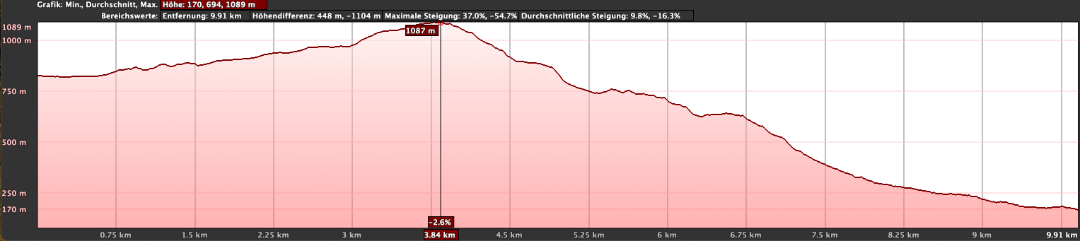
The route is approximately 11.5 kilometres long, and you have to overcome just under 350 metres in elevation.
Difficulty
You hike most of the time on a well-maintained path, which is also popular with guided groups. Additionally, it is mostly downhill, so I would rate this hike as easy. However, you should be able to walk 12 kilometres.
Refreshment
There are refreshment options only at the start of the hike in Arure and at the end in Vallehermoso. Therefore, please bring enough water and possibly snacks for the journey.
Variants
You can also hike the tour in the opposite direction from Vallehermoso to Arure. It will be a bit more challenging as you have more elevation to climb.
A much more demanding and longer alternative route between Arure and Vallehermoso is part 4 of the long-distance hike on the GR-132. A detailed description of this tour can be found here.
Other hikes that pass through Arure and/or Vallehermoso can be found on SiebenInseln:
- Tamargada circuit
- Valle Large Circular Valle Gran Rey Tour
- Long-distance hike on the GR-132 Vallehermoso – Valle Gran Rey
- Chijeré circular hike from Vallehermoso
Hike Arure – Vallehermoso
Section Arure GM-1 to Camino de la Quintana
You start your hike in the village of Arure at Calle Arure (GM-1). My track begins near a bus stop, as we arrived by bus that day. We only had to walk a short distance along the GM-1 before turning right onto the Camino del Rincón to join the hiking trail. Initially, this trail runs parallel to the GM-1. The next section is a bit unclear.
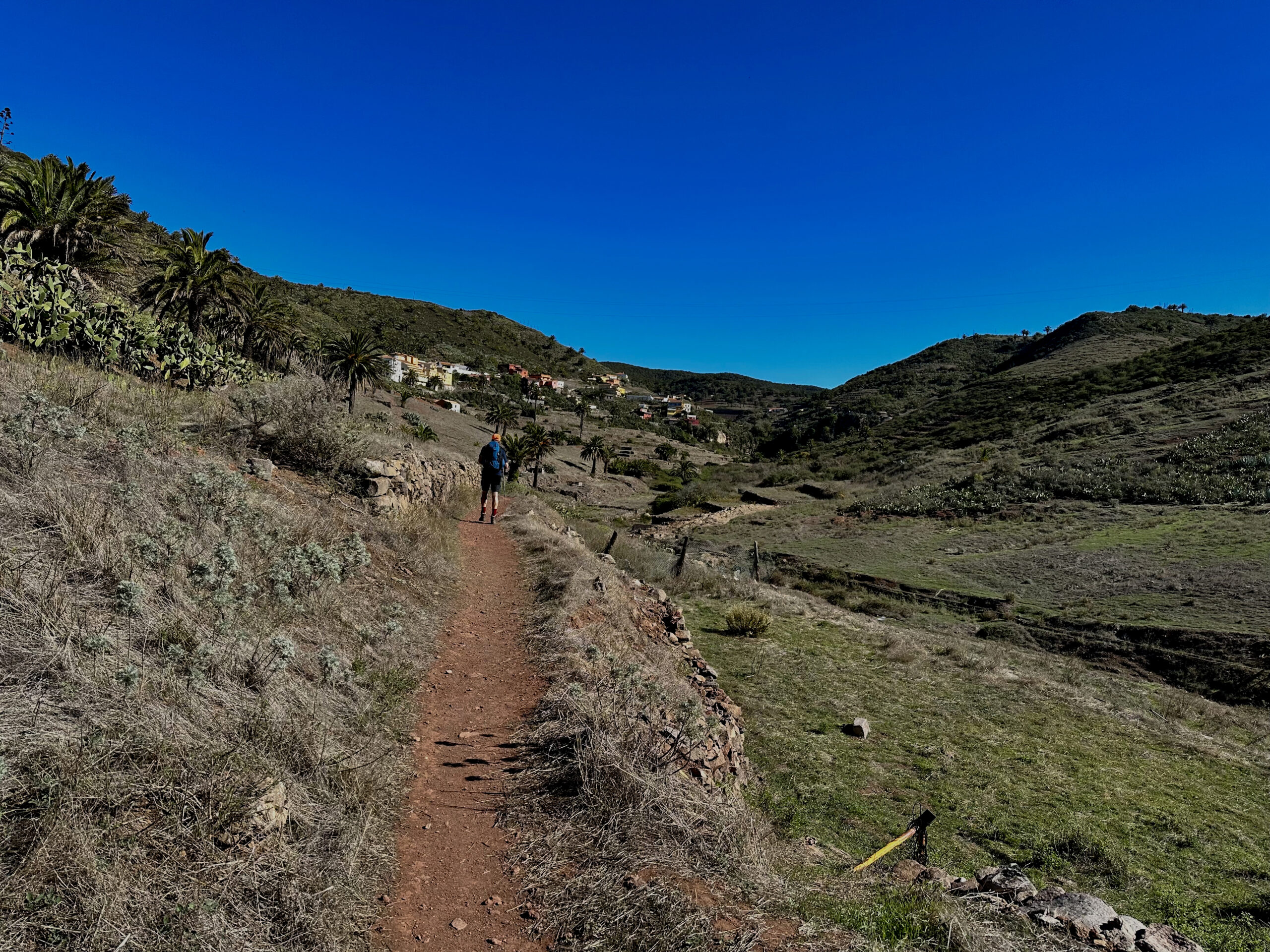
We chose a path straight through the fields, which then led us back to the left towards the road. On the Grand Valle Gran Rey Tour, we stayed more to the left and walked directly along the road. You can’t get lost, but this small section is not very well signposted. It is important to finally get onto the Camino de la Quintana, which runs parallel to the GM-1. Alternatively, you can cross the small dam and continue left on the Camino del Castaño to reach the Camino de la Quintana.
Section Camino de la Quintana to Mirador Risquillo de Corgos
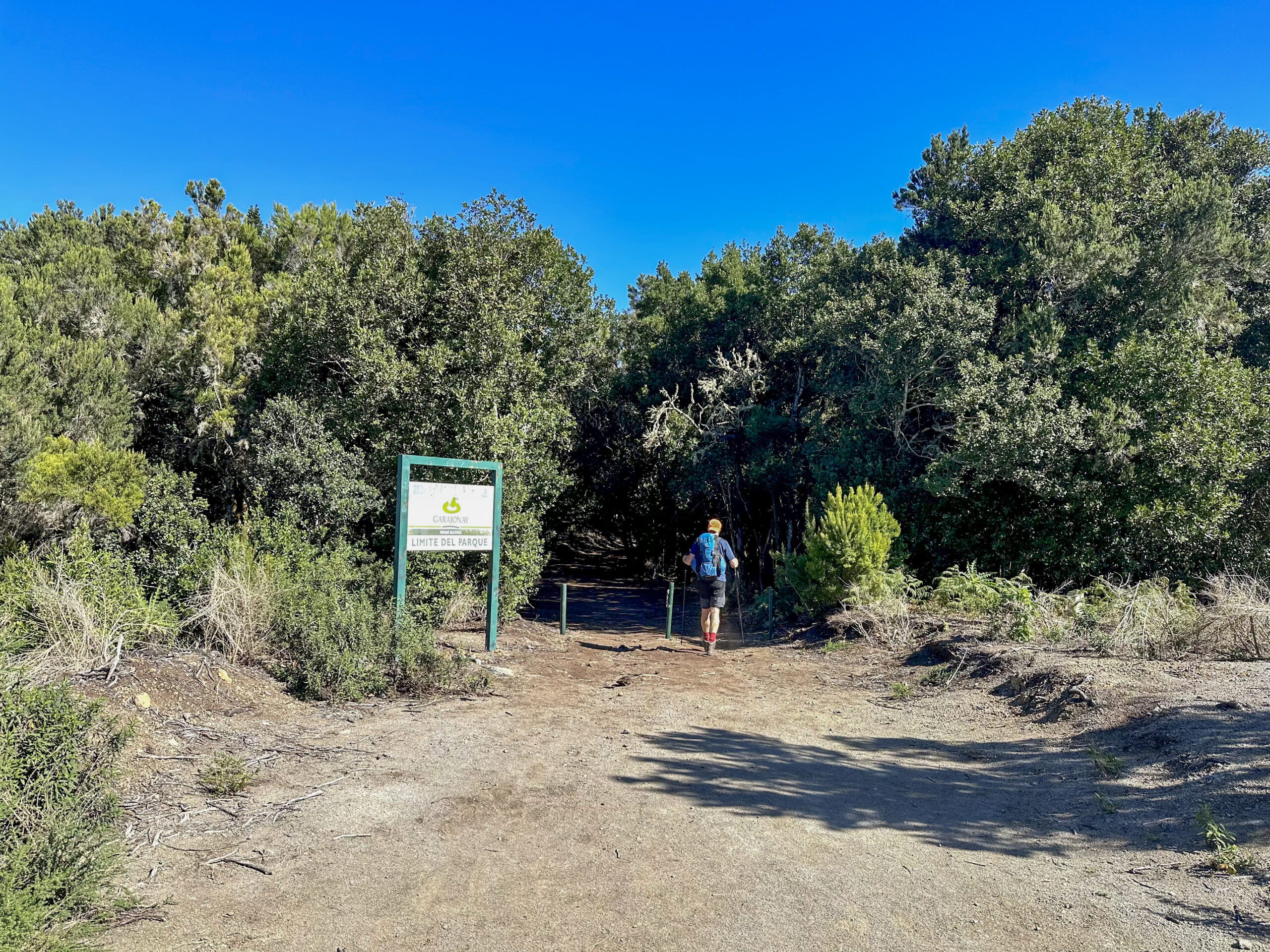
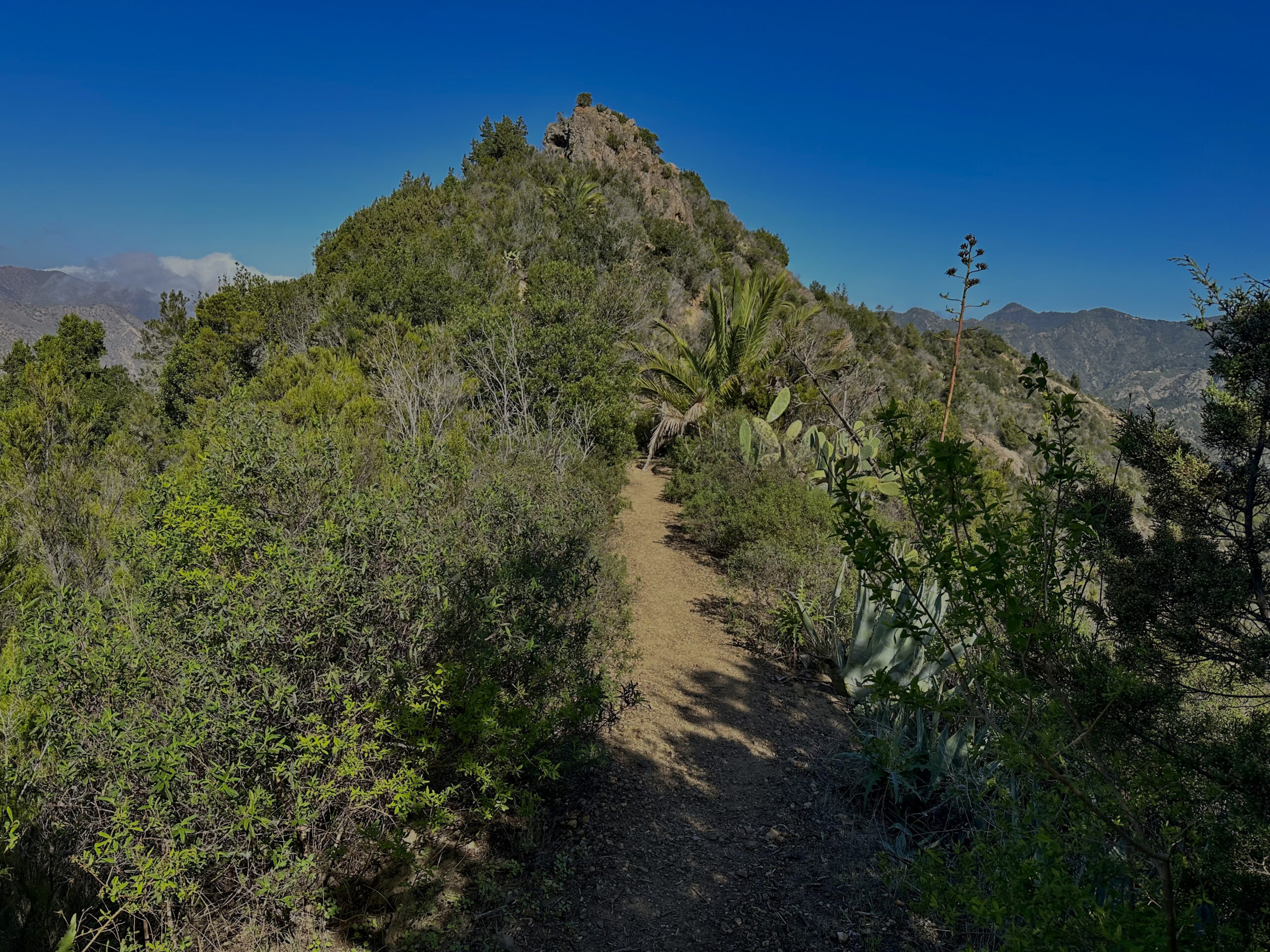
Shortly after the two paths, Camino del Castaño and Camino de la Quintana merge, you come to a fork. Large Circular Valle Gran Rey continues to the right on the Sendero Helecho. However, you continue on the wide Camino de la Quintana. This path leads you gently uphill past fields and forests into the Garajonay National Park. Soon you enter the impressive dense cloud forest.
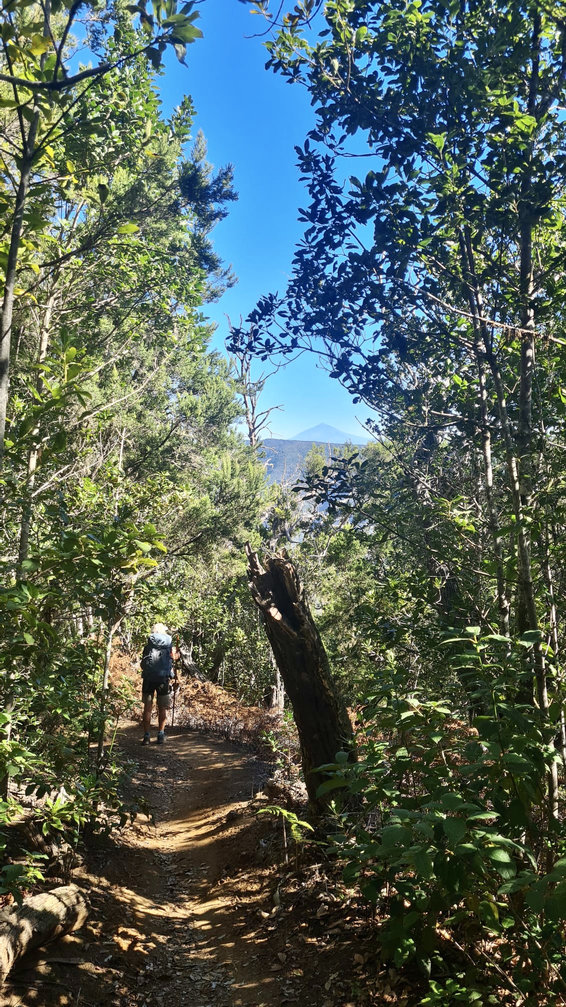
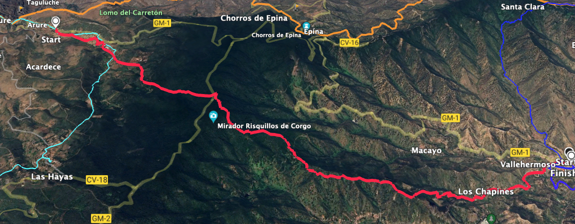
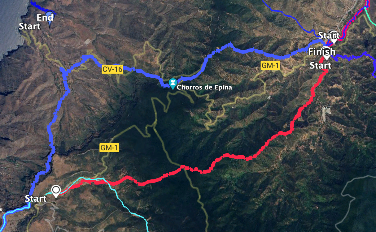
The path towards Vallehermoso is well signposted and hard to miss. Initially, it goes uphill quite a bit and sometimes steeply. After some time, you cross the main island road GM-2. You can enjoy the forest, the sounds, and the views at many small rest areas. At the Mirador Risquillos de Corgo, you reach the highest point of the hike at 1100 metres. Here you also meet the long-distance hiking trail GR-131, which comes from San Sebastian and crosses the island to Vallehermoso.
Section Mirador Risquillo de Corgos to Vallehermoso
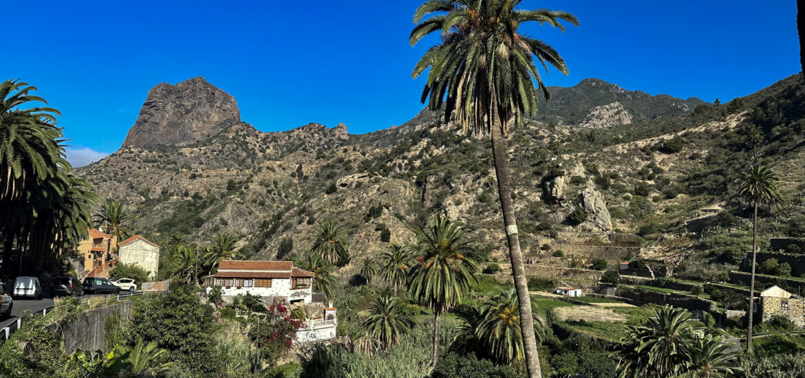
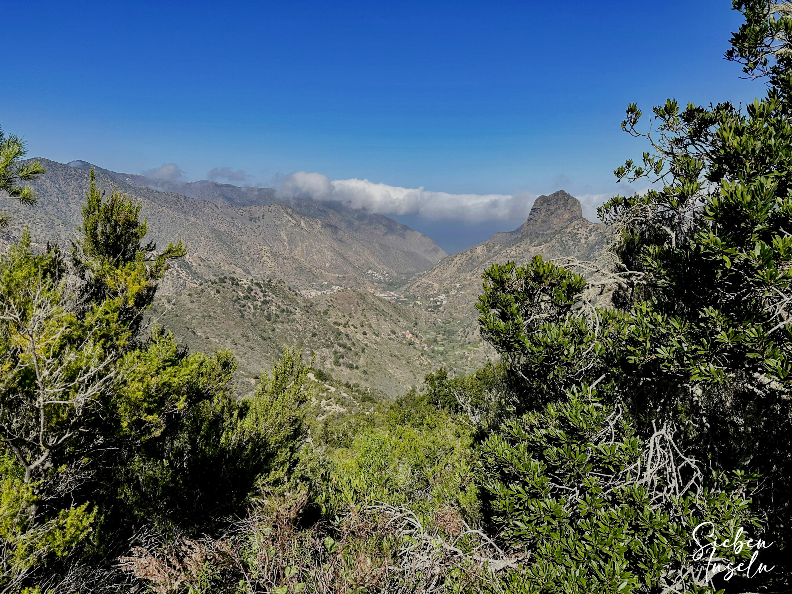
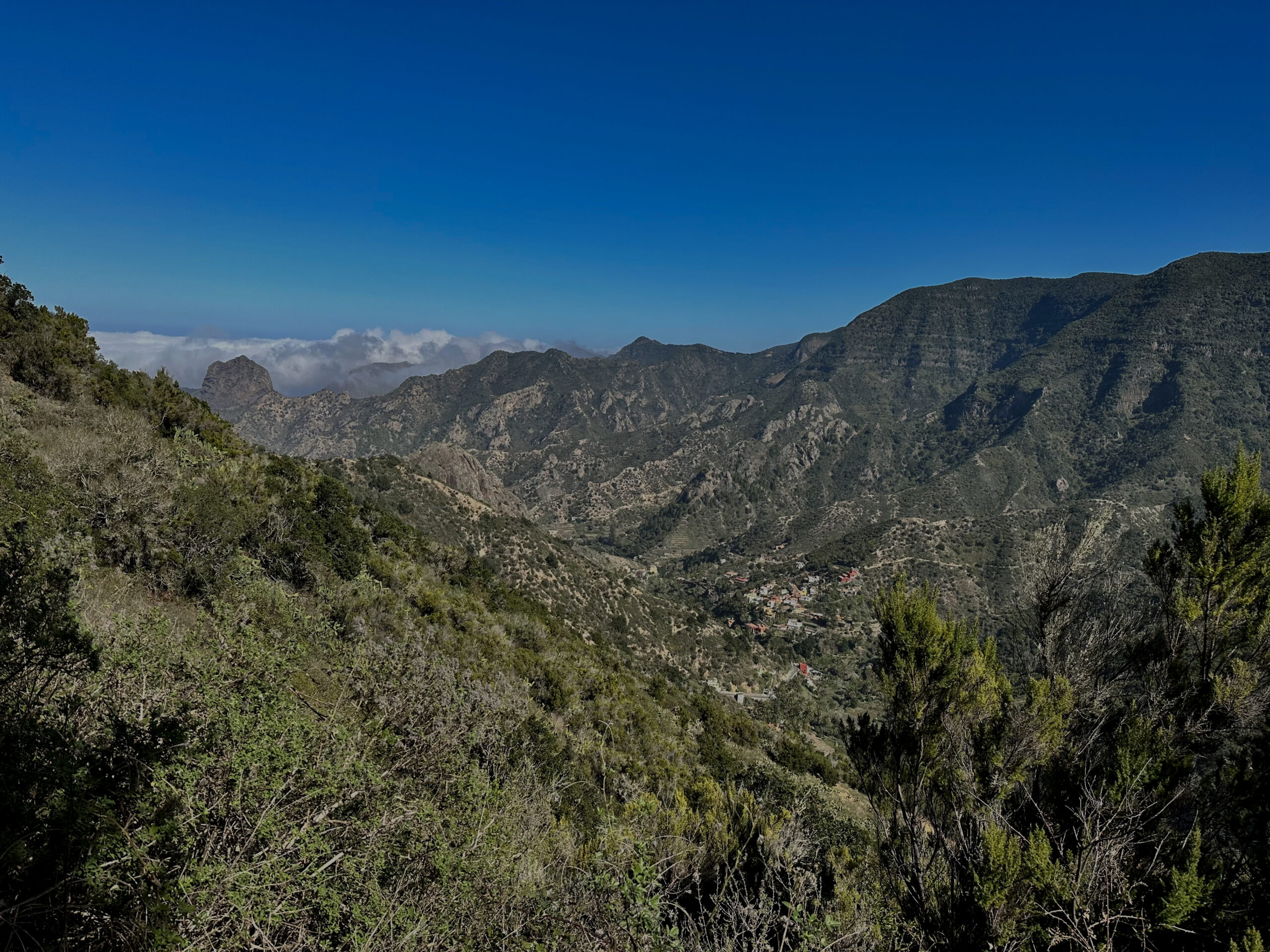
From now on, you follow the long-distance hiking trail GR-131 to Vallehermoso. From this point, it’s all downhill through the beautiful dense cloud forest. The path is unmistakable and leads you steadily downhill, close to the ridge. After some time, you have lovely views of the valley beside you. Later, you look down on the colourful village of Banda de las Rosas. Shortly afterwards, you reach a larger crossroads where you keep left. Briefly, the path climbs to a ridgeway, offering you wonderful views of the distant and lower Vallehermoso with the distinctive rock El Cano.
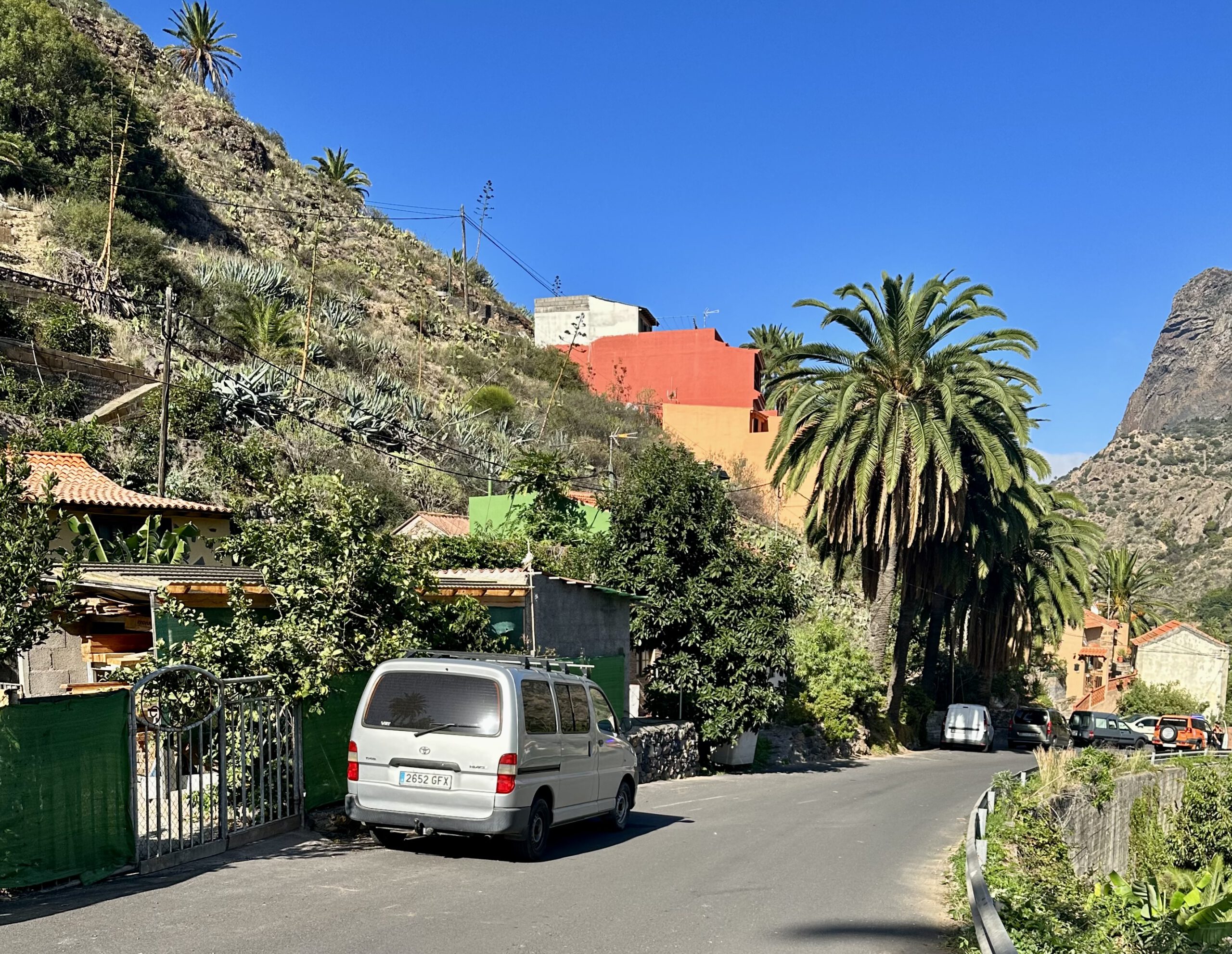
After the ridgeway, you come to a wide track, which you follow for a long time. It takes you down towards Vallehermoso with some long switchbacks. Eventually, you reach a road coming from Embalse de la Encantadora. You are now in the upper valley of Vallehermoso and follow the road to the left. You soon reach the first houses of Vallehermoso. It takes a while to walk down the quiet road before you reach the centre of Vallehermoso.
And finally
I hope you enjoyed this leisurely hike with its wonderful views through the cloud forest. It is designed for those who often write to me saying they love hiking, but many hikes on SiebenInseln are not feasible for them. This route, with its few elevation gains on a beautiful hiking trail, is a tour for connoisseurs. I wish you much joy on all your hikes,
Dagmar from SiebenInseln