The Barranco del Agua – A Fascinating Natural Area
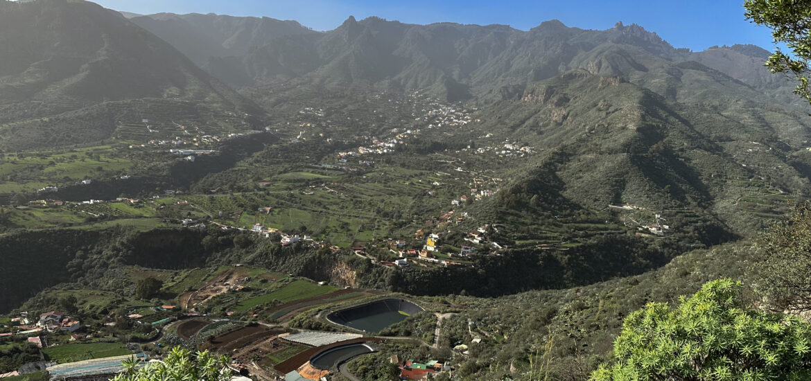
The Barranco del Agua near Vega de San Mateo is one of the many impressive ravines on the island of Gran Canaria, known for its diverse and captivating landscape. This ravine, located in the heart of the island’s mountainous interior, is a typical example of the geological diversity of the Canary Islands. The Barranco del Agua is situated in the municipality of Vega de San Mateo, a region in the northern part of Gran Canaria’s central highlands. And the ravine is part of an extensive network of barrancos that crisscross the island, playing a significant role in shaping its unique topography. The ravine is characterized by lush vegetation, which is encouraged by the higher rainfall in this area.
The flora includes a variety of endemic plant species typical of the Canary Islands. And the Barranco del Agua is particularly impressive after rainfall, when water flows through the ravine, forming small waterfalls. However, I was “lucky” to experience it without rushing waterfalls, making the hike easily accessible. The region around Vega de San Mateo has a long agricultural tradition, and barrancos like the Barranco del Agua play an important role in water supply and irrigation. In earlier times, these ravines were also vital transportation routes between the various settlements on the island. Like many other areas on Gran Canaria, the Barranco del Agua is protected to preserve its unique flora, fauna, and geological features. Visitors are therefore encouraged to respect nature and not leave any litter behind.
Hiking from San Mateo through the Barranco del Agua
The area around the Barranco del Agua is very popular with hikers. There are various trails that run through or near the well-known ravine, offering spectacular views of the surrounding landscape. One of these popular hiking routes is the circular tour from Vega de San Mateo around El Montañón. This hike initially takes you from Vega de San Mateo to the heights south of the town. From there, you can enjoy wonderful views. Then, in a wide loop, you descend through a wild side ravine towards the Barranco del Agua.
You descend into the Barranco del Agua, and your further path takes you through the ravine and then up the other side, crossing the barranco once more. At the end of the hike, you descend back to Vega de San Mateo. The Barranco del Agua near Vega de San Mateo is simply a fascinating natural area that has much to offer both hikers and nature lovers. The mix of lush vegetation, dramatic rock formations, and cultural significance makes it a worthwhile destination on Gran Canaria. I would be delighted if you also enjoyed this beautiful circular hike.
General Information about the Barranco del Agua Hike
Starting Point and Directions
Your hike begins at the large car park in Vega de San Mateo on Calle del Agua.
Access by car
From the south of the island, take the GC-41, and from the north, take the GC-42 to Vega de San Mateo. From the east and west, the GC-15 runs through Vega de San Mateo. On all roads, head towards the town center. Then, follow the GC-41 south of the town center. This road runs directly past the large car park, which is the starting point. There are plenty of parking spaces available in the car park.
Access by bus
Bus line 303 from Las Palmas stops in Vega de San Mateo. For detailed information, just check the Guaguaglobal website.
Time
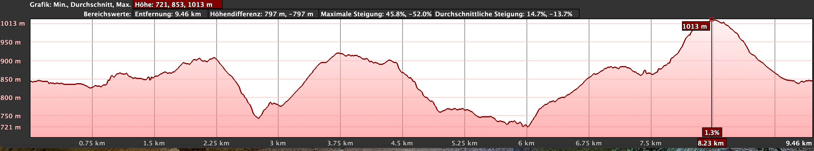
I am reluctant to give specific time estimates as these can vary greatly from person to person. We took just over 4 hours for this circular tour, including breaks.
Elevation Difference and Distance
The elevation difference on this hike is about 670 meters, and the route is 11 kilometers long.
Difficulty
The majority of the hike is on good hiking and farm tracks. However, part of the hike leads through a very green and overgrown side ravine with steep, narrow paths. At this point, surefootedness is required. As the rest of the hike is on good paths and is relatively easy, I would classify the hike overall as moderately difficult.
Refreshments
Refreshment options are available—at least as far as I have seen—only at the beginning and end of the hike in Vega de San Mateo. The hike does pass close to small villages along the Barranco del Agua. If you take a detour into these villages, you might find a bar.
Variants
As mentioned above, the area around Vega de San Mateo and the Barranco del Agua is a popular hiking area, so you will find many different routes there.
Two nearby routes in the vicinity of Vega de San Mateo can be found on SiebenInseln here.
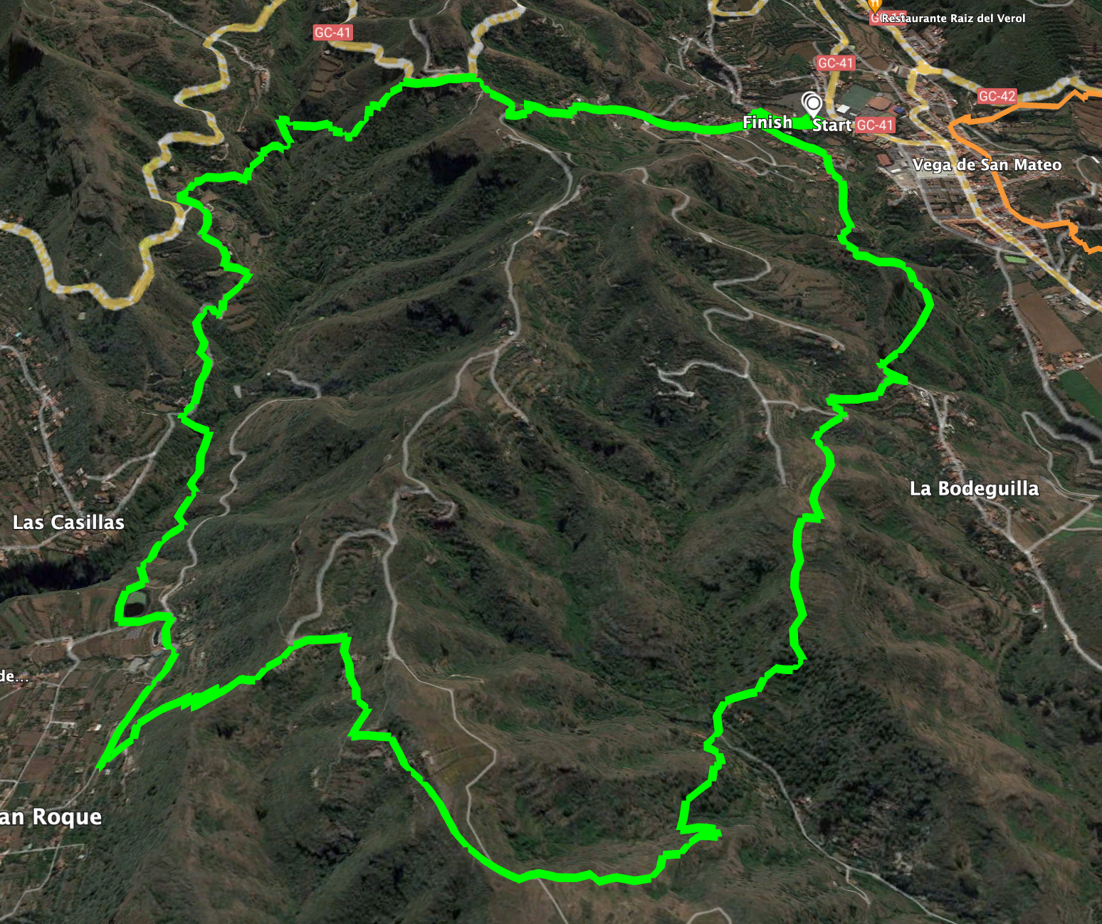
Circular Walk through the Barranco del Agua
Section: Parking in Vega de San Mateo to ridge behind La Bodeguilla
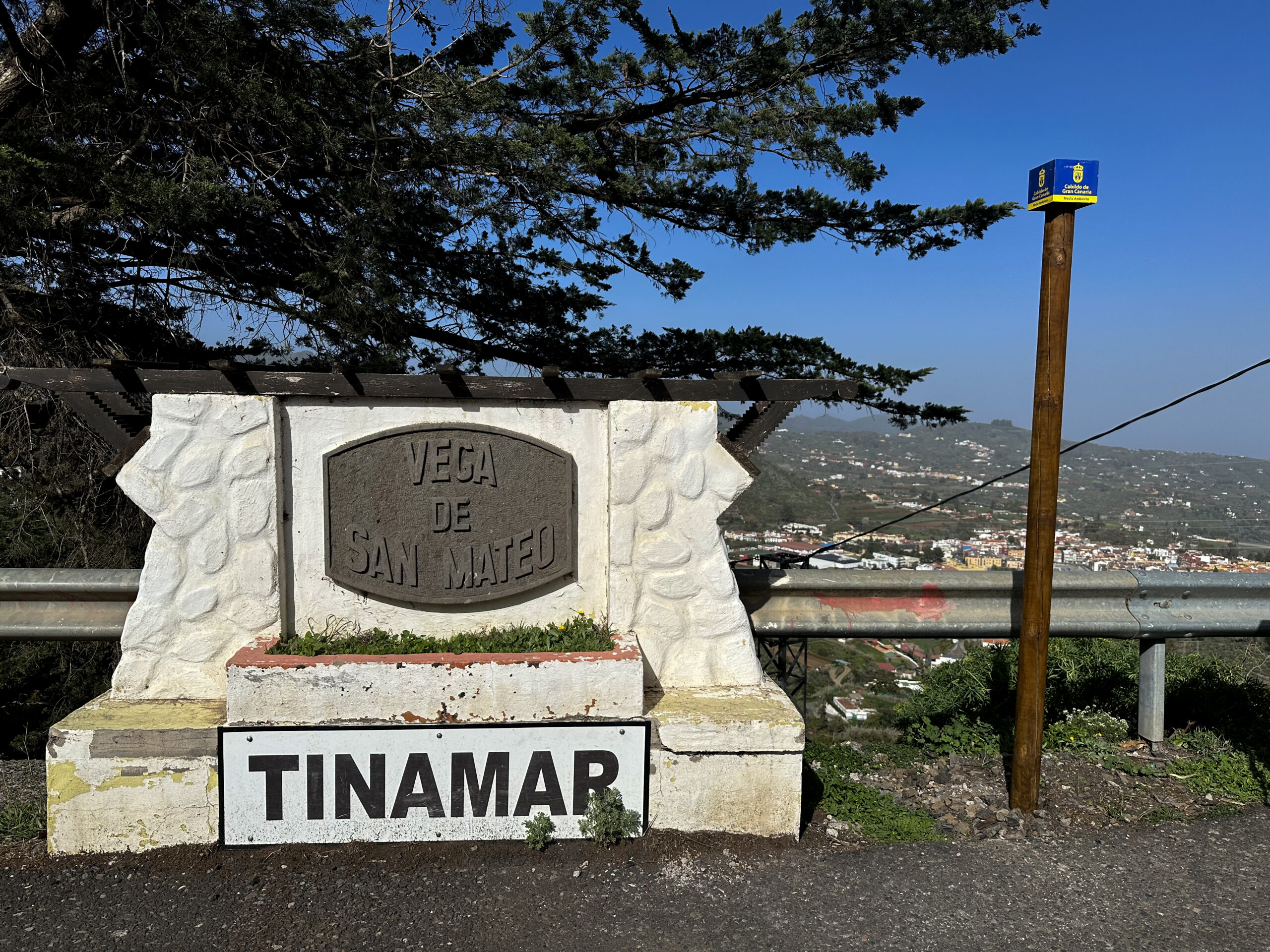
You start your hike at the large car park in Vega de San Mateo on Calle del Agua. At the back of the car park, you reach Calle El Cantillo, which you follow to the right. After a short time, this road makes a 180-degree right turn over a small stream. On the other side, continue in the opposite direction on Calle La Higuera. Follow this road straight through the town for a long time. Eventually, this road ends in front of a house. The hiking trail continues to the right of the road on a small path uphill.
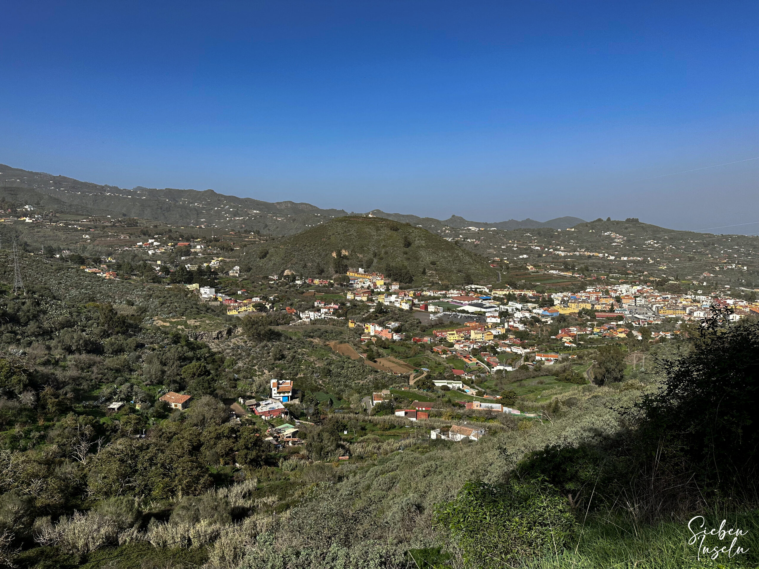
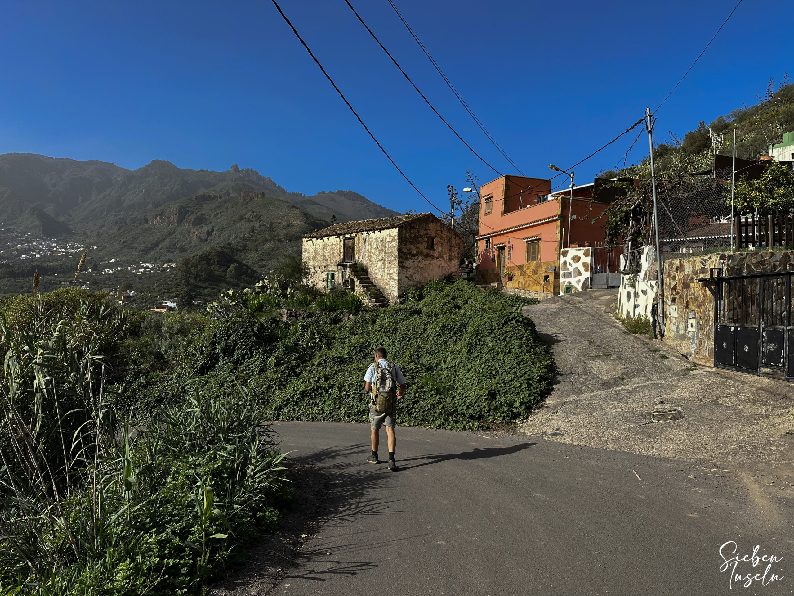
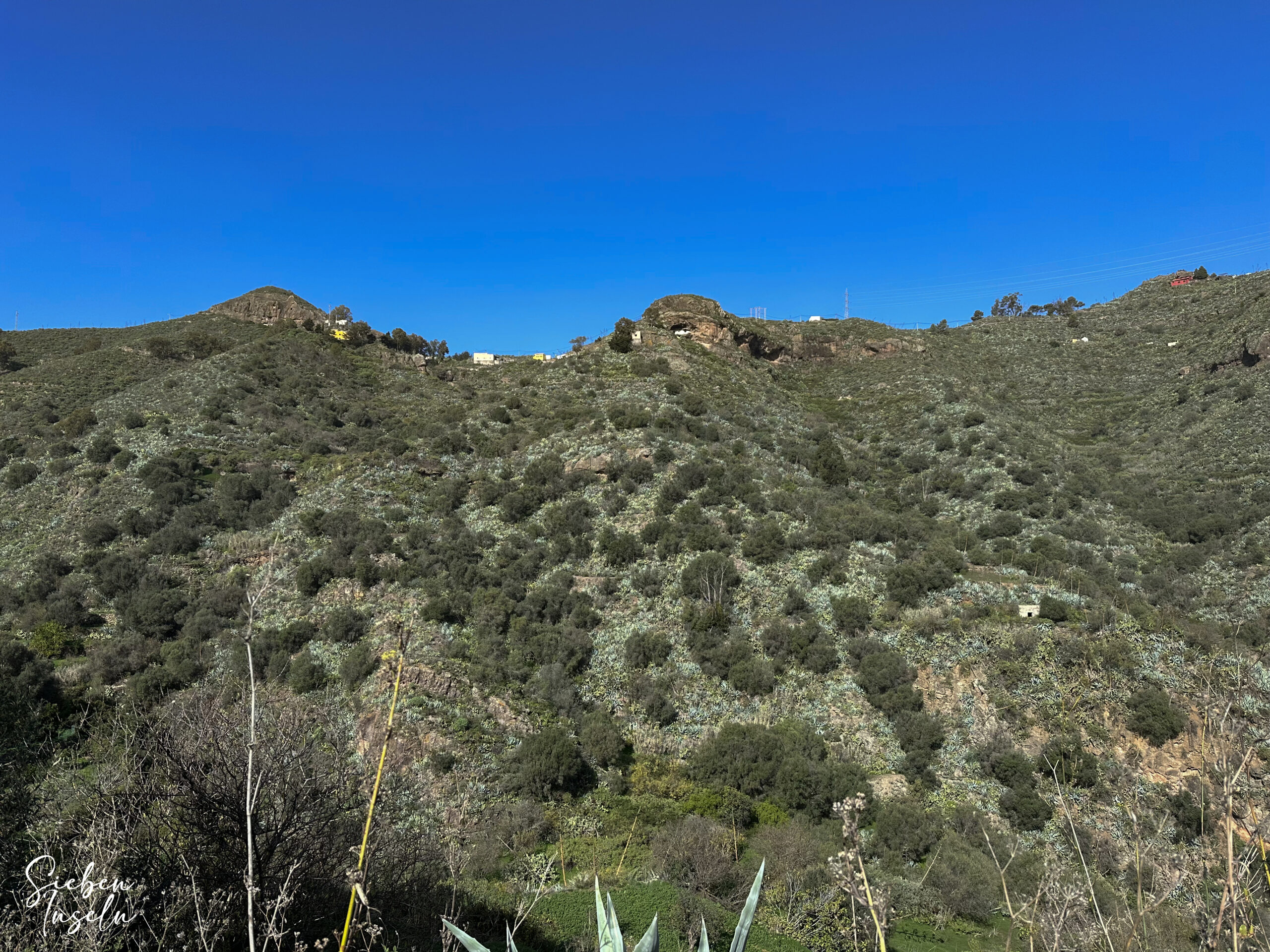
The path leads you uphill past the last houses of Vega de San Mateo. Then, you hike up towards the small hamlet of La Bodeguilla. You reach a road, which you cross. On the other side, the path continues along the edge of the village. Follow this path, which initially crosses a small ravine, for some time. It ends above some houses and continues eastward on a ridge with beautiful views over the eastern part of Gran Canaria.
Section: Ridge behind La Bodeguilla to Barrio El Helechal
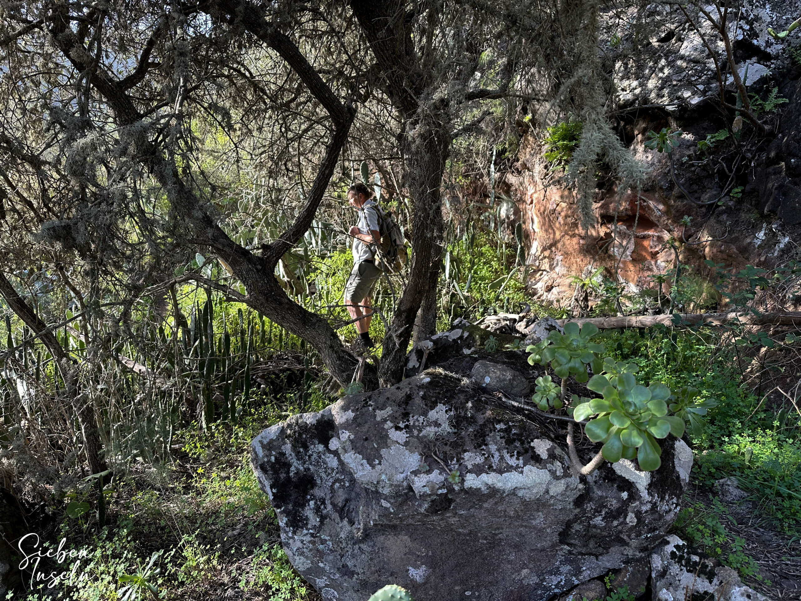
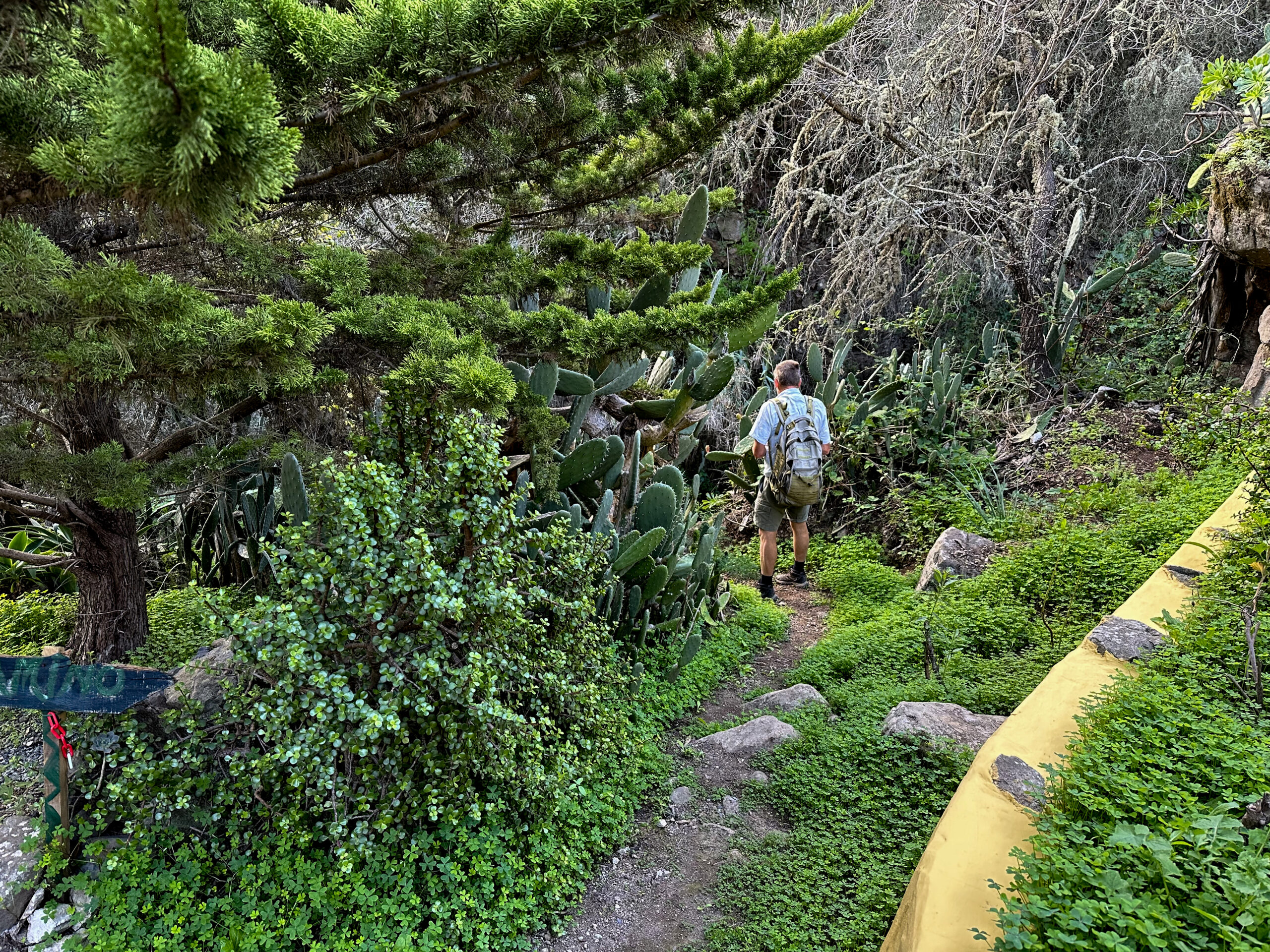
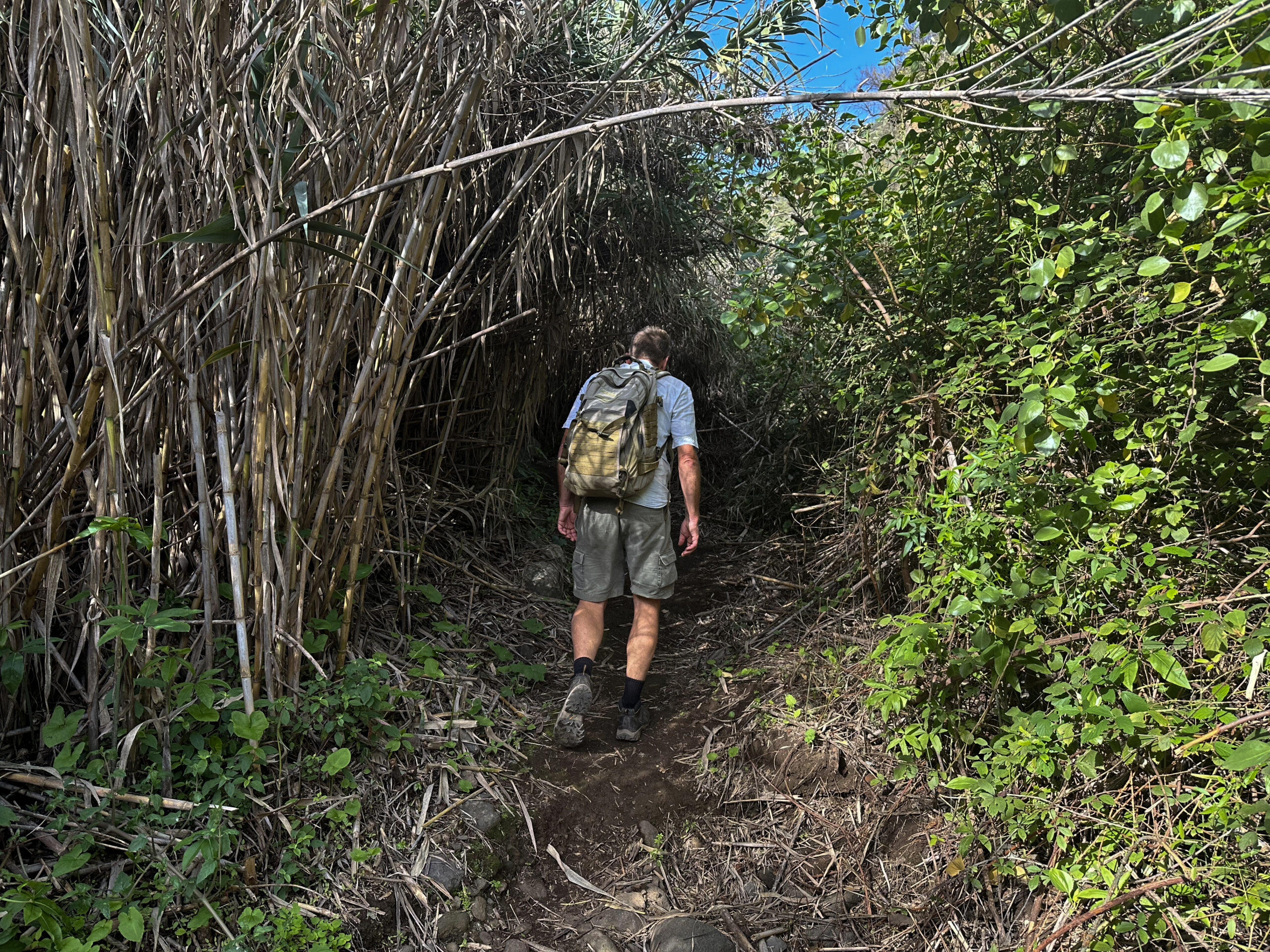
Now comes the most challenging and less straightforward part of the hike. You hike through densely vegetated scrubland on a steep and narrow path down towards Gamonal. Sometimes, finding the path is not easy, but as the direction is clearly downwards, you will keep finding a small trail. Once you reach the bottom, you come to a wider ravine, which you cross. There is also a house here. You finally climb straight uphill on a narrow path to a track (Camino Cruz de Gamonal). Follow this track uphill to the right. Near a house, the track ends and turns into a hiking trail. Continue hiking uphill through wooded terrain.
Eventually, you emerge from the wooded area and can enjoy beautiful views again. The path now takes you downhill. You reach a track, which you follow to the right for a very short time. Then, the hiking trail branches off to the left from the track. This trail, with beautiful views over the wide plain in front of you, takes you down towards El Helechal. Initially, the path runs along the slope in a westerly direction for a long time. Then, you hike downhill in large switchbacks in a southerly direction. Finally, you reach the hamlet of El Helechal.
Section: Barrio El Helechal to Upper Part of Barranco del Agua
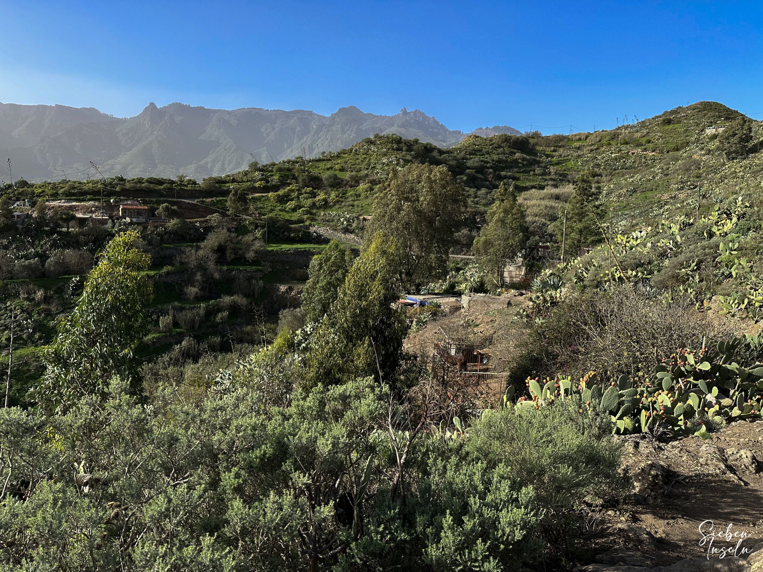
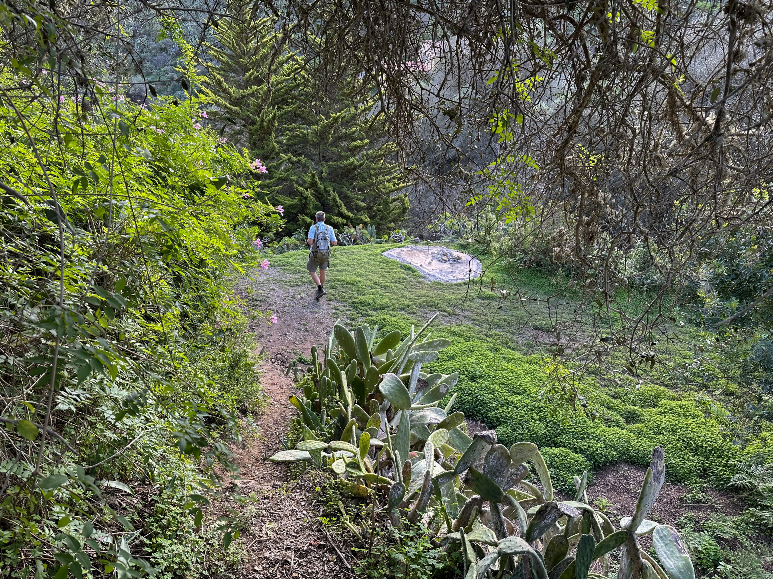
Follow the wide track to the right through El Helechal, past houses and two water reservoirs (first a smaller one, then a very large one). After the large reservoir, you are already above the Barranco del Agua, which runs below to your left. The hiking trail continues straight above the Barranco del Agua. Gradually, it takes you down into the ravine. Eventually, you hike into the impressive green barranco. The trail runs along the bottom of the barranco for some time.
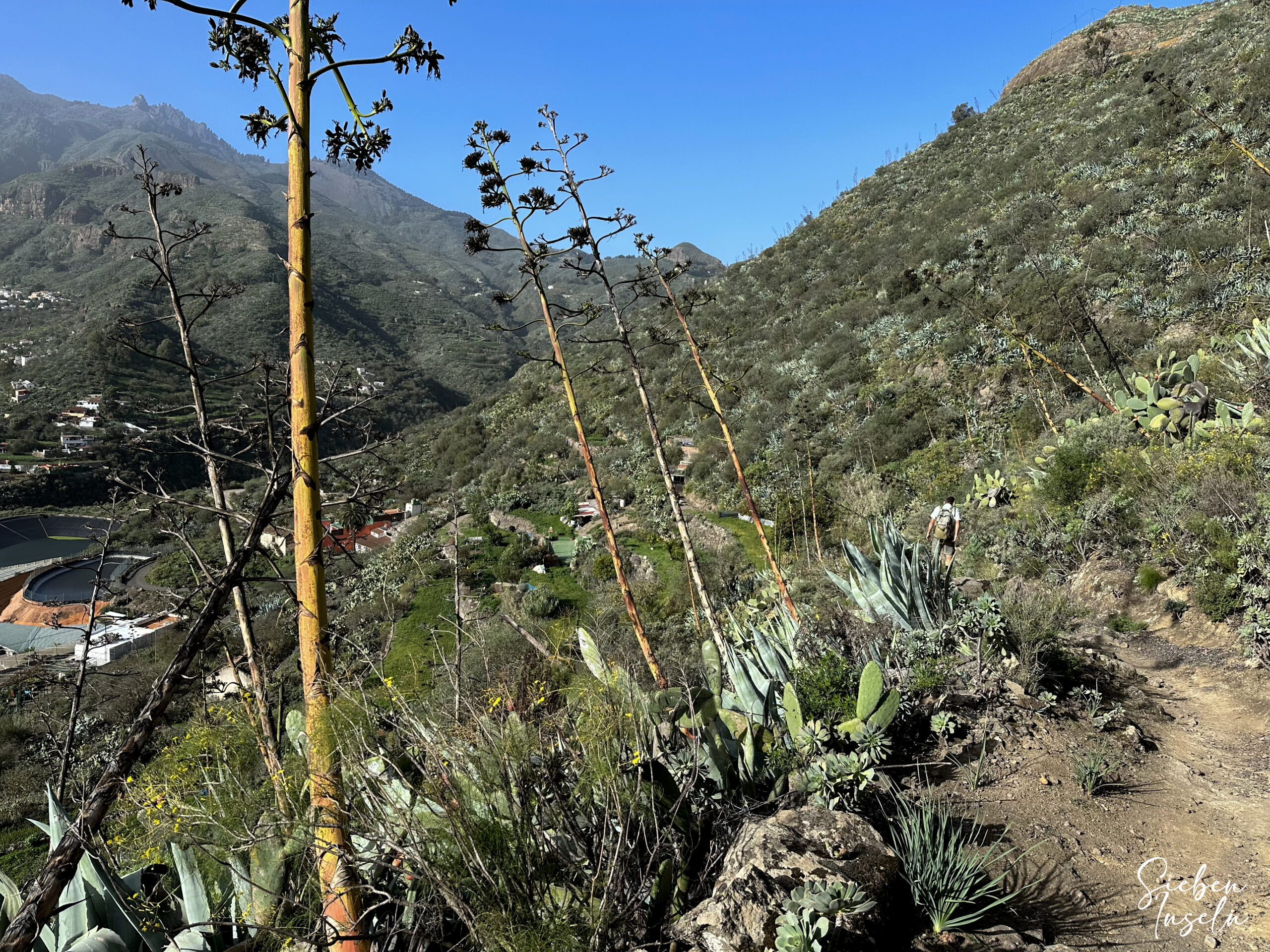
Then, the trail takes you up the left side of the ravine onto a track. Follow this track to the right, past houses and fields. Now, hike parallel to the GC-41 on this track above the Barranco del Agua. However, eventually, the trail turns back towards the Barranco del Agua. At this point, the ravine is already branched. You must cross both branches before you can climb the other side. This part of the hike through the impressive ravine is beautiful, green, and offers you stunning views.
Section: Upper Part of Barranco del Agua to Starting Point at Parking in Vega de San Mateo
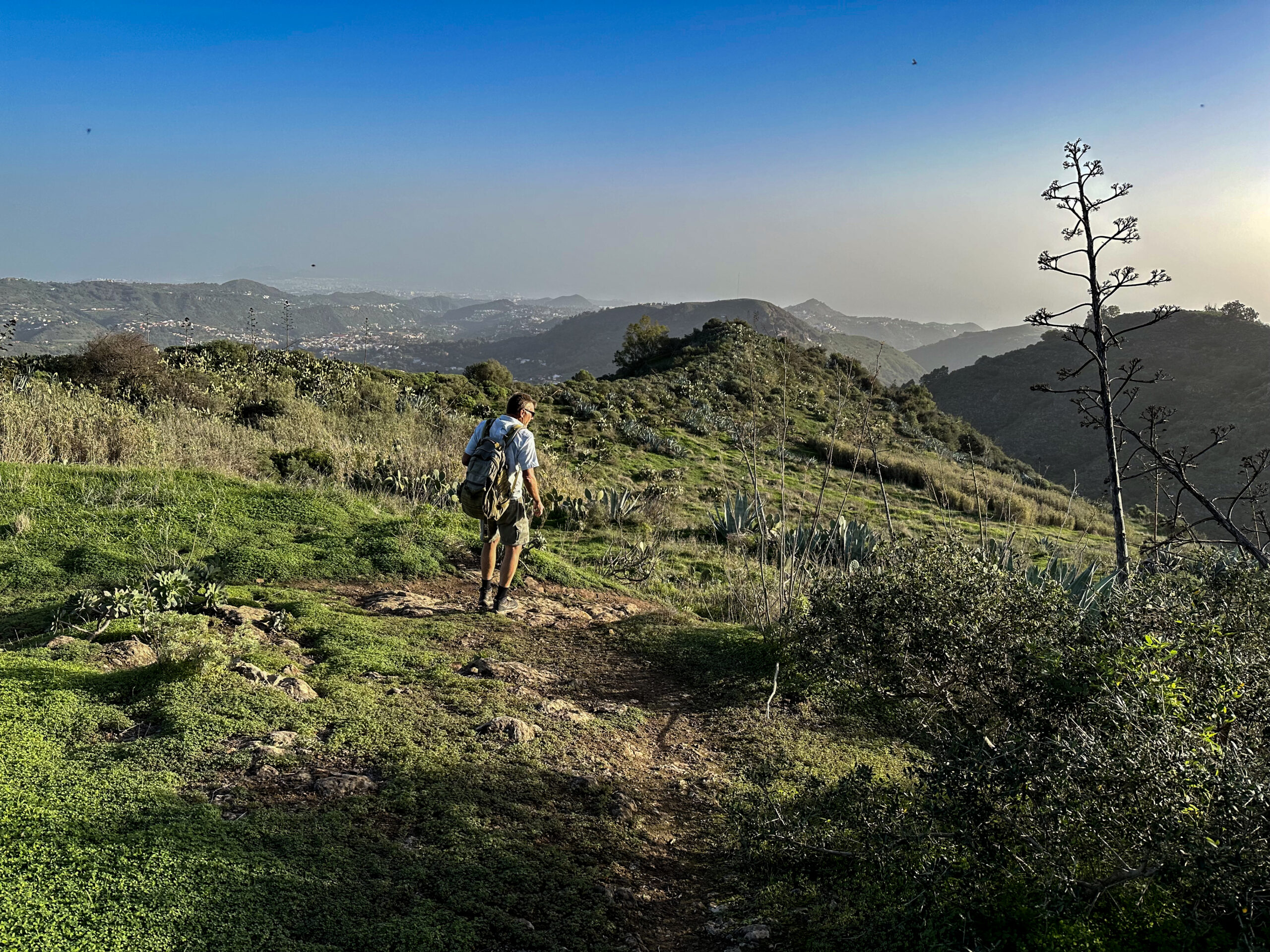
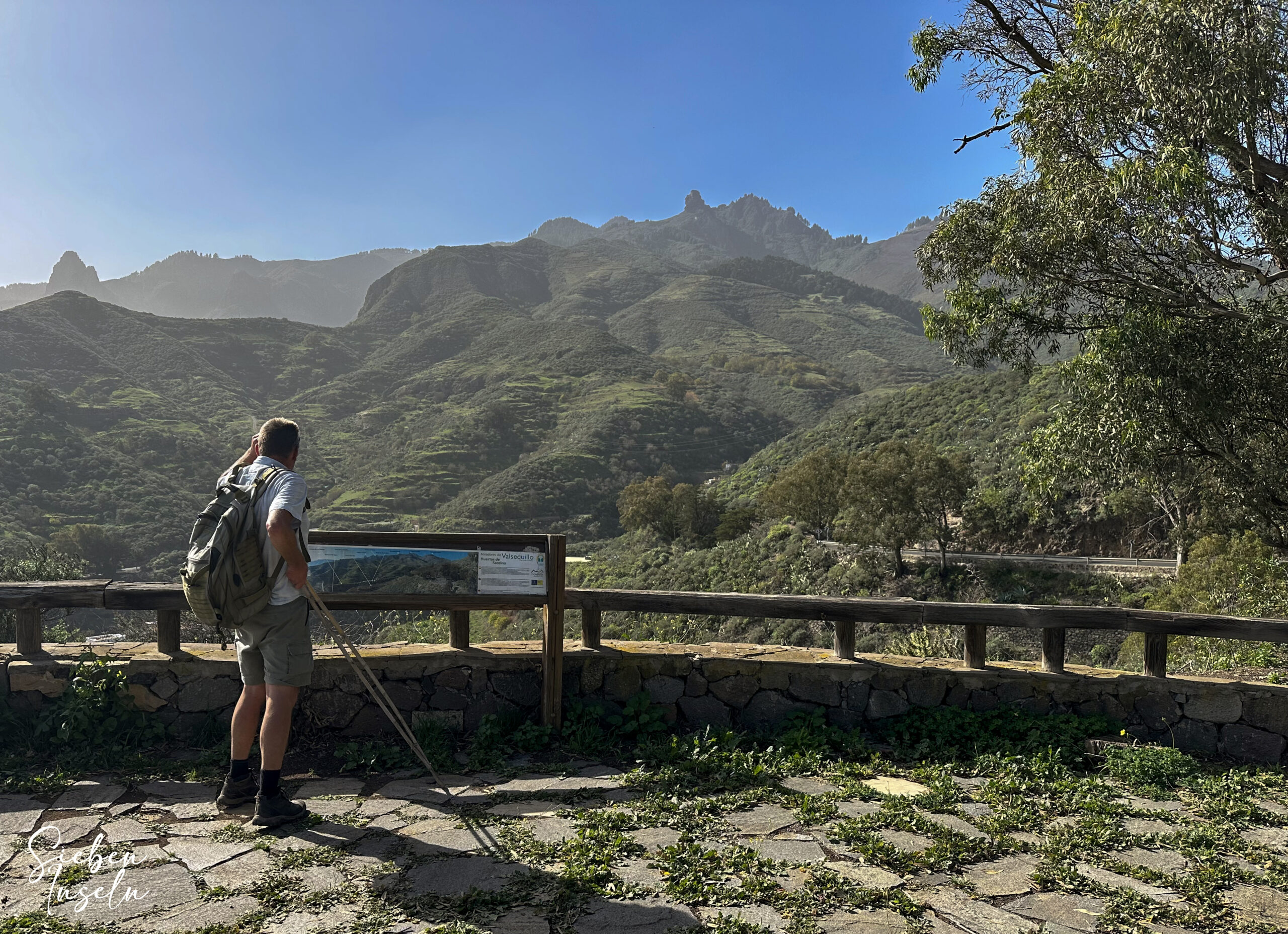
After hiking through the Barranco del Agua in this section, there is one last very steep climb. This takes you up to over 1000 meters to the Mirador de La Plata on the GC-41. At the top, you can rest and enjoy the magnificent view. Then, turn right and walk for a short time along the GC-41. Before the first left curve, the hiking trail branches off to the right on a road towards El Montañón.
After a short time and the first right curve, the trail that branches off to the left takes you back down towards Vega de San Mateo. First, you reach the hamlet of La Higuera. Here, you already reach a road, which you follow down through the village towards Vega de San Mateo. Finally, you arrive at the point where you turned left onto Calle La Higuera on the way up. Now, go in the other direction, turning left again, and after a short time, you will be back at your starting point.
And finally
I hope you enjoyed this varied hiking loop around the well-known Barranco del Agua. Wherever you may hike, I wish you beautiful impressions and experiences,
Dagmar from SiebenInseln