- Los Brezos circular hiking trail with high adventure value
- General information about the Los Brezos circular walk
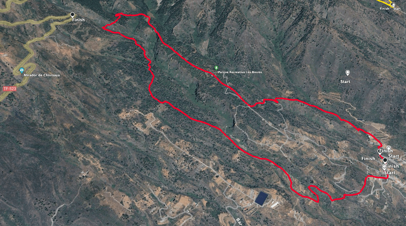
- Circular hike Los Brezos above Araya
- Section Calle Araya to the ascent path behind the Barranco de las Goteras
- Section behind the Barranco de las Goteras until crossing the Barranco del Corcho
- Section crossing Barranco del Corcho to the Parque Recreativa Los Brezos rest area
- Section of the route from the Parque Recreativa Los Brezos rest area to the starting point of Calle Araya
- And finally
Los Brezos circular hiking trail with high adventure value
The Los Brezos circular hiking trail with the official designation SL TF 294 in the Valle de Güímar connects several traditional hiking trails. Part of this trail is also identical to the circular hike around Pico Igonse. Most of the hike runs through agricultural land at medium altitudes in the south-east of Tenerife. It passes through the Corona Forestal Nature Park. The Siete Lomas protected hiking area is located at this altitude. Along the route are typical Canarian cultural assets such as canals, water troughs, fountains, ponds and old ovens that were used to dry fruit.
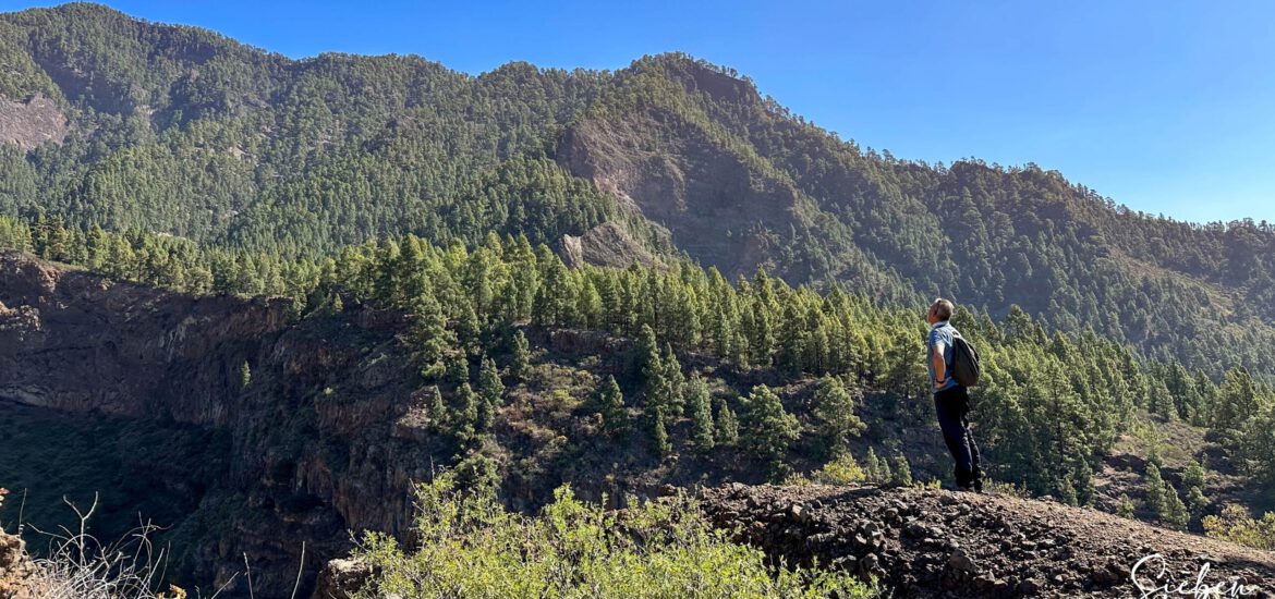
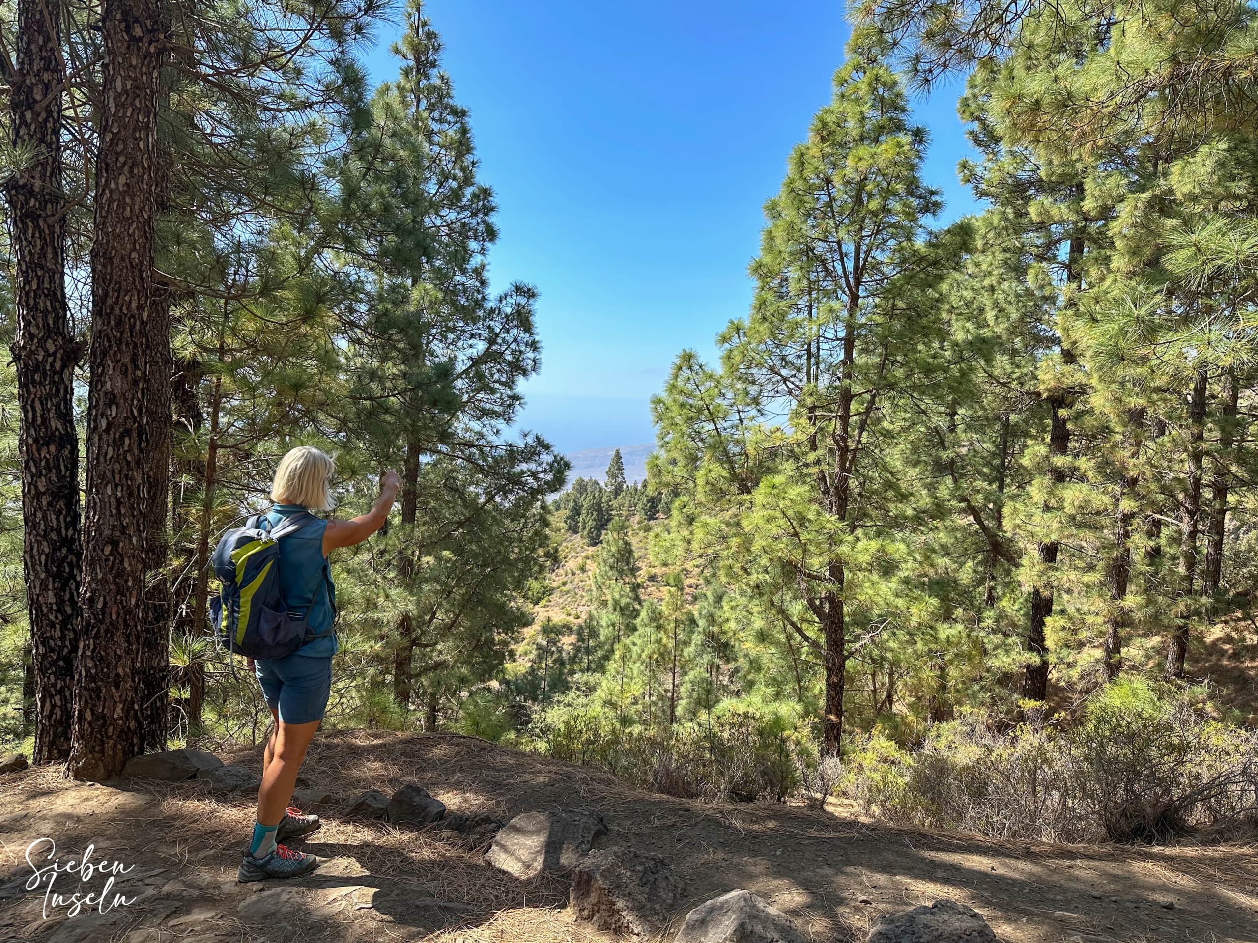
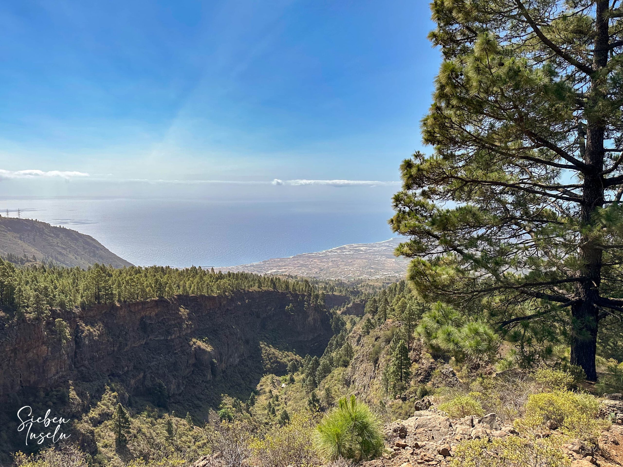
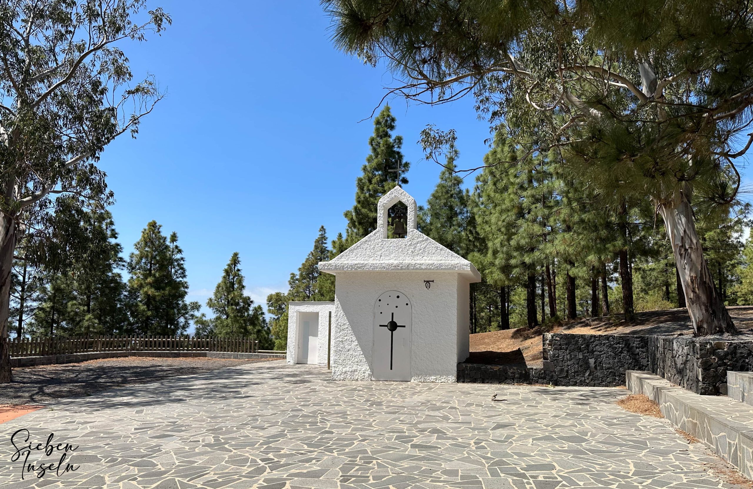
You will also pass the Finca de Las Haciendas with its traditional Canarian architecture. You can enjoy wonderful views of the east coast of Tenerife and the neighbouring island of Gran Canaria from the Los Brezos hiking trail. Deep below you lie Araya, the Canal of Araya and deep gorges with striking rock faces. The hiking trail also passes the Los Brezos rest area with its chapel, which gives the hike its name. Hiking through pine forests and green areas with marvellous views is simply beautiful, and the Los Brezos hiking trail is ideal for experiencing the natural and rural side of Tenerife away from the main tourist crowds.
General information about the Los Brezos circular walk
Starting point and directions
The starting point of the hike is above Araya near Cruz del Camino on Calle Araya.
Getting there by car
Coming from the north or south via the TF-1, take the Candelaria, Araya motorway exit. From there, follow the TF-247 and the signs for Araya until you reach the village of Araya. From the TF-247, turn right uphill and then only drive uphill to the starting point on Calle Araya. You can park at the roadside there.
Getting there by bus
The Titsa bus line 123 goes to Araya and stops at the TF-247, so you still have to walk up through the village to the starting point. Details and further information on the exact timetable can be found on the Titsa homepage.
Time
I don’t like to give general times for hiking tours, as the times are very individual. We needed 3.5 hours for this tranquil tour with breaks.
Height difference and route length
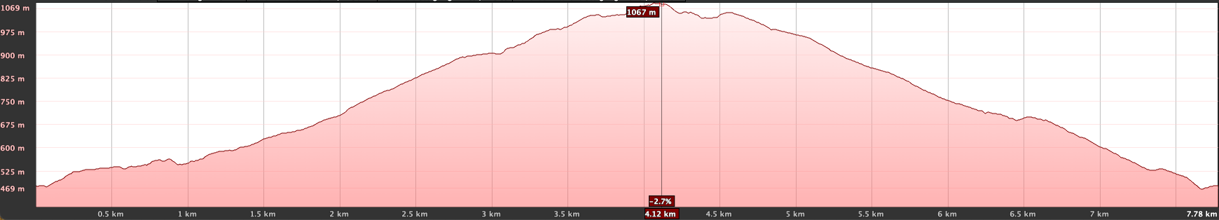
The difference in altitude is approx. 700 metres (the TenerifeOn app indicates 802 metres of altitude for this hike) and the route is just over 9 kilometres long.
Requirements
The entire route is on good hiking or cycling paths.
Refreshment
You will find restaurants, bars and shops in Araya – if they are open. Make sure you take enough water and food with you for the round trip.
Variants
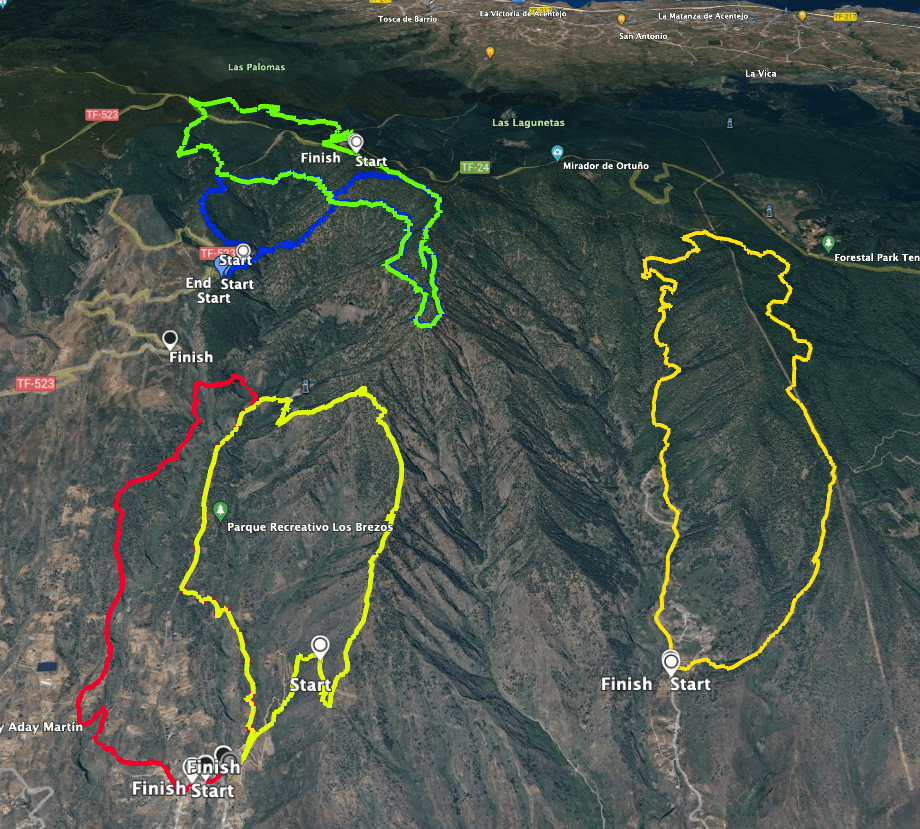
You can of course do the hike on the left or right. I describe it on the left. As part of it runs parallel to the Igonse circular hike, you can also combine these two hikes very well. This is especially true if you want to extend the hike a little.
Other hikes in the vicinity on SiebenInseln:
Igueste de Candelaria – Steep ascent through the protected landscape of Las Lagunetas
Circular hike high above Candelaria
Circular hike Los Brezos above Araya
Section Calle Araya to the ascent path behind the Barranco de las Goteras
You start your hike on Calle Araya near the Cruz de Camino in Araya. Follow Calle Araya to the Cruz de Camino. Then walk a few metres to the south. Then turn left uphill into Calle Lomo las Goteras. There you walk past some houses. Behind the last house, leave the road to the left onto the hiking trail. This takes you across fields to a road again.
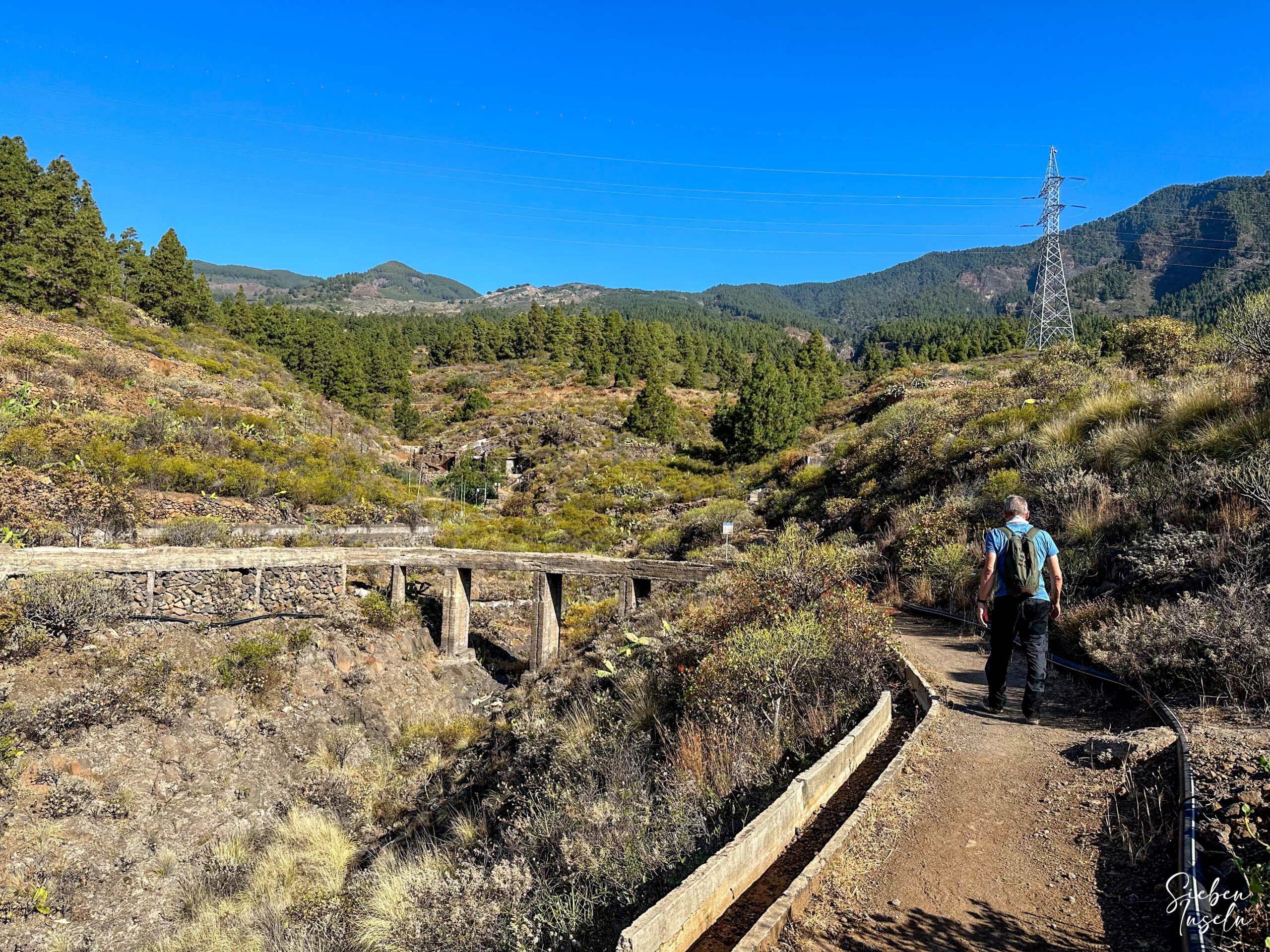
Cross the road and continue uphill on the hiking trail. The path first leads you through a small gorge and then to the Barranco de las Goteras. At first, follow the path along the gorge, which you then cross. On the other side, you climb back up through the forest. Finally, the path turns westwards uphill. You walk along and on the Canal de Araya for a short time and then uphill through agricultural land. Along the way, there are canals and other interesting things to see that are associated with Canarian agriculture.
Section behind the Barranco de las Goteras until crossing the Barranco del Corcho
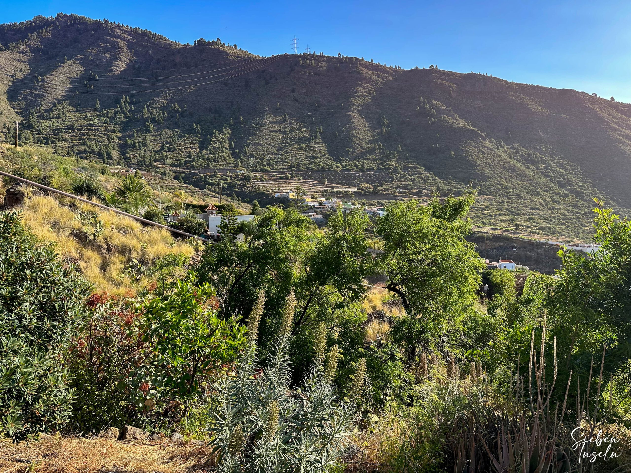
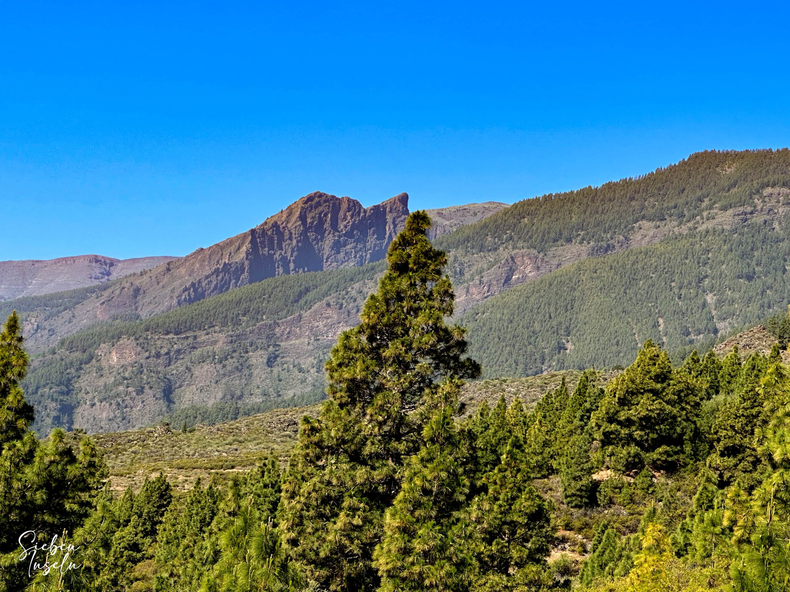
The rest of the hiking trail initially takes you directly along the Barranco de las Goteras. On some maps, the barranco is also referred to as Barranco Chese or Barranco Amanse. The hiking trail then turns away from the gorge and you hike mostly uphill through the pine forest. Looking back, you can always enjoy wonderful views of the east coast of Tenerife and the neighbouring island of Gran Canaria. You walk uphill on a ridge path and can look down into the Barranco de las Goteras below you. On the opposite side, you can see the ridge to Pico Igonse. On the other side is the striking Pico Marcial.
Finally, the hiking trail turns back towards the gorge. You can’t miss the well-signposted SL TF 294 hiking trail. The higher you go, the better the views. The hiking trail finally takes you a little to the west along the edge of the Barranco del Corcho (also known as Barranco de la Erilla). This is a side gorge of the Barranco de las Goteras. You walk along it for a short while. Then you walk downhill into the gorge and the hiking trail crosses it. On the other side, the path leads you back uphill through the forest.
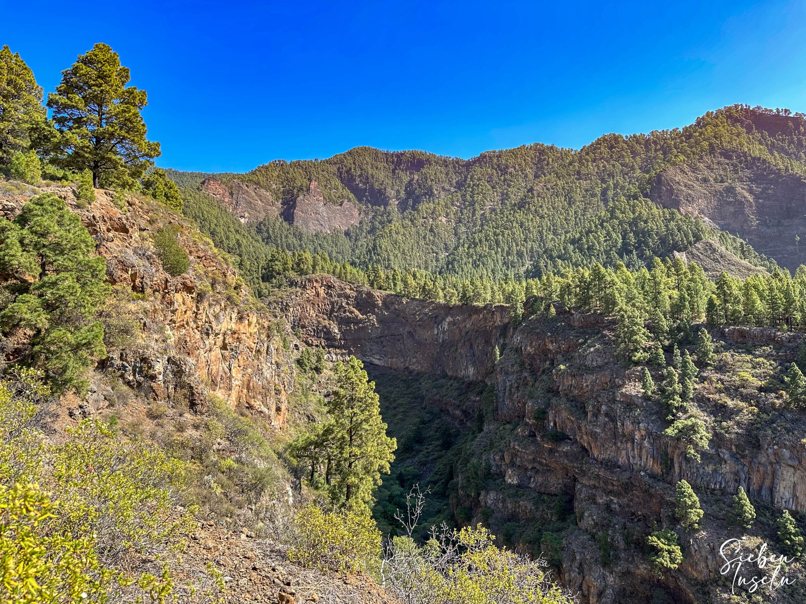
Section crossing Barranco del Corcho to the Parque Recreativa Los Brezos rest area
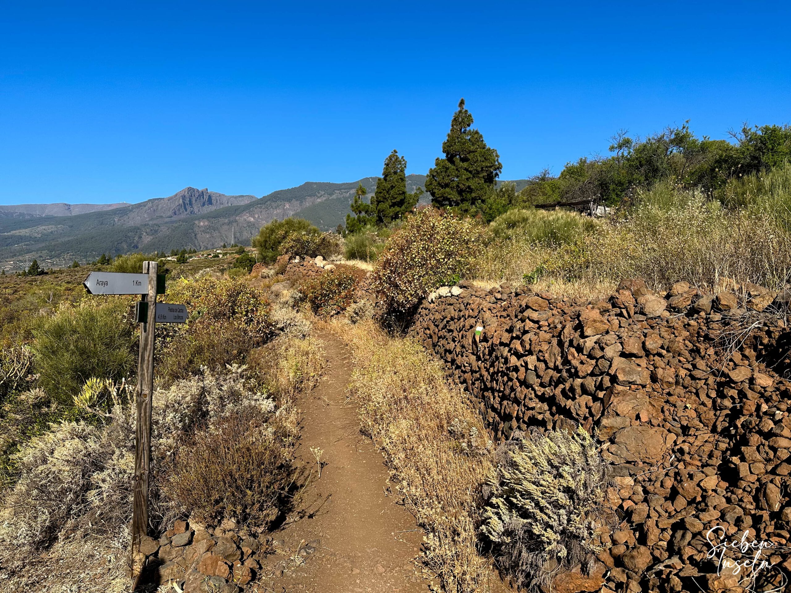
You hike uphill for a short while and find yourself at a very beautiful viewpoint at an altitude of around 1050 metres. Here you hike through the protected natural landscape of Siete Lomas. From there, the path turns downhill again to the Barranco de las Goteras. You cross this. The path then climbs again on the other side of the gorge. After a while, you will reach a plateau. There the hiking trail joins the main Camino de la Hoyas de la Viña trail. Continue left to Igonse. The path to the right is also identical to the Igonse hiking trail.
The route continues along the striking rock Risco de La Vera, which brings you very close to the edge of the gorge. We abseiled down this barranco a few years ago. And it is really worth seeing – even from a height. You can enjoy the great view of the gorge for a while. Then the hiking trail takes you further down via a track to the Parque Recreativo Los Brezos rest area. You can cross this at right angles to the white chapel.
Section of the route from the Parque Recreativa Los Brezos rest area to the starting point of Calle Araya
From the rest area, the hiking trail runs straight downhill and spares you the long windings of the road. After a while, you come back to the road and can leave it again on the hiking trail to avoid a large hairpin bend. But when you reach the road again, you have to follow it downhill for a while. The hiking trail finally leaves the road and is signposted at the Barranco de las Vigas, which you cross. Once you reach the other side, continue downhill – still with good views. You walk along a marvellous ridge path between two gorges.
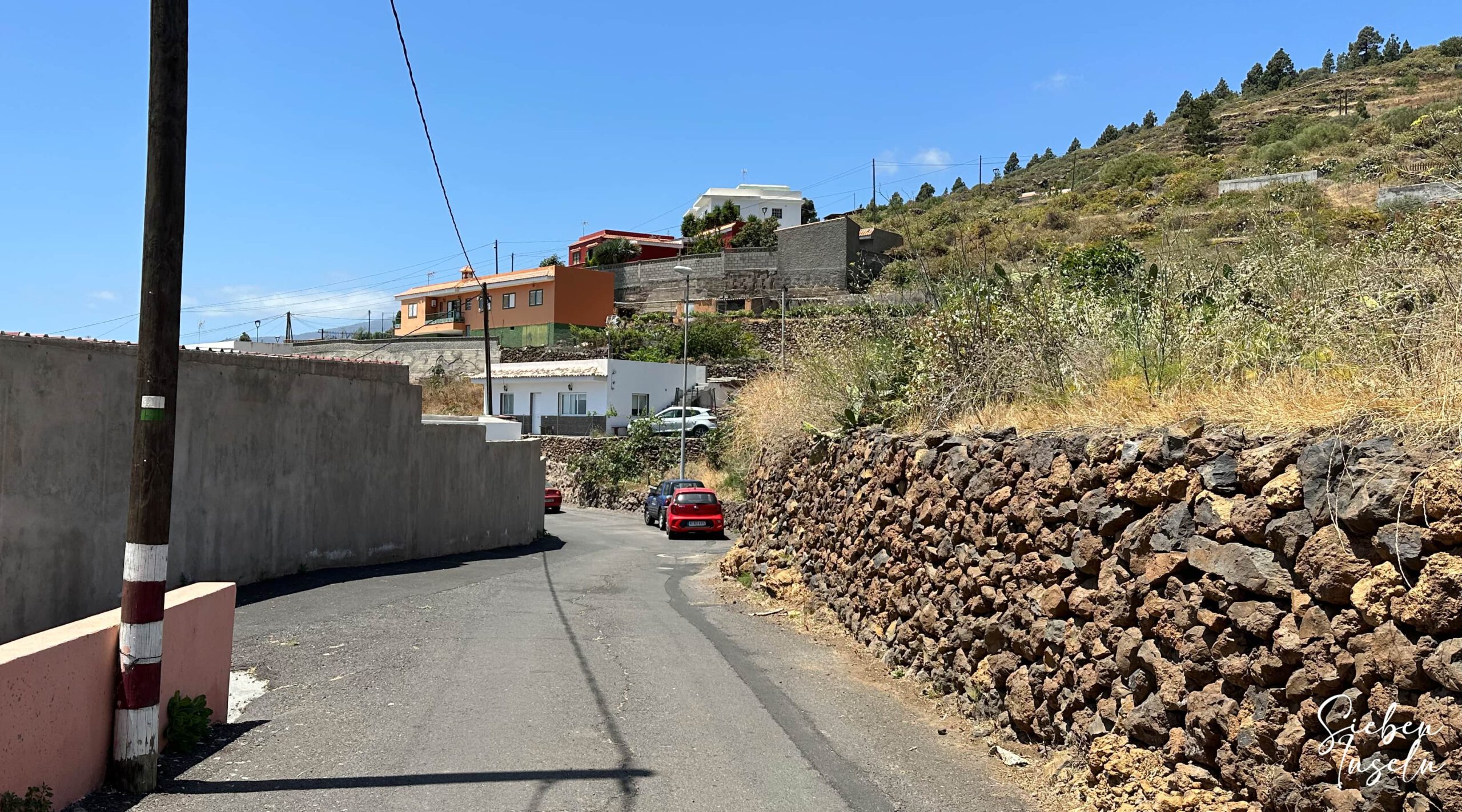
You cross the covered canal of Araya. The route then descends very steeply past some fincas and fenced-in land. A concrete path takes you down to the first houses. Opposite is the finca Las Haciendas, built in Canarian style. From there, you walk downhill along the Camino de las Haciendas. After a short time, the hiking trail leads you downhill on a small path on the right to Calle Araya. Once you have reached this, it is only a few metres to the starting point of the hike.
And finally
I hope you enjoyed the Los Brezos hike high above Araya. I myself like the beautiful hiking area on the east coast of Tenerife so much that I will definitely be returning there again and again. Wherever you go, I wish you lots of fun on all your hikes,
Dagmar from Siebeninseln