
- From the Degollada de la Aldea through an Impressive Steep Wall to the Inagua
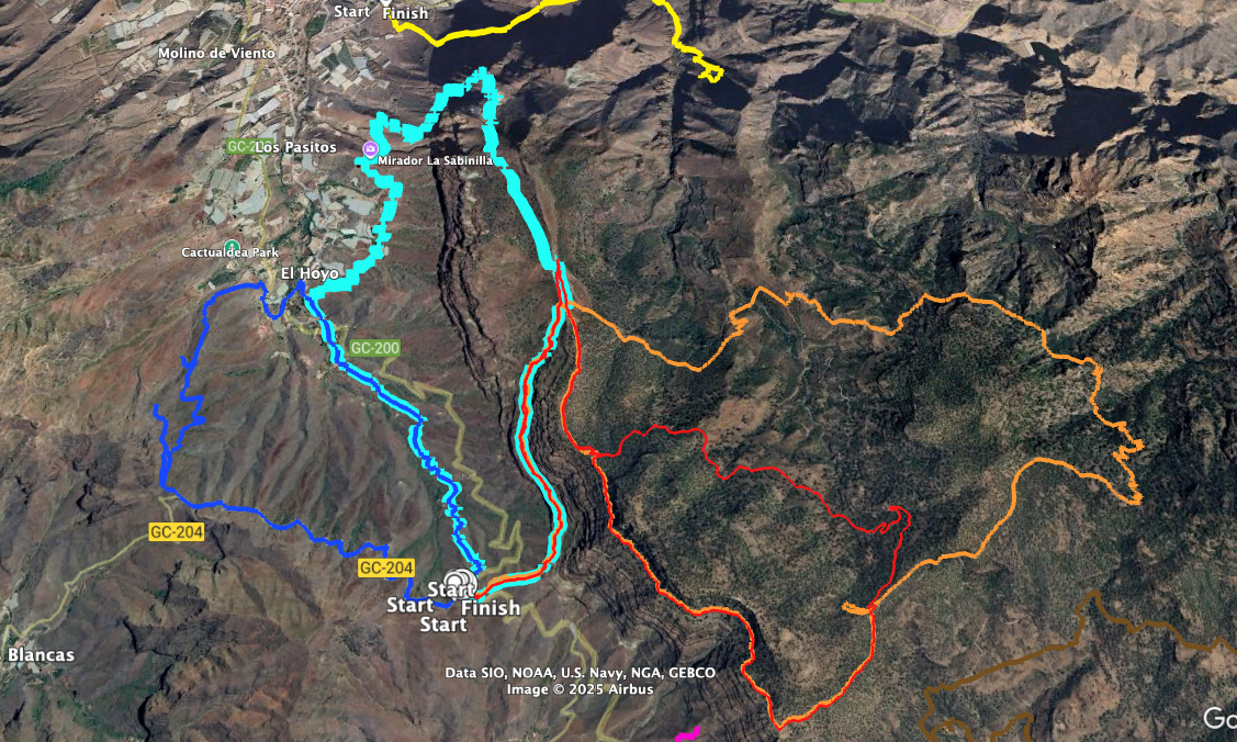
- Circular Hike Degollada de la Aldea
- General Information about the Circular Hike Degollada de la Aldea
- Circular Hike Degollada de la Aldea
- Section Degollada de la Aldea to Rock Slabs Below the Wall
- Section Rock Slabs Below the Wall to the El Laurelillo Plateau
- Section El Laurelillo Plateau to the End of the White Plateau
- Section End of the White Plateau to the End of the Village El Hoyo
- Section End of the Village El Hoyo to Degollada de la Aldea
- And finally
From the Degollada de la Aldea through an Impressive Steep Wall to the Inagua
The large circular hike from the Degollada de la Aldea to the Inagua Nature Reserve begins with a walk through an impressive steep wall. The path runs directly along the rock band and will then lead you through a side valley up to the El Laurelillo plateau and into the nature reserve. On SiebenInseln, I have already described a hiking circuit in the Inagua Nature Reserve. On Gran Canaria there are more than 30 nature reserves with a total area of 66,707 hectares. The large Inagua Nature Reserve, covering 3,920 hectares and bordering the municipalities of Tejeda, Mogán and Aldea, has the highest level of protection.
It is a protected area for a variety of endemic animal and plant species. In the Inagua, those interested will find geological and geomorphological features that provide clues to the formation of the Canary Island of Gran Canaria. There are also archaeological sites of cave villages of the ancient Canarians. Stone circles and small stone towers have been found there, which may be connected with religious or astronomical activities. Places of worship and burial sites are also suspected in the Inagua on Gran Canaria.
Circular Hike Degollada de la Aldea
But this hike not only takes you up to the Inagua Nature Reserve, it also brings you always close to the escarpment edge back towards Aldea. As you descend slowly, you can enjoy wonderful views of the gorges lying below you, back to the Degollada de la Aldea and to Aldea itself. The hike takes you past impressive rock formations and brings you across white sandy and rocky areas as well as across black lava.
The descent ends at the Mirador del Canal. From there you walk back at the foot of the impressive rock massif to El Hoyo. After you have passed through the small village, another “hard bit of work” awaits you at the end of this varied circuit. You go uphill and towards the end also very steeply through the Barranco de Tocodomán back to the starting point, the Degollada de la Aldea.
General Information about the Circular Hike Degollada de la Aldea
Starting Point and Access
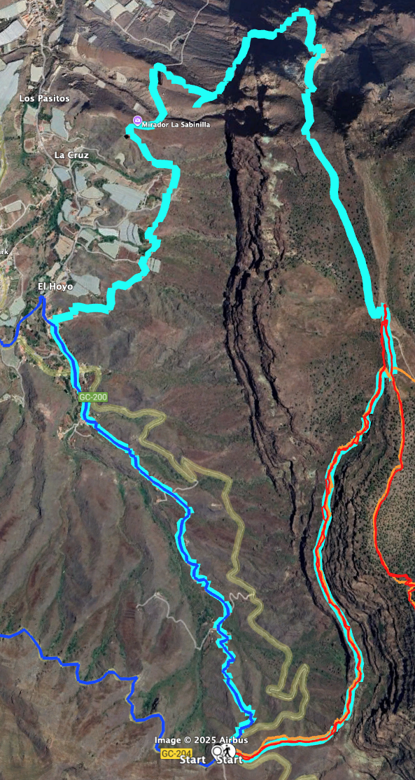
The starting point of the hike is the Degollada de la Aldea at an altitude of 642 metres on the GC-200 at kilometre 42.6.
Access by Car
Access to the starting point is via the island road GC-200 either from Puerto Mogán to La Aldea de San Nicolas or vice versa. The Degollada de la Aldea is located at the junction of the road to Tasártico at KM 42.6. There is parking space at the wide roadside around the Mirador Degollada de la Aldea.
Access by Bus
You can reach the Degollada de Aldea by bus line 38 (Puerto de Mogán – La Aldea de San Nicolas), which has a stop there. Further information and the exact departure times can be found on the Guaguasglobal homepage.
Time
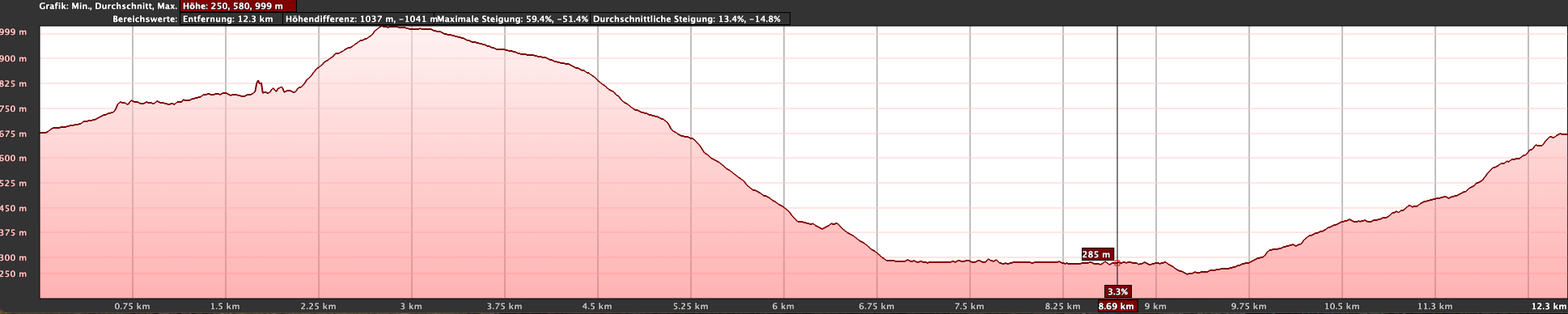
I am reluctant to give general time indications for hiking tours, as the times are very individual. We needed just under 7 hours for this circular hike, including a few breaks.
Difference in Altitude and Distance
The difference in altitude is approx. 780 metres and the route is approx. 15 kilometres long.
Difficulty
Throughout the entire circuit, you walk on good hiking or dirt tracks. However, the descents and ascents are partly quite steep, and due to the length of the tour you should have good physical fitness.
Refreshments
There are no refreshment opportunities directly along the route. You might find a bar open in El Hoyo via a small detour. In this case, you should enquire precisely about the opening hours before the hike. Nevertheless, please take sufficient water and, if necessary, provisions with you.
Variants
On SiebenInseln you will also find the following two hikes nearby, which adjoin this hike directly and can therefore easily be combined with this hike in one way or another:
Small circuit above Aldea de San Nicolás – Degollada de Tasartico
Inagua Nature Reserve on Gran Canaria – rugged rock walls, pine forests and a unique animal and plant world
IMPORTANT
From June to October, access to the nature reserve is prohibited, as the endemic blue chaffinch (Pinzón Azul), which is threatened with extinction, breeds there during this time. The ascent and descent from the Degollada de la Aldea to the El Laurelillo plateau remain possible.
Circular Hike Degollada de la Aldea
Section Degollada de la Aldea to Rock Slabs Below the Wall
The hike starts at the Degollada de la Aldea. You cross the road and cannot miss the small signposted path leading up the slope. Below you on the right runs the road to Mogán. You walk uphill and reach a small plateau after a short time. There the hiking path changes to the other side of the slope. Now you see the road to Aldea below you. The hiking path, which runs towards the steep wall, forks after a while. You take the left option. There you are immediately below the large rock wall towering steeply into the sky.
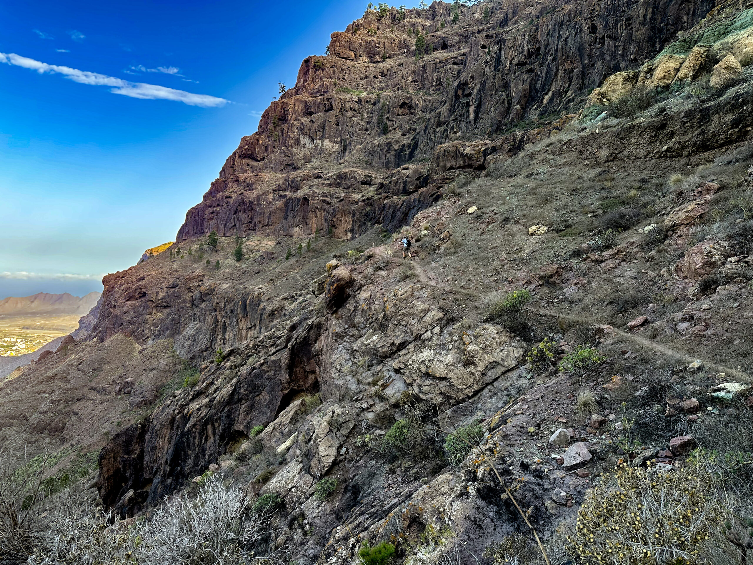
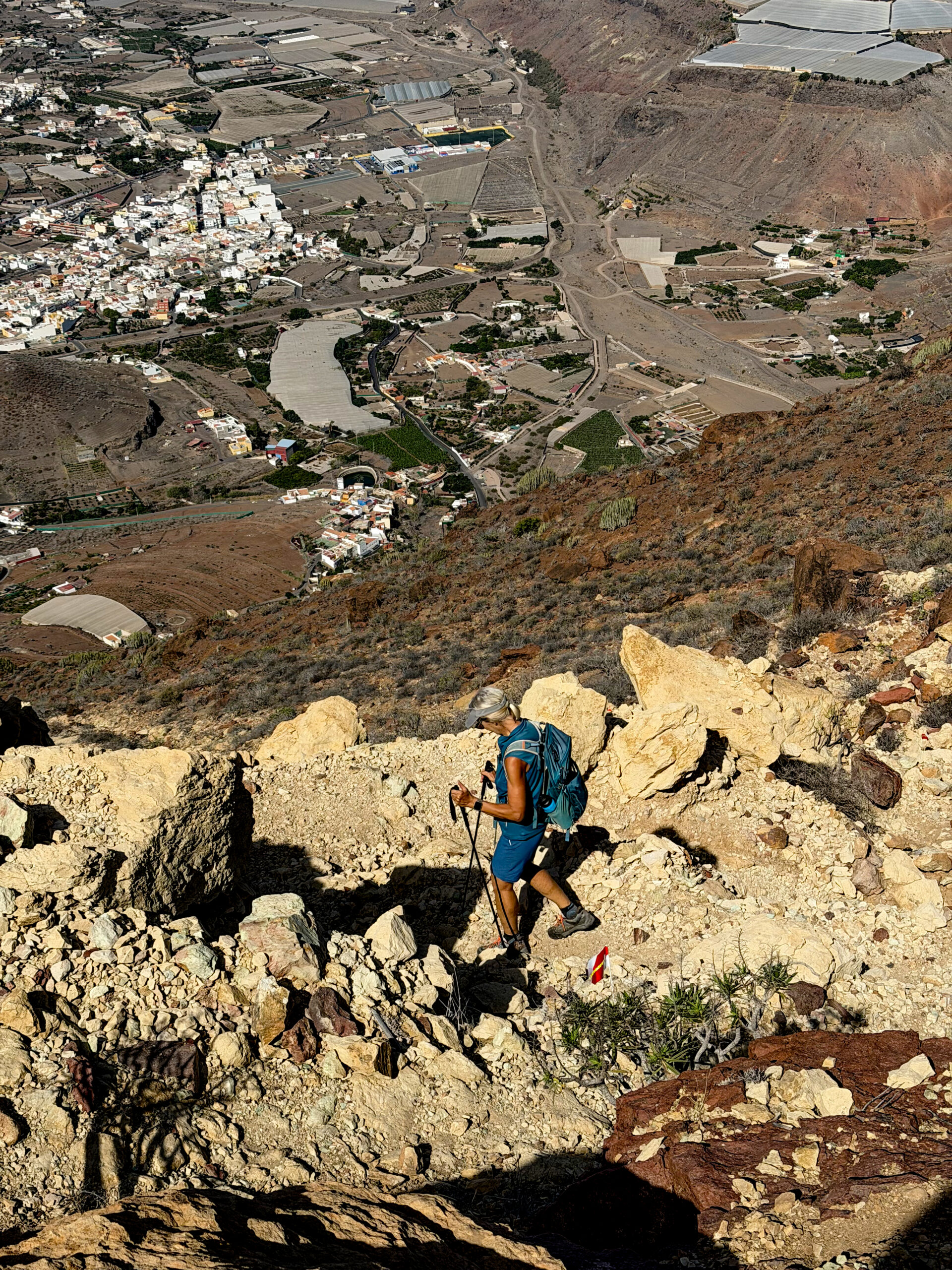
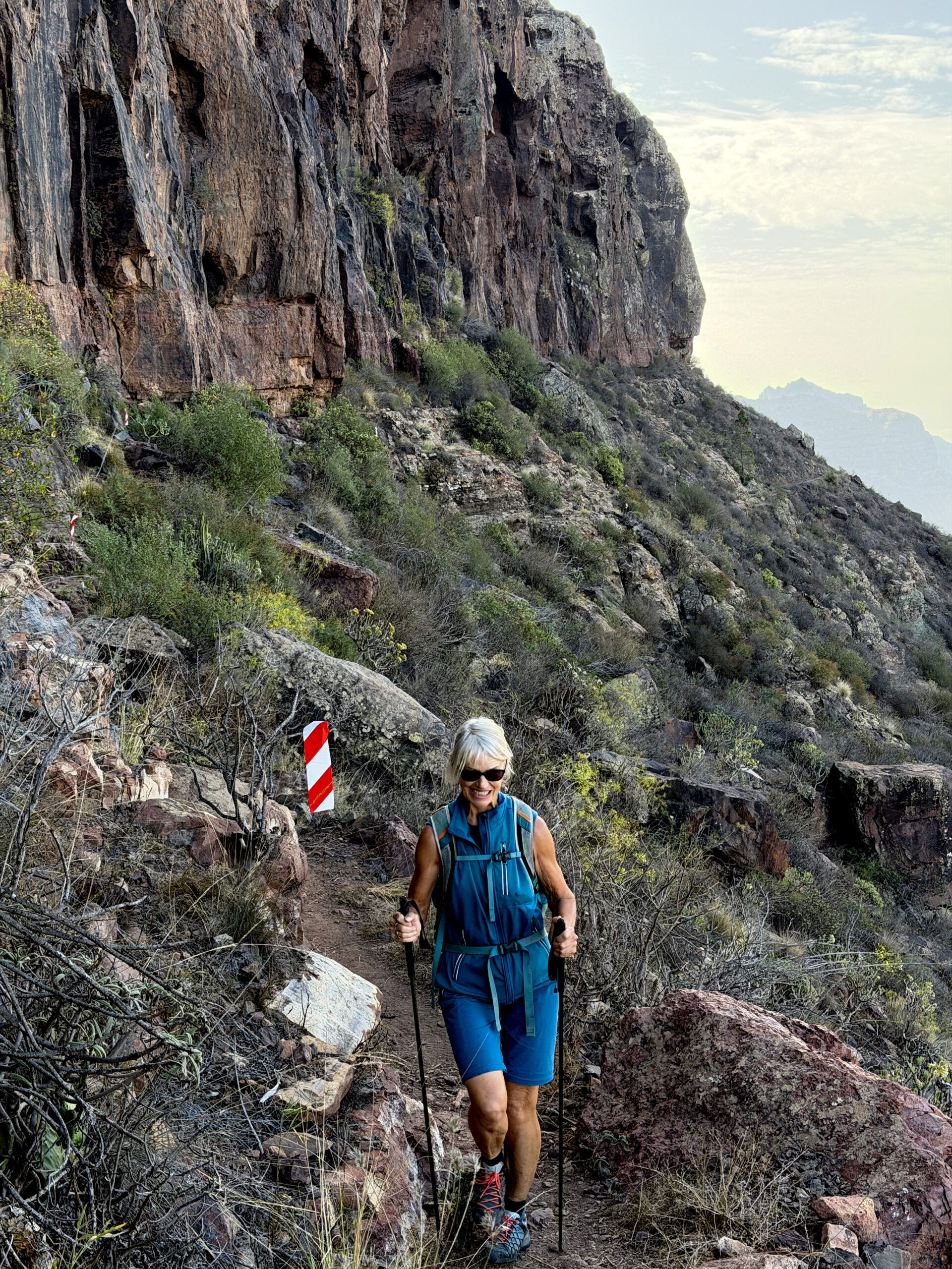
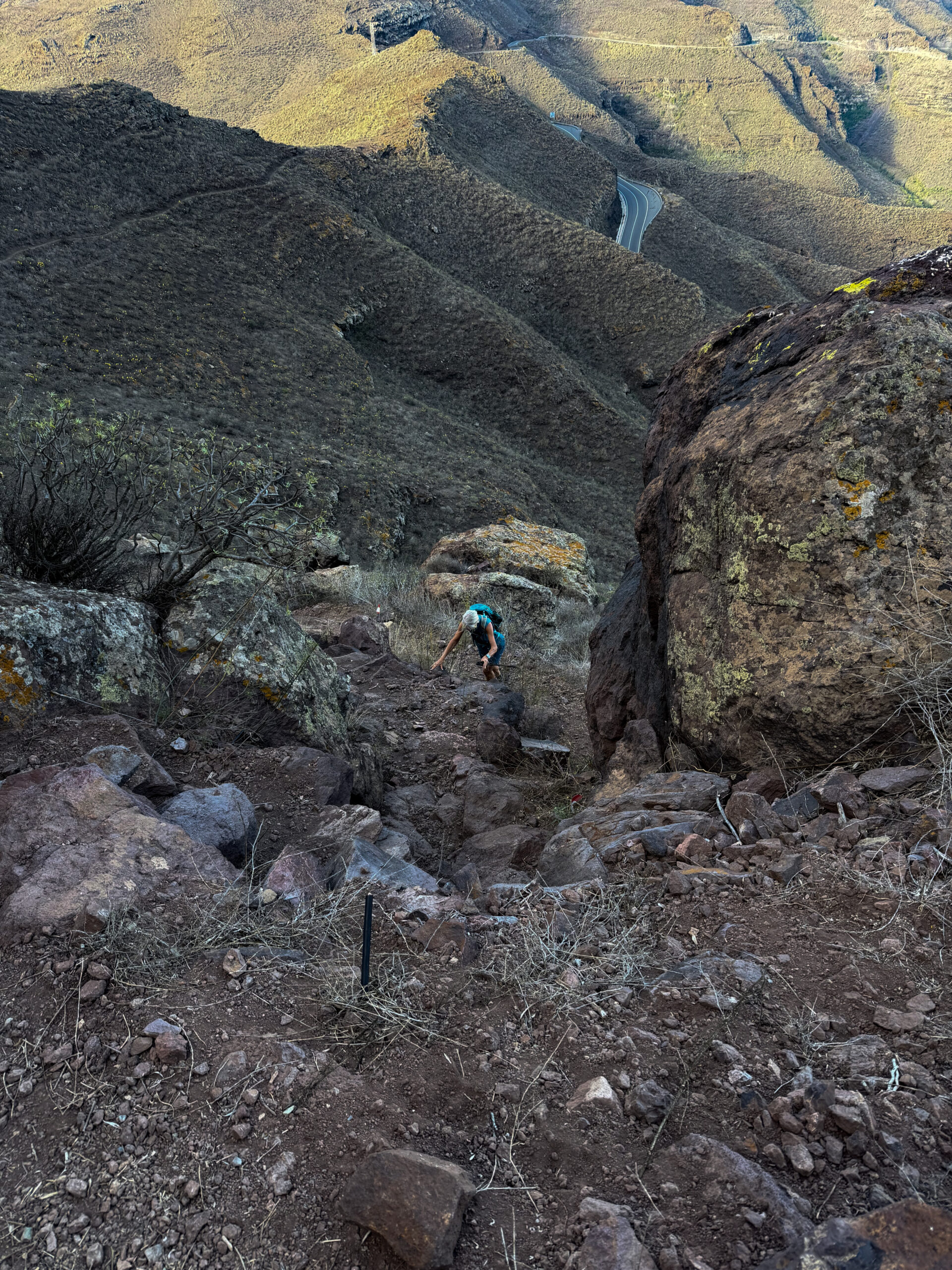
The path continues further below and along the rock wall. It is rocky and from time to time you have to climb over some large boulders. It follows the rock recesses and already from here offers you very beautiful views of the wide valley over Aldea below you. After just under half an hour, the path leads over rock slabs. Small cairns mark the path across the rock slabs. Simply keep diagonally uphill across the rock platform. At the end the hiking path continues clearly again.
Section Rock Slabs Below the Wall to the El Laurelillo Plateau
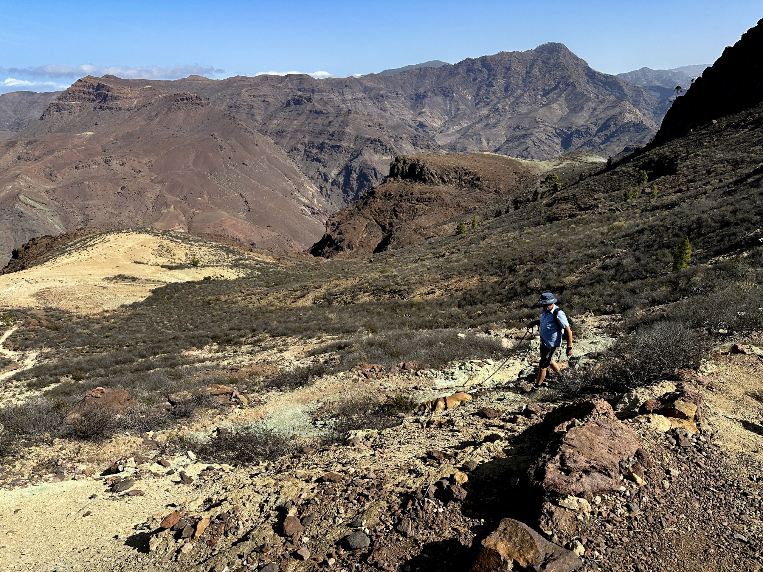
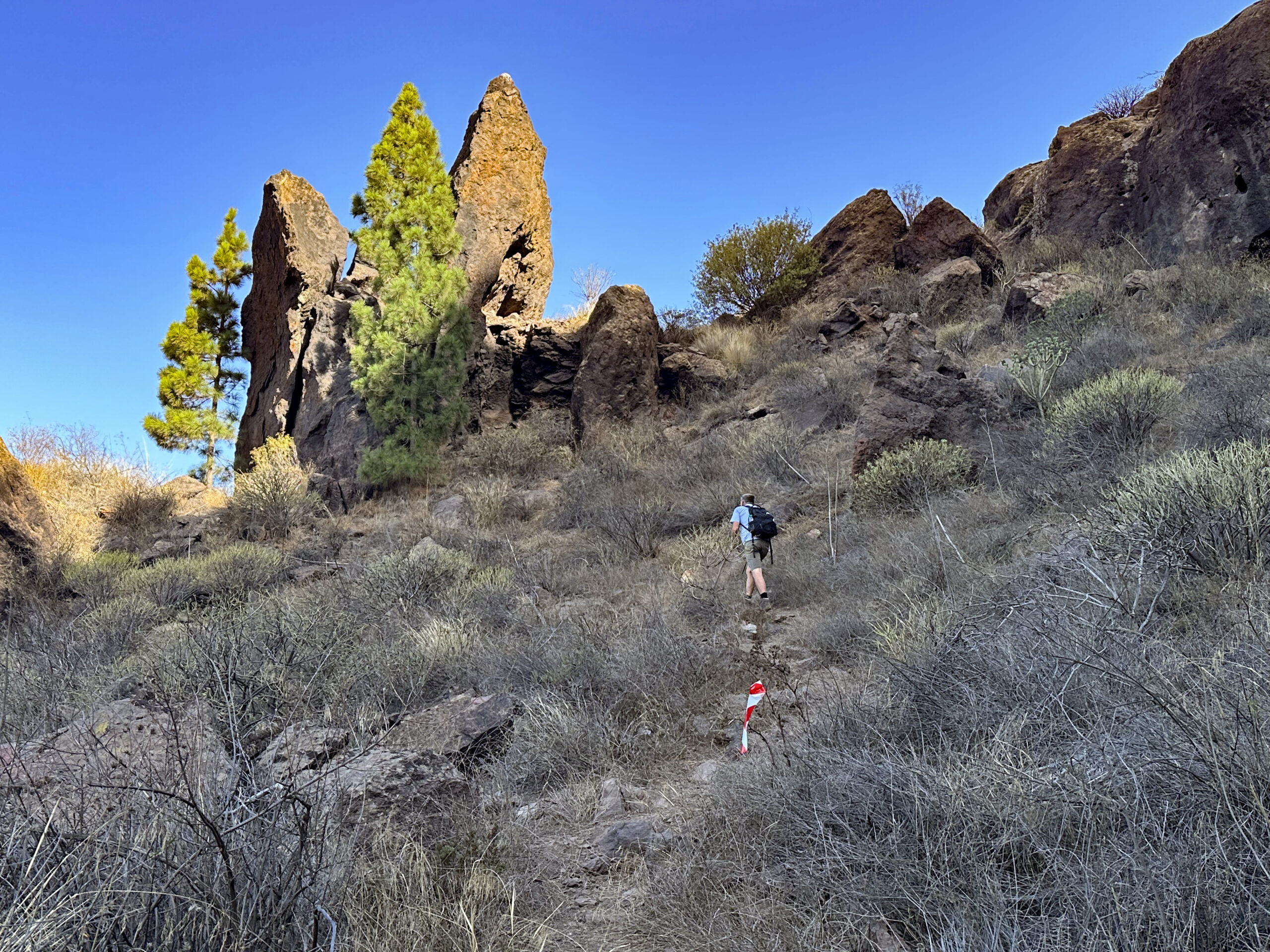
After you have walked across the small rock platform, the path continues for some time along the rock wall and its recesses. A few times you must also watch your head and duck a little on the path, as the rocks protrude into the way. After a while you reach a small side gorge (Barranco de los Almacigos). Here the hiking path now continues to the right. It ascends steeply in small switchbacks – sometimes also with a bit of scrambling – parallel to the gorge. You walk past pine trees and impressively large boulders.
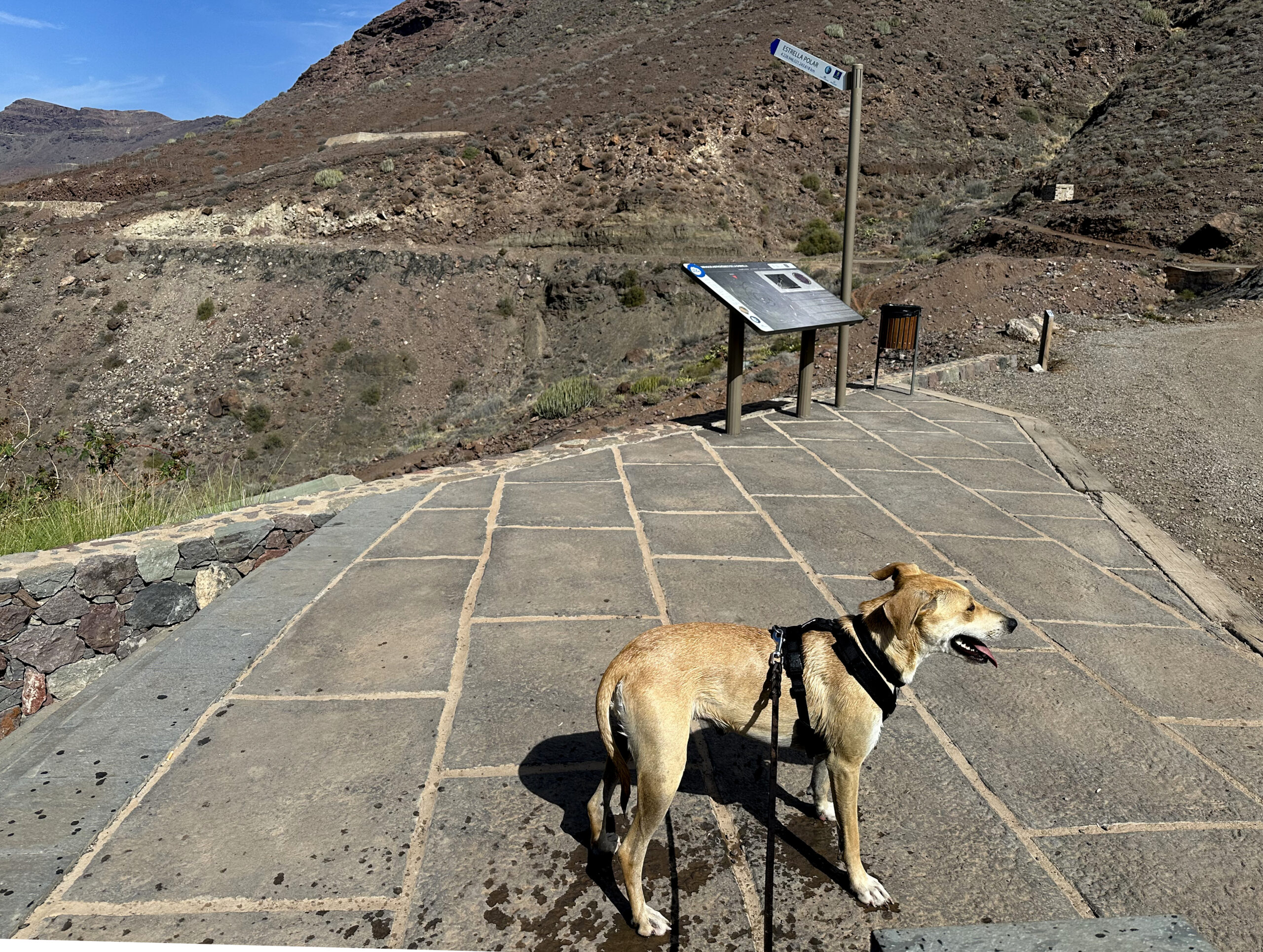
The hiking path continues to ascend northwards. Finally, after some scrambling, the path becomes less steep and the terrain becomes somewhat flatter overall. For the last “metres” you have two possibilities. Turning left, you climb more comfortably but longer to the plateau. More quickly, but steeply over rocks, you climb straight up. In both options it is no longer far, and you ascend the last metres to the El Laurelillo plateau. From the Degollada de la Aldea you have now already left 320 metres of altitude behind you. You are rewarded for the effort with wonderful views.
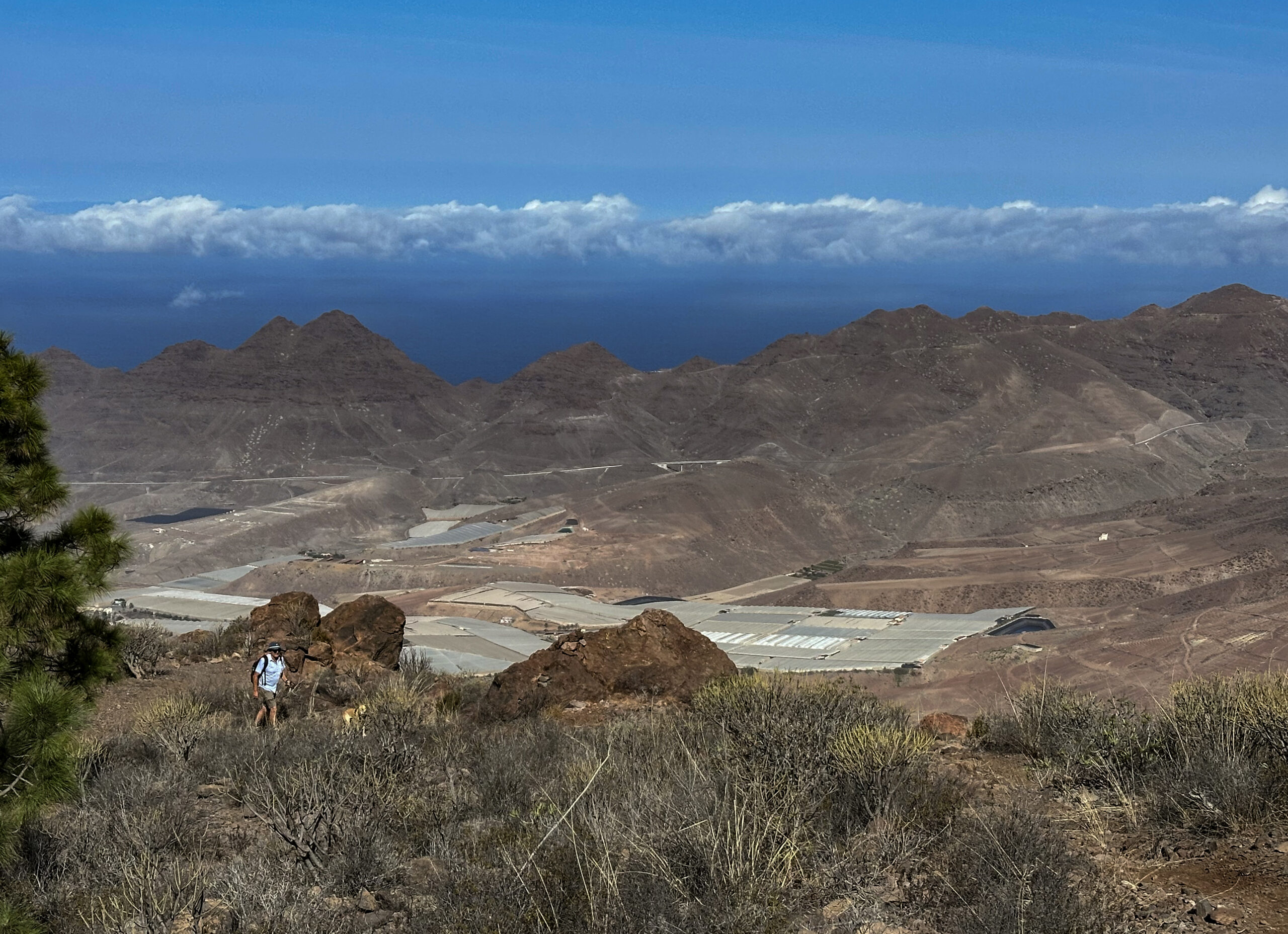
Section El Laurelillo Plateau to the End of the White Plateau
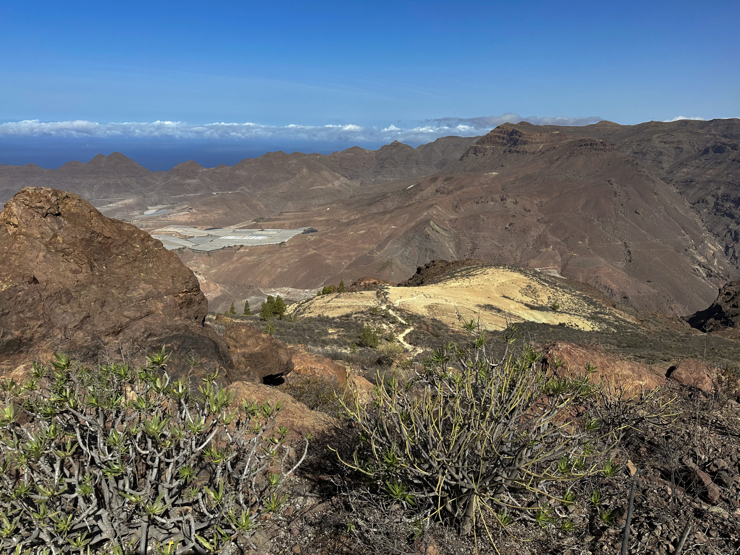
When you have enjoyed the beautiful view on the plateau, follow the signposting to the left towards Aldea de San Nicolás. The initially wide dirt track leads you along the ridge with wonderful views slowly downhill. You walk below the Lomo del Viso and the Viso, which rises beside you to 996 metres. Finally, the dirt track ends and becomes a hiking path, which now brings you down more steeply.
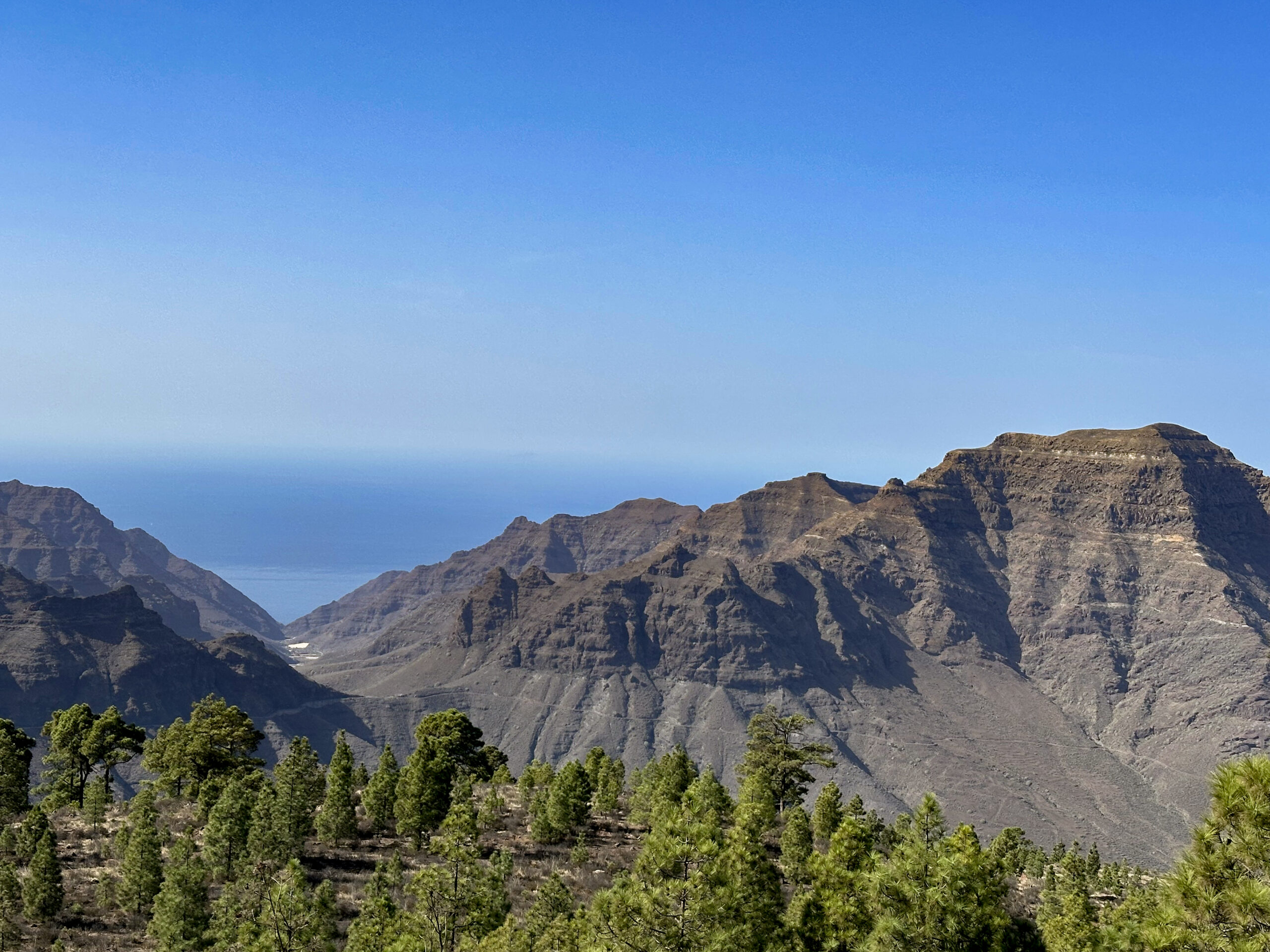
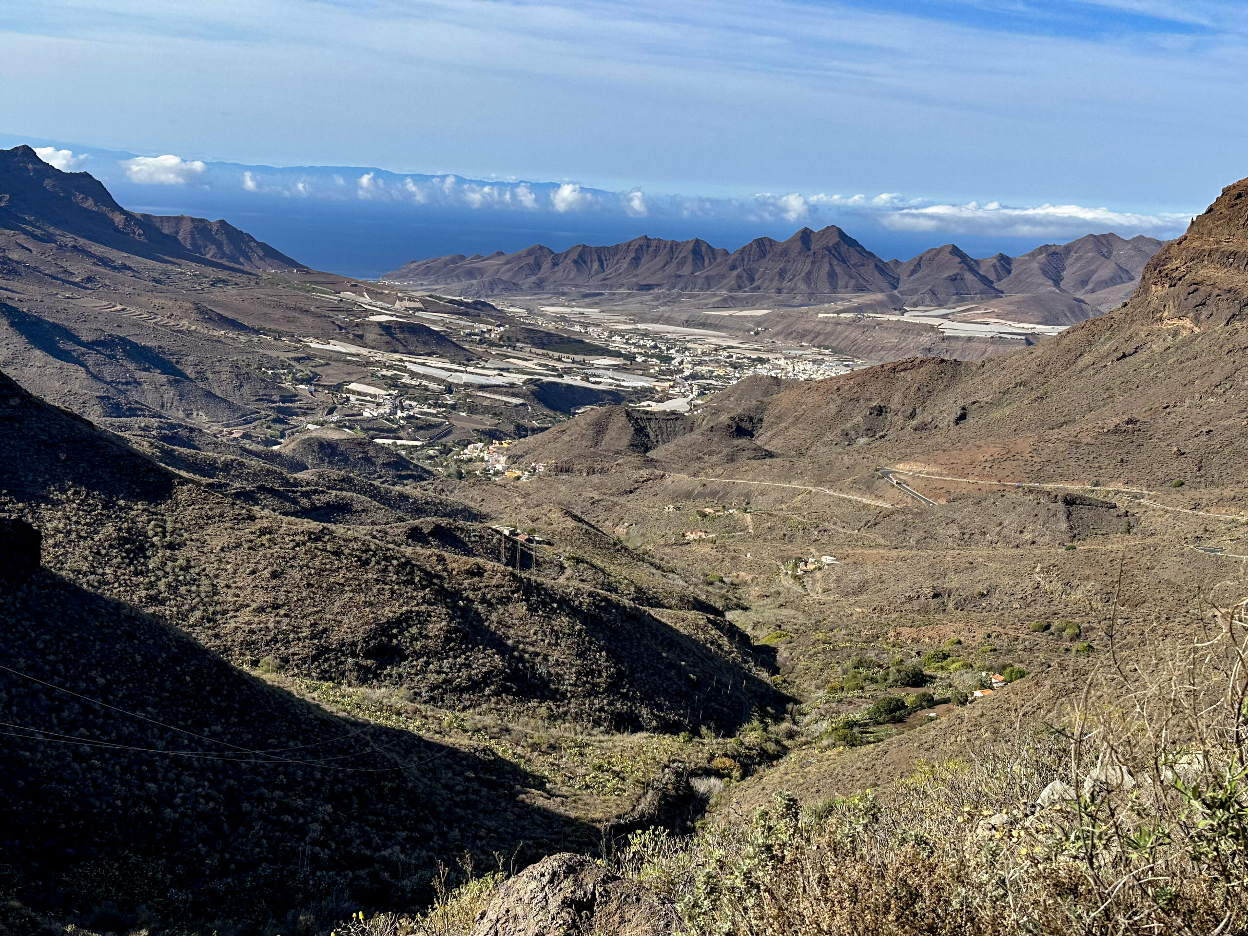
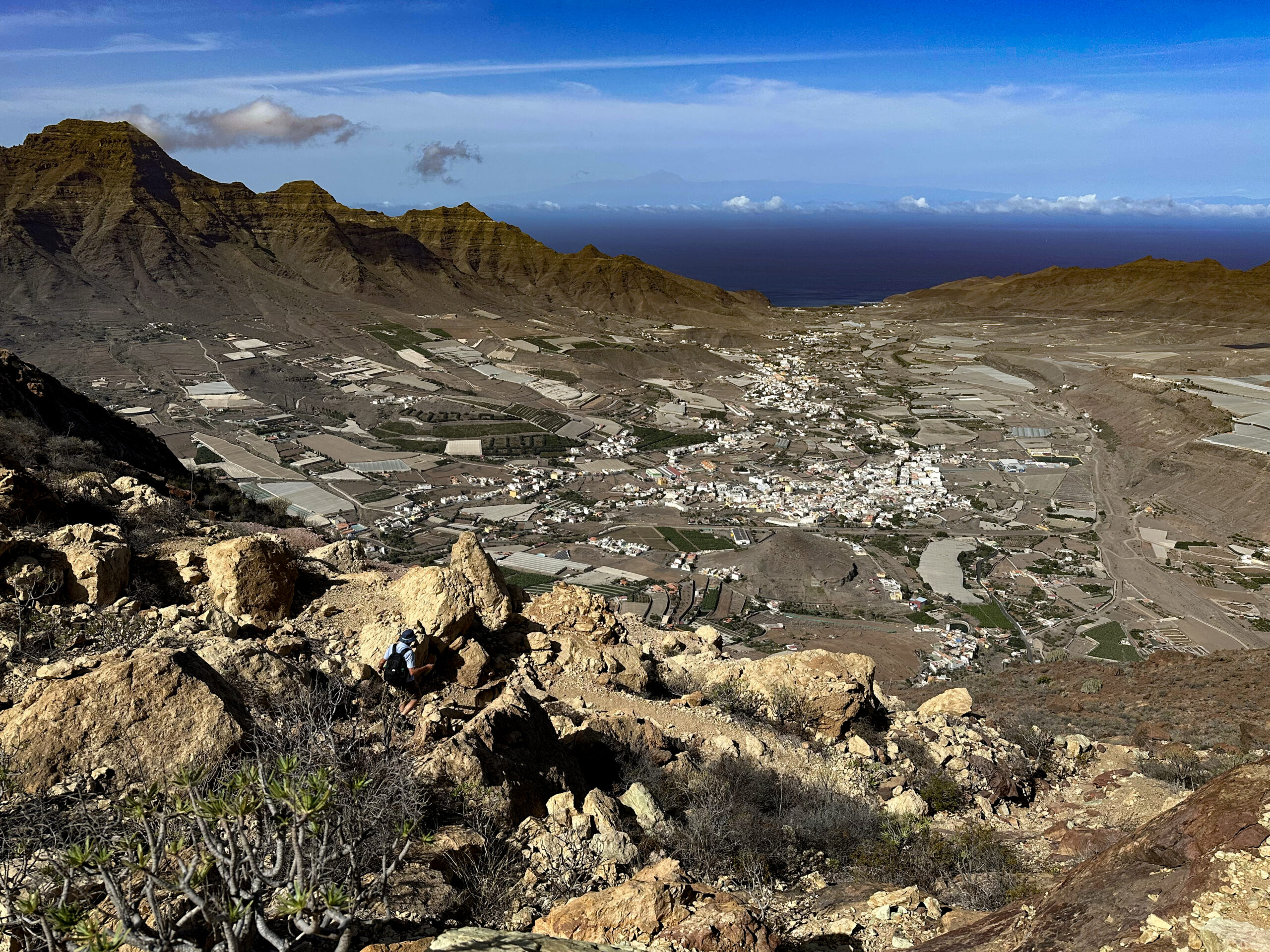
First you walk across a wide plateau with scattered pine trees. Then you reach an exposed viewpoint from which you can overlook the entire area. Afterwards, steep switchbacks lead down to another plateau with white rock, which you can already see very well from afar. Before you leave this imposing plateau to the left, you pass another viewpoint. Deep below you, you can now see Aldea de San Nicolás increasingly clearly.
Section End of the White Plateau to the End of the Village El Hoyo
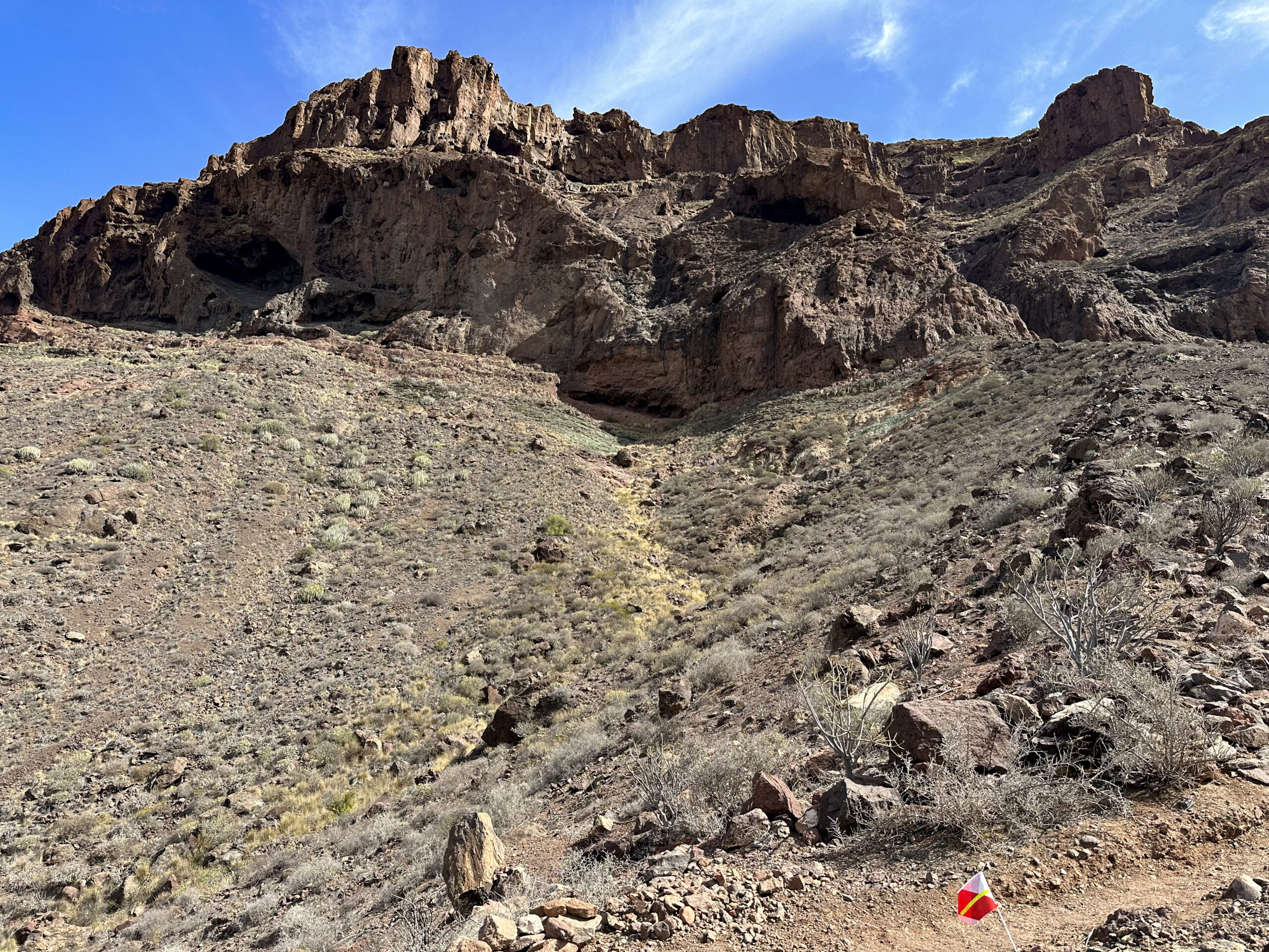
A steep descent then follows between the rugged rock walls. In switchbacks with impressive views, the route continues along the SL-1 past the Cueva del Mediodía. You walk along the rock wall and finally below it on the descending path. At approx. 500 metres altitude, the path then turns further downhill towards the west. Out of interest, we made a small detour to the left here, as the Aldea Trail Run was signposted along that route (November 2025). But the main path goes straight down. Next to a water collecting basin, the steep path finally joins the GR-139, which here is a wide dirt track.
There you are at the charmingly designed Mirador del Canal. You now follow this wide dirt track to the left. After a short time, you pass the next viewpoint, the Mirador La Sabinilla. Walking is easy here, but the long dirt track stretches on for quite a while before you reach the small hamlet of El Hoyo (approx. nearly 2 kilometres). There the dirt track joins the Calle el Hoyo, which you follow through El Hoyo to the left. The road finally meets the GC-200, which you cross. Opposite, the hiking path continues on the Calle las Vistillas. You follow this road uphill through the village. At the end of the village, the actual hiking path (GR-139) begins again.
Section End of the Village El Hoyo to Degollada de la Aldea
From here you encounter only a few isolated houses. The ascent becomes steep – sometimes also in switchbacks – back towards the Degollada de la Aldea. The hiking path climbs on the left side of the Barranco Tocodomán (Barranco de los Almacigos) below the GC-200. Initially, the ascent in the wide valley is still quite moderate. You also pass some isolated farmsteads.
But the closer you get to the Degollada de la Aldea, the steeper the ascent becomes. After a final steep climb, you eventually return to the GC-200. You walk briefly to the right along the road. And then, after a short time, you are back at your starting point, the Degollada de la Aldea.
And finally
I hope that you enjoyed this large and varied hike high above Aldea de San Nicolás and in the Inagua Nature Reserve. Whatever hiking trails you decide on, I wish you lots of pleasure while hiking,
Dagmar from SiebenInseln