Hike to Degollada de El Perchel from the small district of Aldea Playa de San Nicolás
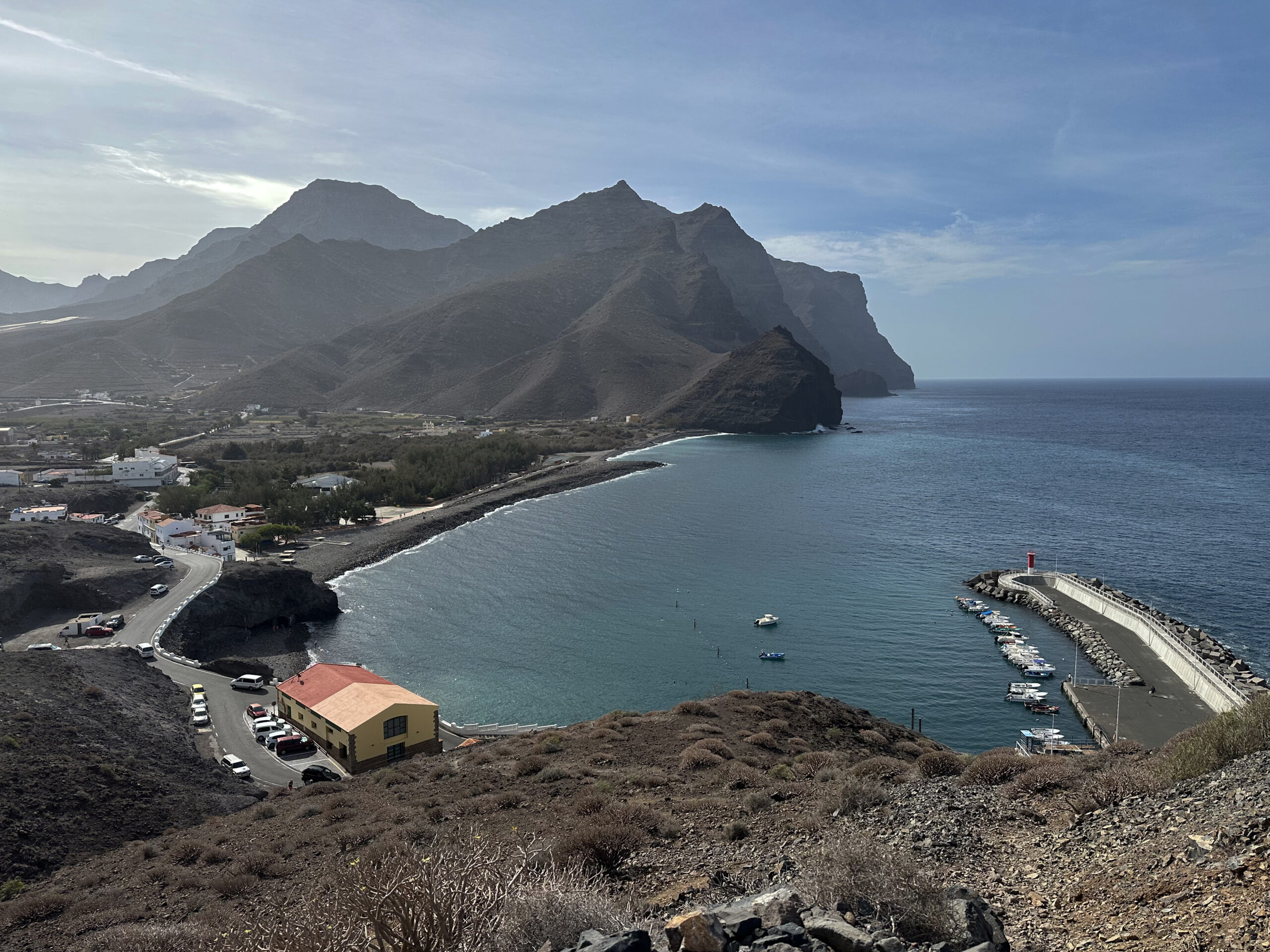
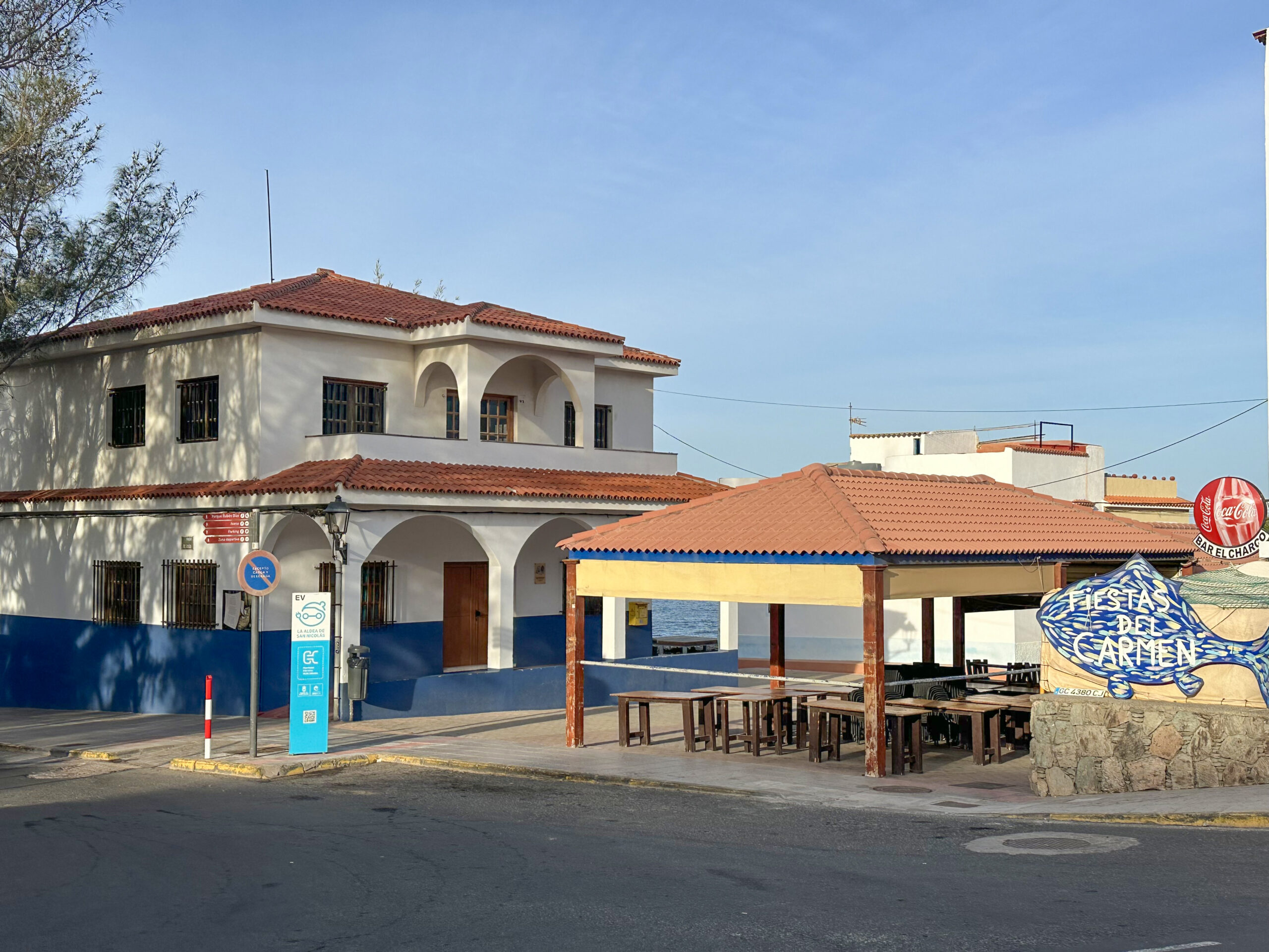
Playa de San Nicolás is located on the west coast of Gran Canaria in the municipality of La Aldea de San Nicolás. This small coastal settlement essentially consists of the harbour area, the beach zone and the seafront promenade. From here, this short circular walk to Degollada de El Perchel Aldea begins. The surroundings are characterised by the close interplay between the coast and the steeply rising mountains of the western part of the island, which give the region its particularly rugged character. In the immediate vicinity of the small community lies one of Gran Canaria’s most significant pre-Hispanic archaeological sites: the archaeological ensemble of Lomo de los Caserones.
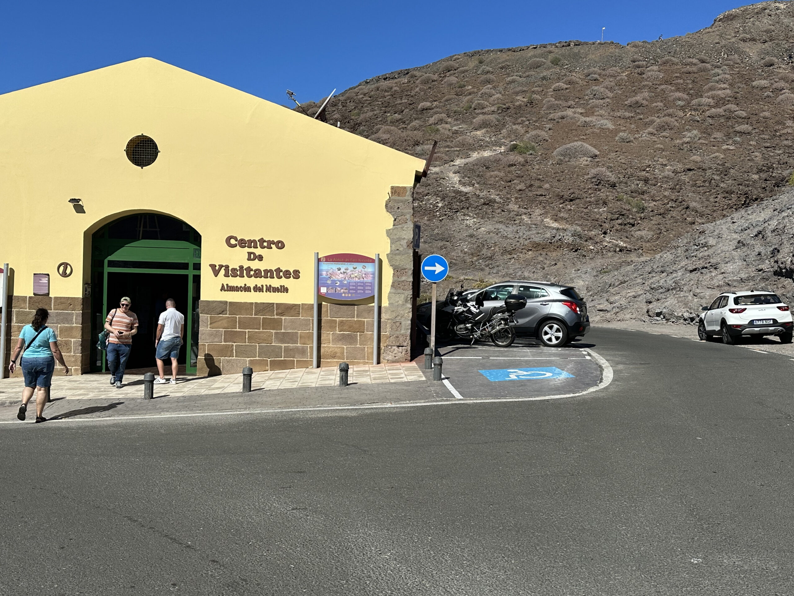
A visit to the excavation site, which displays settlement remains and burial sites of the ancient inhabitants of the Canary Islands, is incorporated into this walk. This gives you an important insight into the early settlement of the island. If you would like to learn more, there are also two information centres in Playa de San Nicolás. Right beside the track, you will find the Centro de Interpretación de Los Caserones, which vividly presents the history of the settlement and the island’s early inhabitants through artefacts, models and multimedia displays. In this way, the beautiful coastal walk near Playa de San Nicolás can easily be combined with a cultural excursion into the island’s history.
Degollada de El Perchel Aldea
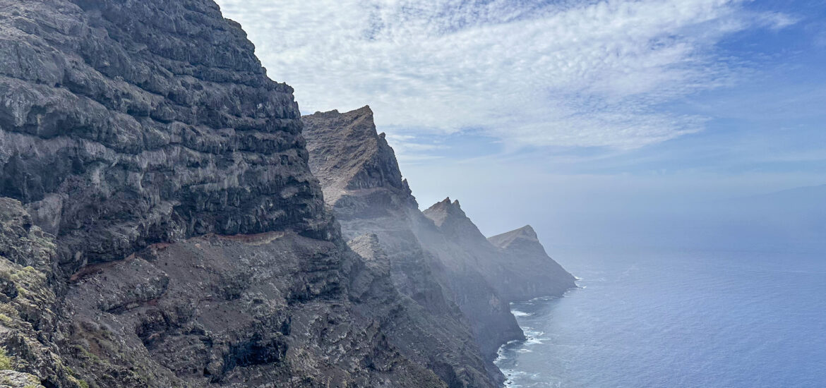
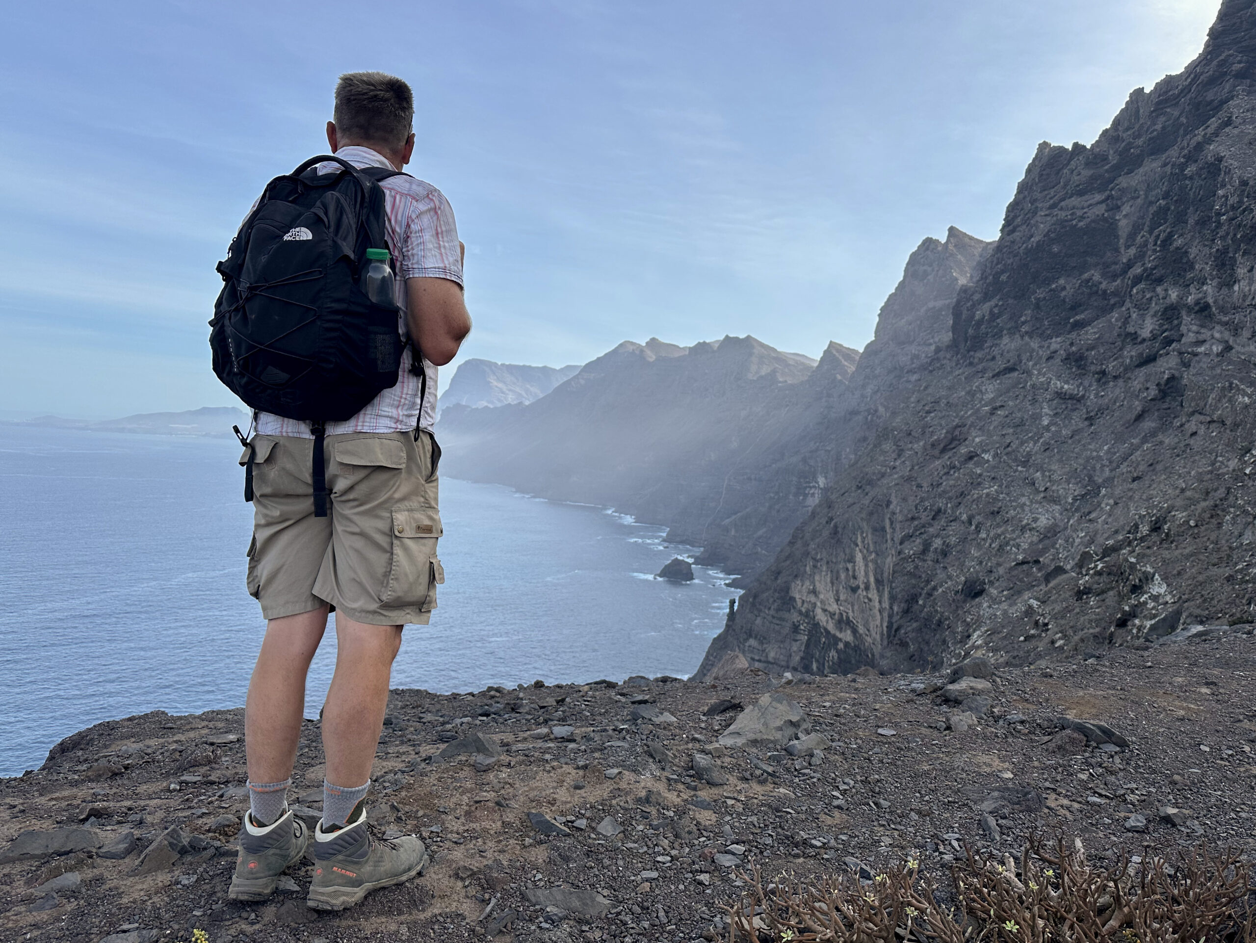
Degollada de El Perchel is one of the lesser-known yet particularly scenic viewpoints in the west of Gran Canaria. The walk leads you uphill from Playa de San Nicolás through an unspoilt coastal landscape characterised by deeply incised barrancos, rugged rock formations and wide-ranging views. Away from the major tourist routes, a peaceful and authentic side of the island reveals itself here. As I am frequently asked about shorter walks as well, I decided to introduce this lovely little circuit.

From the pass at Degollada de El Perchel, impressive panoramic views open up over the surrounding mountains and the coastal region in the west of the island. The walk combines the experience of nature, varied scenery and the unique atmosphere of rural Gran Canaria into a rewarding hike for anyone wishing to discover the island away from its better-known routes. If this short coastal walk seems too brief for you, it can easily be extended with longer strolls around the excavation site, along the beach and through the attractive little village.
General Information about the Degollada de El Perchel Aldea Hike
Starting Point and Directions
The starting point of the walk is the GC-173, the main road in Playa de San Nicolás.
Getting There by Car
You can reach Aldea de San Nicolás from either direction via the GC-200. At the roundabout outside the village, turn onto the GC-173 and continue towards Playa de San Nicolás. Within the village itself, you can park either along the road or in designated parking areas.
Getting There by Bus
It is possible to travel by bus (Route 101) from the north of the island, from Gáldar to La Aldea de San Nicolás. Bus Route 38 runs from Puerto de Mogán to La Aldea de San Nicolás. Details and further information can be found on the Guaguas Global website.
Time
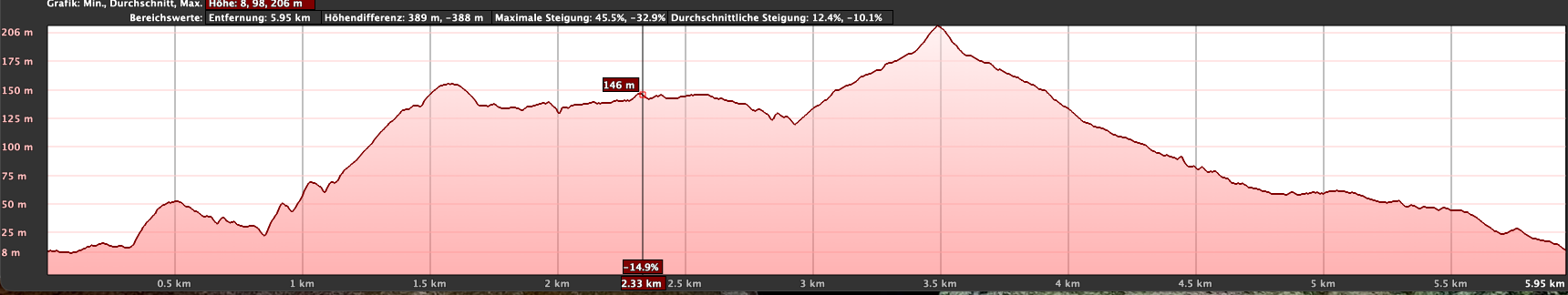
I prefer not to give general timings for walking tours, as walking speeds vary greatly from person to person. We needed 2.5 hours for this leisurely circuit, including breaks and a visit to the excavation site.
Altitude Difference and Distance
The total ascent amounts to just under 300 metres, and the route is 6.8 kilometres long.
Requirements
Throughout the entire circuit, you walk on hiking paths or tracks. Occasionally, the paths along the cliffs are somewhat narrow, but they remain easy to negotiate.
Refreshments
Refreshment facilities are only available at the starting point in Playa de San Nicolás. Therefore, be sure to carry sufficient water with you.

Variants
The walk can easily be extended by taking a larger circuit around the excavation site and eventually returning along the beach (green route). Those who have done enough walking can relax comfortably on the beach or in one of the bars, or continue exploring the information centres.
On SiebenInseln, you can also find the following hikes nearby:
Hike to the secluded Güi Güi Beach
Short Circuit above Aldea de San Nicolás – Degollada de Tasartico
Circular hike Degollada de El Perchel Aldea
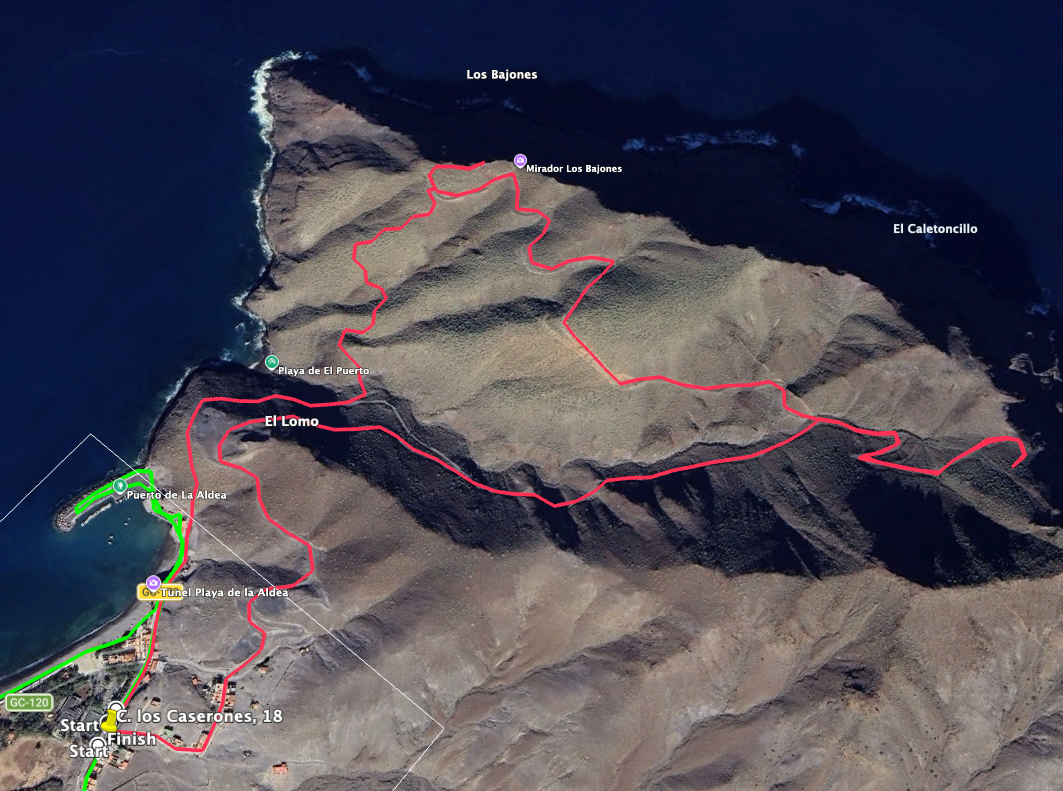
Section: Playa de Aldea de San Nicolás to Mirador Los Bajones
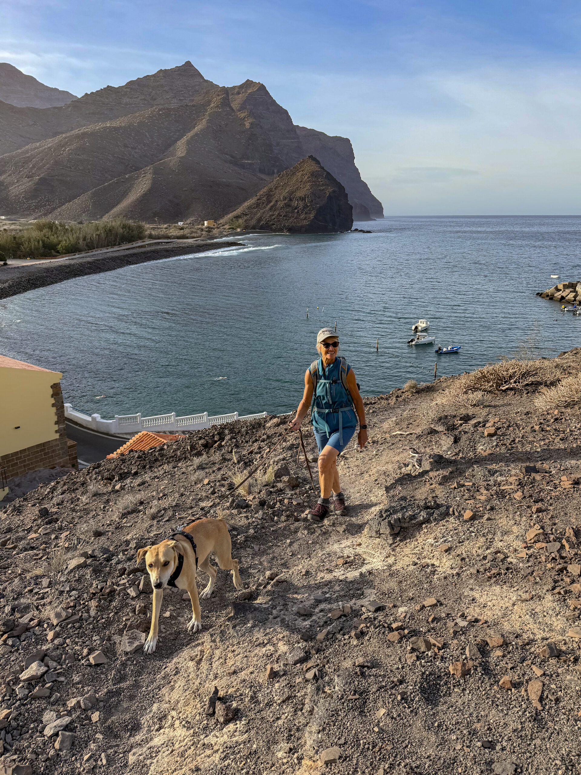
You begin this short coastal walk to Degollada de El Perchel de Aldea on the GC-173. This is the main road leading to Playa de Aldea de San Nicolás and the harbour. Continue straight ahead along the road. After leaving the actual village behind, the extensive beach and harbour area lies to your left. Eventually, the GC-173 continues into the harbour itself. You will find yourself in front of an information centre, which you may also wish to visit. The walking route then passes to the right of the information centre. Before the road bends left again, a small path leads straight uphill. Follow this path.
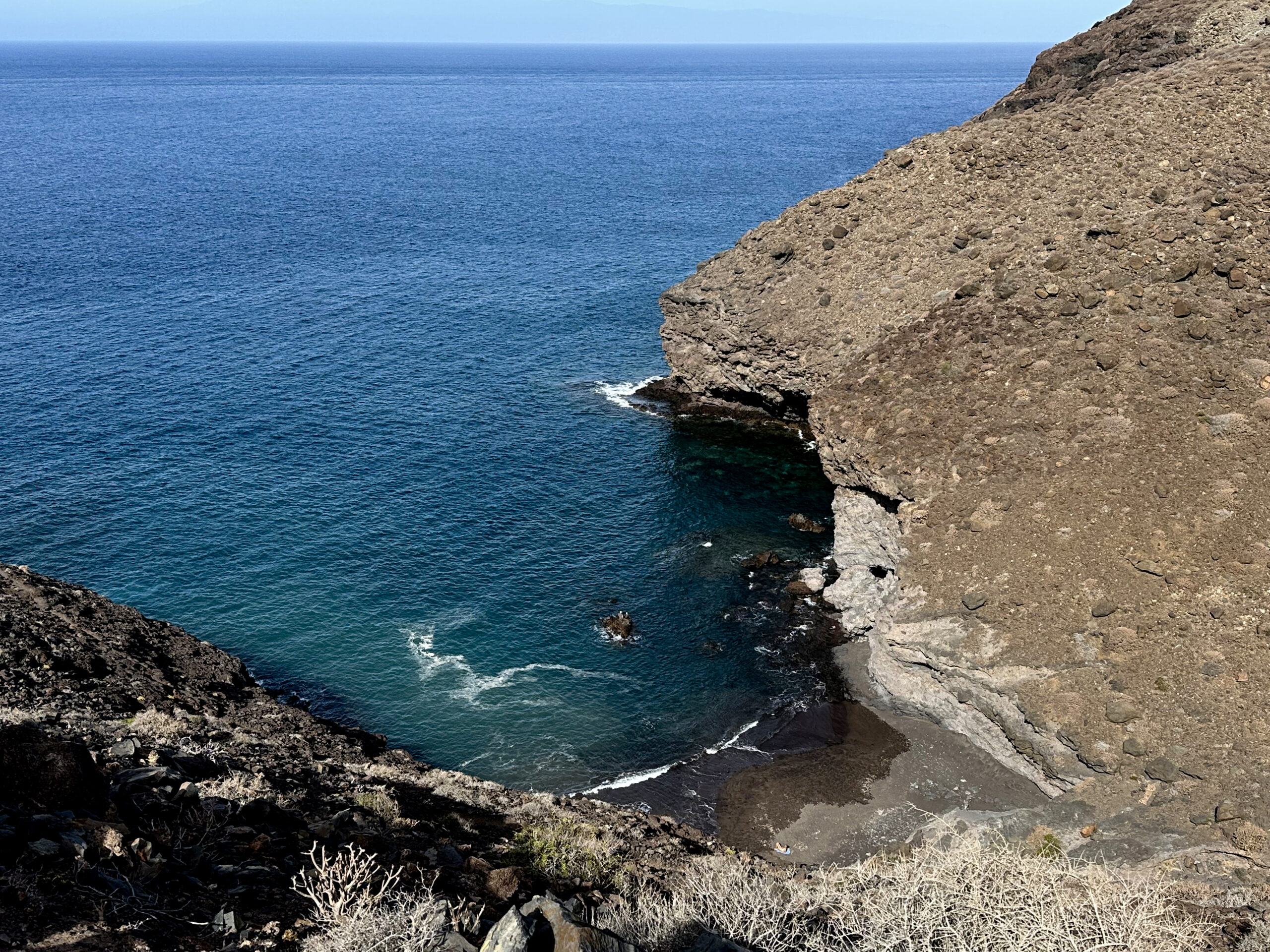
The route takes you uphill and left towards the coast. It then turns right above Playa de El Puerto. With fine views of the picturesque bathing cove below, you walk around it on the coastal path, keeping left at a fork. From here, the path continues with gentle ups and downs towards the west coast. Eventually, you ascend along a ridge. We climbed a little further ourselves to enjoy an even better view of the Atlantic. However, the route itself continues straight ahead at the foot of the mountain range as far as Mirador Los Bajones.
Section: Mirador Los Bajones to the Ruta Playa El Puerto Junction
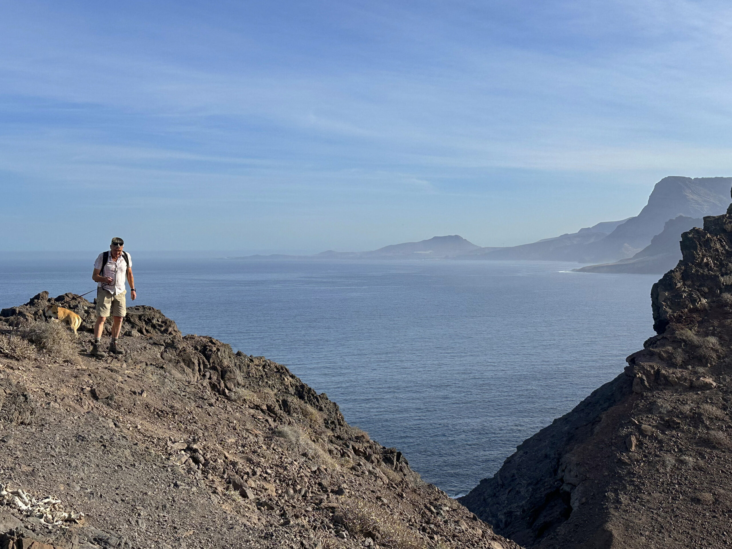
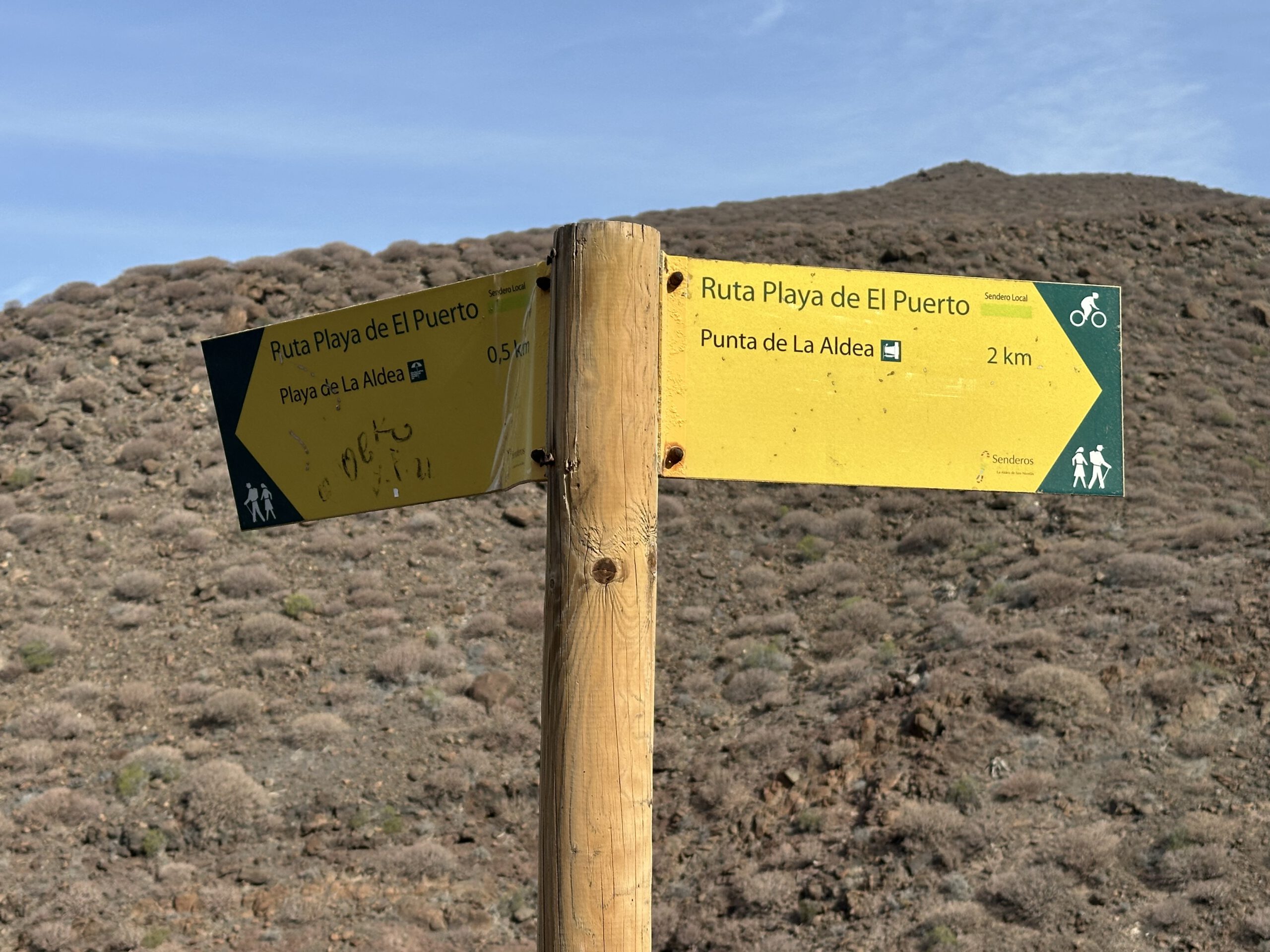
From there, the route known as Ruta Playa El Puerto continues in broad loops around several ravines. You walk continuously along the small coastal hills, following the wide track for quite some time. Eventually, it turns sharply to the right and descends. At this point, a path branches off to the left, climbing towards Degollada de El Perchel Aldea. All the routes continue to be signposted as Ruta Playa de El Puerto. The ascent to Degollada de El Perchel Aldea is only 600 metres long. However, the climb now becomes quite steep. Once you reach the top, you will realise that the ascent has been well worth the effort because of the magnificent views.
You can enjoy wonderful views over the entire rugged west coast of Gran Canaria. We climbed a little higher beyond Degollada de El Perchel Aldea ourselves to see what the view was like from there. In clear weather, you can also see Tenerife very well. Once you have taken in the scenery, retrace your steps for the 600 metres. You then continue downhill along the Ruta Playa El Puerto, keeping to the left.
Section: Ruta Playa El Puerto to the Starting Point of the Walk
The route now descends for a long distance along the hillside above the Barranco de Perchel. At a larger junction, keep left if you would still like to visit the excavation site on your return journey. If you keep right, you will very quickly rejoin your ascent route and soon find yourself back at the harbour of Aldea de San Nicolás. The left-hand option, however, takes you further downhill in a straight direction. Initially, you walk parallel to the ascent route for some time. The path then makes a wide curve to the left.
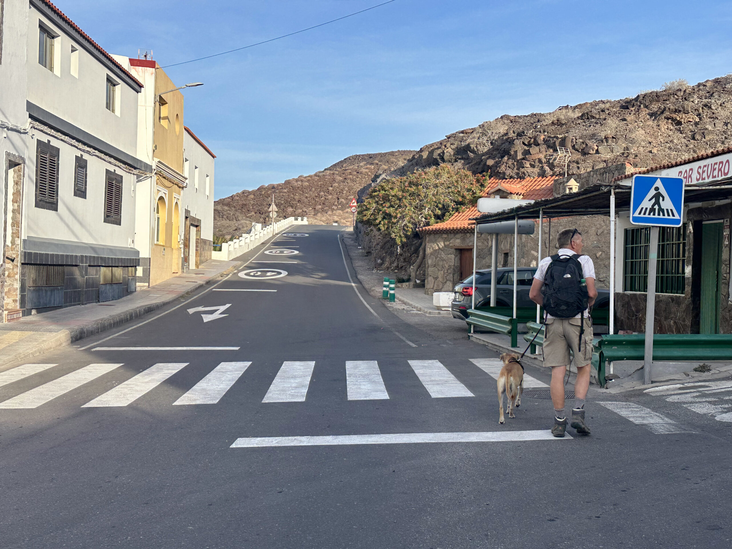
This brings you onto a broad track and then onto a road. This is Calle Lomo del Carmen. After a short while, you will reach the Lomo de Caserones excavation site. You can take your time exploring it. Afterwards, return to the road, which leads you back down to the right and returns you to the main road. From there, depending on where you parked your car, you will be back at the starting point of the walk in no time.

And finally
I hope that you enjoyed this peaceful coastal walk to Degollada de El Perchel Aldea and the excavation site. If desired, it can easily be extended in all directions. Whatever you decide, I wish you great enjoyment on all your walks.
Dagmar from SiebenInseln