Cho Pancho – A Place with History
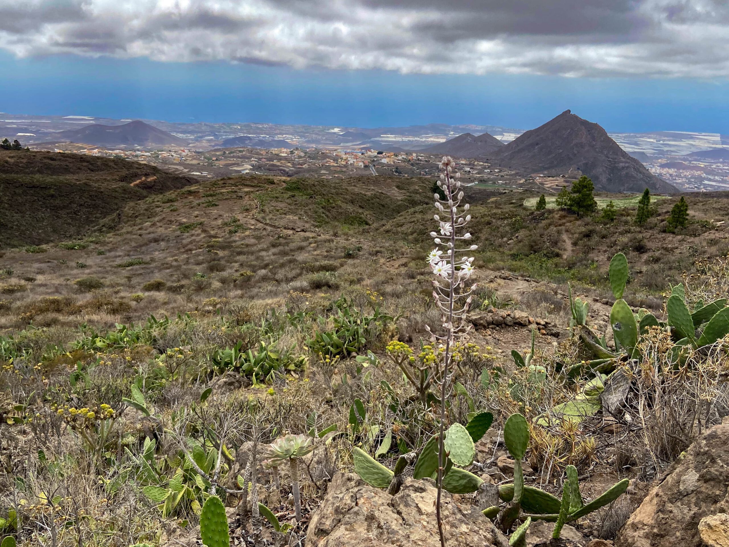
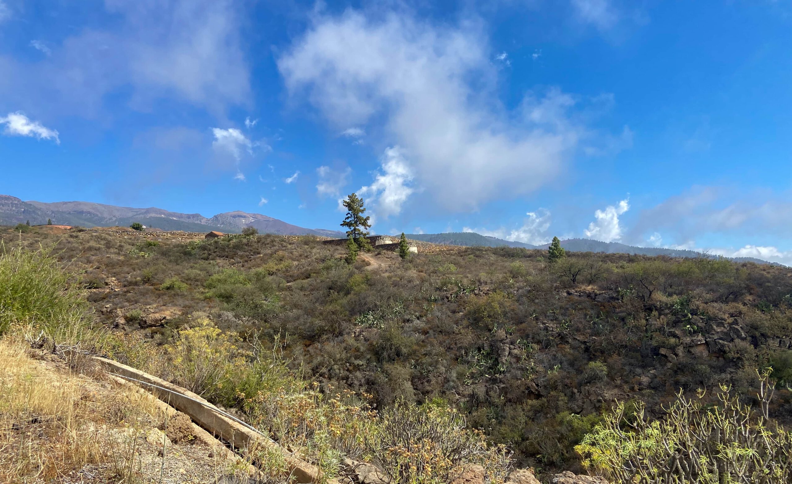
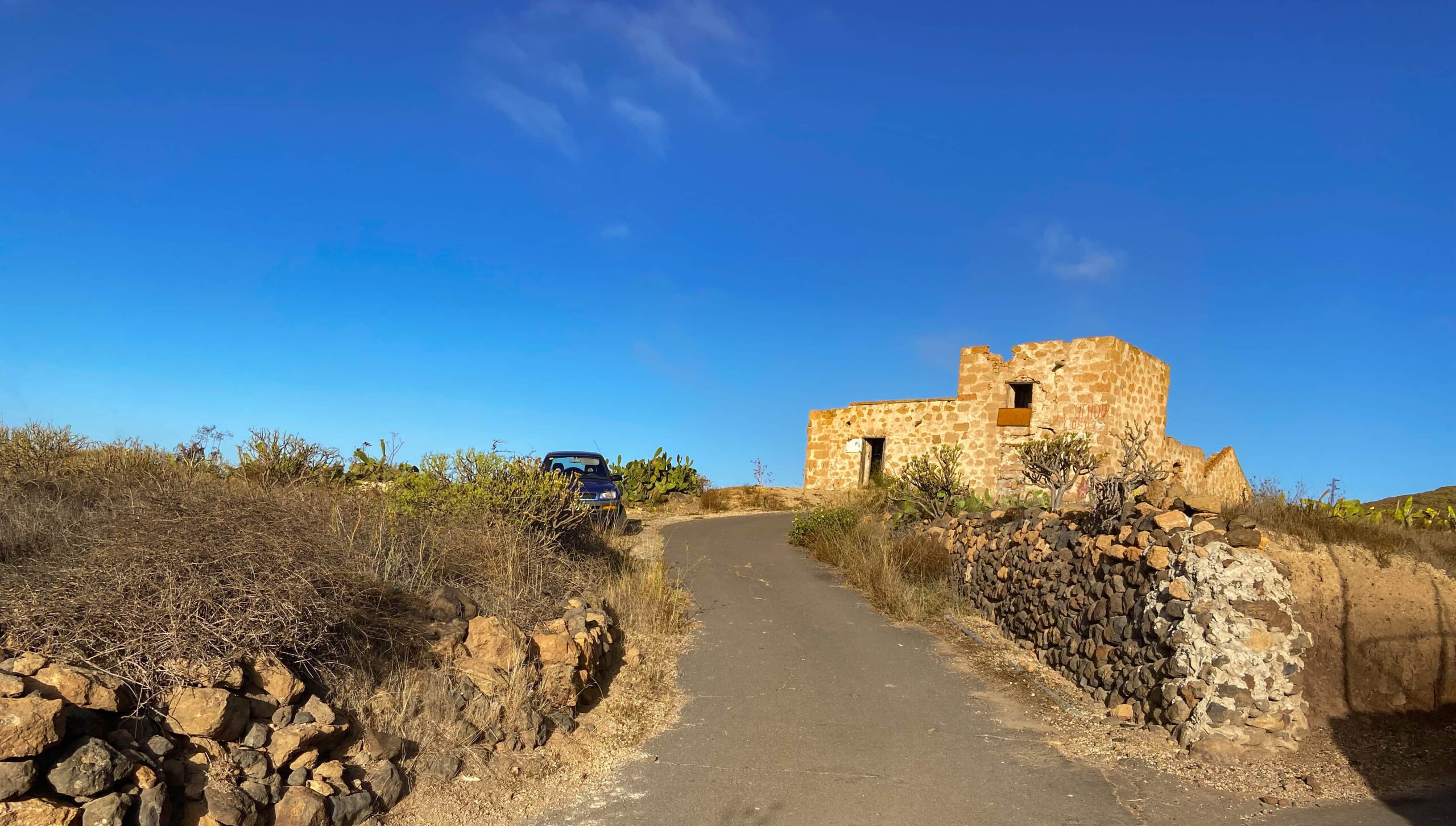
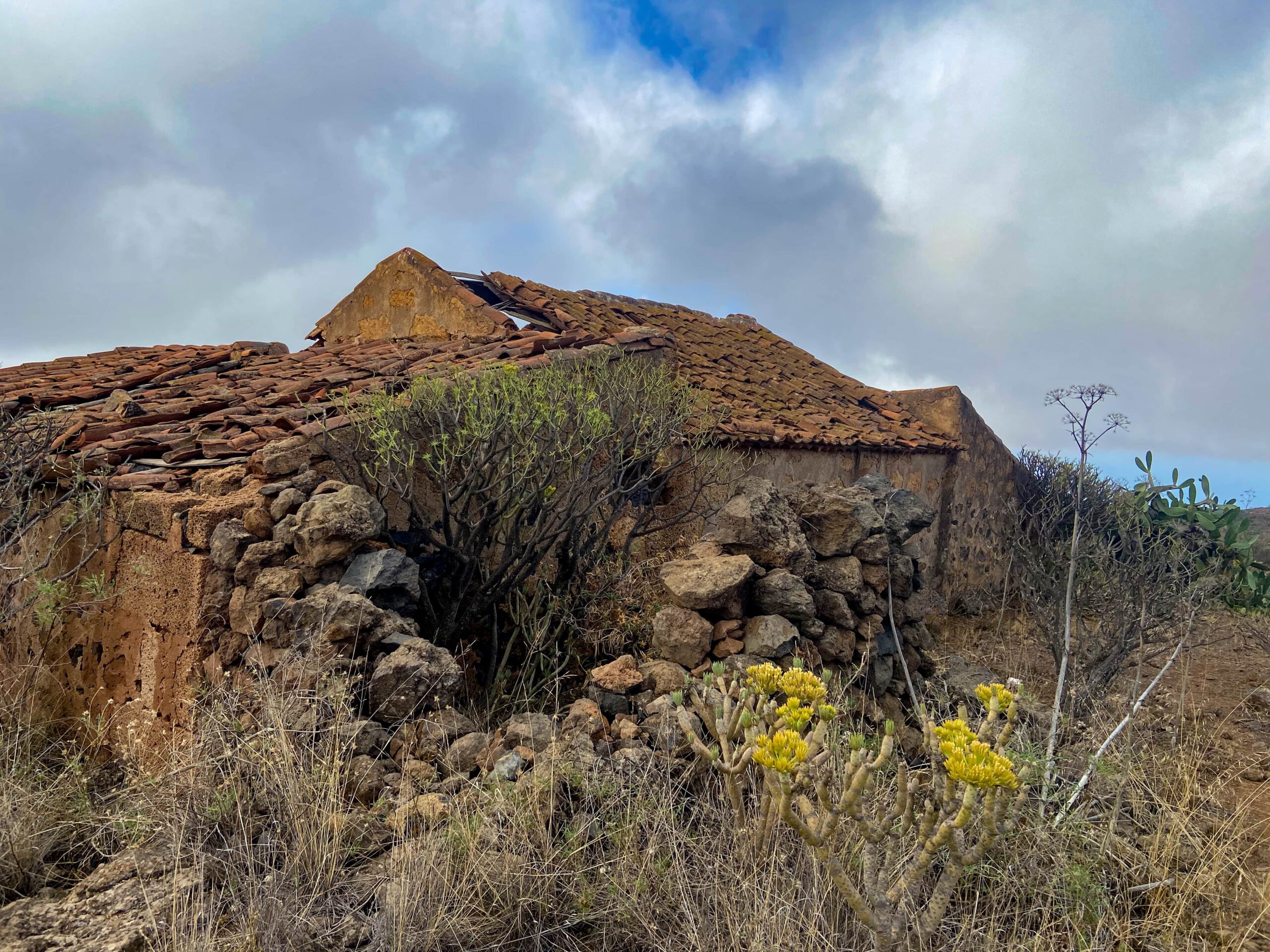
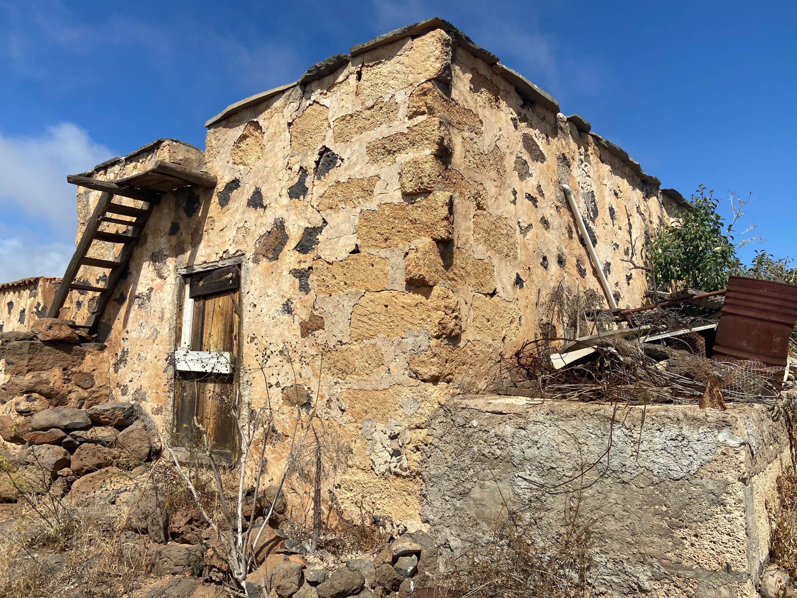
The hike to Cho Pancho not only takes you through a peaceful and varied landscape, but also through an area that tells the story of Tenerife’s past. The area around Cho Pancho was shaped by agriculture for a long time. Even today, old terraced fields and isolated agricultural structures bear witness to the former cultivation of this high-altitude area. Surrounded by cacti, shrubs and wide-ranging views, you can experience the unique atmosphere of this historic place.
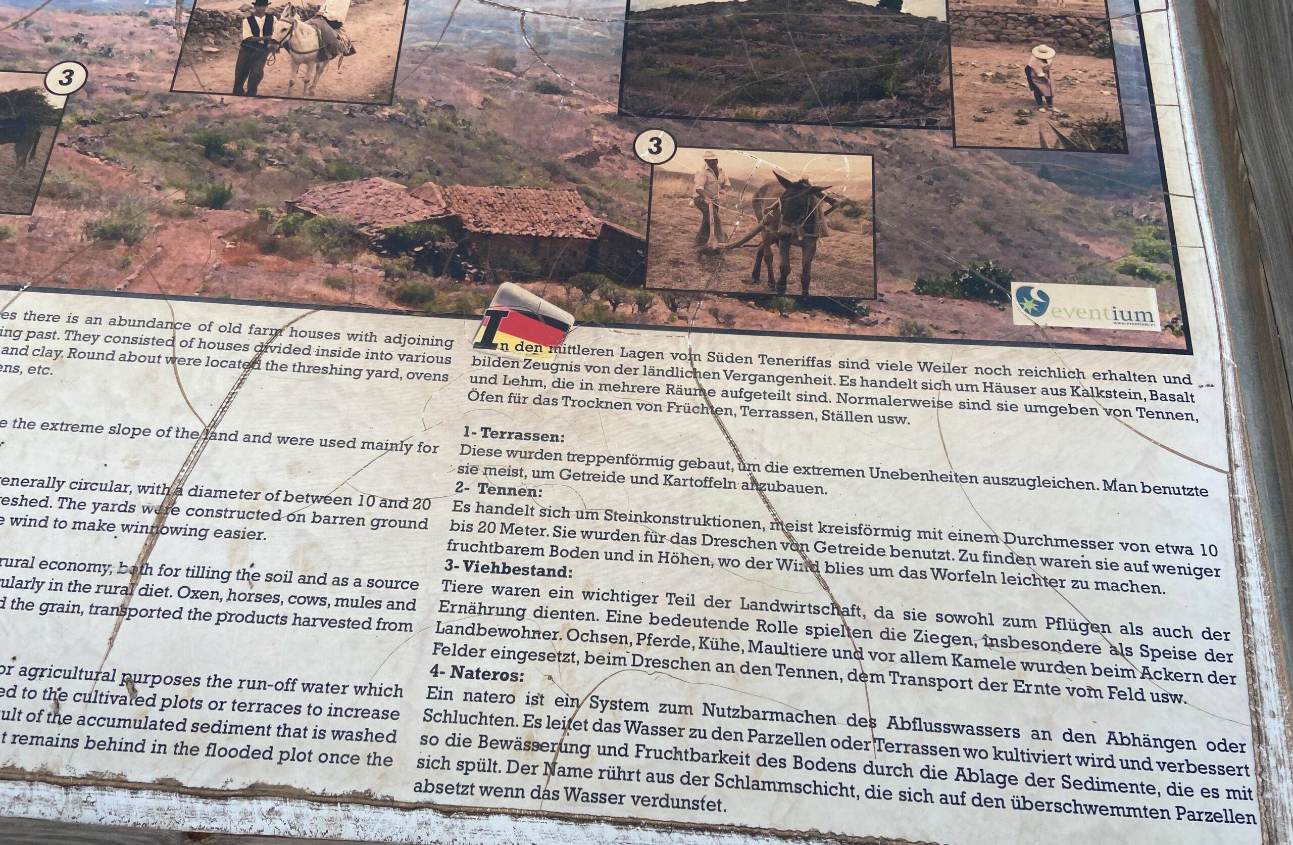
Along the hiking route, information boards provide details about the history of the El Jama and Cho Pancho area as well as about the former lives of the people who inhabited this part of the island. They tell of agriculture, the arduous water supply, traditional building methods and the everyday lives of the people who lived here for many generations. This makes the hike not only a nature experience but also a fascinating journey into the past.
From Historic Hamlet to the Cho Pancho Recreation Area
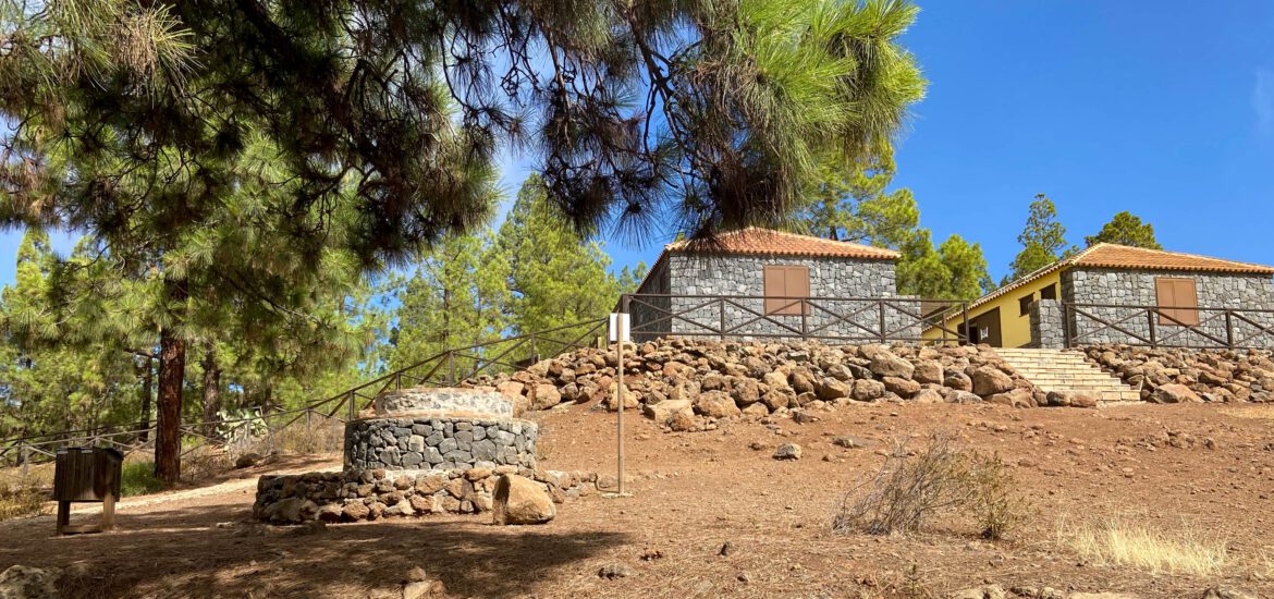
Today, Cho Pancho is a well-maintained recreation area in the middle of an open pine forest. A picnic area with barbecue facilities, seating, a children’s playground and shady trees invites both locals and visitors to take a break before or during the walk and enjoy the tranquillity of nature. Especially at weekends, Cho Pancho is a popular meeting place for families from the south of Tenerife, who can also easily reach the area by car. This walk starts above the small village of El Roque on the south coast of Tenerife.
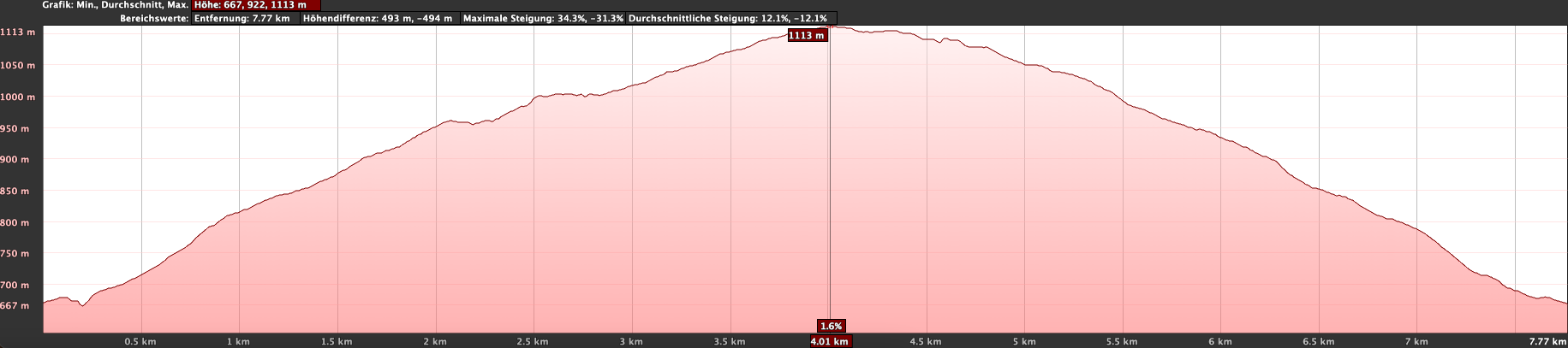
With a distance of 9 kilometres and an elevation gain of 450 metres, it is a relatively short circular walk that can be completed without major difficulties and enjoyed at a leisurely pace. You first walk uphill towards the Cho Pancho picnic area. Even along the way, there are numerous old houses and caves to discover. After the Cho Pancho picnic area, the route continues in a small loop before descending back towards El Roque. In this way, you experience a walk that combines impressive landscapes, fascinating history and an attractive excursion destination in a very special way.
General Information about the Cho Pancho Circular Walk
Starting Point and Directions
The starting point of the walk is Calle el Tapado above El Roque.
By Car
By car, you reach El Roque via the TF-1 motorway. Take the exit at Las Chafiras towards San Miguel. Follow the TF-65 to the centre of San Miguel de Abona. There, the TF-65 ends and meets the TF-28. Turn left and follow it out of the village towards San Lorenzo.
As soon as you reach El Roque, turn right onto the TF-565. Follow the road into the village centre. There, turn right again and reach Calle el Tapado. Follow this road to the left out of the village. At the first left-hand bend, a track branches off to the right. This is where your walk begins. Parking is available at the roadside.
By Bus
Titsa bus route 416, which runs between Los Cristianos and Granadilla, stops in El Roque. Further information can be found on the Titsa website. From there, you can reach the starting point on foot.
Time
I am reluctant to give general time estimates for walks, as these vary greatly from person to person. We needed just under four hours for this leisurely circular walk, including a longer break at the Cho Pancho picnic area.
Elevation Gain and Distance
The elevation gain is 450 metres and the route is approximately 9 kilometres long.
Difficulty
Throughout the entire circular walk, you walk on good walking paths or tracks. Near Cho Pancho, the described path is briefly a little unclear, but it can easily be bypassed via a track.
Refreshments
There are no places to eat or drink anywhere along the route. However, the beautiful Cho Pancho picnic area is ideal for an extended break. You should bring sufficient water and, if necessary, food with you. und Streckenlänge
Variants
If you are travelling by car, you can also start the walk directly at the Cho Pancho picnic area. In that case, you will first walk downhill and later uphill again. Personally, I prefer getting the ascent over with at the beginning of the walk.
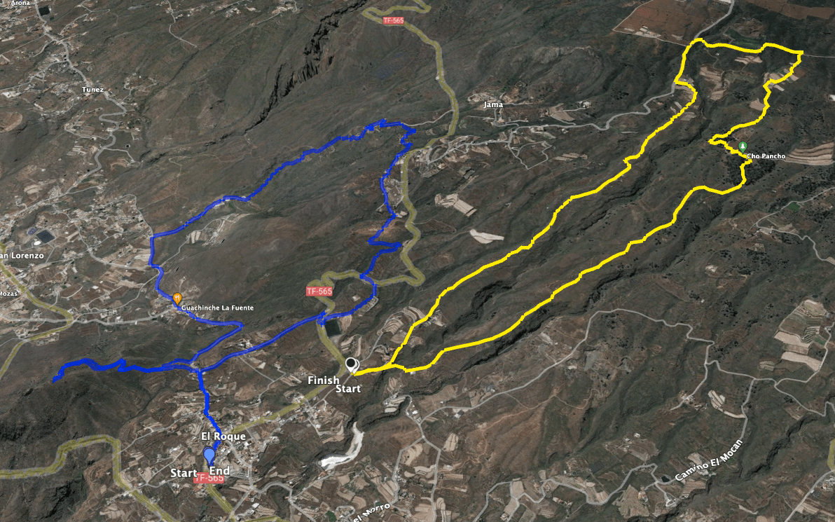
Nearby, you will also find the beautiful hike from El Roque to Roque del Jama on SiebenInseln.
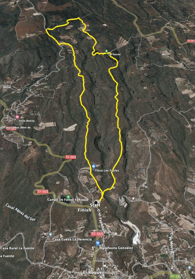
Cho Pancho Circular Hike
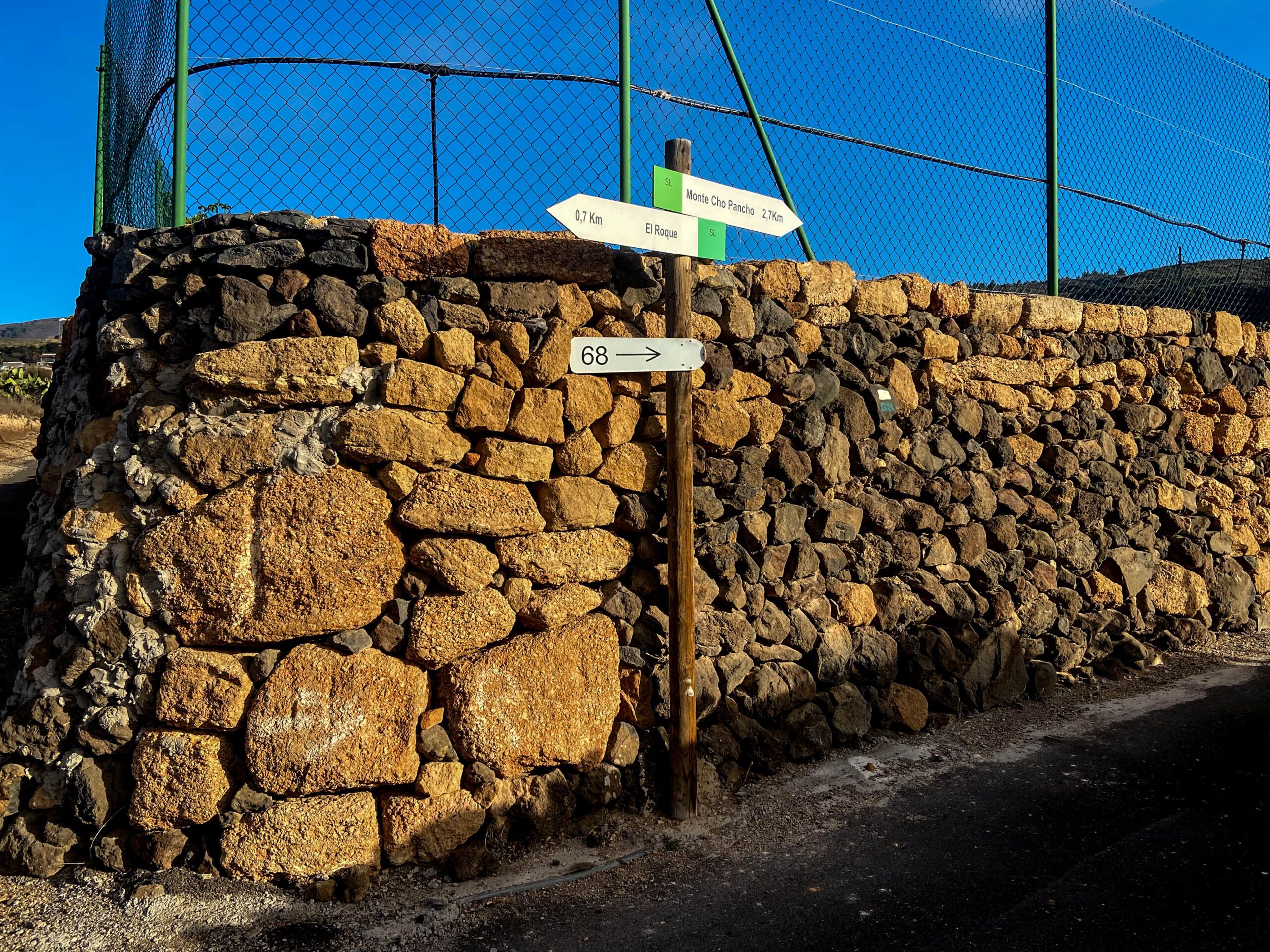
Section Calle el Tapado via El Roque to the Cho Pancho Ascent Path
You begin your walk north of the small village of El Roque on Calle el Tapado. However, while the road bends to the left after a short distance, you continue to the right at a larger junction. On the right-hand side, you pass a few buildings. The track then forks again. You will return later via the left-hand track. For now, however, keep to the right. In this way, you first walk through Barranco Rodrigo. After a while, there is a water reservoir on the right-hand side. The path then climbs to the left, running parallel to the barranco.
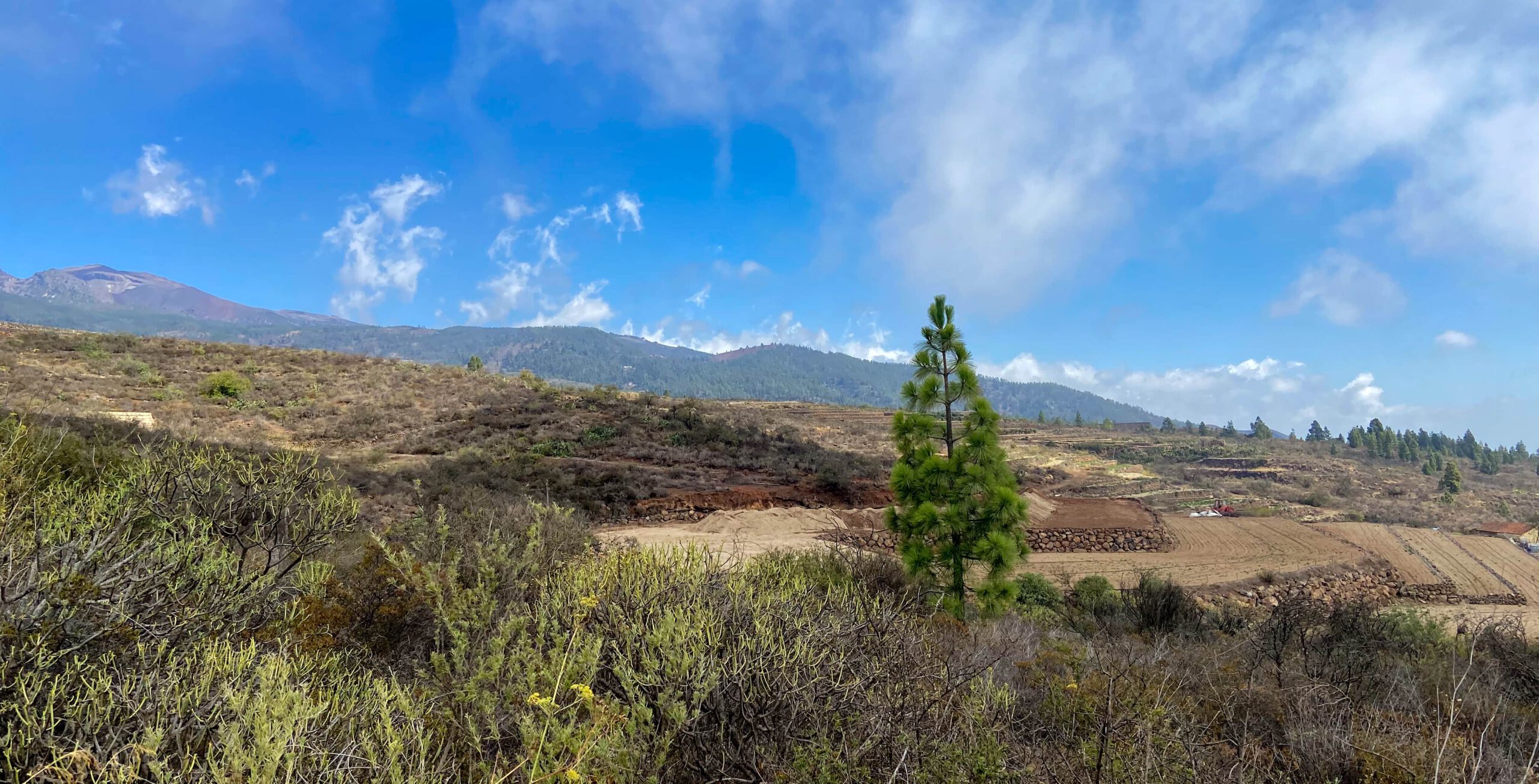
You walk along the south-east coast of Tenerife on a barren, stony path that nevertheless offers magnificent views of the Cañadas high above you and back towards the Atlantic. On your left-hand side, you can admire the area around Roque del Jama. Throughout the entire circular walk, you repeatedly come across information boards telling you about the history and former inhabitants of this part of the island. The many terraced fields you pass alone are evidence of its former use as the island’s granary.
Section Cho Pancho Ascent Path to the Cho Pancho Car Park
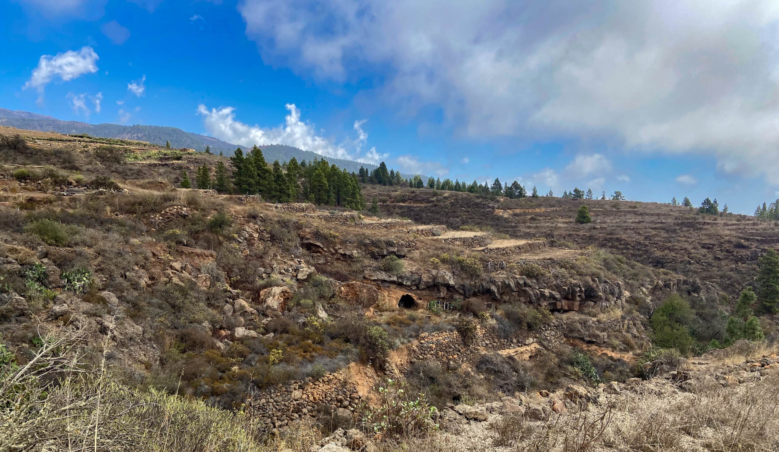
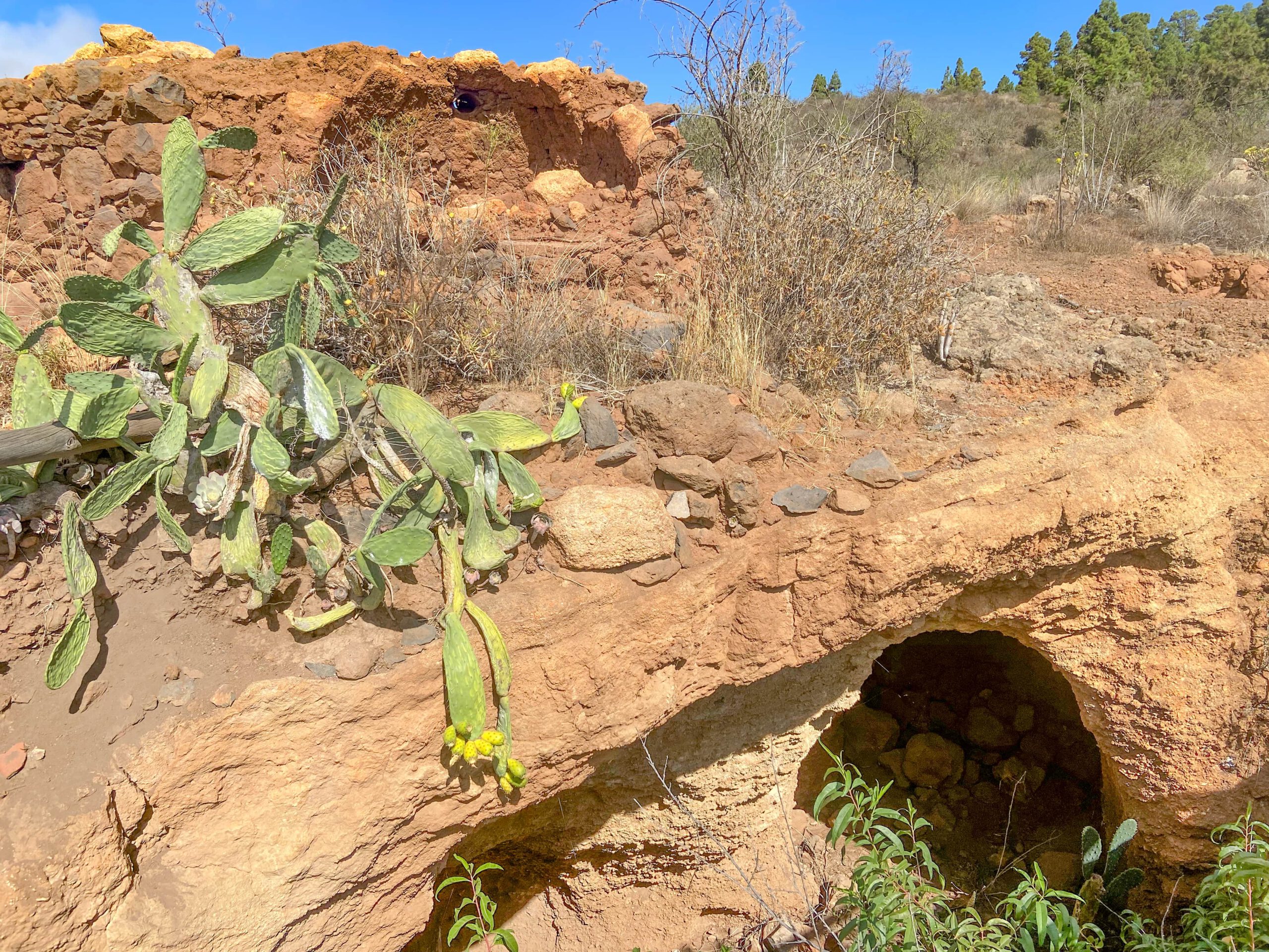
As you climb between Barranco Rodrigo and Barranco de la Mesa, you can discover not only the terraced fields but also numerous caves. Most of the caves (around eight) are located just below the Cho Pancho picnic area. If you leave the path below this area and head a little to the right, you will discover several caves. An old oven can also be found on the left-hand side of the walking path, bearing witness to the former settlement of the area.
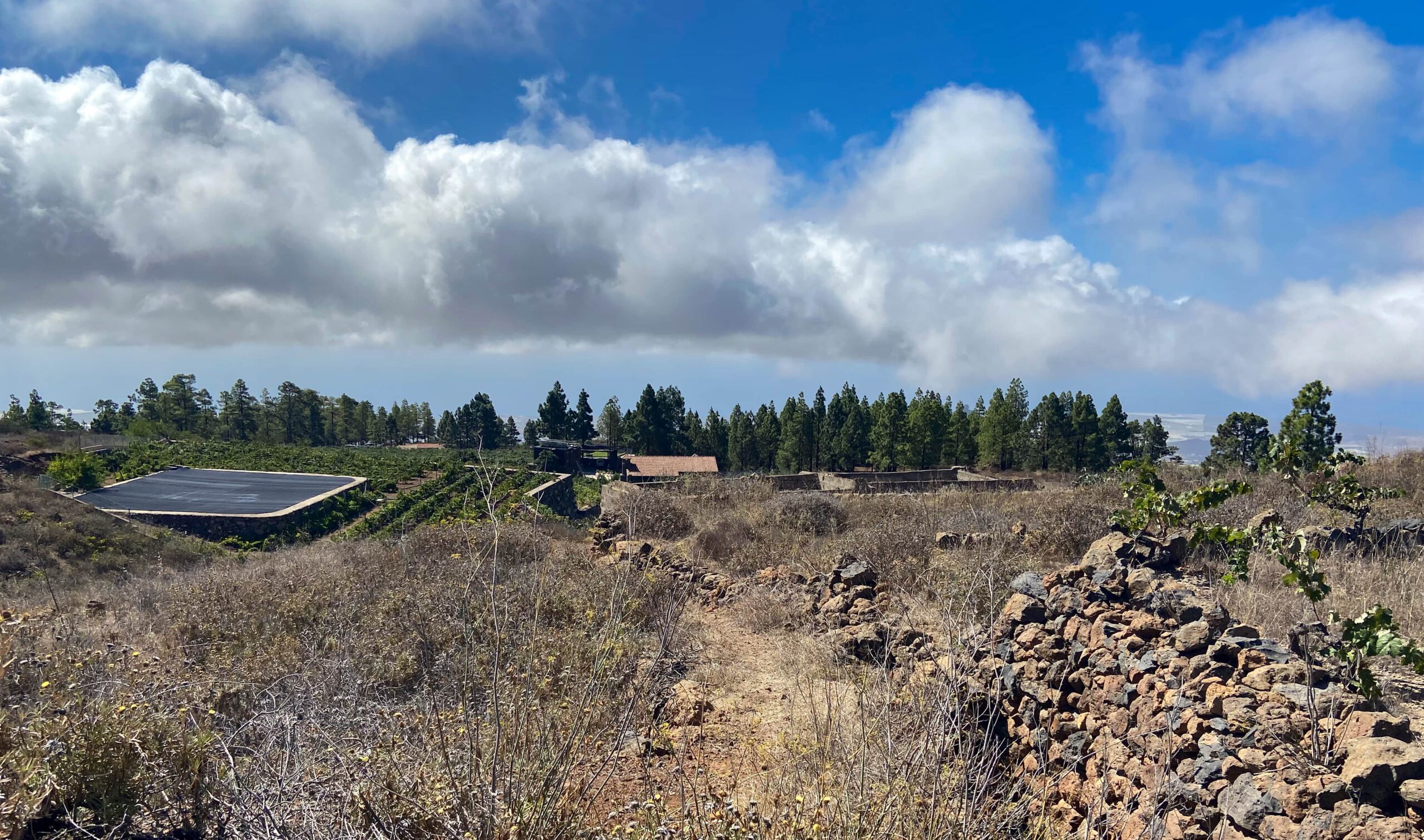
A short while later, you reach the spacious grounds of the Cho Pancho picnic area. There is plenty to see and discover here. After the ascent, you may wish to take a break on one of the comfortable benches. Once you have explored everything and perhaps taken a rest, continue north until you reach a small road above the Cho Pancho area. Follow this road for a short distance to the left. It ends at a car park.
Section Cho Pancho Car Park to the Descent Path
We chose the slightly “wilder” route and followed a small path to the left from the car park. It initially heads north, bypassing a large finca. Eventually, it passes several fields and water retention basins before rejoining a larger track. If you prefer not to do this, it is easier to follow the road to the right from the Cho Pancho picnic area. Then take the first path on the left. This route also brings you back to the same track, which continues to the left.
Follow this track eastwards for some time. The ascent is now complete. The track joins a wider road, which you follow downhill to the left. If you do not want to walk on the road the whole way, turn left after a short distance at Casita Tenerife. The path first leads straight ahead past fields and then descends through a barren landscape. Along the way, you are rewarded with impressive views of the coastal scenery.
Section Descent Path to the Starting Point of the Hike
You reach the road again, which comes to an end shortly afterwards. You then continue downhill above Barranco Rodrigo. While the path initially runs straight ahead, it becomes somewhat steeper towards the end of the descent. You descend in a series of short switchbacks.
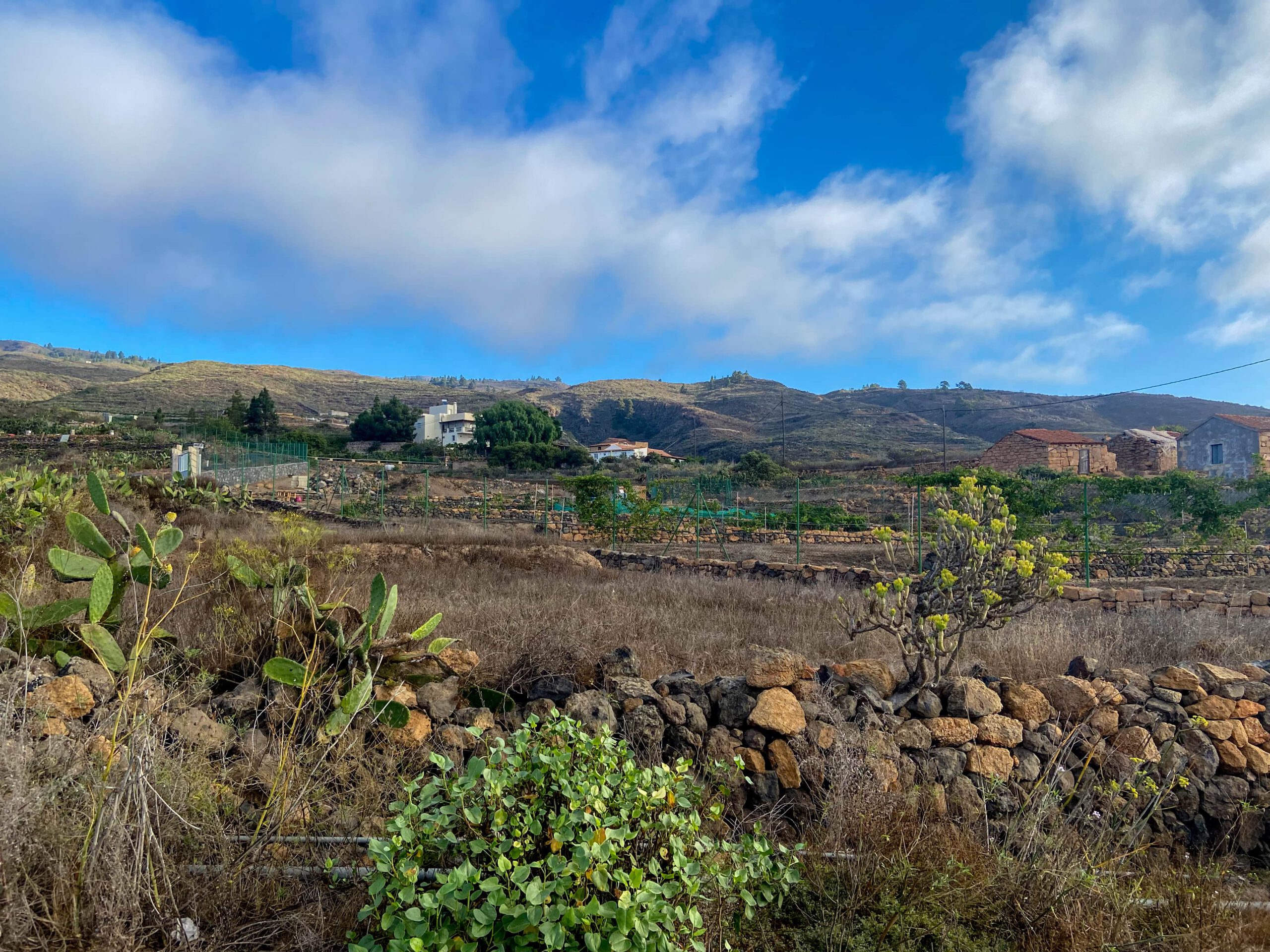
You arrive at a large finca and shortly afterwards return to Calle el Tapado. From here, you could follow the road in a wide loop downhill back to your starting point. However, the walking path is more attractive. It leads straight downhill past farmsteads and terraced fields. Eventually, you reach the junction where your ascent path branched off to the left. Here, keep slightly right and, following the same path, return to your starting point after a short while.
And Finally
I hope you enjoyed this short and peaceful walk to Cho Pancho on the east coast of Tenerife. If you are thinking about getting a four-legged walking companion, as I did, take a look at the rescue dogs and at the dogs I have featured.
In any case, I wish you great enjoyment on your walks.
Dagmar from SiebenInseln