- Azulejos de Veneguera – The Colourful Rocks of Gran Canaria
- Hike Azulejos de Veneguera
- General Information about the Azulejos de Veneguera Walk
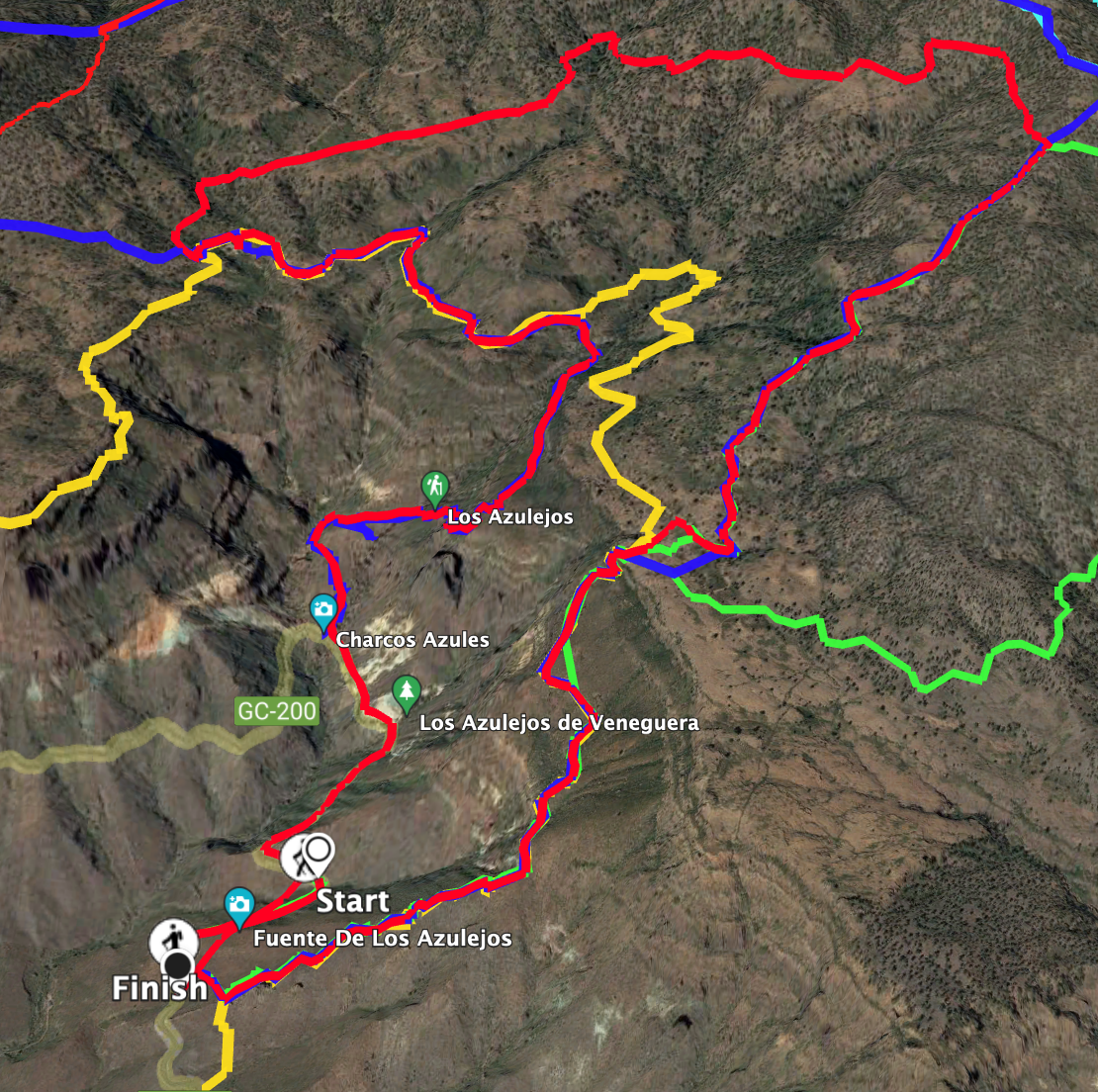
- Circular Hike Azulejos de Veneguera
- Section GC-200 via El Roque to High Plateau Inagua Nature Park
- Section High Plateau Inagua Nature Park to Hiking Junction
- Section Hiking Junction to Aula de la Naturaleza
- Section Aula de la Naturaleza to Charco de las Aneas in Barranco de la Manta
- Section Charco de las Aneas in Barranco de la Manta to Starting Point
- And finally
Azulejos de Veneguera – The Colourful Rocks of Gran Canaria
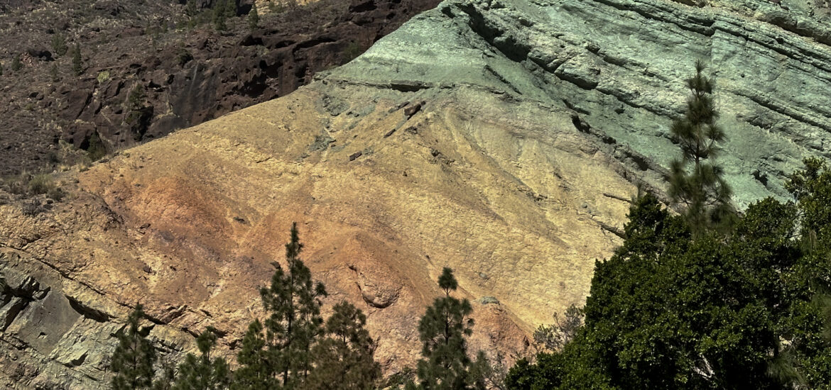
The Azulejos de Veneguera are located in the south of Gran Canaria on the GC-20-200 between Mogán and Aldea de San Nicolás. Colourful rocks and entire rock bands are commonly found on the Canary Islands. However, the Azulejos de Veneguera shine with a unique intensity. Unfortunately, I cannot depict this visually as, during our stay in Gran Canaria and our hikes in this area, we experienced daily Calima, resulting in a lot of haze. Nevertheless, the radiant colour hues daily impress many tourists who stop and marvel at the rock wall Fuente de los Azulejos.
The colouration is the result of erosion and various deposits. So the dominant greenish-turquoise shades are due to iron hydrate, and the reddish hues come from iron oxide. The purple to dark areas originate from basalt, and the yellow ones from sulfur. And the name “Los Azulejos” refers to blue ceramic tiles in Spain. The colourful rocks, which attract new viewers daily, are located on the edge of the protected Inagua Nature Park, which entices visitors with many hiking trails.
Hike Azulejos de Veneguera
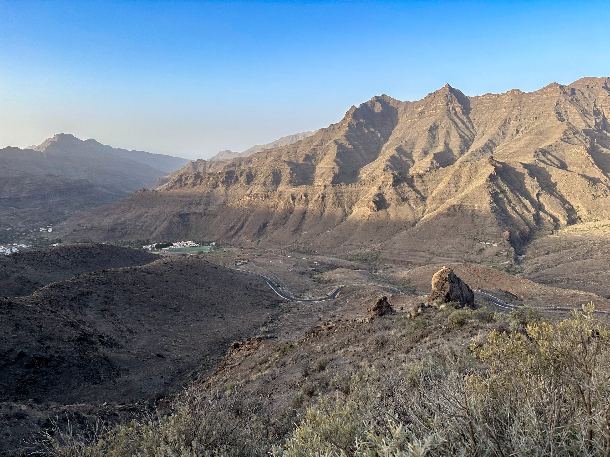
The hike that leads you to the Azulejos de Veneguera follows the so-called Ruta 2 of Gran Canaria. You ascend from the GC-200 via a steep path over the distinctive El Roque rock. After the strenuous ascent, you are rewarded with pristine wild nature and magnificent views in the Inagua Nature Reserve.
On the return journey, you pass the Aula de Naturaleza, a building for nature-related events. Soon after, you reach the Barranco de Manta on the descent path. At the end of the hike, the absolute highlight awaits you. You walk directly in front of the impressive Azulejos de Veneguera back down to the road. From the descent path, you have beautiful views of the stunning colour play of the rocks.
General Information about the Azulejos de Veneguera Walk
Starting Point and Arrival
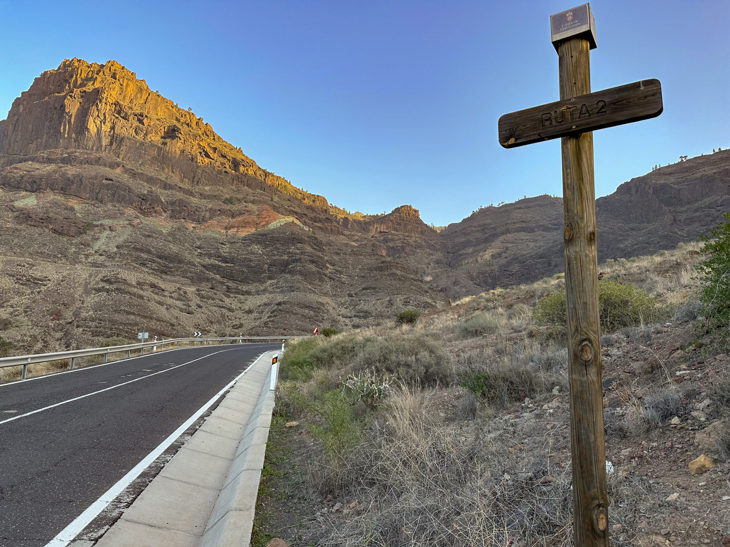
You start your hike on the GC-200 between the Azulejos de Veneguera and the ascent path marked with a wooden sign Ruta 2.
Arrival by car
You can reach the starting point from either side on the GC-200. As you will walk on the GC-200 for a while on this hike, it does not matter where exactly you start between the Azulejos de Veneguera and the ascent path to El Roque. We parked our car – as you can see from the track – closer to the ascent path and had to walk along the road longer on the way back. There are occasional parking bays along the roadside. Otherwise, use the parking spaces directly at the Azulejos or another nearby.
Arrival by bus
Bus lines 38 (from Puerto de Mogán to La Aldea de San Nicolás) and 86 (from Puerto de Mogán to Playa de Tasarte) of the Global bus company pass by the Azulejos de Veneguera. There is no bus stop at the Azulejos, so you need to ask the driver for the nearest stop. For exact bus schedules, visit the Guaguaglobal website.
Time
I am reluctant to give time estimates as they are very individual. For the Azulejos de Veneguera hike, we took 6.5 hours with several breaks.
Elevation Difference and Distance
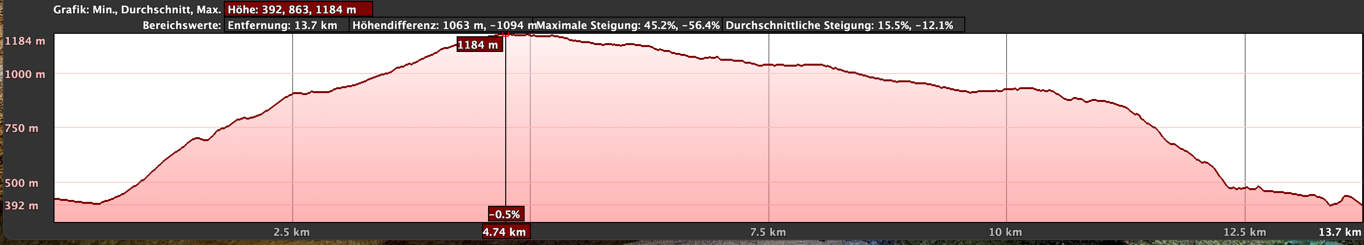
The elevation difference is nearly 850 meters, and the distance is 16.5 kilometers.
Requirements
The hike mostly follows good hiking trails, tracks, and roads. Only the last section of the descent path is quite steep, so surefootedness and a good head for heights are necessary. However, as the hike is quite long, you should be in good physical condition.
Refreshments
There are no refreshment options along the entire hike. Therefore, please bring enough water and possibly food for the hike.
Variants
You can combine this hike well with many other hikes in the vicinity.
A nearby hike on SiebenInseln is the Inagua hike, which can be combined with this hike via a connecting path.
Circular Hike Azulejos de Veneguera
Section GC-200 via El Roque to High Plateau Inagua Nature Park
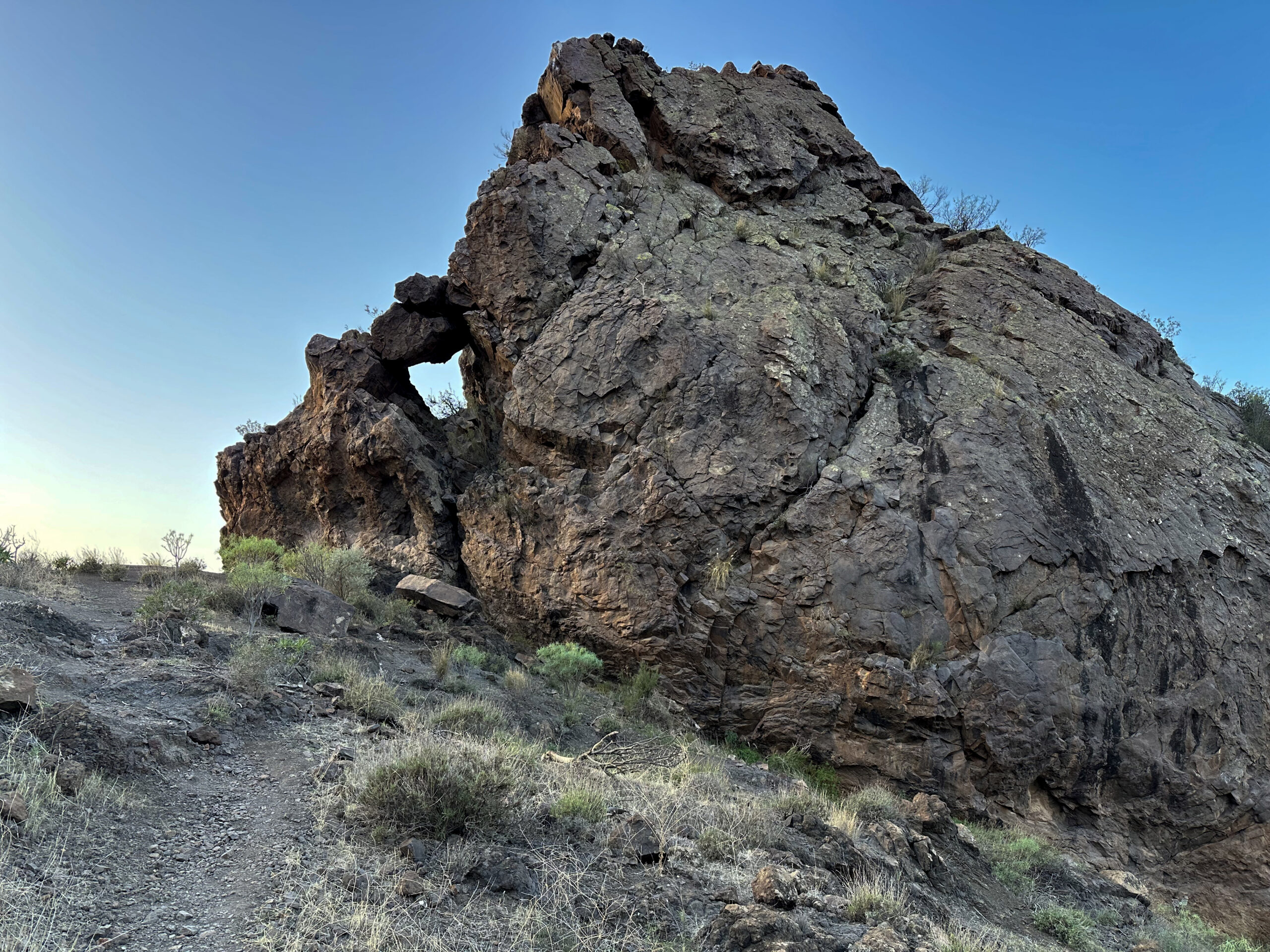
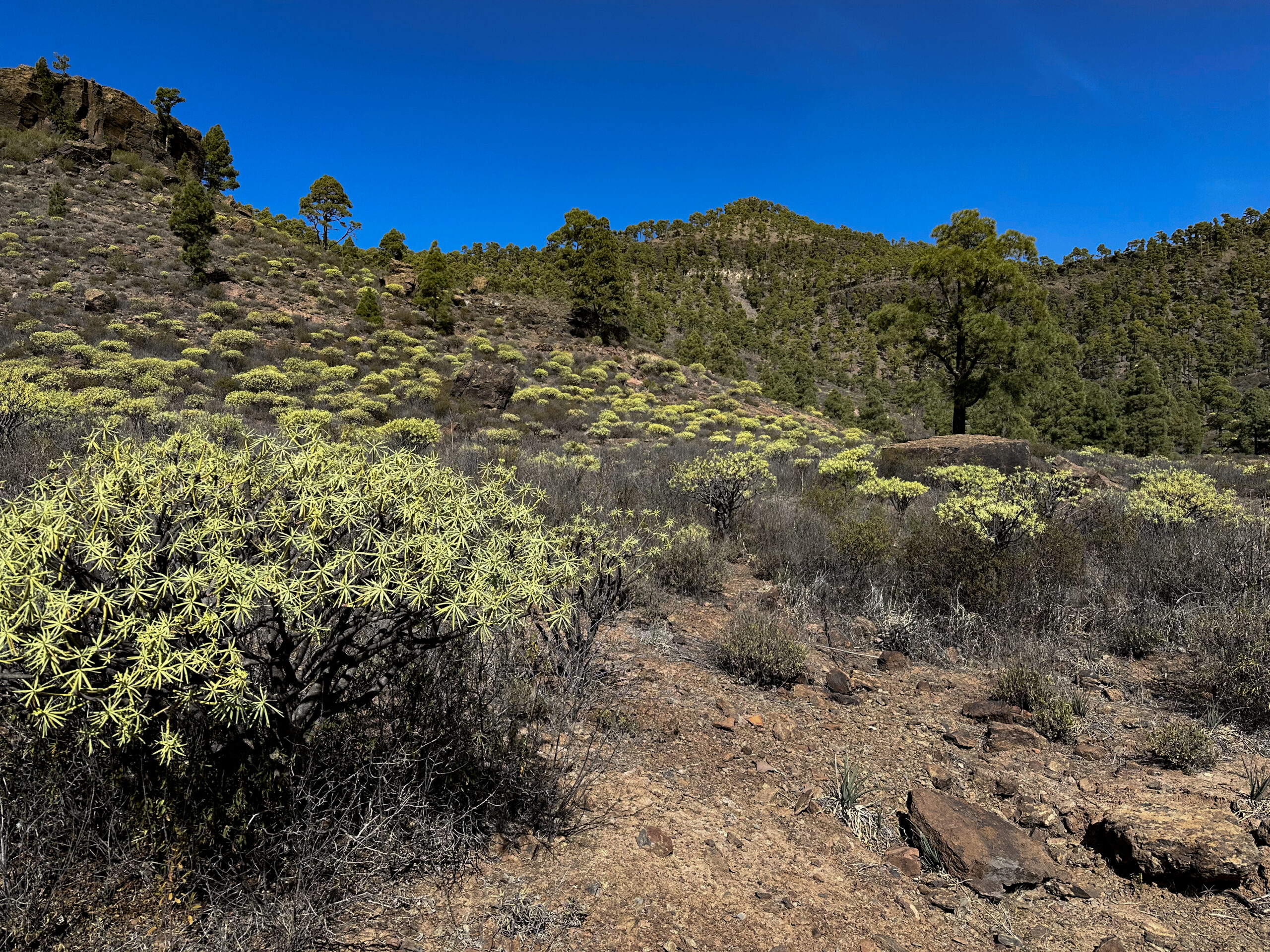
You start your hike on the GC-200 at any point between the Azulejos de Veneguera and the ascent path. Then you walk along the GC-200 until you reach the ascent path marked with a wooden post (labelled Ruta 2). You are at about 400 meters altitude and walk up the path to the right to a ridge. You continue steeply up the ridge path. Soon you reach the prominent El Roque rock, visible from afar. You pass it on the left side.
The hiking trail continues to climb. The path is easy to follow and always leads near the ridge up to an altitude of about 680 meters. Already from here, you can observe beautiful rock colourations right in front of you. The trail now turns left and leads you along a rock band and a gorge. It continues to climb steeply. Finally, the path turns right again. You reach a final steep climb, which finally brings you to the high plateau and into the Inagua Nature Park at an altitude of over 900 meters.
Section High Plateau Inagua Nature Park to Hiking Junction
At the top of the escarpment, you can enjoy wonderful views back. Then you walk straight through a small vegetated gorge, the Barranquillo del Salobre. After that, you reach a wide track. Follow it briefly to the right. Before the track curves right for the first time, a small ascent path begins on your left. Follow this path uphill.
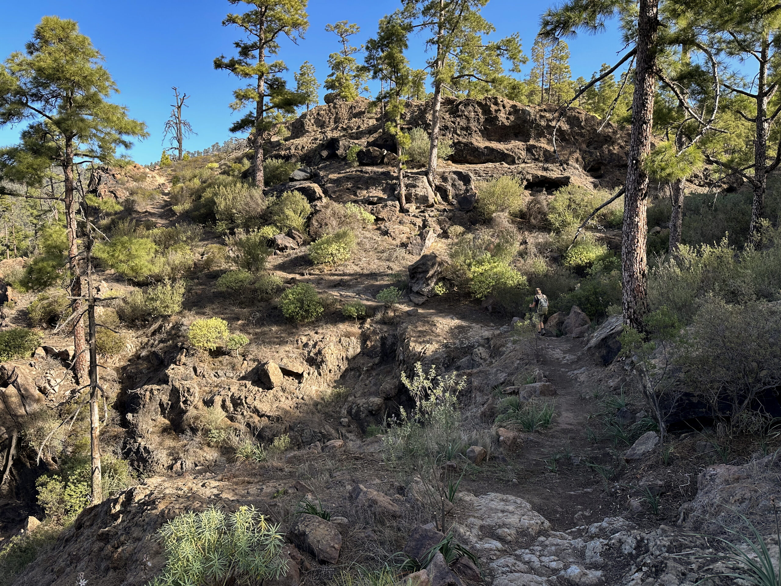
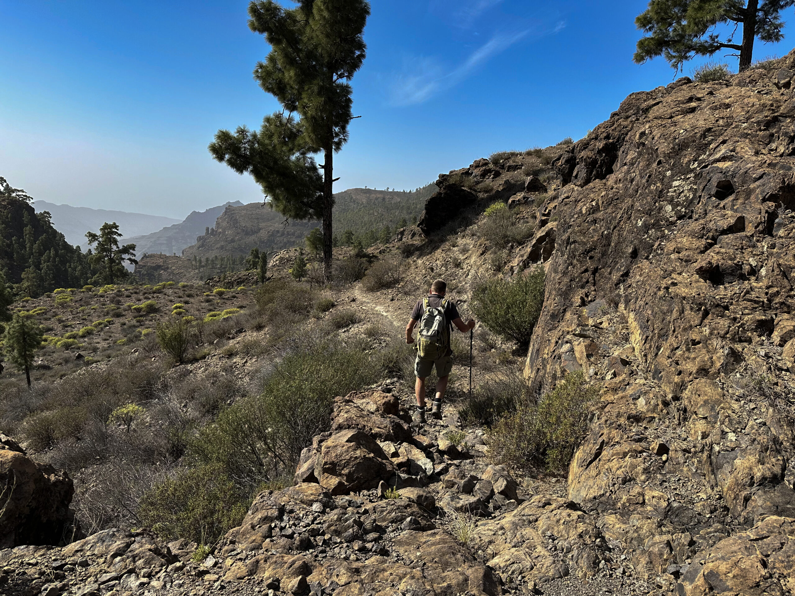
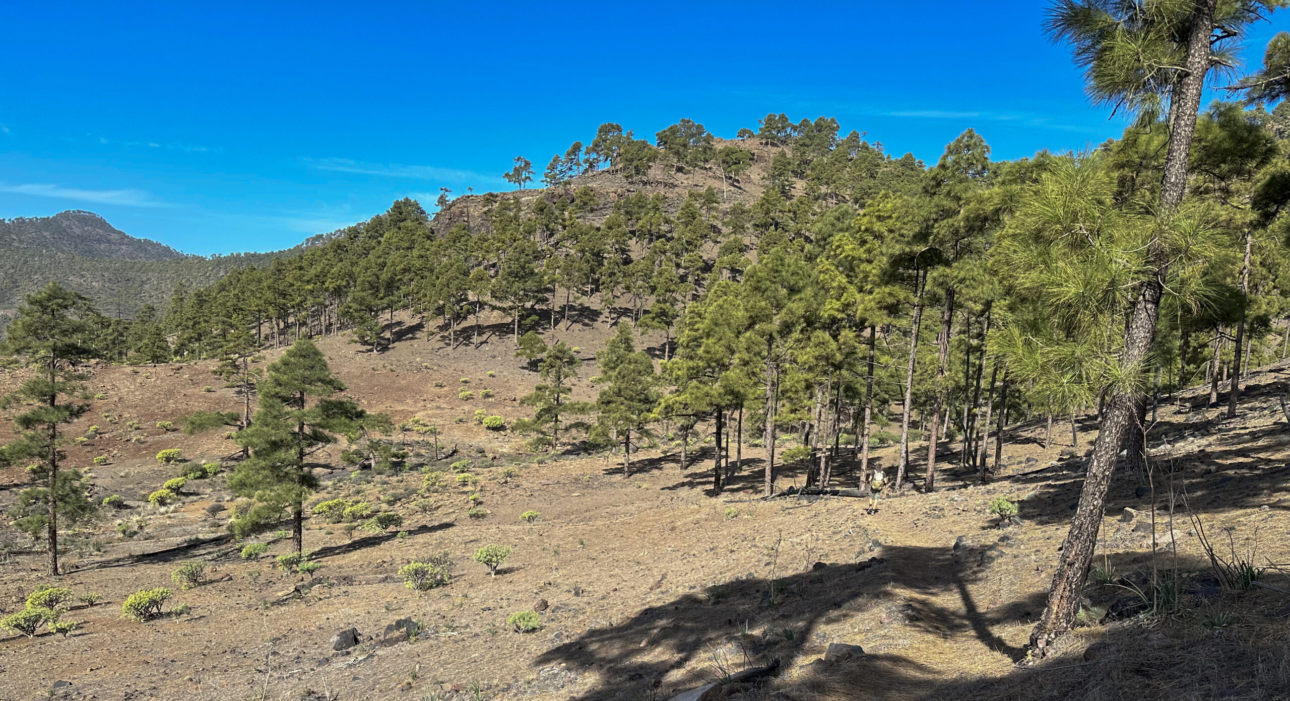
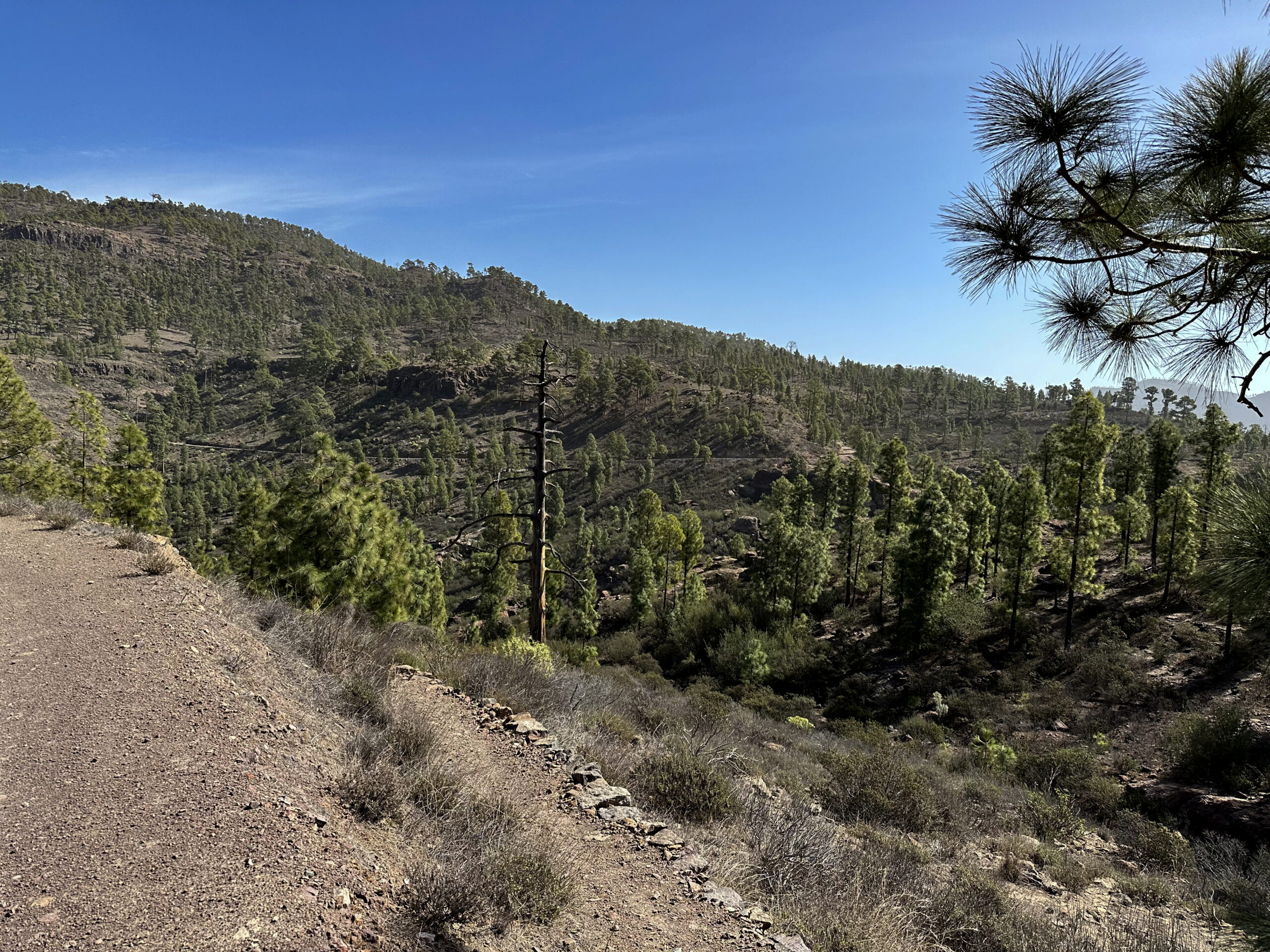
The further ascent path takes you through the beautiful landscape of the Inagua Nature Reserve. With more wonderful views and surrounded by forest, you continue to climb. At about 1200 meters altitude, you reach a hiking junction. You can continue straight ahead. Two paths branch off to the left. Both later merge again. We chose the higher path, which took us even higher through the forest and along a gorge.
Section Hiking Junction to Aula de la Naturaleza
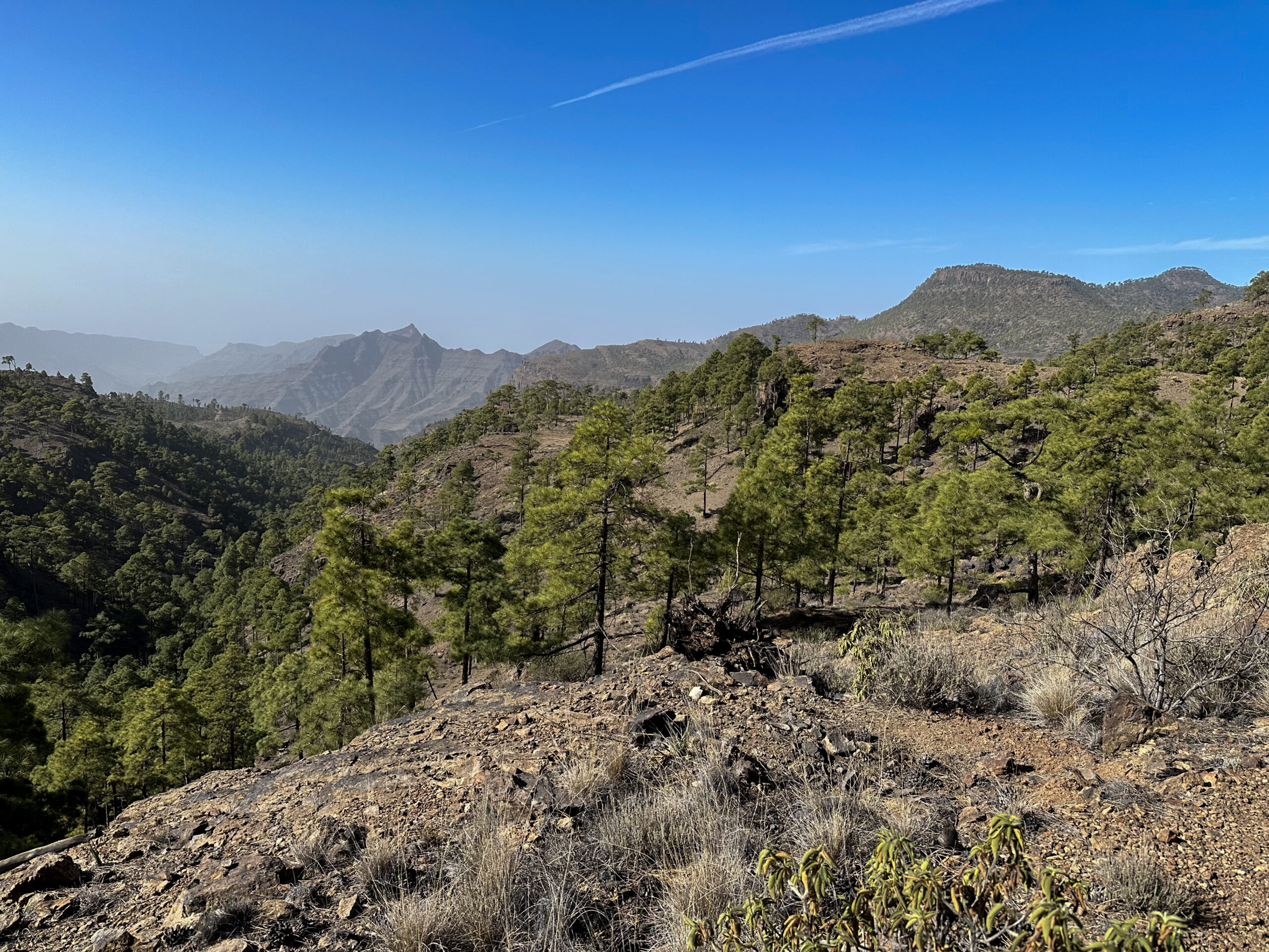
After circling the gorge, the two paths merge again. From now on, it goes mainly downhill with a few small climbs. But first, you continue at the same altitude and cross some gorges on really beautiful hiking trails with magnificent views. After hiking over the large Barranco del Medio, the path quickly descends further on an open track.
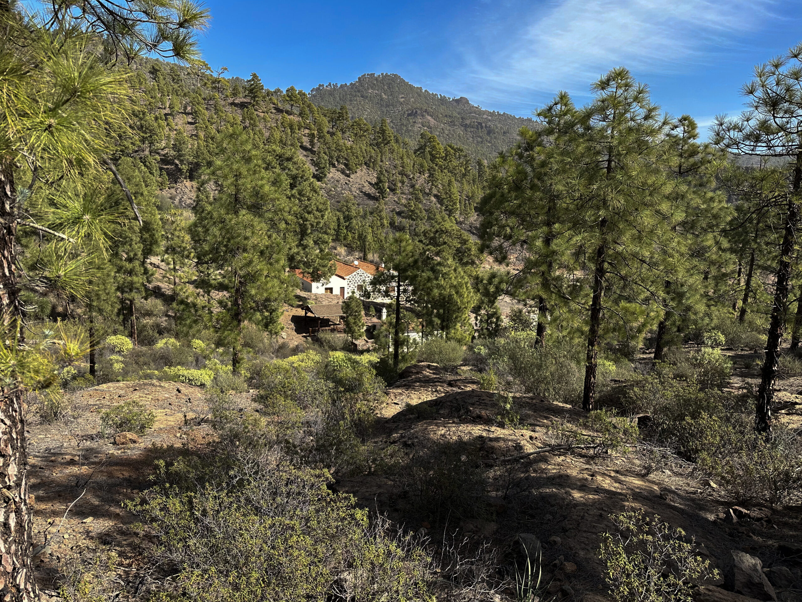
This path eventually merges into a track. If you turn right, you would reach the track of the Inagua hike. However, on this hike, you turn left and follow the path further down through forested areas. In a loop, you then reach the Aula de Naturaleza. The building, which is used for nature events, appears to be closed at the moment (as of March 2024). If you wish, you can still take a small detour to the building and have a look around.
Section Aula de la Naturaleza to Charco de las Aneas in Barranco de la Manta
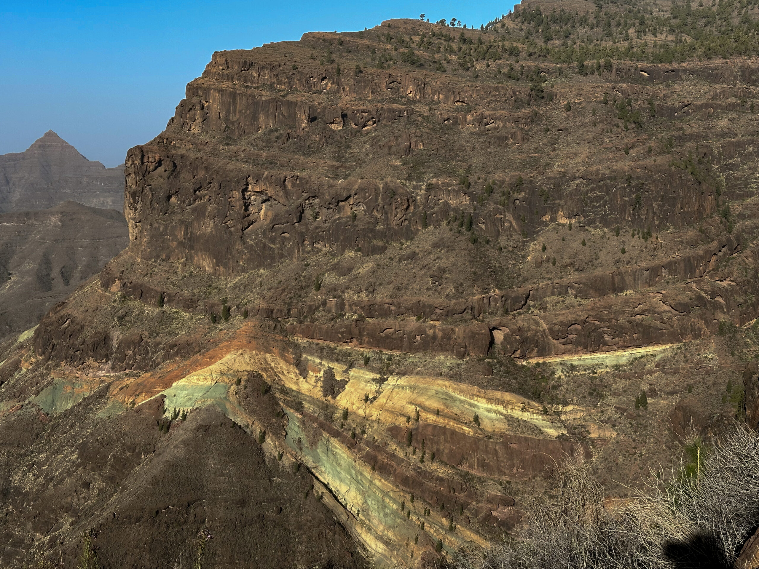
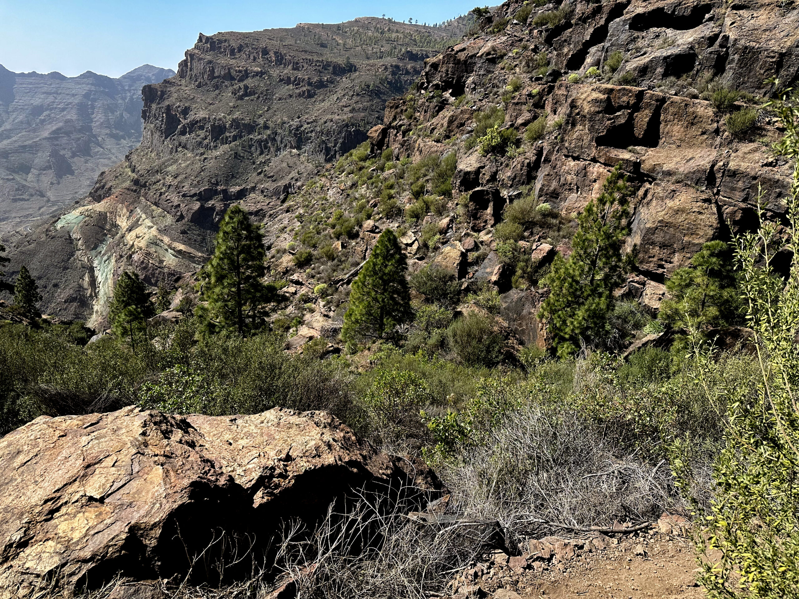
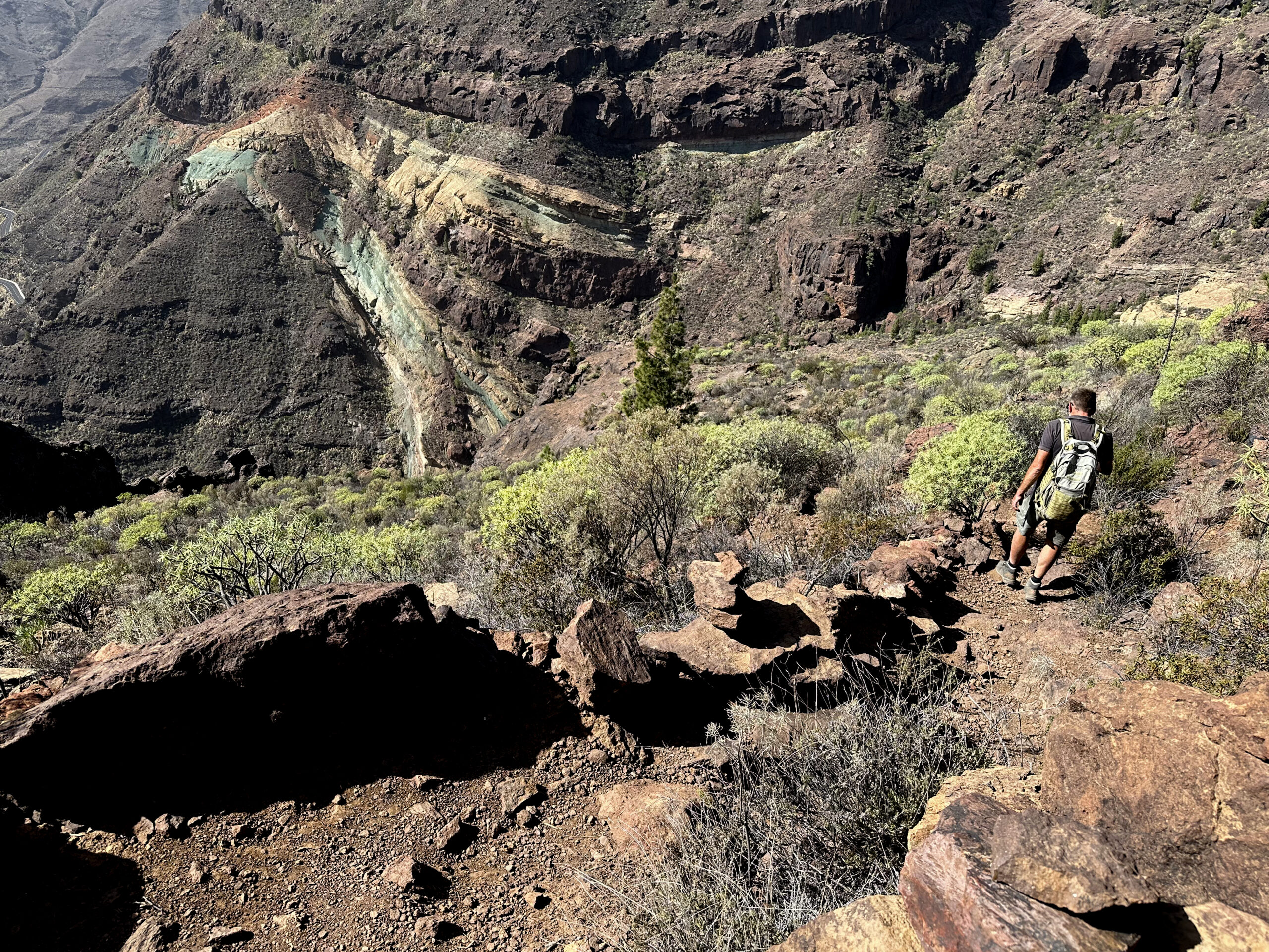
After that, continue along the track. If you followed it straight on, you would reach the point where you ascended to the high plateau. But on this circular tour, the Ruta 2 path branches off to the right next to the track, descending towards Barranco de la Manta. The trail quickly leads you down into the gorge, which you cross. On the other side, the narrow path continues through bushes below the track along the slope.
Finally, you reach a kind of viewpoint. From here, you have wonderful views of the rocks in front of and below you. Now the trail begins to descend steeply. In switchbacks, it takes you further down towards the rock band. Eventually, the path leads you down to the lower end of Barranco de la Manta. At Charco de las Aneas, you cross the gorge on rocks at 680 meters altitude.
Section Charco de las Aneas in Barranco de la Manta to Starting Point
After crossing, the path takes you slightly downhill along the rock band for a longer time. You get closer to the Azulejos de Veneguera and can enjoy beautiful views of them from the trail. Then the trail turns left. Now it descends steeply and passes the Azulejos de Veneguera down to the GC-200.
The path is easy to follow but very steep and requires full concentration. The landscape, with the colourful rock bands, is simply indescribable. After this impressive descent, you finally reach the GC-200 again. Now you only need to walk back to your car or the bus along the road.
And finally
Hope you enjoyed the colourful hike to the Azulejos de Veneguera. I found this tour more than impressive and will definitely return. I wish you much joy on all your hikes,
Dagmar from SiebenInseln