Tenteniguada and the Renowned Sendero Caldera de Los Marteles
Tenteniguada is a small, picturesque village on the island of Gran Canaria, part of the Valsequillo municipality. Located in the central part of the island at about 800 meters above sea level, it is known for its natural beauty and the spectacular scenery that surrounds it. Tenteniguada is a popular destination for nature lovers and hikers. The area is characterized by an impressive mountainous landscape, deep ravines, and lush vegetation typical of the island’s mid-altitude regions. Tenteniguada is especially famous for its hiking trails, which lead through breathtaking nature and offer spectacular views of the surrounding mountains and valleys. A highlight is the “Sendero de La Caldera de los Marteles,” a trail I want to introduce here, which passes through the nature reserve of the Caldera de los Marteles, a geological formation of volcanic origin.
The Caldera de Los Marteles is an impressive geological formation near the village of Tenteniguada. It is one of the most striking calderas on the island, attracting many visitors due to its scenic beauty and geological and ecological significance. The Caldera de Los Marteles is a type of maar caldera, formed by an explosive volcanic eruption. This type of caldera is created when magma comes into contact with groundwater, resulting in a massive steam explosion.
The explosion leaves behind a deep, circular depression that can later fill with water, though this is not the case with the Caldera de Los Marteles. With a diameter of about 500 meters and a depth of around 80 meters, the caldera is one of the larger and more prominent volcanic structures on Gran Canaria. The crater floor is flat and fertile, making it an ideal spot for agriculture.
Hike from Tenteniguada to the Caldera de Los Marteles
The Caldera de Los Marteles is located in a nature reserve and is surrounded by a diverse and partly endemic flora and fauna. The area around the caldera is particularly known for its rich plant life, which includes numerous rare and protected species. These include various types of heather, Canary Island pines, and many other endemic plants of the Canary Islands. During the wet months, the crater floor transforms into a green, blooming landscape, providing a fascinating contrast to the drier regions of the island. This vegetation provides a habitat for a variety of birds and other animals that can live undisturbed in this relatively remote area.
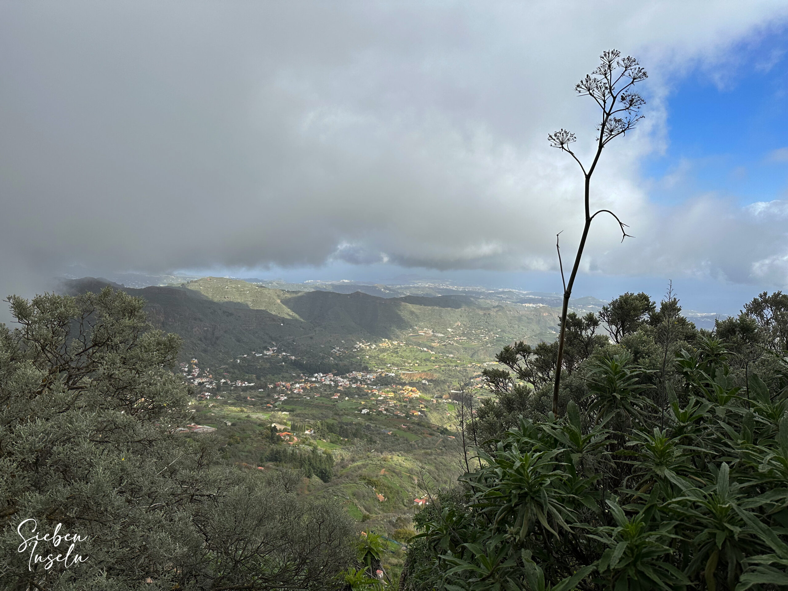
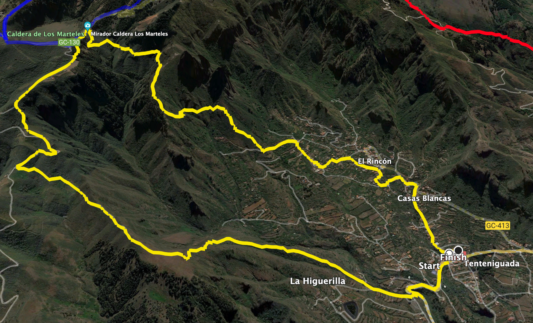
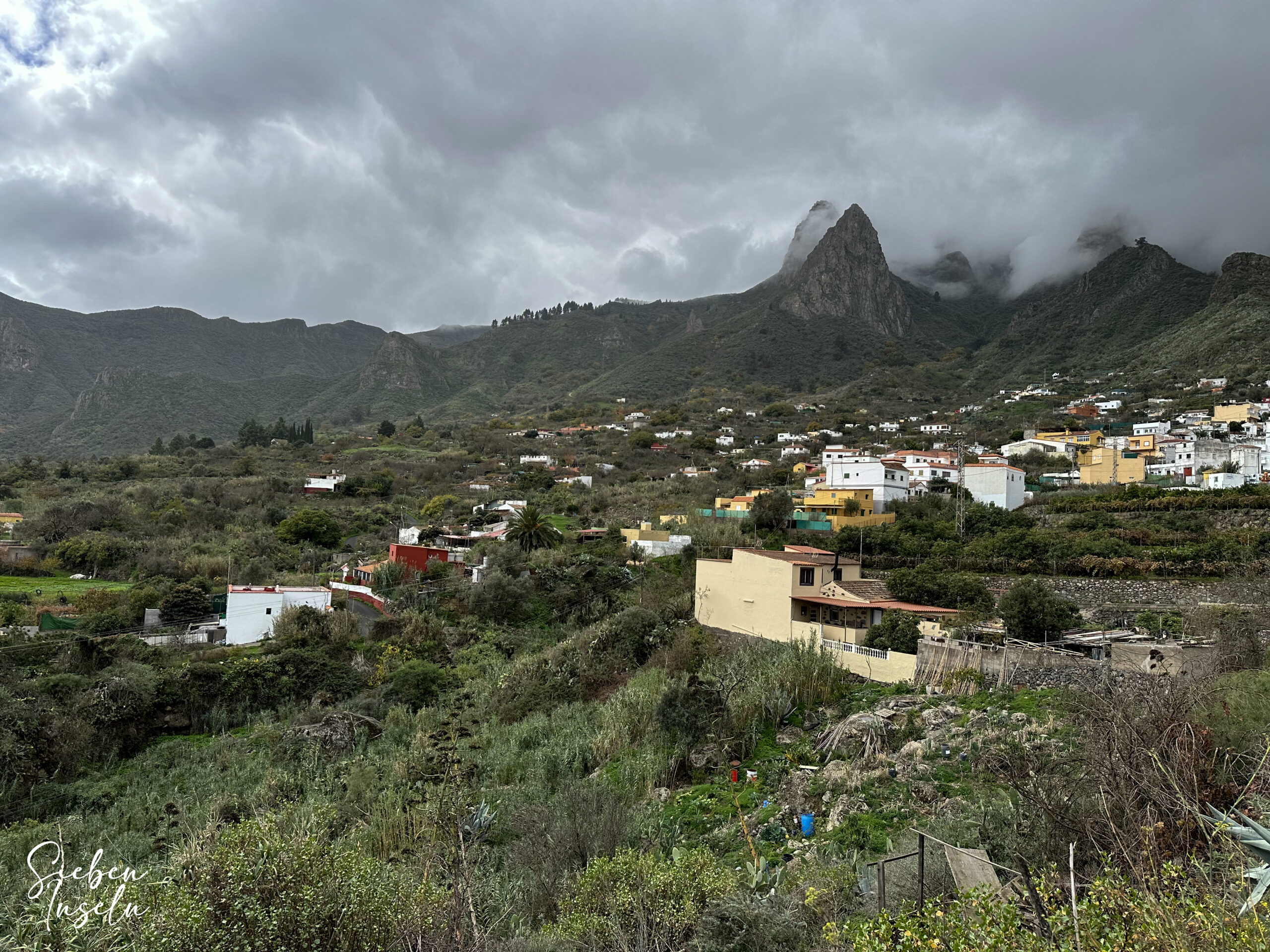
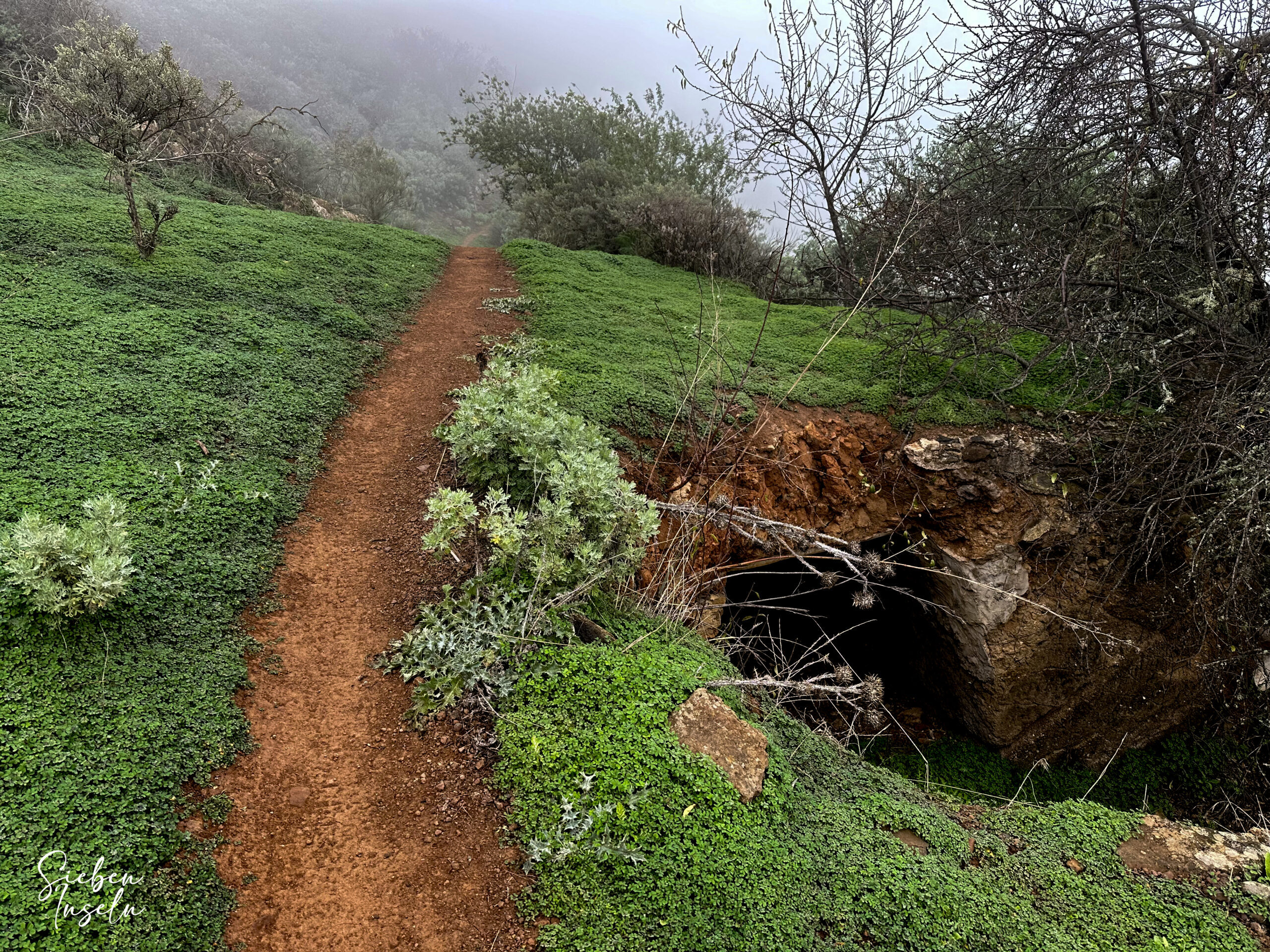
The trail takes you on a wide circular route from Tenteniguada to the Caldera de Los Marteles, passing through a landscape that is both scenic and ecologically interesting. Unfortunately, during our hike, it rained quite a bit, and the ridges were shrouded in clouds. As a result, I can only offer gray photos. However, when I return to Gran Canaria, I will definitely repeat this wonderful hike and hopefully replace the photos. Despite the rain, I was very impressed by the hike, and I am presenting it here in the hope that you can enjoy it in better hiking weather.
General Information about the Tenteniguada – Caldera de Los Marteles Hike
Starting Point and Access
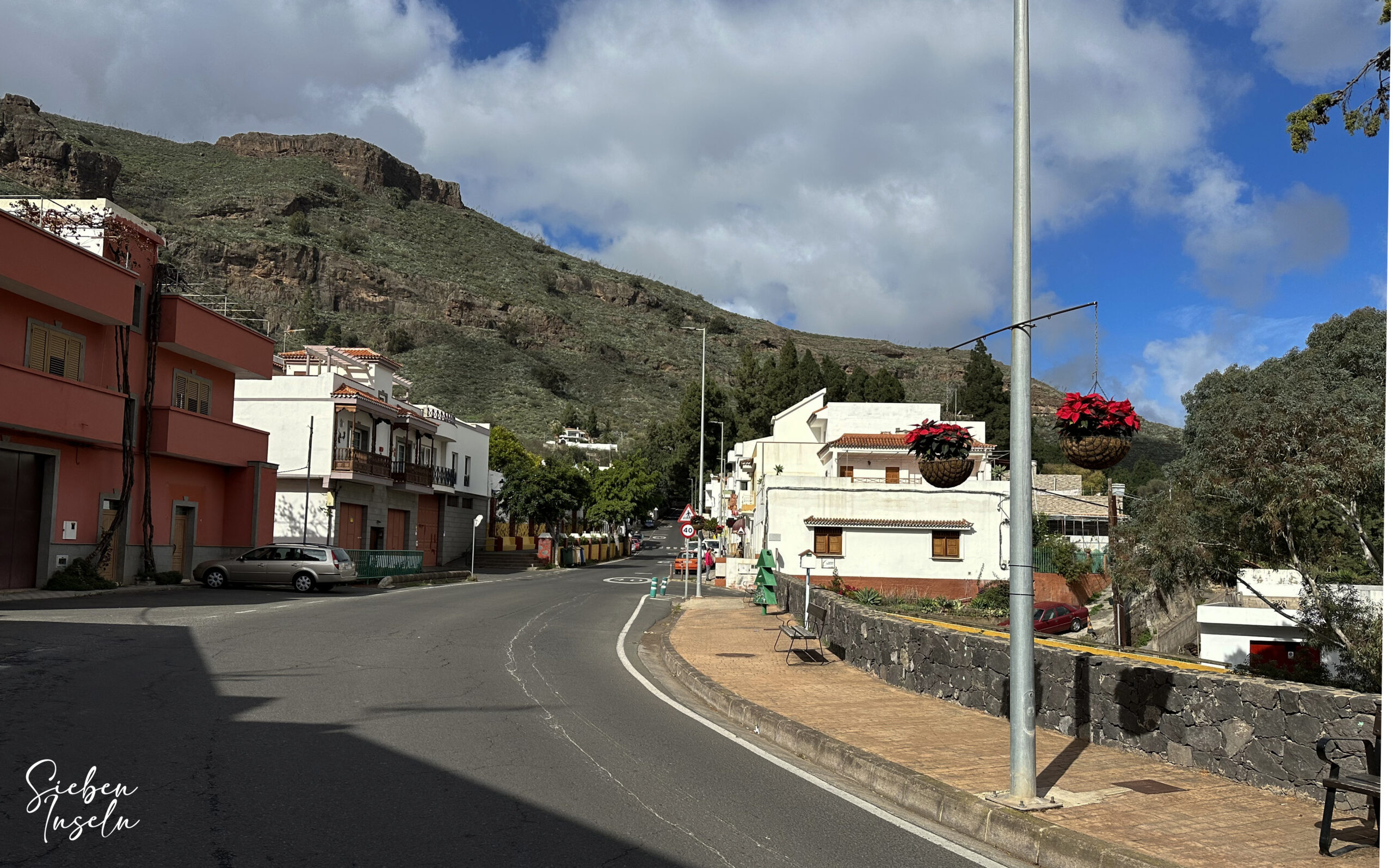
You begin your hike at the GC-41 in the town center of the small village of Tenteniguada, at Calle El Molino – Calle La Parada.
Access with car
To reach Tenteniguada, drive from either Vega de San Mateo or Telde on the GC-41. There is ample roadside parking in the village.
Access with bus
Bus line 13, which runs between Telde and Vega de San Mateo, also stops in Tenteniguada. You can find details and more information on the Guaguaglobal website.
Time
I prefer not to give exact time estimates, as hiking times can be very individual. We took 4.5 hours for this loop, with a short break (due to the bad weather).
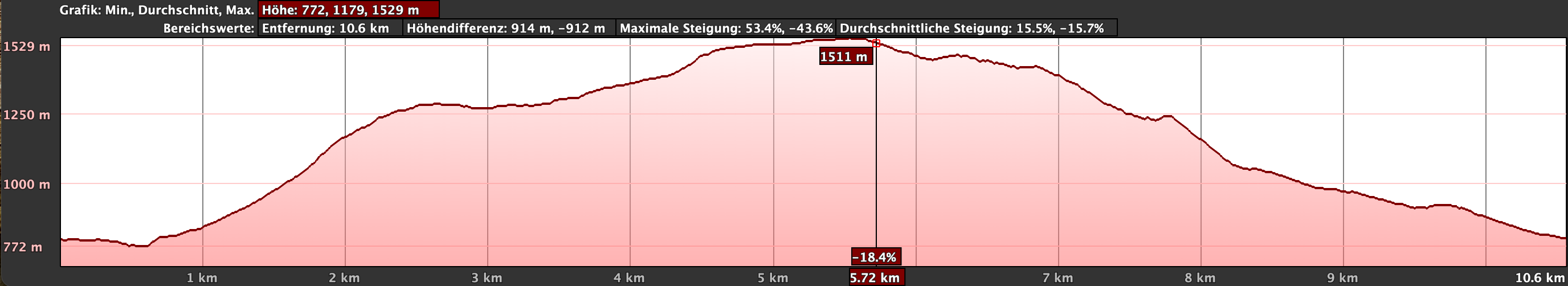
Elevation Gain and Distance
You will need to overcome approximately 810 meters in elevation, and the trail is just under 13 kilometers long.
Difficulty
You will be hiking on well-marked trails the entire time. However, during our visit, the paths were somewhat muddy and slippery due to the heavy rain. The steep climbs require good physical condition.
Refreshment
You will only find refreshment options at the starting point in Tenteniguada. Therefore, make sure to bring enough water and possibly some food.
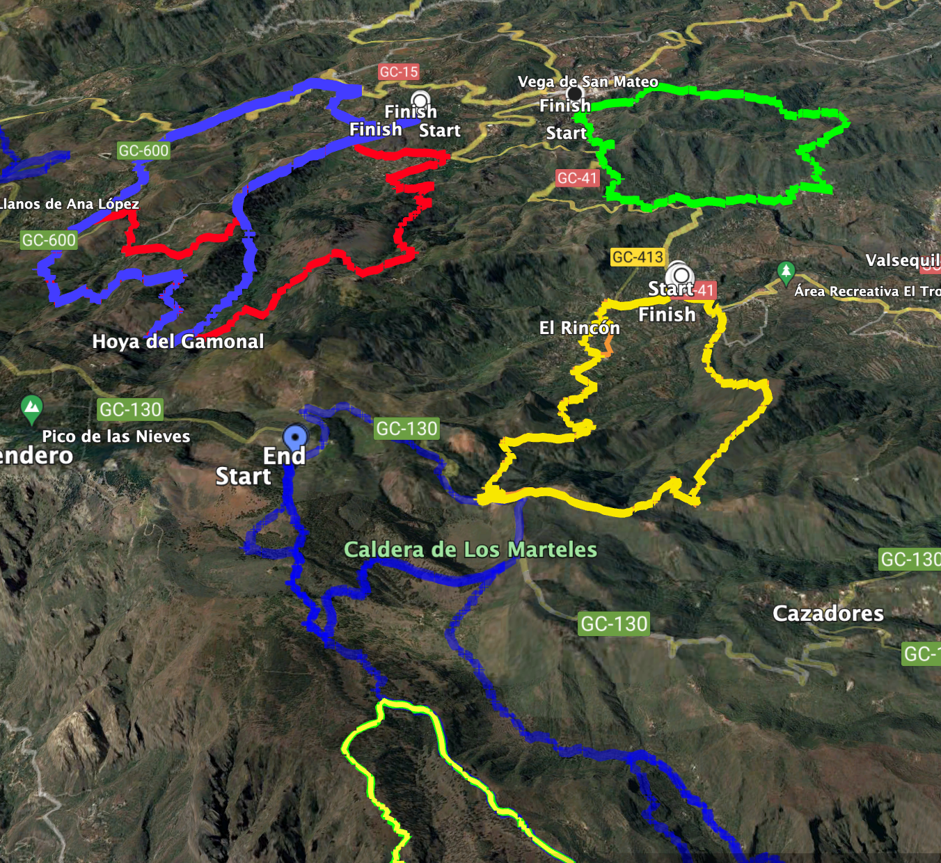
Variants
As the area around Tenteniguada is a popular hiking region, you will find many other trails where you can take shorter or longer routes if needed.
The small Becerra loop and the large Barranco de Guayadeque hike are adjacent to this hike at the Caldera de Los Marteles.
Additionally, you will find the Barranco del Agua hike nearby
Circular Walk Tenteniguada – Caldera de Los Marteles
Section: Tenteniguada to the Climb up the Ridge at 1250 Meters
You begin your hike on the main road GC-41 in Tenteniguada, at Calle El Molino, which becomes Calle La Parada further along. Walk eastwards along the road out of the village. Soon, you will reach a large right-hand curve, where a small road branches off to the right. However, continue straight along the main road. After the next left-hand hairpin bend, a narrow path leads uphill through the bushes on the right. Following this path will bring you to the cemetery of Tenteniguada. If the small detour seems too difficult, you can continue along the road and then turn right onto Calle Maestro Daniel Pérez, which will bring you back to the cemetery.
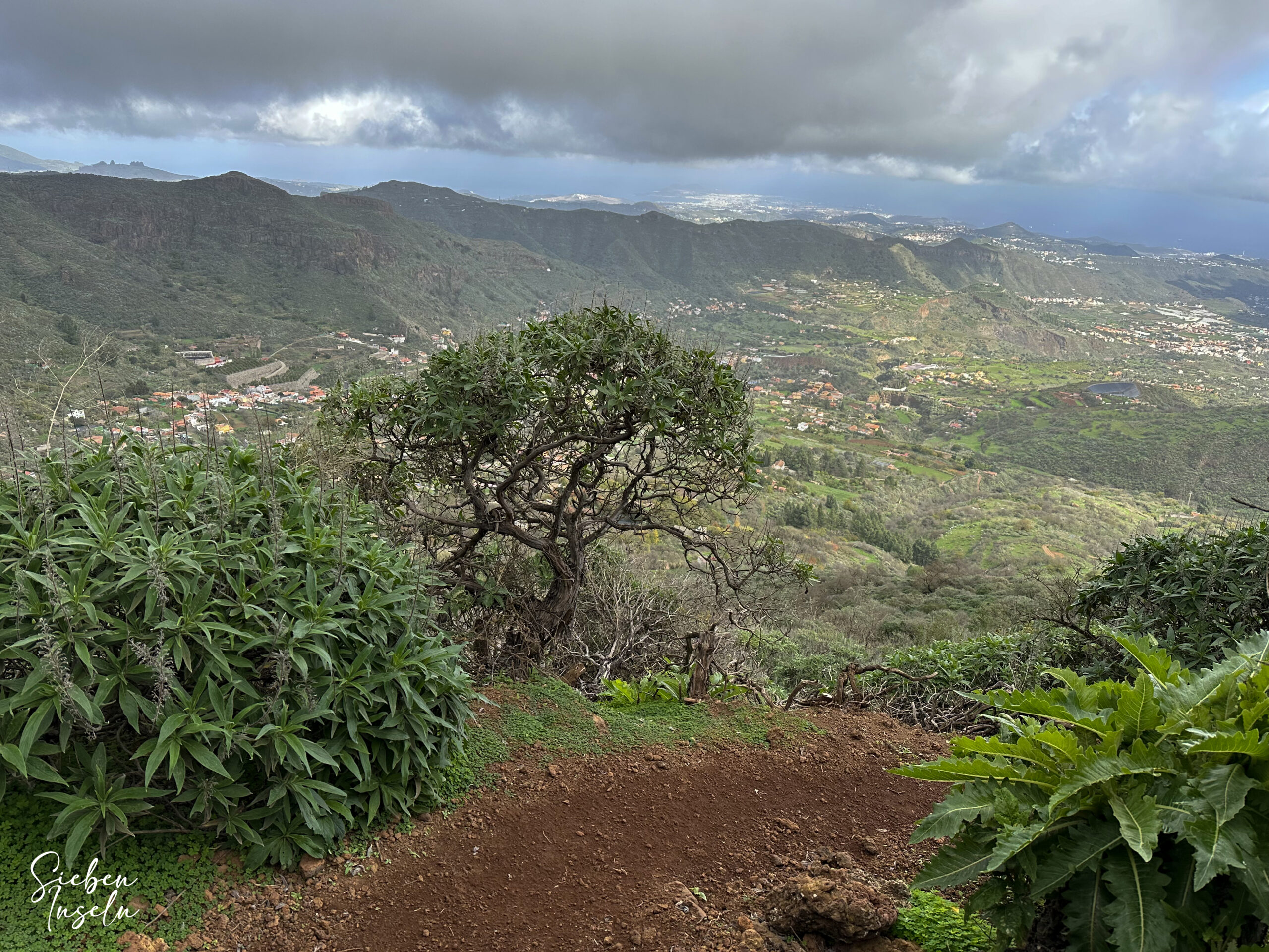
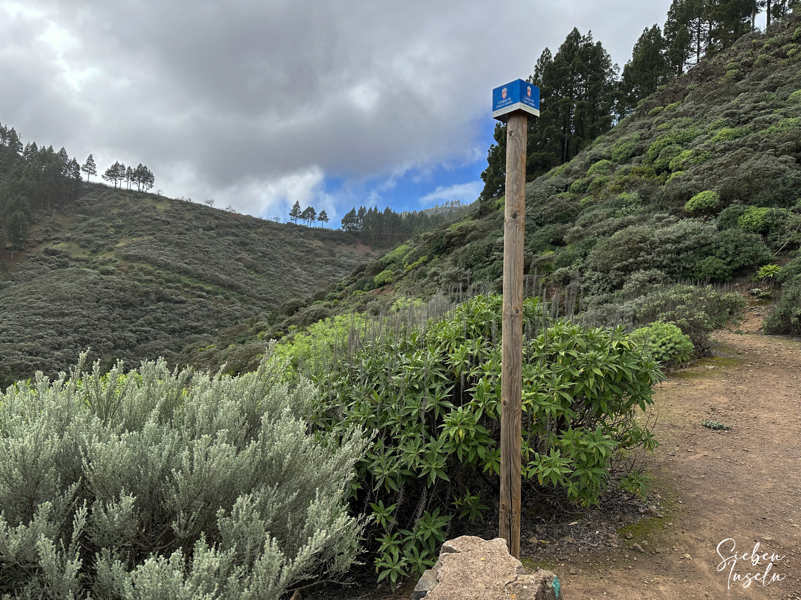
Beyond the cemetery, continue along this road, with or without the shortcut. Shortly after, a road branches off to the right, which soon turns into a signposted hiking trail (Los Alfaques). Here, your ascent begins. You quickly leave Tenteniguada behind. If you have a view (which we didn’t), the steep climb, although tough, offers beautiful nature and stunning views around you. You climb up to 1250 meters in many steep hairpin bends. At this point, the climb flattens out somewhat on a rather barren plateau. You continue to hike along a ridge close to the edge, gradually ascending.
Section: Ridge Climb at 1250 Meters to Caldera de Los Marteles
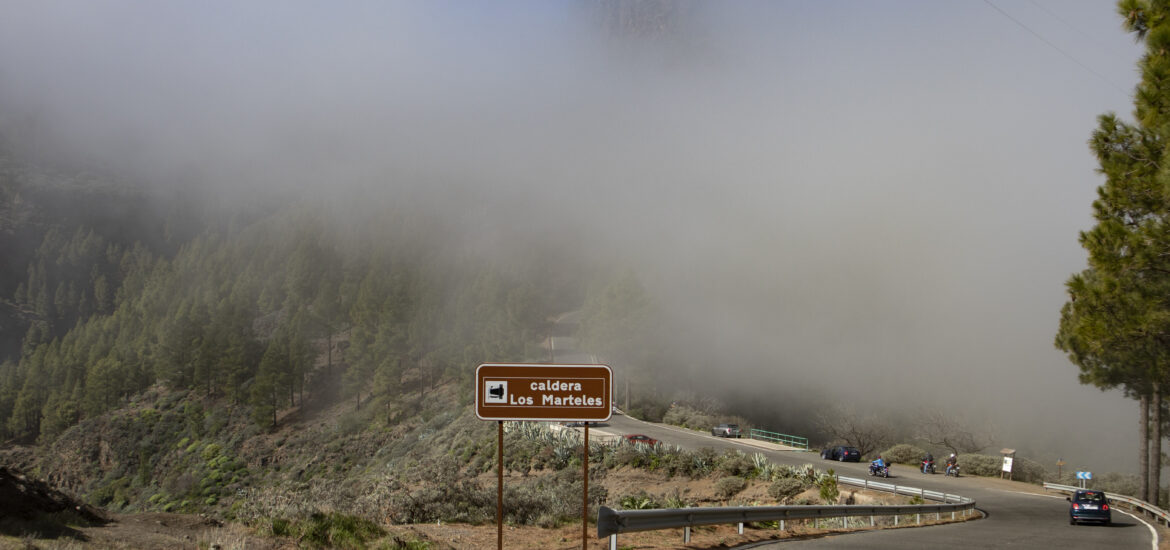
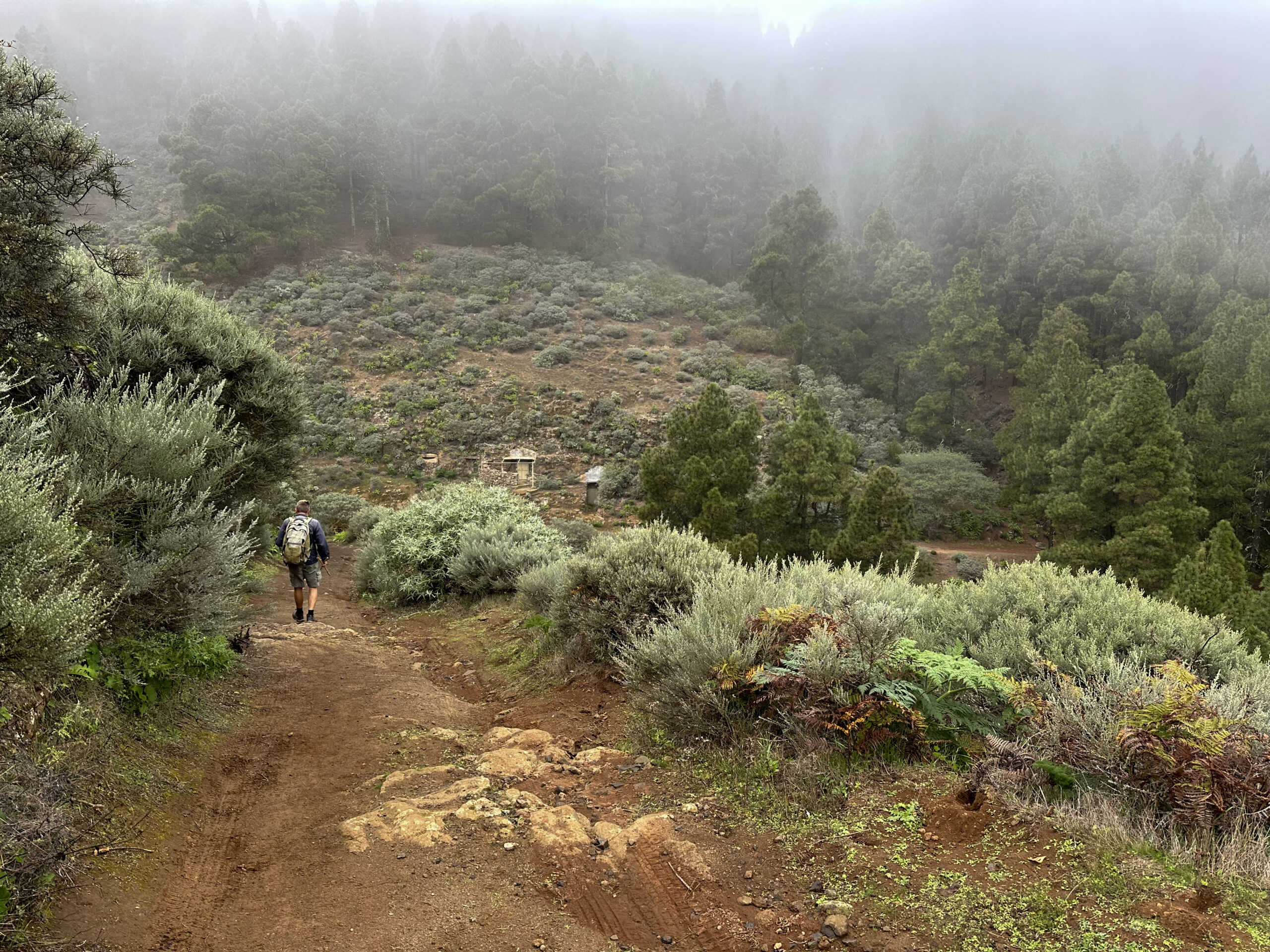
Eventually, you reach a track, which you follow to the right. After a hairpin bend, the path turns southwest. Ignore a branching track to the left. You pass a farmstead on your right side. Shortly after, the path enters the forest, and you continue uphill towards the Caldera de Los Marteles. In the forest, you encounter the SL-2 hiking trail, which you follow to the left. It takes you further up to the GC-130 road. Here, you have reached the Mirador Caldera de Los Marteles.
In good weather, it’s worth walking along the road to enjoy the beautiful view from the Mirador Caldera de Los Marteles. However, when we were there, it was very rainy, and the view was not impressive. This can also happen in good weather if clouds drift over the mirador. But whether you have a view or not, you must cross the mirador. Walk a bit along the right side. Behind the large parking lot, you will find the SL-1 hiking trail, which branches off to the right from the road.
Section: Caldera de Los Marteles to Starting Point in Tenteniguada
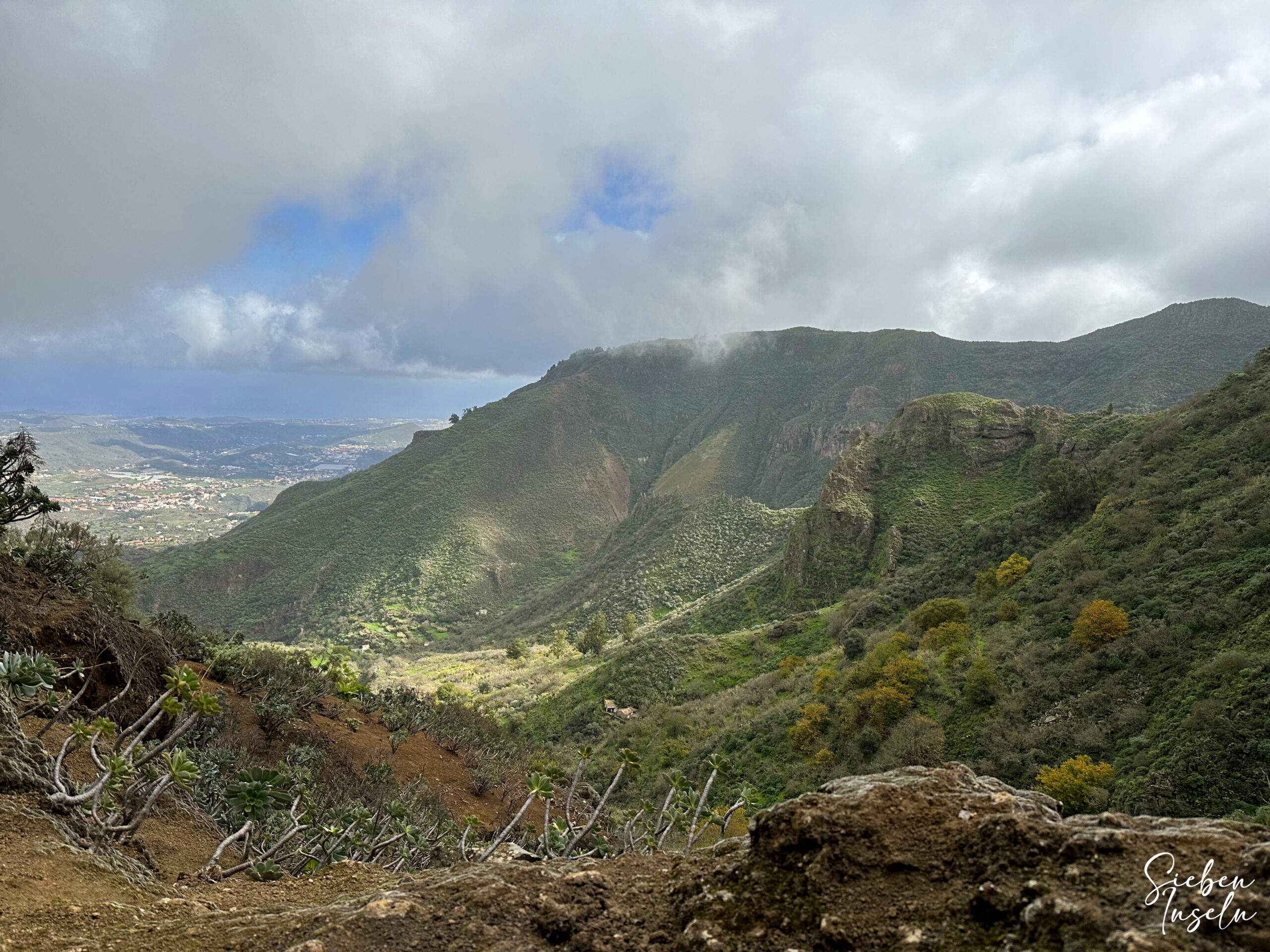
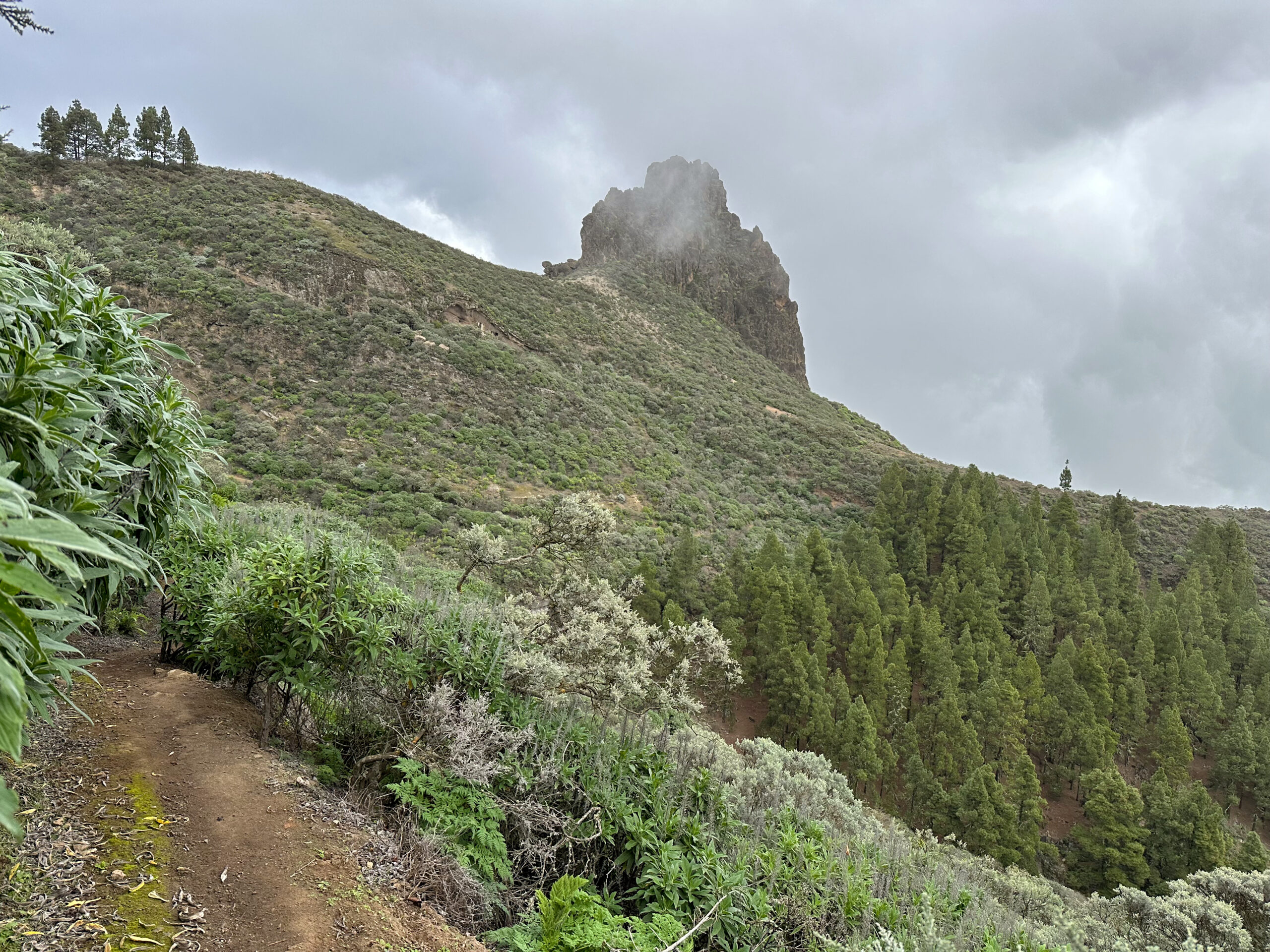
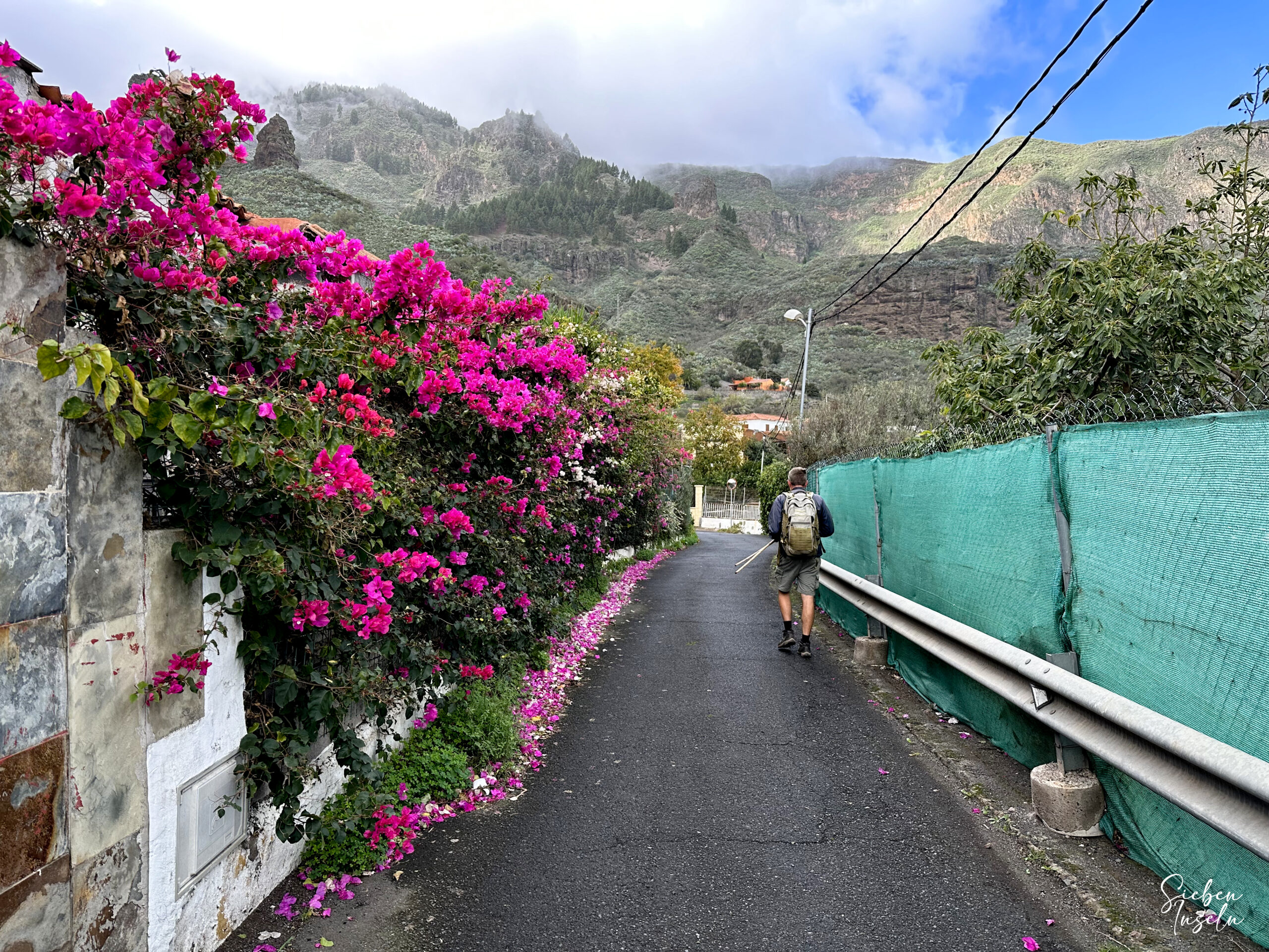
On the return journey, follow the wide SL-1 hiking trail, which brings you back down into the forest. After some time, the path crosses the Barranco de la Capellania. The SL-1 trail offers beautiful views as it leads along the mountainside. After a while, the Roque Grande (1554 m) and the distinctive Roque Chico (1459 m) appear in front of you. You will walk around the rocky massif on this beautiful trail, which now takes you steeply downhill towards Tenteniguada. At the end of the long, winding descent, you reach Calle Roque Grande, which you follow to the left.
You walk straight along the road, passing forests, meadows, and houses. At a crossroads, turn right and continue along Calle Roque Grande. Eventually, you reach a junction where you turn left onto Calle Los Parrales. From here, there are several options. The SL-1 trail continues straight onto Calle Almendrillo. Shortly after, Calle Las Portadas branches off, which will bring you back to the center of Tenteniguada following the SL-1 signs. From there, you will quickly return to your starting point.
And finally
I hope you enjoyed this beautiful hike from Tenteniguada to the Caldera de Los Marteles. Most importantly, I wish you better hiking weather if you decide to undertake this hike. I apologize for only presenting gray photos in this article, but I hope to replace them soon. Enjoy all your hikes!
Dagmar from SiebenInseln