Roque Bentayga – History Between Rocks and Ravines
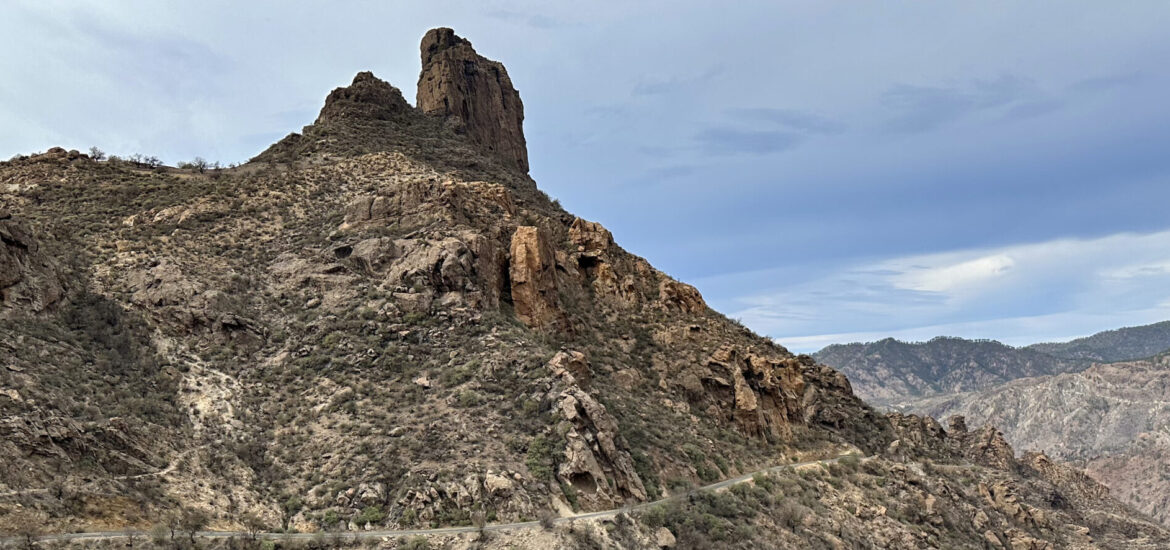
Roque Bentayga rises prominently from the centre of Gran Canaria and is one of the island’s most striking natural monuments. At approximately 1,404 metres, this basalt rock towers over the central massif, offering expansive views of the surrounding ravines, volcanic cones, and rugged landscape. The distinctive rock tower is visible from afar and is considered a landmark of the central highlands, much like its well-known “neighbour,” Roque Nublo. Moreover, Roque Bentayga is part of the UNESCO World Heritage site “Paisaje Cultural Risco Caído y Espacios Sagrados de Montaña,” highlighting the special connection between nature and culture on Gran Canaria.
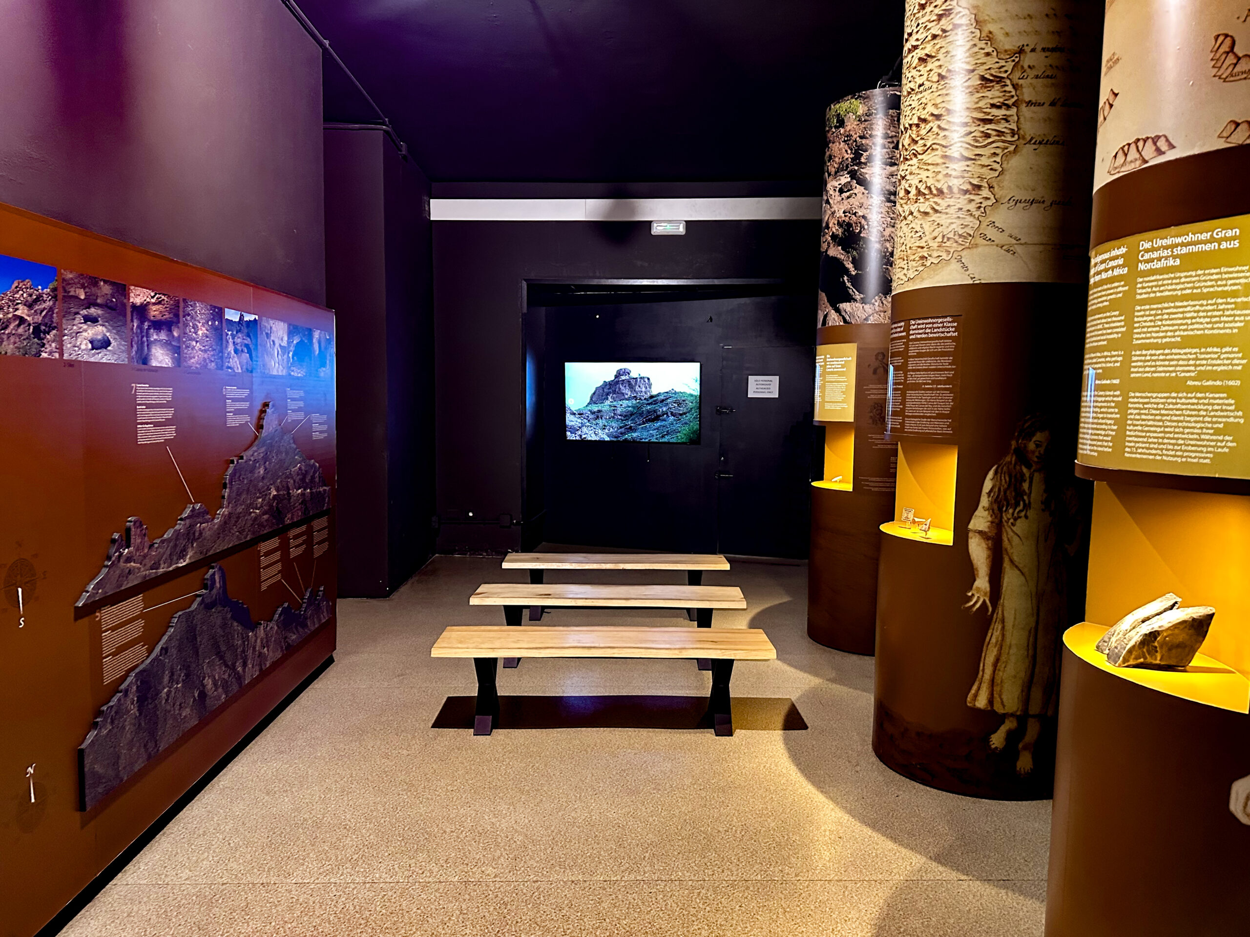
In addition to its scenic beauty, Roque Bentayga holds considerable historical and cultural significance. The indigenous people of Gran Canaria used the rock as a place of worship and refuge – traces of this use remain visible in the archaeological park today. A convenient starting point for a visit is the Centro de Interpretación del Roque Bentayga, open daily from 10 a.m. to 5 p.m., with free admission. Here, modern exhibitions, models, and 3D representations provide extensive information on the geology, settlement, and ritual significance of the site. From the centre, a signposted path leads to the ancient almogarén, the ritual site on the eastern side of Roque Bentayga.
The Guanches and Roque Bentayga
For the Guanches, the indigenous people of Gran Canaria, Roque Bentayga was not only a sacred place but also a last refuge during the Spanish conquest in the 15th century. They lived in the caves surrounding the rock and stored their provisions there, while the summit served as a defensive position. It is recorded that one of the last major battles against the Castilian forces took place here. Many Guanches fortified themselves at Roque Bentayga to defend their independence, but they were ultimately unable to withstand the Spaniards’ superior numbers. The rock thus became a symbol of both resistance and the tragic end of the ancient Canarian culture.
Here, I describe a hike from Tejeda through the Barranco Tejeda to this truly remarkable site. Unfortunately, we encountered calima during the hike, so the photos appear slightly grey and hazy. If the hike through Barranco Tejeda seems too strenuous, you can also drive to the Interpretation Centre and perhaps just climb Roque Bentayga itself. Additional options are listed under the section “Variants.”
General Information on the Roque Bentayga Hike
Starting Point and Access
The hike begins in the village of Tejeda, at Calle de Don Tomás Arroyo Cardoso near the Tejeda cemetery.
Access by car
From Artenara, take the GC-210 and then the GC-60 to Tejeda. From the south, you can also reach the village via the GC-60. Head towards the village centre. Just south of it, at Calle de Don Tomás Arroyo Cardoso, there is a large car park. You may also park elsewhere in the village. Since the start and end of the hike form a small loop, you can begin the tour at any point above the Barranco de Tejeda.
Access by bus
Bus line 18 stops in Tejeda. The stop is very close to the cemetery, the starting point of the tour. For further information, see the GuaguasGlobal website.
Time
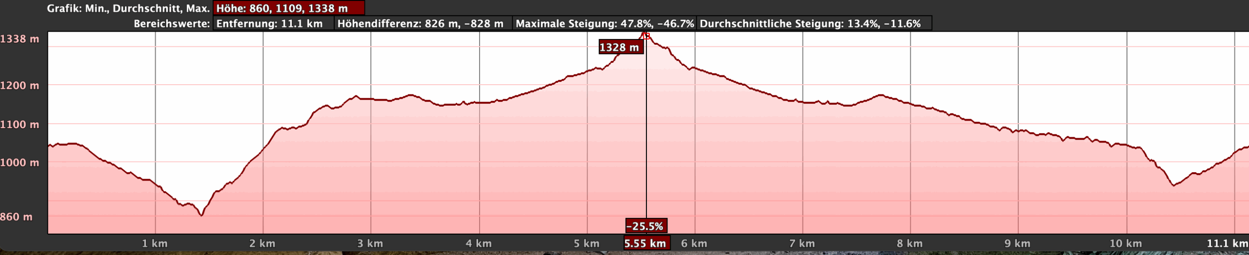
I prefer not to give general time estimates for hikes, as these are highly individual. For this leisurely circuit, including breaks and a thorough visit to Roque Bentayga and the Interpretation Centre, we took just over five hours.
Elevation Difference and Distance
The elevation gain is approximately 650 metres, and the route is 13 kilometres long.
Difficulty
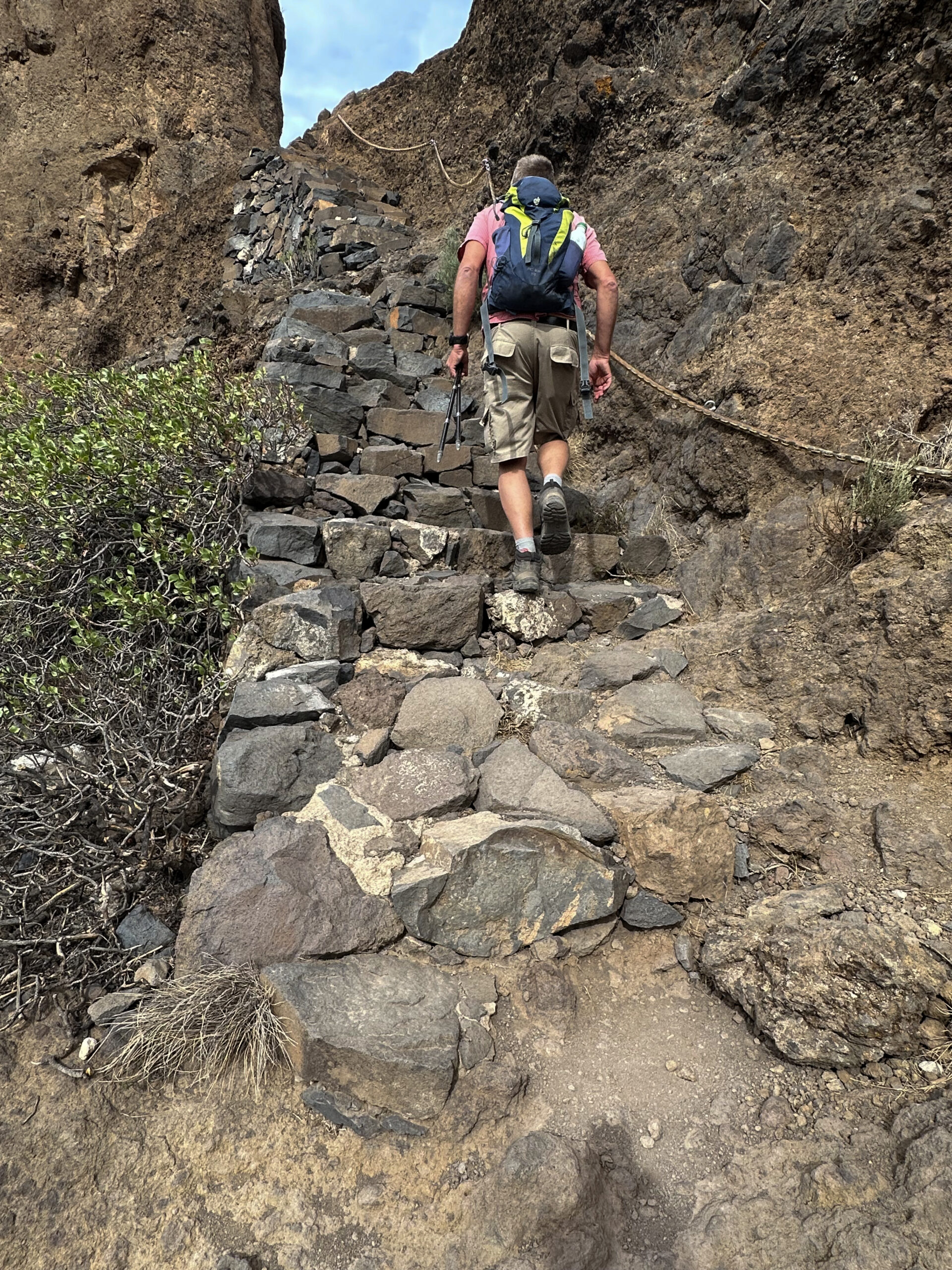
From Tejeda, you cross the Barranco de Tejeda along the GR-138 long-distance trail, which is generally well maintained but slightly eroded and steep in some sections (as of November 2024). On the opposite side of the ravine, you walk mostly on good paths and small roads. The return path along the GR-138 is also in good condition (as of November 2024).
Refreshments
According to my knowledge, refreshment options are only available at the starting point in Tejeda. Be sure to carry sufficient water and food.
Variants
The hike can be considerably shortened if you skip the Barranco crossing, which I personally found very interesting, and start the hike on the far side of Barranco Tejeda towards Roque Bentayga. Of course, you can also drive there directly, although you may not then be the type looking for hiking tours :-).
Additionally, the hike can be shortened by returning via the same path through Barranco Tejeda.
On SiebenInseln, you can find the following nearby hikes:
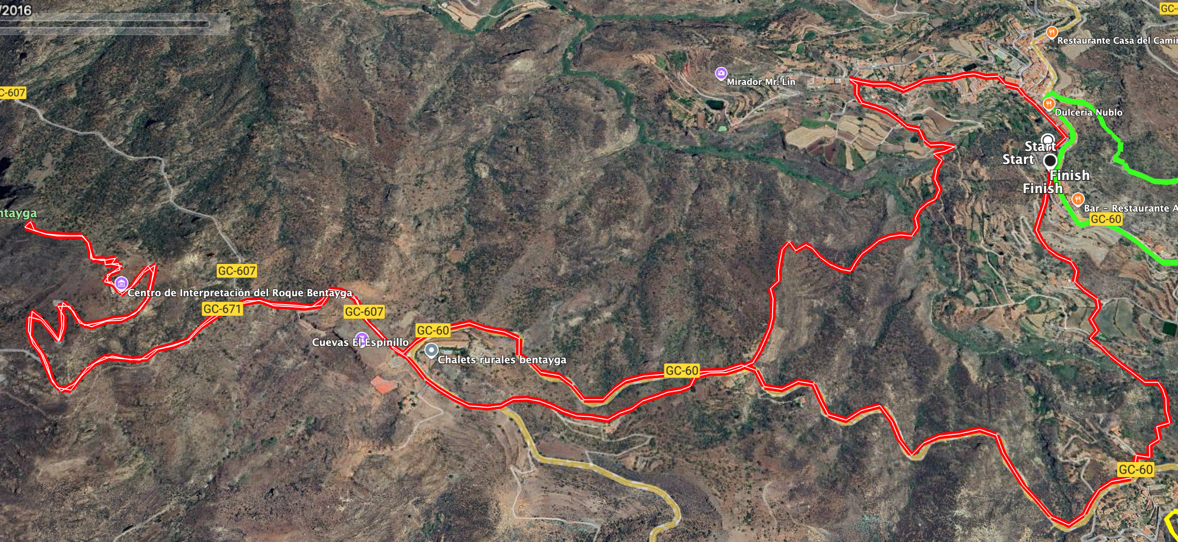
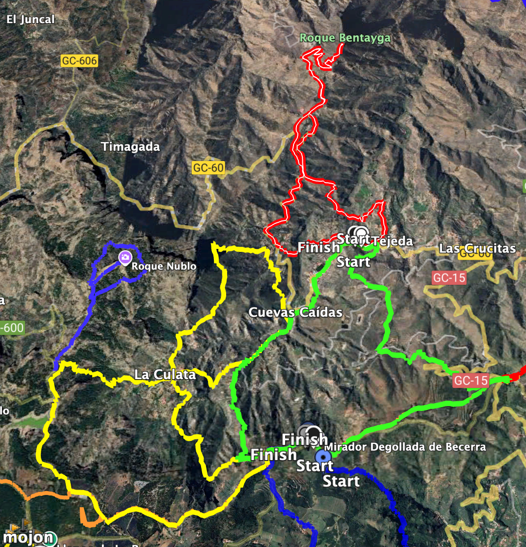
Hike to Roque Bentayga
Section: Tejeda to GC-60
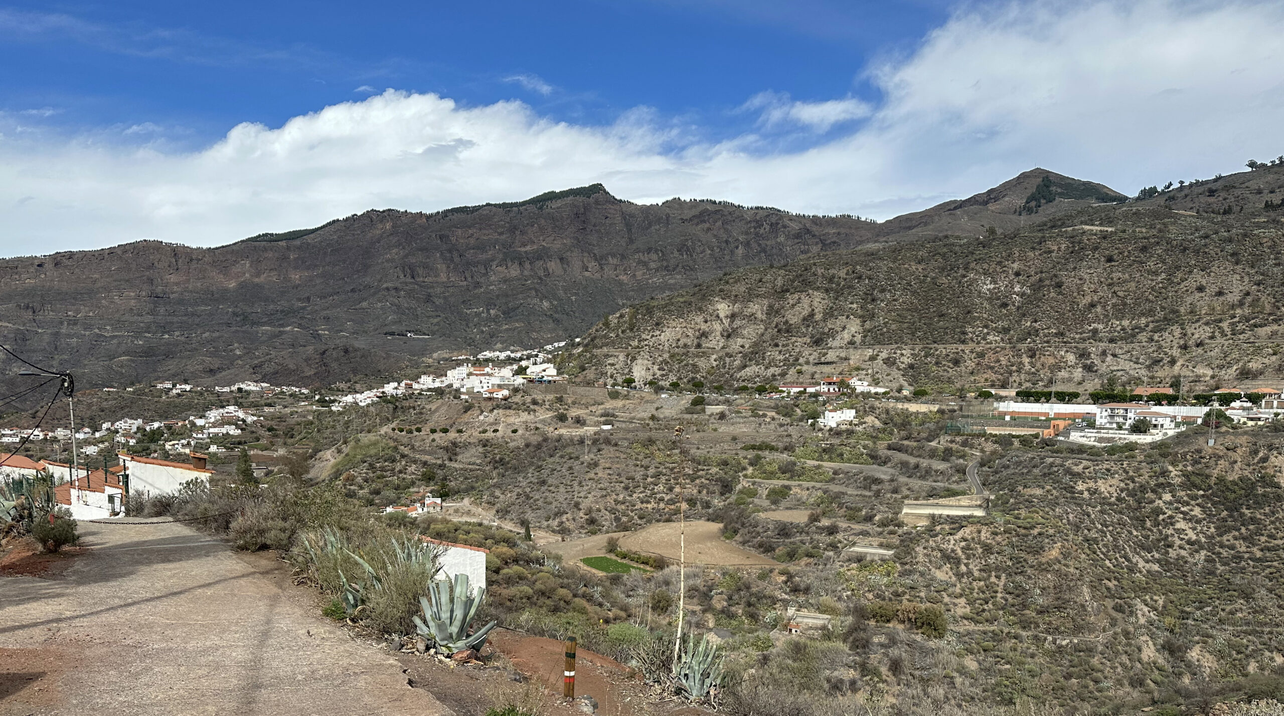
Begin your hike in Tejeda near the cemetery at Calle de Don Tomás Arroyo Cardoso (also signposted as GR-138). Follow the path towards the village centre (northwest). It soon becomes Calle Dr. Domingo Hernandez Guerra, which you continue along towards the centre. You reach the plaza Nuestra Señora del Socorro, walk past the church, then turn right across the forecourt. This brings you to Calle Dr. Heraclio Sanchez, which you follow left and continue slightly downhill for a long stretch. At the Museo Típico Canario Tres Cruces (on your right), turn left onto Camino los Llanos.
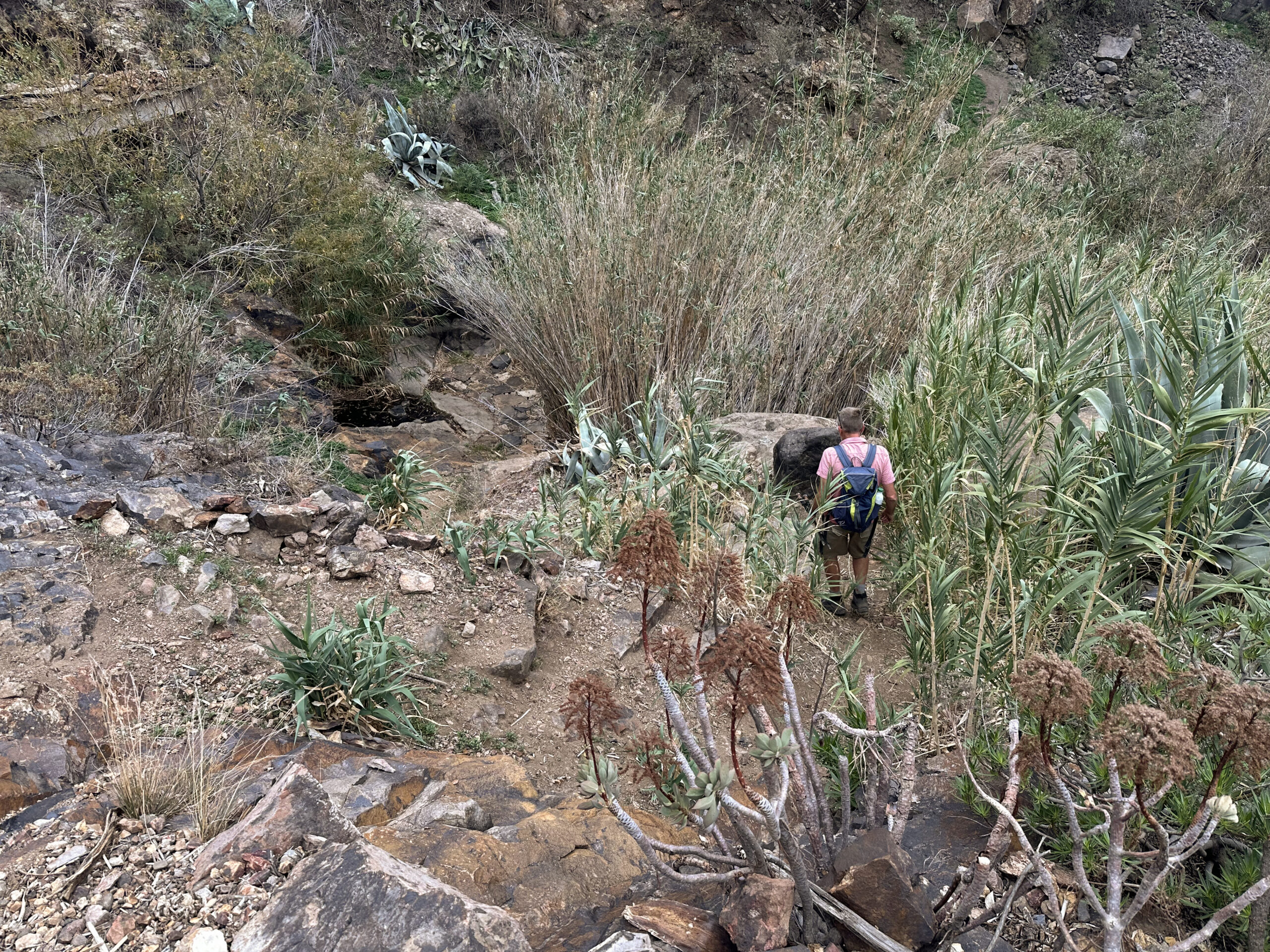
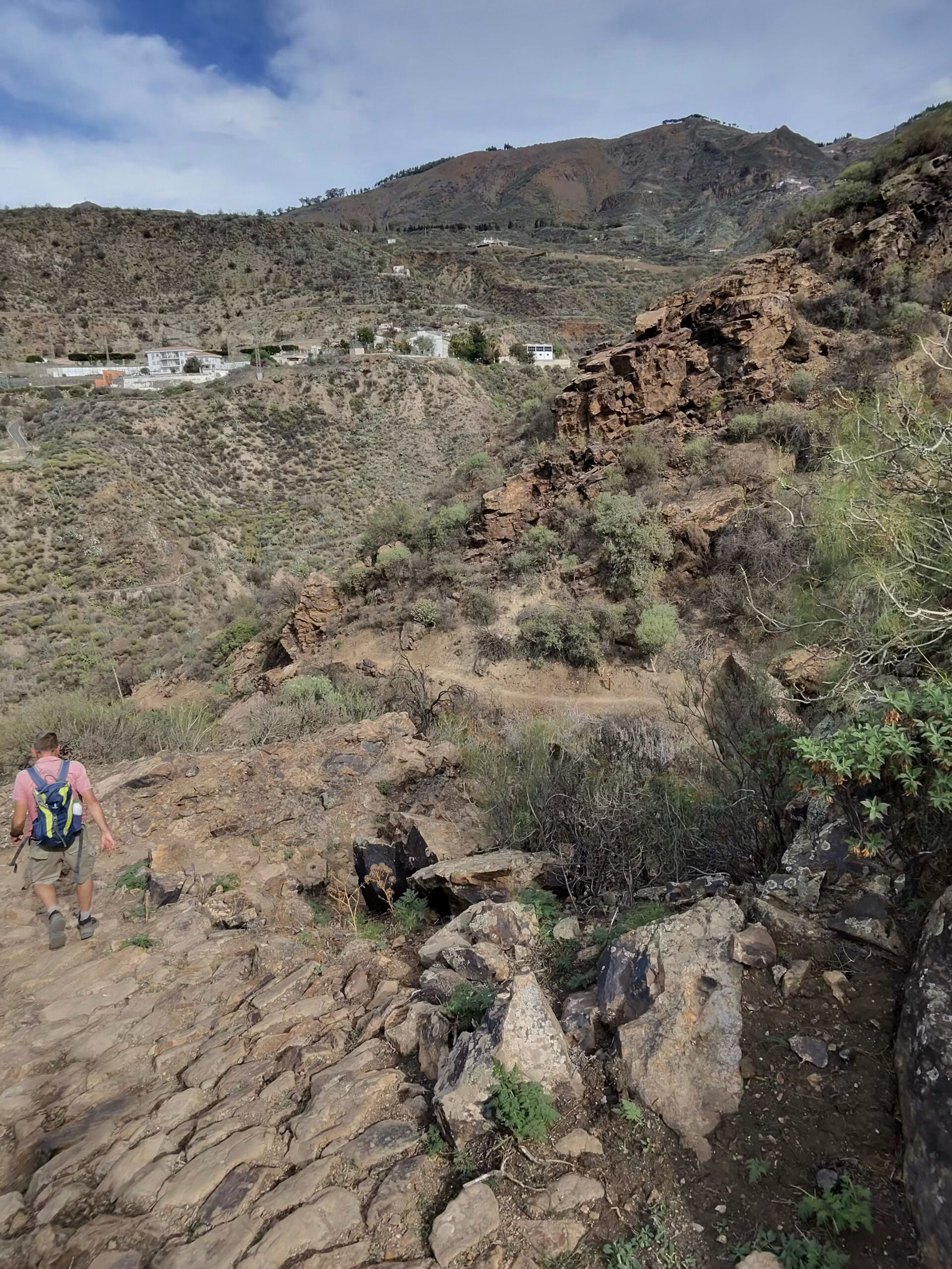
The road curves left, and shortly after the curve, a broad path branches right towards Barranco Tejeda. Follow this path downhill for a long distance. Initially, you pass fields, meadows, and scattered farmhouses. The path then passes through scrubland and later partly through reeds. In some places, the path narrows as you approach the bottom of the ravine, but it is always clearly marked as GR-138. After reaching the bottom of Barranco Tejeda, the narrow path climbs steeply on the opposite side. Here, you can enjoy beautiful views back towards Tejeda. The steep ascent eventually leads to a wider path, passing a few houses until you reach the GC-60.
Section: GC-60 to Centro de Interpretación del Roque Bentayga
Turn right along the GC-60. Shortly after, the GR-138 trail branches left – the same trail you have been following. You then hike uphill through scrubland and woodland, enjoying views of the surrounding landscape. The path eventually joins the GC-60 again, which you follow to the right. The GR-138 then turns left. After a short distance, the GC-607 branches straight left from the GC-60. You follow this small road. Traffic is light, so walking along the road is not an issue. At the next fork, take the left branch and continue on GC-671.
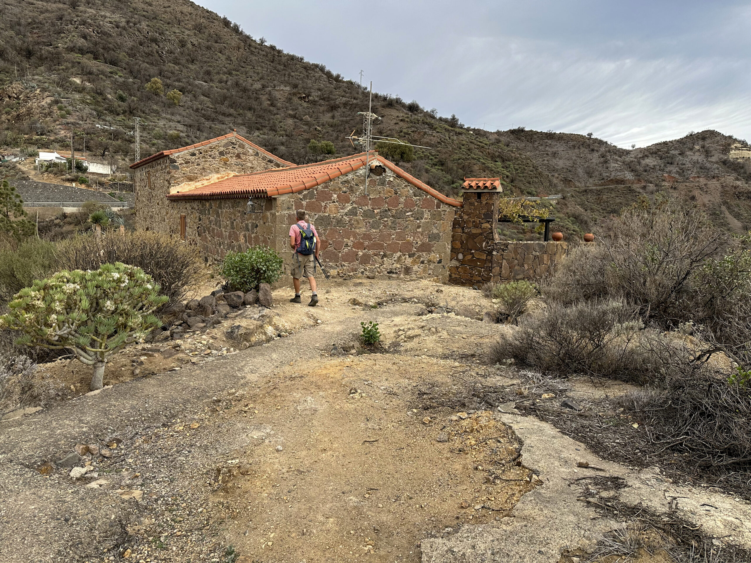
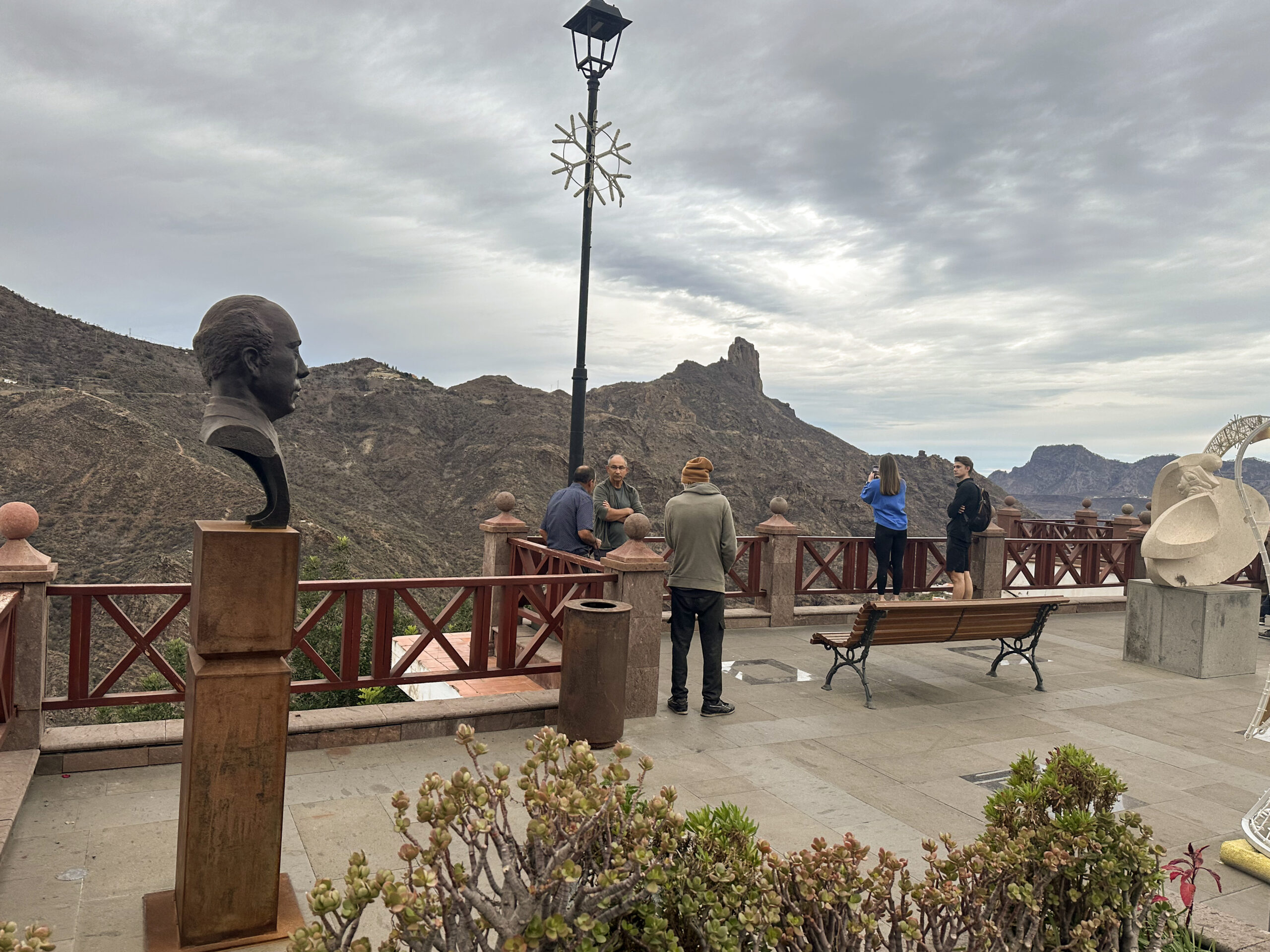
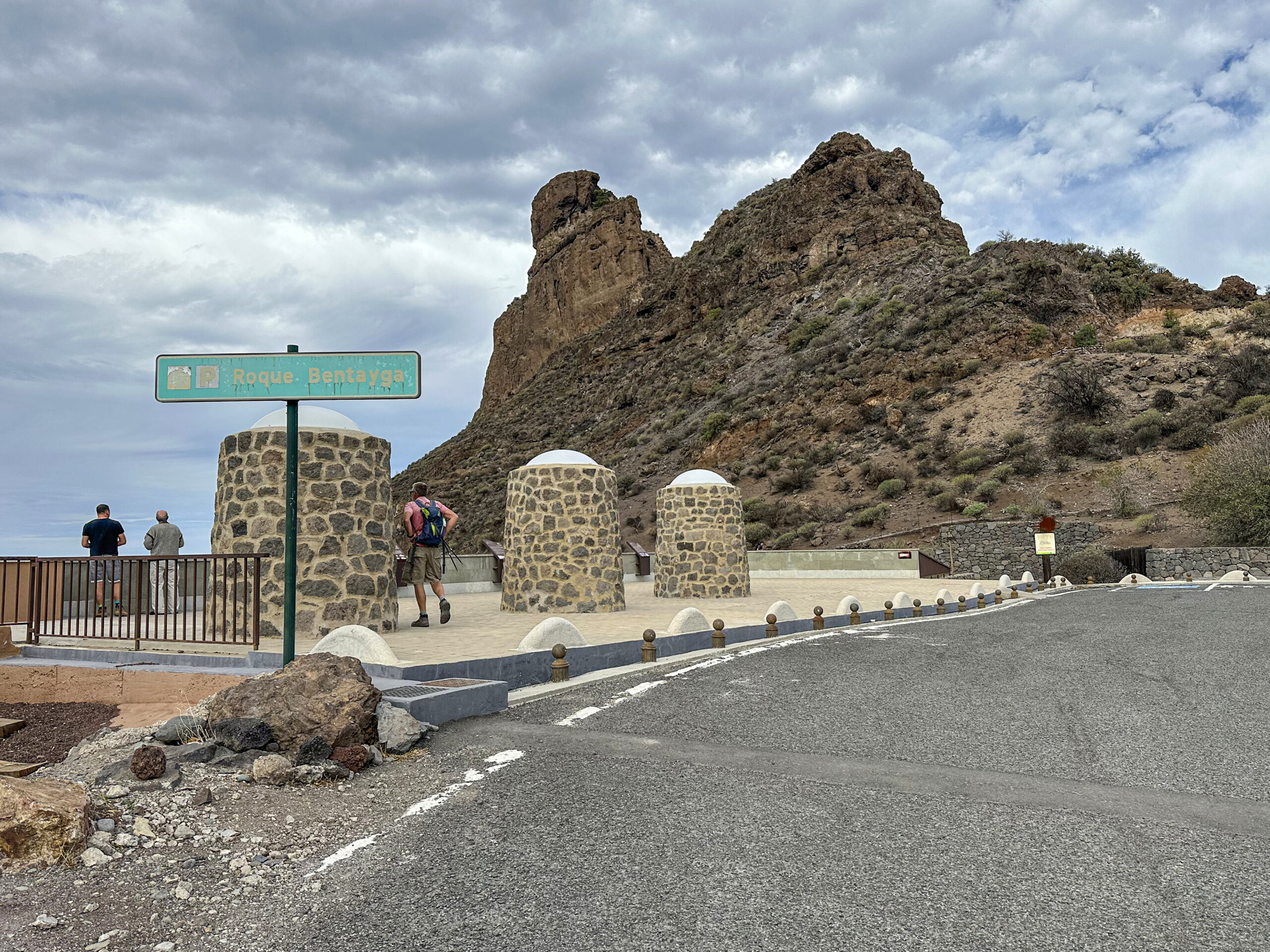
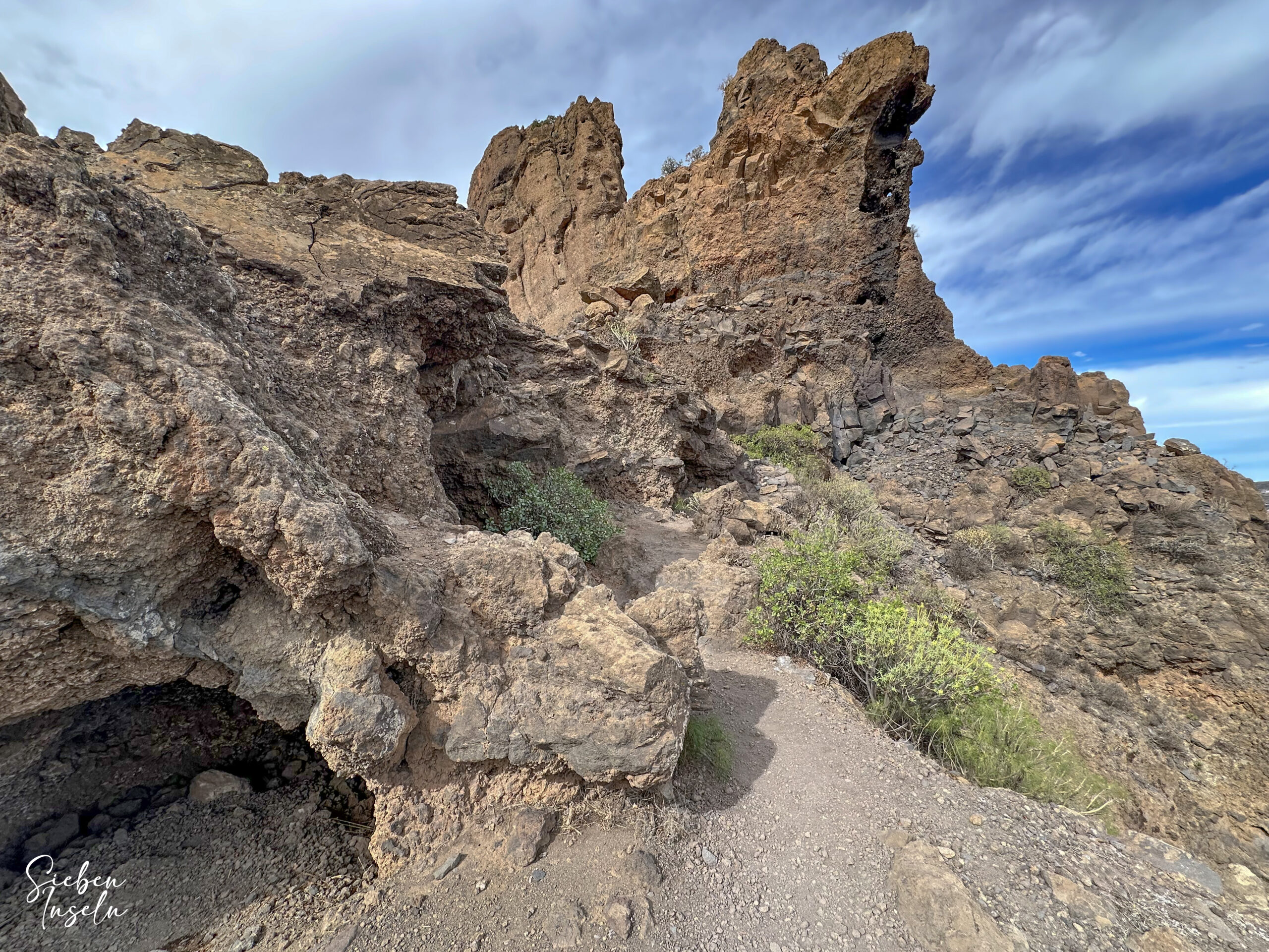
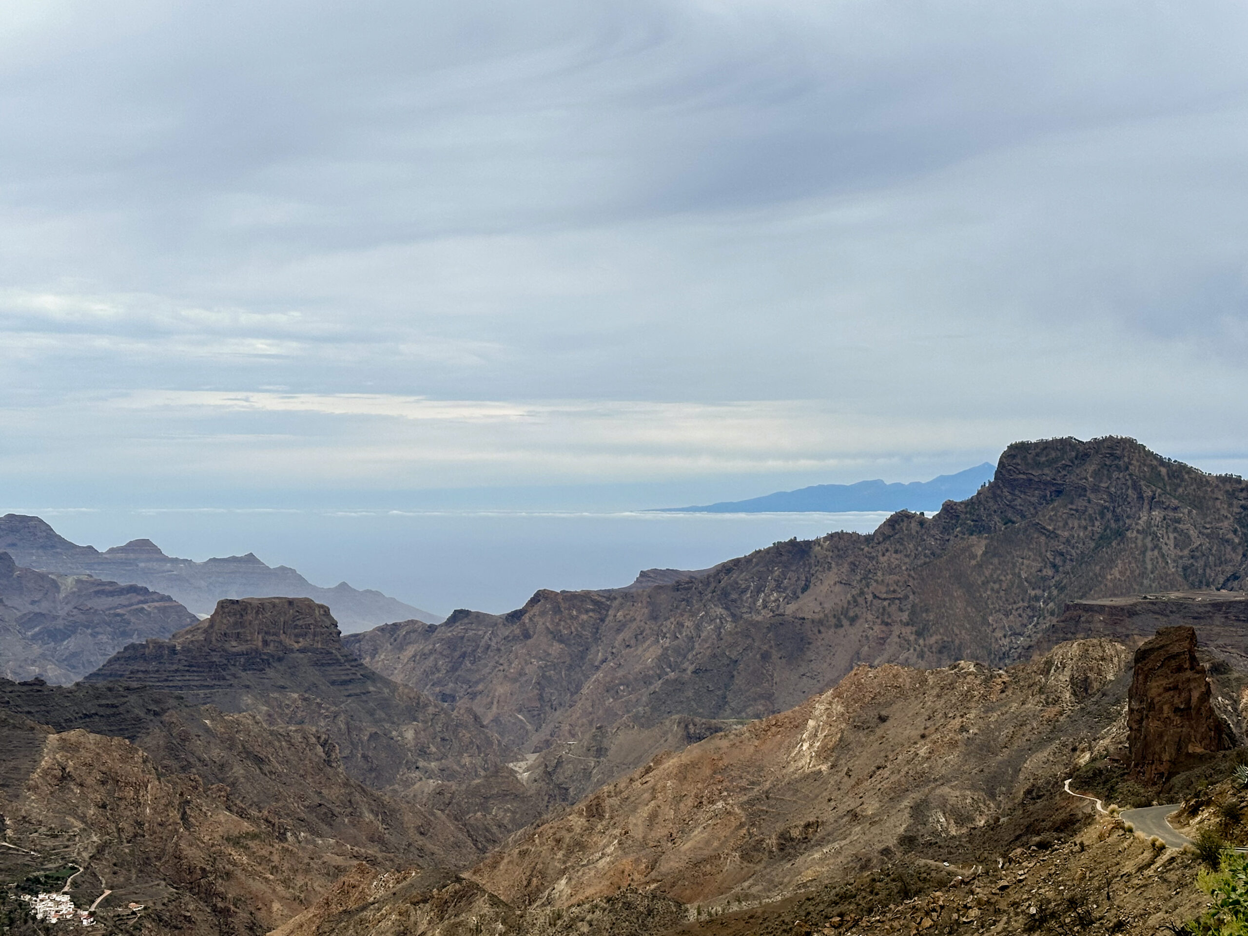
You are now quite close to Roque Bentayga and can enjoy excellent views of the striking rock. You walk along the road beside a rock massif. At the next junction, leave GC-671 and climb in long switchbacks to the Centro de Interpretación del Roque Bentayga. Along the way, you pass a viewpoint offering spectacular panoramic views of the area surrounding Roque Bentayga. Then you reach the Interpretation Centre, which you can visit for free and learn extensively about Roque Bentayga and the Guanches.
Section: Centro de Interpretación del Roque Bentayga to GC-60
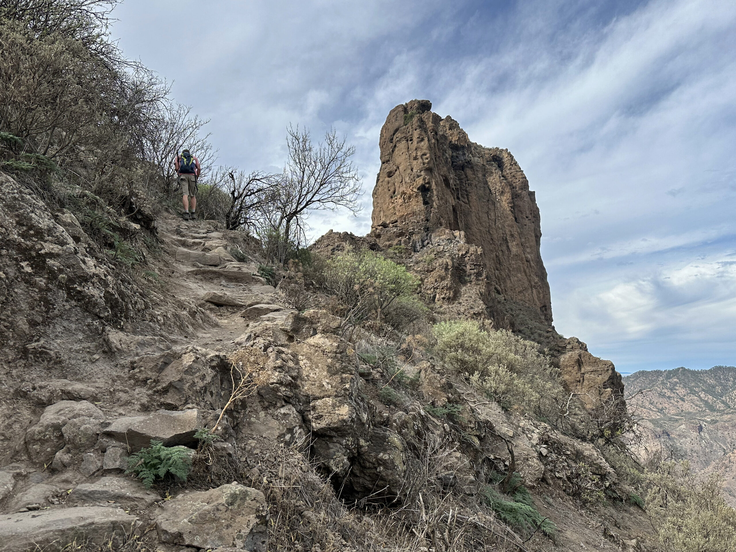
The centre is very well laid out and offers detailed information on the history of the prominent Roque Bentayga and the Guanches who once lived there. From the centre, a designated path leads up the rock, offering wonderful views in all directions. You cannot leave the path or explore additional caves, but the steep climb is well worth the effort.
Once you have explored the area, you return the same way to the centre and then back along GC-671. At the next junction, turn right and follow GC-607. At the point where this meets GC-60, you have two options: follow the same trail as on the outward journey down to GC-60, or continue along GC-60 for a while, walking along the road.
Section: GC-60 to Starting Point in Tejeda
Where you ascended from Barranco Tejeda, you can choose to return via the same path through the ravine or continue along GC-60 to complete a small circular tour back to Tejeda. We chose to walk along the road on the return to explore another section of Barranco Tejeda. You will need to walk along GC-60 for some time until you reach the small settlement Barrio Casas de Lomo.
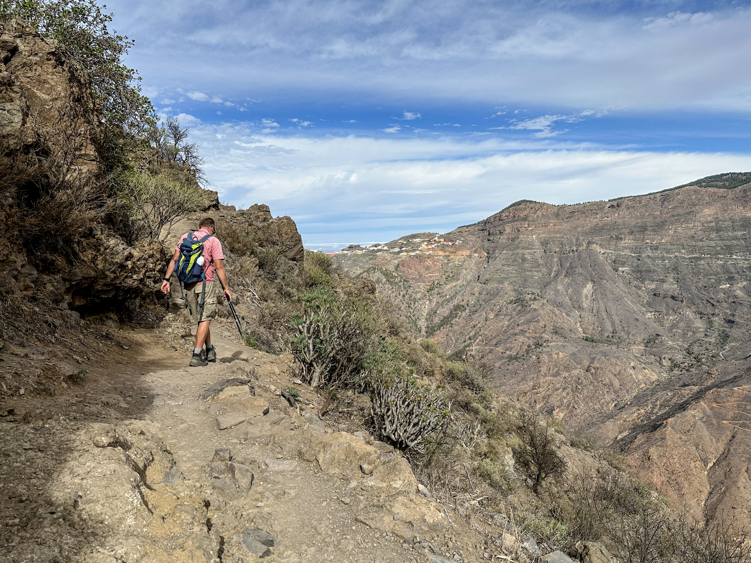
Here, turn left onto a street and shortly after turn right onto the GR-138 trail. The trail offers beautiful views of Barranco Tejeda and the surrounding area as it descends to the ravine floor. You do not need to descend as far as on the outward journey, as you are now higher up and cross the ravine. Afterwards you first cross two small gullies, then descend the floor of Barranco Tejeda on well-constructed steps.
You then climb the opposite side and after some time reach a small road, which you follow to the right. At the next opportunity, turn left and then right again. The GR-138 is well signposted. The road transitions into a path that shortly afterwards leads to another road. Follow this uphill to return to Calle de Don Tomás Cardoso. Turn left, and you are shortly back at the starting point of your hike.
And finally
I hope you enjoyed this hike through Barranco Tejeda and up the striking Roque Bentayga on Gran Canaria. Whatever variant you choose, Roque Bentayga is certainly worth a visit. I wish you every enjoyment on all your hikes.
Dagmar from SiebenInseln