Puerto de Mogán and Mogán – a Popular Excursion Destination
More well-known than the village of Mogán is the holiday resort of Puerto de Mogán. The famous harbour and frequently visited tourist spot emerged in the 1980s right on the coast. However, the village of Mogán, which lies a bit further inland, has existed for much longer. Today, this village, together with Puerto de Mogán, forms the municipality of Mogán. The village stretches along the GC-200, which connects the coast with the island’s interior and the western part of the island. On both sides of the Mogán Valley, mountain ranges rise, extending up to the island’s interior.
Therefore, there are many hikes around and above Mogán, especially around the nearby Montaña de Tauro. Hikers vacationing on the coast have short travel times to reach here. This also benefits the local gastronomy in Mogán a little. To the right above Mogán, heading east, a massive mountain range with a partially sheer drop rises, the Tauro Ridge. This hike leads you along this ridge on the long-distance trail GR-139.
Hike from Mogán over the Tauro Ridge
The hike over the Tauro Ridge starts at the GC-200 near Mogán. Unfortunately, it is unavoidable to walk along the road for a while, as this is the only way to enjoy the entire ridge with its magnificent views while completing a beautiful circuit. We started near our holiday apartment. However, you can start at any point around Mogán on the GC-200. Shortly after leaving Mogán, the steep ascent towards Montaña de Tauro begins.
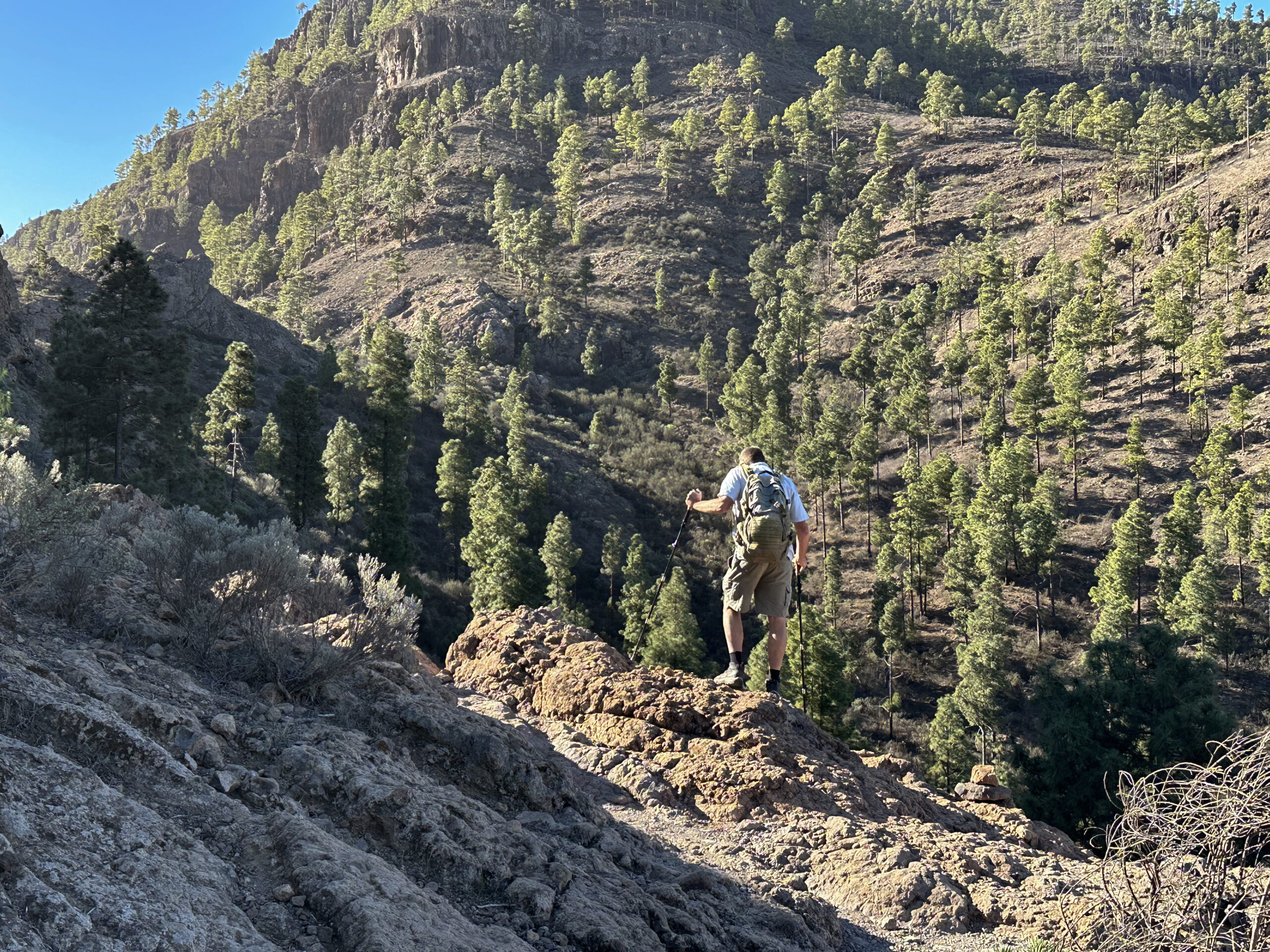
Once on the Tauro Ridge, you walk for a long time always on or parallel to the ridge on the long-distance trail GR-139. Along the way, you can enjoy caves and magnificent views of the surrounding mountain ranges all the way to Tenerife. Then follows a very steep descent on the GR-139 through the cliff face. The path is partially secured with chains. However, absolute freedom from vertigo and surefootedness are necessary. A breathtaking descent. From Molino de Viento, you finally return to the starting point.
General Information about the Mogán – Tauro Ridge Hike
Starting Point and Access
You start your hike at the GC-200 near Mogán.
Access by Car
You can drive from the coast and the GC-1 on the GC-200 to Mogán. From the island’s interior, you can come via the GC-605, and from the west from the other side also on the GC-200. There are parking spaces in the village itself and partially also at the roadside or in side streets.
Access by bus
Line 1 stops in Puerto de Mogán coming from Las Palmas via Maspalomas and then continues to Mogán. You can find more information on the Guaguaglobal homepage.
Time
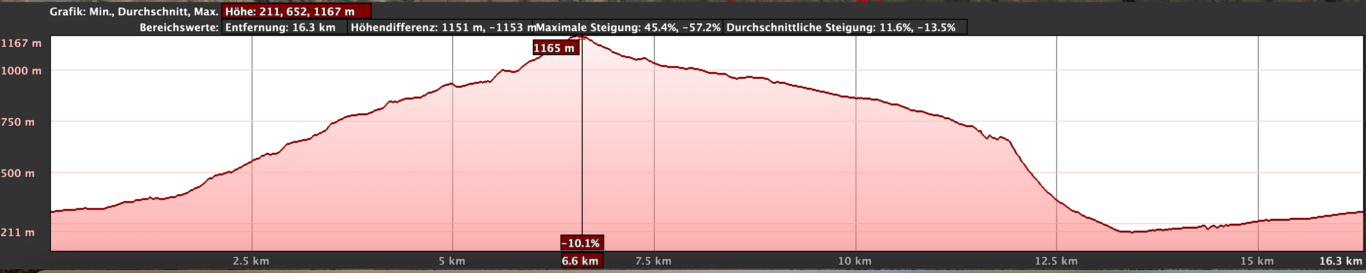
I am reluctant to give time estimates as times are very individual. For the hike from Mogán over the Tauro Ridge, we took a little over 7 hours with one large and several small breaks.
Elevation Difference and Route Length
The total elevation gain is just over 1000 meters, and the route is almost 19 kilometers long.
Requirements
The hike mostly follows good hiking trails, tracks, and the road. However, the descent on the long-distance trail GR-139 through the cliff face requires absolute surefootedness and freedom from vertigo.
Refreshments
You will only find refreshment options at the end of the hike in Molino de Viento and Mogán.
Variants
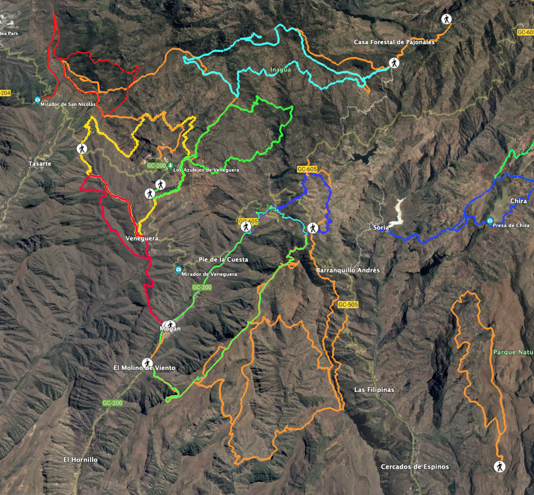
You can easily combine this hike with many hikes nearby. One hike you will come very close to on this tour is the hike to Presa de las Niñas. In the near future, I will introduce you to more hikes in this area on SiebenInseln.
Circular Walk Mogán – Tauro Ridge – Molino de Viento
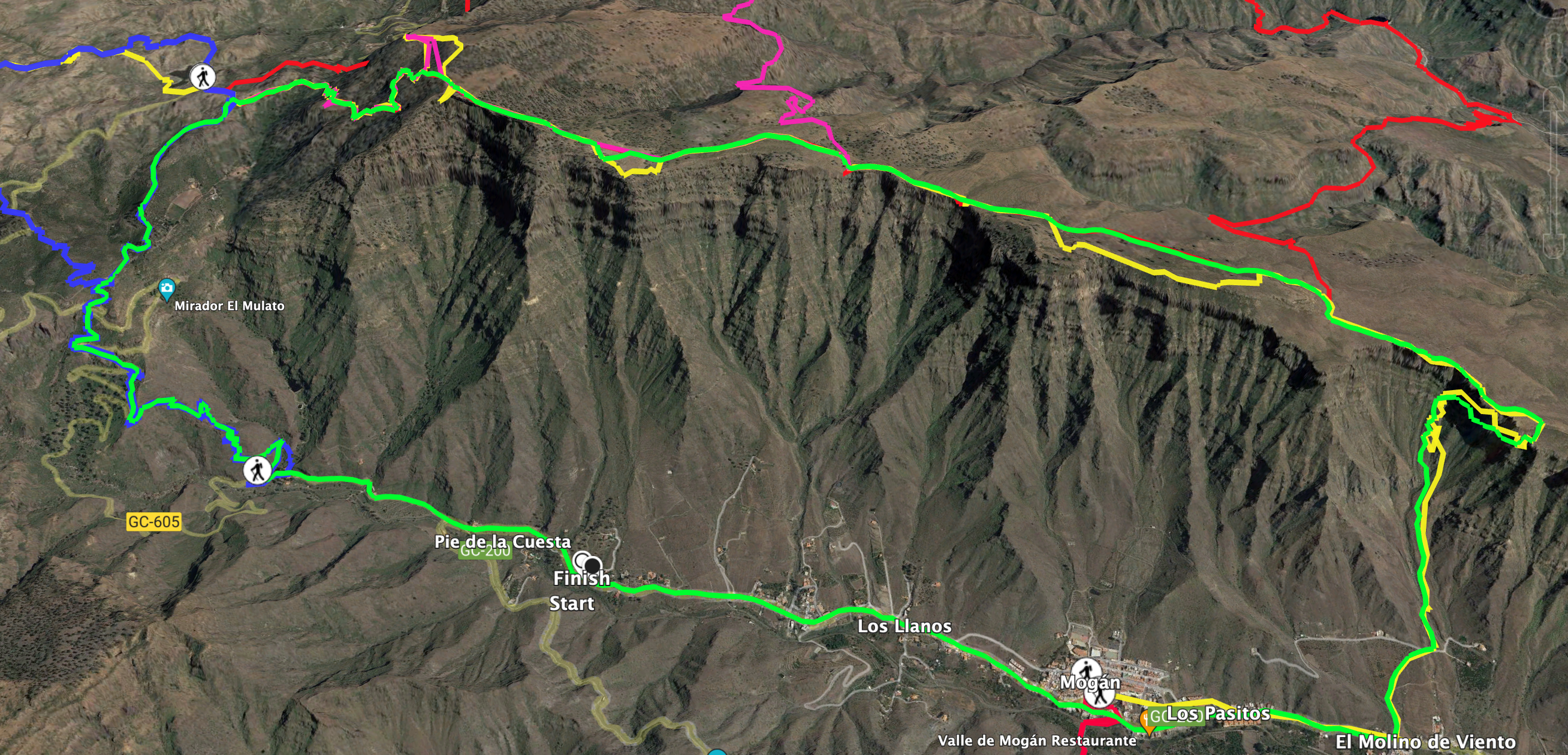
Section GC-200 near Mogán to Hiking Trail above Mirador Pie de la Cuesta
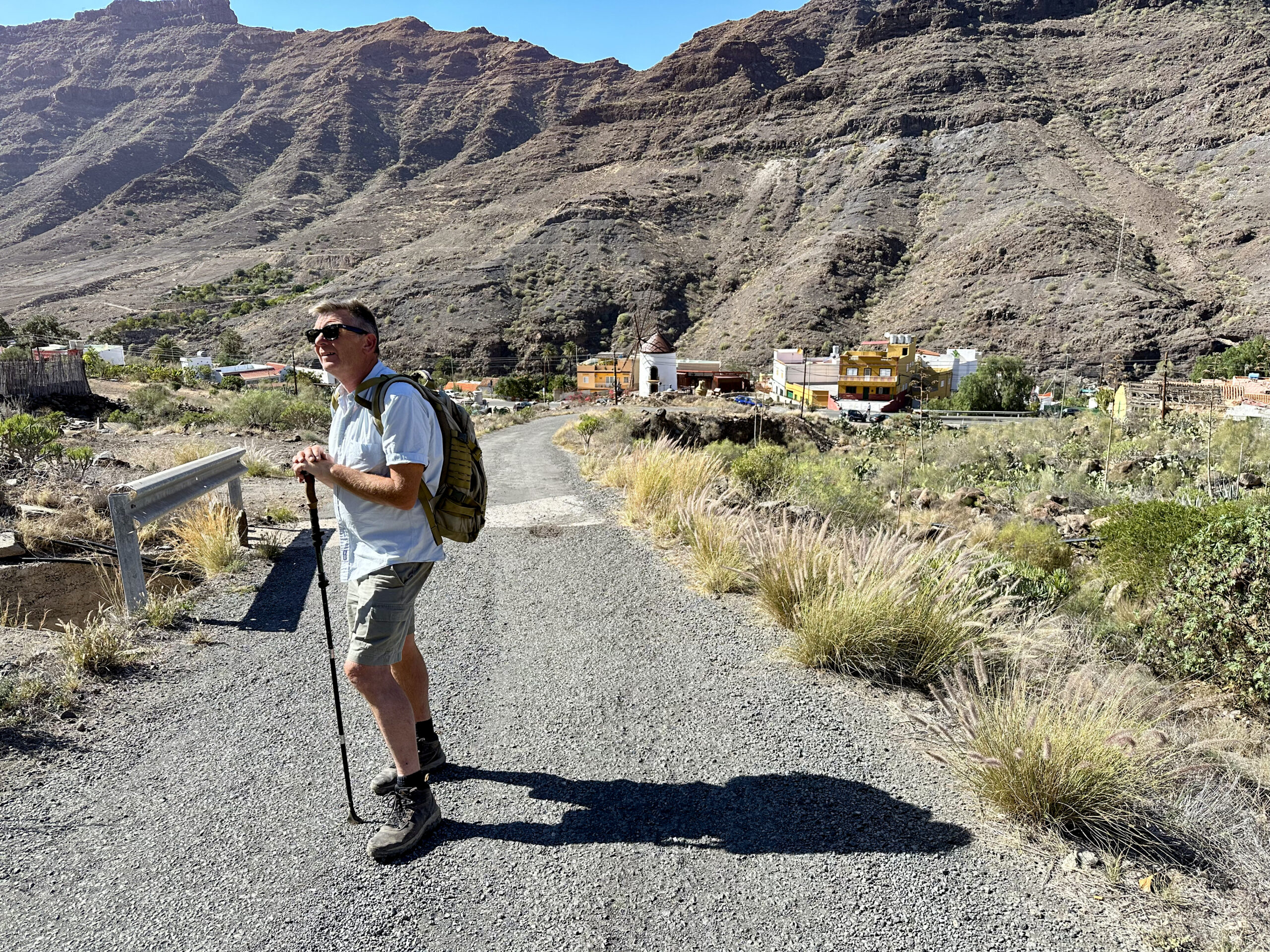
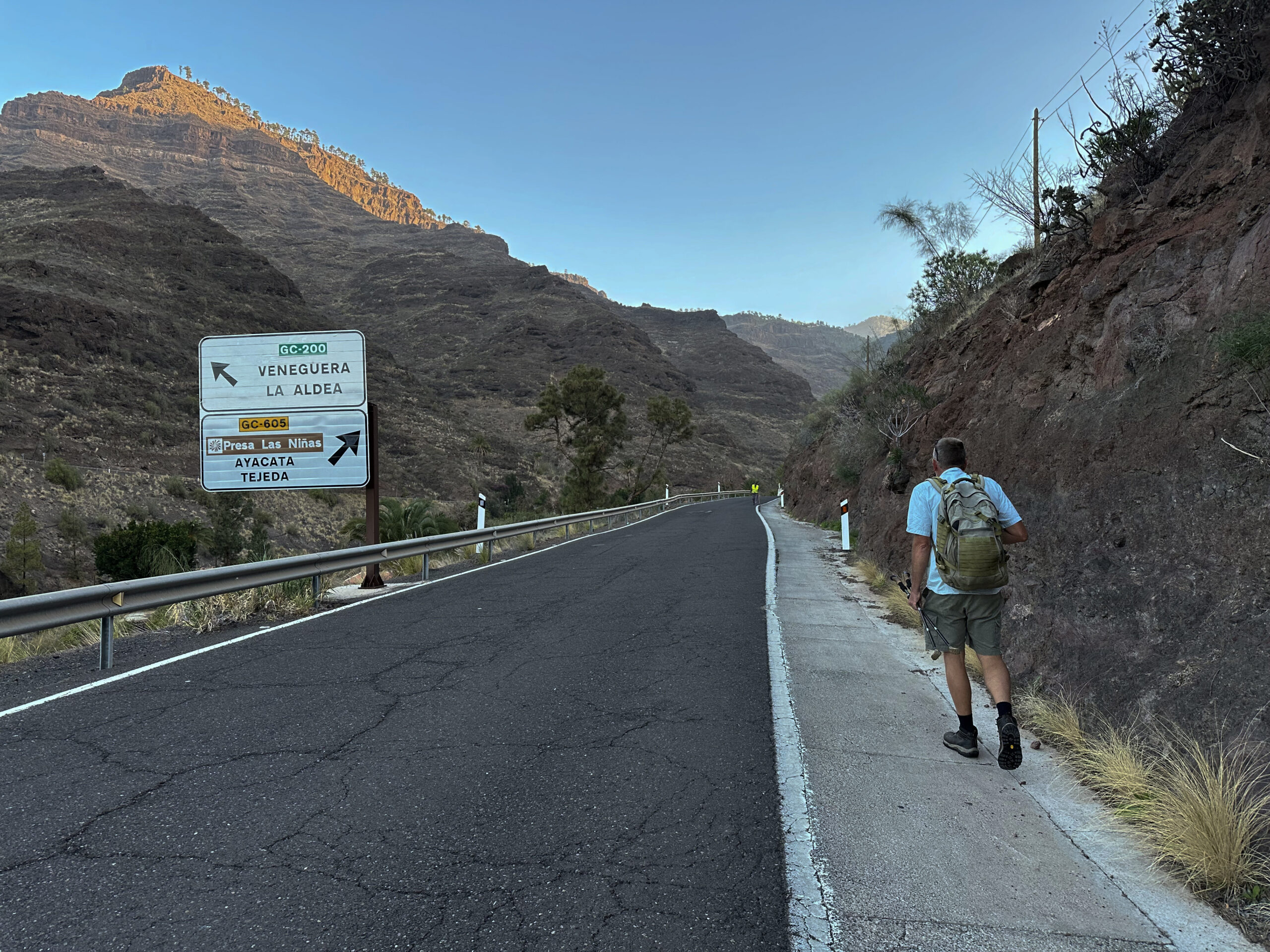
We started our hike in the hamlet of Pie de la Cuesta because we had our accommodation there. However, it does not matter where exactly you start on the GC-200 around Mogán, as you will have a longer walk along the road either on the way out or back. You walk uphill on the road towards the northeast for a while. After some time, the GC-200 takes a left turn. Straight ahead, the much quieter GC-605 continues uphill towards the island’s interior. Follow this road. Initially, you continue uphill on the road for a while. Then, a wide track branches off to the right from the road, which is hard to miss.
Follow this track until the first bend. In this bend, a signposted hiking trail branches off to the left. This trail brings you in a large steep switchback up onto a ridge. From there, it continues up the ridge in a short time. Finally, you reach the GC-605 again. The road also winds its way up the mountain to the viewpoint Pie de la Cuesta. At times, you briefly walk along the road, but mainly you take the signposted hiking trail to shortcut the switchbacks. This way, you reach a track that leads you high above the Mirador Pie de la Cuesta towards the east.
Section Track above Mirador Pie de la Cuesta to Montaña de Tauro
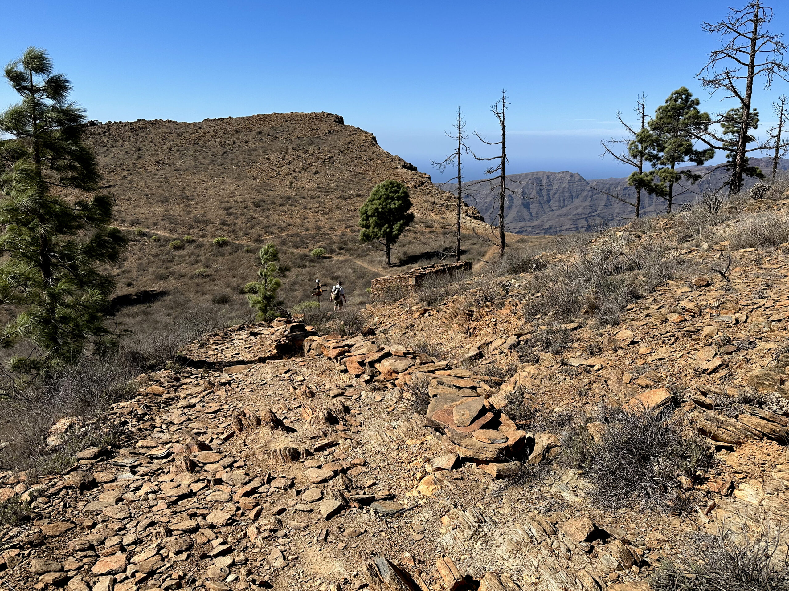
Follow this track for a short time, circling a small indentation. Then the track continues straight ahead. However, the hiking trail branches off to the left from the track. It brings you up the mountain with magnificent views over Mogán and towards the coast. To your left, you can now see the area around the Presa del Salto del Perro and the Presa de las Niñas. At the level of the Presa del Salto del Perro, the long-distance trail GR-139 comes from the left, which you can follow from here to Mogán. Initially, follow the GR-139 to the right up the mountain.
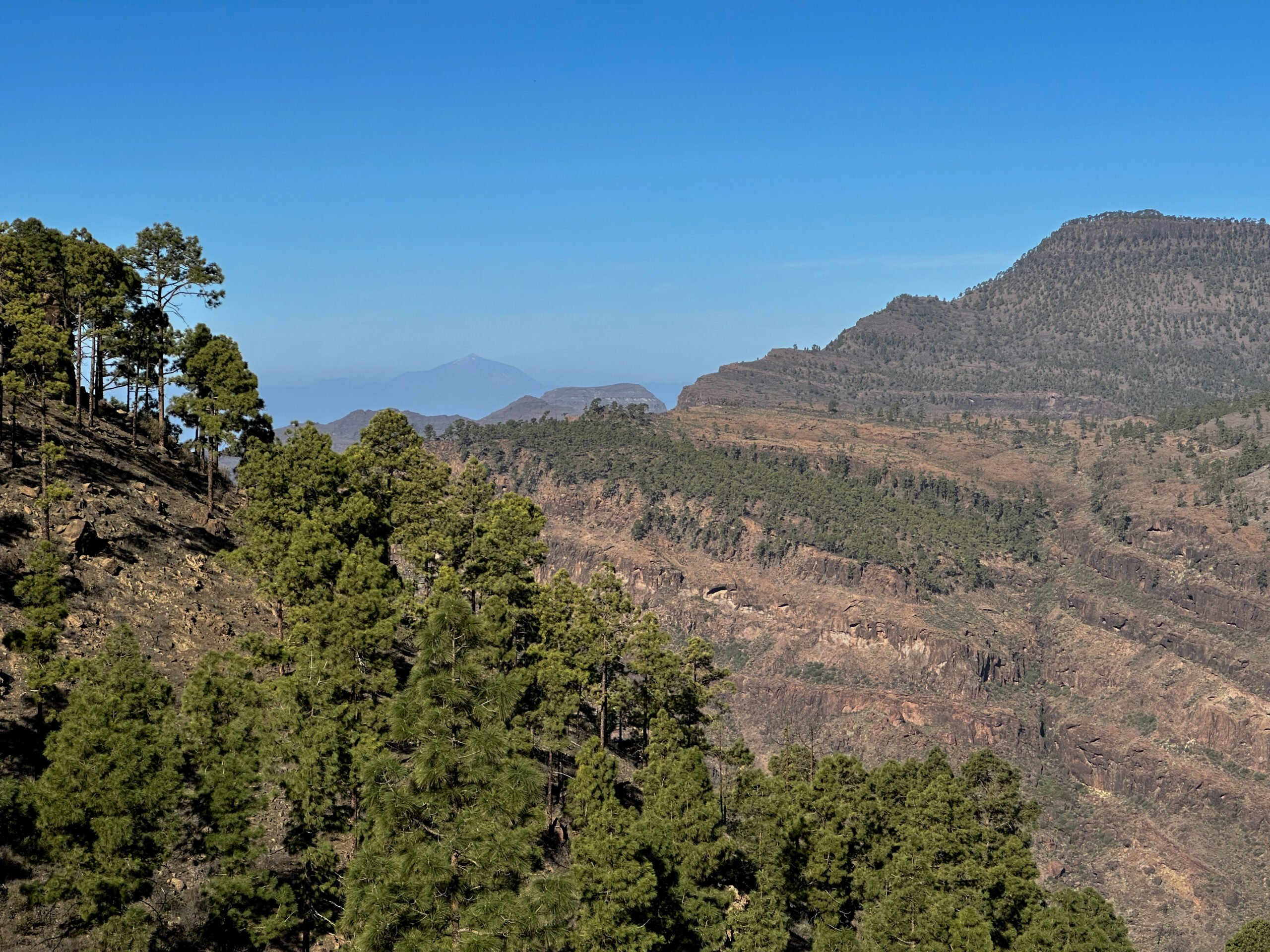
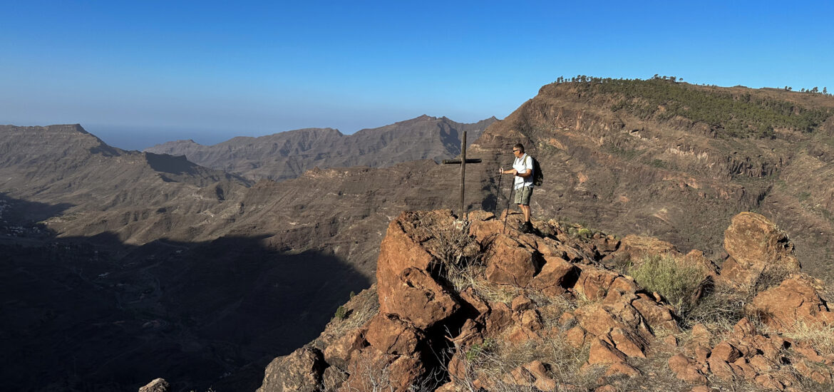
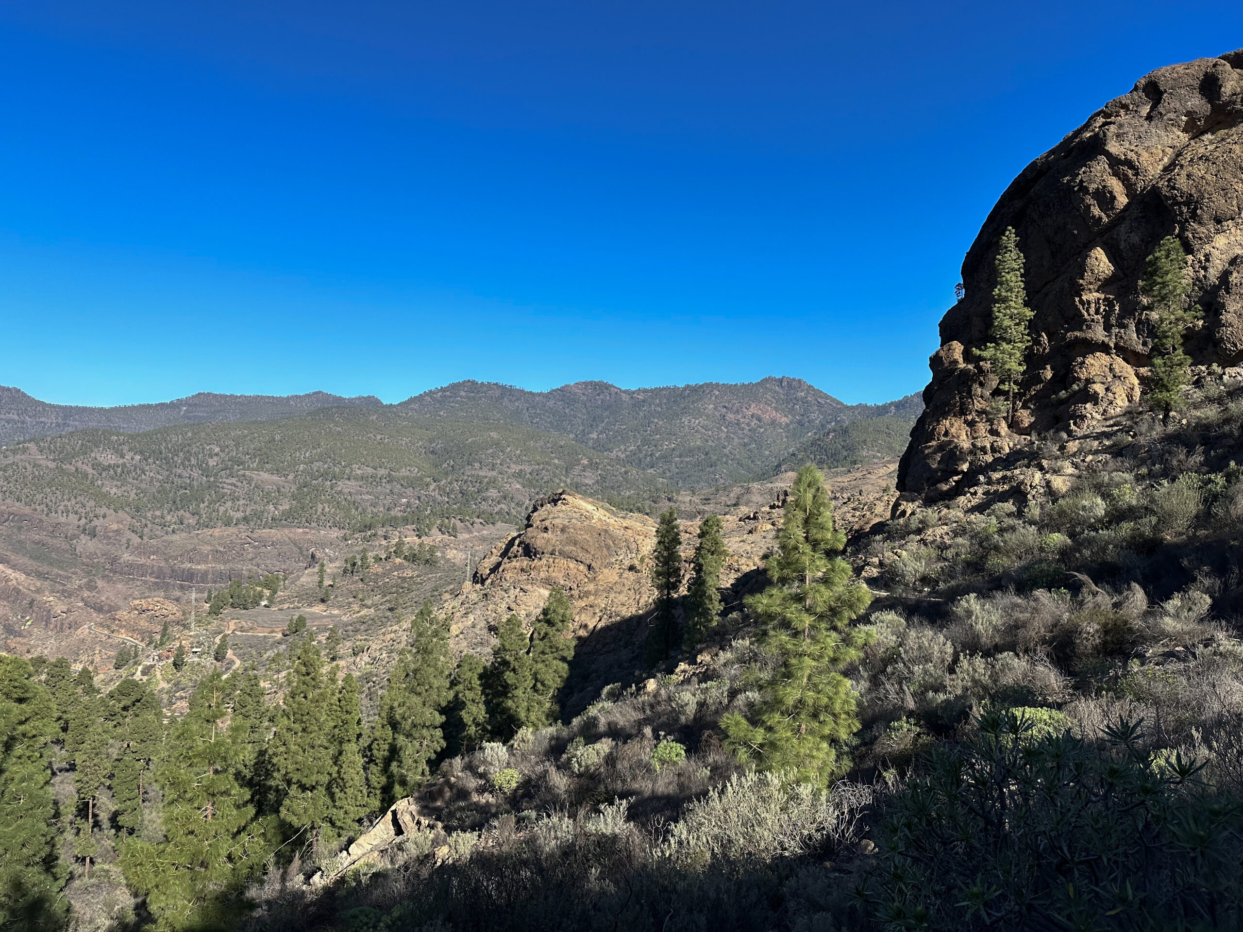
Your path climbs steeply up through the forest. You can’t miss the way, as the GR-139 is well signposted. If you manage this ascent, you will find yourself immediately below the Montaña de Tauro (1225 meters). If you like, you can go left to the summit. However, even from the Tauro Ridge, you already have beautiful all-around views and can even see Tenerife on the horizon in good weather.
Section Montaña de Tauro to Llanos de Guirre
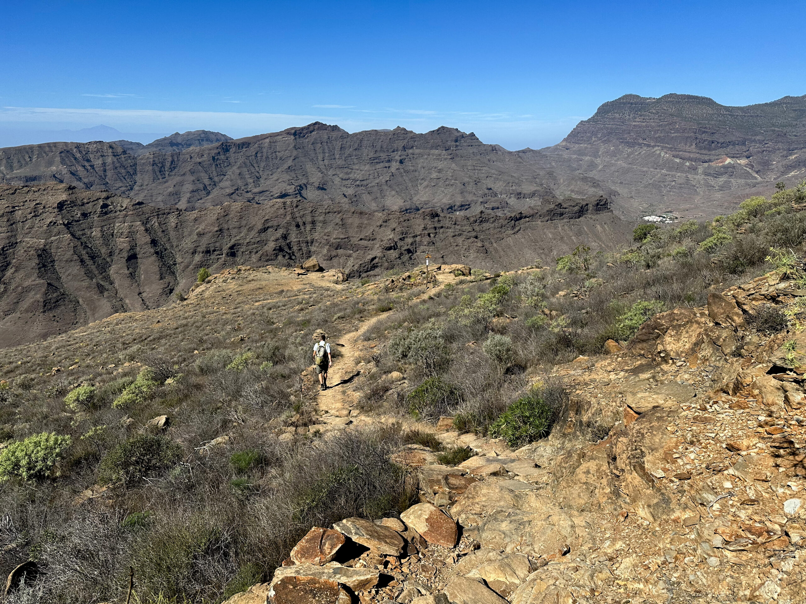
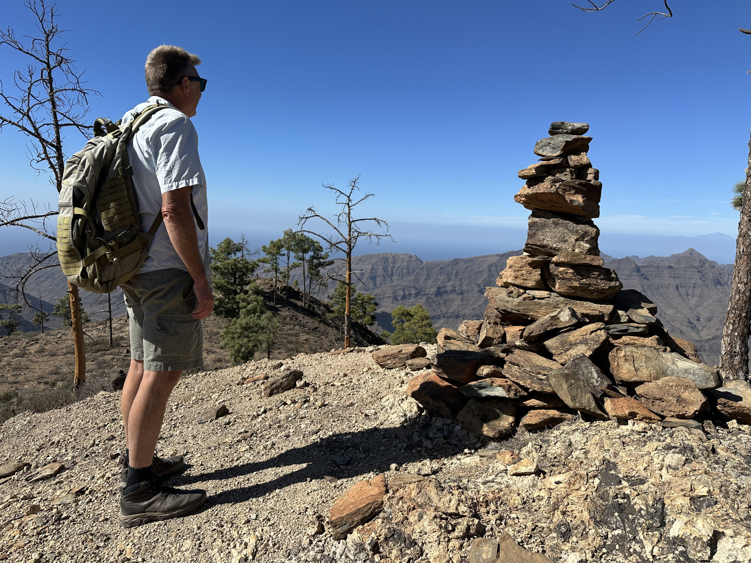
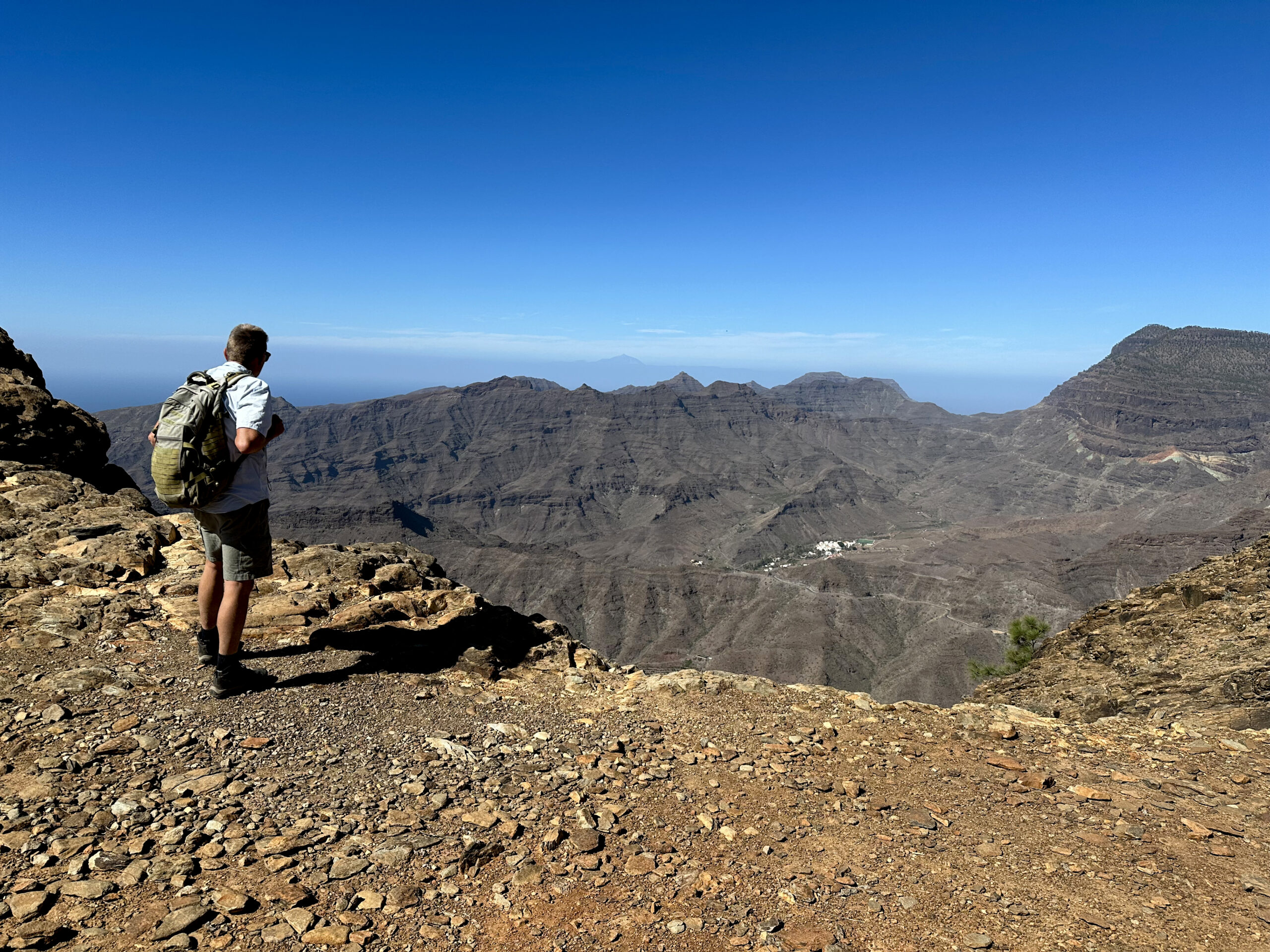
You have completed the entire ascent and can now enjoy the ridge with alternating beautiful views on the long-distance trail GR-139 for a long time. Occasionally, the trail moves slightly away from the ridge. If you enjoy it, there are some opportunities to climb small peaks to the right. After a while, you will also pass caves that you can explore. The trail now runs in a slight up and down but mostly descends.
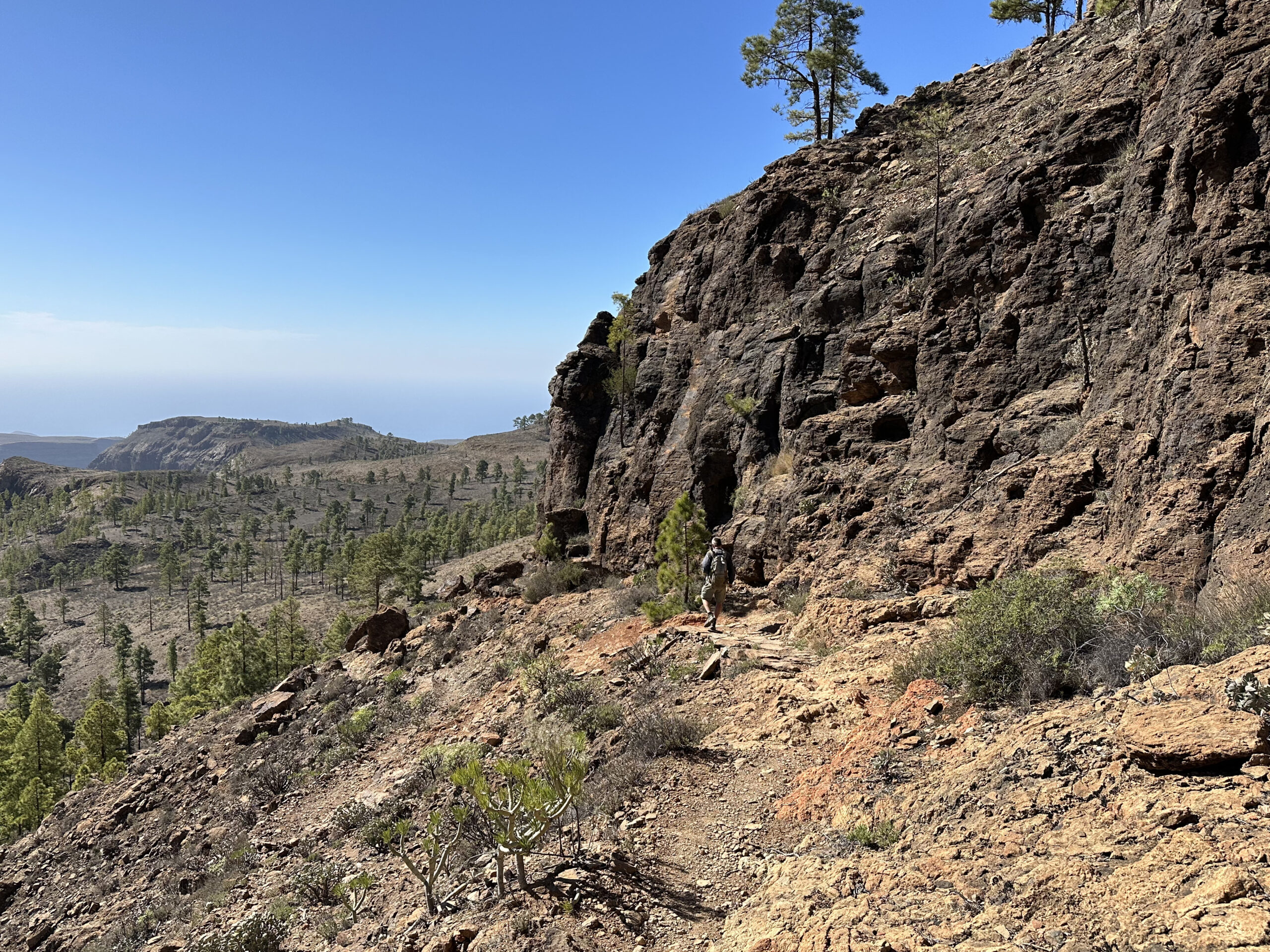
At the Degollada de las Lapas at 960 meters, you come again to the sheer drop. From up there, you can enjoy magnificent views into the valley around Mogán. The landscape now appears very wide without trees on the ridge path. You can easily continue descending. You pass the height of Guirre (932 meters) and then continue over the wide plateau Llanos del Guirre, always close to the ridge.
Section Llanos de Guirre to Molino de Viento
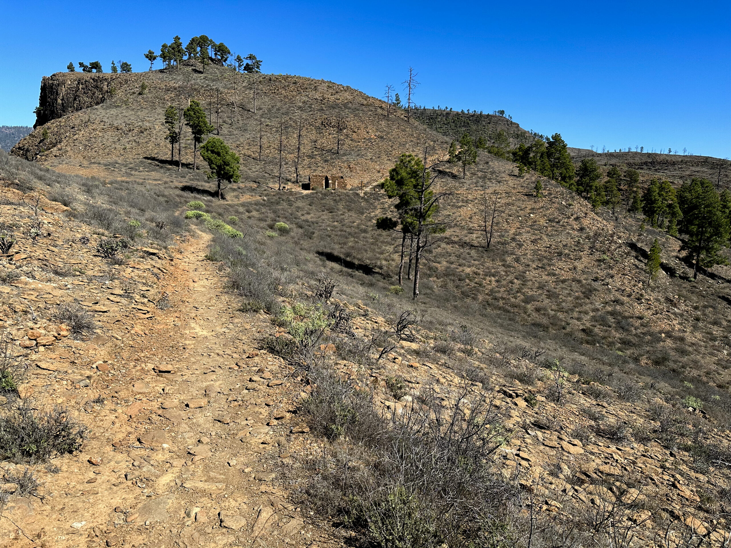
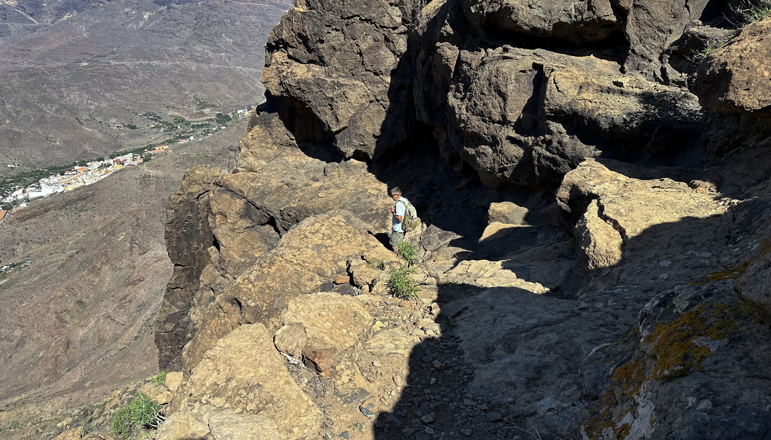
Finally, you reach a rock (Laderones at 745 meters), which you circle on the trail. Then the long-distance trail signposted towards Mogán leads steeply down through the cliff face. If you want to avoid this descent, you could also continue along the drop-off. However, the hike would be very long, as you would then only come back to the road just above Puerto de Mogán. If you choose the steep descent, you should be surefooted and free from vertigo.
If you are both, you will enjoy the breathtaking walk on narrow paths through the cliff face. It descends steeply through the wall with views of Molino de Viento and Mogán. In a few places, the path is also secured with a chain. Once you have left the cliff face behind, the path flattens out a bit. Eventually, you reach a small road.
Section Molino de Viento to Starting Point
Follow this road to the right. After a few meters, you reach the road Lugar El Molino de Viento. Go left down this road and return to the GC-200 at the windmill. We then simply walked right along the road over Mogán back to the starting point.
It is a bit nicer if you go down the road and towards the Barranco de Mogán. From there, the GR-139 runs parallel to the road. Only in the village of Mogán does the GR-139 turn left towards Cruz de Mogán. At this point, you are also already back in Mogán. From there, it is probably not far to your individual starting point.
And finally
I hope you enjoyed the rather long hiking circuit around Mogán. Those free from vertigo will particularly enjoy the descent through the cliff face. And for everyone else, the hike offers a lot of variety. Enjoy all your hikes,
Dagmar from SiebenInseln
If you are staying in Puerto Mogan, you can take a bus all the way up to Mogan valley, summit Tauro and then walk the whole ridge back to Puerto Mogan. Very little road walking. You miss the descent to El Molino de Viento, though.
Thanks Edmunds for the additional information
Thank you really enjoyed the walk and the instructions were prefect There is an excellent cafe at the museum Los Molinos Viento to enjoy so much deserved refreshments at the end. It is close to the bus stop so you can achieve the whole trip without a car
Best wishes
https://photos.app.goo.gl/vrvQ7eZ1dUd5KSfCA
Thanks John for the additional information