Veneguera – A Traditional Canarian Village Away from the Tourist Areas
Veneguera is a small village on Gran Canaria, located within the municipality of Mogán in the southwestern part of the island. The village is renowned for its picturesque setting in a fertile valley, surrounded by impressive mountains and lush vegetation typical of the region. Veneguera is one of the few villages on Gran Canaria that has managed to retain its traditional Canarian charm, remaining largely untouched by mass tourism, which gives it an authentic and tranquil atmosphere. The village has a long-standing agricultural tradition.
And is particularly known for cultivating tomatoes, fruits such as mangoes and avocados, as well as olives. Some of the older buildings in the village still stand from the time when agriculture was the primary source of livelihood for the residents. There are numerous hiking trails that lead through the surrounding mountains and valleys, offering breathtaking views of the landscape. Veneguera provides visitors with a peaceful and authentic experience, away from the bustling tourist areas. It is an ideal place for those who appreciate nature, tranquillity, and Canarian traditions.
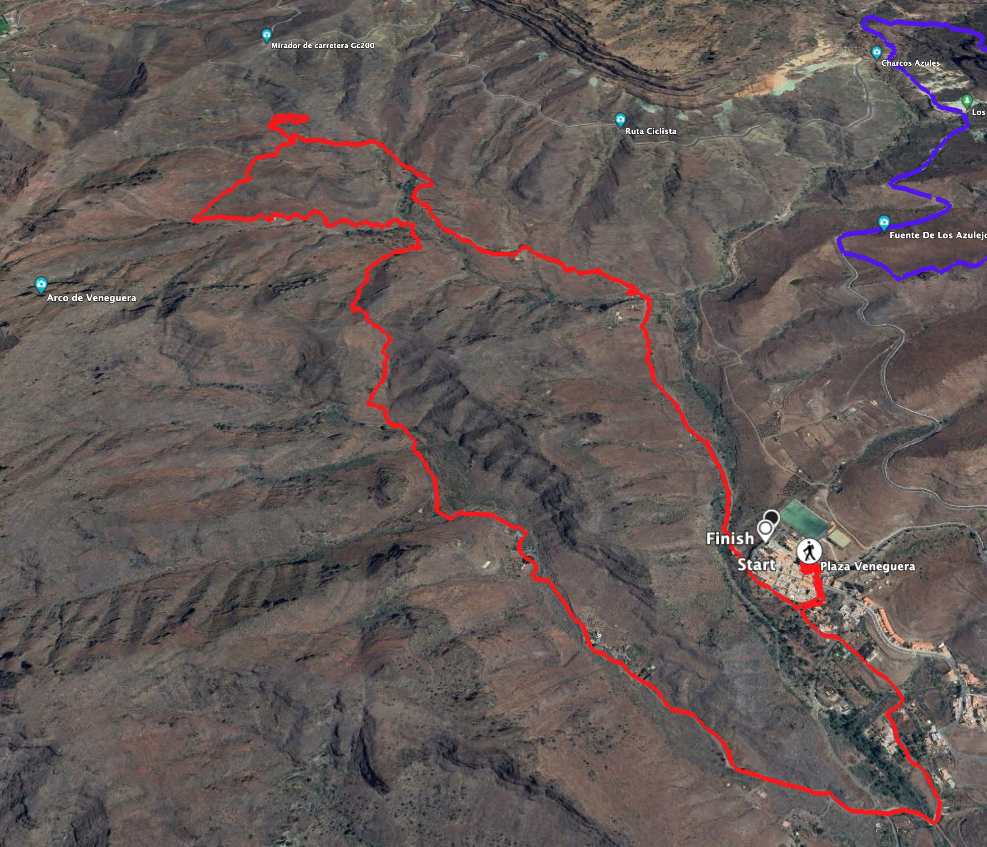
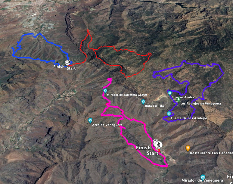
Veneguera Circular Hike
Unfortunately, I can’t share particularly beautiful pictures of this walk as there was a strong Calima on the day we undertook it. Everything around us appeared hazy and misty. I hope I can still convey just how lovely the small circular walk around the village of Veneguera and the surrounding ridges actually is. You start by walking from the village of Veneguera uphill on the GR-139 towards the Mirador at the GC-200. From there, you can opt for a small extension.
However, you can also return via the Circular de Veneguera before reaching the GC-200, following a high loop along the mountainside. Here, another ascent awaits you with stunning views. A side trip along a ridge with a small summit climb is also possible. You then descend until you eventually rejoin the GR-139 south of Los Almácigos. This path will take you back to the starting point in Veneguera.
General Information on the Veneguera Circular Walk
Starting Point and Directions
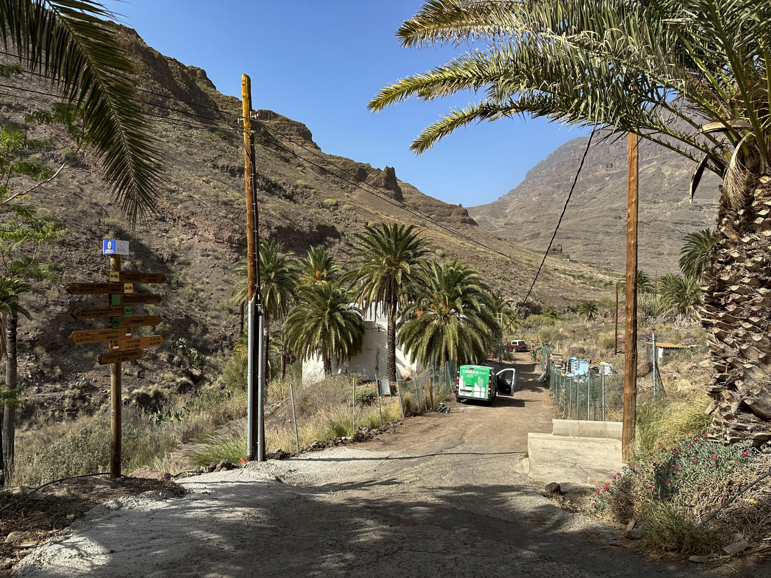
The starting point of the hike is the small village of Veneguera. You can begin at the Plaza or any other place where you may have parked. From there, head towards the ravine on Calle Pedro Betancor Valencia. This is also the GR-139 hiking trail, where your circular walk begins.
Arrival by Car
You can reach Veneguera from both directions (northwest and southeast) via the GC-200. A road branches off from the GC-200 at the Barranquillo de las Marreras, leading you into the village centre in a short time. Parking is available along the streets.
Arrival by Bus
Bus lines 38 and 86 stop in Veneguera on Calle Los Azulejos. For more information and exact timings, visit the Guaguasglobal website.
Time
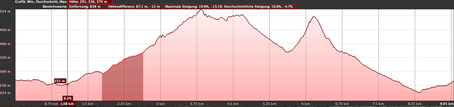
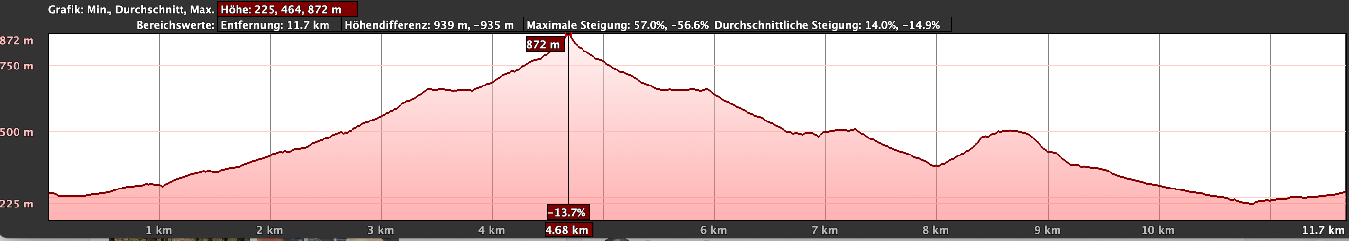
I’m reluctant to give general time estimates for hiking tours, as the times are highly individual. We took nearly 6 hours for the larger loop, including some elevation gain and extensions, with breaks. The smaller, more leisurely circuit takes about 3.5 hours with breaks.
Elevation Gain and Distance
The elevation gain is approximately 450 metres for the shorter loop and 820 metres for the extended route. The shorter loop is 9.5 kilometres long, while the longer route covers 13.5 kilometres.
Difficulty
On the standard Veneguera Circular route, you’ll be walking on good hiking or farm tracks. Only the extension along the slopes of Inagua will lead you onto narrow, challenging paths, which are only recommended for experienced hikers. The other extension along the ridge can be done by anyone with good footing and a head for heights. However, you should have a decent level of fitness.
Refreshment
You’ll find places to eat only in Veneguera, so be sure to bring enough water and possibly some snacks with you.
Variants
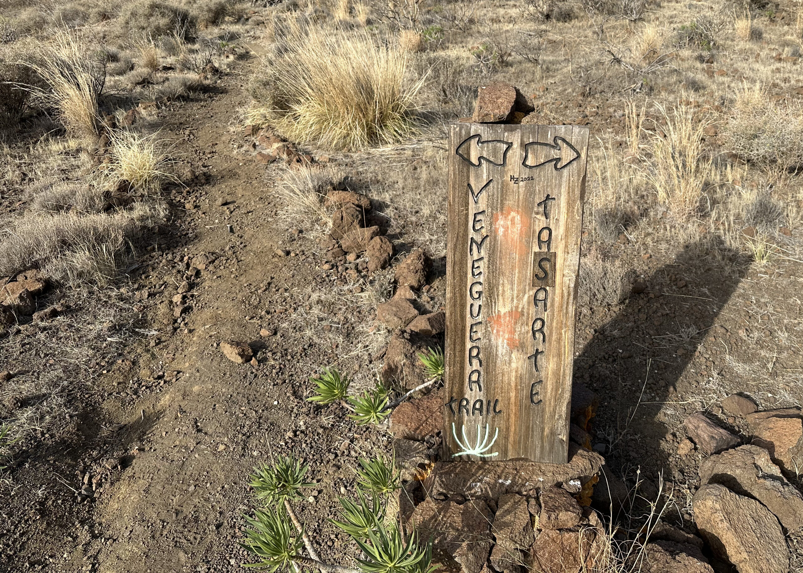
The shortest variant is to avoid climbing up to the GC-200 and simply follow the signs for the Circular Veneguera. On this route, you have the option to hike up along a ridge to a small peak. Another slightly longer option is to avoid the GC-200 but go a bit further in that direction, thus extending the Veneguera Circular a little.
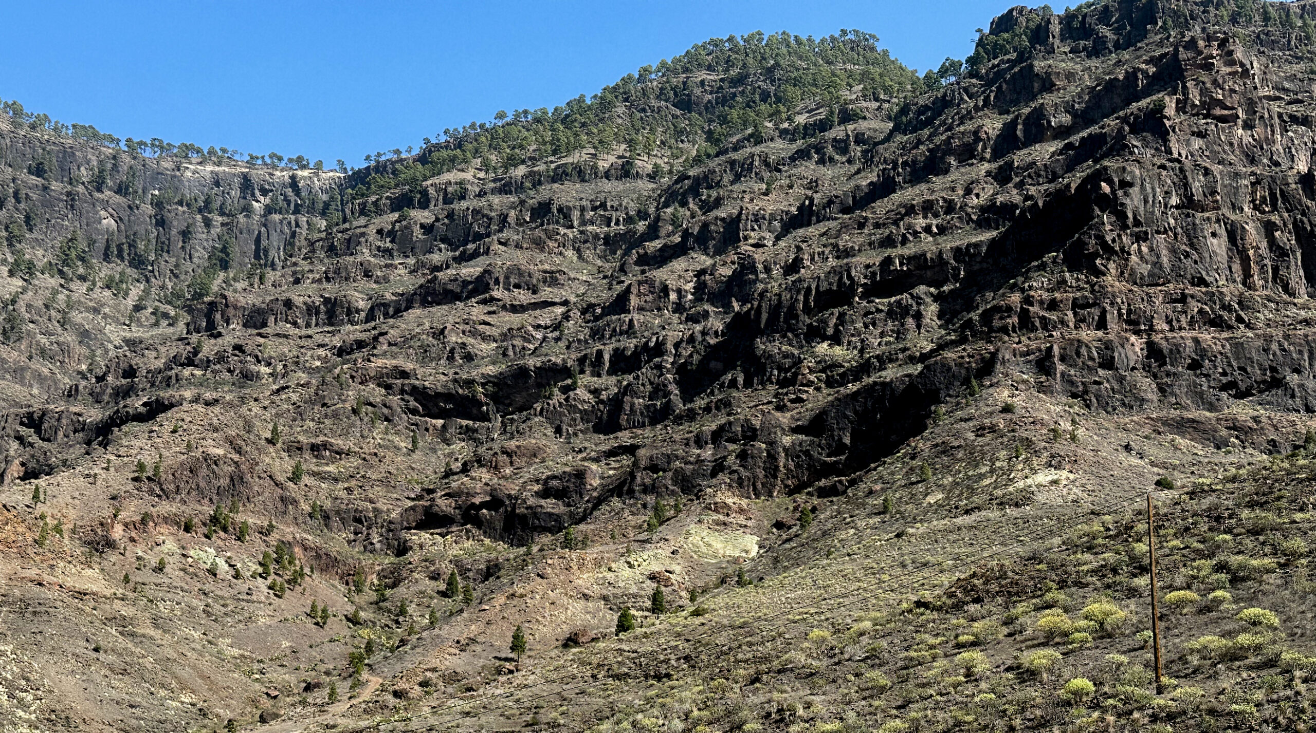
For more extensive variants, you can either climb up to the GC-200 and continue towards the Inagua Nature Reserve. Since it is very steep and rugged there, this is really only recommended for experts. Better extensions include continuing from the GC-200 towards Tasarte or following the GR-139 southwards from Veneguera, eventually reaching Mogán.
Neighbouring Hikes available on SiebenInseln:
3. Circular Walk through the Inagua Nature Reserve
Veneguera Circular Hike
Section Hike from Veneguera to Zona Arqueologica
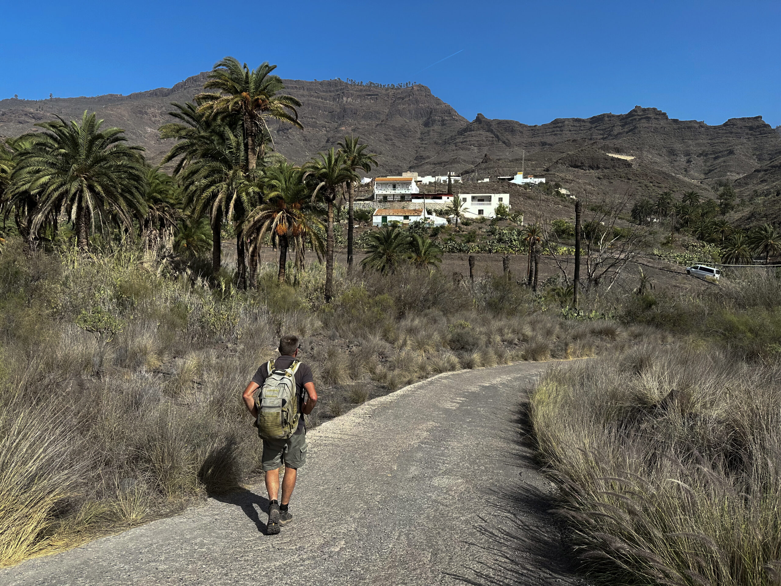
You start your hike from any point within the village of Veneguera. From there, head towards the ravine (Barranco de Veneguera) along Calle Pedro Betancor Valencia. This is the last street running above the ravine and where you’ll find yourself already on the GR-139 and S-73 trails. Follow the road to the right, heading northwest out of the village. The path quickly leads you past the last houses of the village, and you soon reach open fields.
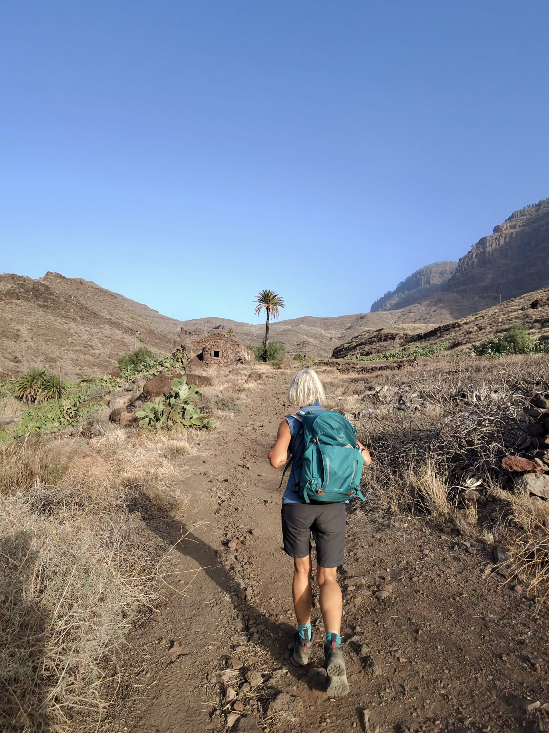
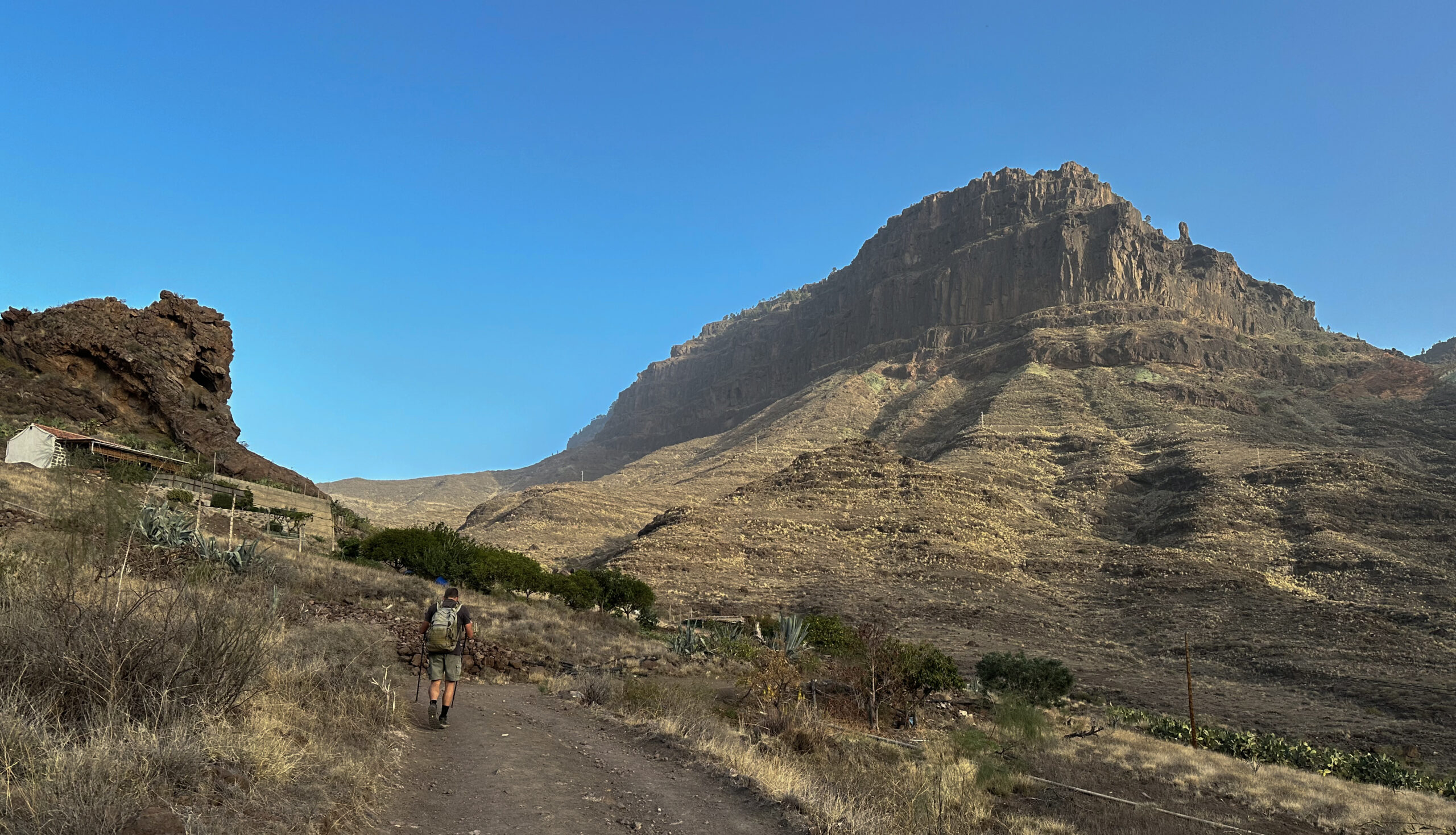
Shortly after leaving the village, you cross the ravine and continue along its left side. The path is very well signposted and easy to follow. To your right and ahead, you’ll see steep cliffs, including the Azulejos de Veneguera. You pass by a few abandoned houses, and at a point where you cross another ravine, there is a protected area (Zona Arqueologica La Cogolla de Veneguera) on your right. After passing this, you continue to climb upwards via several switchbacks.
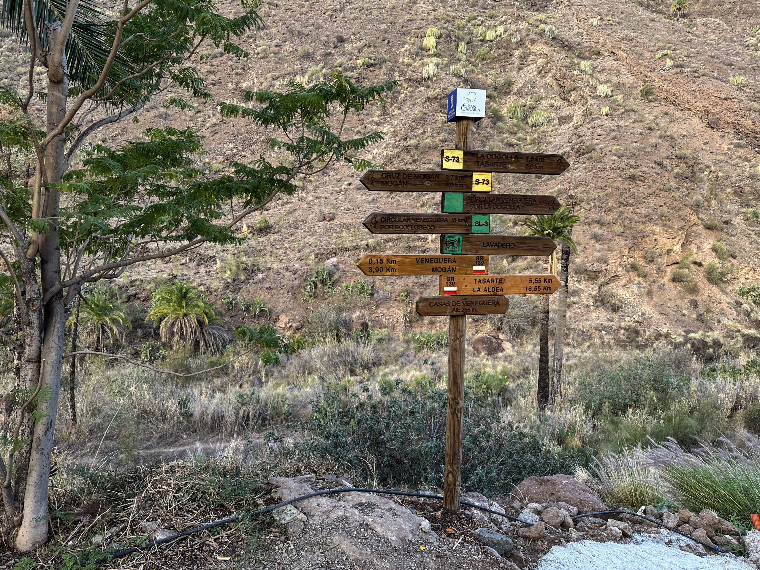
Section: Zona Arqueologica to Junction with GR-139
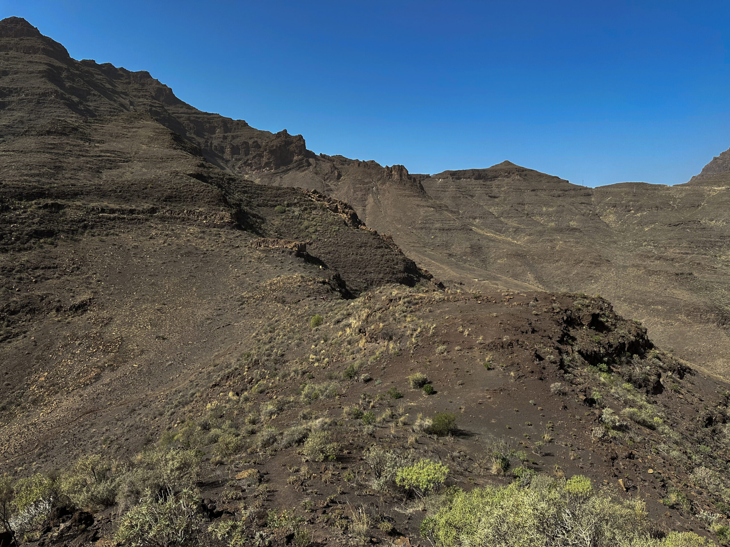
The trail continues to lead you uphill, crossing two more small ravines. You then reach a junction where the lower Veneguera Circular leads across the ravine to the left. If you wish to continue ascending, simply follow the GR-139 and S-73 higher up. Eventually, you reach another junction to the left. This is where you will need to return later for the circular walk. If you continue a bit further, you’ll arrive at a viewpoint (Mirador) on the GC-200 after a steep ascent, offering a beautiful view of the surrounding cliffs and the wide valley below.
We ventured a little further along the GC-200 and explored the area around the cliffs, though I wouldn’t recommend this. If you wish to continue, follow the trails on the left side of the road, which will then lead you left down to Tasarte. For the small circular walk, however, you must descend from the Mirador to the last junction (to the right from this direction).
Section: Junction with GR-139 to Ridge Path
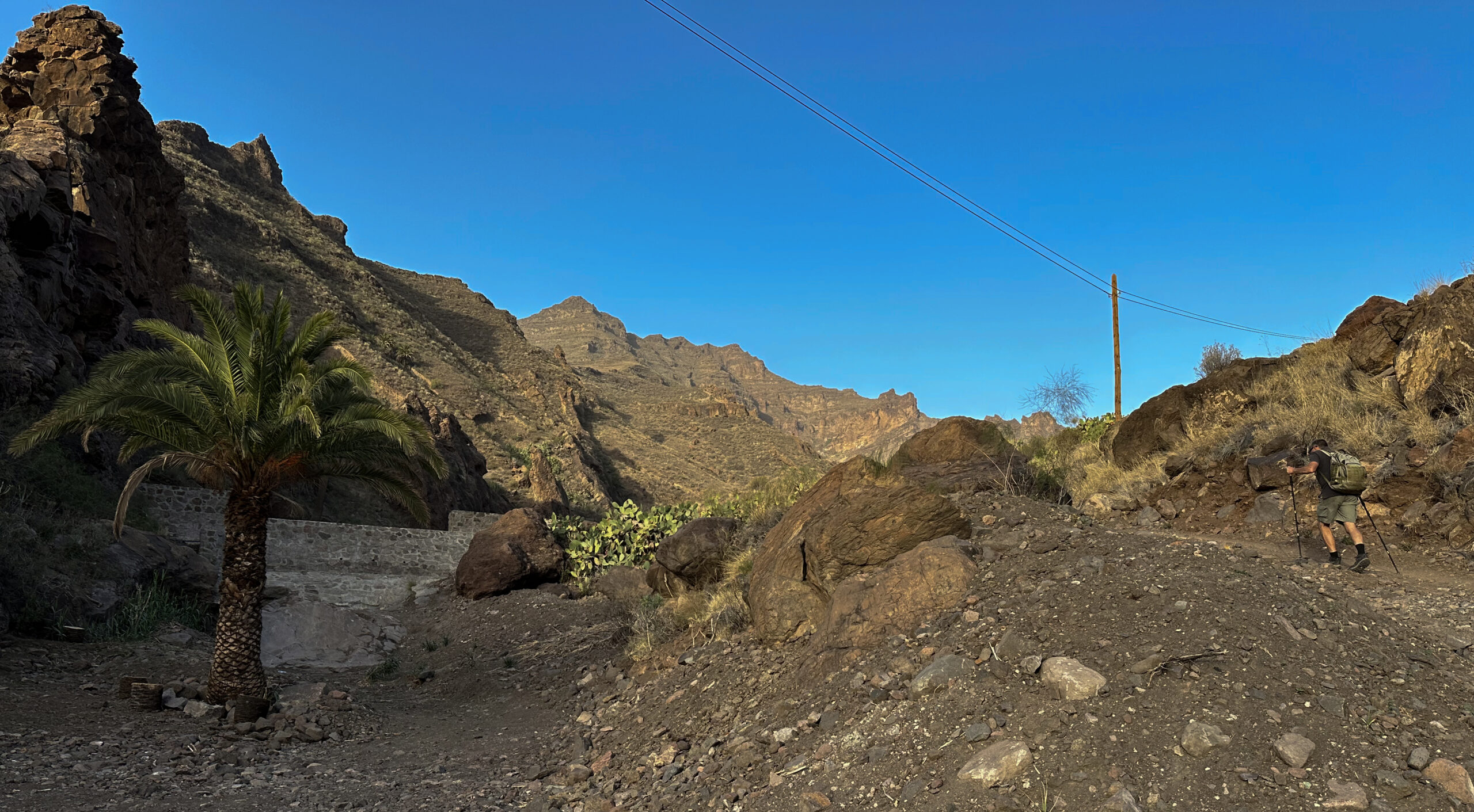
At this junction, turn right. The path climbs gently along the hillside with beautiful views, crossing another ravine. The trail eventually ends before a hillside and ravine. High above you is a natural rock arch. From here, turn left and descend, passing another abandoned house. The trail eventually ends near the Barranco de Veneguera. On the other side of the ravine is the trail you originally ascended. Here, you can cross back over and turn right to return to Veneguera.
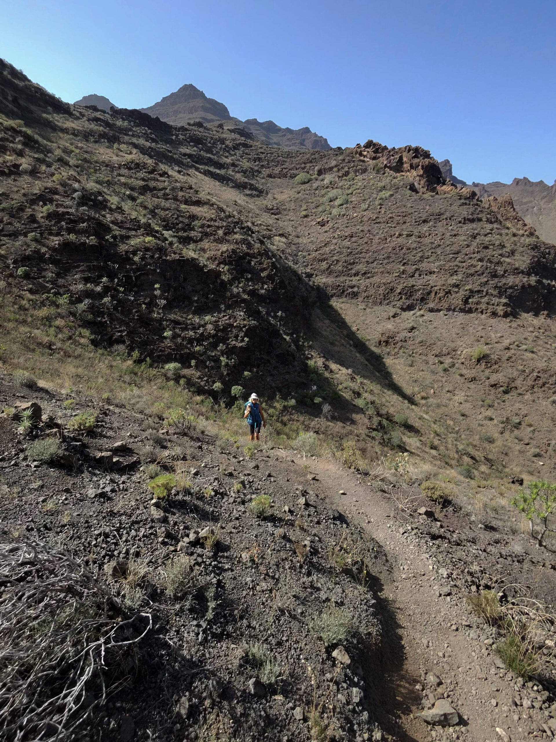
For the circular walk, however, stay on this side of the ravine. The trail first crosses a small side ravine, then climbs steeply up the hillside on the right. You’ll have to ascend once more. After circling around and climbing the hillside, you’ll see a small path to the left. Here, you can make a short climb to a ridge path with a small summit. From up here, you’ll enjoy stunning views on both sides of the ridge. Afterward, return to the main path.
Section: Ridge Path to Veneguera Village Centre
Back on the main path, continue straight downhill. The trail is quite narrow in places and descends steeply. After a while, it gradually levels out. Eventually, you reach a small road near some houses, which you follow further. The road takes you past a few isolated farms. You gradually pass fields and shortly after, a small hamlet. To your right lies the Barranco de Loseco de los Viejos. The road runs parallel to the ravine.
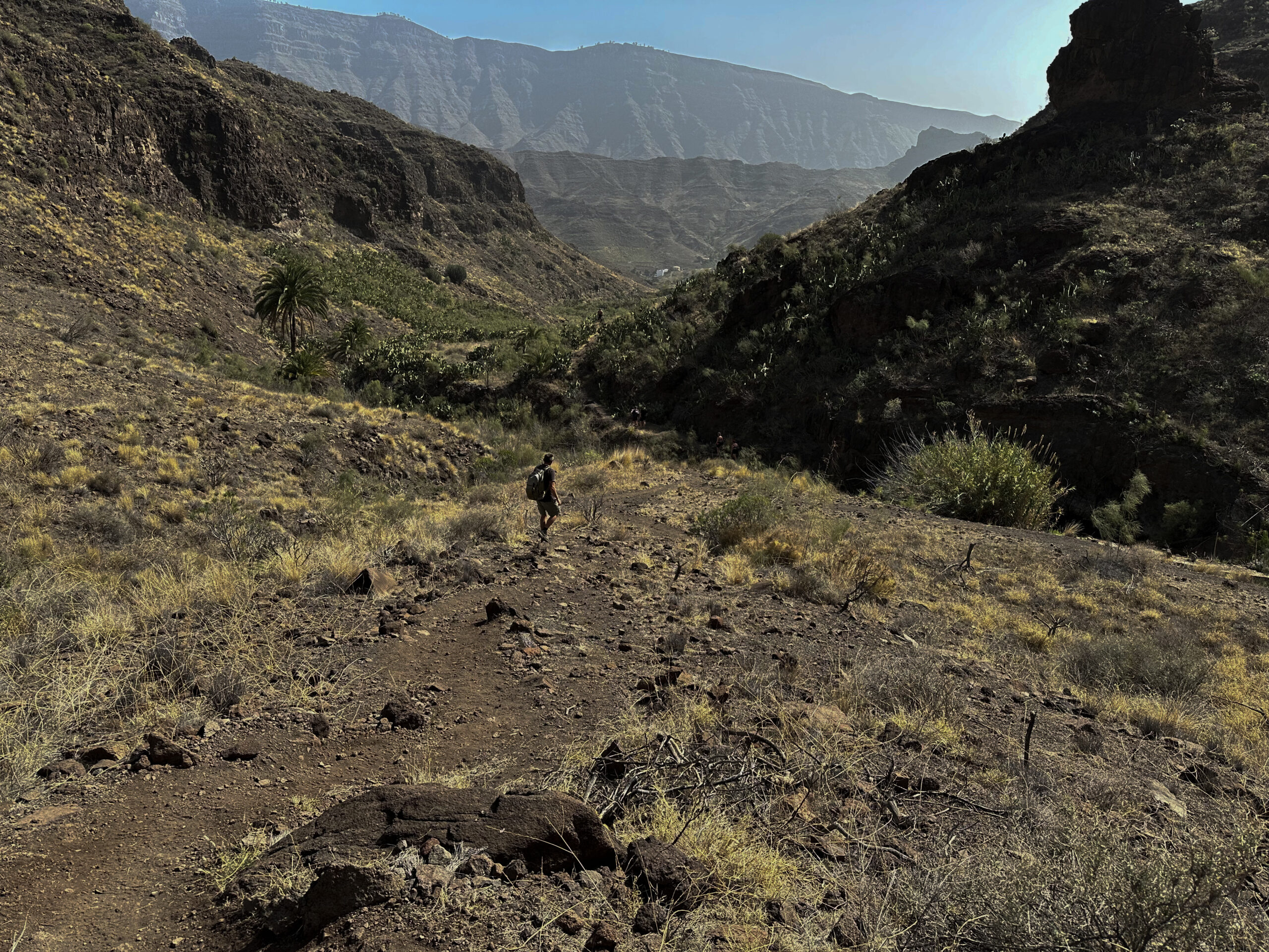
Finally, the path merges with the GR-139 near Los Almácigos. Shortly before, you cross the Barranco de Veneguera for the last time on this hike, this time from left to right. After that, turn left and follow the GR-139, which will quickly lead you back to the centre of Veneguera.
And finally
I hope you enjoyed this little circular hike around Veneguera. It’s ideal for those who prefer shorter, less strenuous hikes. For everyone else, the hike can easily be extended in several directions. Whatever you choose, I wish you much joy on all your hikes,
Dagmar from Siebeninseln