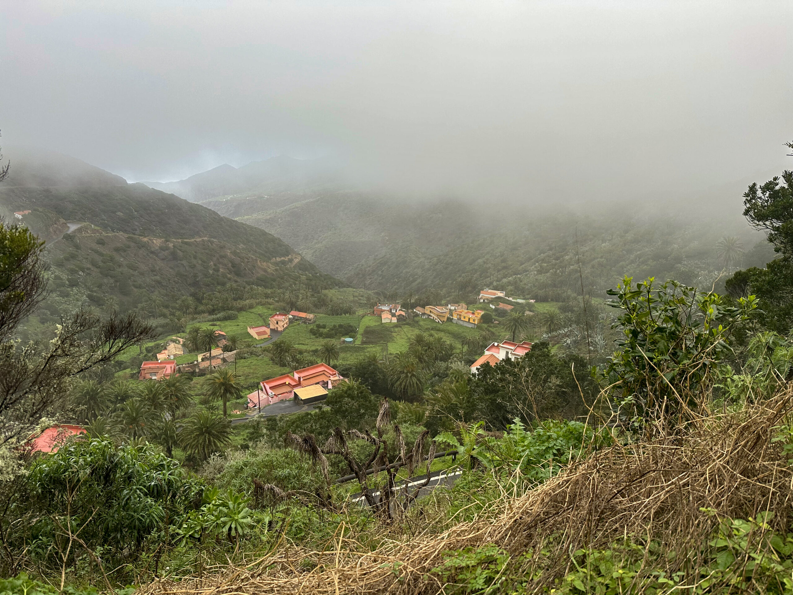
The small hamlet of Tazo
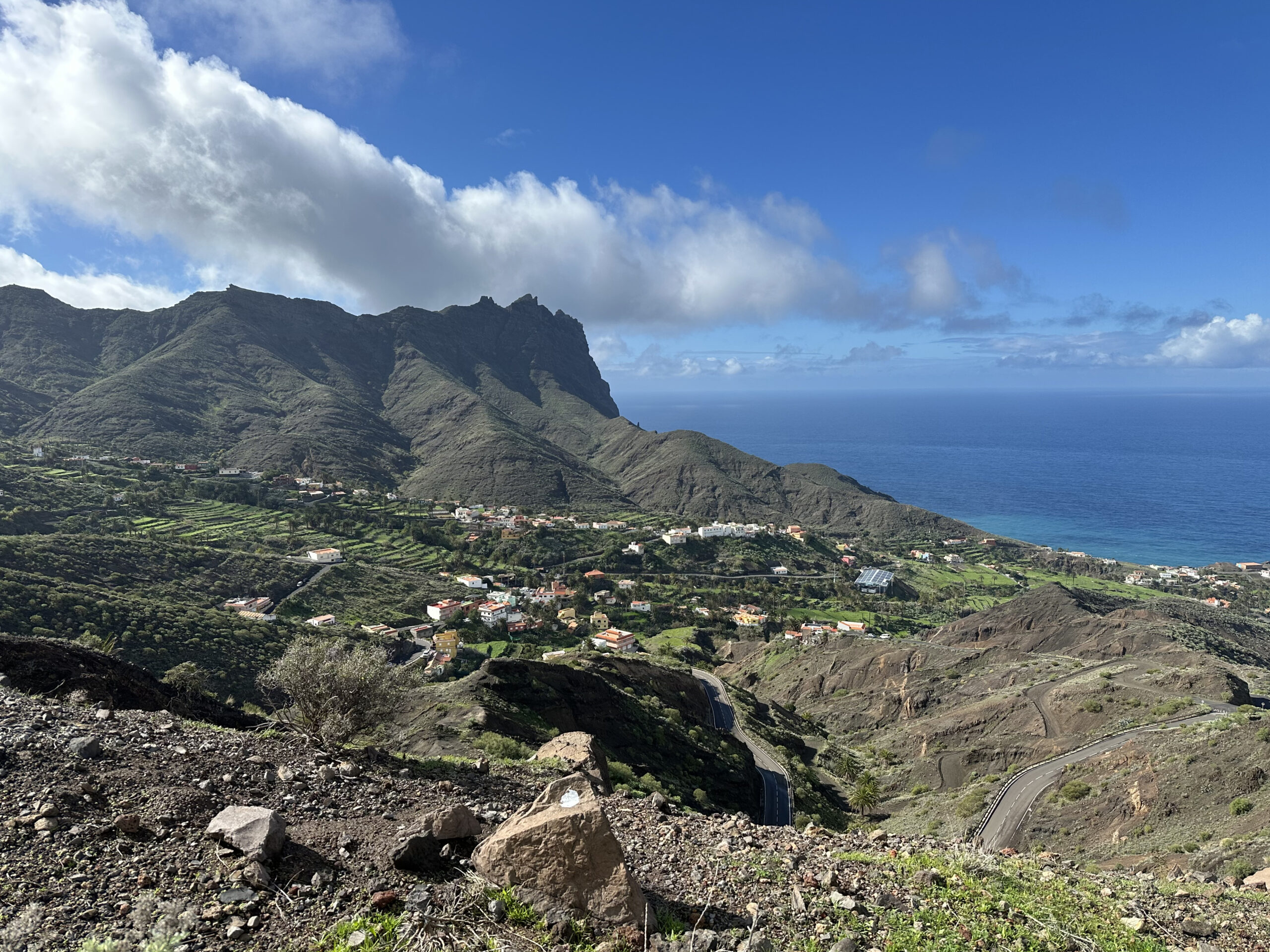
Nestled between the deeply incised barrancos and the forested heights of northern La Gomera lies Tazo – a hamlet that no one discovers by chance. Anyone who arrives here has made a conscious decision to do so: along narrow roads and tracks, past terraced fields, old stone walls and with the constant presence of the Atlantic Ocean. Tazo is not a place you pass through, but a place where you arrive. The few houses, situated between 300 and 440 metres above sea level and home to around 17 residents in January 2026, are scattered across the vegetated slopes dotted with palm trees. Everything feels quiet, almost timeless.
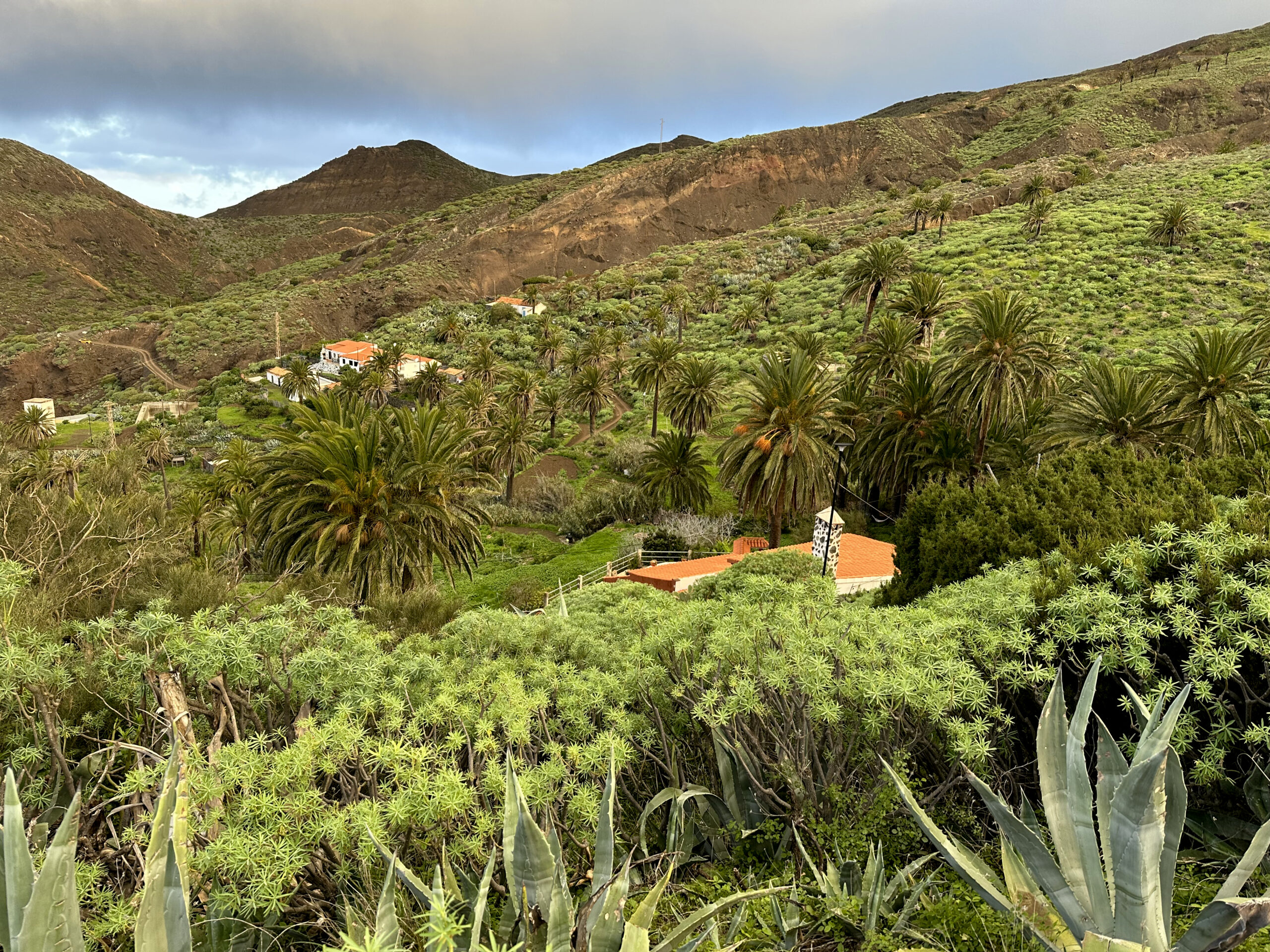
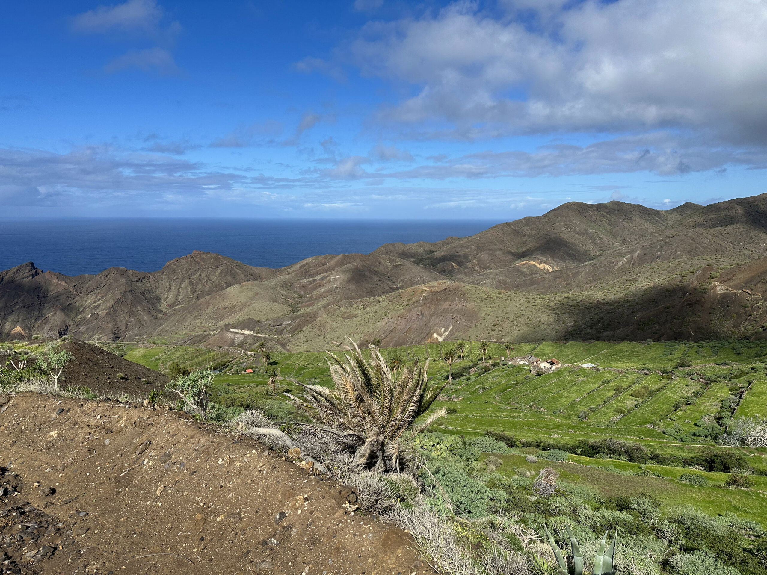
Surrounding the hamlet is one of La Gomera’s most unspoilt walking landscapes: old connecting routes, stony paths and surprisingly green ravines where moisture gathers. Walking from Tazo allows you to experience the island in a particularly original form. The landscape tells stories of agriculture, isolation and adaptation – and this is precisely where its charm lies. Tazo is not a destination for the hurried, but a tranquil starting point for walks that are more about perception than about distance. Due to the rainy weather on several days, our walking options were somewhat limited, which meant we were able to fully enjoy Tazo and our wonderful accommodation at Casa Rural Hyggeland.

Circular Hike Tazo – Epina – Alojera
Naturally, this walk also starts in Tazo. As it is a circular route, you can begin at any other point along the loop (for example in Alojera or Epina). From Tazo you walk uphill to join the long-distance trail GR-132. You follow this trail for a while through several ravines, undulating up and down in the direction of Epina. Once there, you can visit the famous springs, the Chorros de Epina. Afterwards, the route continues for some time through the cloud forest.
The walk then leads first through woodland and later across meadows and scrubland, offering magnificent views of the surrounding landscape and the Atlantic Ocean as you descend towards Alojera. Near Alojera, you walk along a ridge with fantastic views, passing numerous water installations and the village itself. Finally, you reach the connecting path between Tazo and Alojera, which you follow uphill through several ravines back to Tazo.
General Information on the Tazo Circular Hike
Starting point and access
The walk starts in Tazo. We began directly from our accommodation, CasaRural Hyggeland. If you also wish to start in Tazo, you can reach the highest houses of the hamlet via various routes and begin the walk there. Alternatively, the walk can easily be started from Epina or Alojera.
Getting there by car
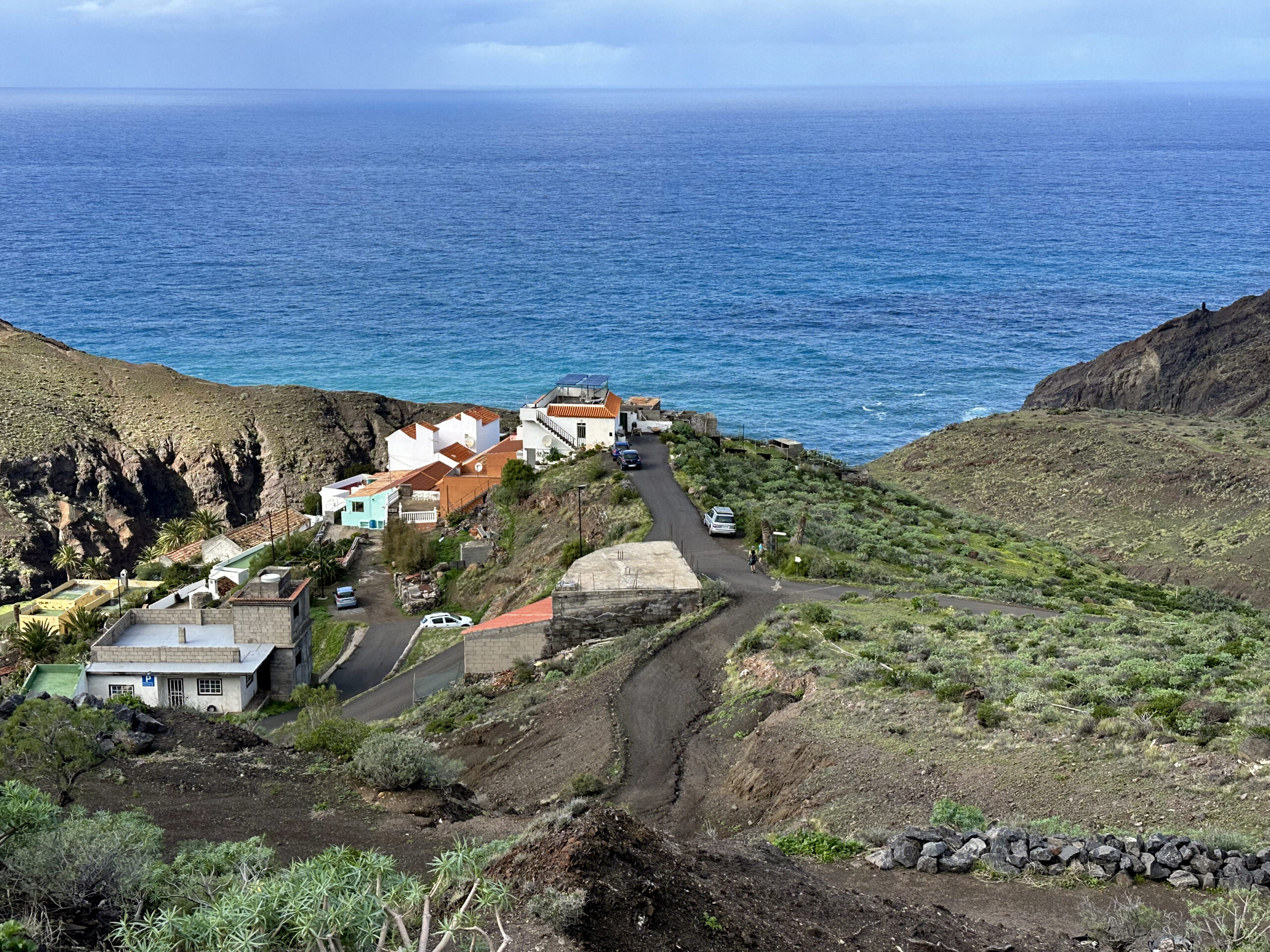
From San Sebastián, drive along the GM-3 towards Valle Gran Rey. Before reaching Valle Gran Rey, you will come to a roundabout where the turn-off to Vallehermoso is signposted – take this exit. Follow the GM-1 for quite some time. On the left-hand side you will eventually pass the restaurant Epina. Shortly afterwards, take the exit for Alojera / Tagaluche (CV-16) and soon after that turn right onto a small road towards Tazo / Arguamul. This beautiful panoramic road to Tazo was only surfaced after 2020. After about six kilometres downhill you reach the hamlet of Tazo, where you may, as we did, have to follow a rough track to reach your accommodation.
Getting there by bus
There are no buses to Tazo. General information on bus routes on La Gomera can be found here.
Time
I prefer not to give general time estimates for walks, as they vary greatly from person to person. Including breaks, we took a little over 5 hours for this circuit.
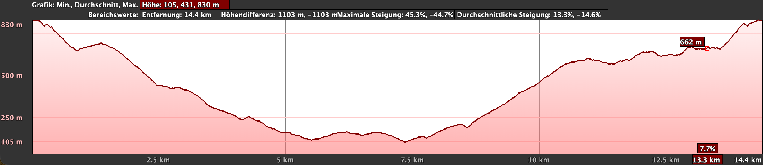
Ascent and distance
The total ascent is approximately 840 metres, and the route is just under 14 kilometres long.
Difficulty
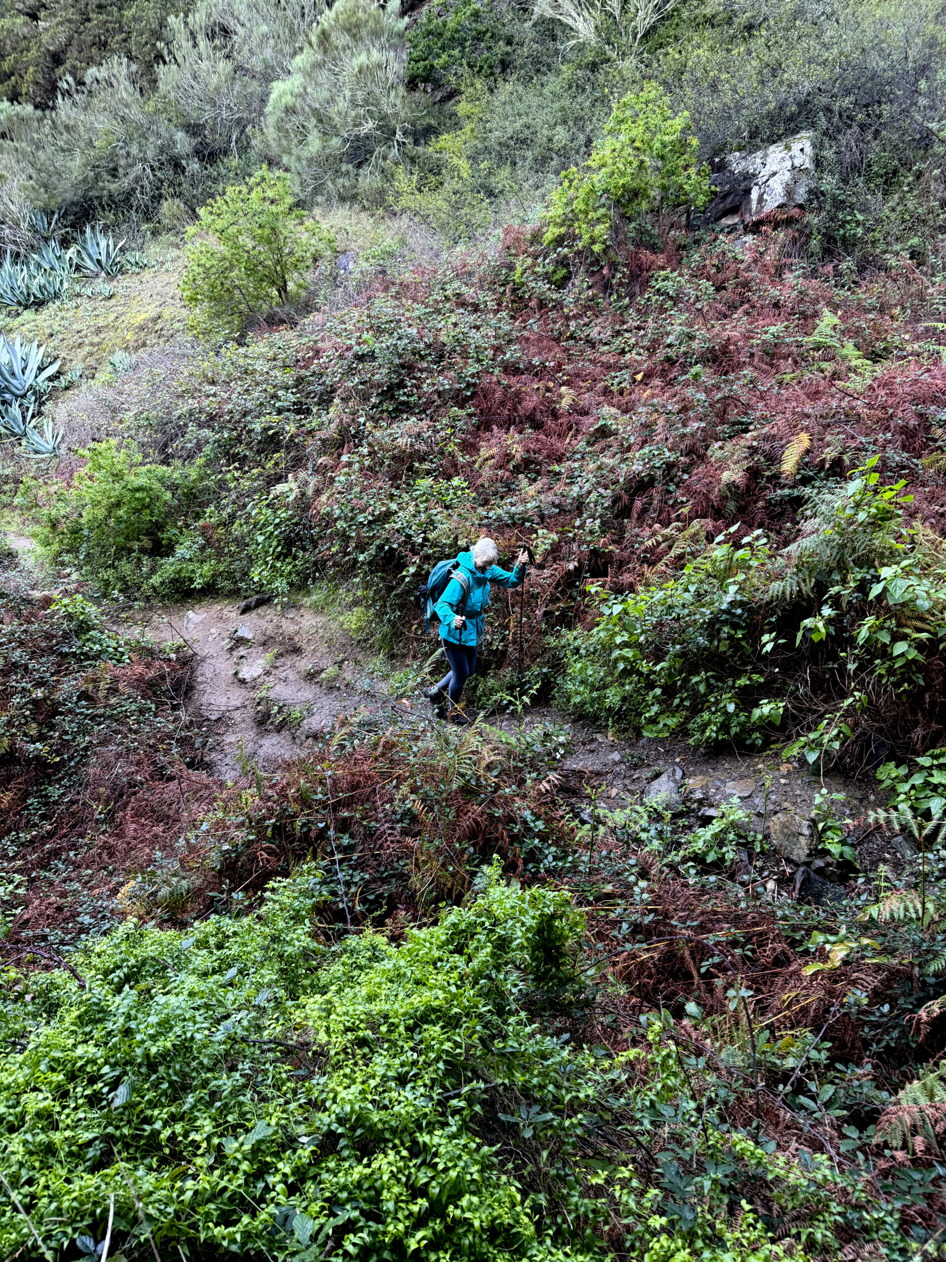
Throughout the entire route you walk on good hiking paths or tracks. However, when we were there in January 2026, the paths were very waterlogged due to the rain and in places slightly eroded and muddy.
Refreshments
There are no refreshment stops directly along the route unless you make a detour to the nearby restaurant in Epina or to Alojera. Be sure to carry sufficient water and, if necessary, food.
Variants
This walk connects with several other walks that I will be presenting on SiebenInseln in the near future. A short section of the route follows the long-distance trail GR-132, which circles the entire island of La Gomera. The individual stages of the GR-132 are:
1.0 San Sebastián – Hermigua – approx. 26 km
2.0 Hermigua – Vallehermoso – approx. 19 km
3.0 Vallehermoso – Alojera
4.0 Alojera – Valle Gran Rey – approx. 22 km (stages 3 and 4 combined)
5.0 Valle Gran Rey – La Dama – approx. 18 km
6.0 & 7.0 La Dama – Alajeró – Playa de Santiago – approx. 23 km (stages 6 and 7)
8.0 Playa de Santiago – San Sebastián – approx. 23 km
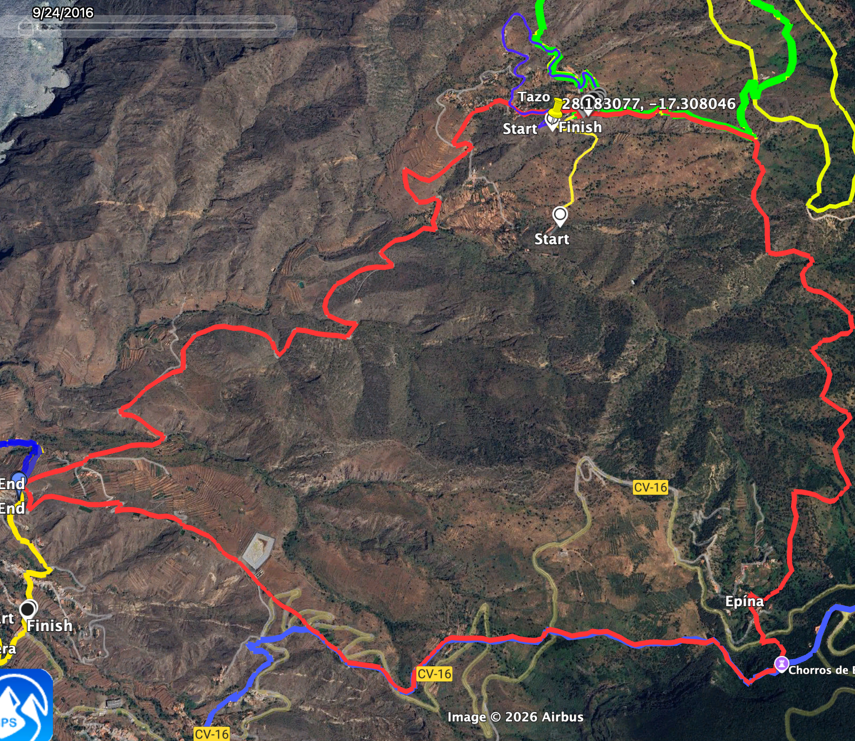
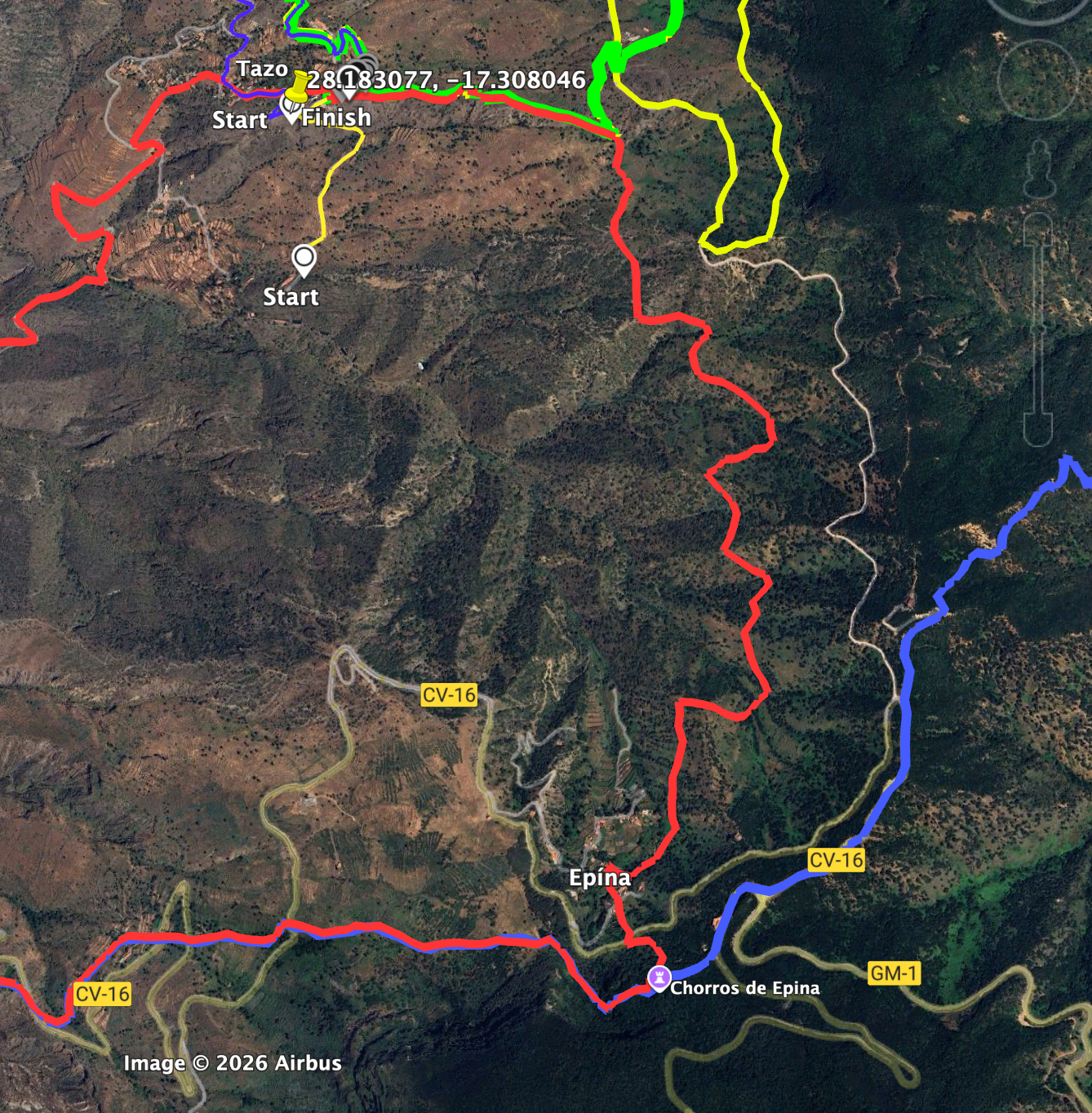
Circular Hike Tazo
Section: Tazo to Epina
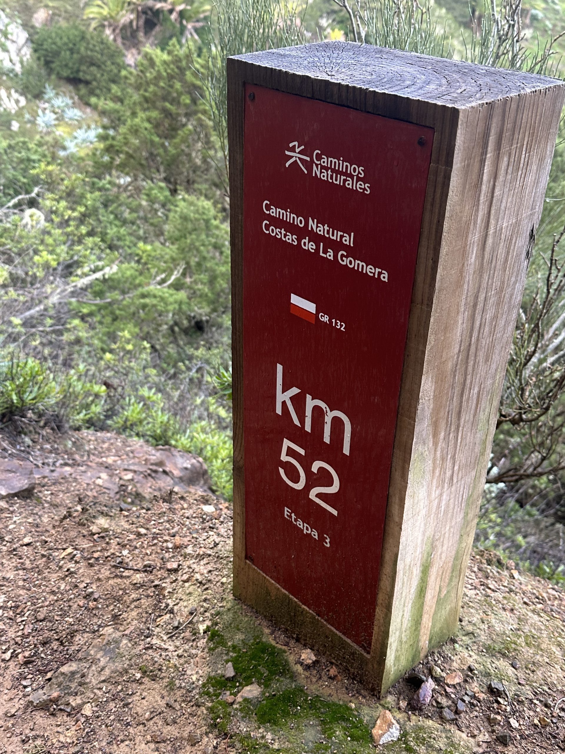
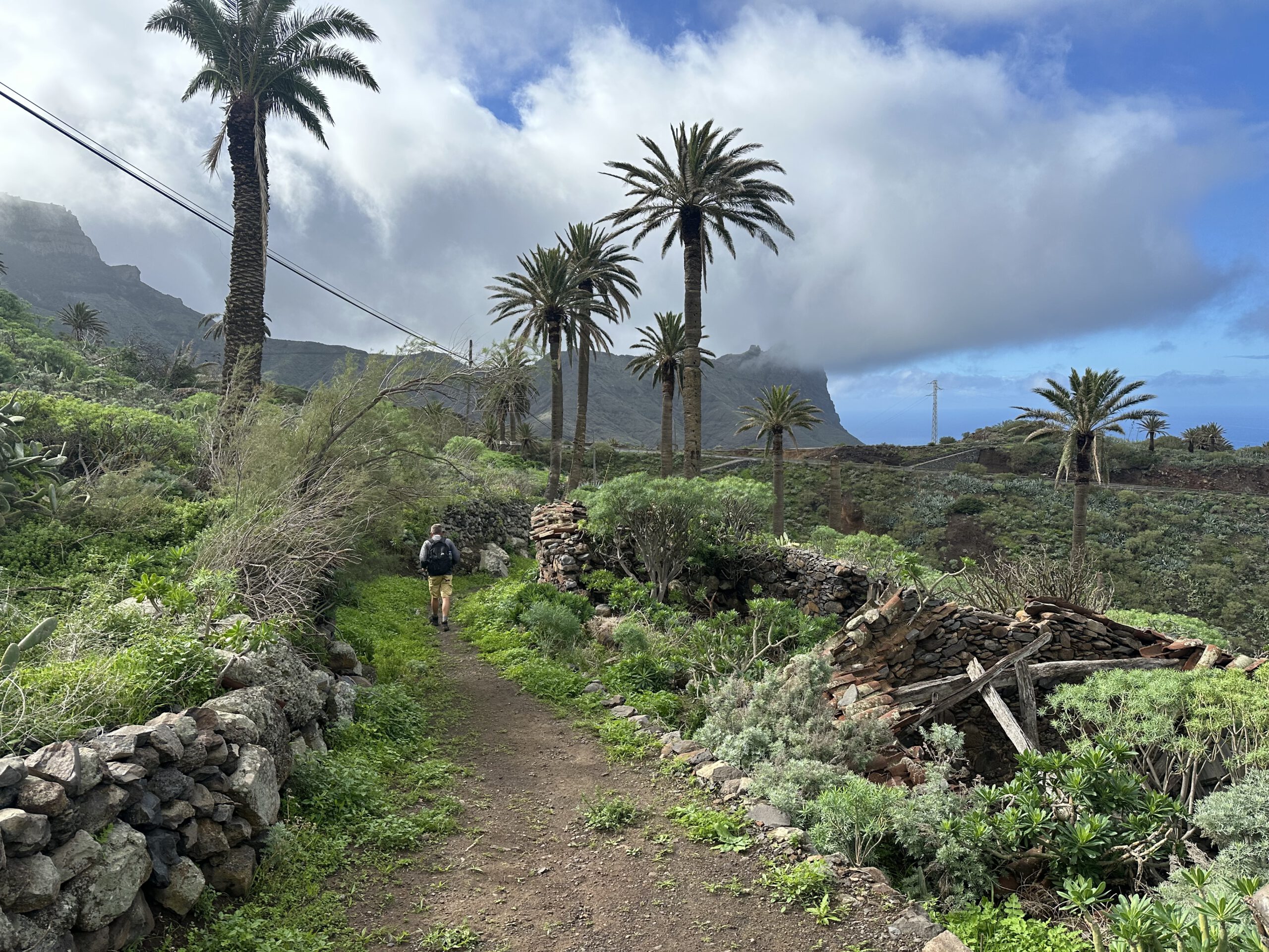
You start your circular walk in the hamlet of Tazo. The Calle Tazo connects the upper and lower houses as an unpaved track. At the point where the highest house in Tazo is located, a path branches uphill from Calle Tazo. This track leads you past the highest houses of Tazo and soon turns into a narrower footpath. Following a ridge path between two small ravines, you ascend to the long-distance trail GR-132, which, like all long-distance trails, is marked in red and white.

You now follow the GR-132 to the right. When we walked here it was very wet, and low-hanging clouds often restricted the views. On clear days, however, the path offers wonderful views across the entire valley, Tazo and out to the Atlantic Ocean. You pass through several ravines, cross ridges and descend again into the next ravine. Above you, you can already see the ridgelines and the cloud forest around Epina. After crossing four larger ravines, you reach the path above Epina.
Section: Epina via the Chorros de Epina to a water reservoir
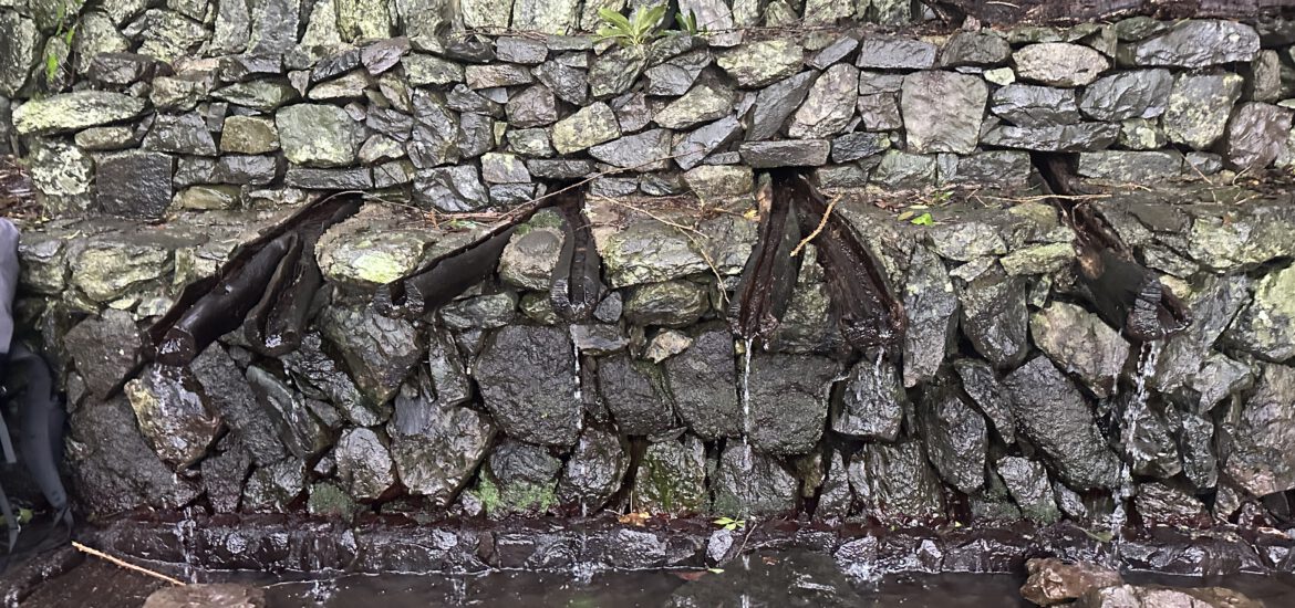
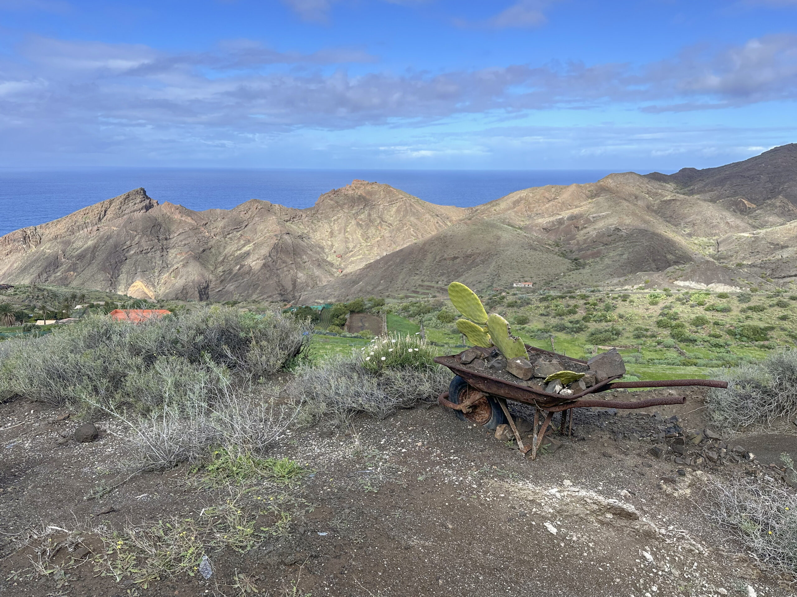
On the GR-132 you skirt around the village of Epina, passing old ruins. A branch to the right leads down into the village, but you continue uphill on steep steps. You then reach and cross the CV-16 road. A narrow, steep path takes you further uphill into the cloud forest. A sign then points right towards the Chorros de Epina. Here, at the seven healing springs made of heather wood, you can not only refill your water bottles. According to legend, the water has healing properties. In the past, wealthy families from Vallehermoso reportedly sent their maids to Epina – a full day’s walk – to fetch water from these springs. To prove that the water truly came from Los Chorros de Epina, they had to bring back a leaf from the Aderno tree, which grows only near these springs.
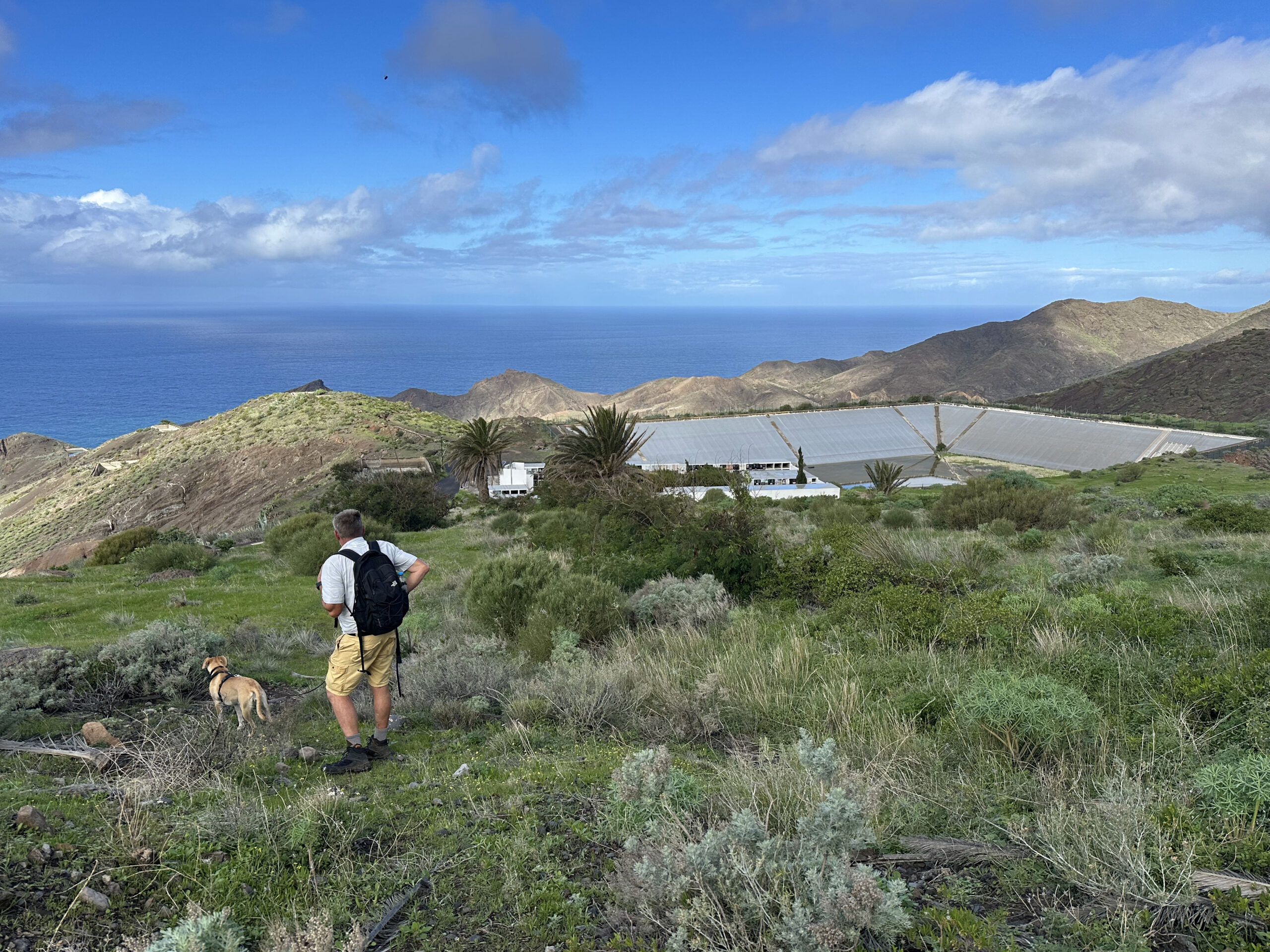
You continue uphill for a short while and soon reach the Ermita de San Isidro Labrador. At this point, the two different sections of the GR-132 between Vallehermoso and Alojera meet. Behind the chapel, the path descends through dense forest. Near a large water reservoir, the path turns west and the forest gradually thins out, allowing increasingly fine views across the wide Alojera valley, the Atlantic Ocean and the neighbouring island of El Hierro.
Section: Water reservoir to the Los Llanos ridge path
This is followed by a long descent through fields and scrubland towards Alojera. Along the way, you cross the CV-16four times, with the footpath continuing on the opposite side each time. After the fourth crossing, the path runs between the road and a house, continuing downhill beside water tanks. When you reach the CV-16 again at a right-hand bend, the GR-132 branches off to the left downhill towards Alojera. You, however, continue straight ahead on a narrow path downhill, crossing the CV-16 three more times.
You then find yourself above the large, empty Embalse de Alojera. The path continues straight downhill and then joins a track that passes to the left of the reservoir. On the Los Llanos track you continue straight downhill, enjoying lovely views of the terraced fields and of Alojera and its surroundings, which appeared beautifully green to us in January 2026 due to the rain.
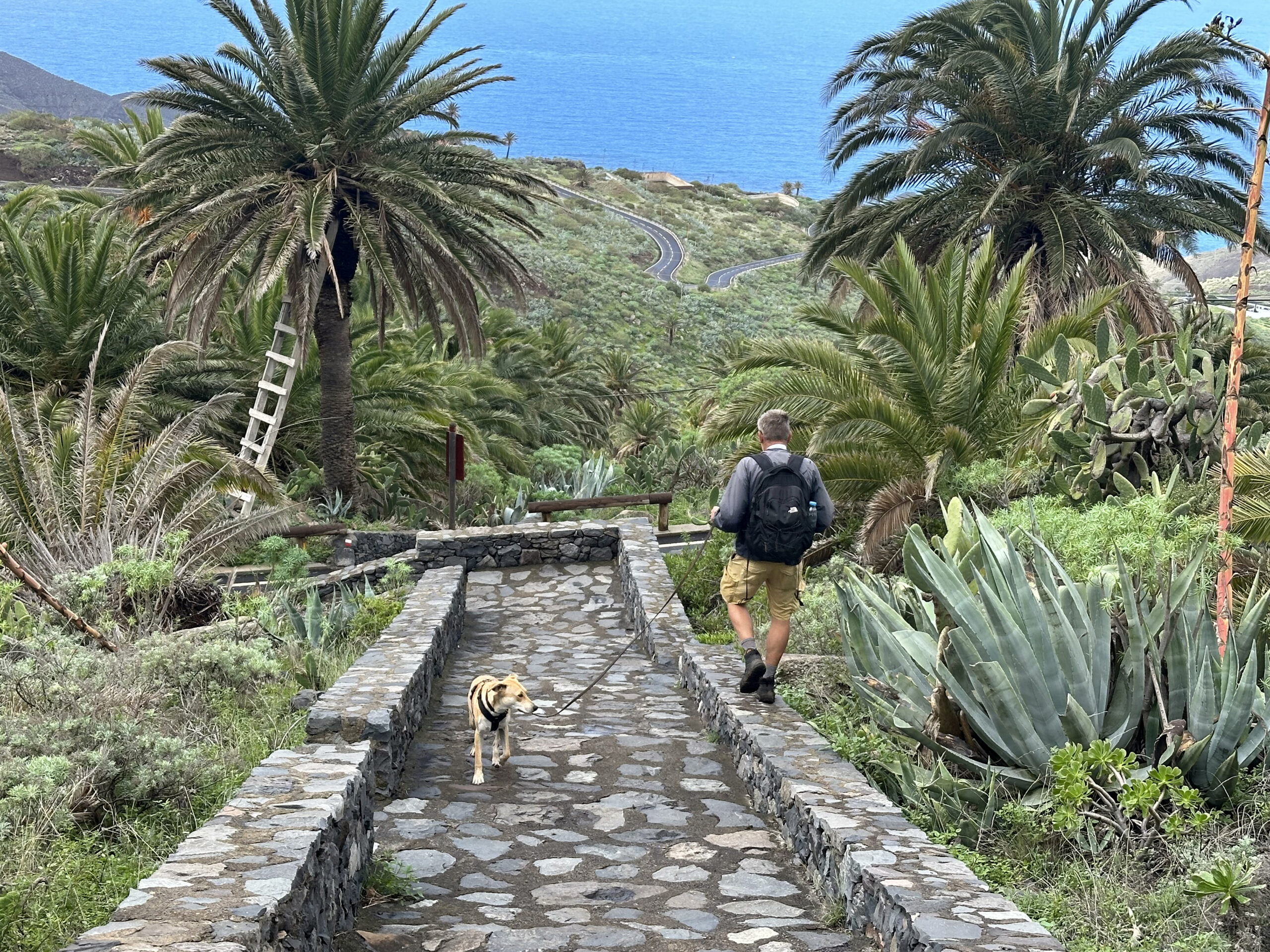
Section: Los Llanos ridge path to Tazo
Ignore paths branching off to the right, as these now cross private land (some were previously shown as walking paths on maps). Eventually, the track makes a large left-hand bend and, after crossing a small ravine, reaches a junction. Running left to right here is the Alojera – Tazo road, which you follow to the right.The road soon turns into a track that curves around the Barranco del Mono. The track then winds in wide hairpins around the Barranco de Tazo, making it impossible to lose your way.
Those looking for a more adventurous option can descend to a small hamlet to the left of the track near Montaña Retarmar, and from there follow a footpath uphill through the Barranco de Tazo. This path alternates between both sides of the ravine, leading uphill towards the hamlet of Cubaba and then on to Tazo. When I was there during heavy rain, I heard from other walkers that this path was impassable due to landslides. We did not try it ourselves, so I cannot comment further. Although the track may seem a little monotonous over time, I personally very much enjoyed this ascent back to Tazo. At a fork, another track branches off to the right towards Cubaba, but you keep left.
After another ascent, a small steep path branches off to the right, leading directly back up to Tazo. Depending on where you are staying, you may quickly return to the centre of the hamlet. For us, and for anyone who started the walk elsewhere, the route continues uphill past the village. You eventually reach the Calle Tazo, which you follow straight uphill. Either take the wide track around a large hairpin bend, or follow a small path uphill through a ravine on the left at a right-hand bend. Both options lead you on a final short ascent back to the starting point of your walk.
And finally
I hope you enjoyed this varied hike in the “wild” west of La Gomera around Tazo. More hikes in this impressive region will follow soon. Whichever route you choose, I wish you great enjoyment on all your walking paths,
Dagmar from SiebenInseln