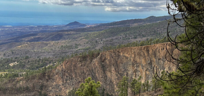
Los Brezos circular hiking trail with high adventure value The Los Brezos circular hiking trail with the official designation SL TF 294 in the Valle de Güímar connects several traditional hiking trails. Part of this trail is also identical to the circular hike around Pico Igonse. Most of the hike runs through agricultural land at […]
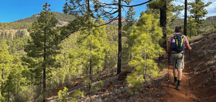
Forest hike
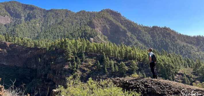
From Artenara to Cruz de Tejeda via a Varied Ridge Trail
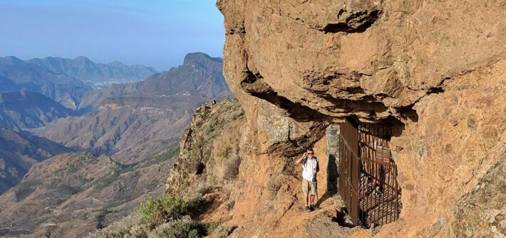
Hiking in and around Artenara Artenara, situated at an altitude of approximately 1,200 metres, is the highest village on Gran Canaria. It stands out for its spectacular location within the island’s Biosphere Reserve and offers breathtaking views of the surrounding mountains, valleys, and ravines. Artenara is renowned for its cave dwellings, carved into the volcanic […]
A Short Circular Walk Around the Montaña de Artenara
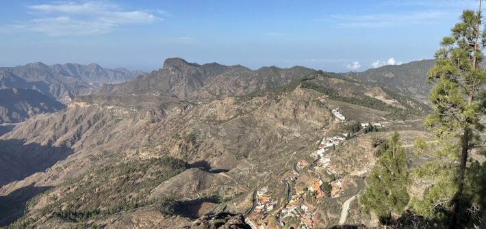
Artenara and the Montaña de Artenara Artenara, situated at an altitude of approximately 1,200 metres, is the highest village on Gran Canaria. It captivates visitors with its spectacular location in the island’s Biosphere Reserve and offers breathtaking views of the surrounding mountains, valleys, and ravines. Artenara is renowned for its cave dwellings carved into volcanic […]
Diverse Hike Circuit Around Trevejos
Trevejos – A Small Hamlet in Southeast Tenerife Trevejos is a small settlement within the municipality of Vilaflor de Chasna on Tenerife. With fewer than 50 residents, it is situated about 3 km from Vilaflor’s centre. The hamlet lies at an average altitude of around 1,640 metres and covers an area of 15 square kilometres. […]
Circular hike from Arico to the El Contador rest area
The El Contador Recreational Area El Contador is a secluded rest area, located 1,250 meters high in the mountains on the eastern side of Tenerife. The surroundings are lush with dense bushes and Canarian pine forests. Among the wildlife species in this area, you can find blue rock thrushes, woodpeckers, various beetles, and butterflies. This […]
Circular Hike through Many Gorges around Montaña de las Lajas
Las Lajas – Picnic Area and Great Starting Point for Hikes The picnic area, Zona Recreativa Las Lajas, is located in the southwestern part of the island of Tenerife at an altitude of 2,100 metres above sea level along the TF-21. Due to this altitude, temperatures can vary significantly between seasons and even between day […]
Two Major Hiking Routes around Vega de San Mateo
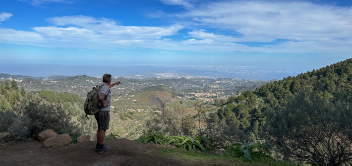
Vega de San Mateo – a Rural and Traditional Mountain Village Vega de San Mateo is a municipality in the central part of the Canary Island of Gran Canaria. It is a rural and traditional community known for its agriculture, markets, cultural festivals, and natural beauty. Situated at an altitude of 800 meters in the […]
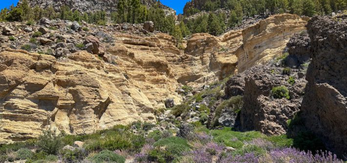
Circular Hike Azulejos de Veneguera
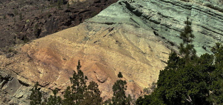
Azulejos de Veneguera – The Colourful Rocks of Gran Canaria The Azulejos de Veneguera are located in the south of Gran Canaria on the GC-20-200 between Mogán and Aldea de San Nicolás. Colourful rocks and entire rock bands are commonly found on the Canary Islands. However, the Azulejos de Veneguera shine with a unique intensity. […]
A Leisurely Stroll Through the Cloud Forest from Arure to Vallehermoso
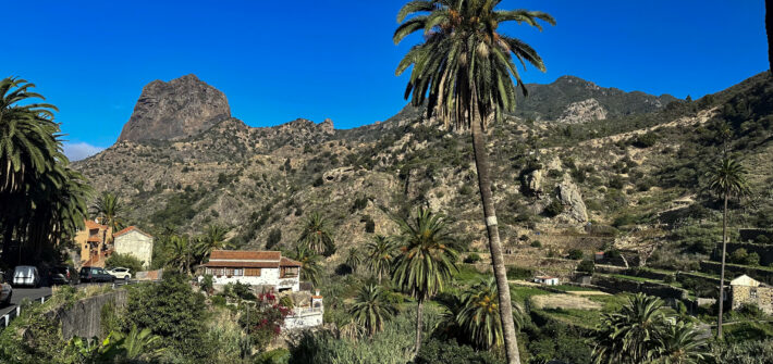
Arure – a Mountain Village in an Extraordinary Location The small mountain village of Arure is situated at an altitude of 825 metres above Valle Gran Rey. The locals often share the tale that Arure was once the seat of the ancient Canarian king after whom the large valley is named. What is certain is […]
Short Circular Hike around Roque Nublo
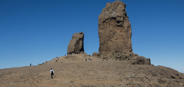
Roque Nublo – Landmark of Gran Canaria Roque Nublo (the Cloud Rock) is an approximately 65-meter-high imposing rock located in the center of the island in the Tejeda district on Gran Canaria. This impressive rock is considered the island’s landmark. Standing at 1,813 meters above sea level, it is visible from afar and is the […]