From La Caleta to Abades via the Arco de Tajao: A Coastal Path Between Lava and Sea
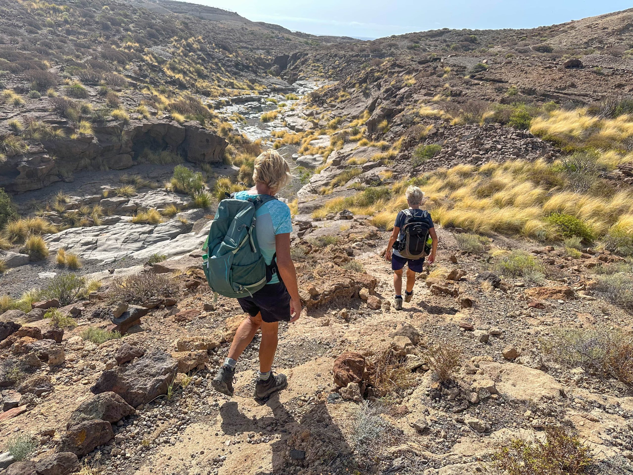
This versatile coastal hike starts in La Caleta, a small, rather inconspicuous coastal village south of Tajao. After just a few steps, you leave the built-up areas and enter a landscape shaped by volcanic rock, sand, and wind. The path runs above the coast over light pumice and darker lava plateaus, always accompanied by views of the vast sea. This area is part of the dry southeast coast of Tenerife, where little vegetation grows and the sun shines almost all year round – an ideal area for a solitary, scenic coastal hike.
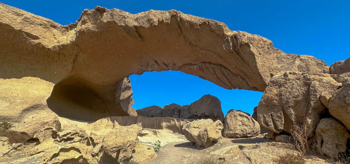
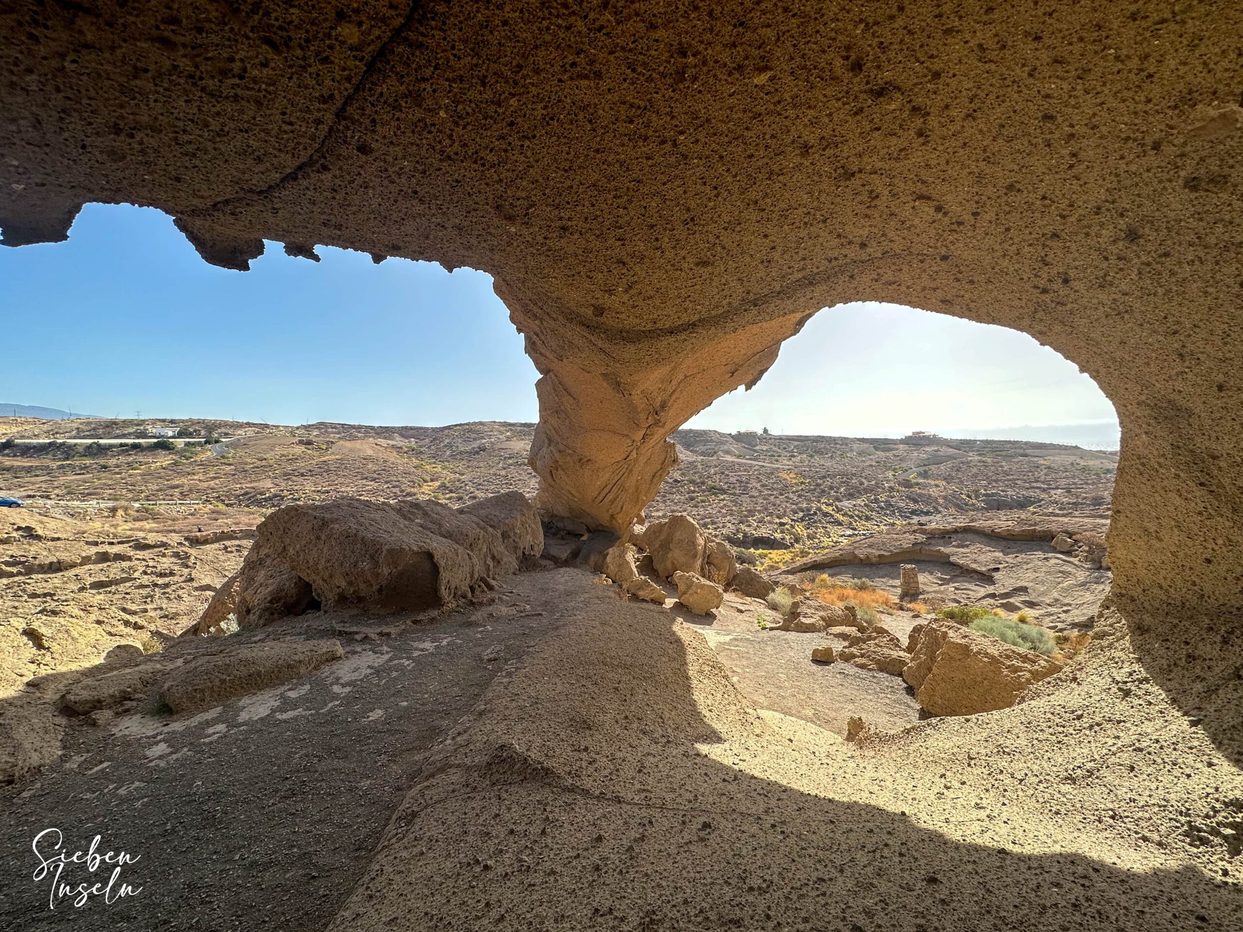
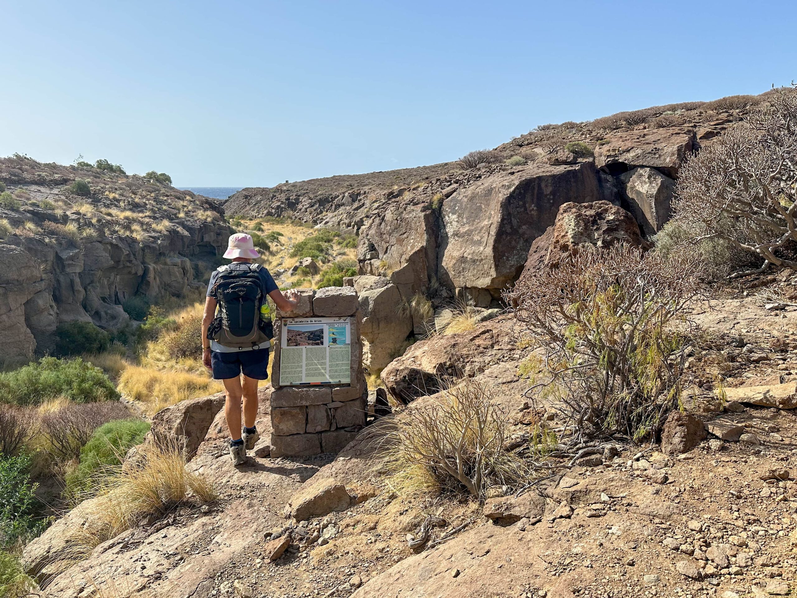
About two kilometres northeast of Tajao lies one of the most remarkable natural monuments of this region – the Arco de Tajao. The natural arch consists of porous, pale yellow pumice, shaped by millennia of erosion from wind and water. With a span of around 30 metres, it is one of the largest natural stone arches in Tenerife. Its curved shape and clear lines appear almost artificially modelled, yet everything is natural. The Arco de Tajao is slightly inland in a small ravine and can be easily reached on foot during this hike. Particularly in the early morning or late afternoon, when the light emphasises the rock formations, a nearly magical atmosphere unfolds here.
Hike from La Caleta via the Arco de Tajao to Abades
After the coastal hike from La Caleta and visiting the Arco de Tajao, the route continues along the cliffs. You reach the tranquil coastal village of La Jaca, which you walk through. The next neighbouring village is La Listada. Afterwards, you continue through the impressive coastal landscape to Abades. There I have already described a small hiking loop in the “ghost town Abades”.
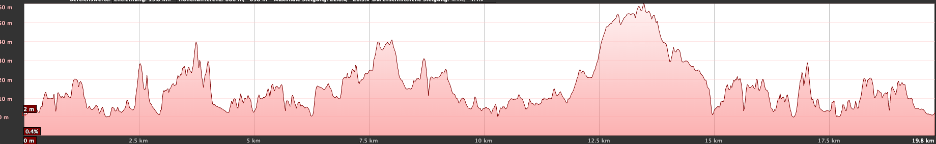
To avoid retracing the same path, I chose some alternative routes on the return journey so you can see other places. Overall, the hike is quite long at about 22 kilometres, so it may not be suitable for everyone. For some, a “one way” option may be sufficient. Regardless, there are many ways to visit the famous Arco de Tajao on a shorter route, which I will present under the section Variants.
General Information on the Arco de Tajao Hike (La Caleta–Abades)
Starting Point and Arrival
The starting point of the hike is Calle el Río in La Caleta at the southern end of the village near Playa Callaos de Las Maretas.
Arrival by Car
You can reach La Caleta from the north and south via the TF-1 motorway, taking exit 49 towards La Caleta. Via Calle de Arico, you reach La Caleta. At the first T-junction, turn right. This is already Calle el Río. You can look for parking there or in the small side streets.
Arrival by bus
The Titsa bus line 430 goes to La Caleta de Arico. Details and further information can be found on the Titsa homepage.
Time
I rarely give general time estimates for hikes, as the times vary greatly individually. For this fairly long hike with long breaks (e.g., coffee stop in Abades), we needed 7.5 hours.
Elevation Difference and Route Length
The elevation difference is about 870 metres (which is considerable for a coastal hike) and the route is 22 kilometres long.
Requirements
Throughout the round, you generally walk on good hiking or service roads. Occasionally, the paths over some cliffs, rocks, and dunes are a little narrow and steep, but manageable.
Refreshments
You will find refreshment options in La Caleta, in Abades, and also in the small villages in between. Nevertheless, be sure to take sufficient water.
Variants
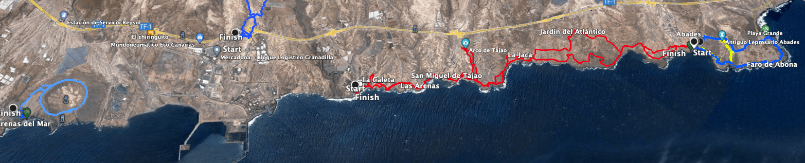
The very long hike can be shortened in many ways. You can either do only the outward or return journey and take the bus back, or divide the entire route into sections and explore the coast gradually. If your main goal is the Arco de Tajao, you can also hike there from La Caleta or La Jaca and return. And for the very “lazy” ones (which surely don’t exist on SiebenInseln 🙂 ), you take exit 46 from the TF-1 and stop at the TF-631 or TF-632. From there, the Arco de Tajao is just a few steps away.
Nearby Hikes on SiebenInseln:
Small hike near the ghost town Abades
Montaña Pelada – small hiking loop over a large volcano
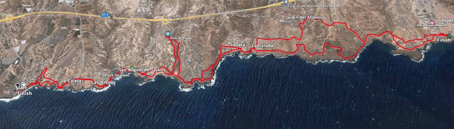
Hike Arco de Tajao (La Caleta to Abades)
Section La Caleta to San Miguel de Tajao
You start your hike at the indicated point on Calle el Río and at the end of the street turn left into Avenida Santiago. You now walk straight ahead between the houses with views of the Atlantic on your right. At the end of the street, turn left into Avenida la Caleta. In front of you lies Playa del Río, which you now cross. At the end of the small beach, scramble uphill to the left until you reach a path. This is still Avenida la Caleta. Alternatively, you could have walked around the beach along the same route (we did this on the return journey).
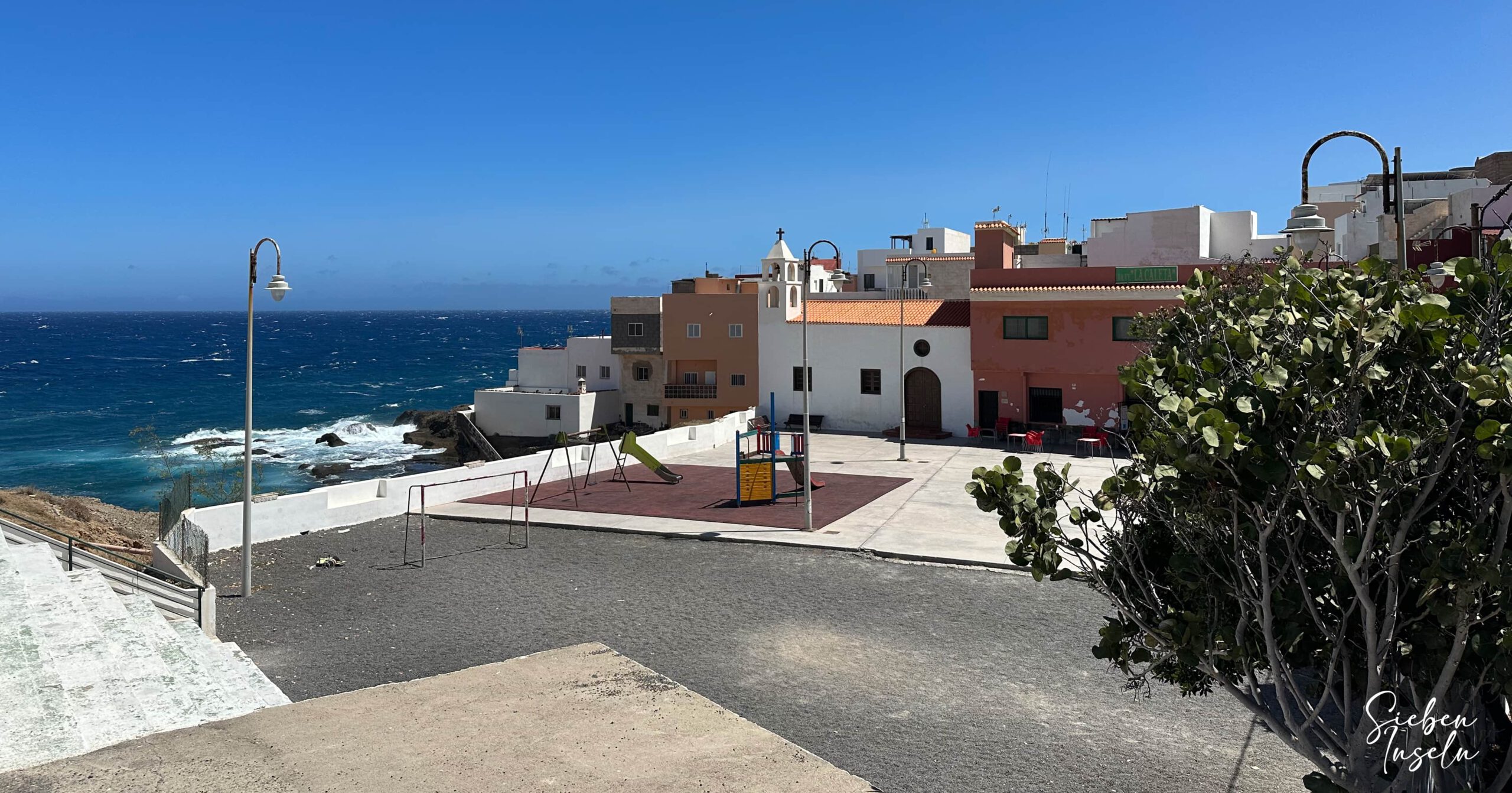
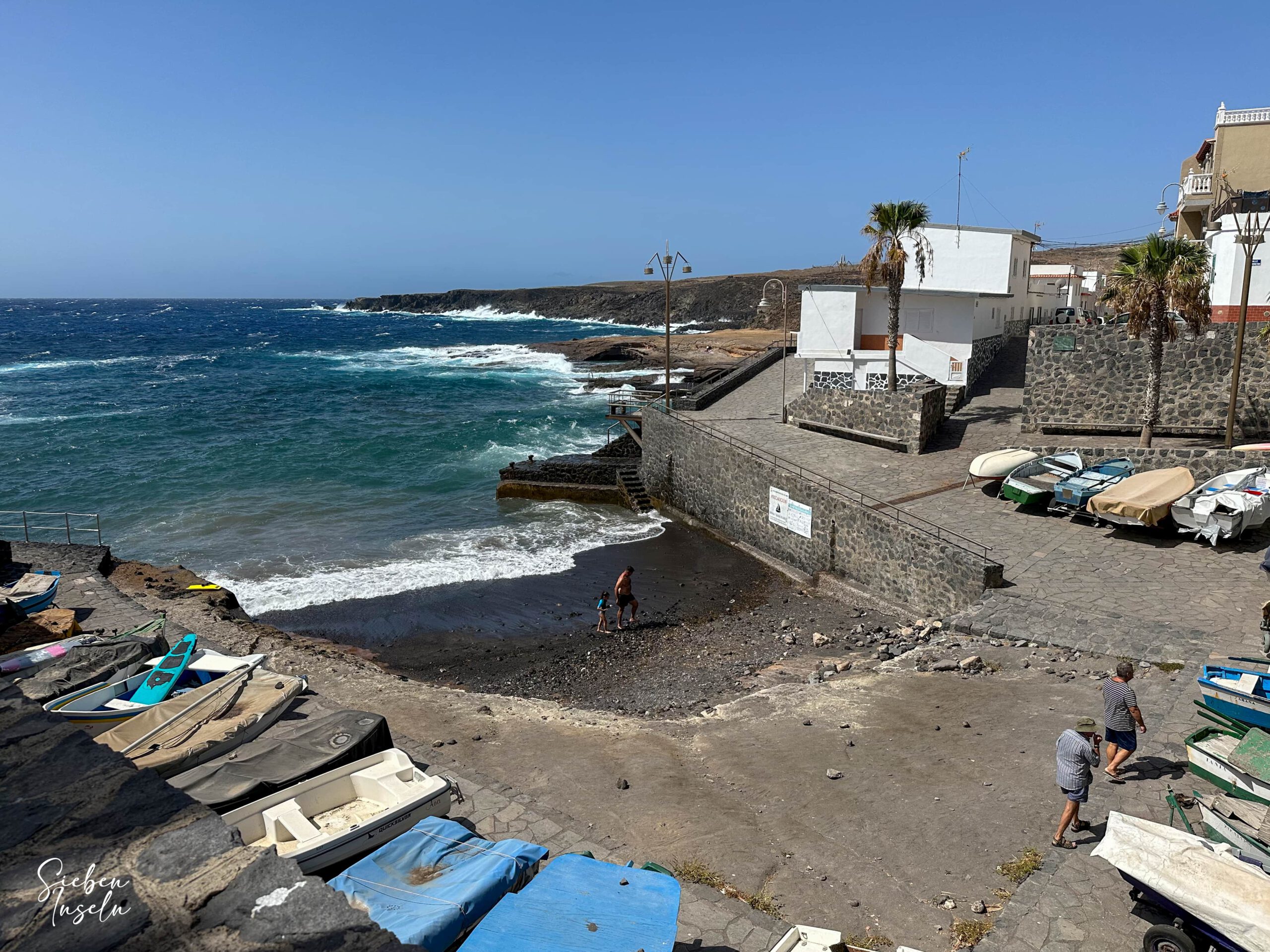
Continue along Avenida de Caleta through the village on the other side of the small bay. We made a detour to the coastal road. Shorter is simply to continue along the Avenida. Shortly after the village, turn right onto the coastal path, which leads you along Avenida Punta Los Surcos directly along the coast. Beyond the last houses, continue along the coast on Calle Callao Hondo. Follow this path straight ahead and circumnavigate Playa de Coyado Hondo. Back at the beach, you find yourself at Playa de Tajao and thus in San Miguel de Tajao.
Section San Miguel de Tajao to Arco de Tajao
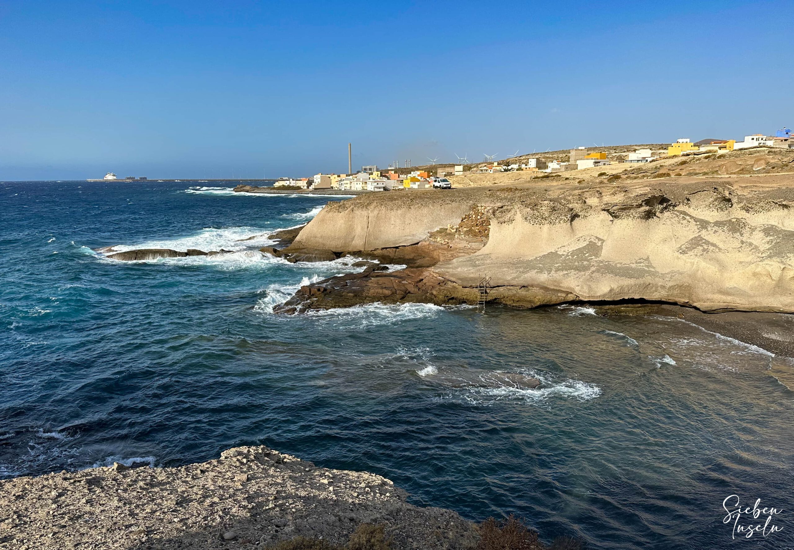
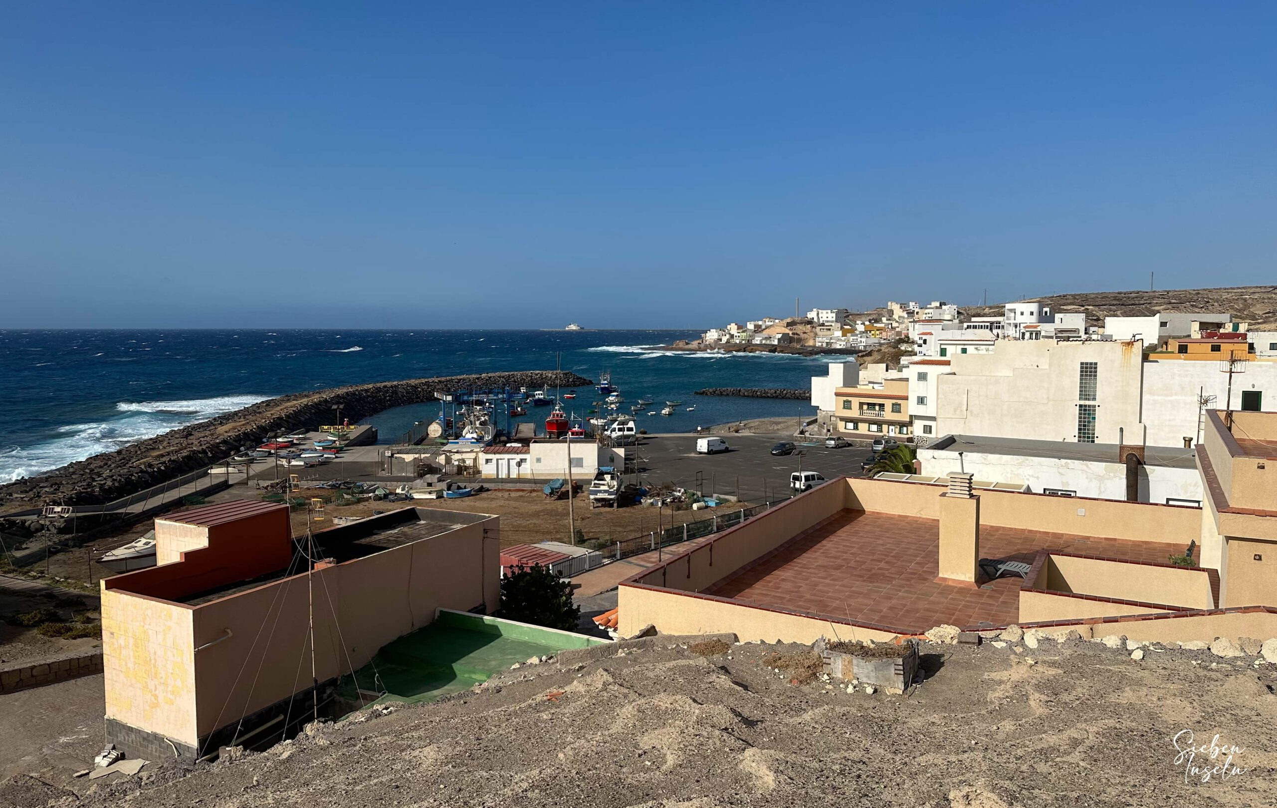
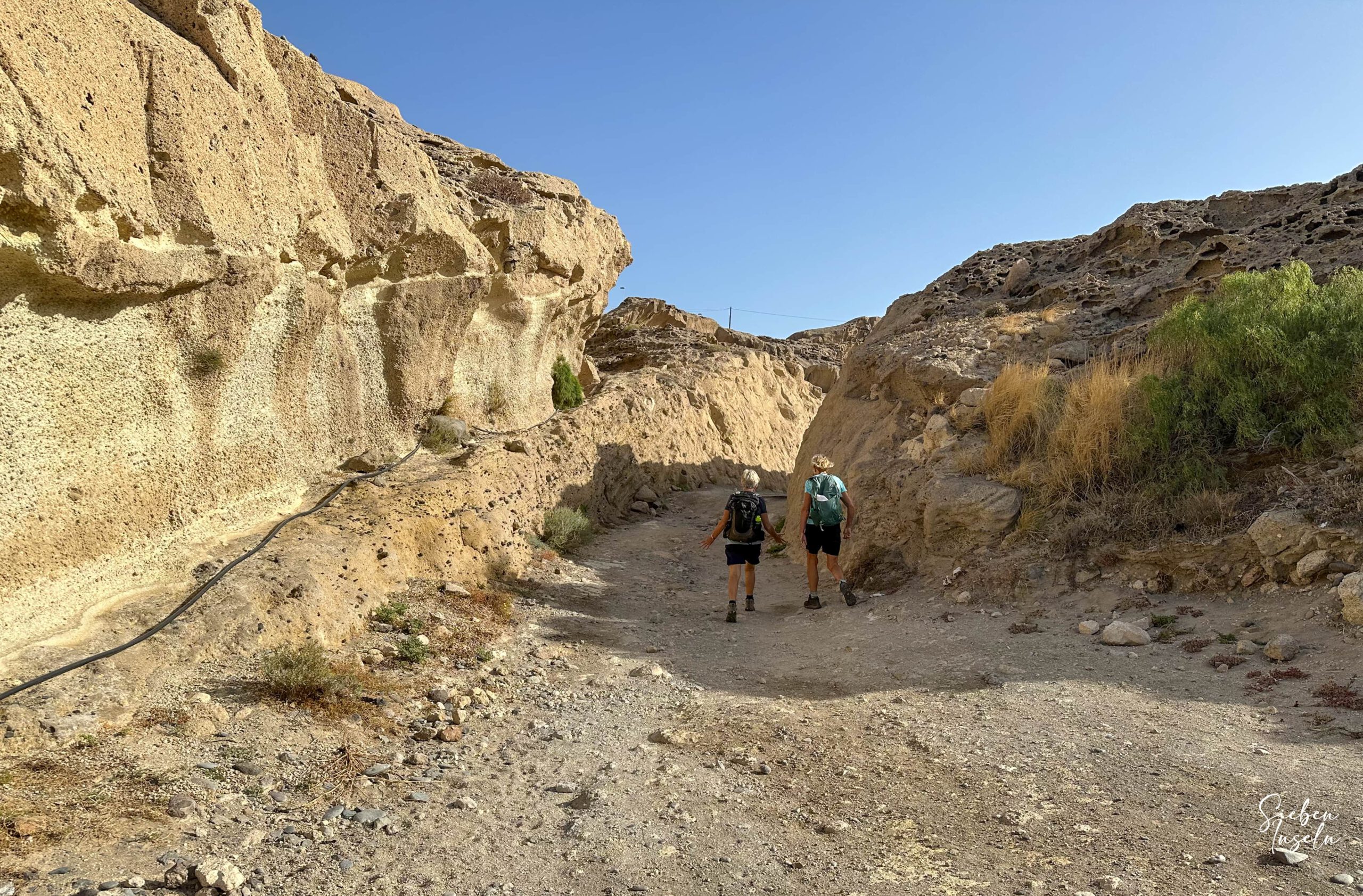
At the end of Calle Callao Hondo, continue straight onto Calle el Charco. After crossing Plaza de la Aurora, continue on Calle Callao Hondo. Passing between houses, you reach the harbour. Then you are at the edge of the village and back on the coast. Ascend to the left on the sandy cliffs, which you cross somewhat without a path until you finally reach the broader coastal path heading north. Turn left into Barranco Vijigua. You walk on a narrow path along the left side of the ravine.
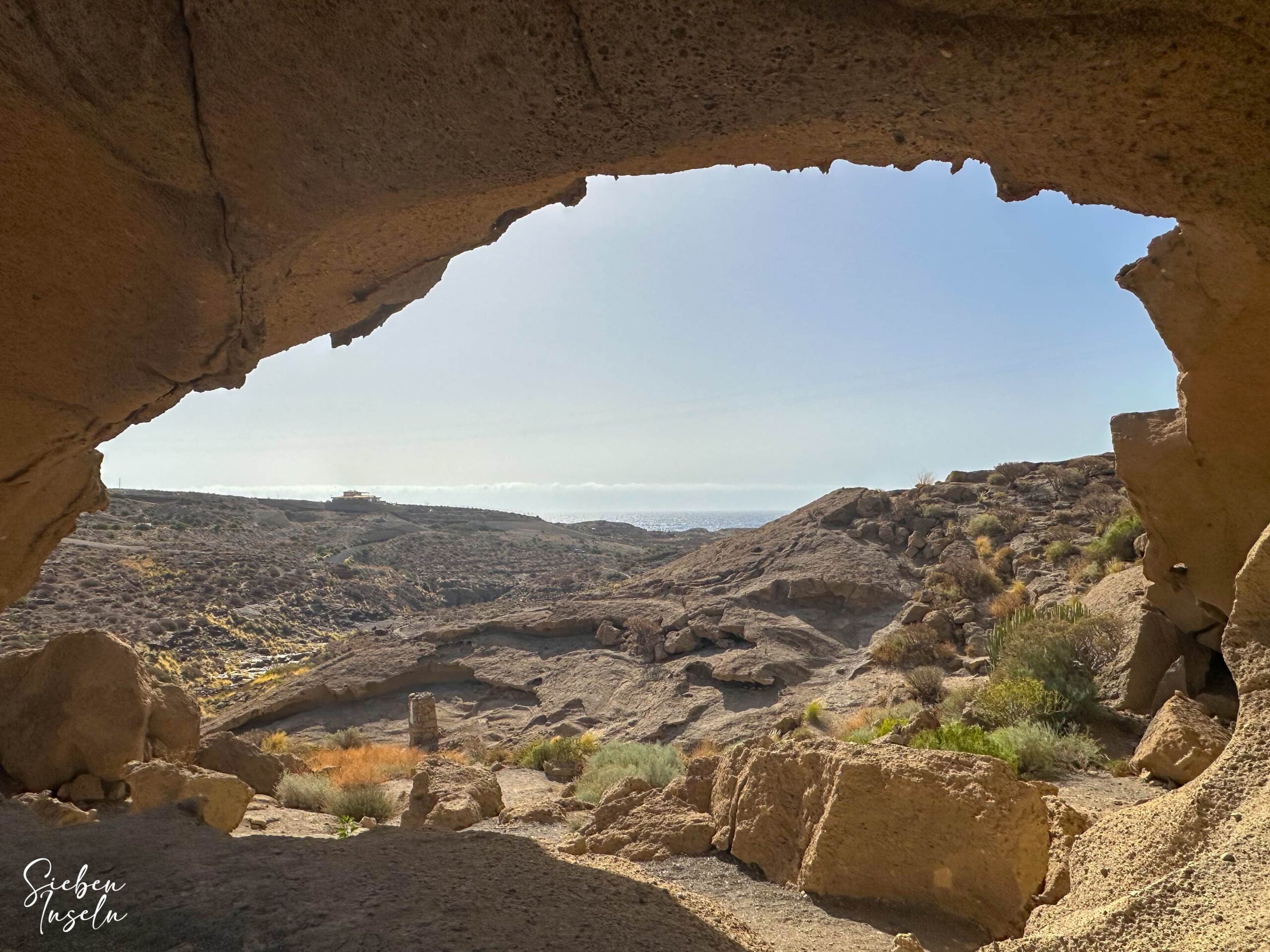
Keep heading northwest. After some time, you will already see the impressive sandstone arch Arco de Tajao ahead. It is really worth spending a little longer here to climb the large arch, enjoy the view, and explore the surrounding area in detail. A great spot for good photos and perhaps a picnic. Since the arch is also accessible by car, you will usually not be alone.
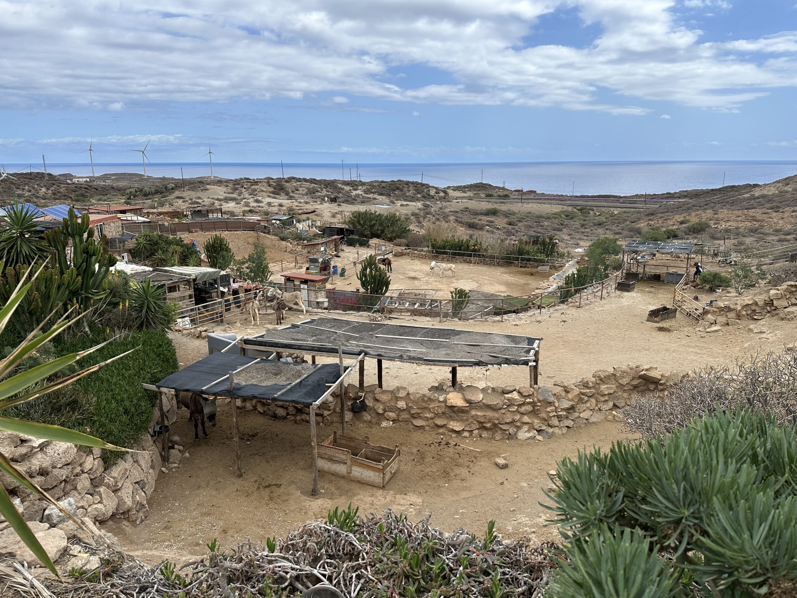
Not far from here is Tenerife Horse Rescue . Since many people voluntarily care for injured and abandoned animals there, I would very much like to mention this organisation here. If you have time during this hike or another occasion, a visit is worthwhile. There are very interesting guided tours explaining in detail the work with the needy animals. Last year, I participated in the March Challenge and, together with my hiking dog Falco, walked almost 500 kilometres in one month to raise money for the animals.
Section Arco de Tajao to La Jaca
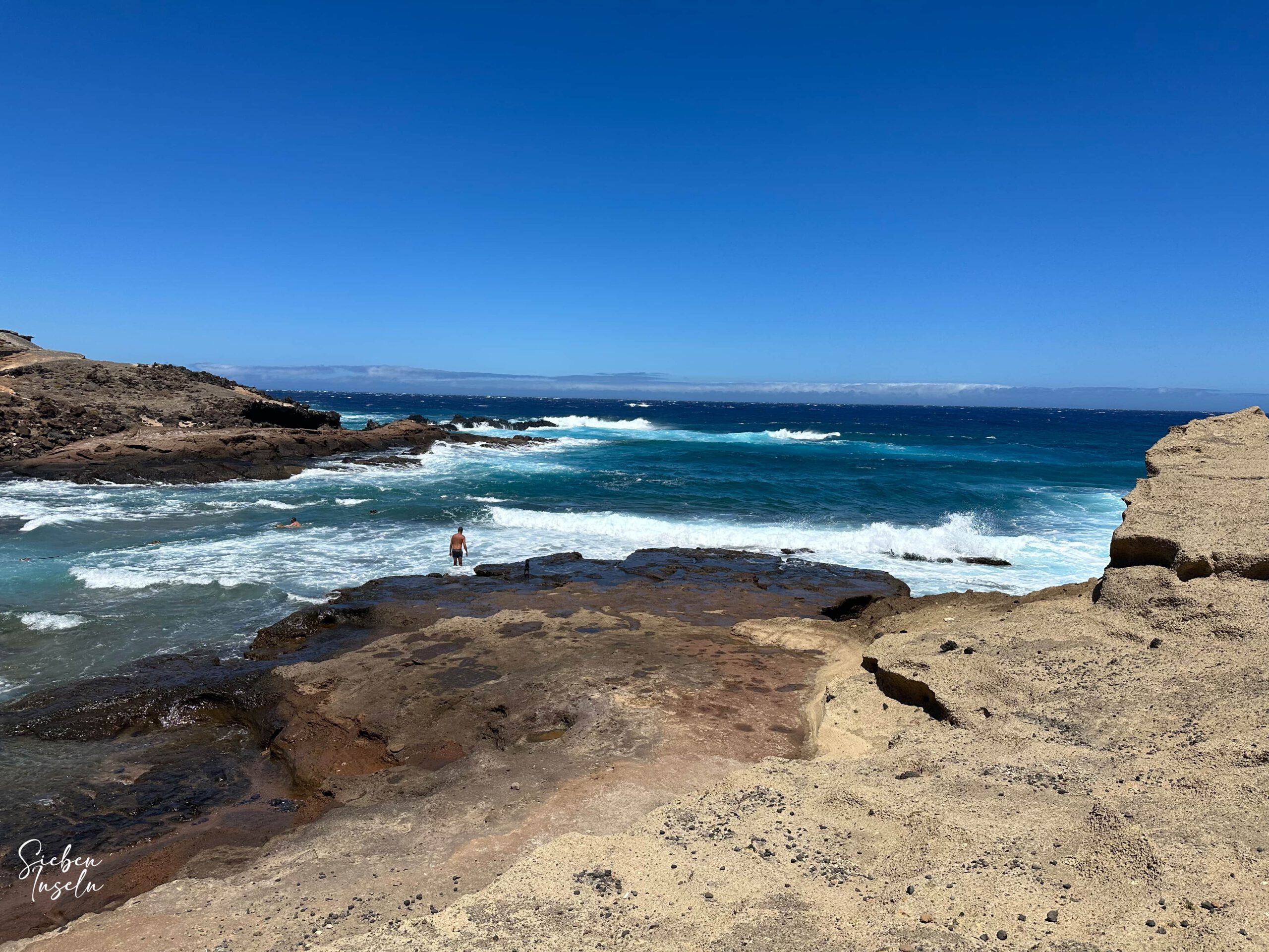
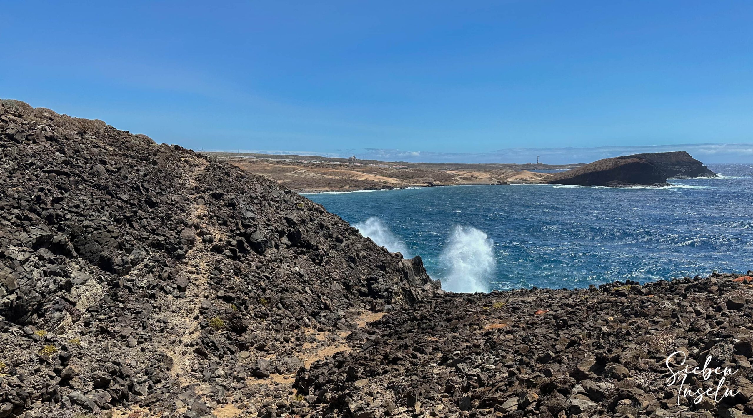
From Arco de Tajao, the return path first takes you on a small path through the Barranco and then along the other side of the ravine over tracks and small footpaths back to the coast. Alternatively, you can follow the bottom of the ravine for a while and then ascend on the left side to return to the main path. Back at the coast, continue your hike to the left towards the east. You walk on a partly rocky path over old lava flows. Then you pass through the small bay of Caleta del Sordo over the beach, a small cove with reddish sand.
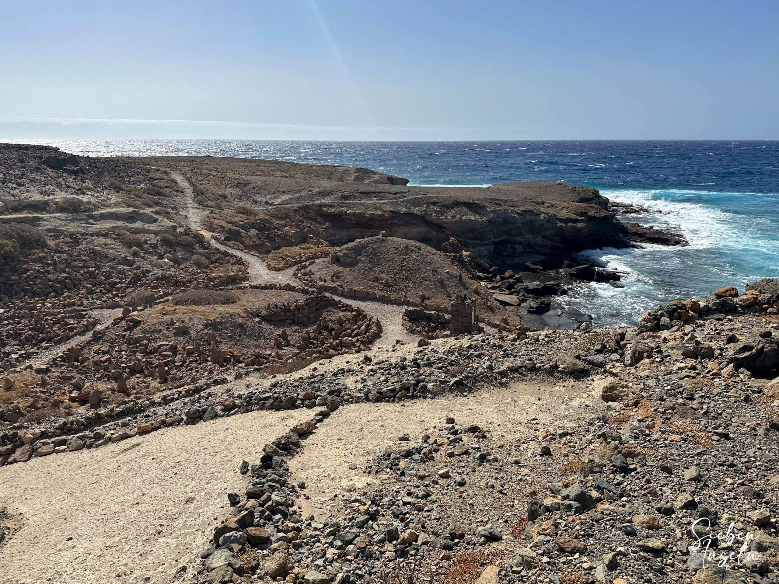
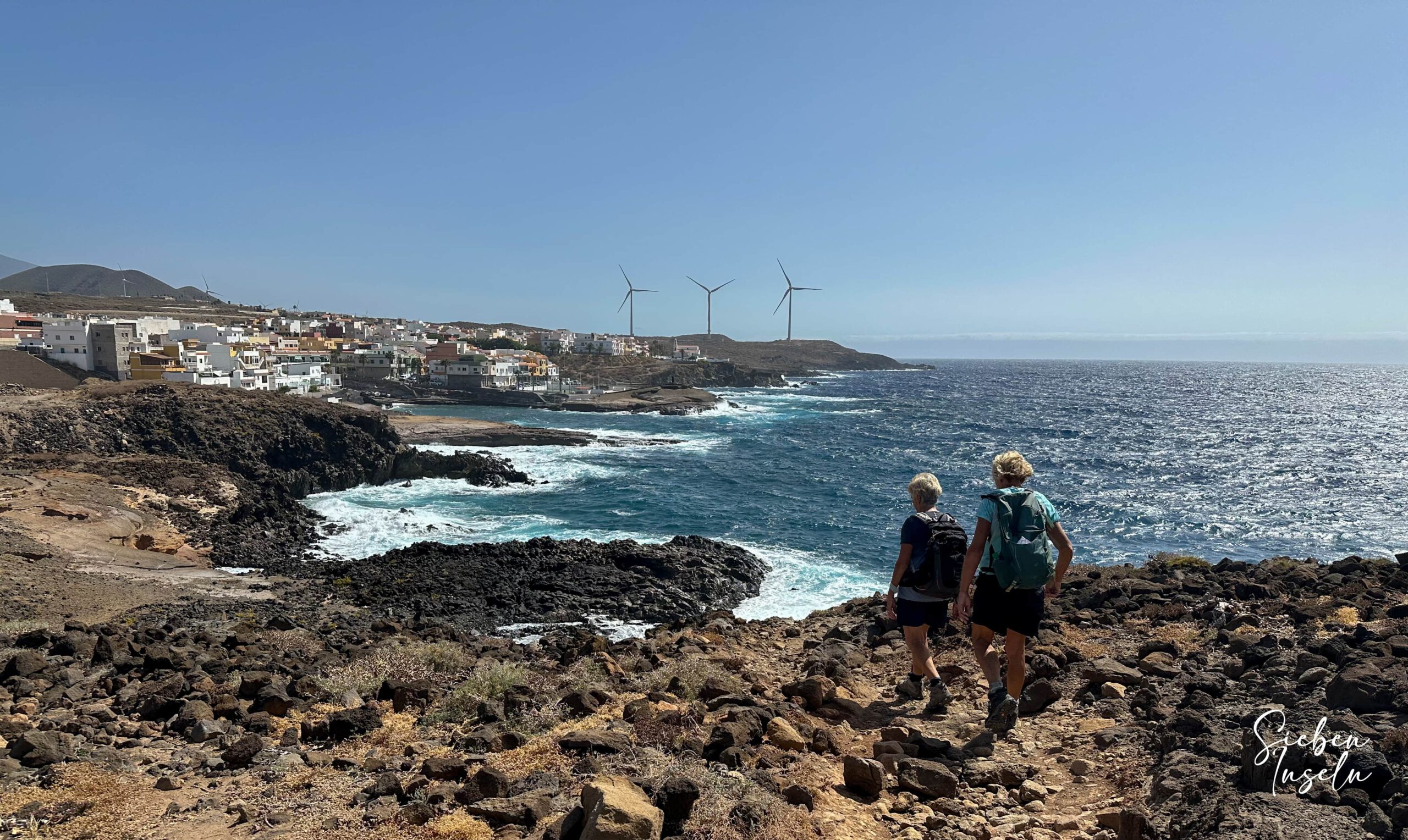
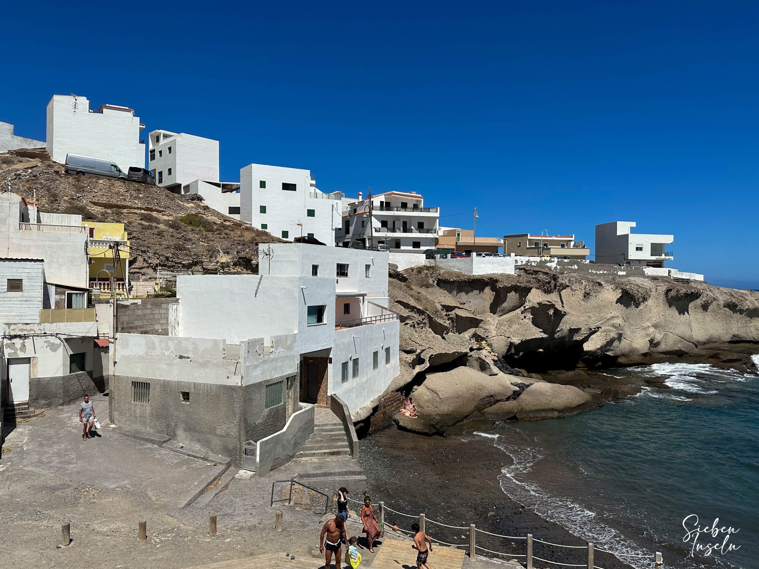
On the other side of the beach, ascend again and follow the coastal path for a long stretch first towards the northeast and then northwest. The path over the lava flows is partially a little steep but offers beautiful views of the coast and the Atlantic. After ups and downs through small bays, you reach a wide, dusty track, which you follow until the first houses of La Jaca appear. In the village, keep to Calle la Respinga parallel to the coast and circumnavigate a small bathing cove. Continue along Calle Aguadulce and then Avenida Maritima, which eventually leads you out of the village.
Section La Jaca to Abades
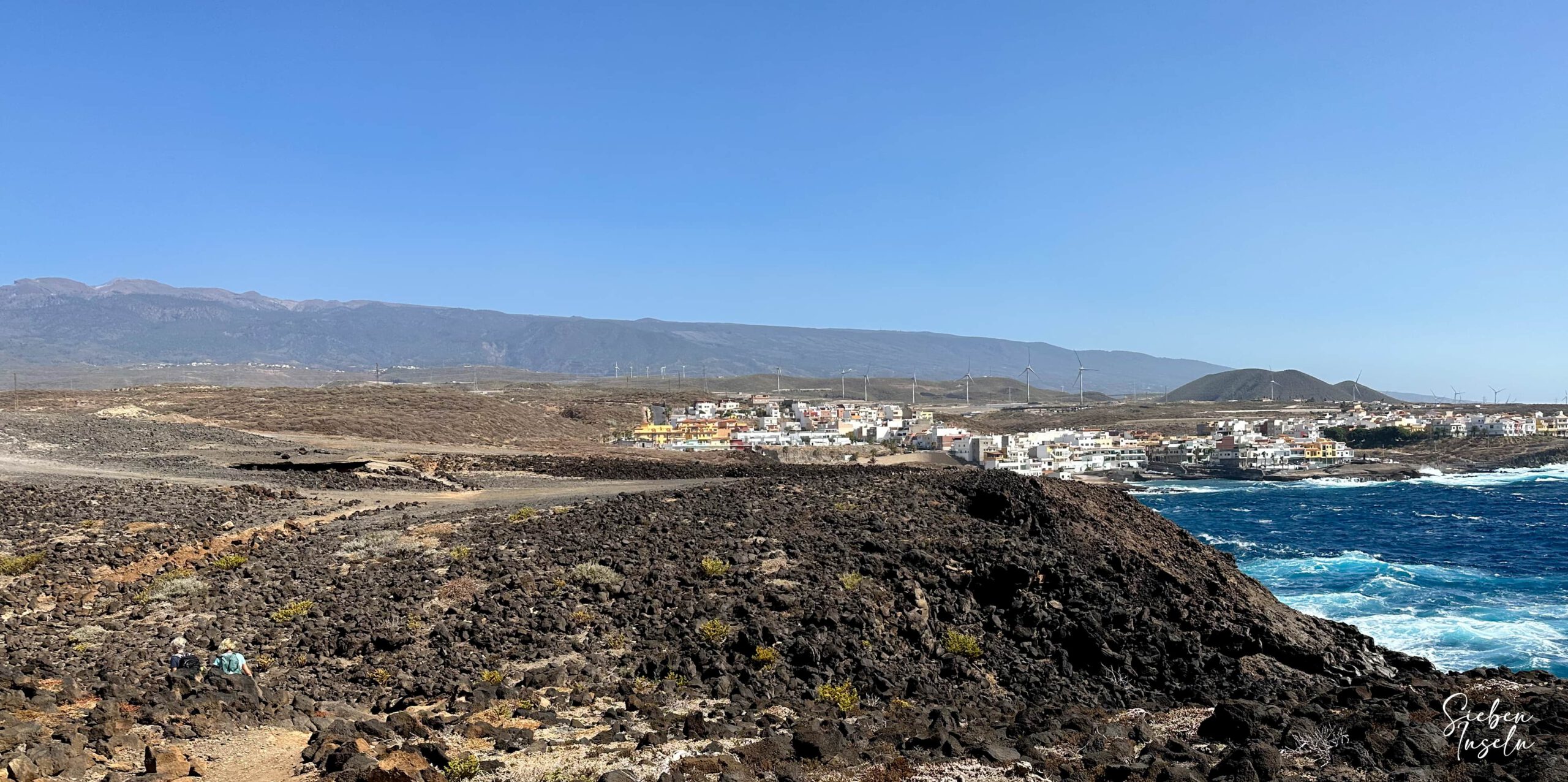
At the eastern end of the village, circumvent a small cove and then reach the neighbouring village La Listada. Walk through the quiet village first on the small coastal road and then on the track parallel to the coast. At the end of the village, continue along the track, which now accompanies you along the coast for a long stretch. Sometimes it rises and moves away from the coast, then descends again through dunes and rocks. You walk over a stony plateau and your path runs over a barren lava landscape with scattered shrubs and sea views. The path alternates several times between track and footpath, sometimes slightly elevated, sometimes right along the cliff edge.
At Punta de los Jureles, the path finally turns north. Continue walking along the cliffs and you can already see Abades in the distance behind the large bay. At the end of the cliff coast, walk along another path towards the west. Circumnavigate the bay and then walk in front of Montaña de Abades. Finally, you reach the first houses of Abades. We went to a café above Playa de los Abades and took a long break. However, in Abades you can also see many other sights, such as the old leper town. Since we still wanted to return, this marked the end of the outward hike for us that day.
Return Section Abades to La Listada
On the way back, we left Abades on the main road. We continued straight on this path and did not follow the coast as on the outward journey. West of Montaña de Abades and Playa la Tabaibita, the paths converge again. You walk around the bay of Abades along the same path. However, instead of following the coastal path on the outward journey, stay on the wide sandy track a little inland from the coast.
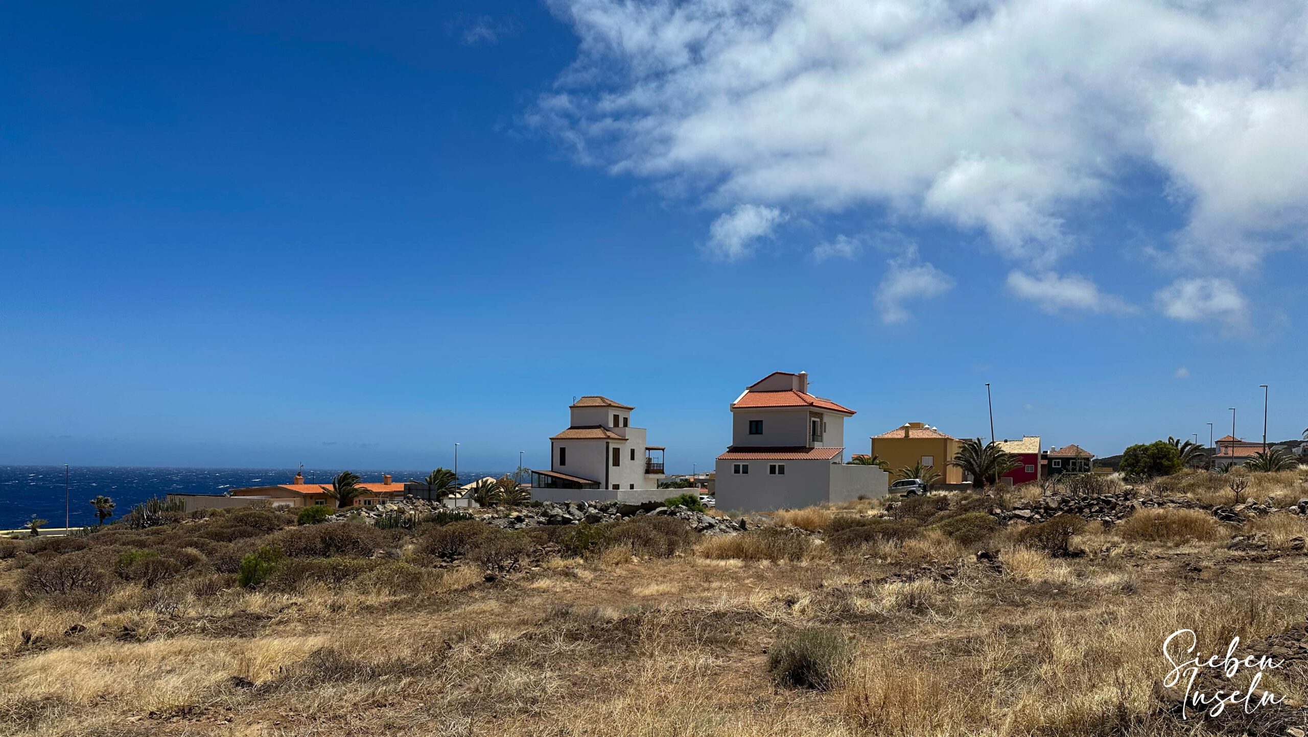
This brings you this time to the small settlement of Jardín del Atlántico. Walk through it westwards and reach a broad sandy track at the other end, which you now follow for a while towards the coast. After some time, it turns southwest and brings you back to the small village of La Listada. This time you are on Calle Vera Cruz, walking west through the village. At the end of the village, turn left onto a street to return to the outward route between La Listada and La Jaca.
Return Route – Section from La Listada to La Caleta
In Listada, and as you leave it heading westwards, you more or less follow the outward route. There are several paths leading towards Camping Caleta del Sordo. You can either walk again immediately along the cliff edge by the sea or take a slightly shorter route along a path further inland. From Caleta del Sordo, you follow the outward route back southwest. You will probably not want to make the detour to the Arco de Tajao again—unless, of course, you have saved this impressive arch for the return journey.
From the coast below the Arco de Tajao, you now more or less follow the outward route. As you can see on my track, we sometimes walked a little along the coastal path and then back along a path further inland. On the return journey, we also did not follow the coast immediately before La Caleta, but rather the wide access road, which brought us into the village slightly further north. From there, we walked down to the beach again via Avenida La Caleta. From the beach, we finally return to the starting point along Avenida Santiago and Calle el Río.
And finally
I hope you have enjoyed this really long coastal walk, including the excursion to the Arco de Tajao. It can actually be varied and adapted in many different ways. Whichever option you choose, I wish you great enjoyment on this walk and on all your other hikes as well.
Dagmar from SiebenInseln