- Ascent to the Fortaleza
- Hard climb and beautiful round around the Galería Vergara
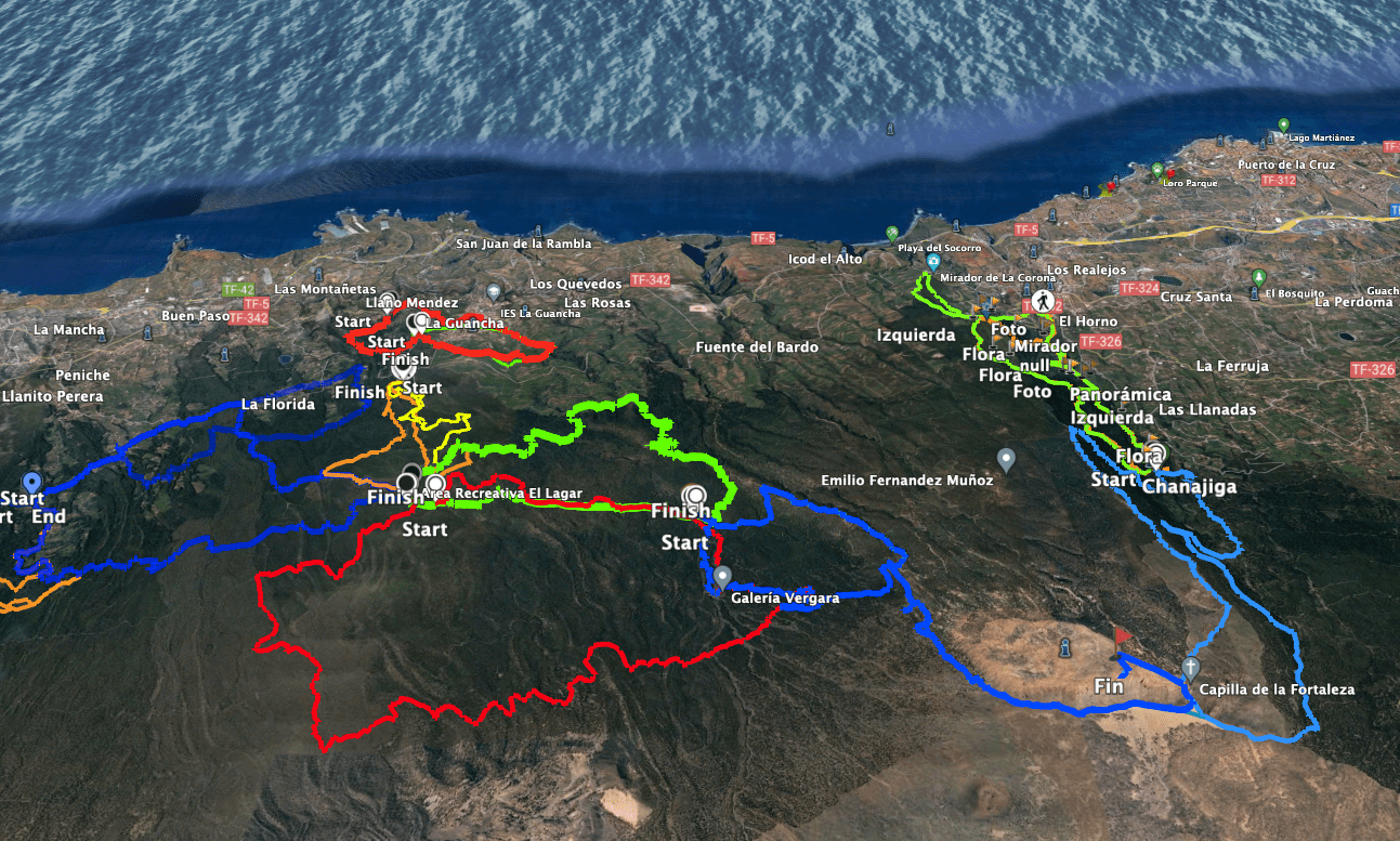
- General information about the round trip Ascent to Fortaleza with Galería Vergara
- Round trip ascent Barranco de la Arena – Fortaleza – Galería Vergara
- Area Recreativa Barranco de la Arena to Juan de la Rambla fire tower section
- Section Fire Tower Juan de la Rambla to Foot of Fortaleza
- Route section foot of the Fortaleza to the summit of the Fortaleza
- Route section top of Fortaleza to Galería Vergara
- Route section Galería Vergara to starting point Fuente de Pedro
- And finally
Ascent to the Fortaleza
There are many ways to hike up the impressive rock massif, which lies to the northeast opposite Teide. The easiest option is from El Portillo. From there, a signposted hiking trail leads towards Fortaleza. This is probably the most frequently used option for visiting Fortaleza. The hike can be combined with the hike to Montaña Blanca.

But there are also options for the ascent from the north-western side of the island. I have already described one tour in the article Ascent to Fortaleza from Chanajiga. And today I describe another way to climb Fortaleza. You start your hike from the picnic area Area Recreativa Barranco de la Arena.

Hard climb and beautiful round around the Galería Vergara
The ascent to Fortaleza from the Area Recreativa Barranco de la Arena is actually quite steep. You hike on good paths, but always and steadily quite steeply uphill. On the Fortaleza you can then take a leisurely look around. You then return along the same path for a while.

But finally you can make a big round tour out of the ascent. You hike moderately downhill through pine forests. You’ll pass the Juan de la Rambla fire protection tower and the large Galería Vergara.

General information about the round trip Ascent to Fortaleza with Galería Vergara
Starting point and approach
Starting point of the hike the rest area Area Recreativa Barranco de la Arena.
GPS: 28.337559, -16.627317

Arrival by car
You come from the north or south on the TF-5 and leave it at the exit for La Guancha. Take the TF-352 to La Guancha. There, take the TF-344 and follow the signs to Area Recreativa El Lagar. A few kilometres beyond La Guancha, a wide forest road (track) branches off to the right from the road and is signposted to El Lagar. Follow this track uphill for 5 kilometres. You will then reach the El Lagar rest area. The road is good to drive on with an off-road vehicle, but normal cars can also drive on it carefully. From El Lagar you can already start if you want to extend the trail. Otherwise, you can continue on the main road for a few kilometres up to the starting point of the Area Recreativa Barranco de la Arena (Fuente de Pedro).
Arrival by bus
You can take the Titsa bus 354 to La Guancha. From there you would have to take a taxi. Details and more information can be found on the Titsa homepage.
Time
I don’t like to give general times for hiking tours, because the times are very individual. I needed about 5.5 hours for this hike with two longer stops.

Difference in altitude and length of the route
The difference in altitude is about 900 metres and the route is just under 18 kilometres long.
Summary information about the article and a large selection of GPS hiking tracks are availableRegister now for my newsletter and get exclusive access to my collected GPS tracks as well as all short information about my articles.
Requirements
You hike the entire time on good driving and hiking trails. However, you should be in good physical condition due to the length of the hike and the tough ascent.
Refreshment
You will not find any restaurants, bars or shops on the entire hike. Therefore, please take enough water with you.
Variants
You can vary the route of this tour according to your needs. It can be combined very well with various other hikes and circular walks from and around El Lagar and the Barranco de la Arena. I will also present other hiking tours in this area in the near future.
Alternatives to get to Fortaleza have already been mentioned above: Montaña Blanca hike and Chanajiga hike to Fortaleza.

Round trip ascent Barranco de la Arena – Fortaleza – Galería Vergara
Area Recreativa Barranco de la Arena to Juan de la Rambla fire tower section
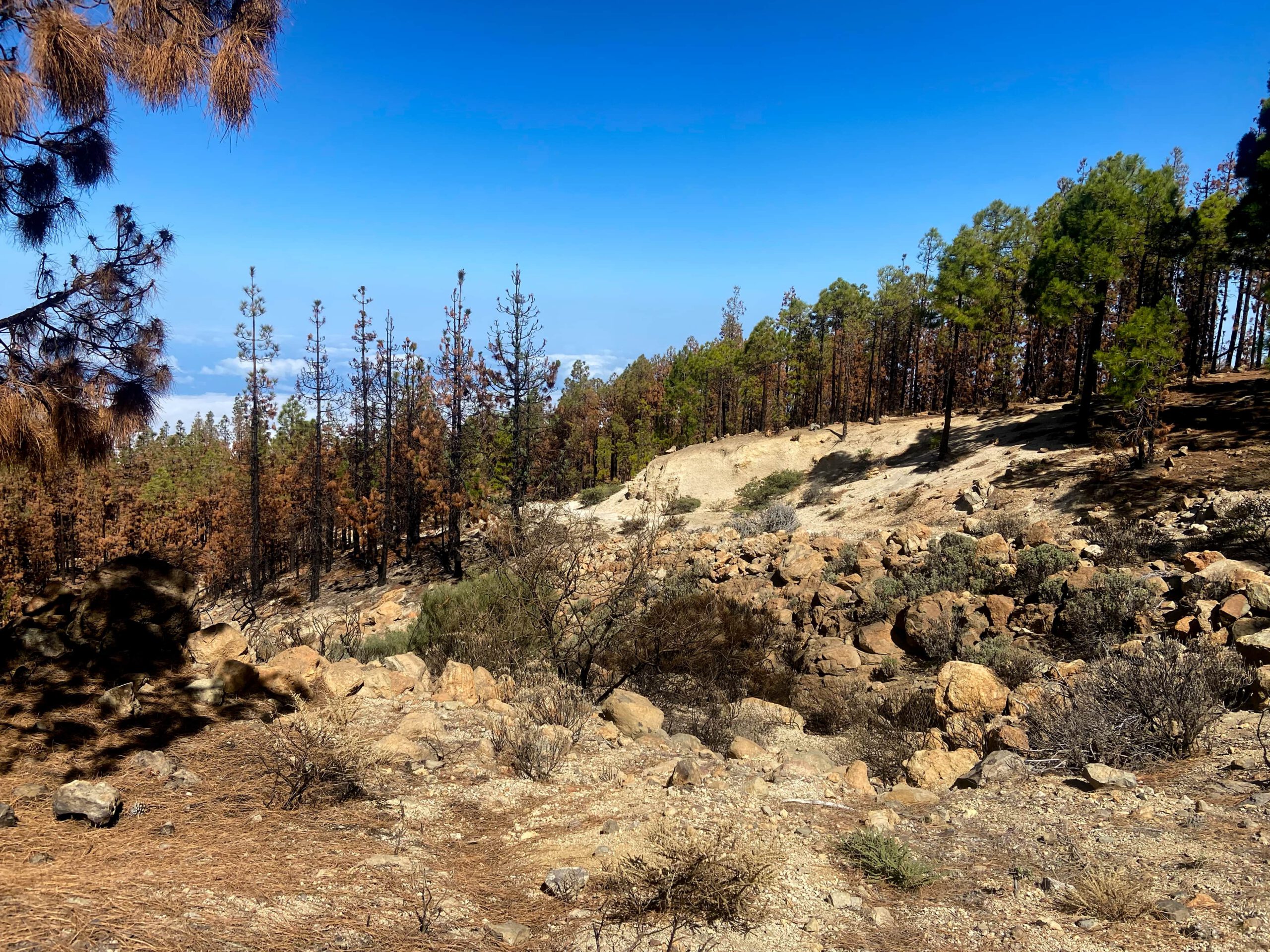
You start your hike at the Area Recreativa Barranco de la Arena rest area. From there, first follow the wide forest road that you used to get to the Area Recreativa Barranco de la Arena and continue straight ahead. The path climbs slightly through the dense pine forest. At a large fork, keep left. Shortly afterwards, the path begins to climb more steeply. It takes you to a wooded ridge. On this ridge path to the right of the Barranco Atalaya you are already climbing steeply.

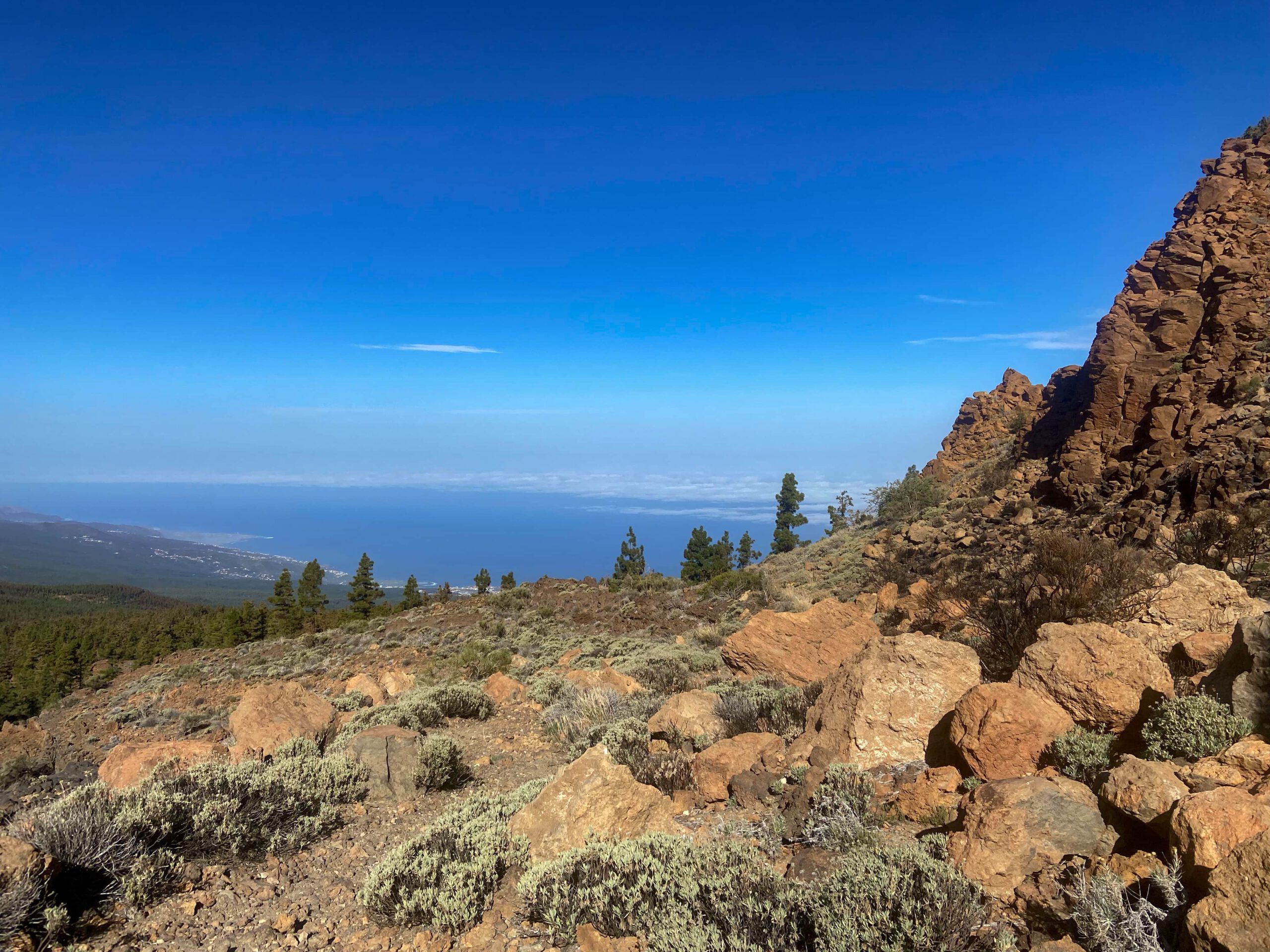
The tracks are wide, but really steep. However, you will be compensated for the effort by the magnificent views of the Teide and the forested area below the Fortaleza from the ascent path. Finally, you will reach the Juan de la Rambla fire tower. Here you will choose a different path on the way back to do a round trip. Now you continue on the ridge path above the tower.

Section Fire Tower Juan de la Rambla to Foot of Fortaleza
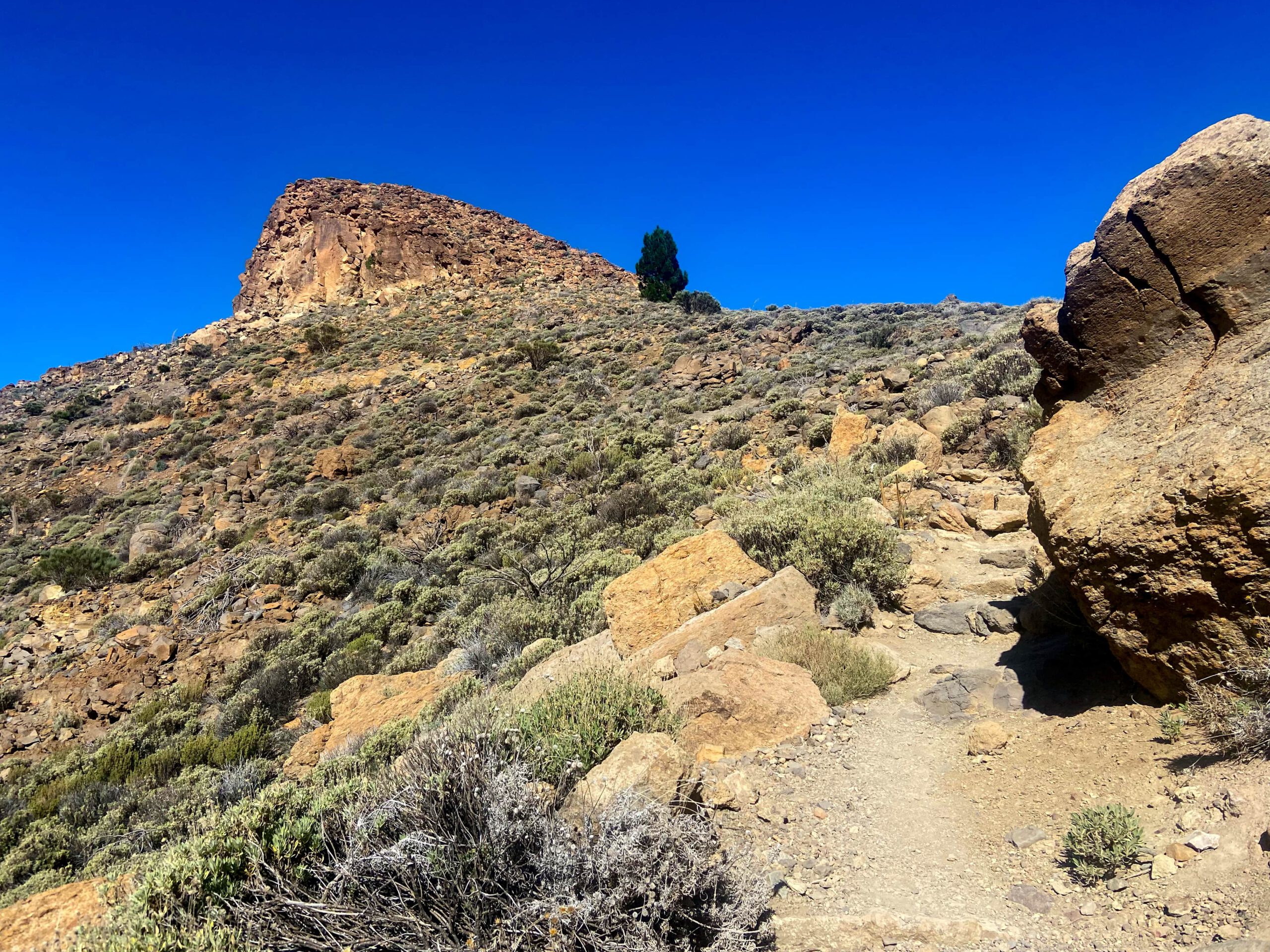
The ascent continues to be steep on a wide path. Finally, the path crosses a small barranco to the right. On the other side of the barranco you have two options. You can – like me – continue straight up the mountain on a narrow, impassable path. Or you can follow the road and take the switchback, which you can otherwise shorten. Then continue straight up the mountain.

However, the path gradually flattens out. You reach the foothills of the Fortaleza. Now you walk along the foot of the Fortaleza for quite a while. Once you have left the forest, you will find yourself on a large plain dominated by light-coloured sand. The path is flatter. You walk around the Fortaleza on the entire south-eastern side.
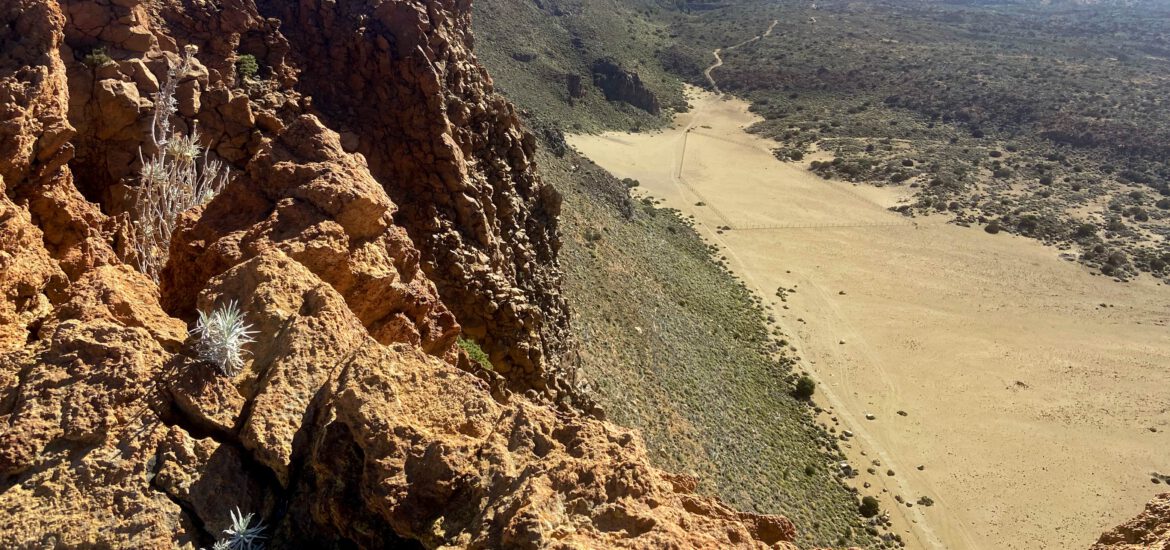
Route section foot of the Fortaleza to the summit of the Fortaleza
While the trail continues straight on to El Portillo, turn left onto the white sand field. On the ascent path, walk up to the small Cruz de Fregel chapel on the Degollada de Cedro. The Degollada is a saddle between the Fortaleza and the Cabezón. This is also the path used by hikers coming from El Portillo. On the right, path S-36 takes you up to the back of Fortaleza in 1.2 kilometres. You should not miss this.
After the short climb, you can enjoy fantastic views of the neighbouring islands of La Gomera and La Palma from up there. You will see the Cañadas, the Montaña Blanca, the Teide and the Cumbre Dorsal. Below, a seemingly white lunar landscape lies at your feet. Do you fancy a rest on the summit? This is the ideal spot. The “lagartos” are already waiting for a few crumbs to fall from your snack.

Summary information about the article and a large selection of GPS hiking tracks are availableRegister now for my newsletter and get exclusive access to my collected GPS tracks as well as all short information about my articles.
Route section top of Fortaleza to Galería Vergara
If you don’t want to go much further, you now have the option of climbing up to nearby El Portillo and taking the bus back from here. Otherwise, walk back to the Juan de la Rambla fire tower along the same route you took on the way up.

To make a nice loop, don’t go downhill to the right at the tower, but go down below the tower on the path to the left. The following long section is quite easy. With beautiful views, you walk slowly downhill on a good road through the pine forest. Eventually the track forks. I once did a loop of El Lagar straight ahead, which I will describe here soon. But you now walk downhill to the left. The path now becomes steeper, but not too steep, and continues in serpentines through the pine forest. Once again you come to a fork. Keep to the left and shortly afterwards you will reach the Galería Vergara.
Route section Galería Vergara to starting point Fuente de Pedro
At the Galería Vergara you have two options. You can walk right down along the pipes. On this hike, however, I walked across the barranco to the buildings of the Galería. A wide footpath leads through the middle of the buildings and then runs downhill on the left side of the Barranco de la Arena. You always keep parallel to the Barranco. Sometimes you can take a shortcut on small paths across the field to avoid the serpentines of the path.

Both paths (on the left and right side of the barranco) cross shortly before the main path. Here you can quickly turn left to reach the starting point at Fuente de Pedro. You can also continue straight ahead and shortly afterwards you will reach the main path. Keep left here and you will quickly return to the starting point, Area Recreativa Barranco de la Arena (Fuente de Pedro).

And finally
I hope you enjoyed this hike in the forests around El Lagar and Fuente de Pedro. This interesting hiking area actually offers you many possibilities. It doesn’t always have to be a strenuous hike like the one to Fortaleza. The climb to the Galería Vergara alone is also worthwhile. I will therefore present more hikes in this beautiful area here soon. Unfortunately (as of November 2022), some forest areas around the Area Recreativa Barranco de la Arena are still badly affected by the fires of the summer of 2022. But in many places, fresh green can already be seen again because of the persistent Canary Island pine. Have fun on all your hikes,
Dagmar from Siebeninseln
Summary information about the article and a large selection of GPS hiking tracks are availableRegister now for my newsletter and get exclusive access to my collected GPS tracks as well as all short information about my articles.