- Caldera de las Cañadas – Formation and Use
- Hike in the Caldera de las Cañadas
- General Information About the Hike in Caldera de las Cañadas
- Circular Hike through the Caldera de las Cañadas
- Section from Ridge Path Cresta de las Cañadas to Final Ascent before Degollada de Ucanca
- Section from the Final Ascent before Degollada de Ucanca to Parador Nacional de las Cañadas
- Section from Parador Nacional de las Cañadas to Descent to the Llano de Ucanca Plain
- Section from Descent to the Llano de Ucanca Plain to the Starting Point at the Parking Lot
- And finally
Caldera de las Cañadas – Formation and Use
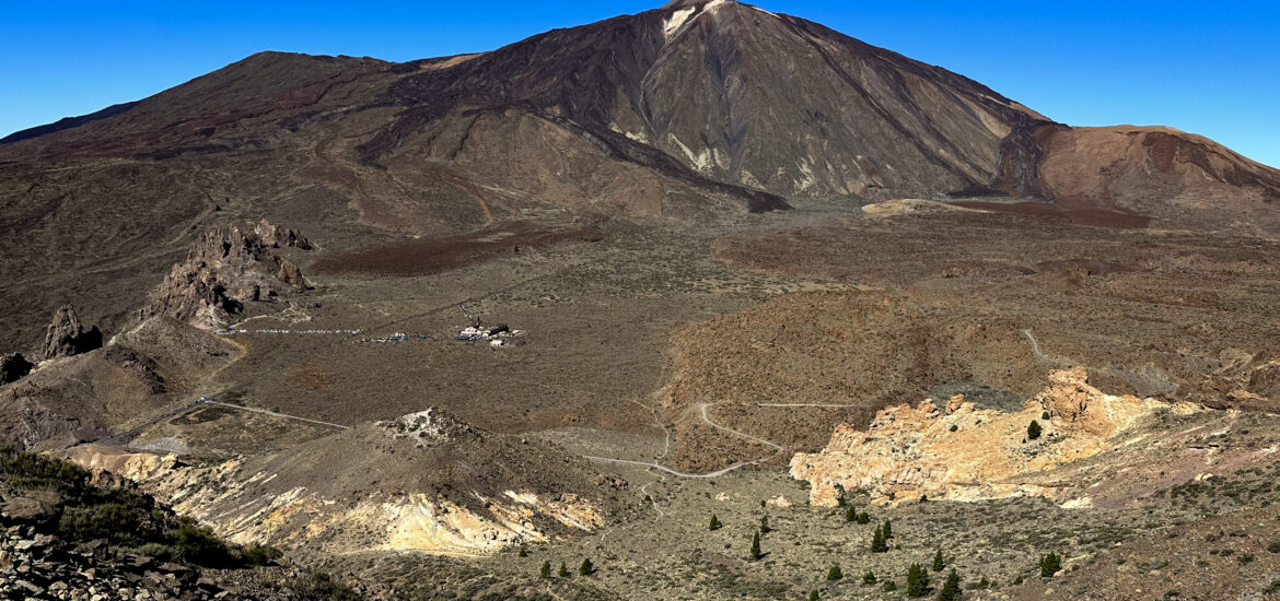
The Caldera de las Cañadas is located in the Teide National Park on Tenerife. It is a massive volcanic collapse crater with a diameter of approximately 17 kilometers. The crater is bounded on the south by crater walls averaging 500 meters high. And the floor of the Caldera lies at an altitude of over 2,000 meters. The Caldera de las Cañadas in Teide National Park is among the largest volcanic calderas in the world. It is believed that the volcano which collapsed here was much larger than the Teide. Some sources even suggest a height of 7000 meters.
After the collapse of the former volcano, new volcanoes such as Pico del Teide and Pico Viejo formed at the same location. Until the mid-1920s, the Caldera de las Cañadas was an important grazing ground for shepherds, who brought their herds here to graze from June each year. Grazing was prohibited with the establishment of the National Park. Today, only remnants of the former shepherds’ shelters can be found. More interesting information about the former life in the Cañadas can be found at the Ethnographic Museum Juan Évora near Boca Tauce.
Hike in the Caldera de las Cañadas
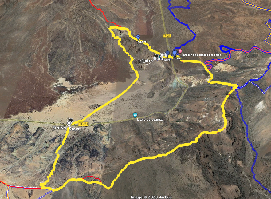
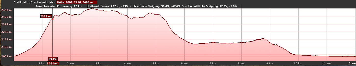
I have previously presented various tours ranging from easy to difficult in the Caldera de las Cañadas on SiebenInseln. You can find the individual tours under Variants. This large circular hike, 14 kilometers long with over 650 meters of elevation gain, takes you on a large and varied round through the Caldera de las Cañadas.
First, you hike steeply uphill out of the crater to the mountains surrounding the Cañadas. Then, you continue along the ridge path with magnificent views. From the Degollada de Ucanca before the Guajara, you descend to the Parador. The route then continues over the Roques de García in a loop down to the wide plain of the Llano de Ucanca.
General Information About the Hike in Caldera de las Cañadas
Starting Point and Arrival
You start your hike at the Caretera de las Cañadas TF-21 from a car park between Boca Tauce and the Parador.
GPS Daten: 28.209968 -16.644819
Arrival by Car
For the drive, use the access roads to Teide National Park and head north towards Boca Tauce and south towards Parador Nacional on the TF-21. The parking lot is between Boca Tauce and the Parador, where there are usually enough parking spaces. However, with the steadily increasing visitor numbers on Tenerife, parking spaces in the Caldera de las Cañadas are becoming scarce (as of 2024). You have a good chance of finding a parking spot if you start your hike early.
Arrival by Bus
The Titsa Bus Line 348 runs along the TF-21. However, the buses only run twice a day, so you need to check the Titsa Homepage in advance for exact times.
Time
I hesitate to give exact times as they can vary greatly. We took 5 hours and 50 minutes for this large round tour, including several breaks.
Distance and Elevation Difference
The trail is about 14 km long, with a total elevation gain of 660 meters.
Requirement
For most of the hike, you walk on good trails. Only the beginning takes you on a somewhat rough path through a small ravine and then steeply uphill on the mountains of the Caldera de las Cañadas to the ridge path.
Refreshment
You can find refreshment opportunities only about two-thirds of the way at the Parador Nacional de las Cañadas. Therefore, be sure to take enough water and possibly food for the rest of the way.
Variants
You can shorten this hike a bit by not making the entire loop around the Roques de García and instead descending directly at Mirador de la Ruleta towards Llano de Ucanca.
The last part of the hike is partially identical to the small circular hike around the Roques de García.
The hike along the ridge path is partially identical to the hike over the Cresta de las Cañadas.
Additionally, the descent to the Parador is partially identical to the hike from the Parador to the Guajara and also to the hike Guajara via the Ucanca Valley, which you will encounter at the Degollada de Ucanca.
Nearby, you can also find the hike Siete Cañadas from the Parador and the small circular hike through the Caldera de las Cañadas.
Finally, you also have a brief overlap with the Sombrero de Chasna trail and the ascent trails to Pico Viejo and Pico del Teide.
Circular Hike through the Caldera de las Cañadas
Section from the Parking Lot on the TF-21 to the Ridge Path Cresta de las Cañadas
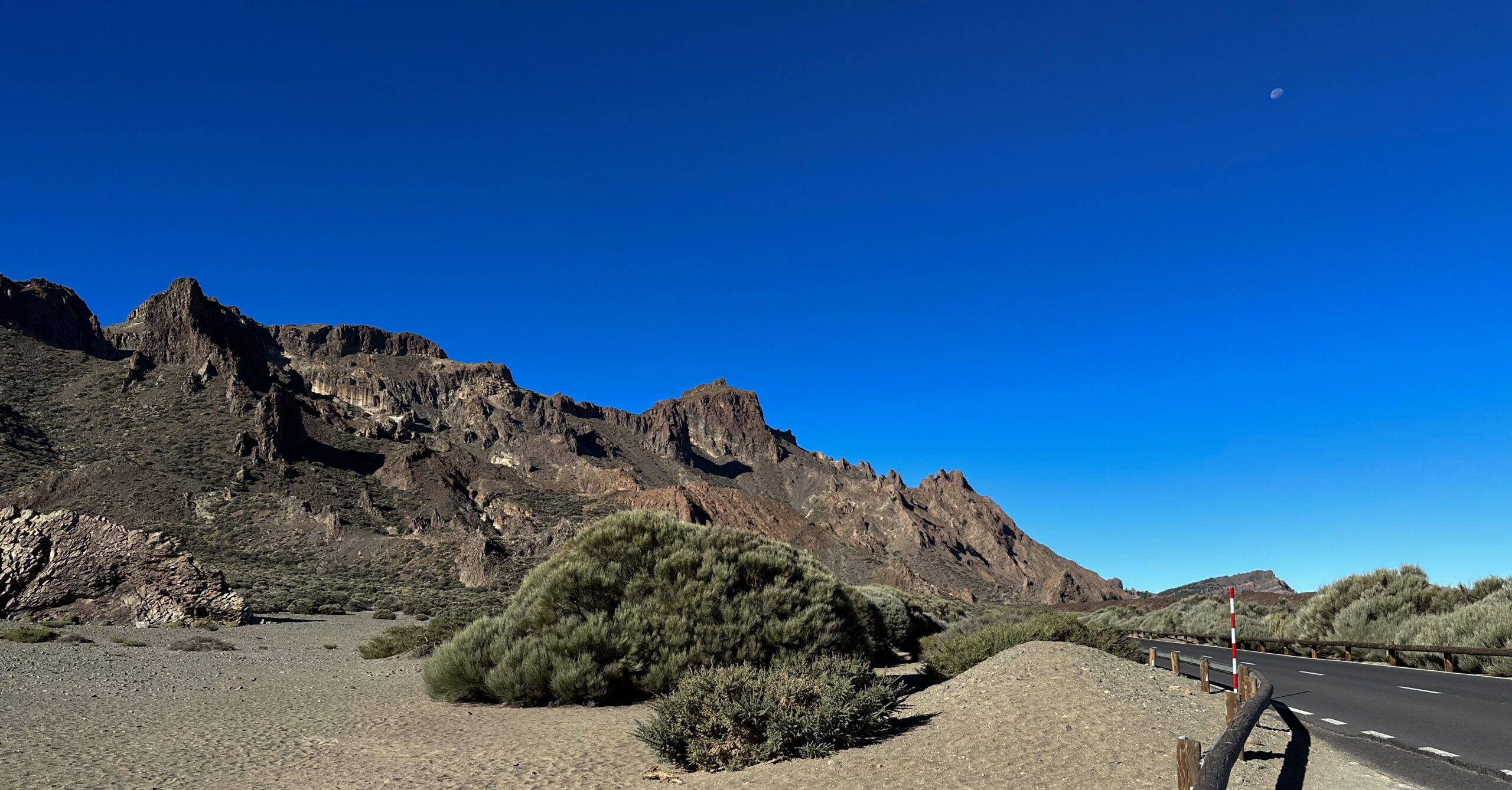
You start your hike at the parking lot described above between Boca Tauce and Parador Nacional de las Cañadas. You first hike across a wide sandy plain towards the mountains, initially ascending gradually. Here, the path can be a bit difficult to find at times, but you can usually see footprints, small paths, and cairns. After a while, you veer slightly left and pass through a small ravine. On the left side, the path continues uphill towards the mountain wall.
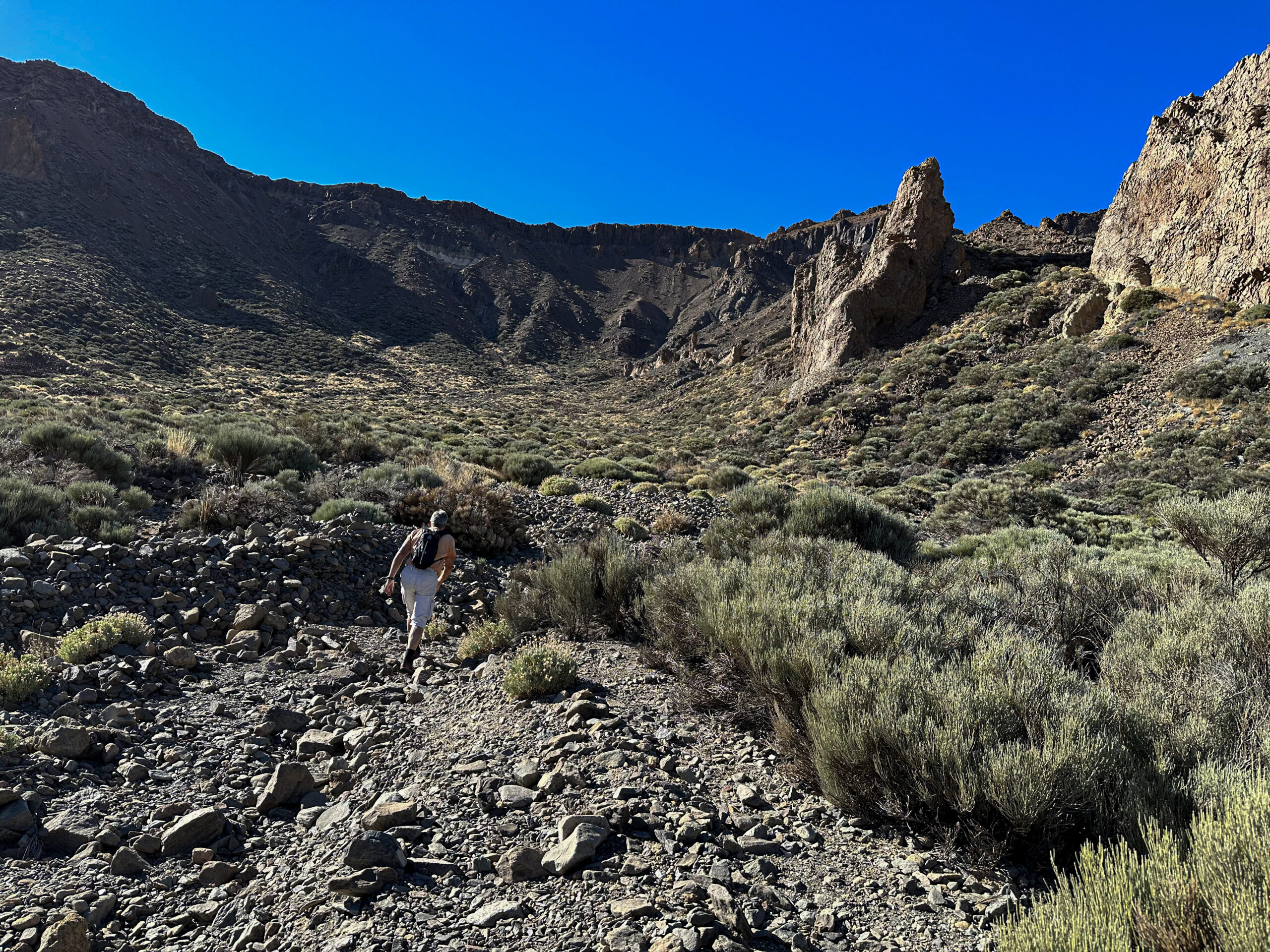
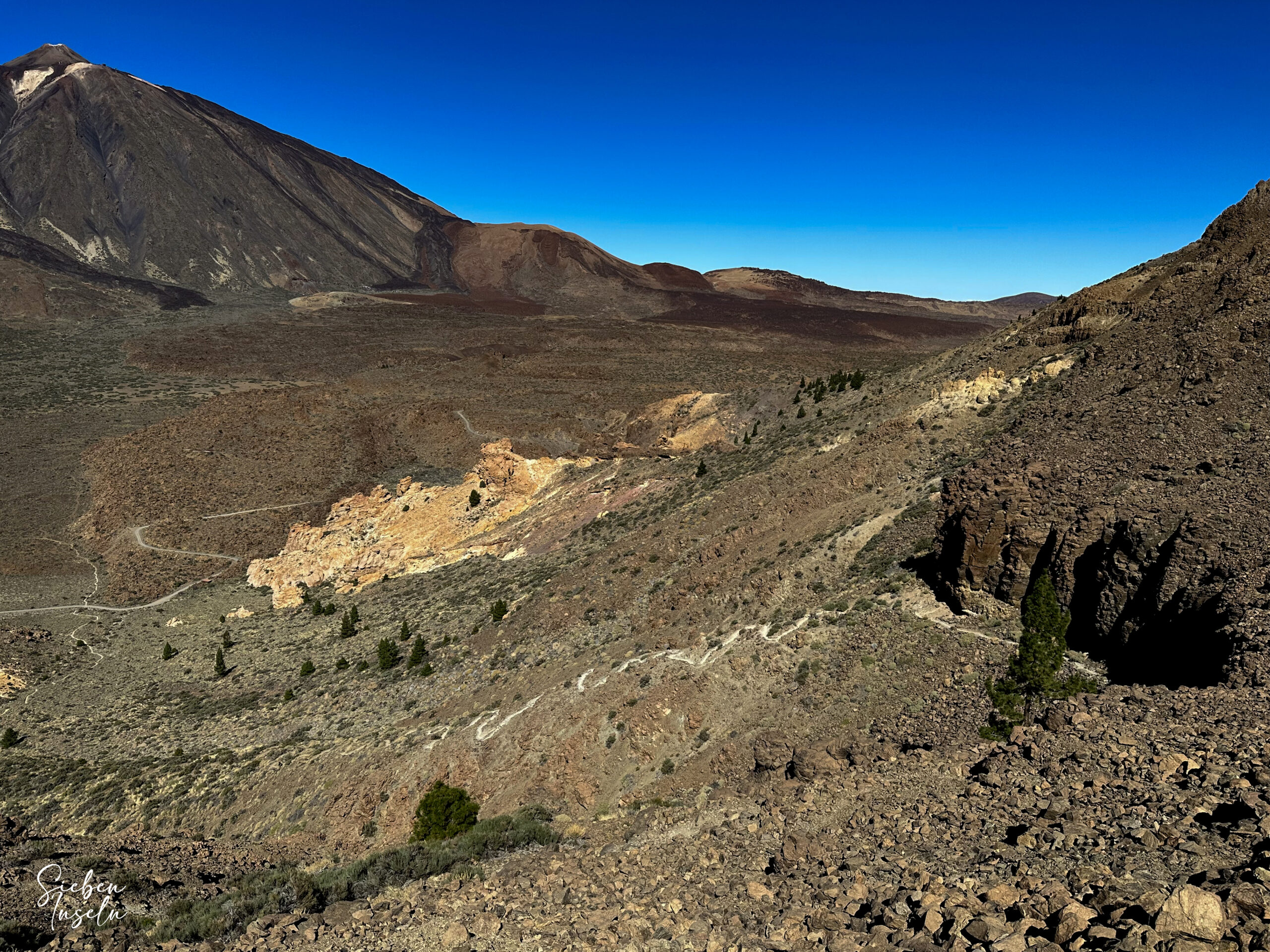
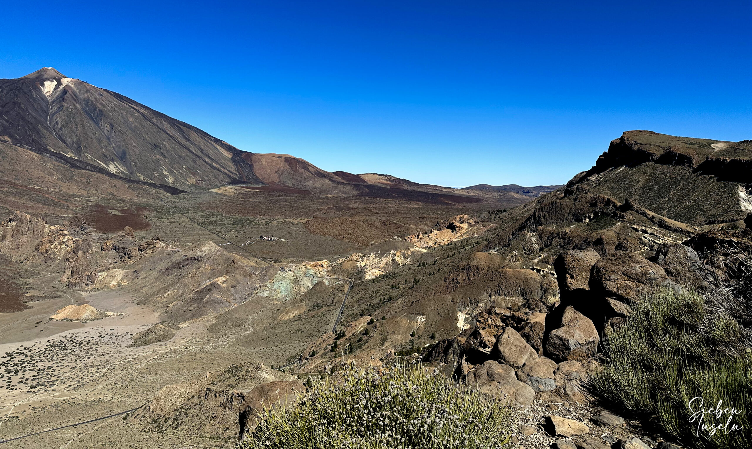
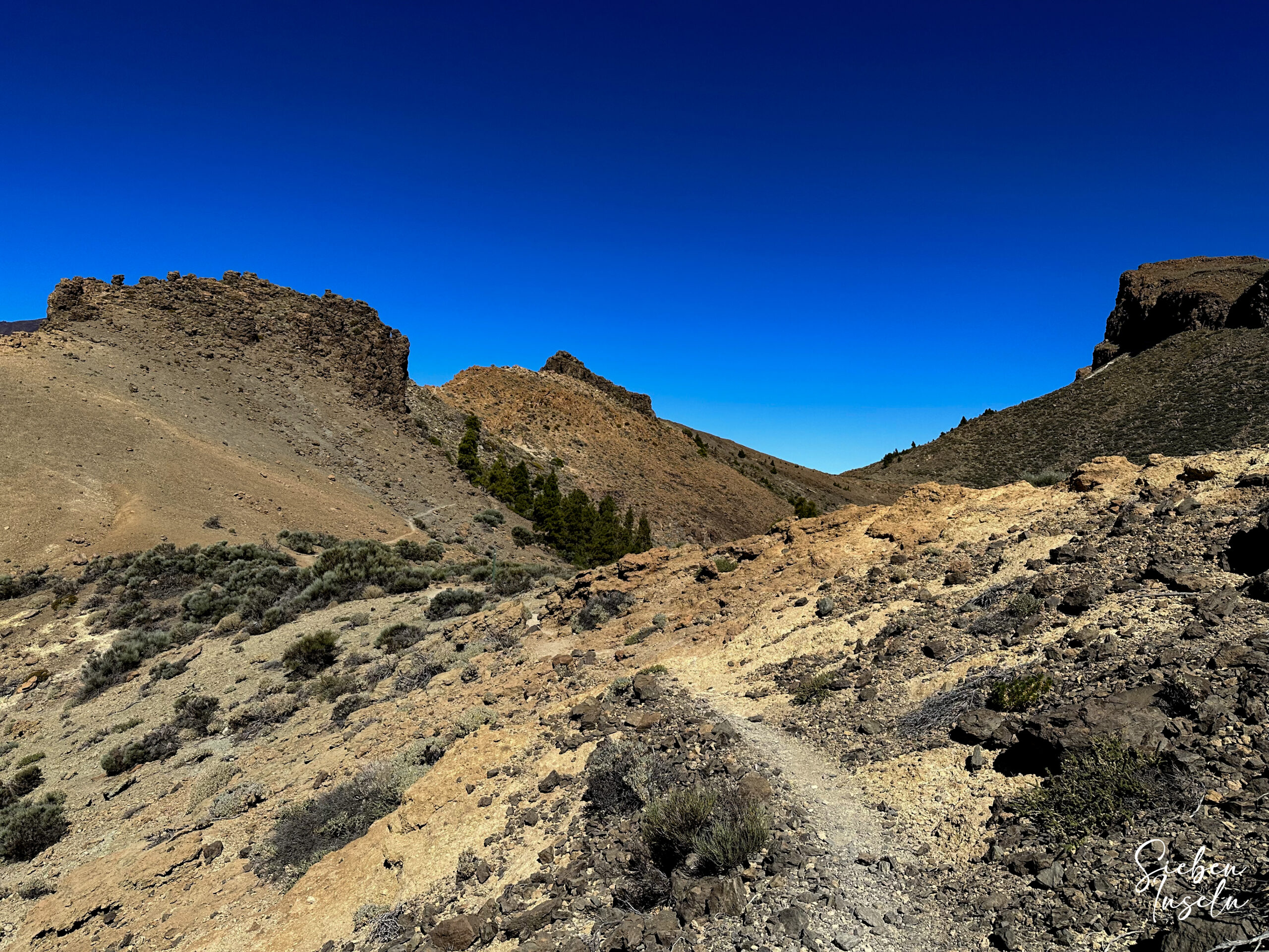
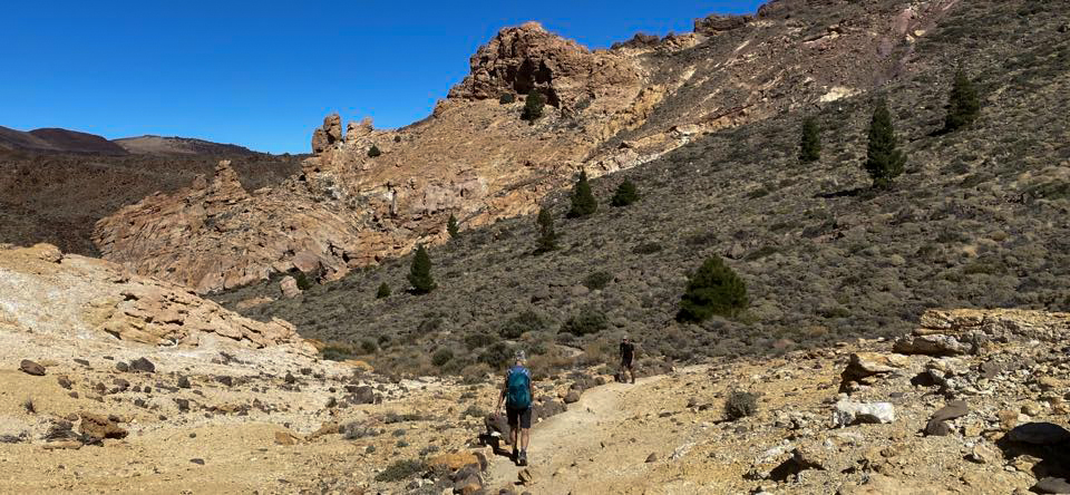
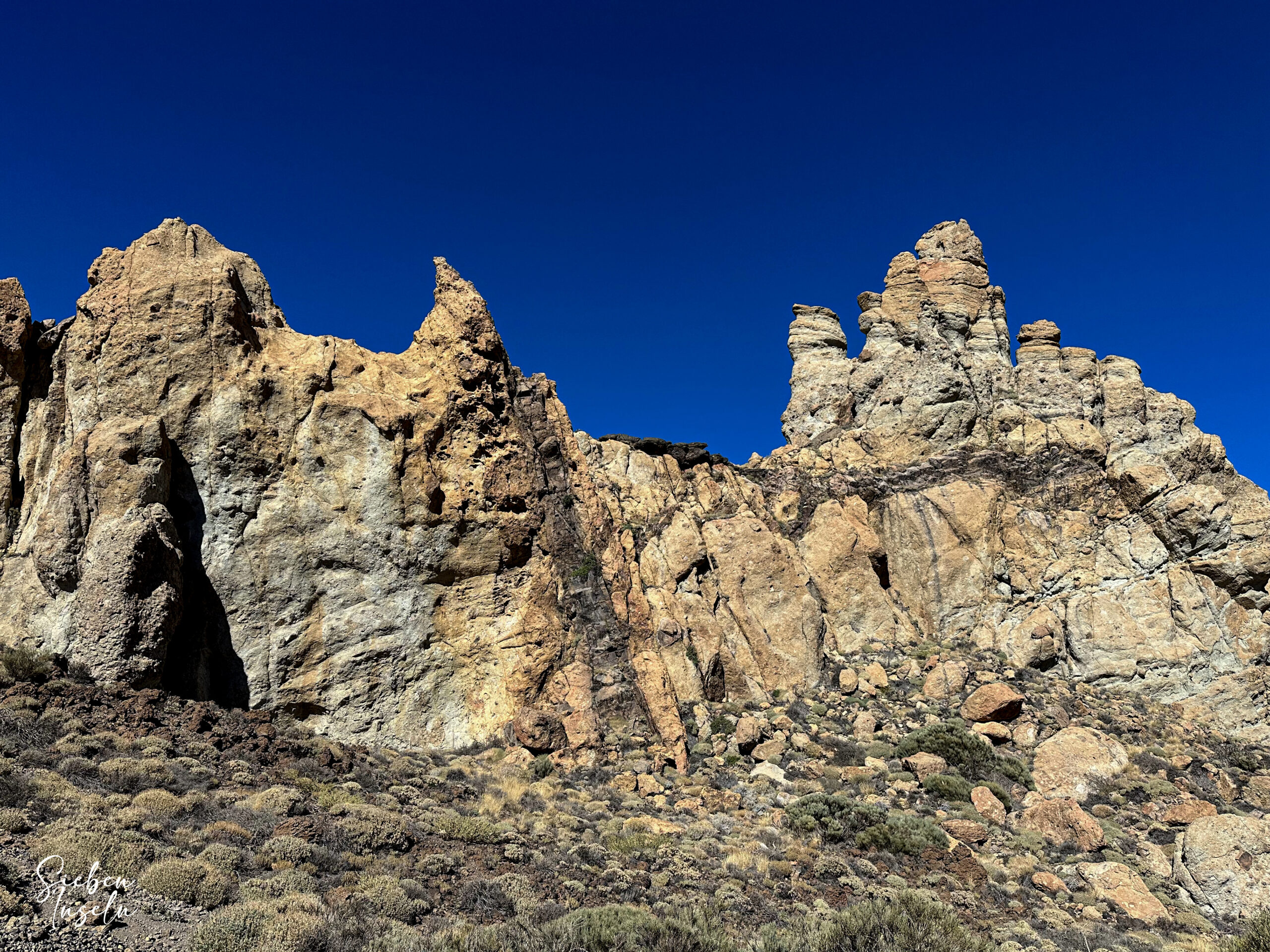
Eventually, you reach the clearly marked ascent path. From here, the path leads steeply uphill in very steep switchbacks and narrow paths along the mountain wall. The views over the vast Caldera de las Cañadas below become increasingly impressive as you ascend. You can see the Teide, Pico Viejo opposite, and the wide plain of Llano de Ucanca below. This is the hardest part of the hike. Once you have conquered this, you find yourself on the ridge path S-31 of the Cresta de las Cañadas.
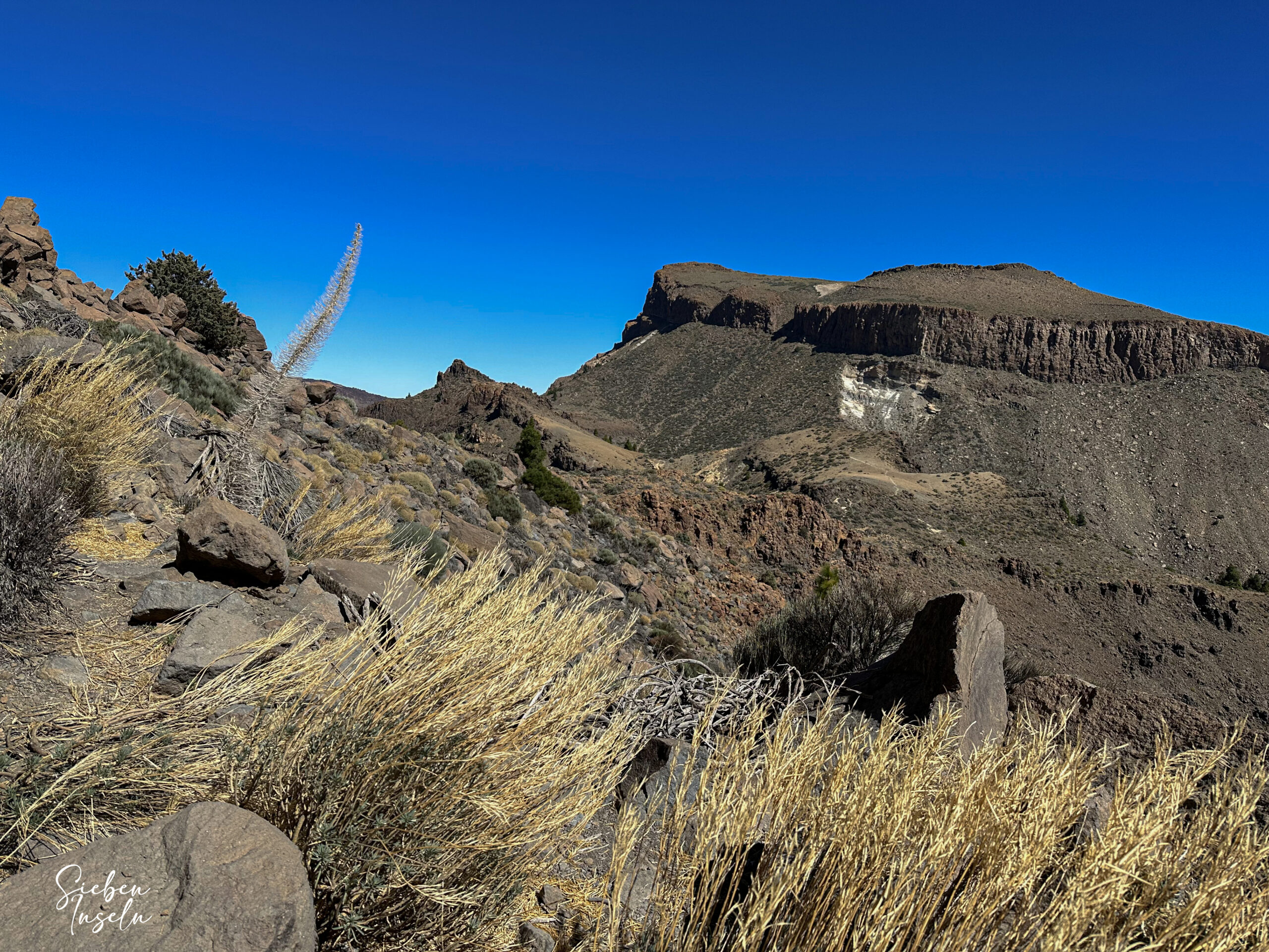
Section from Ridge Path Cresta de las Cañadas to Final Ascent before Degollada de Ucanca
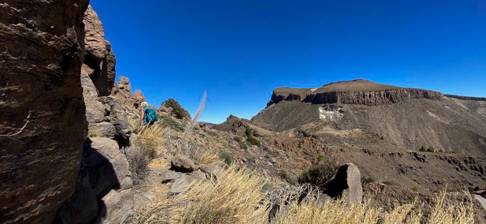
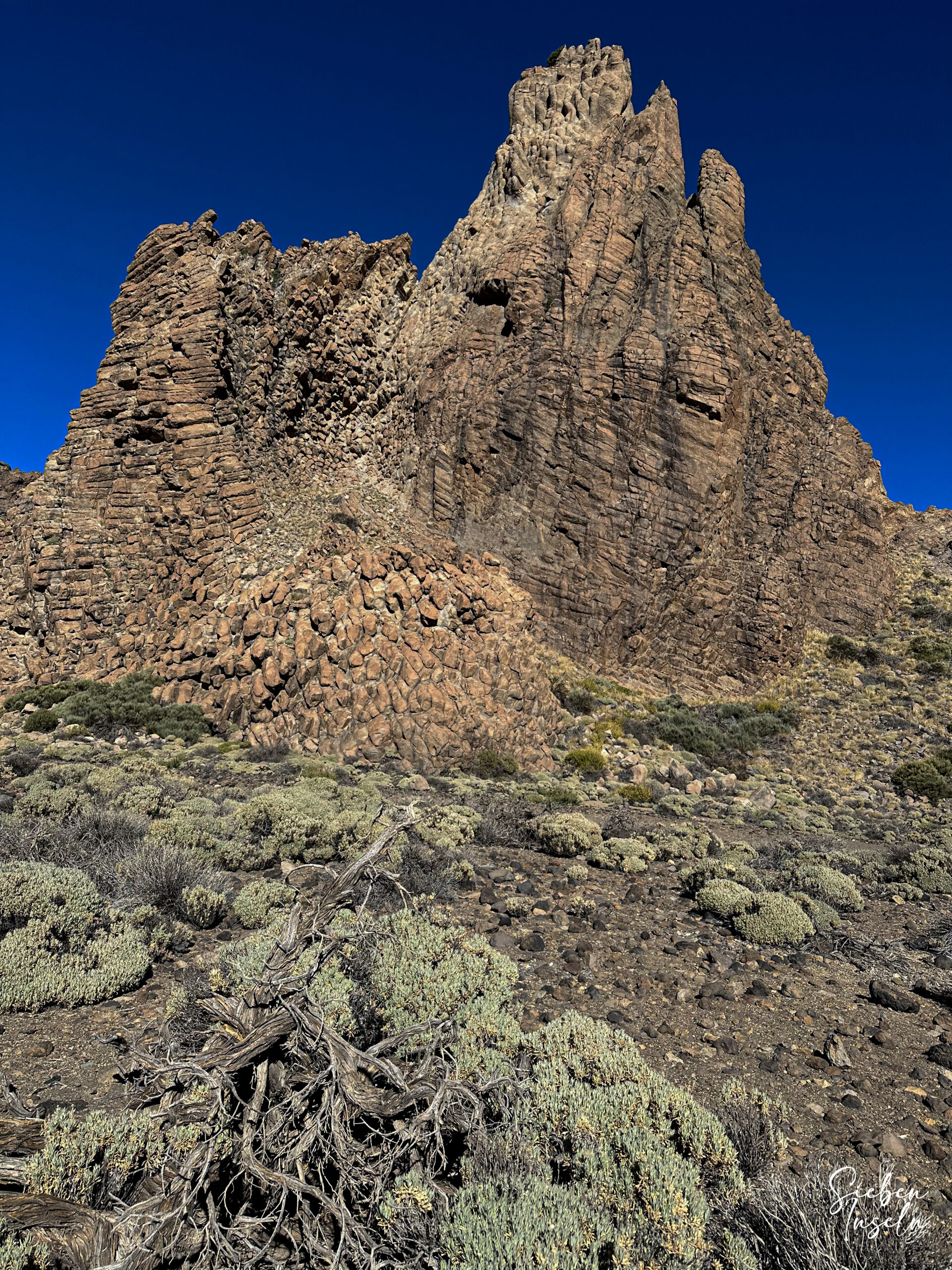
The S-31 continues for a while on top of the Cresta de las Cañadas. To your right is the Sombrero de Chasna (2405 meters). A path branches off to the right towards Sombrero de Chasna. You continue straight ahead and then climb a small peak. After that, you have two options. You can either take a small path over the next peak and then follow a loop. The S-31, however, runs along the base of this small mountain.
After a short descent, the path turns uphill along the mountainside again. After you conquer this ascent, you walk parallel to the ridge for a long time. You then cross a small rock wall and continue parallel to the wall, slightly uphill again. Eventually, you reach a small plateau, which you cross. From there, you descend in a wide arc to a saddle. From there, your last major ascent is on the right side of a large rock.
Section from the Final Ascent before Degollada de Ucanca to Parador Nacional de las Cañadas
After this ascent, you reach the open ridge again and continue uphill on the S-31. However, after two high peaks, the trail slowly descends. You walk along the slope for a long time. Then you slightly cross the ridge and reach the Degollada de Ucanca before the Guajara. You continue straight ahead to the Guajara. However, you descend left with the S-31 towards the Parador. The path is well marked and easy to follow.
Once you have completed the first long descent section with several switchbacks, the path leads you right through a valley downhill. Eventually, you reach the Siete Cañadas road, which you cross. You then continue for some time on the trail until you reach the Parador. If you do not want to rest at the Parador, continue left past the Parador along the parking lot.
Section from Parador Nacional de las Cañadas to Descent to the Llano de Ucanca Plain
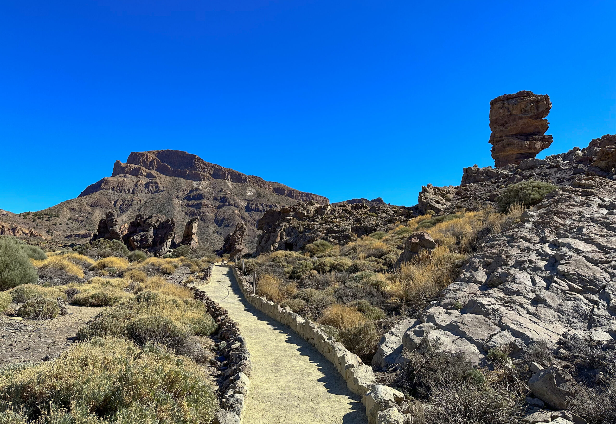
Follow the small road from the parking lot to the TF-21. Once there, cross the road and continue along the road to the Roques de García. To shorten the route, you can descend straight ahead via the Mirador de la Ruleta. However, we followed the hiking trail 3 to the right around the Roques de García.
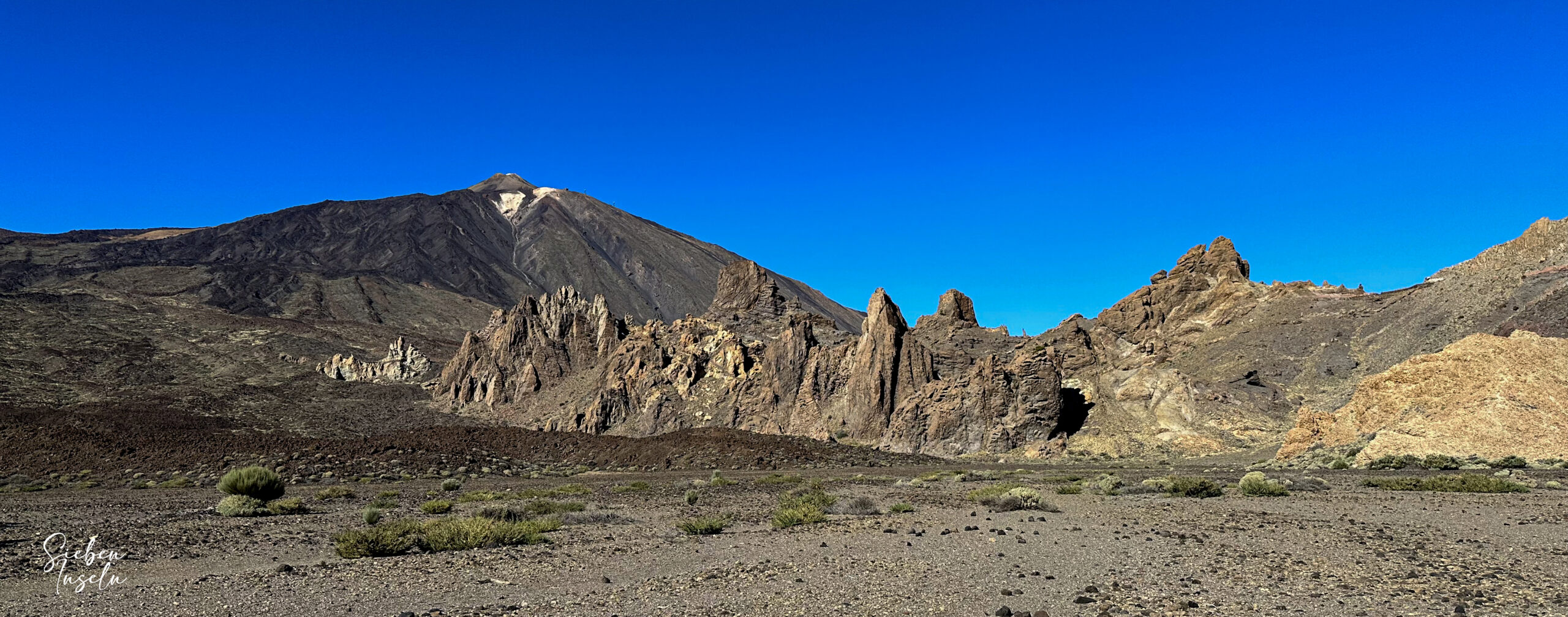
On the left side, you can see the well-known rock formation of Roque de Cinchado, also known as the Finger of God. On the right, a small detour to newly created stone circles is worthwhile. After about 20 minutes of hiking below the Roques de García, you reach the last rock of the massif, the Roque Blanco.
On the right side is a lava field. At the end of the rock massif, you reach a fork in the trail, where hiking trail number 23 to Pico Viejo branches off to the right. However, on the circular route, continue left around the rocks. You reach a small viewing platform, offering a good view of the wide plain of Llano de Ucanca again.
Section from Descent to the Llano de Ucanca Plain to the Starting Point at the Parking Lot
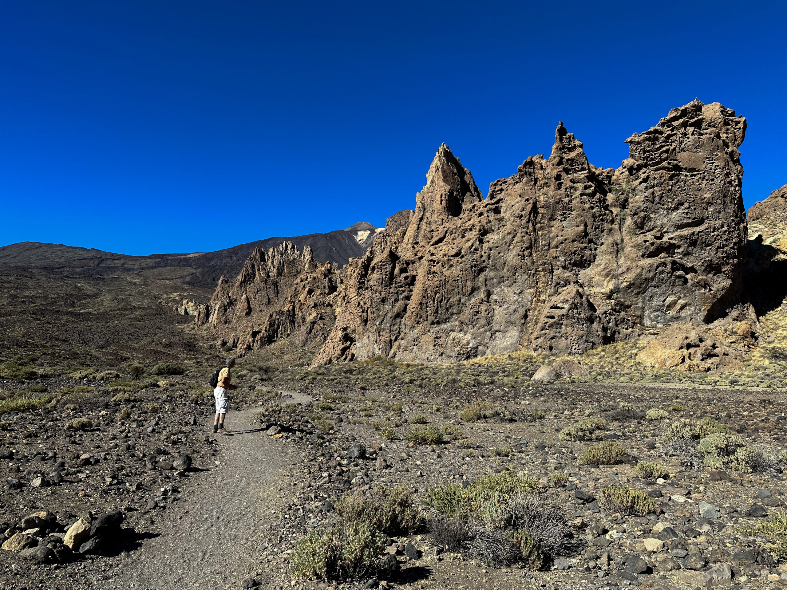
From here, descend via a small rocky path around some rocks. The path leads you further downhill towards the Ucanca plain. It passes many jagged and imposing large rock formations. After descending, you reach another small plain, and in front of you lies the impressive rock of the Catedral. As you approach the large rock, the path forks. The left fork continues the Roques de García circular tour, leading you left past the Catedral and back up to the Mirador de la Ruleta.
However, you keep to the right. This way, you follow hiking trail 26 for some time along the right side of the rocks. Hiking trail 26 leads to the road, so you can walk along the road to the parking lot for some time. This is the correct way, as you should stay on the official paths in the National Park. However, some good paths now also cross the wide plain of Llano de Ucanca. This way, you can cross the plain back to your starting point at the parking lot. This should be avoided if possible.
And finally
I hope you enjoyed this varied circular tour on and around the Caldera de las Cañadas. You can combine this hike wonderfully with the numerous tours I have listed under Variants. Be sure to stay on the official paths in the National Park. Enjoy all your hikes,
Dagmar from SiebenInseln