Candelaria with Virgo and Guanche Kings
The famous town of Candelaria lies on the northeast coast of Tenerife. Today’s hike will take you to the wooded heights above Candelaria. If you don’t know the place yet, you might have the opportunity to visit it before or after this hike. Further information about Candelaria you will find here.
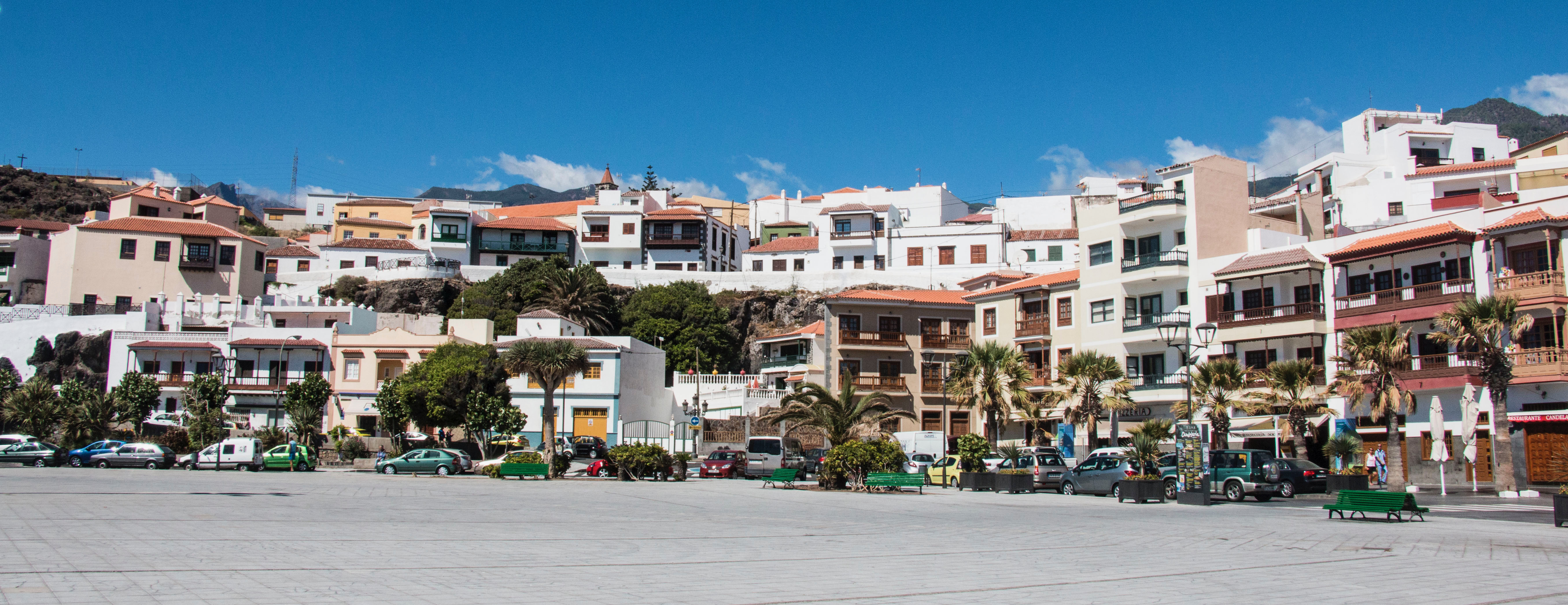
The municipality of Candelaria, with a population of just under 28,000, is situated on the coast and is the most important Catholic pilgrimage site in the Canary Islands.
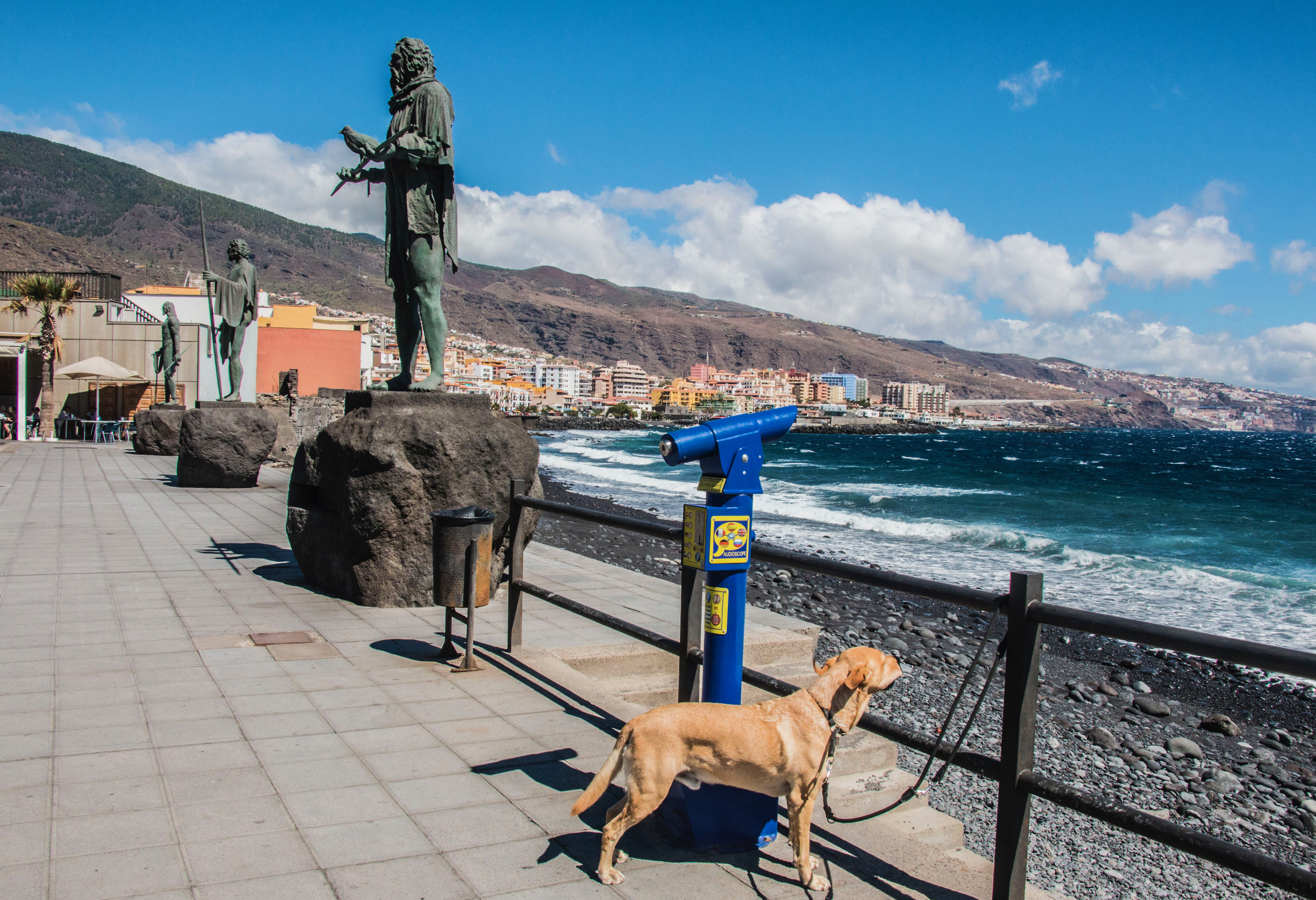
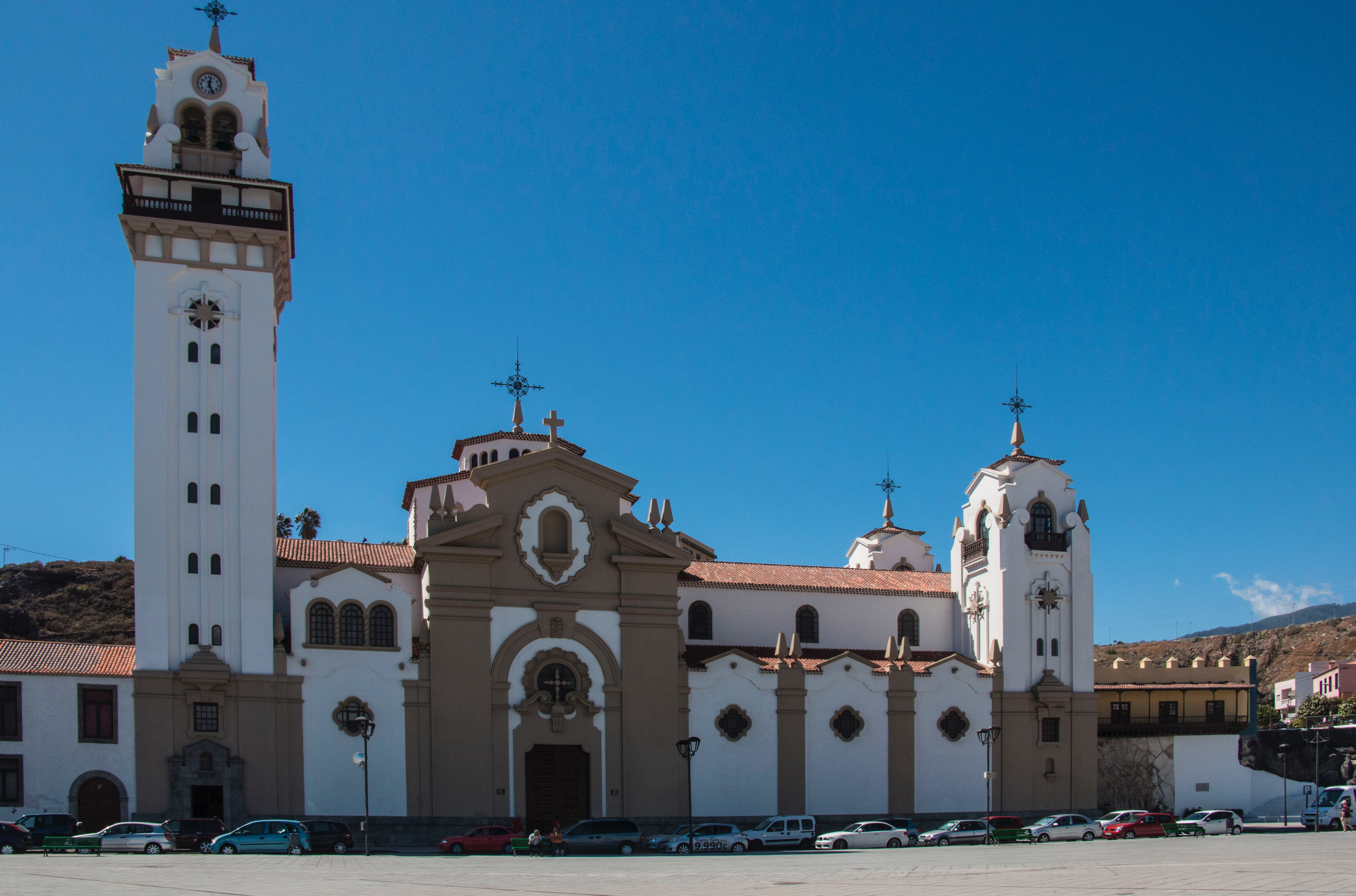
Impressive is the Basílica de Nuestra Señora de la Candelaria with the large Plaza de la Patrona de Canarias in front of it. Nine larger-than-life statues of the Guanche kings are placed on this square, from where you can enjoy a wonderful view of the sea. The Basilíca houses the figure of the patron saint of the Canary Islands, the Virgen de la Candelaria. The great feast days of Virgin worship and pilgrimages are 2 February and 15 August each year.
Hike over Candelaria with view on all sides of the island
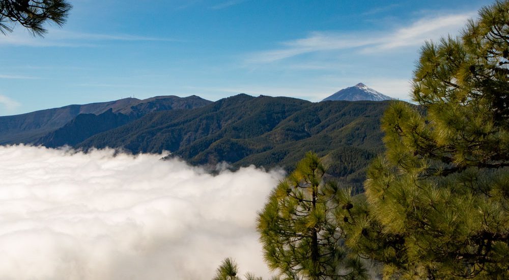
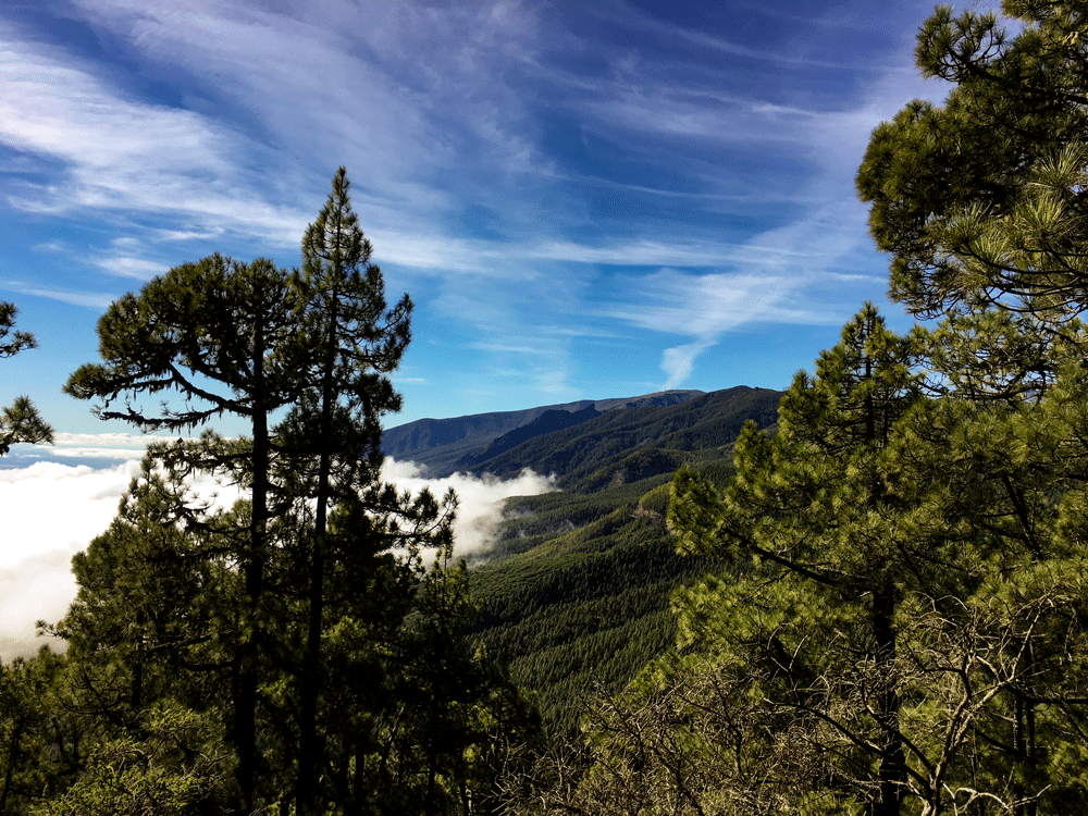
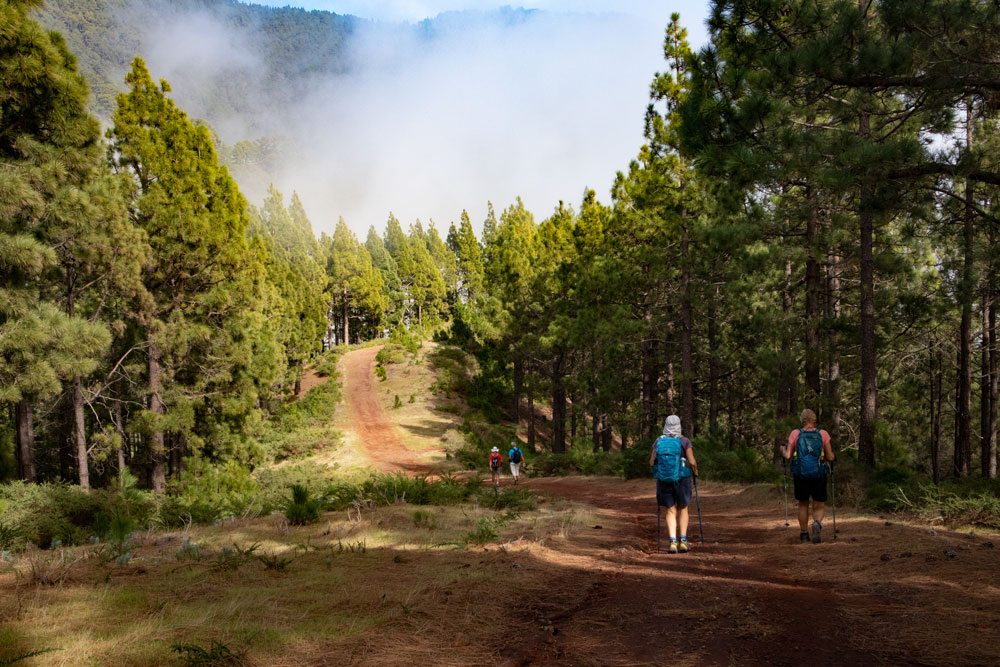
Today’s hike takes you far beyond the coastal town up into the wooded north-eastern slopes of Tenerife. Up there on the main ridge path of Tenerife you have a really fantastic view in all directions. You can look up to the heights of the Anaga Mountains in the north. If you look down to the northwest side of the island, you will discover Candelaria deep below you.
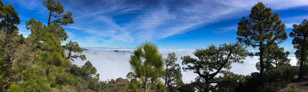
Also the neighbouring island Gran Canaria can be seen in the distance. The 10 km long hike takes you through forests and sometimes through a few clouds. I was lucky and the clouds passed us, so that finally beautiful views to the coast became free again and again. Of course I wish you the same for your hike.
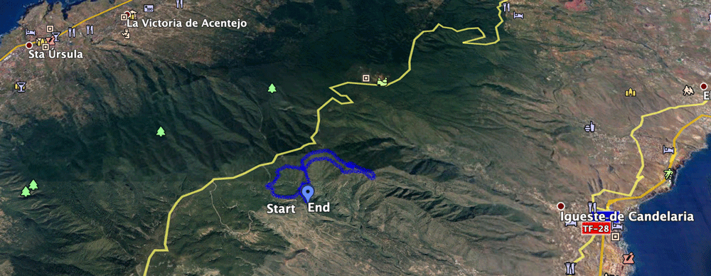
General information about the circular hike high above Candelaria
Starting point and approach
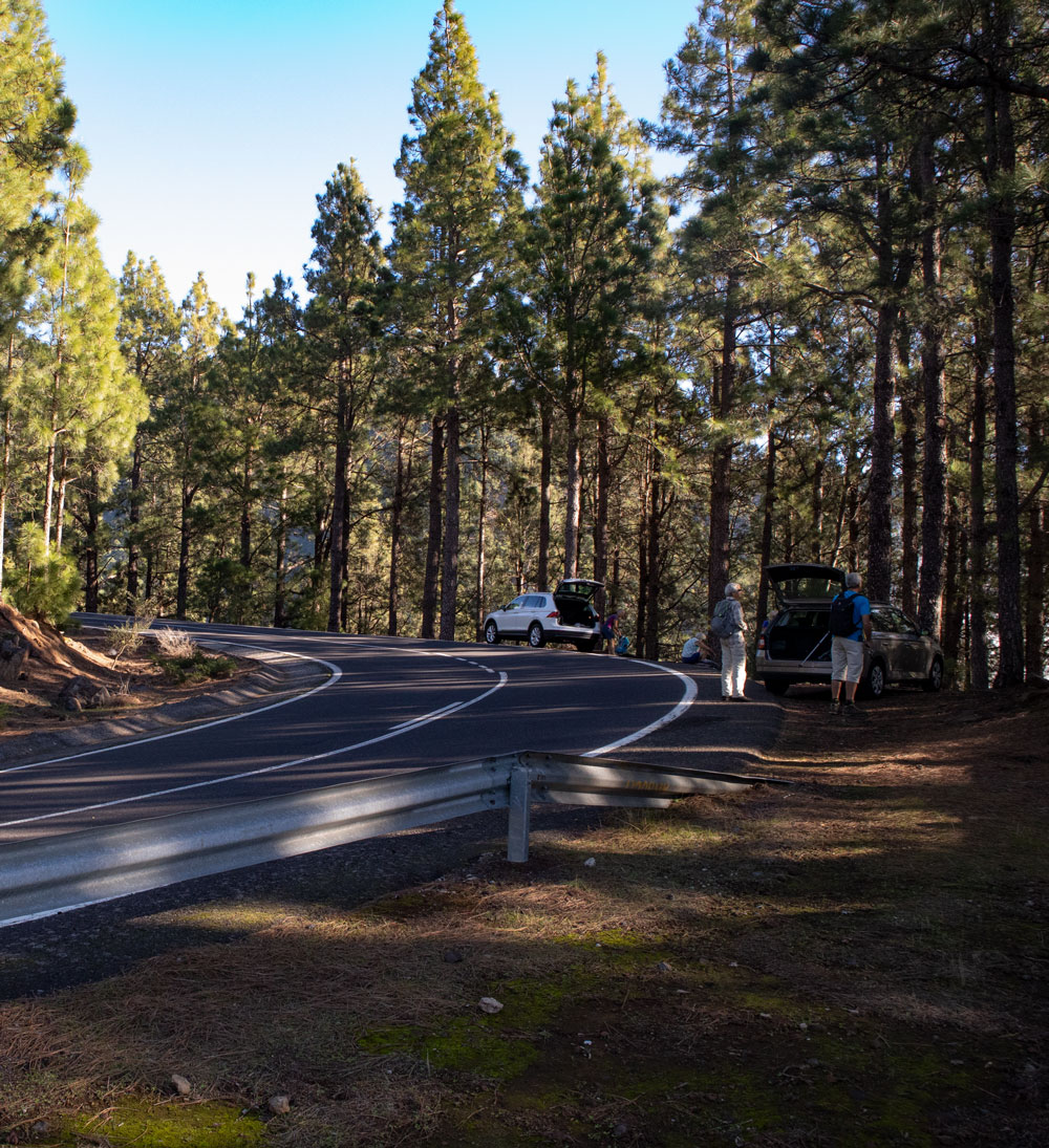
Starting point is a small parking lot at the TF-523 above Arafo – several possibilities to park the car at the roadside.
Arrival by car:
Depending on whether you are approaching from the north or south on the TF-1 motorway, take the Candelaria (north) or Güimar (south) exits. On both exits you drive in the direction of Güimar. In the town of Güimar turn off the TF-28 and a short time later take the TF-525, which becomes the TF-523, towards Arafo. You drive through Arafo and continue in serpentines up the slopes on the TF-523. In a wide bend to the right you will find a parking lot. Here the coordinates 28.38846, -16.449902.
Arrival by bus
The Titsa line 121 goes to Arafo. There are no other bus connections, so you could take a taxi from Arafo without a car. Details can be found on the Titsa homepage.
Time
I don’t like to give general times for hiking tours, because the times are very individual. We needed 4 hours for this round trip with rest times.
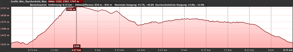
Difference in altitude and distance
The difference in altitude is a little less than 600 metres. The route is almost 10 kilometres long.
Requirement
An easy hike, which generally leads along good hiking trails. In some places the paths are quite narrow and not always easy to find. And a little physical condition is of course a prerequisite.
Refreshment
There are no restaurants, bars and shops on the whole route. Therefore, take enough water and food with you.
Variants
This tour can be combined well with various other hiking and circular walks in the vicinity. I will soon present some more tours on the northeastern slopes of Tenerife.
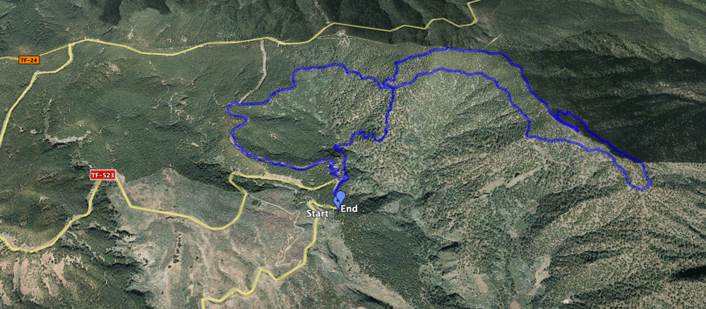
Circular hike high above Candelaria
Section car park to turn-off from the driveway
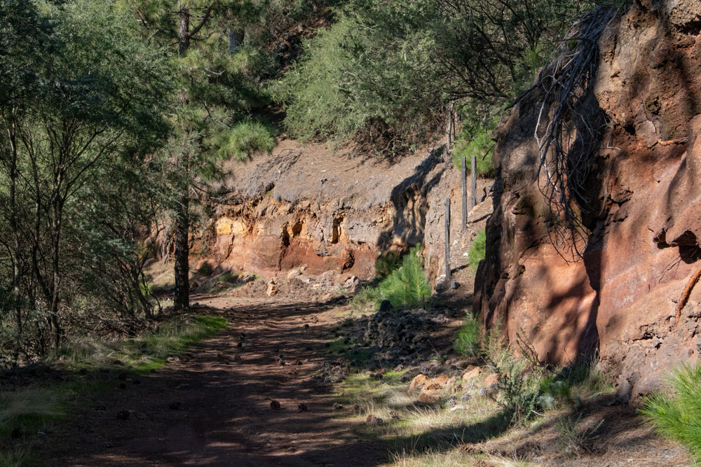
You start your hike at the TF-523 and walk a little uphill along the road. At the next sharp left turn, turn right onto a wide road. On this road you will come back later. Now turn right onto a small path. This leads you steeply down the slope into a small forested gorge. At the bottom you cross the Barranco and climb up again on the other side of the gorge.
Follow the narrow path uphill through the forest. From time to time it is a bit hard to find. Look for markings and cairns. Finally you reach a ridge path. From here you already have a good view, as long as the clouds don’t block your view. At the end of the ridge path you will find a wide driveway. Here you will come back later from the right. But now you go a few meters to the left. Then a very steep path branches off to the right from the road up the hill. Follow this path.
Route section Branch from the driveway to Gratweg
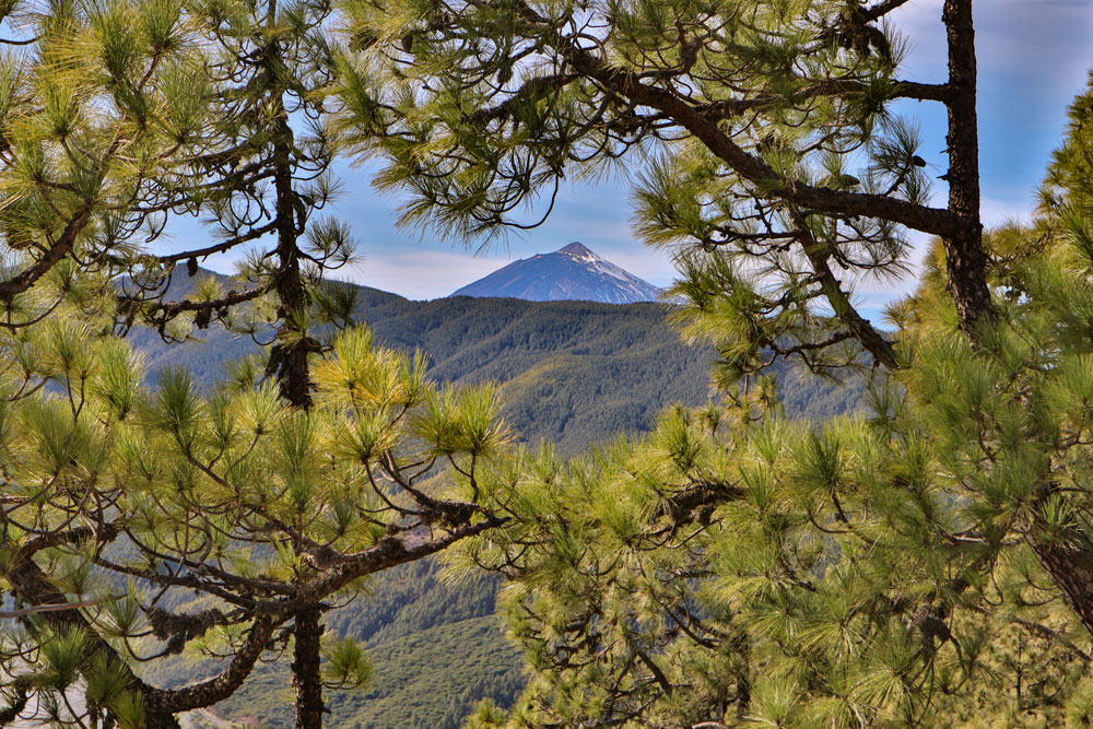
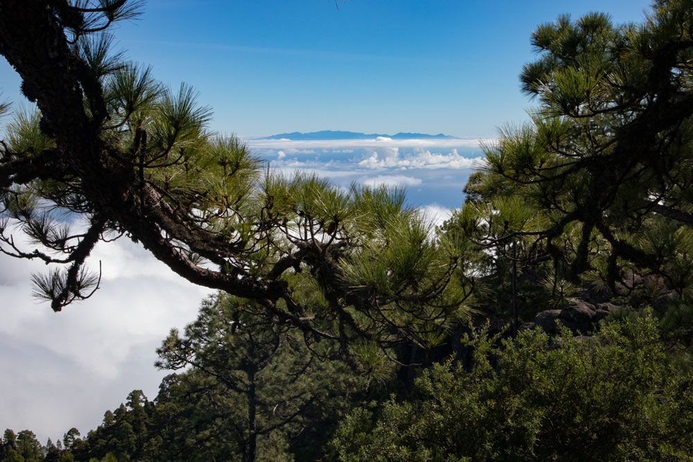
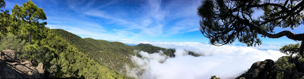
Since this circular hike has the shape of an eight, your second small round starts here. Once again it’s a steep climb on narrow paths. Here, too, the path is a bit confusing from time to time. But since you’re walking on a ridge, you can’t miss the way up in the end. Finally you reach the big ridge, which runs here about in the middle of the island of Tenerife. Now you have views to the north and east coast of the island and in good weather you can also see Gran Canaria.
From here the hike takes you along the main ridge. The views couldn’t be better. On my hike, however, a cloud wall appeared in the east. But above that we had blue sky and sunshine. Also the Teide can be seen in the distance. On the way itself there are some fixed vantage points and terraces. Of course they are also suitable for a small high-altitude picnic.
Route section ridge path to hiking crossroads (middle of the eight)
You can run up to the end of the ridge to enjoy the view. The way back leads you down on the left side about 300 meters before the end of the ridge. The path goes down steeply for a short time. Then it runs along the slope below the ridge. The path leads you underneath a large rock massif. And finally you cross the ridge again at a lower point, so that you circle the end of the whole rock massif.
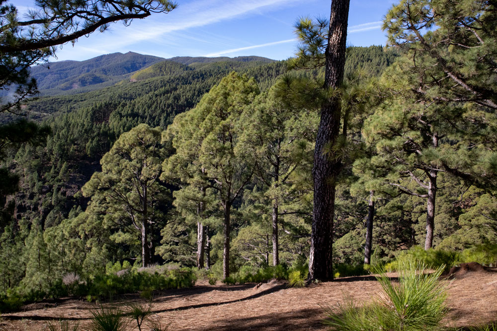
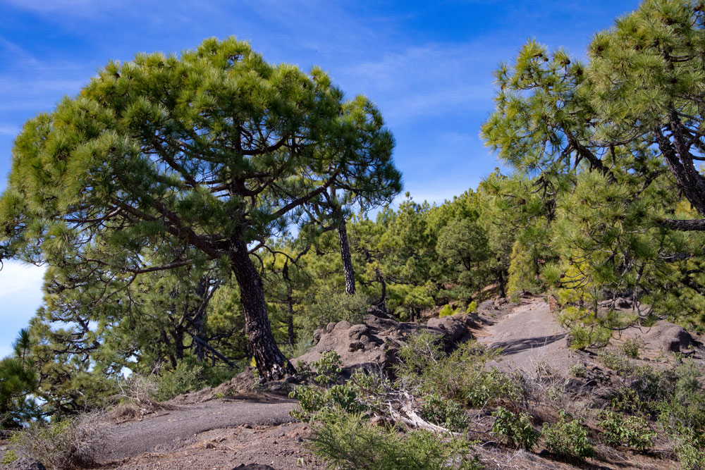
Then the path on the other side of the slope below the ridge takes you down through the forest again. You cross another small ridge. Then continue through the forest on the hiking path parallel below the ridge path. Finally you reach the crossroads, where you came up to the left on the way there and went on to the right. Now simply follow the wide road straight ahead.
Follow the hiking trail (Mitte der Acht) to the starting point of the car park.
The road takes you downhill through the pine forest for a while. Then you meet a very wide road. There are a lot of stones and the path is partly very washed-out, so that the descent at this point is sometimes a bit difficult. At the end of the long descent the path meets the place where you turned right on the way to the small path. Now you have completed the eight. After a short time you are back at the TF-523 and shortly after at the starting point of the hike.
And finally
I hope that you enjoyed this “double circular walk” on the ridge path with wonderful views high above Candelaria. I wish you much joy with all your hikes,
Dagmar von SiebenInseln
Hi Dagmar,
Tried your hike today and have some comments:
The gps points you provided are the reverse of your instructions which made it very confusing to us at the start. The best parking is just past the Forestal sign – close to the start of the trail parking is very washed out. The trail starts at a locked gate. As we ended up doing the trail in reverse, we had the very eroded climb up at the start and it was very slippery with the small stones. There is a newish track on the left near the start which is well marked and cuts of some of the wide trail. At the top of the climb at the 4 way junction the one straight ahead is gated with warning signs of danger of rockslides and falling to lower levels. The trail to the right is very nice but ends in about 1K and is not shown on any maps. We bushwacked a bit in the hope of it clearing with no luck so returned to the junction and took the “Danger” trail. There were a number of recent rockfalls but none blocked the trail which was very good. At the crossover in the figure 8, the trail to the left appeared to be damaged right at its start so we just continued on the main trail for a couple of K before turning back. We decided to take the short route to the right at the crossover back to the start as time was getting on but the trail down was not evident after spending some time trying to find it. We retraced our steps back to the start and the downhill in the eroded section was very slippery.
Even with the problems we had, it was a very enjoyable walk of almost 5 miles in perfect weather and great views and we hope to do it again from the other direction and try to get through the crossover point. Some amazing flowers along the way!
Hello David, thank you very much for your important information. As I run the blog privately and a lot changes over time, I rely on information like yours. I haven’t been on this hike for a long time and have only abseiled nearby. But the last few months here with the heavy rainfall have led to many changes in the hiking trails. Paths have subsided everywhere and there have been many rockfalls. Therefore, I will probably have to gradually revise many of the hikes on SiebenInseln. I will do my best. Many thanks.