- The Remote Hamlet of Caserío de las Fuentes
- Hiking from Caserío de las Fuentes
- Information about the Circular Hike from Caserío de las Fuentes
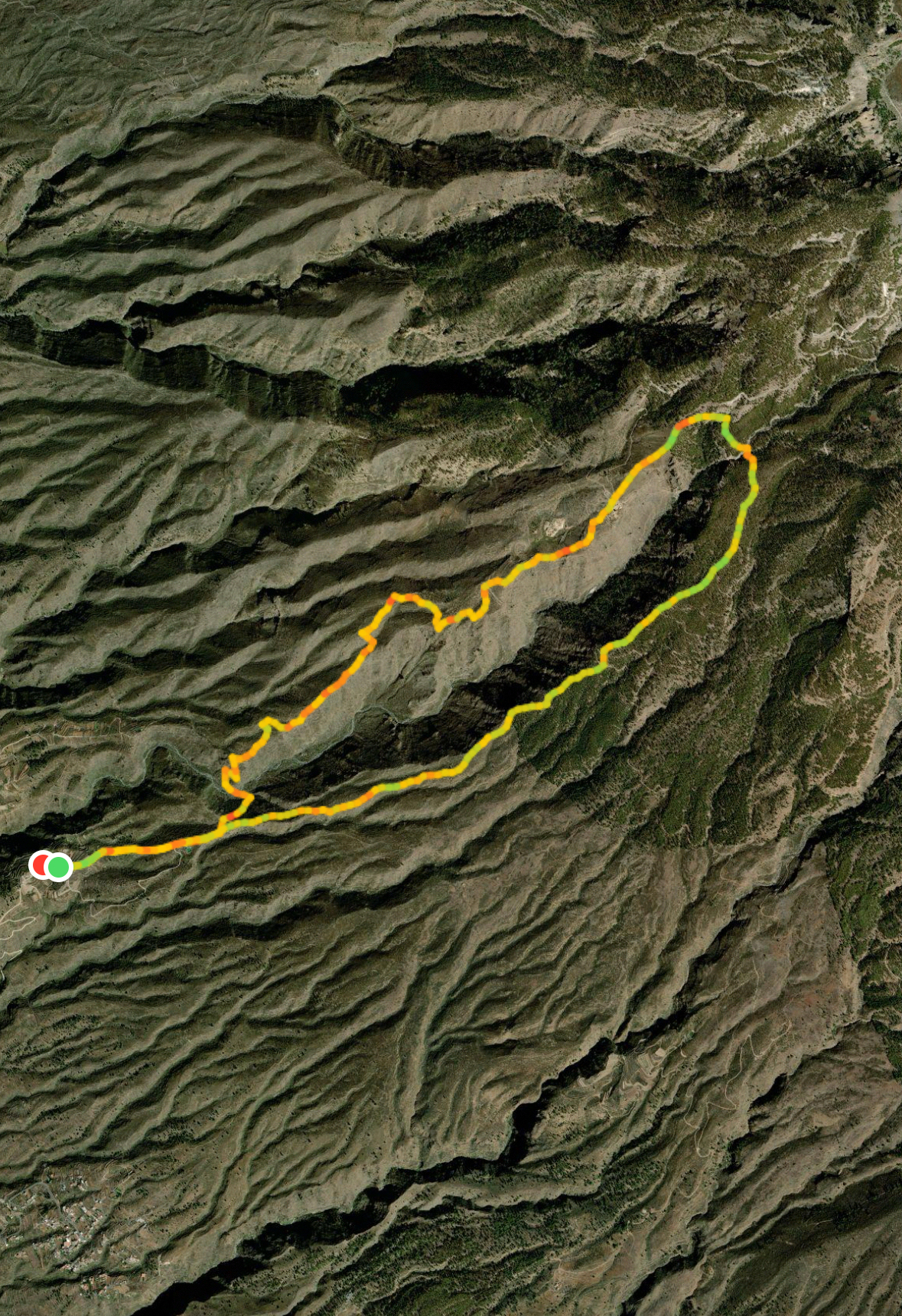
- Circular Hike Caserío de las Fuentes
- Section: Caserío de las Fuentes to Barranco Niágara Cave Houses
- Section: Barranco Niágara Cave Houses to Plateau on the Ridge
- Short Route: Plateau to Caserío de las Fuentes
- Long Route: Plateau to Fuente de Galante
- Long Route: Fuente de Galante to Llano el Negro
- Long Route: Llano el Negro to Caserío de las Fuentes
- Optional Ascent: Montaña de Tejina
- And finally
The Remote Hamlet of Caserío de las Fuentes
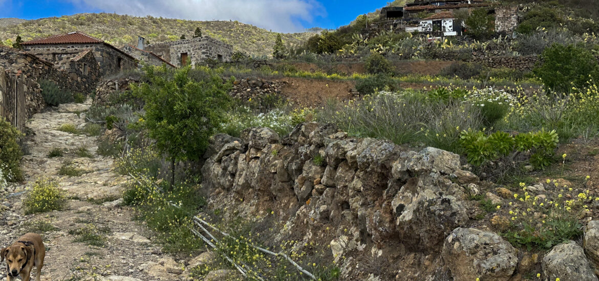
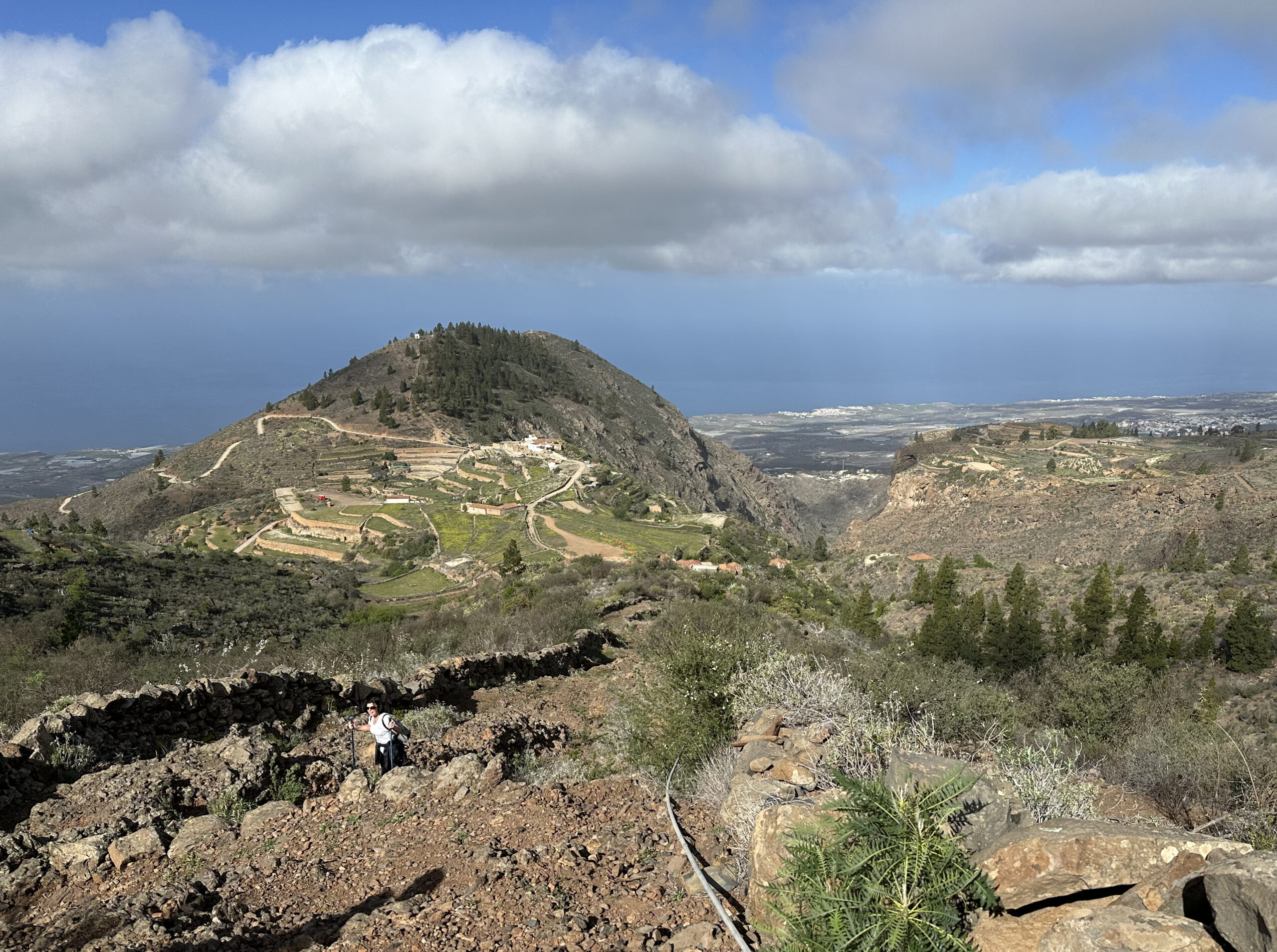
Caserío de Las Fuentes (1000 m altitude) is a historic hamlet in the southwest of Tenerife, located within the municipality of Guía de Isora. Nestled between the ravines Barranco de Guaria and Barranco de Cuéscaro, northwest of the Montaña de Tejina, the small settlement lies among terraced fields. A local once told me that this was the “Machu Picchu of Tenerife” – and from the summit of Montaña de Tejina, it truly looks the part. In the 1930s, an estimated 150 to 200 people lived here. Thanks to fertile soil and innovative agricultural techniques such as “Jable” (a method in which volcanic pumice covers the soil), the hamlet became known as “the granary of Isora”. Potatoes and grains were the primary crops.
Despite its agricultural importance, the hamlet was abandoned in 1973 due to depopulation, caused by its isolated location. In 2015, Caserío de Las Fuentes was recognised as a Cultural Heritage Site (Bien de Interés Cultural) in the category of “Ethnological Site” because of its cultural and architectural value. The preserved structures – stone houses, ovens, cisterns, and threshing floors – bear witness to the region’s traditional way of life and construction methods. The hamlet is now connected by a road to Tejina de Isora. Hikers will find plenty of rewarding trails starting from Caserío de Las Fuentes.
Hiking from Caserío de las Fuentes
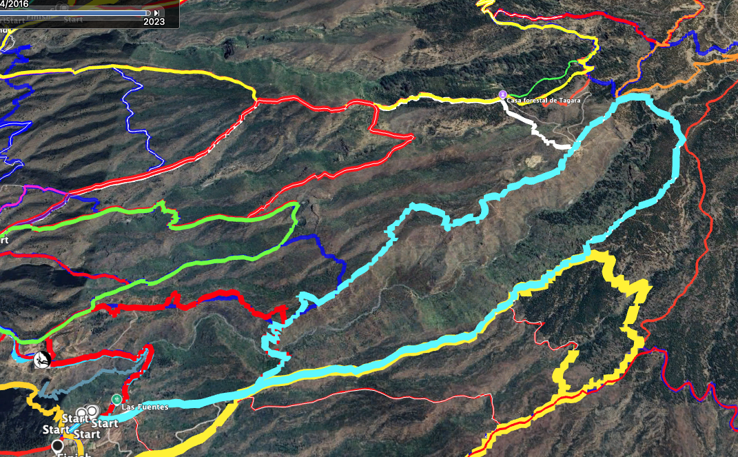
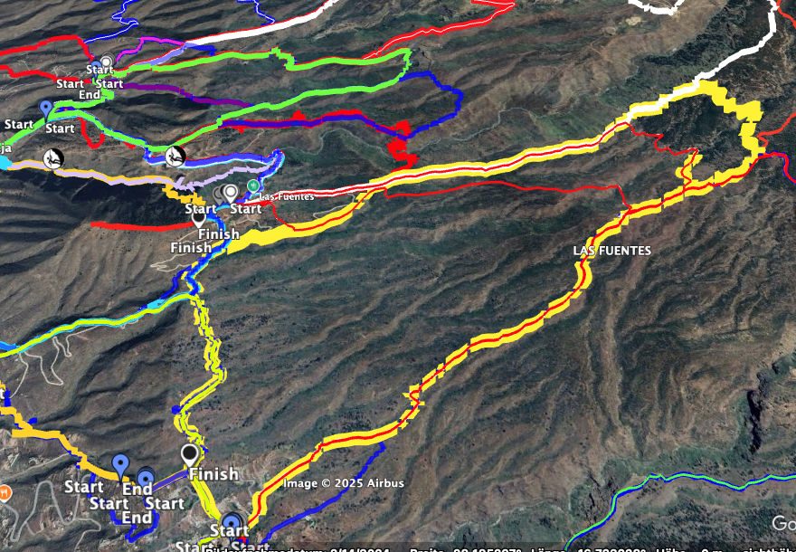
The most well-known trail passing through Caserío de las Fuentes is the PR TF-69, which connects Vera de Erques to Chío. On this route, you may meet other hikers exploring the southwest coast of the island via its many ravines. I have presented the large circular hike from Vera de Erques towards Las Cañadas and over Caserío de las Fuentes on SiebenInseln. This hike partly follows the PR TF-69 and can also be well combined with the tour introduced here, which in its shorter version includes a portion of the PR TF-69. The adventurous circuit around Montaña de Tejina is another adjacent hike in this area.
In the hikes described below, you begin at Caserío de las Fuentes and head into the solitary Barranco Niágara. From there, you ascend to the opposite ridge. On the longer route, you then climb several hundred metres upwards toward Las Cañadas. After crossing the ravine again, you return along the ridge above Caserío de las Fuentes. If this sounds too strenuous, you can descend the opposite ridge towards Caserío el Choro and return via the Barranco Guaría to Caserío de las Fuentes. If you’re up for a small summit experience, you can also climb from the chapel Ermita de San José to Montaña Tejina.
Information about the Circular Hike from Caserío de las Fuentes
Starting Point and Getting There
Start: The hike begins at the small hamlet of Caserío de las Fuentes (approx. 1000 m altitude) near Montaña de Tejina.
Access by Car
Take the TF-82 or the TF-1 motorway (exit Vera de Erques) from either the south or north of the island. After exiting the motorway, head towards Vera de Erques. Once you reach the TF-82, turn left towards Tejina de Isora. In the village, turn right next to Restaurante Vanessa and continue uphill. The next major crossroad is Calle Virgen del Rosario. Follow this road for a while to the right; it eventually becomes Calle las Fuentes. Continue uphill alongside Montaña de Tejina until you reach Caserío de las Fuentes. Roadside parking is available.
Access by Bus
Titsa bus lines 417 and 490 stop in Tejina de Isora. From there, you’ll need to take a taxi or, if you’re in good shape, hike up to Caserío de las Fuentes. Directions can be found in the article about the circuit around Montaña de Tejina. For exact bus times and details, visit the Titsa website.
Time
I generally avoid giving standard times for hikes, as these vary greatly by individual. We took just under 6 hours for the full loop, including several breaks.
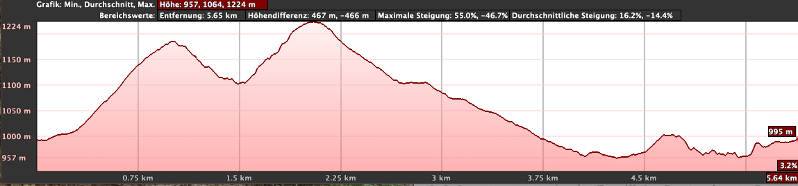
The shortened route via the Barranco Guaría took about 3 hours with breaks.
Elevation Gain and Distance
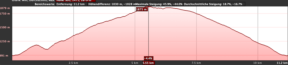
Full loop: About 1000 m elevation gain, approx. 13 km distance.
Shortened route: 6.5 km and 400 m elevation gain.
Difficulty
Most of the route follows good hiking trails. Only the descent and crossing of Barranco Niágara follow a narrow path. In the ravine, the trail can be overgrown and hard to spot in places.
Refreshment
There are no refreshment stops along the way. Be sure to bring enough water and provisions.
Variants
The large hike from Caserío de las Fuentes into Barranco Niágara can be halved in length. Both options are described in this article. As always, you can find the GPS tracks in the download section.
Other hikes on SiebenInseln that can be combined with this one:
Adventurous tour around Montaña de Tejina
Grand Circular Hike from Vera de Erques via Las Fuentes
Circular Hike Caserío de las Fuentes
Section: Caserío de las Fuentes to Barranco Niágara Cave Houses
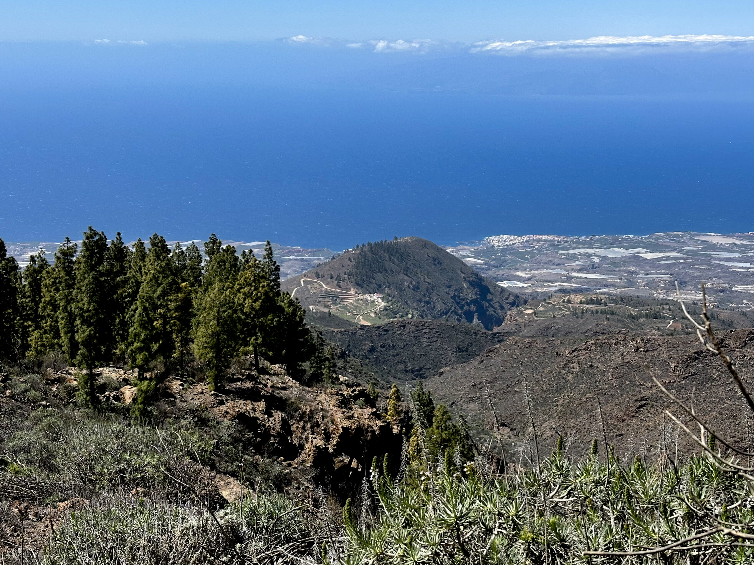
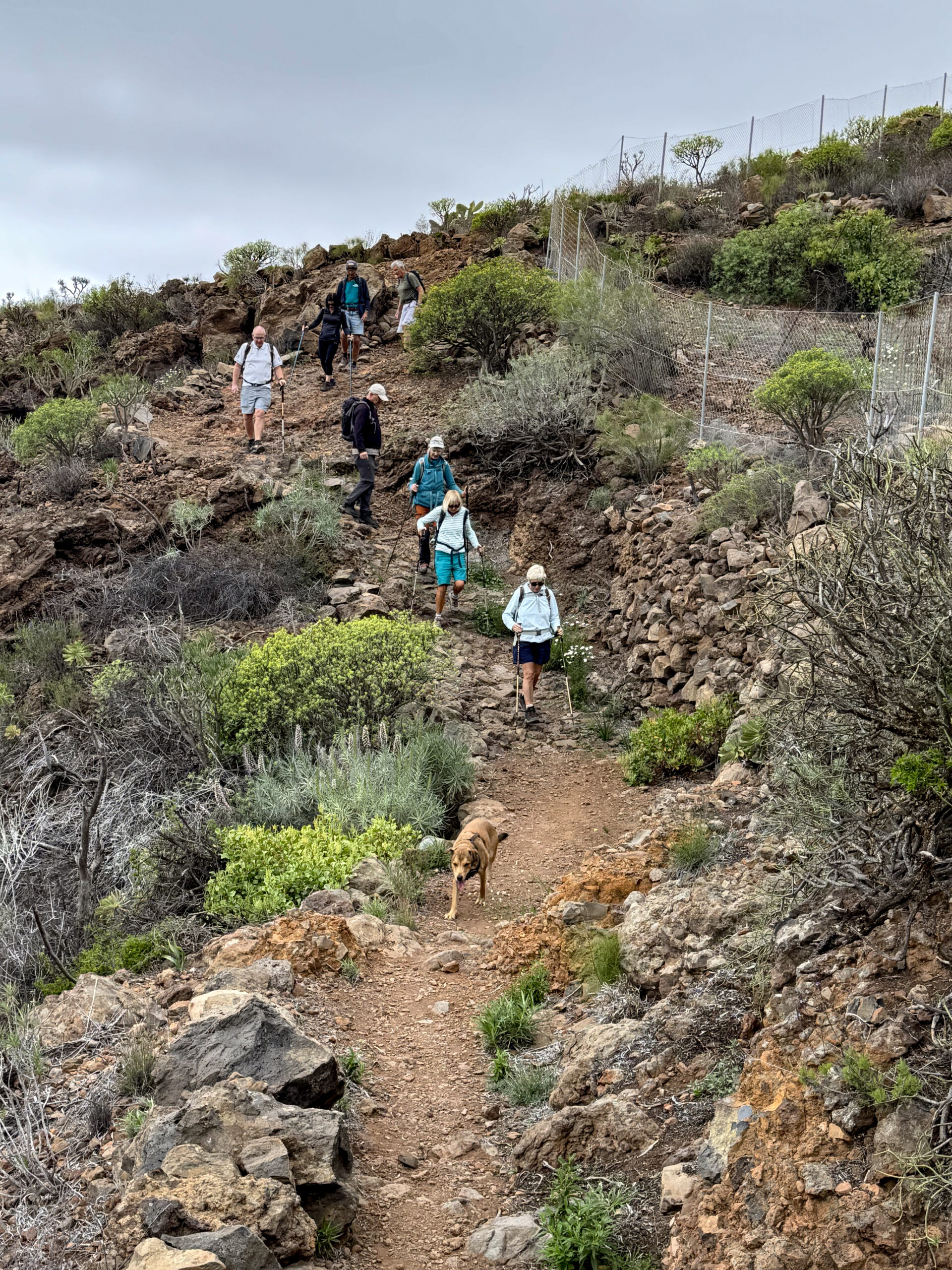
You begin your hike in Caserío de las Fuentes, following the main track along the Camino de las Fuentes, continuing straight ahead through the hamlet towards the mountain ridge. The paved road quickly turns into a dirt track and then into a hiking path. This path climbs steadily, quickly taking you up above Caserío de las Fuentes. Looking back, you can already enjoy beautiful views over the hamlet, Montaña de Tejina, and all the way to the Atlantic Ocean. After some time, you reach the Casa de los Poleos. Just before that, you leave the official trail PR TF-70.2, turning left.
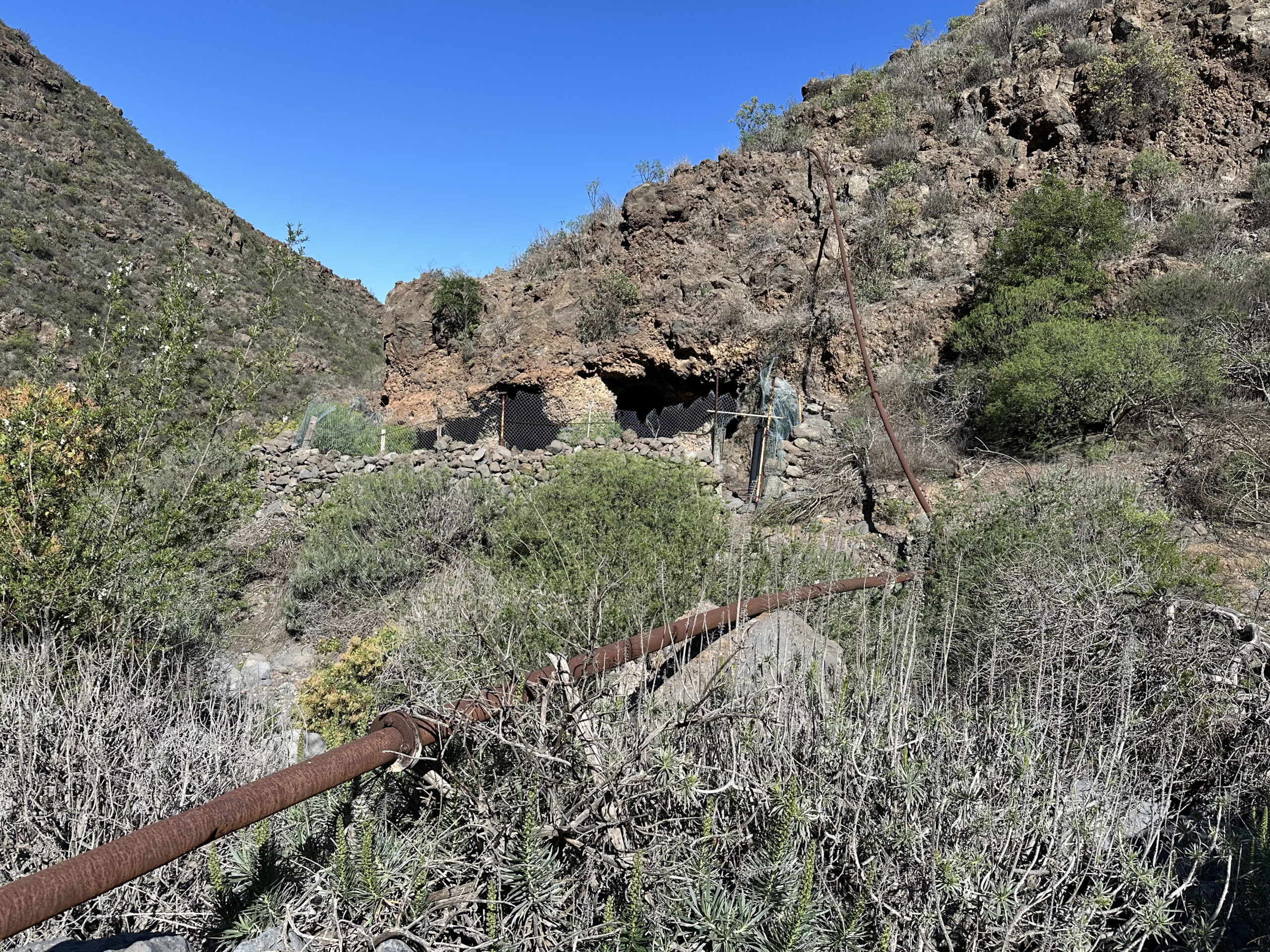
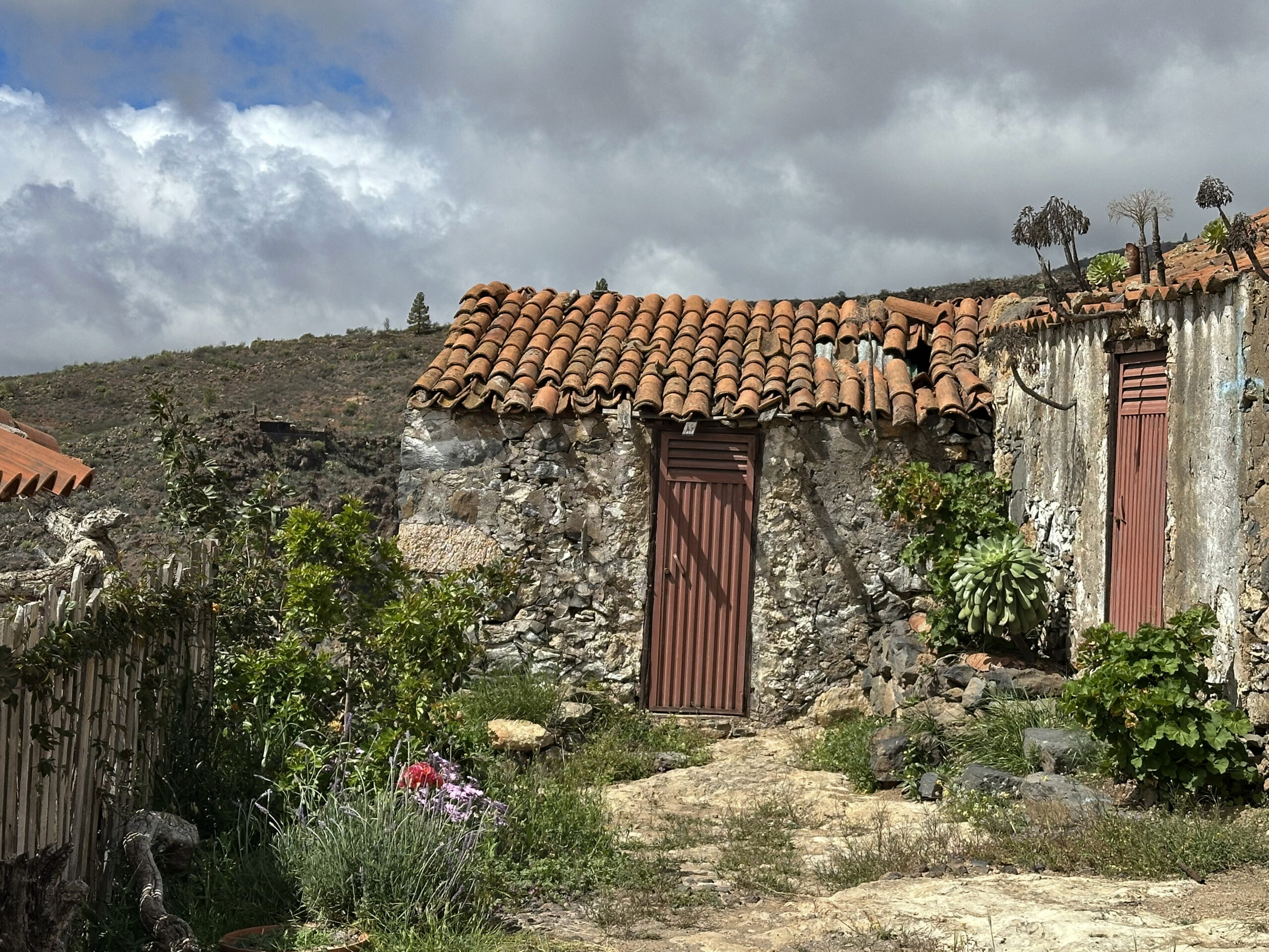
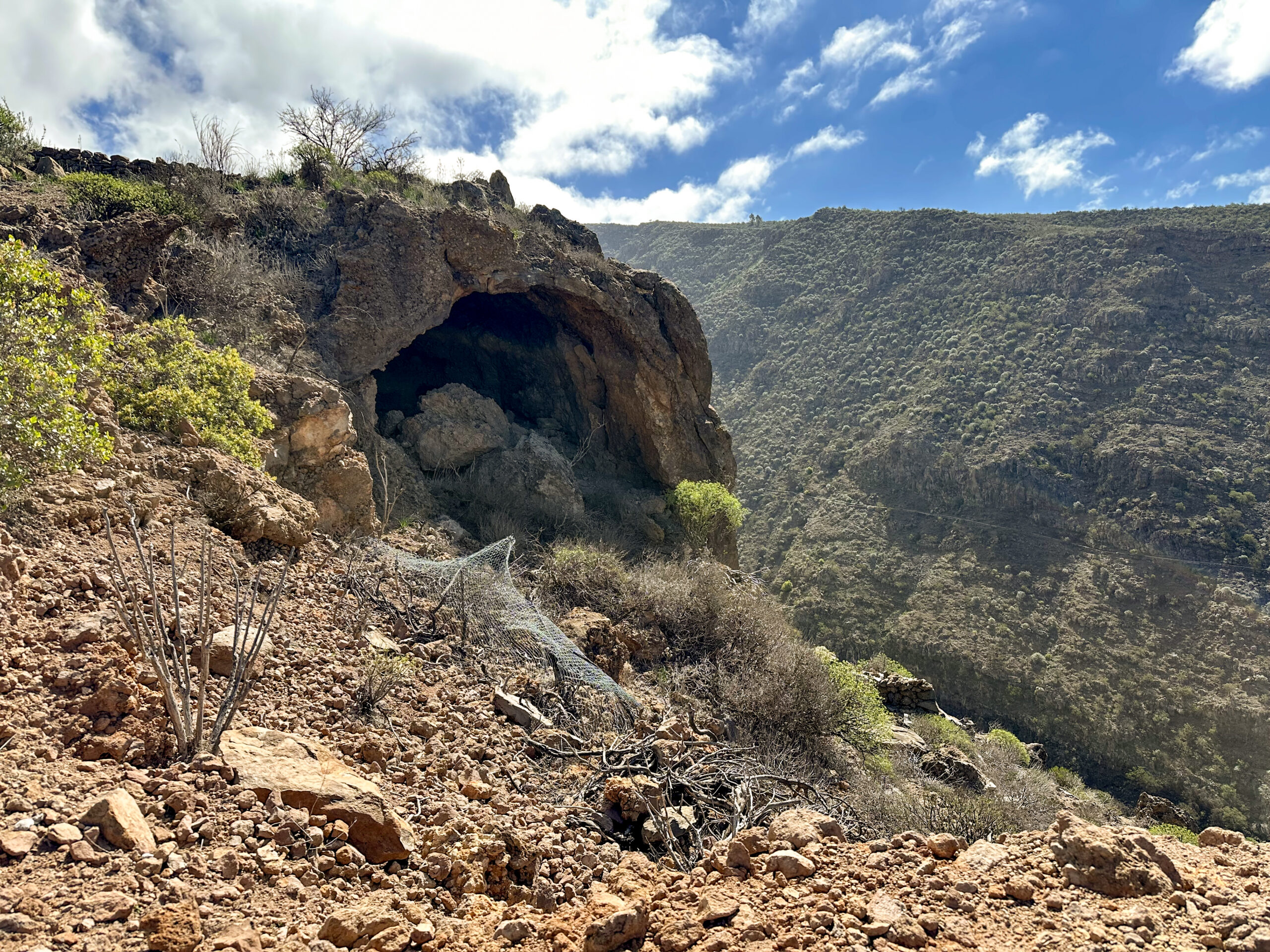
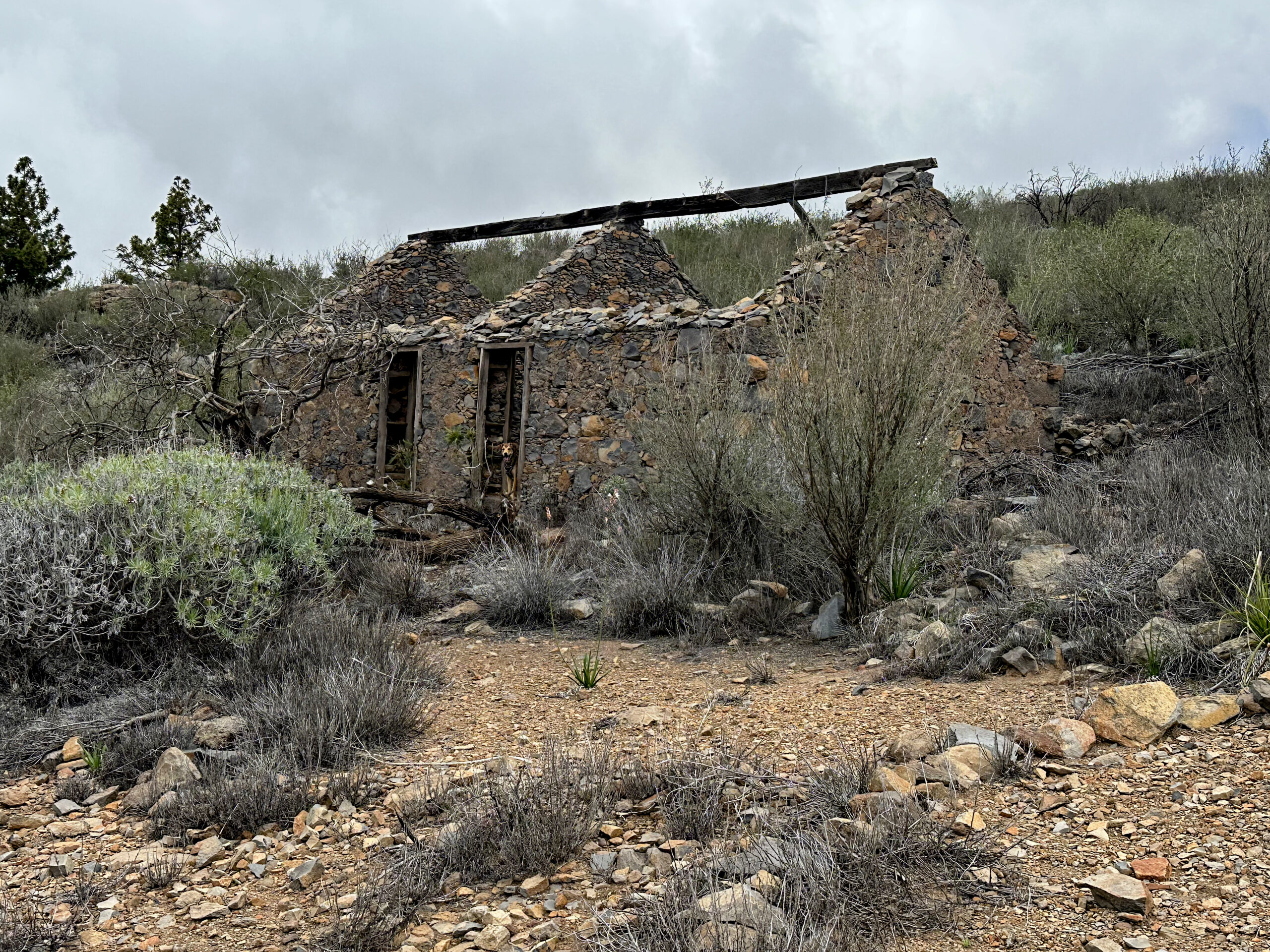
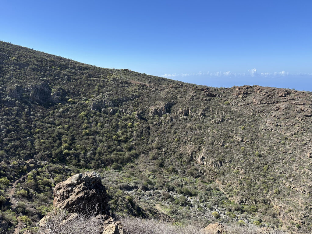
A narrow path now leads you along the hillside down into the Barranco Niágara. The path is narrow but easy to follow. Once you reach the bottom of the ravine, you need to cross it. At this point, the trail becomes slightly unclear, as parts of it may be a little overgrown. However, this is only temporary, and you’ll soon spot cave houses on the opposite cliff wall. Head towards them – they are well worth a visit. Afterwards, follow the path left, continuing around the cave houses through the ravine.
Section: Barranco Niágara Cave Houses to Plateau on the Ridge
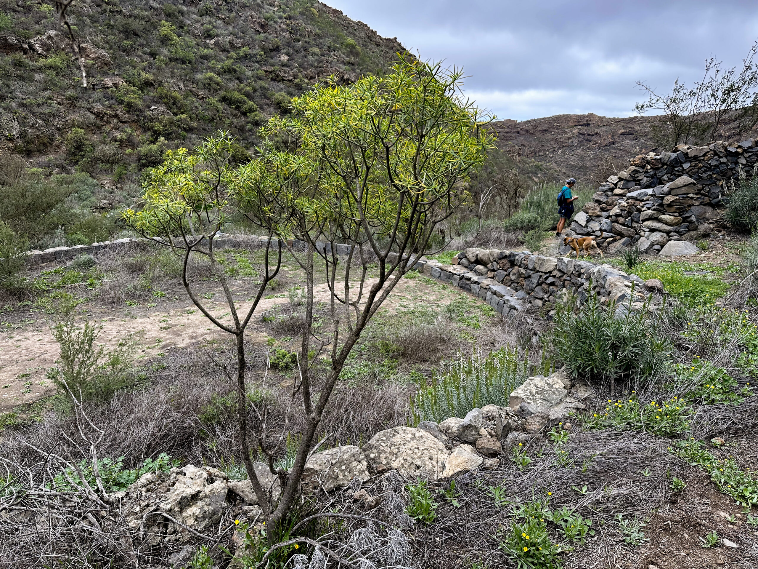
You now climb out of the ravine to the right on a narrow trail. On your left, there is a threshing circle (era), which you pass on the right-hand side. After that, a well-defined path begins, winding steeply up to the ridge in long switchbacks. Once you reach a small plateau at the top, the route splits into the short and long version of the hike. I will describe the short route first.
Short Route: Plateau to Caserío de las Fuentes
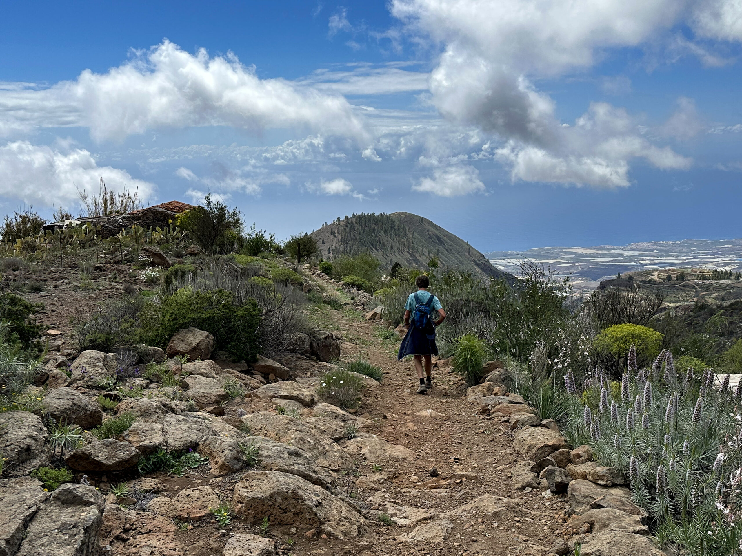
For the short route, either turn left immediately or first take a short loop around another threshing circle. Eventually, you’ll reach the wide descent path heading towards Caserío el Choro. Follow this track downhill for quite a while. Occasionally, the hiking trail cuts off sections of the track to shorten the way. You’ll then reach a road that leads you above Caserío el Choro. Walking between small farms and terraced fields, follow the road that branches off to the left.
This road eventually joins the well-known hiking route PR TF-69, which you now follow to the left. Enjoy splendid views across Barranco Guaría towards Caserío de las Fuentes and Montaña Tejina. The trail is easy to follow, always staying close to the edge of the barranco. You’ll pass an abseil point and walk around the large ravine. On the far side, the trail climbs again, leading you back to Caserío de las Fuentes.
Long Route: Plateau to Fuente de Galante
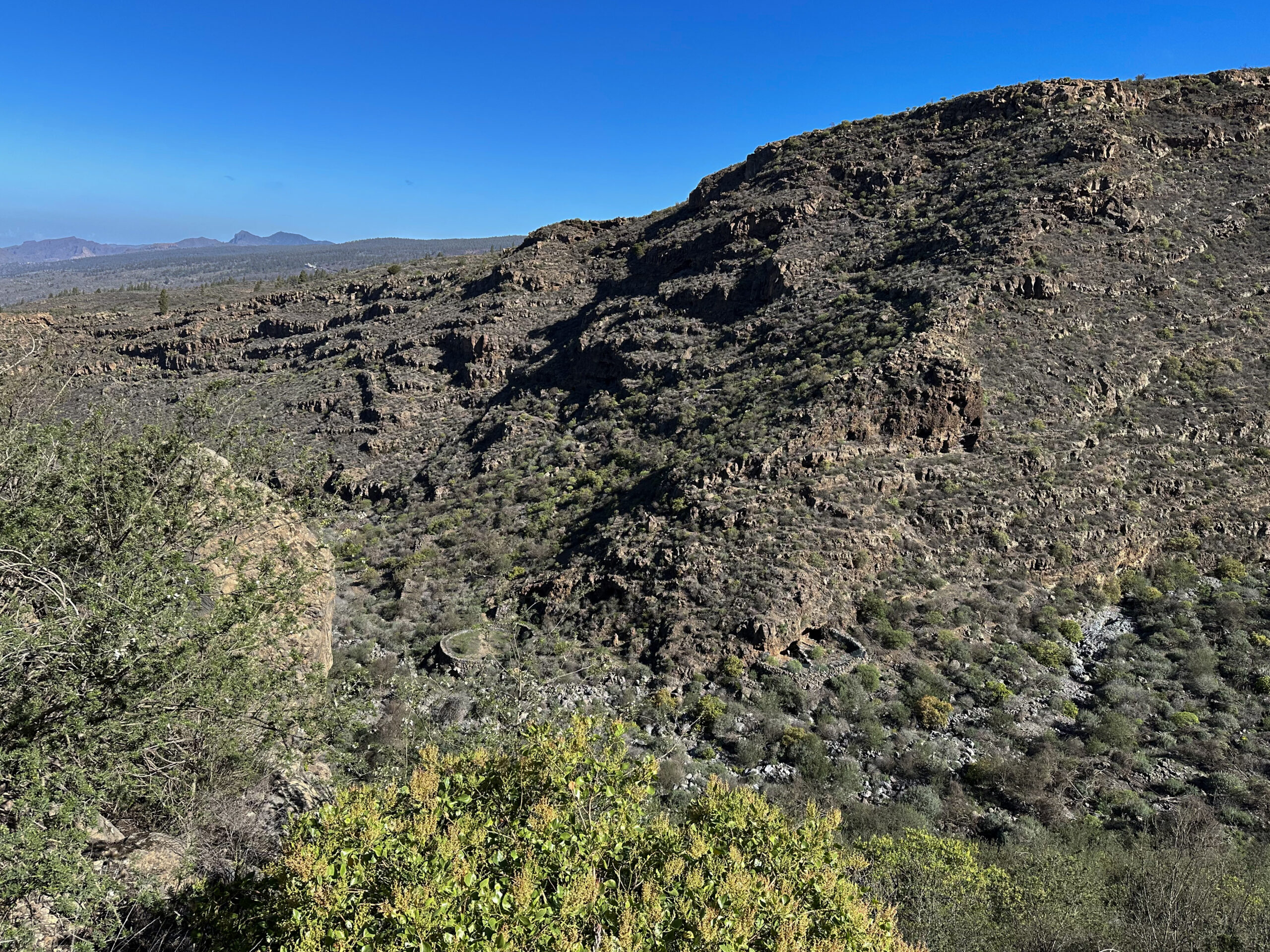
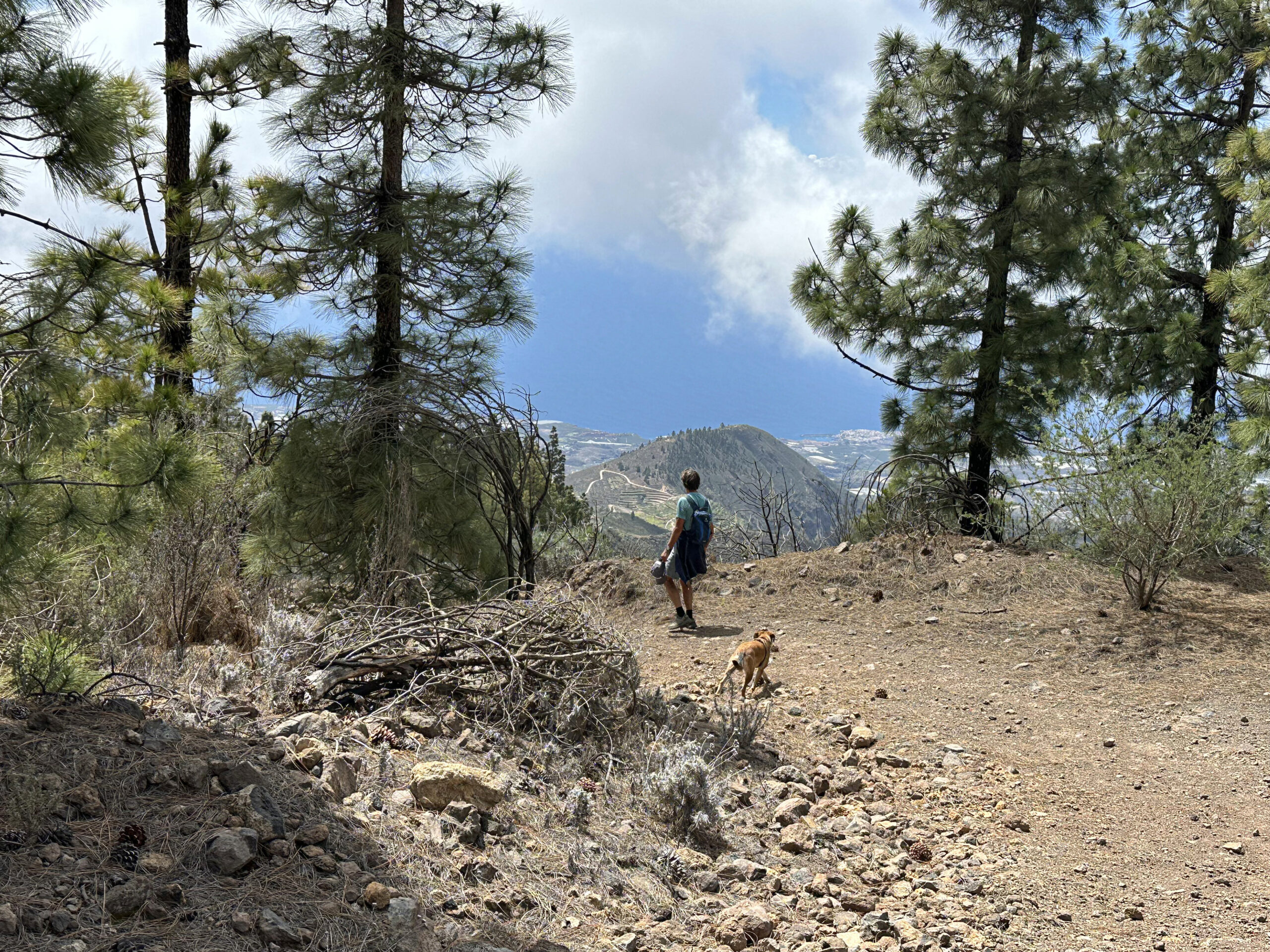
For the longer route, continue climbing along the ridge above Barranco Niágara. At one point, there’s a small side path to the left, which you may choose to take, but you can also simply follow the ridge straight ahead. The ascent is steady and quite steep in parts. Before long, a trail branches left to El Jaral – ignore this and continue climbing. You’ll pass another threshing circle and some large caves.
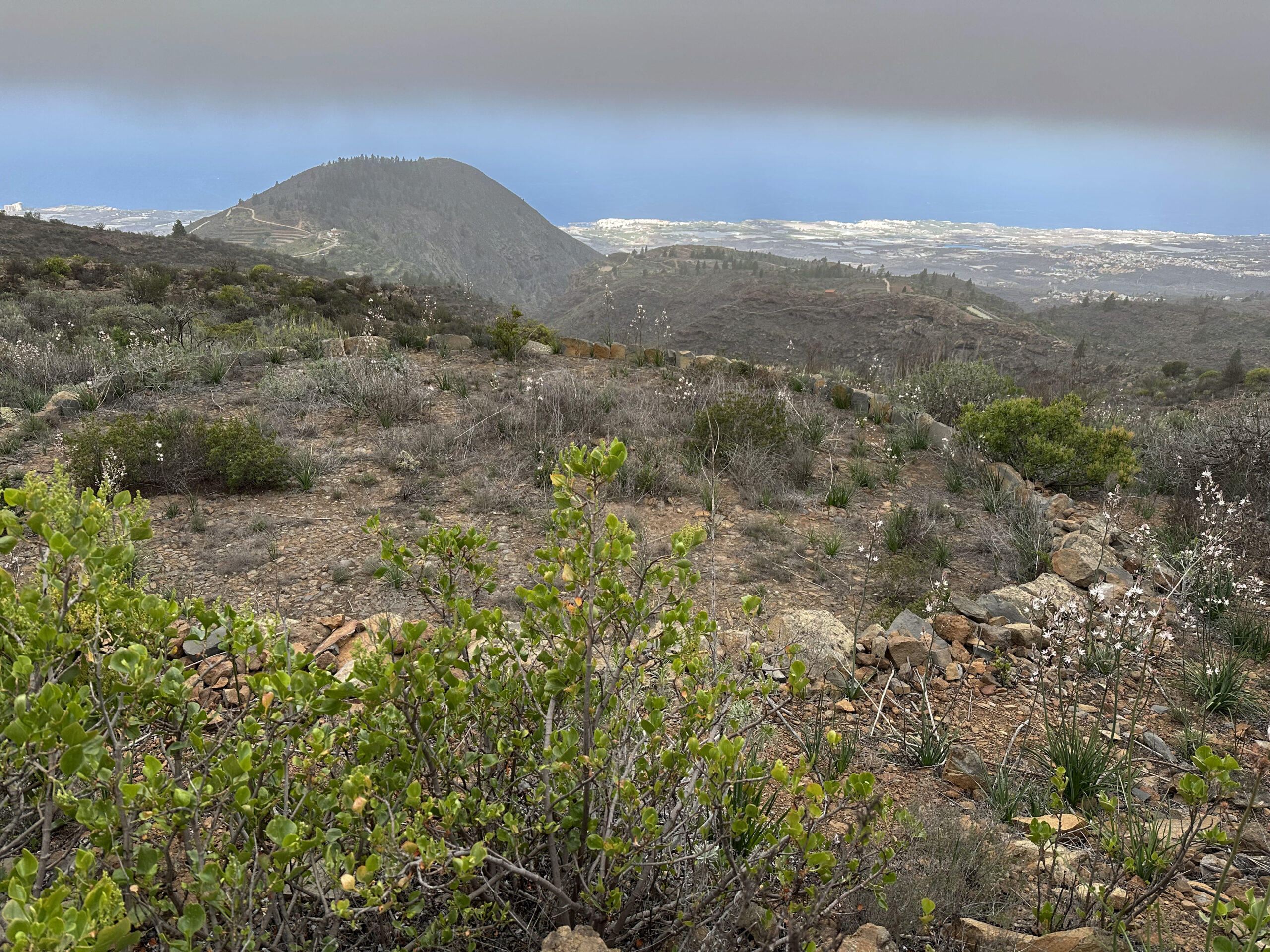
The trail then bends left, crossing a small ravine. On the far side, the path continues uphill. It eventually curves around and rejoins the ridge path. There, you’ll come across another old estate with a threshing circle (La Chifira). The ascent continues, and you’ll find yourself at 1600 metres elevation. Now hiking through bushland, you’ll see large white rocky fields on your left. Eventually, you reach the viewpoint Fuente de Galante, where you join the PR TF-70.1 trail. This trail heads down to El Jaral on the left.
Long Route: Fuente de Galante to Llano el Negro
At Fuente de Galante, not only will you find large stone terraces, but also, provided the sky is clear, fantastic panoramic views. You can see into the upper reaches of Barranco Niágara. But your climb is not over yet – the PR TF-70.1 continues uphill. You’ll pass the viewpoint Alto de Tatosaya. By now, you are in a pine forest at around 1850 metres altitude.
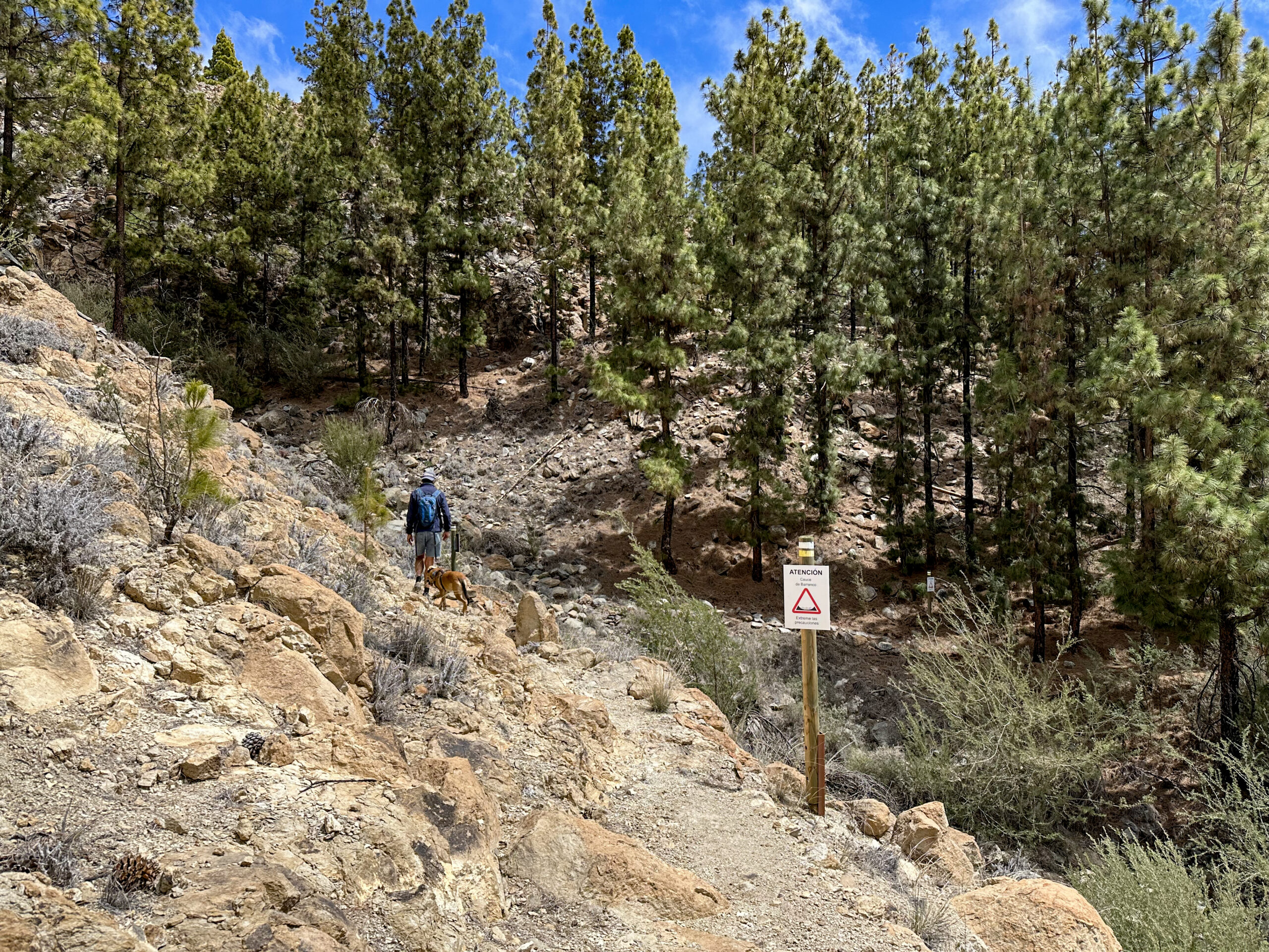
At a large trail junction, the main path continues straight ahead, but you turn right, heading downhill towards Barranco Niágara. The well-marked trail leads you across several smaller ravines and eventually across Barranco Niágara itself. After crossing, the path climbs again. Here, you rejoin trail PR TF-70.2, which you now follow exclusively downhill. Soon you reach the viewpoint Llano el Negro.
Long Route: Llano el Negro to Caserío de las Fuentes
Now you descend pleasantly through the pine forest, enjoying more lovely views. At the viewpoint La Punta del Bardo, the path from the hike Vera de Erques – Las Fuentes joins from the left. Continuing your descent, you’ll pass two shortcut paths described earlier, also joining from the left on PR TF-70.2. Continue descending.
Eventually, you return to Las Fuentes and reach the fenced house Casa de los Poleos, where you earlier descended into Barranco Niágara. Now simply stay on the same path you used for the ascent, following it downhill all the way back to Caserío de las Fuentes, where the long circular hike ends.
Optional Ascent: Montaña de Tejina
If you still have time and energy either before or after your hike, consider climbing Montaña de Tejina. At the point where the road to Las Fuentes meets the PR TF-69 hiking trail, you can ascend about 100 metres steeply uphill to the top of the Montaña de Tejina. At the summit, you’ll first reach the Ermita de San José. If you feel up to it, you can continue hiking along the ridge and enjoy the views of Tenerife’s very own “Machu Picchu” from above. You’ll be rewarded with breathtaking panoramic views in all directions.
And finally
I hope you’ve enjoyed this varied circular hike from Caserío de las Fuentes into Barranco Niágara, with many route options to choose from. Whichever path you decide to take on your next adventure, I wish you happy hiking and memorable experiences!
Dagmar from Siebeninseln