Circular hike Malpaís de Güímar
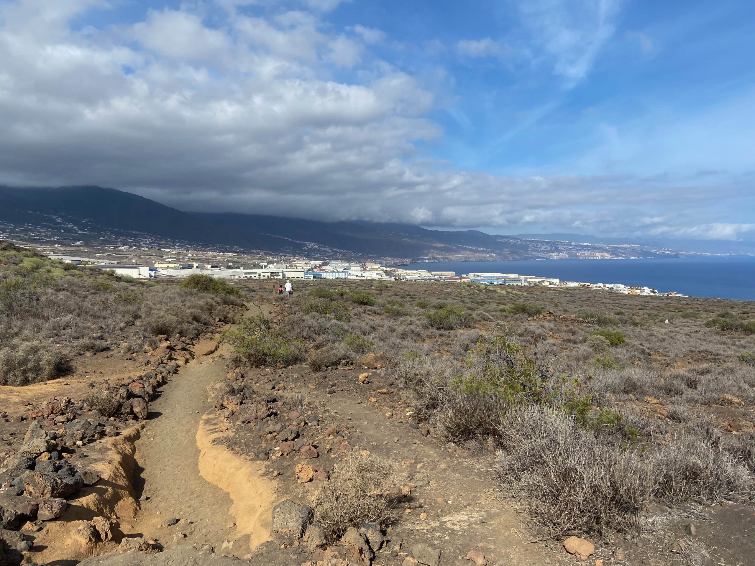
This small circular walk starts and ends on the coast near Güímar, in Puertito de Güímar. It is one of those hikes that I would almost call a long walk. Nevertheless, it is charming and highly recommended. You walk through a beautiful coastal landscape with views of volcanoes, lava fields, mountains and the Atlantic Ocean. There are only a few metres of altitude to climb on this hike and the paths are well laid out. Furthermore, you can shorten or extend the length individually. So this really is a hike for everyone.
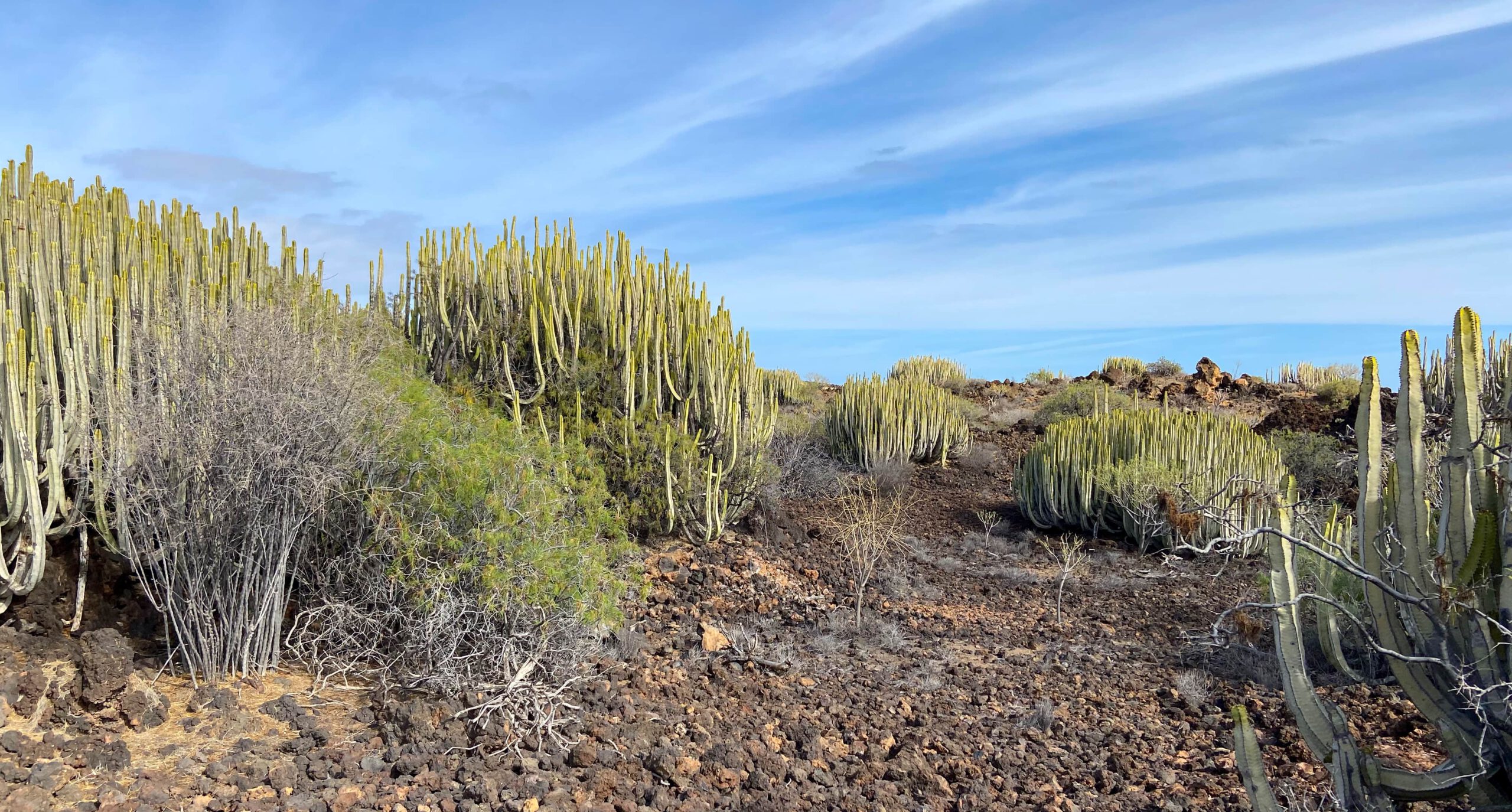
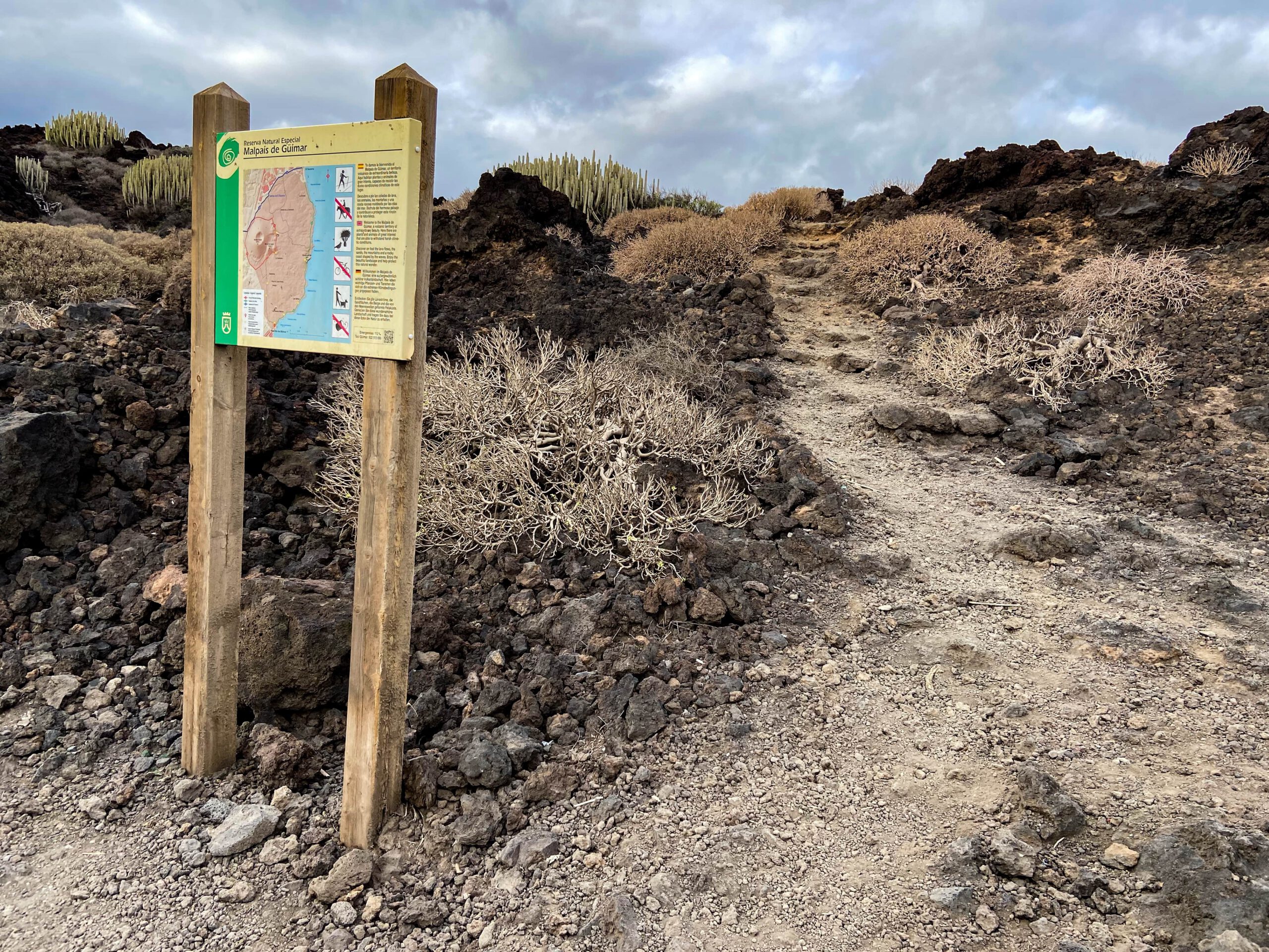
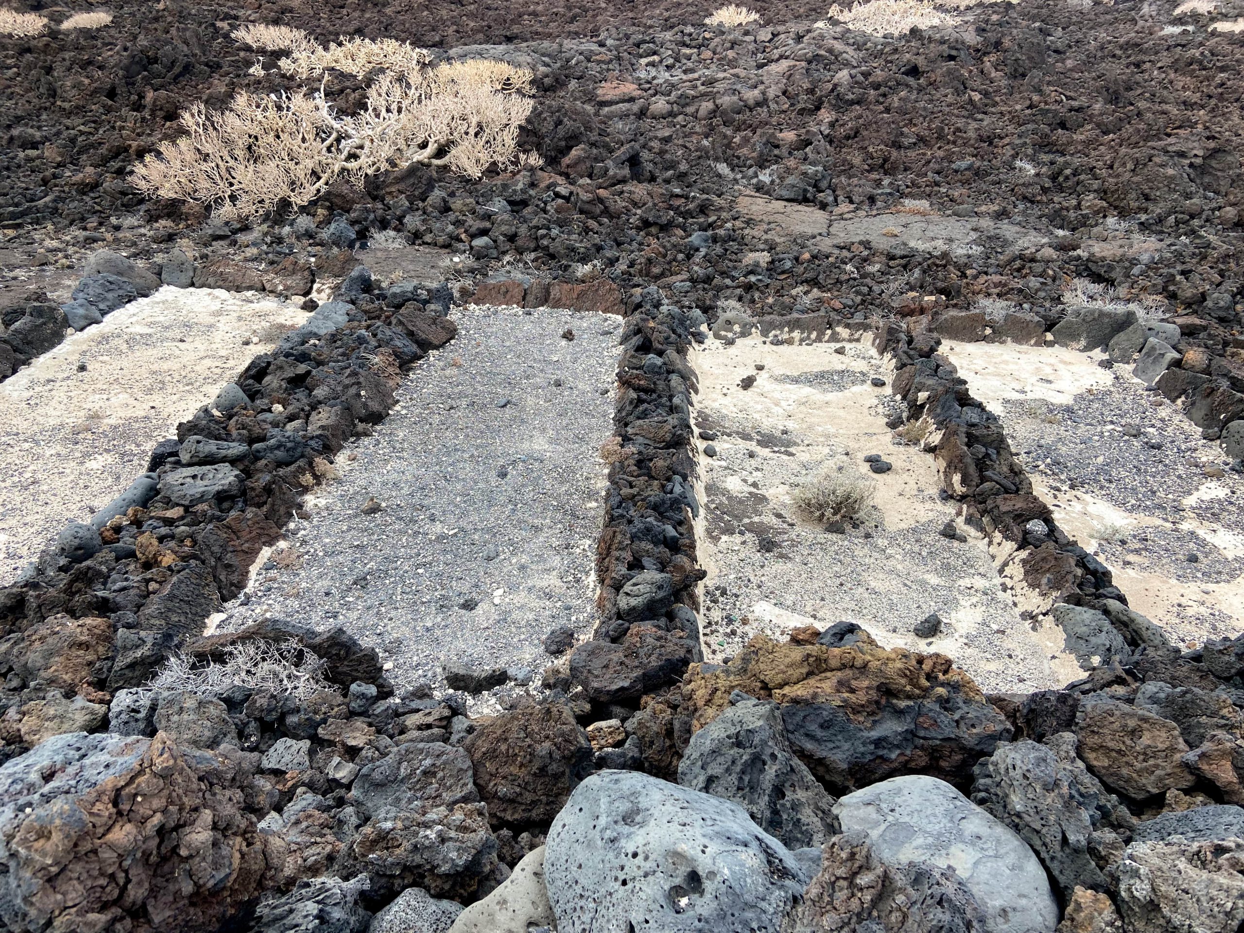
Malpaís de Güímar is a Special Nature Reserve that was placed under protection in 1987. There are many underground lava tubes in this area. The Malpaís is of great ecological importance, because due to the mild climate in this volcanic landscape and the coastal region, you can admire many endemic plant species there. You will walk past the various species of spurge, as well as the Canary Island spurge. In this impressive coastal lava landscape, you will come across lettuce, broom and beach lilac, as well as numerous species of lichen.
There is plenty of information and viewpoints for resting and looking around. Enjoy this short hike with all your senses.
General information about the Malpaís de Güímar hike
Starting point and approach
The starting point of the hike is Calle Marqués de Santa Cruz in Puertito de Güímar. The spot is easy to find, as this is the end of the asphalt road that turns into a dirt track.
Arrival by car
Leave the TF-1 at exit 22 Güímar and continue towards Puertito de Güímar. This will take you to Puertito de Güímar via the TF-61. From Avenida Christobal Colón, turn left onto Calle C. Francisco Pizarro. At the end of this street, turn right onto Calle Isaac Peral. At the end of this street, turn left onto Calle Almte Cervera. Finally, turn left onto Calle Marqués de Santa Cruz. There are parking spaces on the left. If this is not enough, you can also park in the town and walk back to the starting point.
Arrival with bus
You can take the Titsa bus 120 to Puertito de Güímar. You can find out more on the Titsa homepage .
Summary information about the article and a large selection of GPS hiking tracks are availableRegister now for my newsletter and get exclusive access to my collected GPS tracks as well as all short information about my articles.
Time
I don’t like to give general times for hiking tours, because the times are very individual. We needed just under 2 hours for this hike with a few stops. However, you can easily extend the hike to 4 hours with longer stops at interesting places or on the extensions.
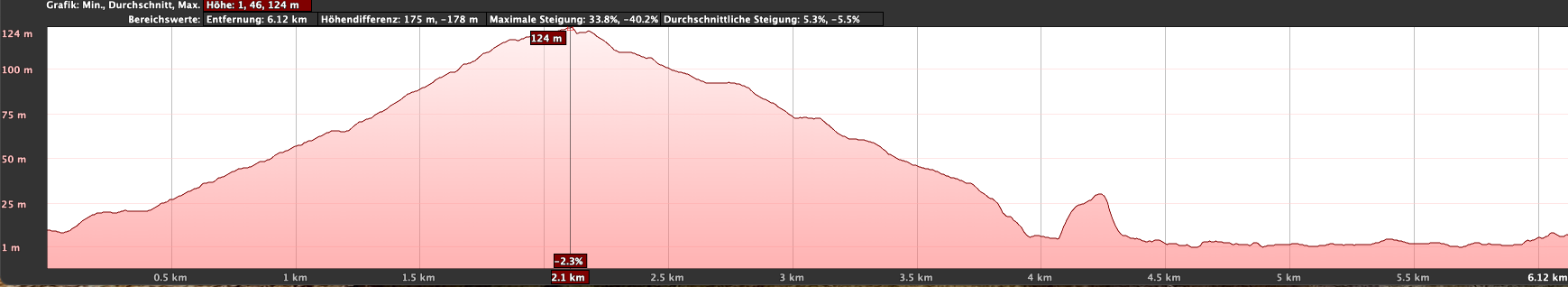
Altitude difference and route length
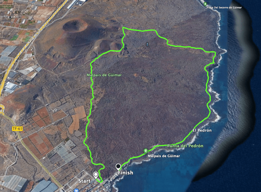
The difference in altitude is about 150 metres and if you walk the extensions, a few metres more. And the small circular hike is about 6.5 kilometres long. The extensions of the route are approx. 9 and 12 kilometres long.
Requirement
Basically, this is a simple and easy hike on good paths.
Refreshment
There are restaurants, bars and shops in Puertito de Güímar at the start and end of the hike. Therefore, at least take enough water with you.
Variantes
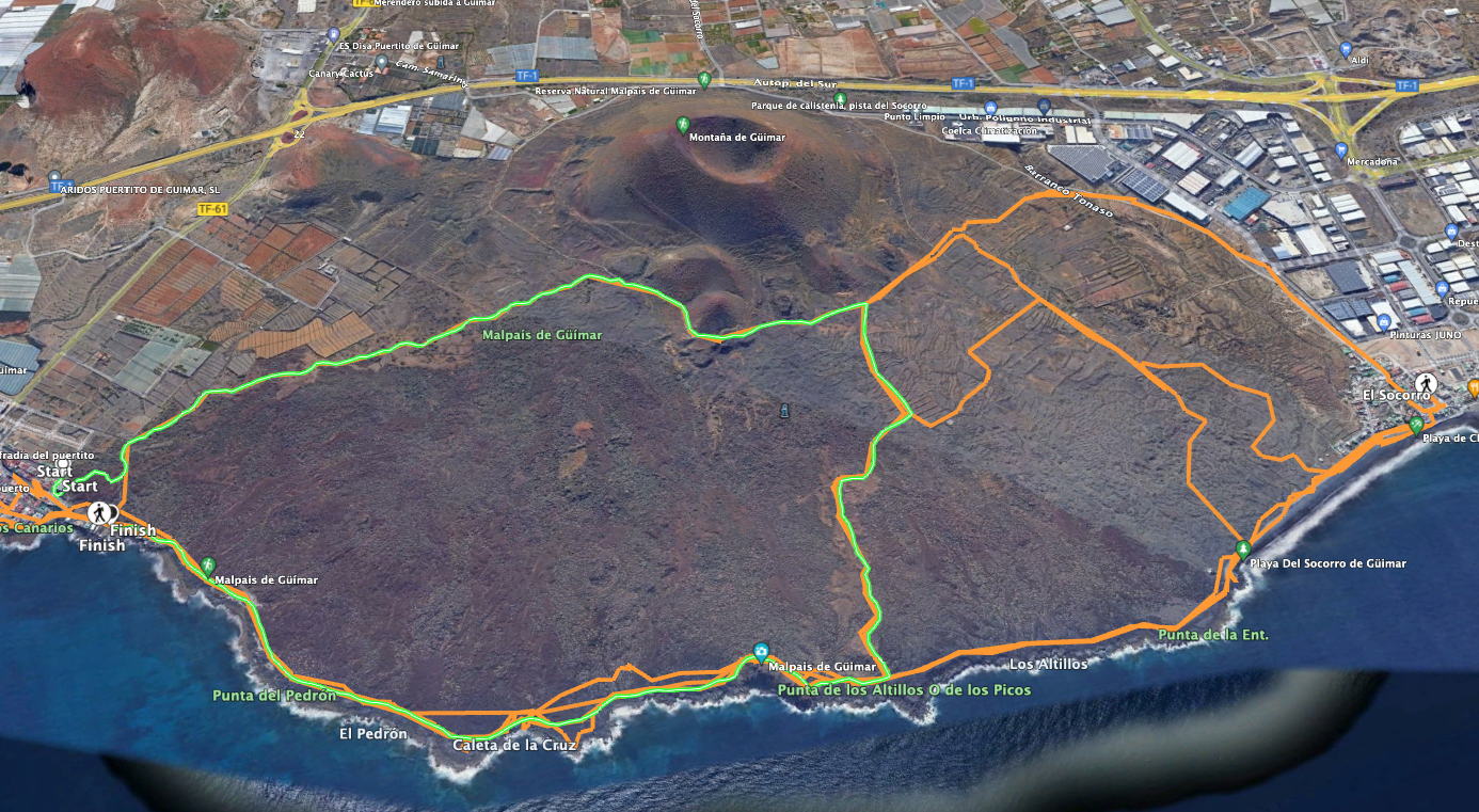
This tour can also be extended in length as a circular walk. I have described here the small round tour of about 6.5 kilometres. On the pictures, however, you can see possibilities to extend this round tour to approx. 9 and 12 kilometres.
Hike Malpaís de Güímar
Puertito de Güímar section, Calle Marqués de Santa Cruz to Montaña Grande
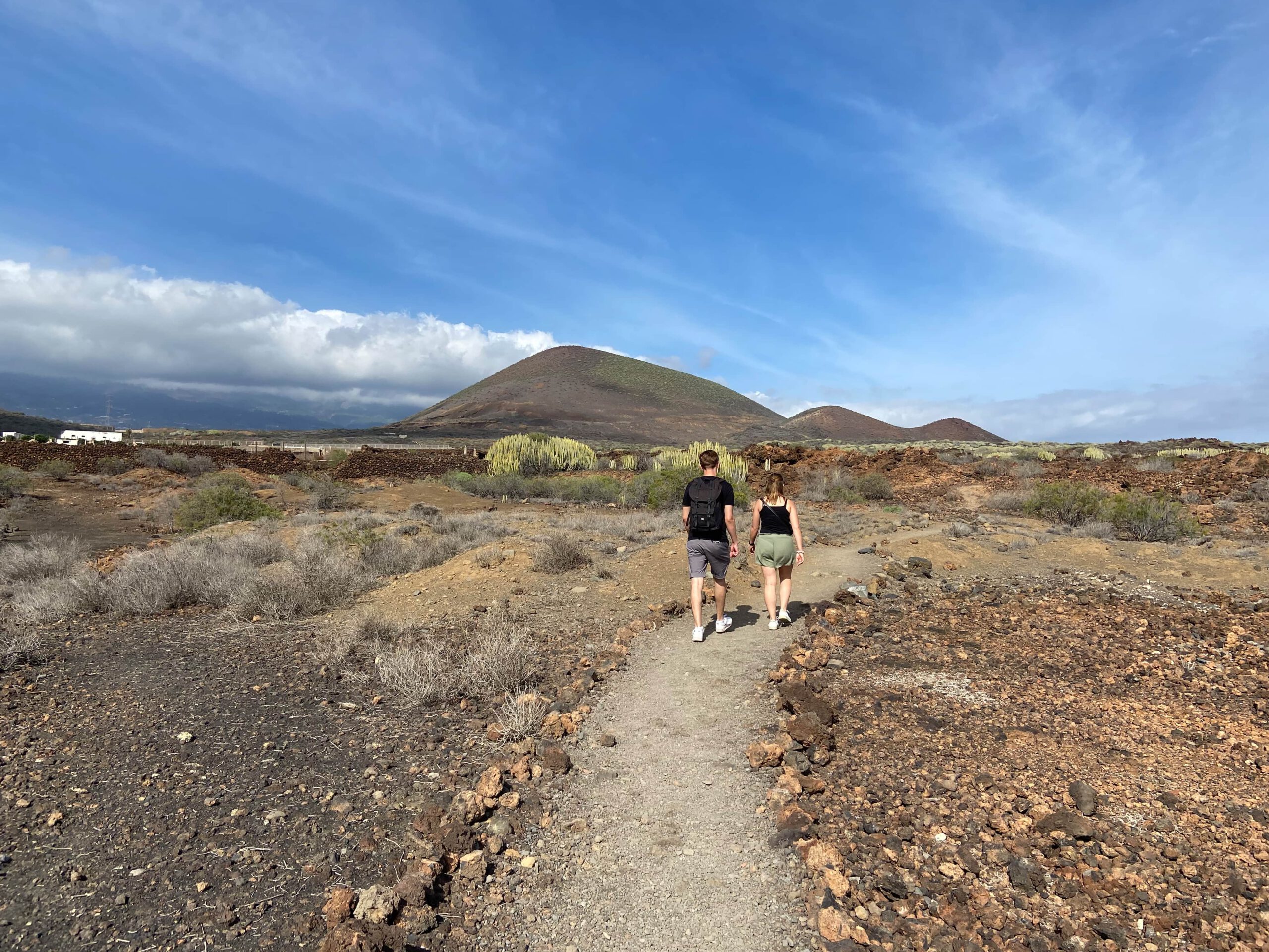
You start your hike in Puertito de Güímar, Calle Marqués de Santa Cruz at the point described above. Please do not follow my track here at the beginning, because I came onto the main path of the hike diagonally from another car park. You can also see this on the track picture. Once on the main path, you can’t miss the well laid out path. On the right and left of the entire hike, you will encounter many endemic plants mentioned above in the lava fields.
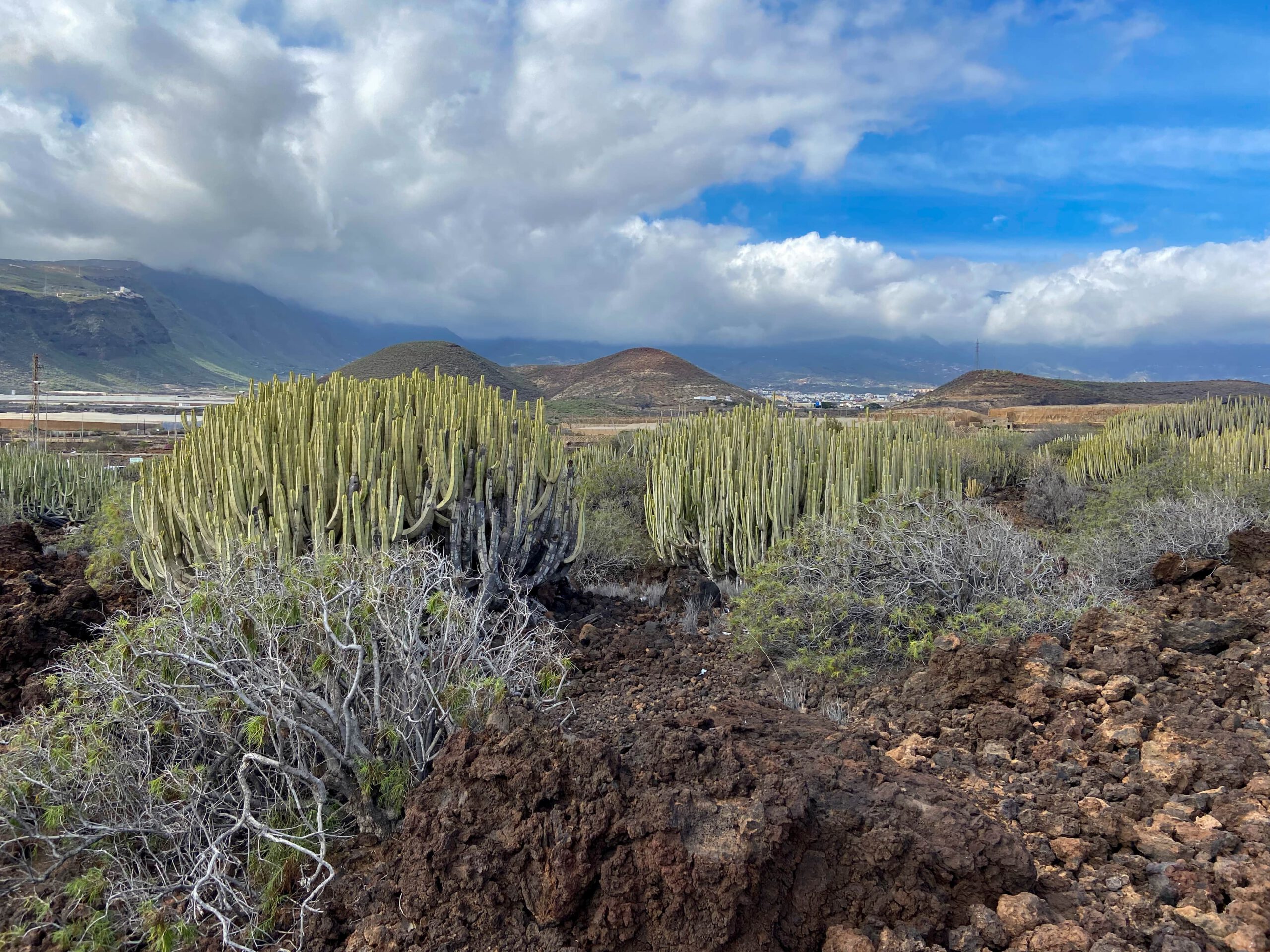
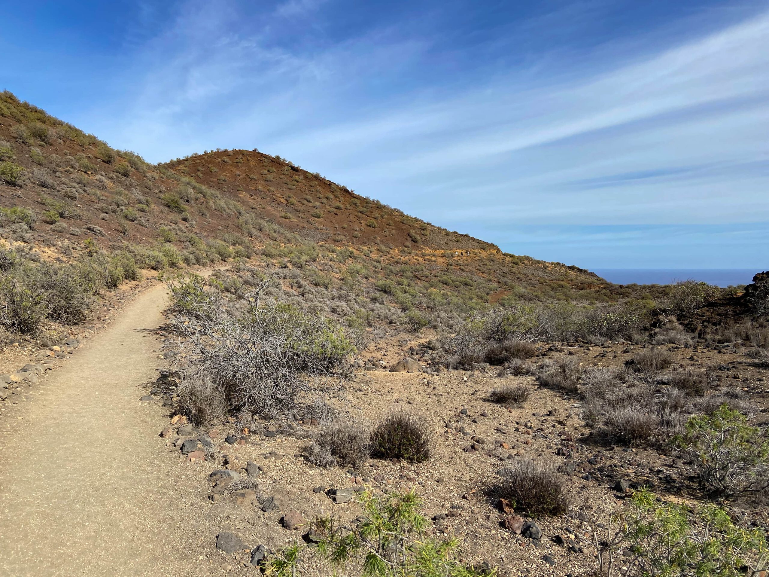
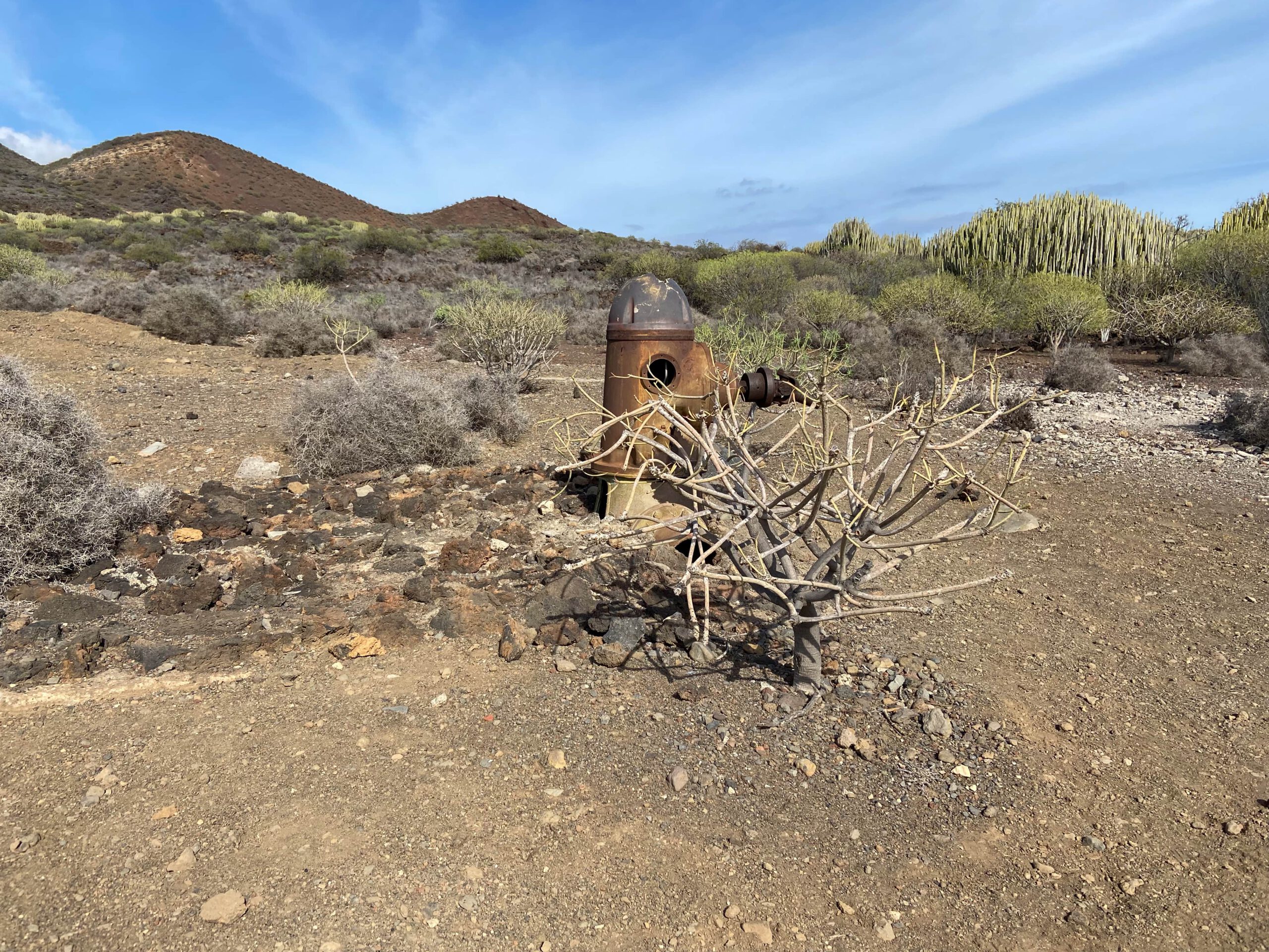
You will see lava tunnels and interesting explanatory panels, which will give you a little more insight into the life of the coastal inhabitants of that time. Since you really can’t miss the path, I will only briefly point out a few striking places below. In the first long section, you hike towards the volcanic cones of Montaña Grande and shortly before you reach them, you pass the impressive viewpoint Morra del Corcho at an altitude of 130 metres.
Route section Montaña Grande to junction east side Montaña Grande
At the foot of Montaña Grande, the path divides. If you go around to the left, you could walk completely around Montaña Grande. However, you would have to walk a large part of the hike right next to the motorway. For this reason, most hikers forego this extension. If you keep to the right, you will also go around a large part of Montaña Grande and climb up the foothills. You will go around some small volcanic cones.
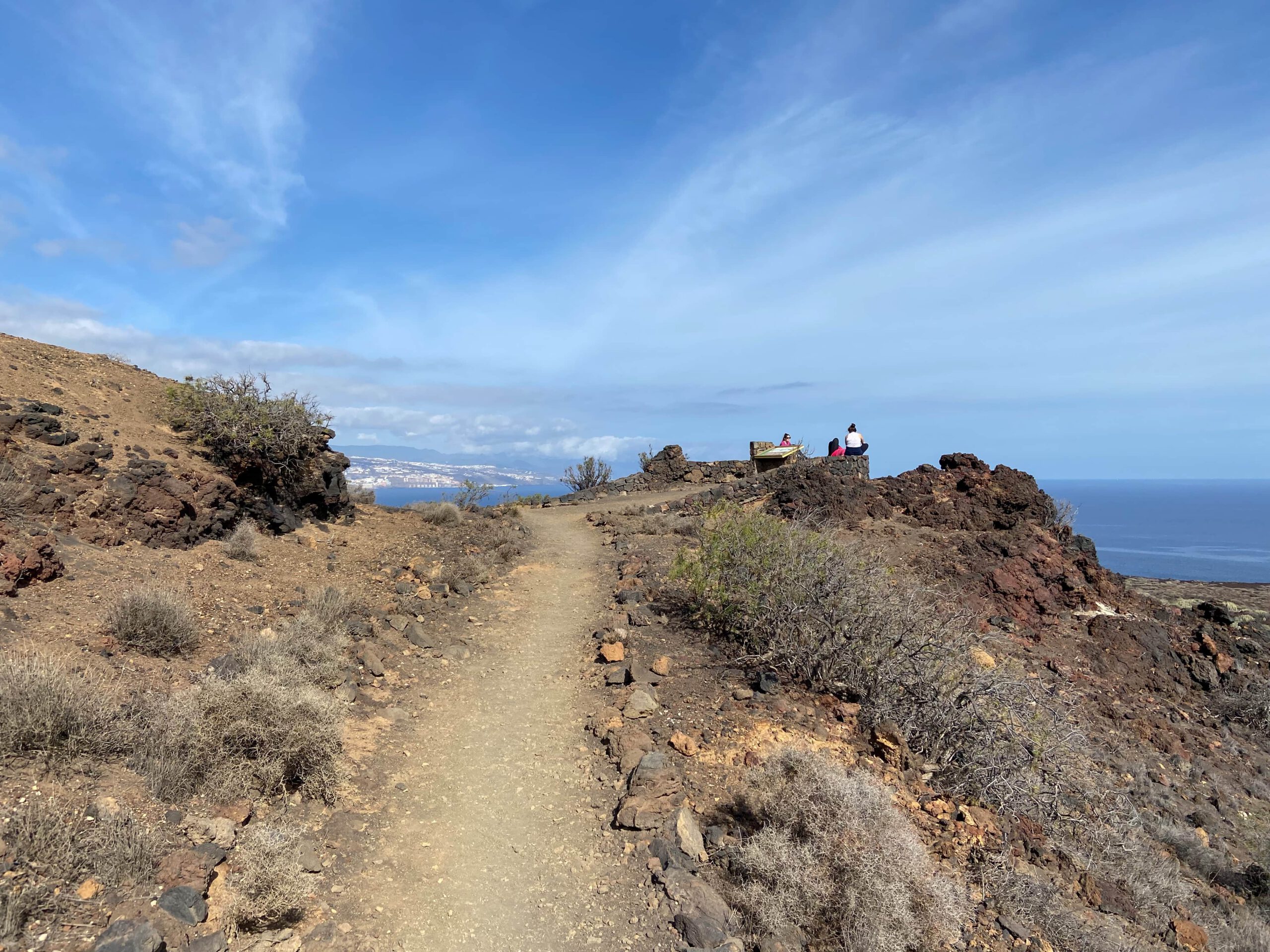
Here, too, you will come across another mirador from which you can get an overview of the impressive landscape. On the east side of Montaña Blanca you will reach a junction. If you continue straight ahead, you can do small and large extension laps in the direction of El Socorro and Playa de la Entrada. You will find suggestions on the track pictures (see orange sections). You cannot get lost, as you will always see the Atlantic Ocean to your right. There on the coast is your way back.
Summary information about the article and a large selection of GPS hiking tracks are availableRegister now for my newsletter and get exclusive access to my collected GPS tracks as well as all short information about my articles.
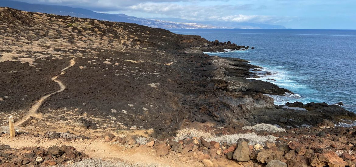
East side of Montaña Grande to starting point of the hike in Puertito de Güímar
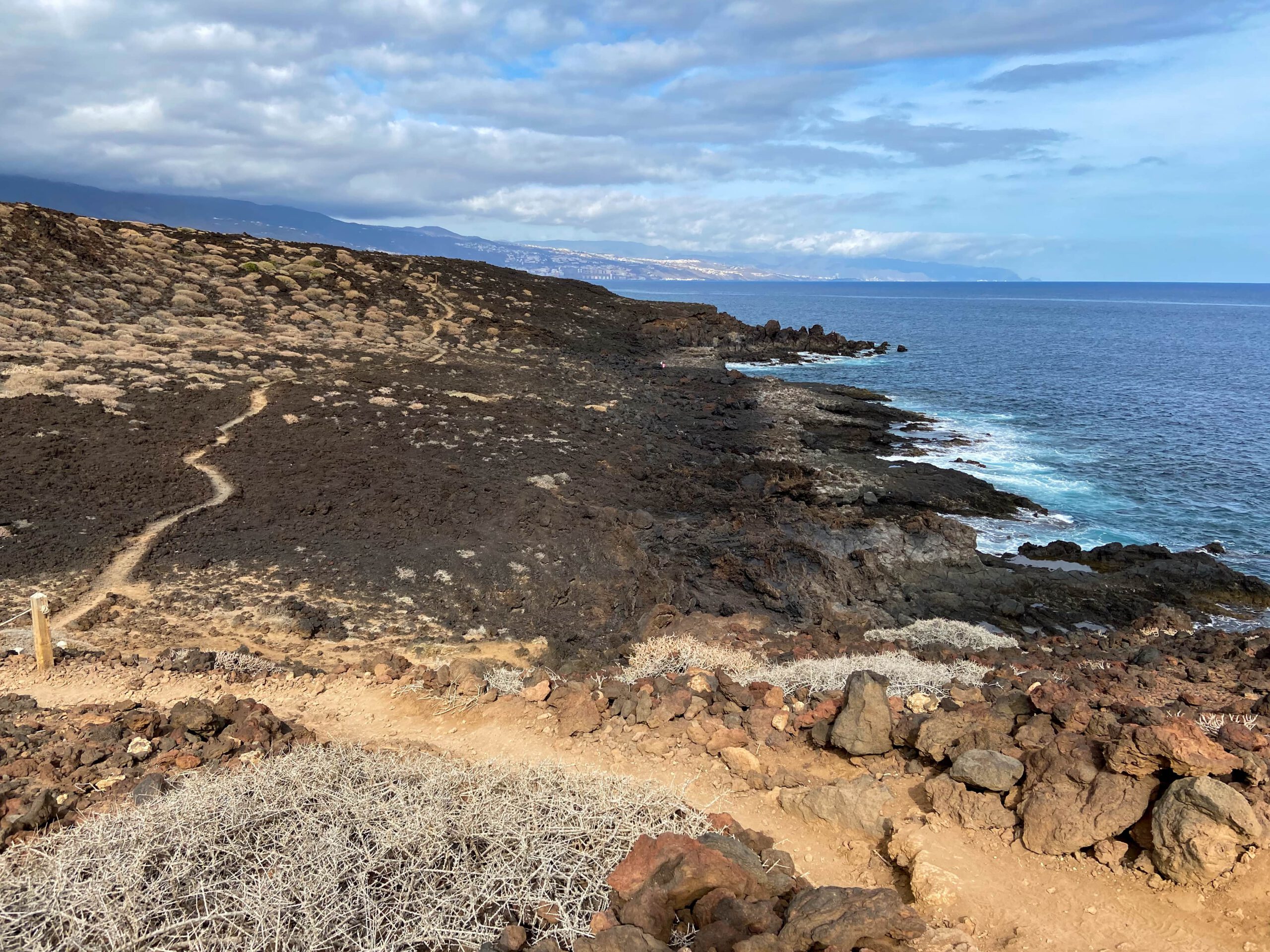
However, you hike around the small loop to the right downhill towards the Atlantic. The whole time, the path goes leisurely downhill through a truly impressive lava landscape. Finally, at the Punta de los Altillos o de los Picos, you reach the coastal trail. You come to this point from the left if you have done one of the extension routes. Now you go around to the right.
The path always leads you near the coast with views of the mountains on one side and the Atlantic Ocean on the other, back to Puertito de Güímar. On the way, you go up and down over cliffs, past viewpoints and information boards. From time to time you will almost reach the sea. Enjoy the way back to the starting point in Puertito de Güímar.
And finally
I hope you enjoyed this little hike in the Malpaís de Güímar. It is extremely relaxing and perhaps also a good alternative for people who, for various reasons, no longer want to or can undertake large mountain tours. But also for all other hikers, this small hike without big challenges has a lot to offer.
Have fun on all your hikes, wishes you,
Dagmar from SiebenInseln