- Punta de Teno – the Western Cape of Tenerife
- Hike from Los Gigantes to Punta de Teno
- General Information about the Teno Circular Hike Punta de Teno
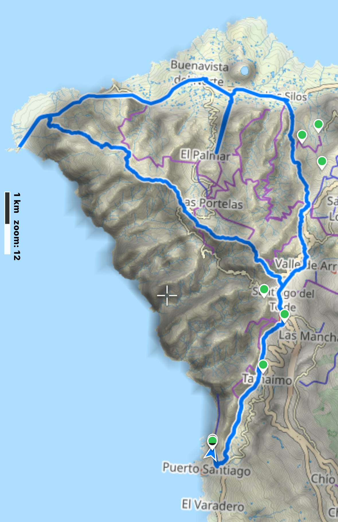
- Circular Hike Los Gigantes – Punta de Teno
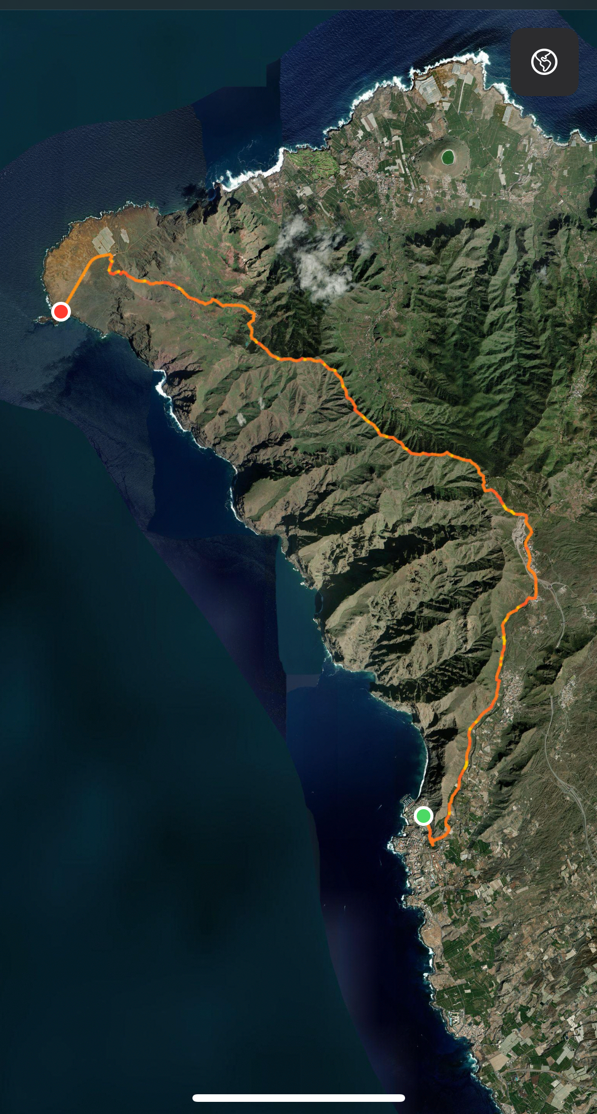
- Part 1 of the Hike: Los Gigantes to Punta de Teno
- Section Los Gigantes bis Tamaimo
- Section Tamaimo to Santiago del Teide
- Section Santiago del Teide to Cumbre Bolico and Ridge Trail
- Section Cumbre Bolico and Ridge Trail to the Red Soil Section
- Section Red Soil Section over Teno Alto to Barranco de las Cuevas
- Section Barranco de las Cuevas to Punta de Teno
- Part 2 of the Hike: Los Silos to Los Gigantes
- And finally
Punta de Teno – the Western Cape of Tenerife
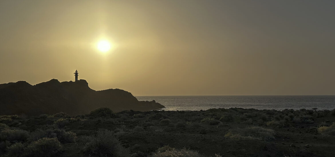
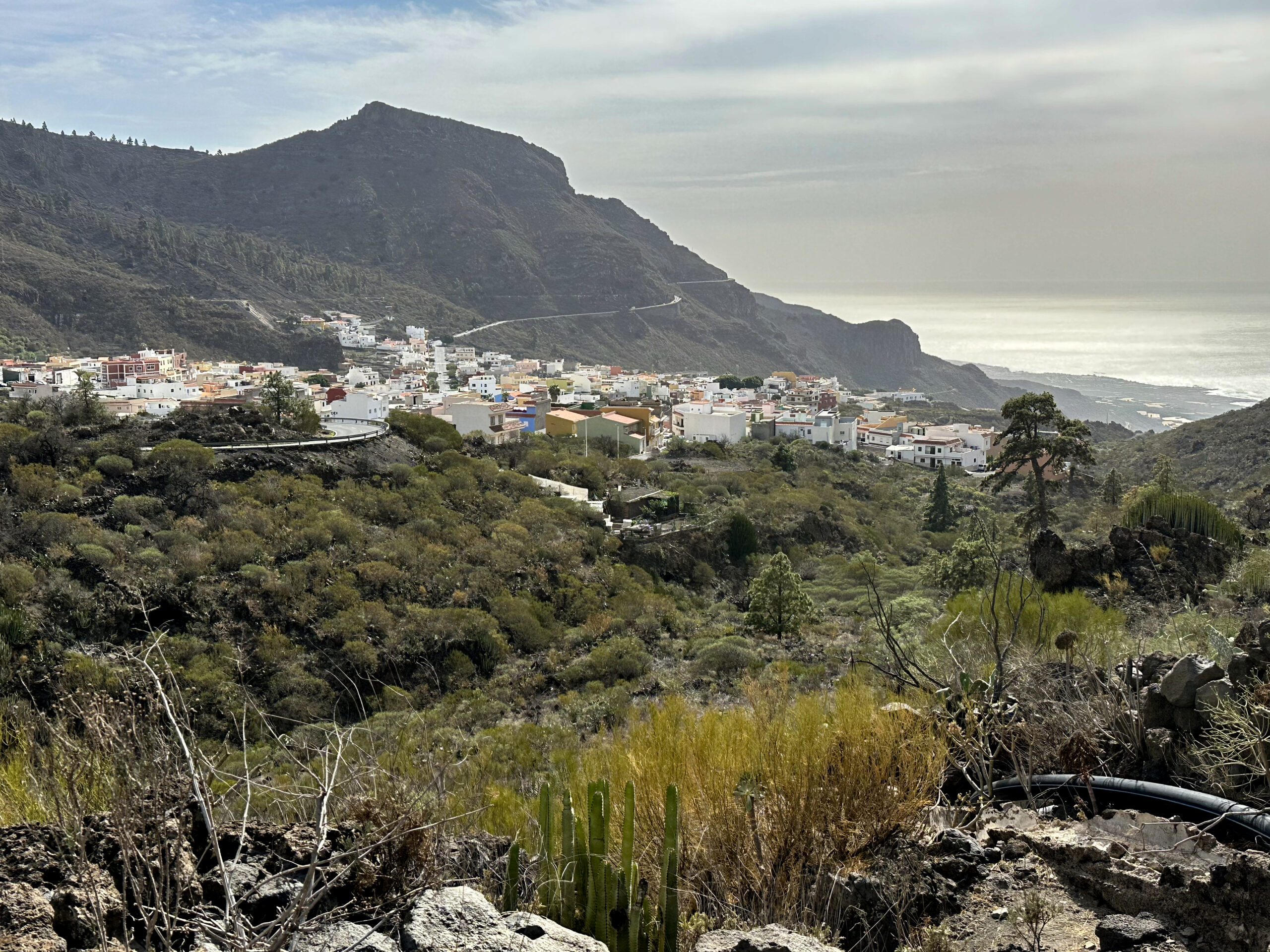
Punta de Teno refers to the westernmost tip of the island of Tenerife, located in the municipality of Buenavista. This cape is known for its impressive views and the lighthouses. There are two lighthouses on the peninsula. The older one dates back to 1893. Since 1976, a larger tower has stood nearby, replacing the old one. The new lighthouse is 20 metres tall. From the cape, you can enjoy breathtaking views of the cliffs of Los Gigantes on one side and the neighbouring islands of La Gomera and La Palma on the other. The location of the lighthouse at Punta de Teno makes it a striking landmark and a popular destination for hikers and nature lovers.
Access to Punta de Teno is via the TF-445 road, which has been partially closed for years due to a landslide. Since 15 April 2019, the road has been closed during the week from 10:00 to 19:00 (from 09:00 to 20:00 in summer). However, a shuttle bus runs hourly (line 369) for €1 per person per journey. Hiking trails around the lighthouse lead through a protected landscape with diverse flora. The lighthouse itself is not open to the public, but its surroundings invite visitors to take extended walks and form an essential part of the Teno nature reserve. Due to its exposed location, the Faro de Punta de Teno is also a significant landmark of Tenerife.
Hike from Los Gigantes to Punta de Teno
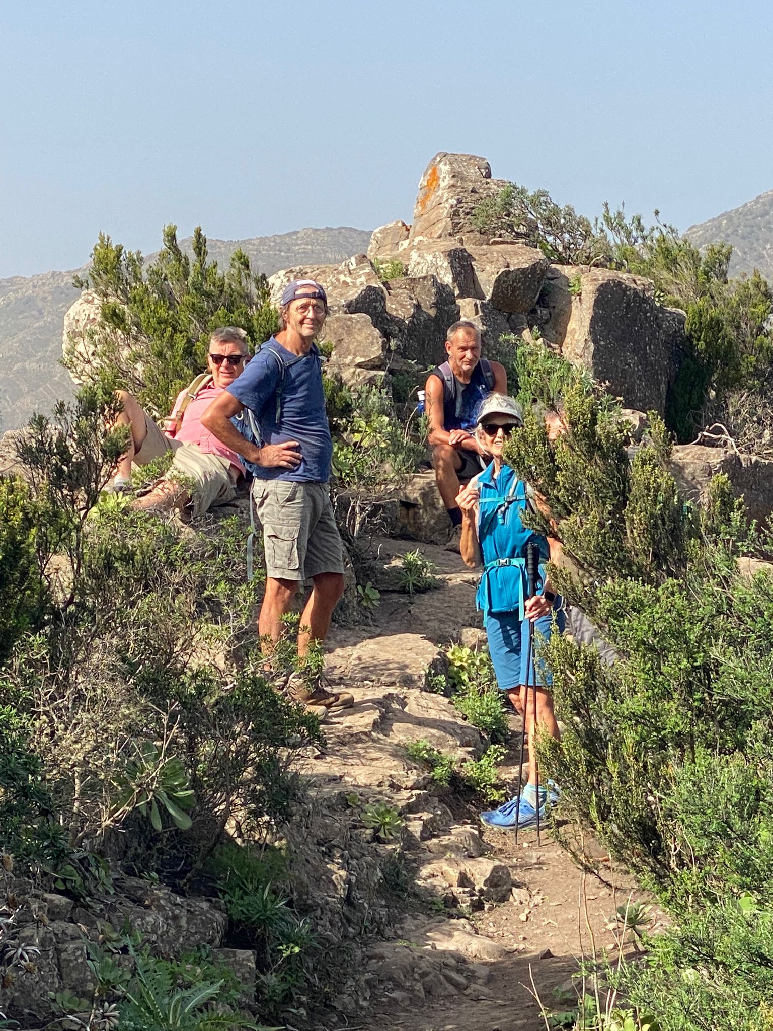
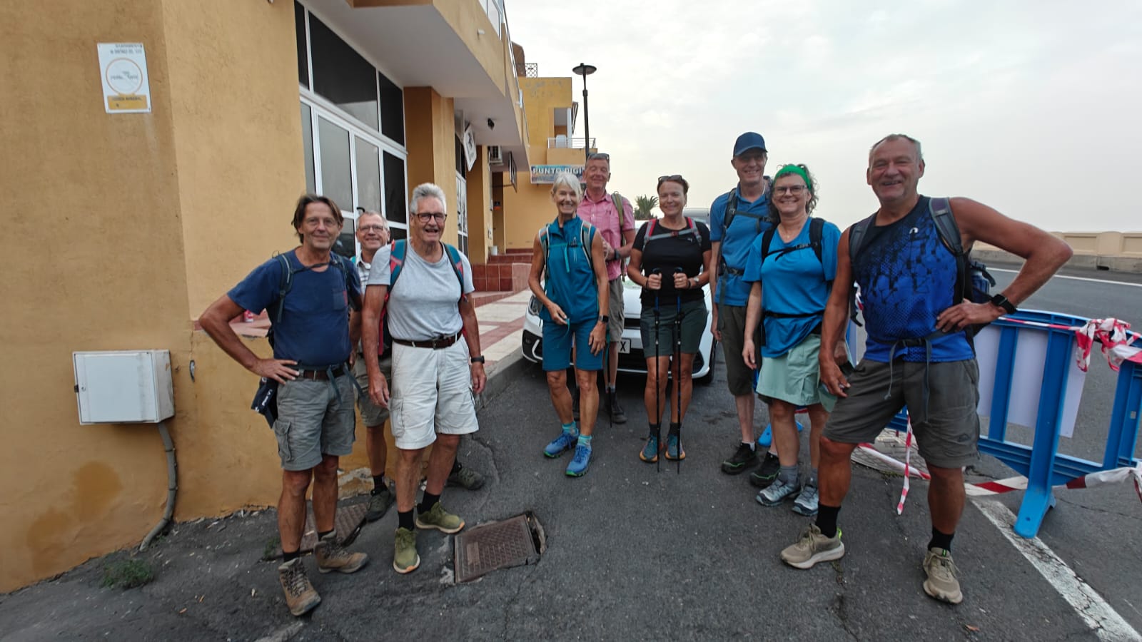
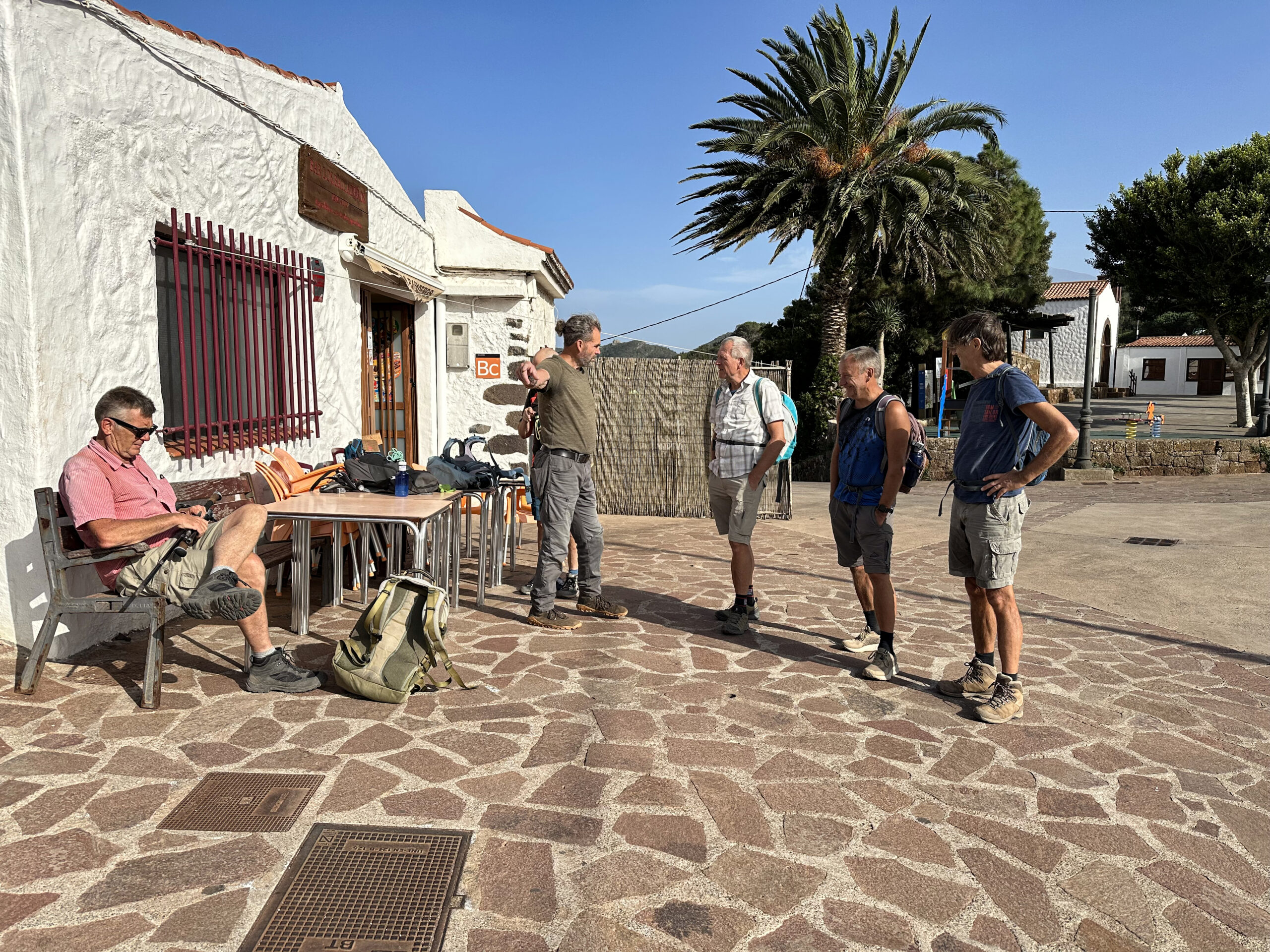
This excellent hike to Punta de Teno from Los Gigantes was the idea of my hiking friend Iain Schroeder, who also organised it. Along the way, we crossed the entire Teno mountain range twice via different routes. We hiked as a larger group from Los Gigantes to Punta de Teno, overcoming considerable elevation. Some of us arranged our own transport back, while others preferred to hike back. This gave rise to the idea of returning via Los Silos, Erjos, Valle Arriba and Santiago del Teide to Los Gigantes. And so, the concept of the great Teno circuit was born.
The hike consists of two parts, each of which can of course also be walked independently. For a complete circular hike, the section between Punta de Teno and Buenavista is still missing. This section can also be hiked, but it involves a very long stretch along the TF-445. I have done this before (see Risco Climb – Teno Alto Circular). In that case, we took the bus via Buenavista and stayed overnight with a hiking friend. We quite enjoyed this long and strenuous tour. However, those who find it too demanding can also break it up into individual hikes.
General Information about the Teno Circular Hike Punta de Teno
Starting Point and Access
Starting point first part of the hike is Los Gigantes, specifically the Avenida Quinto Centenario above Los Gigantes.
The starting point of the second part is the large car park near the church on the TF-42 in Los Silos.
Access by car
You can reach Los Gigantes both along the coast and from the north via the TF-47. Parking spaces are available at the starting point on Avenida Quinto Centenario or above it at the Mirador Archipenque. In Los Silos, you will find a large car park in front of the church and more roadside parking.
Access by bus
The following bus lines stop directly at the starting point of the hike in Los Gigantes: Titsa line 325 (Puerto de la Cruz–Los Gigantes), lines 462, 493, 494 (Guía de Isora–Los Gigantes), and lines 473, 477 (Los Cristianos–Los Gigantes); line 477 is direct and therefore faster. Details and further information on Los Silos and Erjos can be found on the Titsa website.
Time
I am reluctant to give general time estimates for hikes, as times can vary greatly from person to person. We took 9.5 hours for the first part of the hike with many breaks, as we had to wait for each other. Some of us were faster, and some a bit slower. On the return journey, we were only three people, so it went quicker. We took 6.5 hours with breaks.
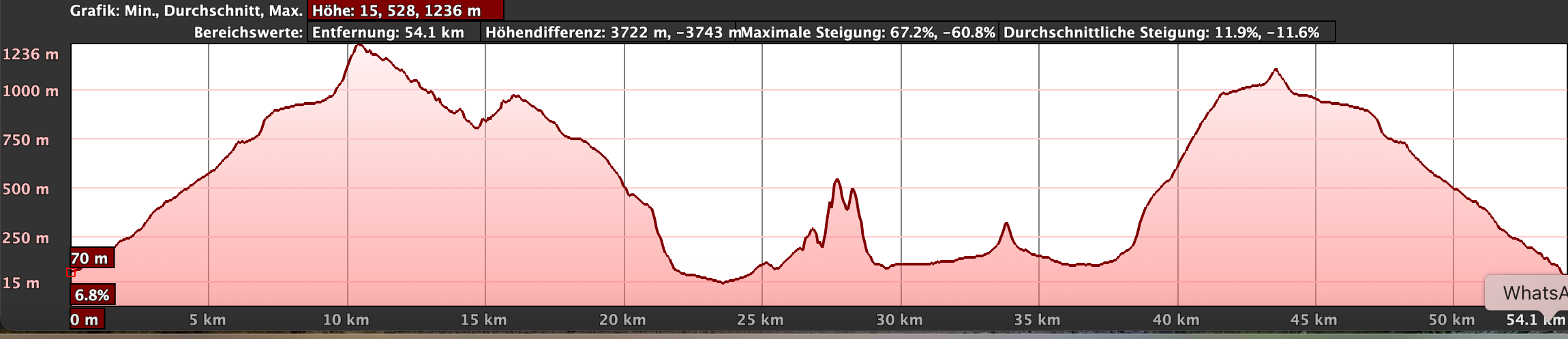
Elevation and Distance
The elevation gain of the first part is 1,500 metres, and the distance is just under 28 kilometres. The second part involved 980 metres of elevation and a distance of just under 20 kilometres.
Difficulty
Throughout the entire circuit, you walk on good hiking or access paths. The hike is demanding only due to the many elevation changes and the long distance. Therefore, good physical condition is required.
Refreshments
You will find more opportunities to stop for refreshments on the first part of the hike from Punta de Teno to Santiago del Teide. There is also a bar in Teno Alto. On the second section, you will find refreshments in Erjos and Santiago del Teide. Nevertheless, there are long stretches without any possibility to stop on the outward journey. Therefore, please make sure to carry enough water and provisions if necessary.
Variants
You can divide the hike not only into two sections but also into smaller units if needed.

Hikes on SiebenInseln that overlap with or are directly adjacent to this hike and can therefore be combined:
Adventurous Hikes in the Northern Teno Mountains
Circular Hike Teno Alto – Risco Trail
Hiking on the White Volcanic Rocks Risco Blanco
Large Circular Hike through Tamaimo and Charming Canarian Villages
Ridge Hike with Ascent of Baracán
Hiking in the Southern Teno Mountains
Hiking through the Teno Mountains – Circular Hike Part 1

Circular Hike Los Gigantes – Punta de Teno
Part 1 of the Hike: Los Gigantes to Punta de Teno
Section Los Gigantes bis Tamaimo
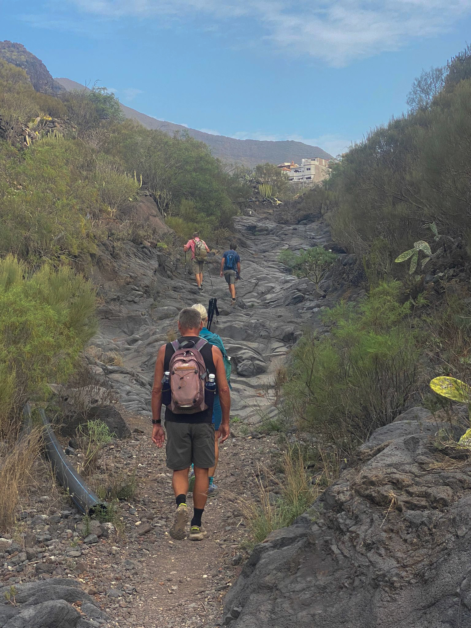
You can start the hike at any place in Los Gigantes. You only need to head uphill, away from the town center. All three paths (two by the road, one along a slope) lead to the main road, Carretera General Puerto de Santiago, TF 454. For this hike, we started together at the junction to the entrance of Los Gigantes. You follow the road uphill straight ahead through a long hairpin bend.
Then you pass the Mirador Archipenque viewpoint. From there you already have the first magnificent view of the cliffs and the entire steep coast of Los Gigantes. At the very end of the cliffs, on a clear day, you can already see Punta de Teno. You continue following the road around a bend and after about 50 meters, on the left side, you find the hiking trail PR-TF 65 (marked white-yellow with an information board) towards Santiago del Teide.
You continue following the road around a bend and after about 50 meters, on the left side, you find the hiking trail PR-TF 65 (marked white-yellow with an information board) towards Santiago del Teide. A small paved road leads steeply uphill and then continues for a few minutes past some houses and banana plantations. After that, the actual hiking trail (camino real) begins. This trail takes you through the banana plantations past a finca (farm estate) and a water reservoir towards Tamaimo. The path is well signposted and steadily ascends. On the left side lie the southernmost mountains of the Teno range.
After just under an hour of hiking, the circular hiking trail TF-65.2 branches off to the left. You continue straight ahead. Then you pass some newly built buildings and a locked tunnel on the left side and shortly after, cross a goat farm. The path continues towards Tamaimo. There the path is well marked and leads into the barranco (ravine). You hike past the town on the left and then cross the ravine turning left to continue on the Camino Real towards Santiago del Teide.
Section Tamaimo to Santiago del Teide
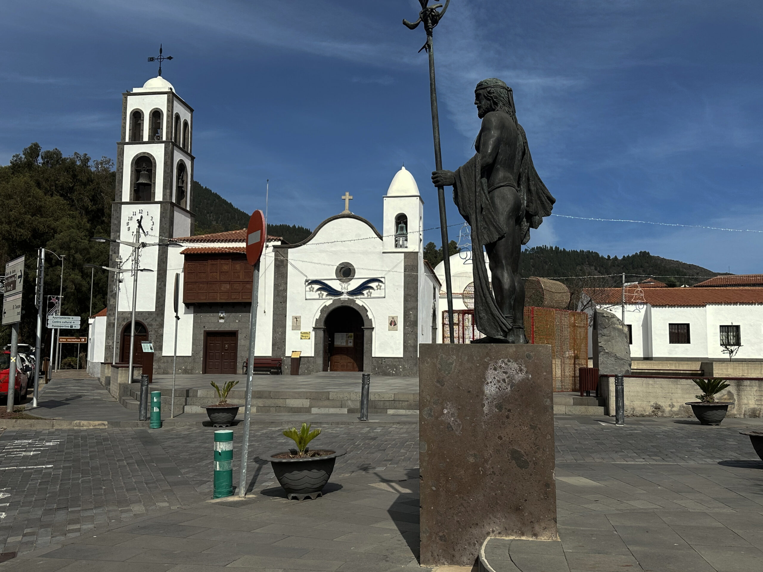
At first, the trail goes steeply uphill and then continues moderately uphill for some time. Shortly before the small village of El Molledo, the actual Barranco Santiago ends. Now the path ascends steeply in narrow switchbacks for a short time. You pass a sign indicating the nature reserve area. Shortly after, you reach El Molledo. Normally, you could continue on the Camino Real for 1.2 kilometers to Santiago del Teide. But currently (also in 2025), the trail is closed due to construction work on the highway. Therefore, you must turn right into the village of El Molledo and then ascend to the main road TF-82.
Going left, after some time, you reach a new roundabout and then the village of Santiago del Teide. Here you walk along the main road, passing first the church and the large main square. Then you pass a large picnic area (area recreativa) and shortly after leave Santiago del Teide. You follow a narrow footpath and later a path along the edge of the TF-82 road towards Icod de los Vinos. On a long right curve, the marked hiking trail PR-TF 56 (white-yellow marked) leads left towards Degollada de la Mesa. Currently (2025) there is a large tunnel construction site there, and only a temporary path exists. I assume a good new hiking trail will be built there soon.
Section Santiago del Teide to Cumbre Bolico and Ridge Trail
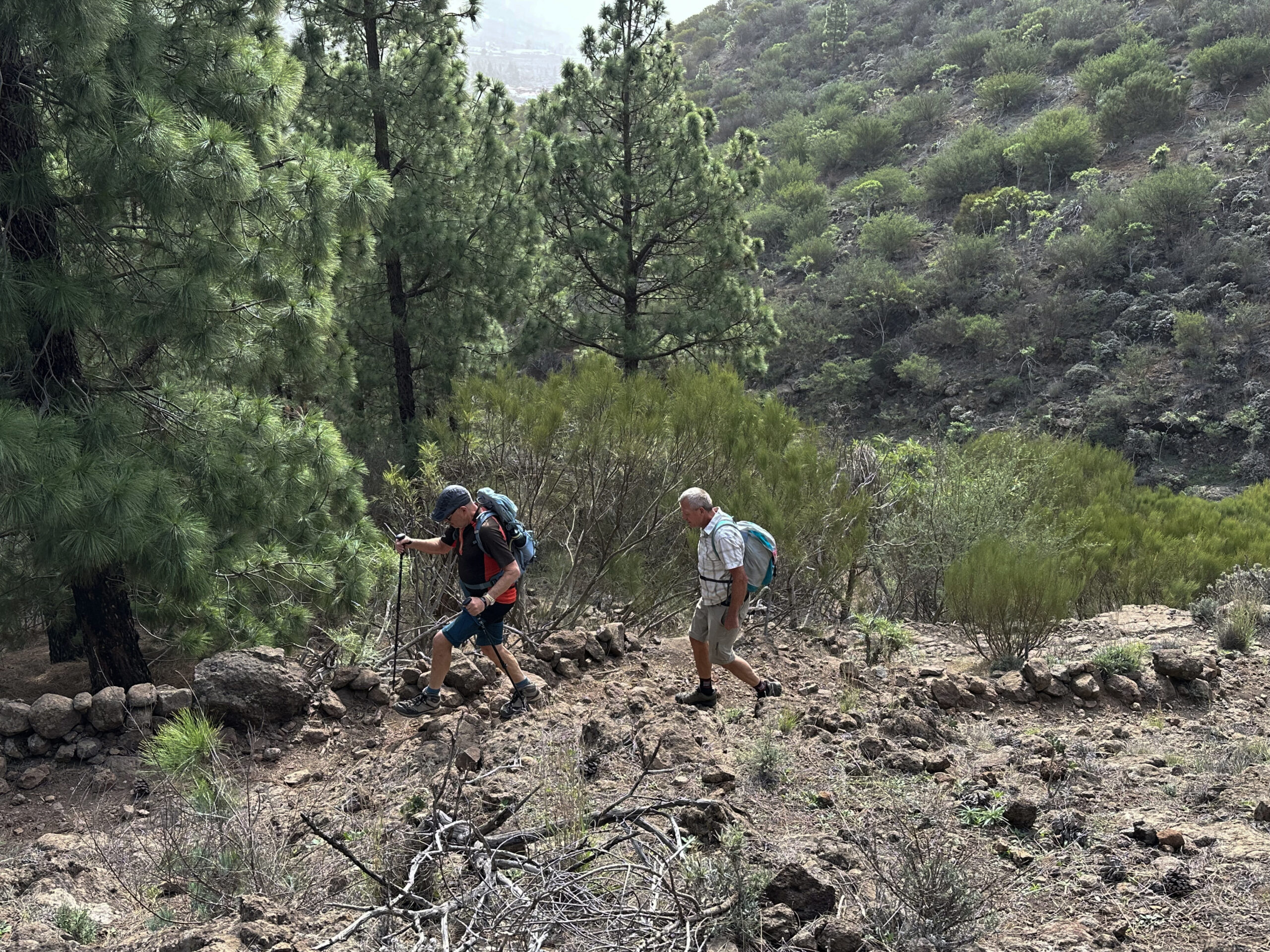
From Santiago del Teide, the trail climbs 317 meters on a beautiful hiking path into the Teno mountains. The path first leads through a pine forest, crosses a creek that only flows during heavy rain, and then winds up the right side of the gorge at a relaxed pace. After about half an hour, you cross a wide forest road. You stay on the narrow trail straight ahead and after about 20 minutes more, reach Degollada de la Mesa (1247 meters elevation). From here, you have magnificent views of the Teide volcano and Santiago del Teide. To the west, you see the neighboring island La Gomera and the entire Teno mountain range. Far below to the west, you can already see Cruz de Hilda and the surroundings of the village Masca.
You first follow the PR-TF 51 trail from Degollada gently downhill along the slope. Wonderful views open up of the Teno mountains and La Gomera. After about a kilometer, you reach Cumbre Bolico with its cloud catchers. The cloud catchers are installed on the north side of the mountainside to capture water from the clouds. A few minutes later, you come to a kind of clearing with ruins and a threshing floor from which several hiking trails branch off.
You continue straight ahead on PR-TF 51 along the ridge trail towards Teno Alto. This means hiking on a ridge with beautiful views. On the left, you have beautiful views of the southwestern part of the Teno mountains, while on the right side you can look northwards. El Palmar and the coastal region gradually become visible. The path alternates between gentle and steep downhill sections. It mostly runs along the right side of the slope through the northern cloud forest.

Section Cumbre Bolico and Ridge Trail to the Red Soil Section
At first, a trail branches off the ridge trail to the right towards Las Portelas and another one to the left towards Cruz de Hilda. You continue straight ahead. Eventually, another path branches left towards Los Carrizales. However, you continue straight with PR-TF 51 towards Teno Alto. After some time, the ridge trail descends and brings you to the TF-436 at Tabaiba Pass and the Mirador de Baracán viewpoint. From there, you simply follow PR-TF 51. It takes you from the road along the ridge trail towards Teno Alto. Right at the beginning of the hike, you can enjoy magnificent panoramic views over the Teno mountains in all directions from the Mirador.
You hike first on the left and then on the right side of the mountain with views over the Palmar valley. The paths are mostly narrow but are good hiking trails along the ridge. In parts, the path goes through lightly wooded areas and bushes. The constant up and down finally leads you back to the left side of the mountain. Here, after some time, you meet a small path on the right side leading to the summit of Baracán. However, the hiking trail continues straight ahead, alternating between the left and right ridge sides, mostly ascending towards Teno Alto. After some time, you reach a high plateau. Then you enter a small section with tree heather forest. When you come out of the forest, you find red soil.
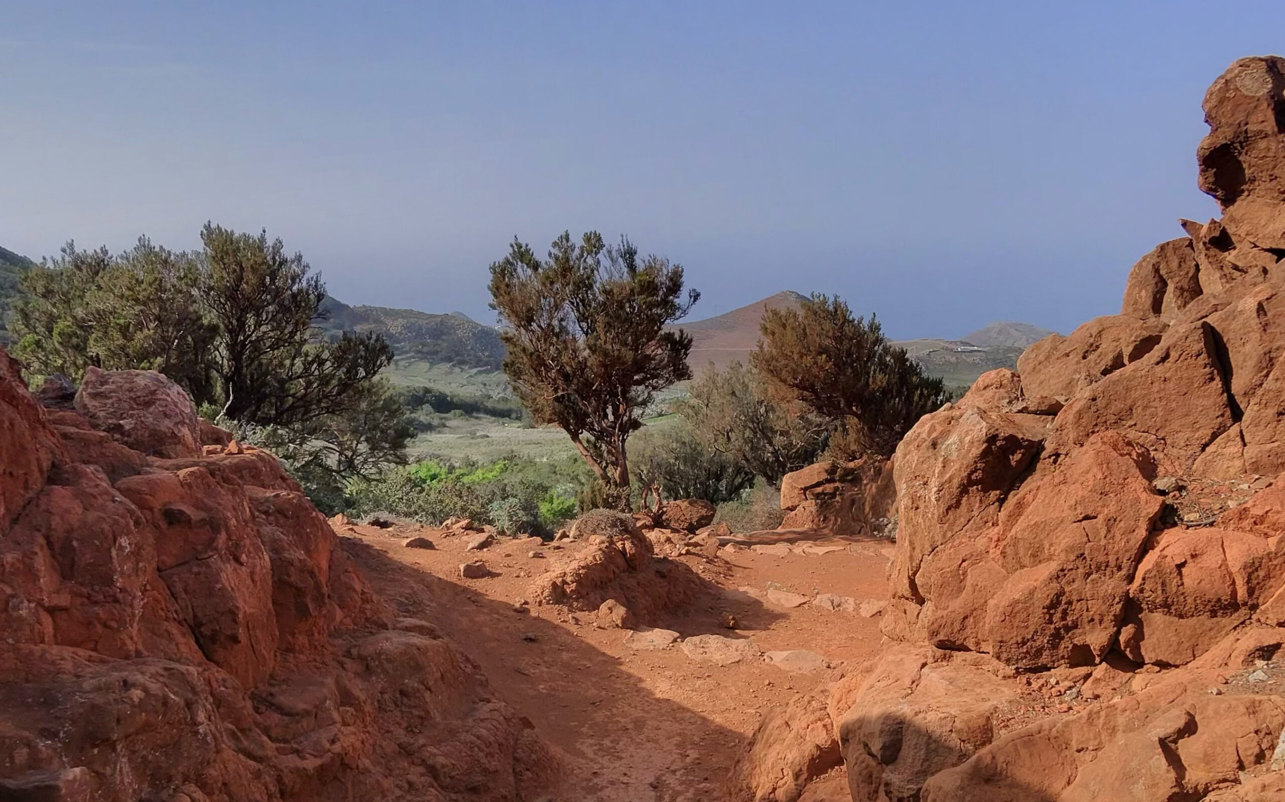
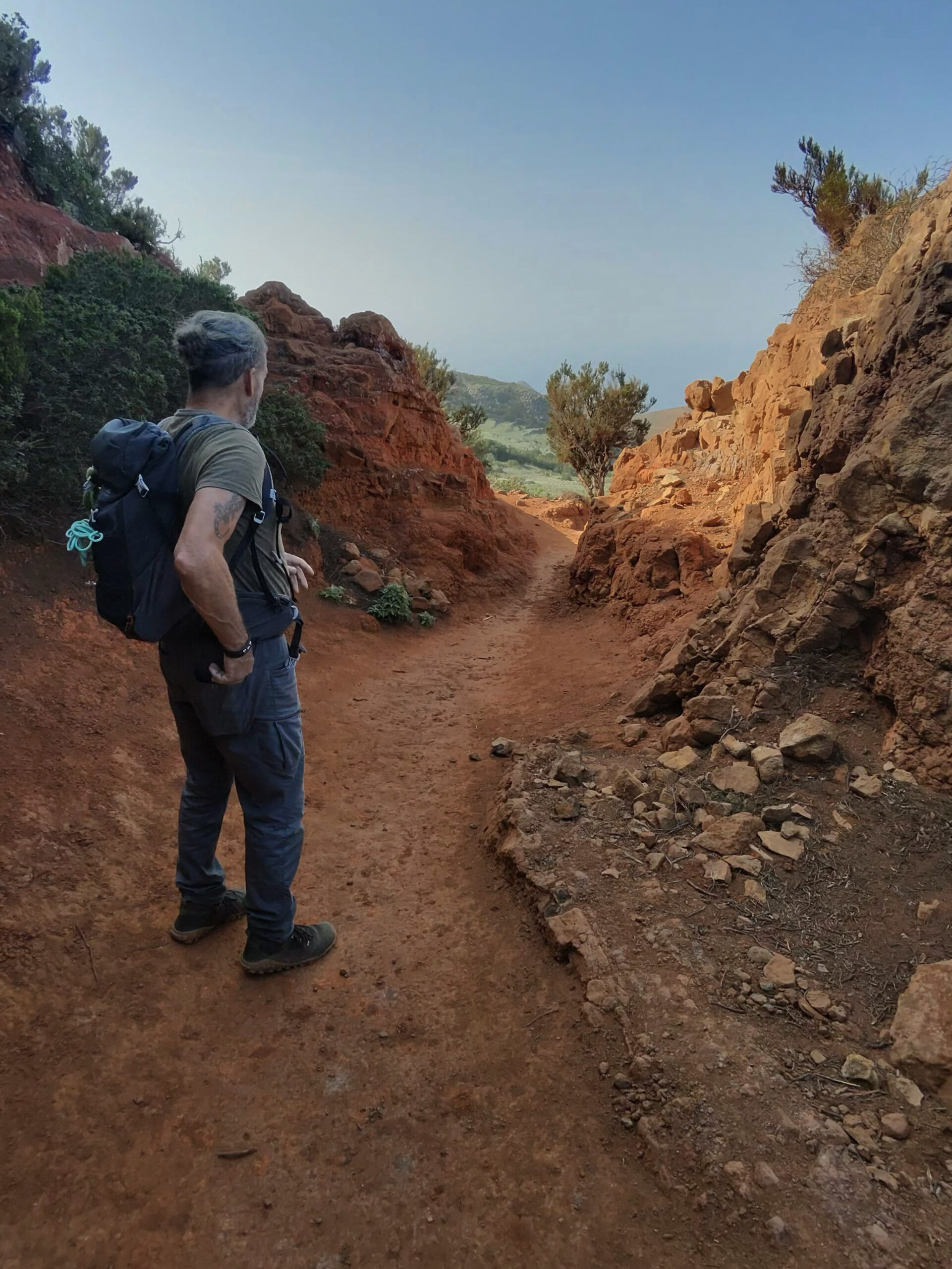
Section Red Soil Section over Teno Alto to Barranco de las Cuevas
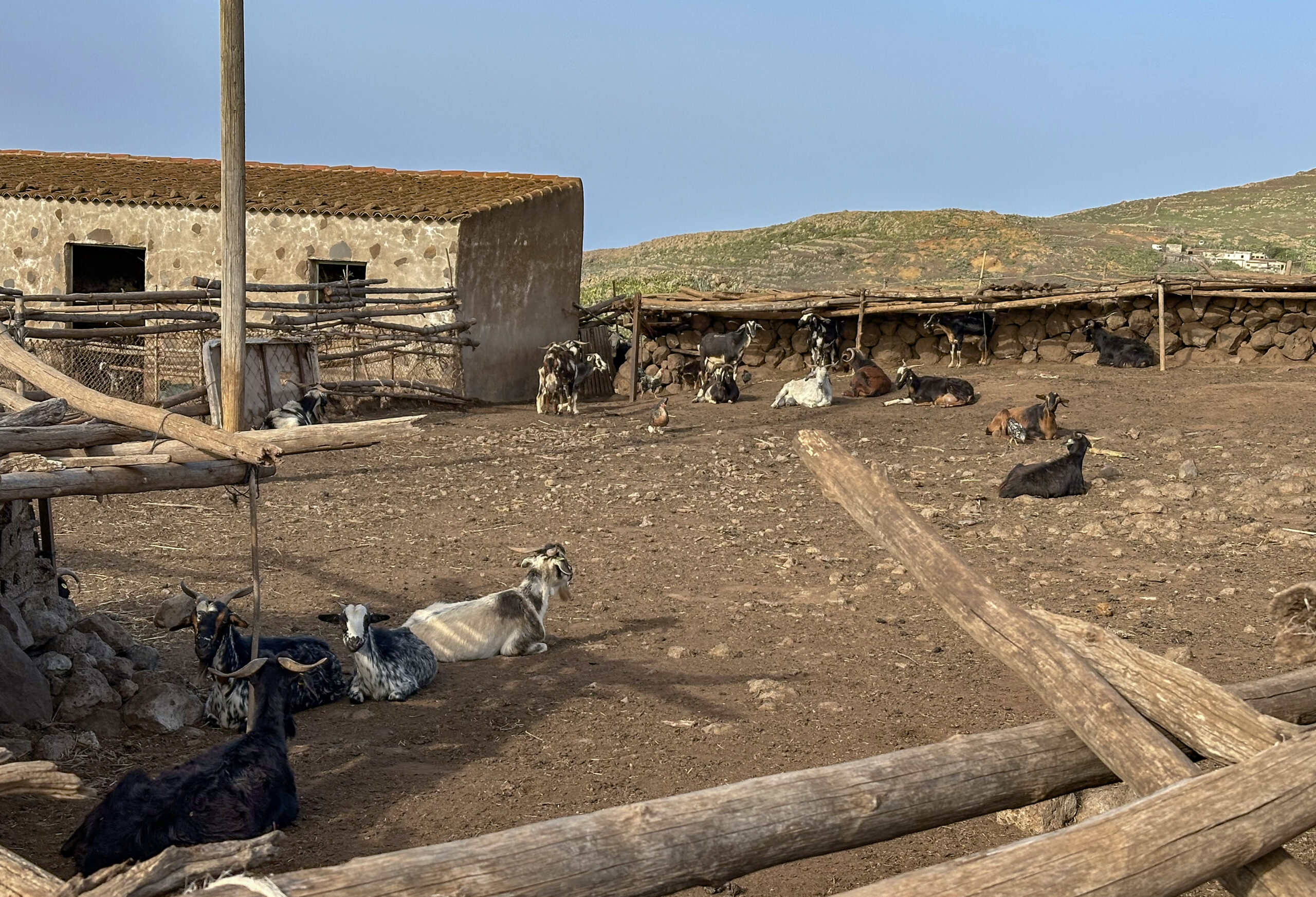
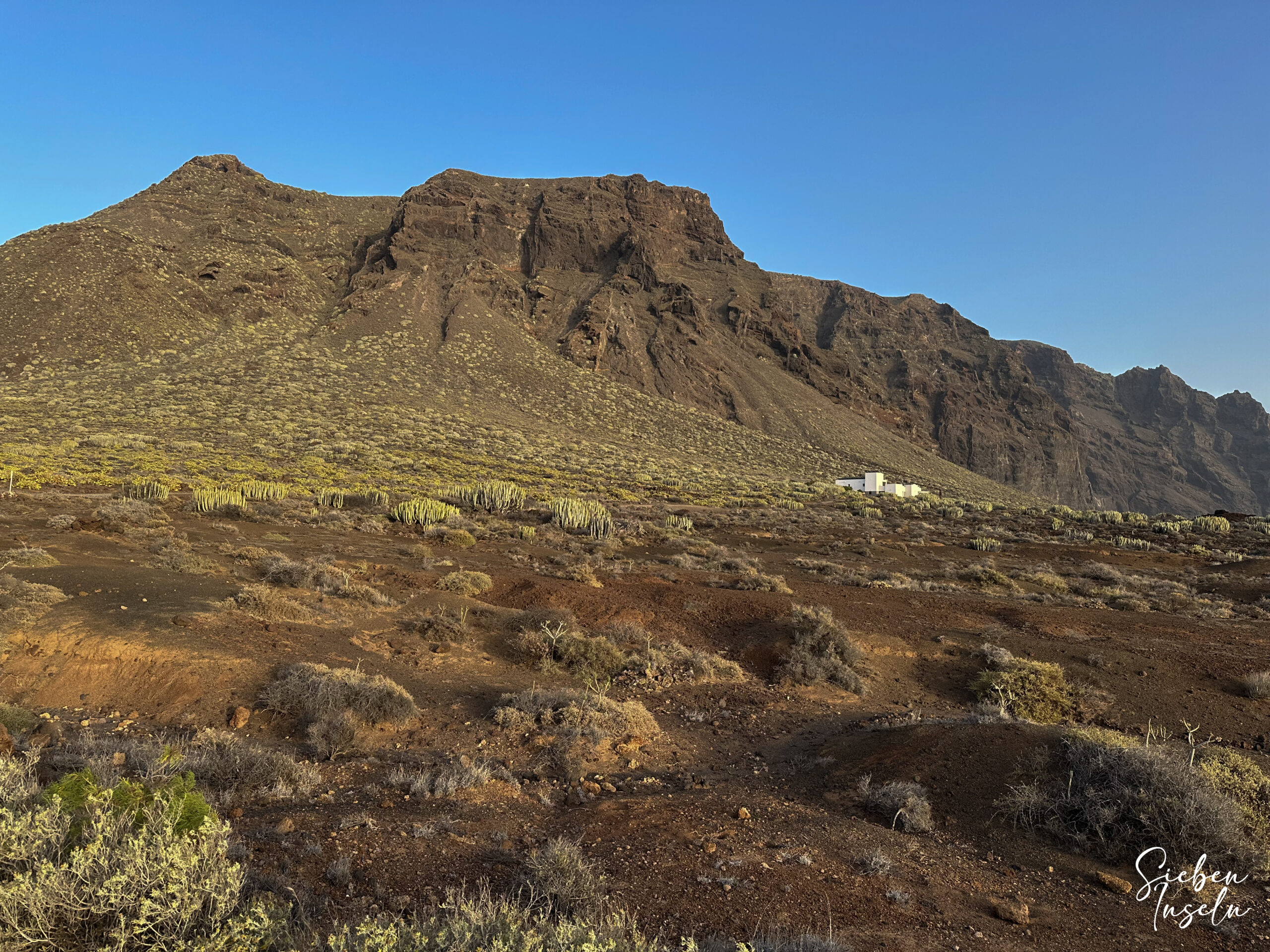
The red soil forms a beautiful contrast to the surrounding landscape. Now you see the wide plain around Teno Alto already lying in front of you. On the red soil, the hiking trail continues straight downhill. You pass a house on the left. Shortly after, you reach a wide road (Camino La Siete), which you follow to the right. You pass some houses. At a fork, you keep left on Camino La Mesita, which brings you shortly to Teno Alto (Los Bailaderos). Here in Teno Alto, besides goats, many hikers and hiking trails, there is also a bar inviting for a rest.
In Teno Alto, you continue on PR-TF 51 on Pista las Cuevas straight out of the village towards Punta de Teno. This initially leads you out of the village along a road past meadows towards the coast. After a short time, you reach a ridge. The road branches off to the left. Here you leave the road and follow a wide trail (Camino el Vallado) straight down. Later, the trail meets a road, which you cross, continuing your way on the other side. After a few minutes, you are back at the road, which you follow left for a short time. Then the trail leaves the road and runs for some time directly along the upper slope of the Barranco de las Cuevas.
Section Barranco de las Cuevas to Punta de Teno
You hike along the edge of the Barranco until you meet the road again. You follow it for some time downhill past houses. Soon at a right curve, the trail leaves the road again and continues down the Barranco de las Cuevas. You walk for a while until the path leads you at some houses back to the road. Here, at the bottom of the ravine, you cross the Barranco and then follow the path left. This path takes you in wide loops along the slope towards the coast. Along the way, you come to a goat gate through which you continue straight.
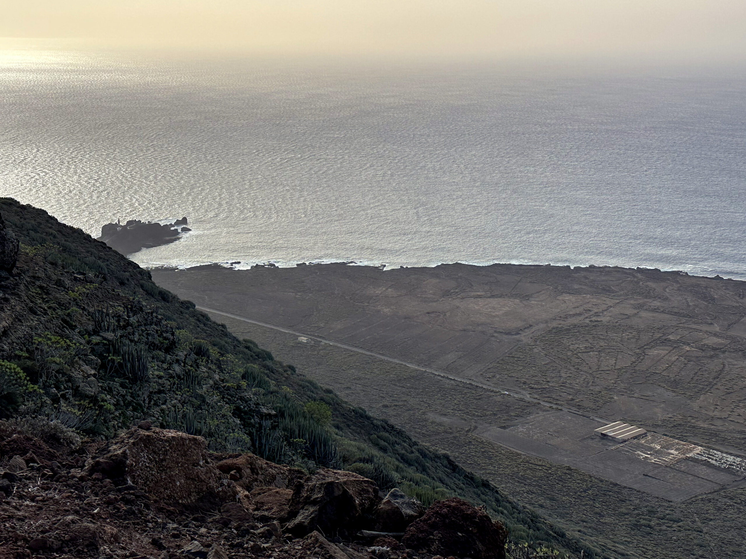
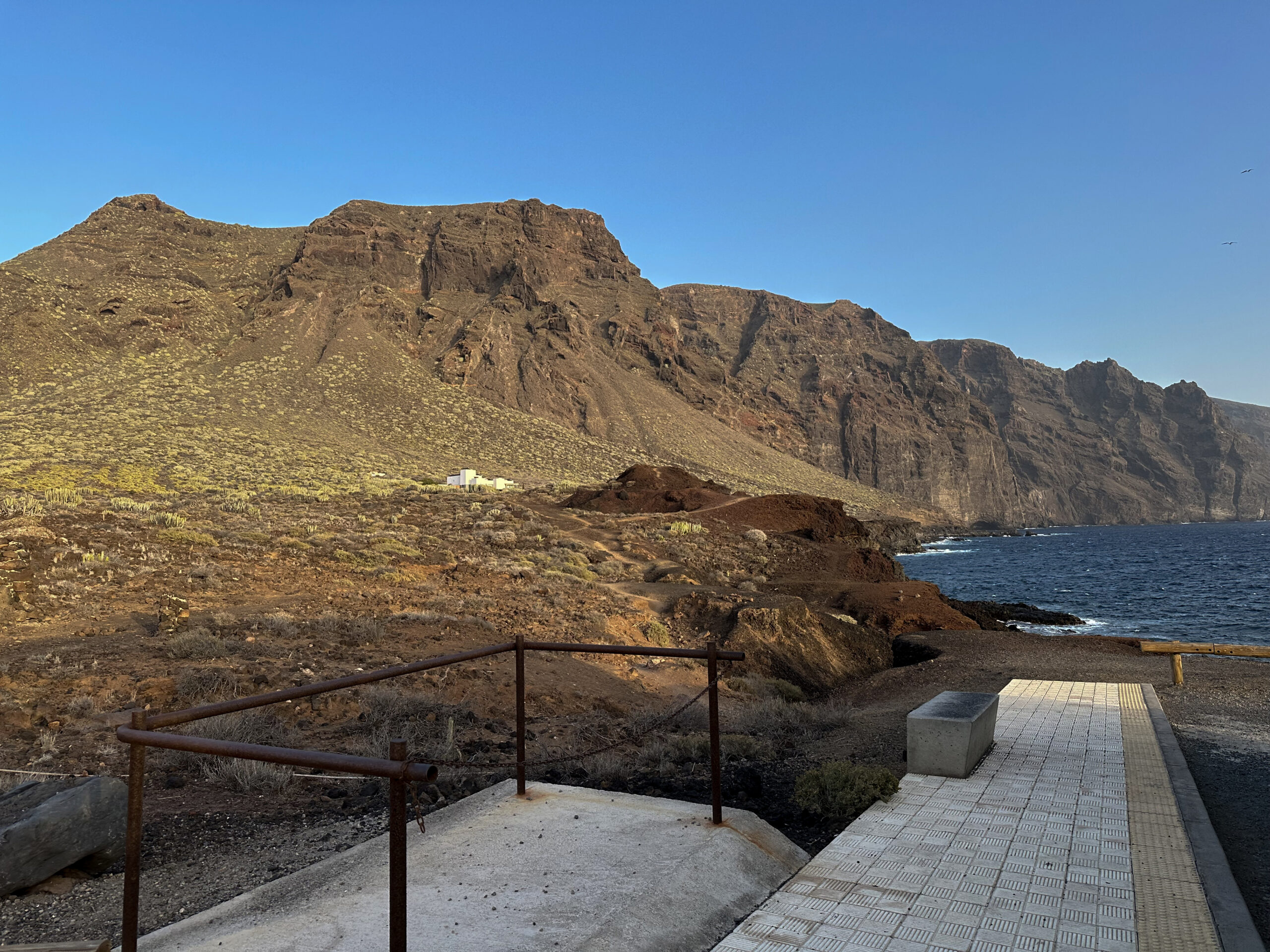
The path ends on a kind of hill, from whose edge you can see the northern coast and already Punta de Teno very well. Here at Roque Chiñaco is also a nice viewpoint for a rest. From Roque Chiñaco, the narrow descent trail leads down in wide switchbacks to the road. You descend from 400 meters to 90 meters at the TF-445 (Carretera Punta de Teno). Passing a large plantation, you finally reach the road. Turning left on the road, you continue to the first stage goal of the hike, Punta de Teno. After the long day of hiking, you probably no longer have time or energy for more small hikes that are naturally offered around Punta de Teno. A wonderful place to look at the cliffs of Los Gigantes and the Atlantic Ocean.
Part 2 of the Hike: Los Silos to Los Gigantes
Section Los Silos to Cuevas Negras
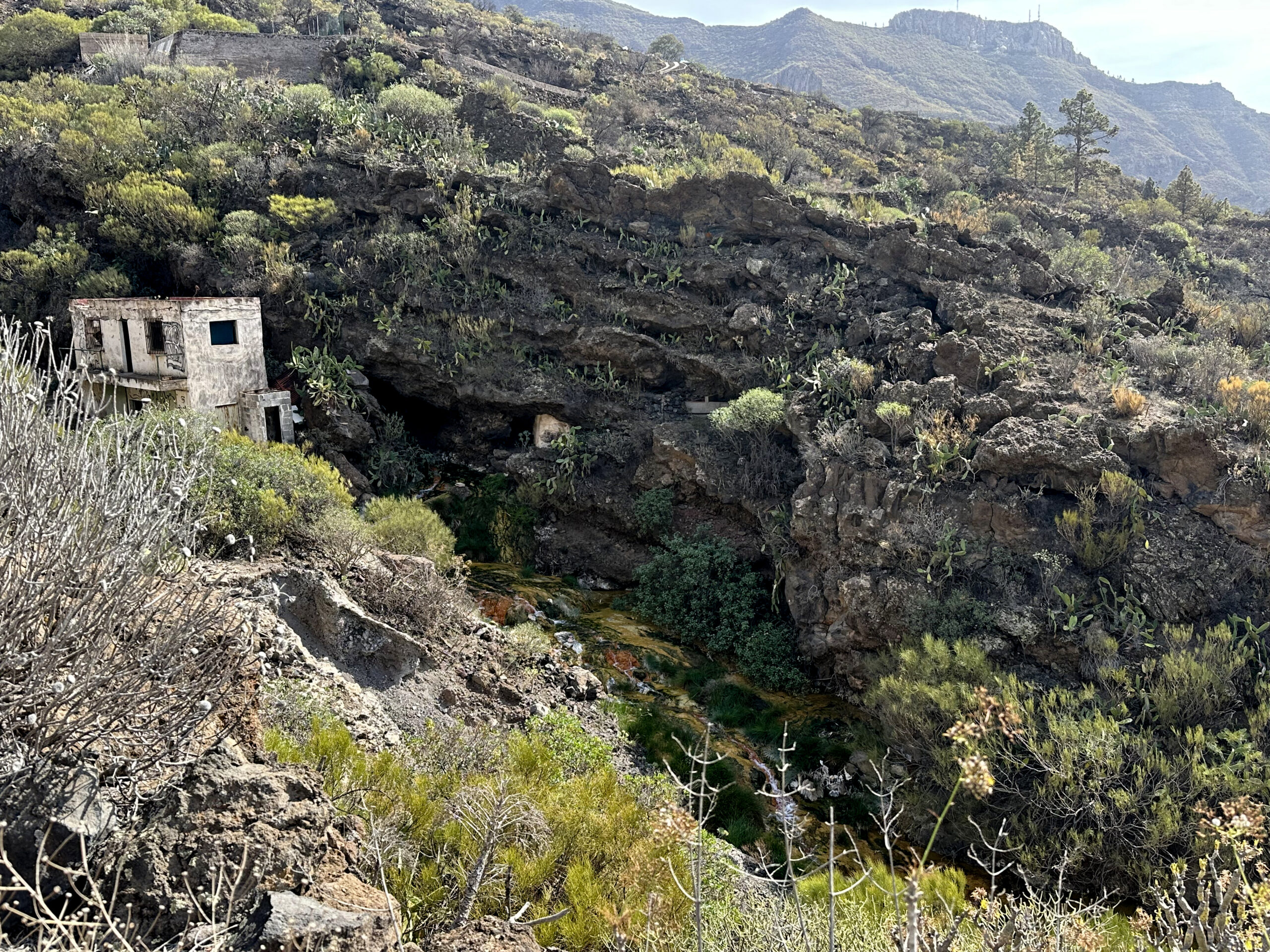
You start the second part of the large circular hike at the large parking lot near the church on TF-42 in Los Silos. After crossing TF-42, you follow the road straight ahead on the opposite side of the parking lot (Calle Susana) for a long time. At side streets, you always keep straight until you reach the hiking trail PR-TF 53 to Cuevas Negras. Here, the path is also called Camino Cuevas Negras. You cross a small creek on a wooden bridge to the left. The trail leads you out of Los Silos past fields, meadows, and some farms. On the road, the path already goes uphill at times. Finally, the hiking trail to Cuevas Negras PR-TF 53 branches off uphill to the left from the road. This is the old royal road (Camino Real), which once connected Garachico and Santiago del Teide.

After a short time, the path turns into a steep cobblestone path that quickly takes you high above Los Silos on many switchbacks. Right and left of the path, many different flowers, plants, and even wild dragon trees stand out in their rich green colors contrasting with the dark rock. The ascent to Erjos is the toughest part of the hike because it goes mostly steeply uphill. After 1.5 kilometers, you round a large black rock with many caves. There you find a white stone with red inscription “No. 6” by the path. From this point, you can see many black rock caves in the slopes on both sides of the trail. These are the Cuevas Negras, which gave the path its name. Here you can closely observe the caves of the aboriginal inhabitants. Shortly after, you reach the ruins of the hamlet Cuevas Negras.
Section Cuevas Negras to Charcas de Erjos
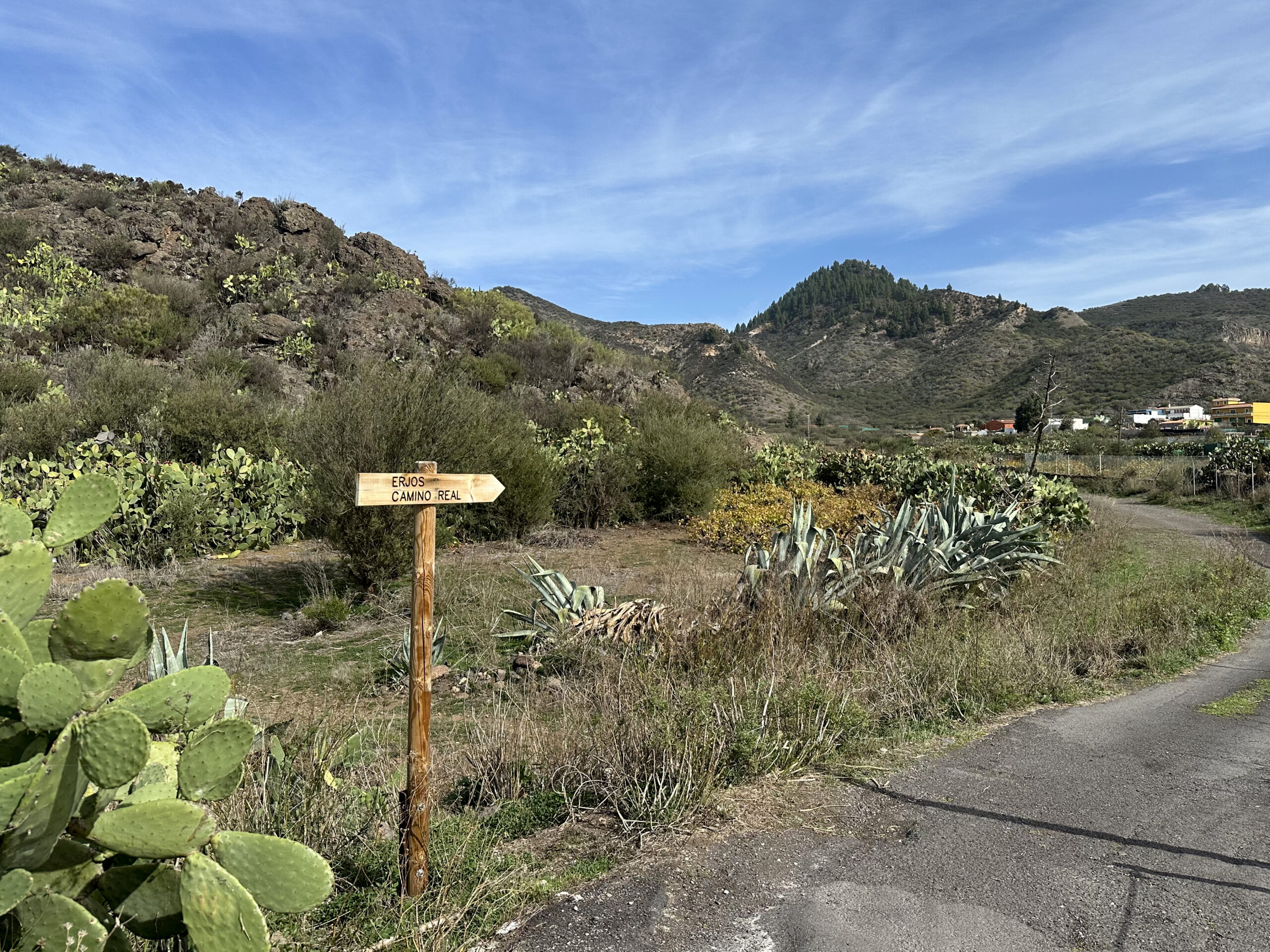
You then come to a well-signposted fork where the trail to Tierra del Trigo branches off left. You continue straight past the houses of Cuevas Negras towards Erjos on PR-TF 53. On the narrow path, which now increasingly runs through leafy forest, you gain more and more altitude. Old water channels accompany you on both sides of the path, partially overgrown by lush vegetation or sometimes no longer visible. Shortly before Erjos, you leave the forest and continue on wider field paths. You pass fields, gardens, and then the first houses of Erjos. Through the houses and gardens, the path leads to the end of the ascent on a paved path up to the first street in Erjos.
This is Calle Cruces Erjos, which you follow to the right. If you need a rest, there is a well-equipped resting place here. At the end of the street, you walk past houses downhill to the right, then shortly after turn left and continue on PR-TF 51. This path leads you slightly uphill below Erjos and then parallel to TF-82. You hike past Charcas de Erjos, which were lakes years ago but are now (2025) dried out. Shortly after the Charcas, PR-TF 51 turns right. However, you continue straight ahead.

Section Charcas de Erjos to Santiago del Teide and Los Gigantes
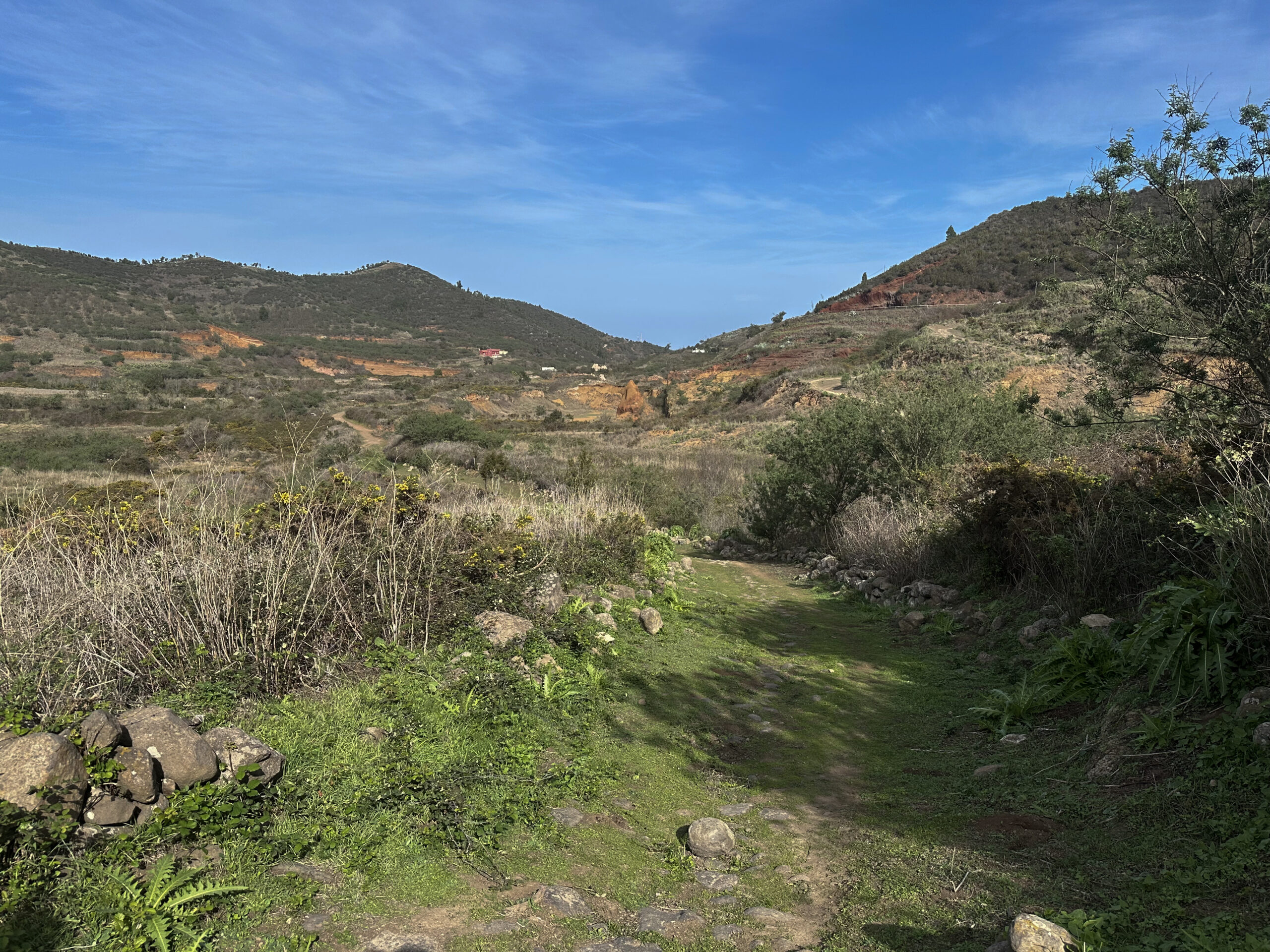
The small trail leads you steeply uphill through wooded areas. At the top, you reach the road leading to the Gran Gala. You cross this road and walk a few steps down to TF-82. You cross this road as well and find a viewpoint a few meters to the right. From there, you have a beautiful view of the Teide and can overlook the entire Valle Arriba valley. At the viewpoint, you follow a trail downhill towards Valle Arriba. After a short time, the path forks. You go right and walk briefly through bushland. Then you reach a road that brings you in a wide curve to the Camino Real road between Santiago del Teide and Valle Arriba.
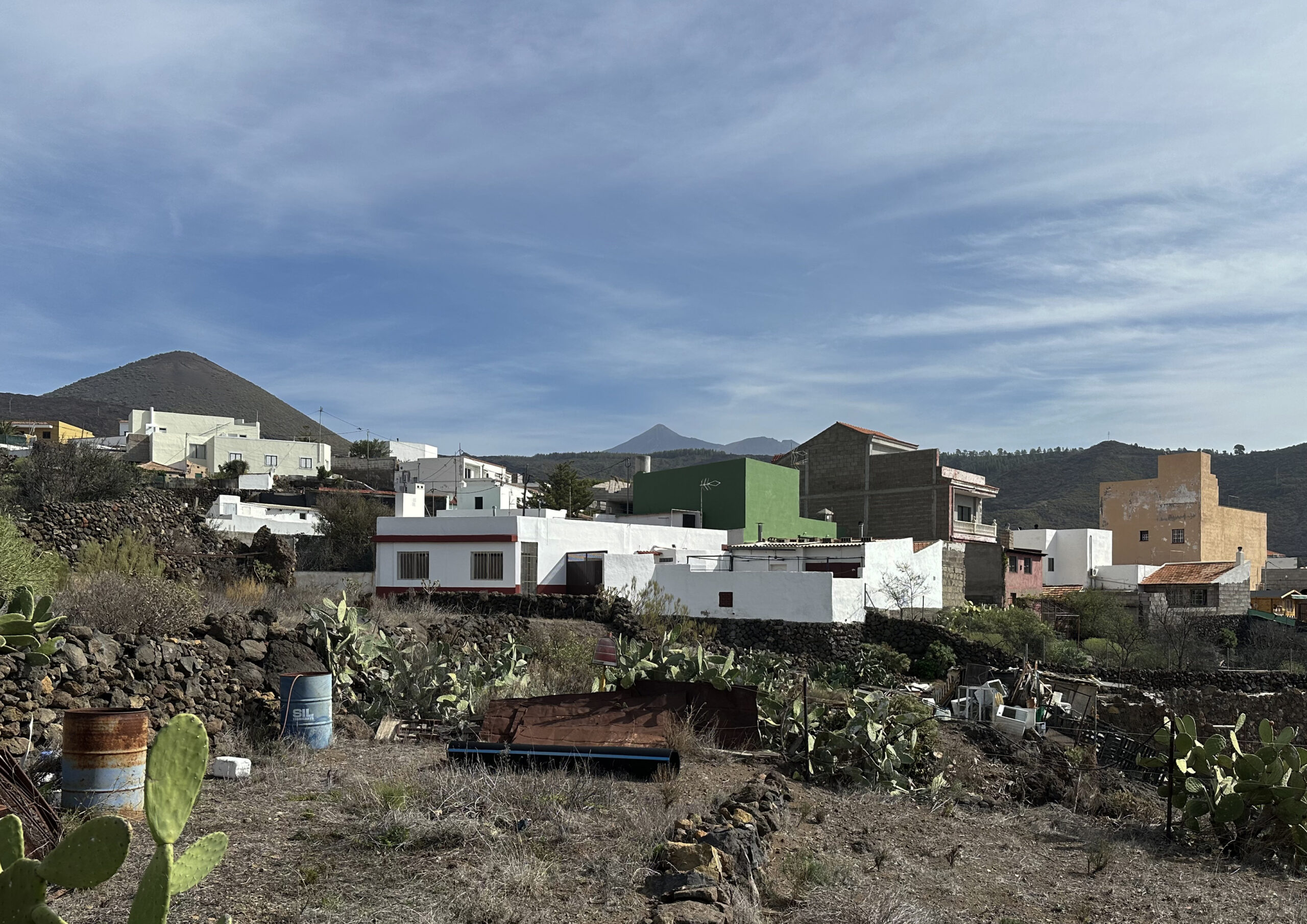
Shortly before the Ermita de Santiago Apóstol chapel, you reach the road. From there, you follow the Camino Real road for quite a while past gardens and fields. Finally, it joins TF-82, on which you soon turn left towards Santiago del Teide. This closes the hiking loop. From Santiago del Teide, you now return the same way you came. You hike through Santiago del Teide to El Molledo. From there, you continue over the Camino Real PR-TF 65 via Tamaimo back to Los Gigantes.
And finally
I hope you enjoyed this large hiking loop through the impressive Teno mountains with quite a few ascents. Whether you choose the big loop or many smaller individual hikes, I wish you much joy on all your hikes.
Dagmar from Siebeninseln