Vera de Erques – A Great Starting Point for Interesting Hikes
So far, on SiebenInseln, I have only described the hike from Vera de Erques to the Chindía Waterfall. This route partially overlaps with the ascent path of the hike that will now take you to the other side of the large gorge. Soon, I will also describe another hike from Las Fuentes into the Barranco Niágara. All these hikes around Vera de Erques and Las Fuentes can be easily combined with each other.
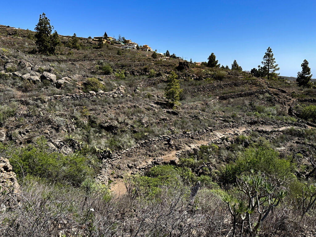
The small village of Vera de Erques lies at an altitude of 850 metres on the edge of the Barranco de Erques gorge, in an area that was once one of the largest grain-growing regions in the area. Thanks to its agricultural history, the village and its surroundings contain several ethnographic sites. You can find old houses, cisterns, and wine presses. From the village, you can enjoy wonderful hikes in all directions. One well-known hiking route is PR TF 69, which takes you across many gorges to El Jaral and on to Chío.
Hiking from Vera de Erques Towards the Cañadas
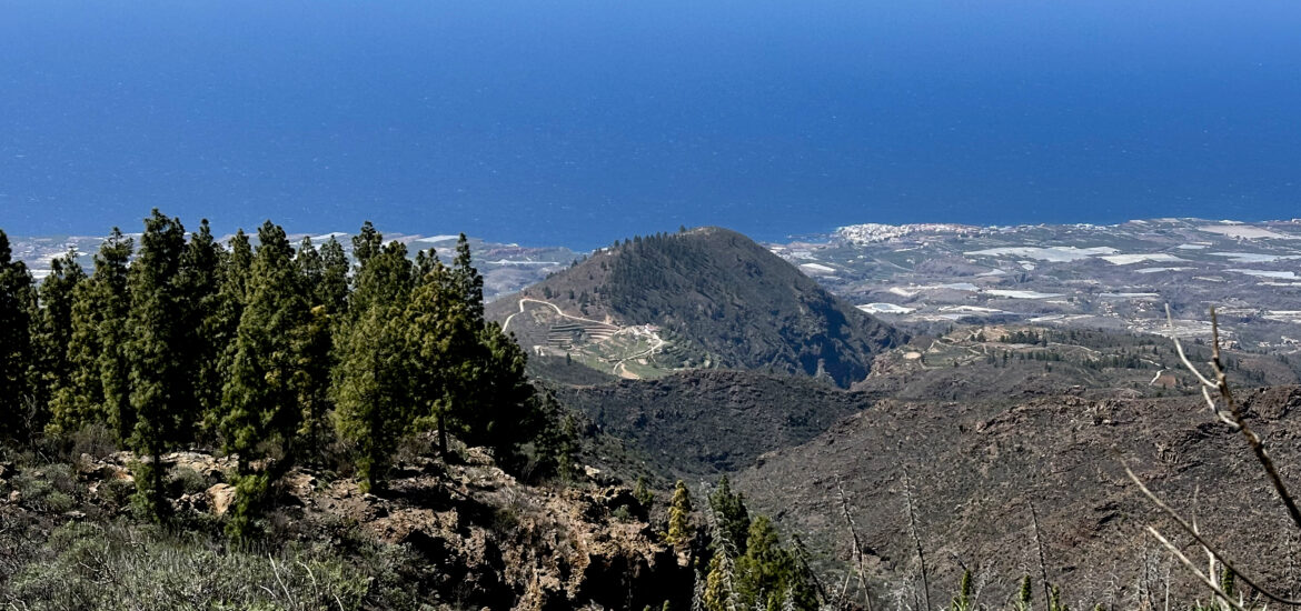
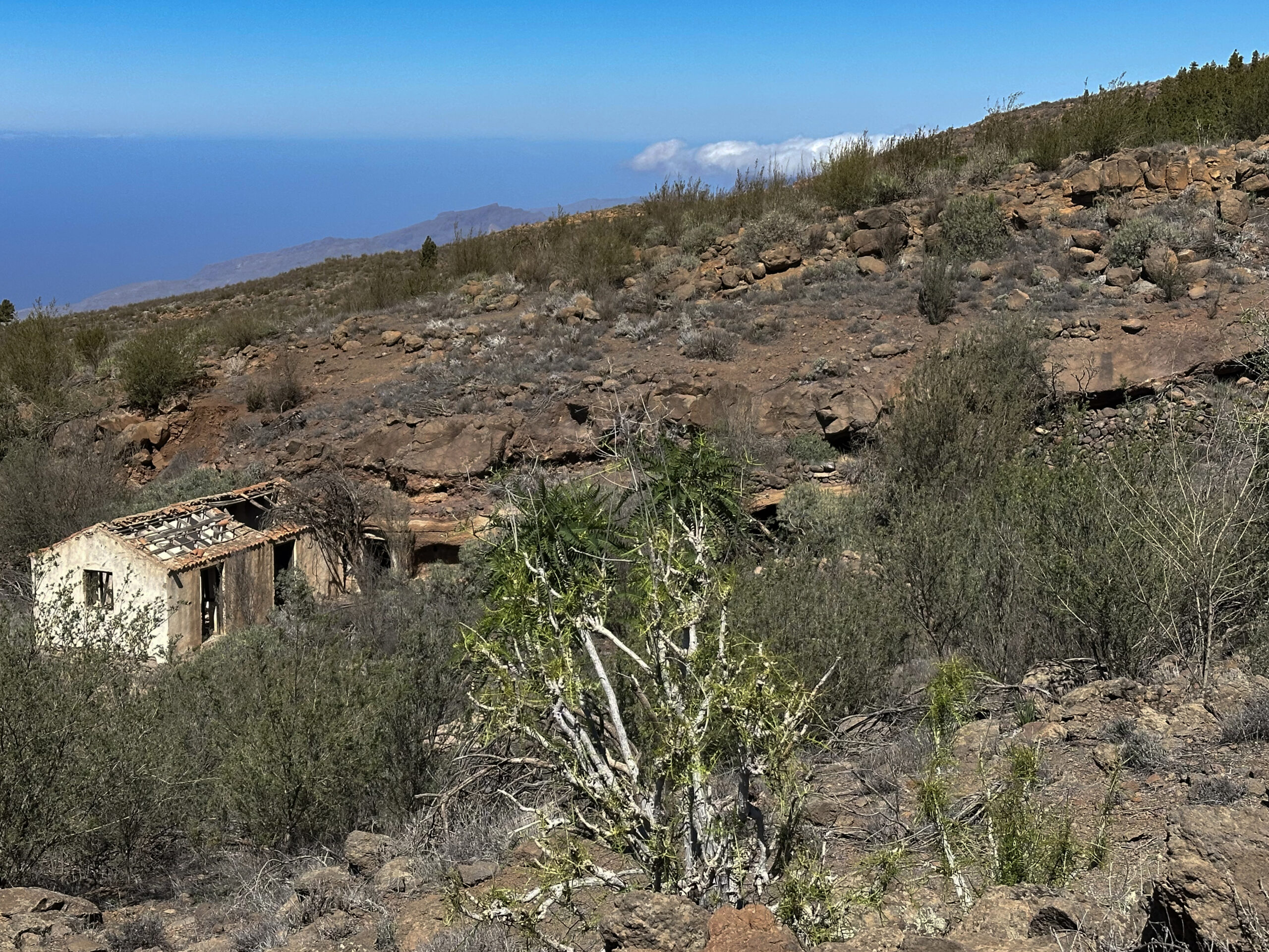
The hike from this village presented here takes you back to the village via part of the PR TF 69 at the end of the tour. However, the initial section leads steeply uphill towards the Cañadas. Along the way, you will enjoy stunning views of the coast and deep ravines, as well as visit old farmsteads such as Pino Redondo or the Casa de los Poleos. This extensive hike is perfect for those who enjoy route variations, as the circular hike from Vera de Erques can be shortened or modified in several ways.
I will introduce two gorge crossings that can shorten the route while making it even more interesting. One of these crossings follows a regular hiking trail, while the other is quite adventurous and may not be suitable for everyone. See which option suits you best.
General Information About the Circular Hike from Vera de Erques
Starting Point and Access
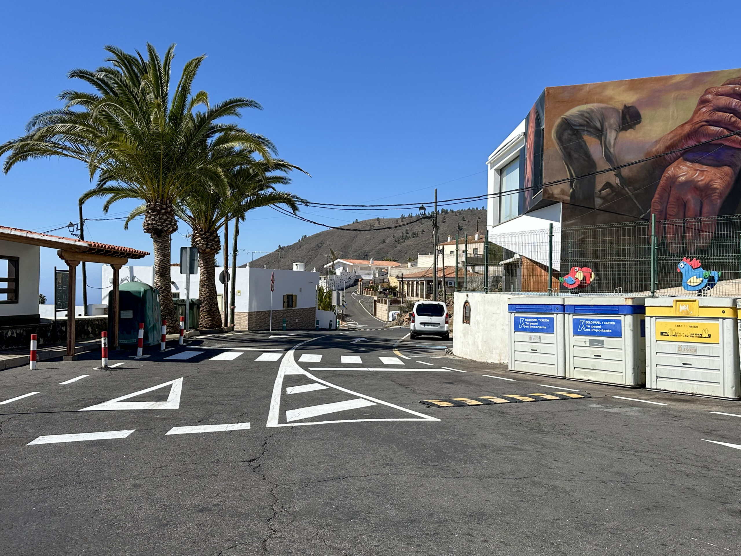
The starting point of this hike is the small mountain village of Vera de Erques (approximately 840 metres in altitude). The hike begins at the TF-465 road (village centre, plaza, bus stop).
Access by Car
You can reach Vera de Erques via the TF-82 or the motorway (exit: Vera de Erques) from either the south or north of the island. From the motorway exit, take the TF-465, which winds up to Vera de Erques in numerous hairpin bends. There are plenty of parking spaces in the plaza and along the roadside in Vera de Erques.
Access by Bus
Titsa bus lines 417 and 490 stop in Vera de Erques. The final stop is also the starting point of the hike. Check the Titsa website for exact schedules and further details.
Time
I prefer not to give general time estimates for hikes, as hiking times vary greatly from person to person. We completed this extensive route in just over six hours, including breaks.
The shortened version from Las Fuentes with two gorge crossings took about 4.5 hours.
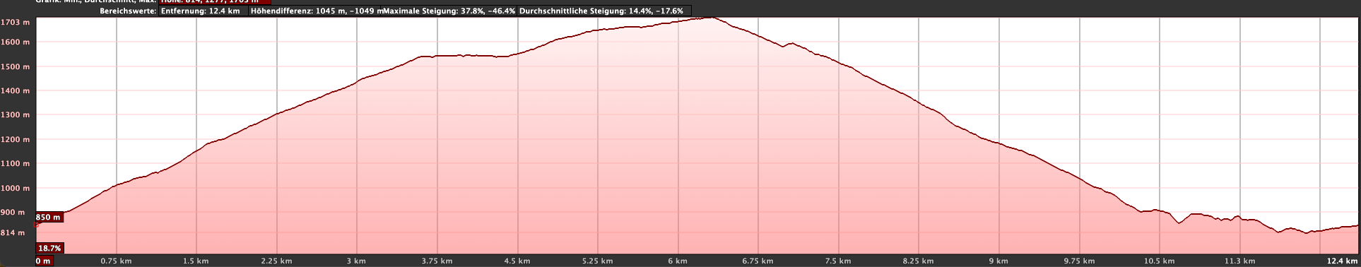
Elevation Difference and Distance
The total elevation difference is approx. 960 metres and total distance just over 14 kilometres.
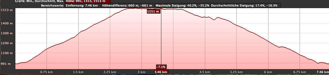
The shortened route is approximately 9 kilometres with 640 metres of elevation gain.
Difficulty
The entire hike follows well-maintained trails. However, if you choose the upper gorge crossing on the shortcut route, the descent into and ascent out of the gorge can be tricky to find, sometimes trackless and quite steep. This section is only recommended for adventurous hikers.
Refreshments
There are no refreshment options along the route except at the starting point in Vera de Erques. Be sure to bring enough water and snacks.
Variants
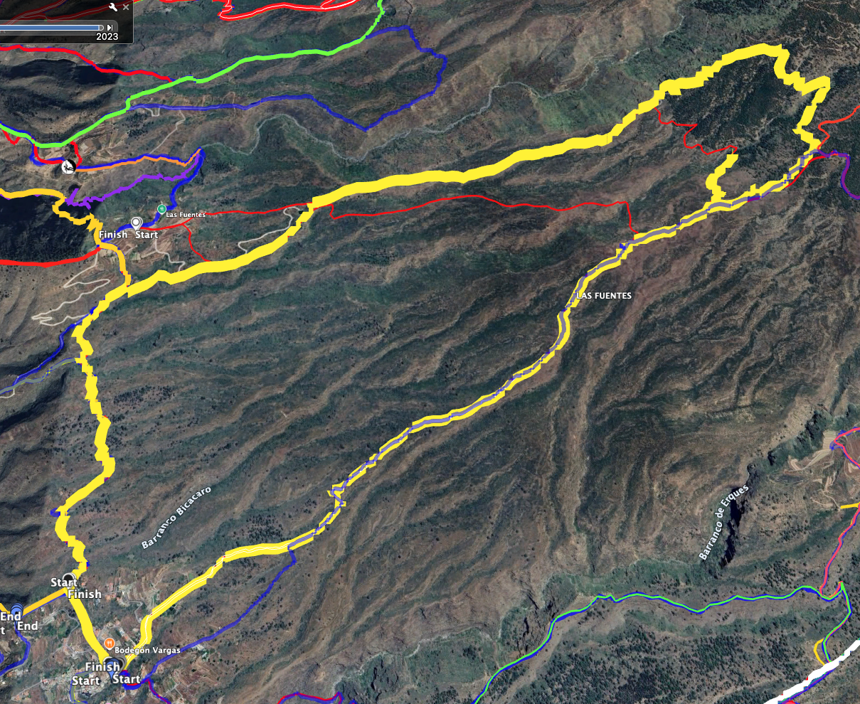
The hike can be shortened. I describe the shorter options in detail in the article. You can also find downloadable GPS tracks for the different variations.
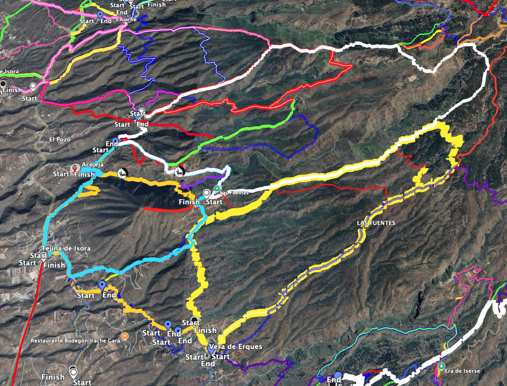
The hikes from Caserío de Las Fuentes via the Barranco de Niágara are directly adjacent to this hike and can be easily combined with it.
Additionally, you can hike from Vera de Erques to the former Chindía Waterfall.
Another nearby hike is the adventurous tour around Montaña de Tejina.
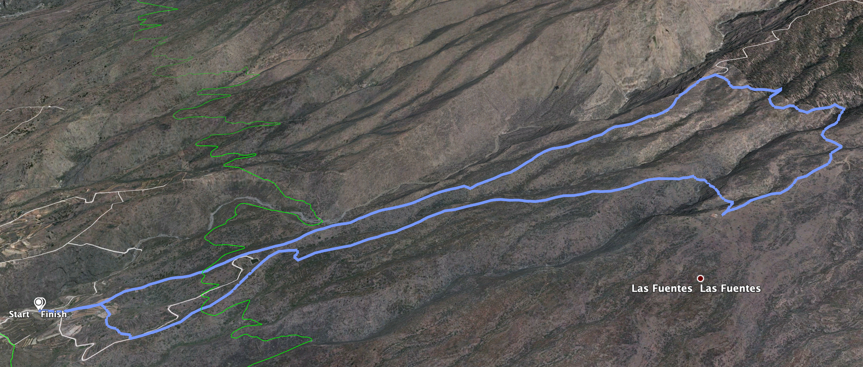
Circular Hike from Vera de Erques
Section: Vera de Erques to Pino Redondo
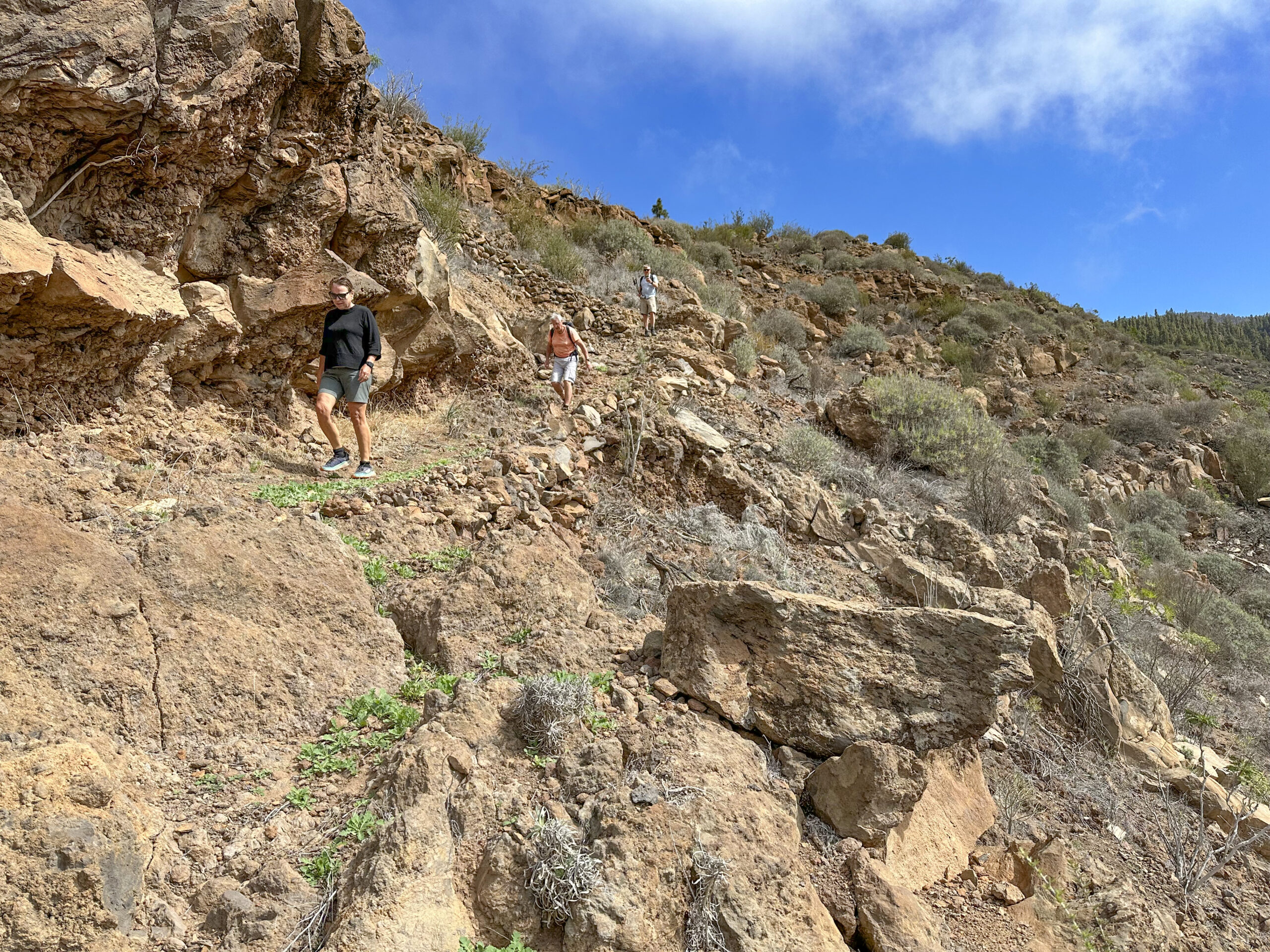
Your hike starts at TF-465 in the village centre of Vera de Erques, where Calle Santo Domingo and Calle Parranda meet. Follow Calle Santo Domingo uphill, passing many houses before leaving the village. The steep street turns into a steep track and then into a hiking path, quickly gaining elevation.
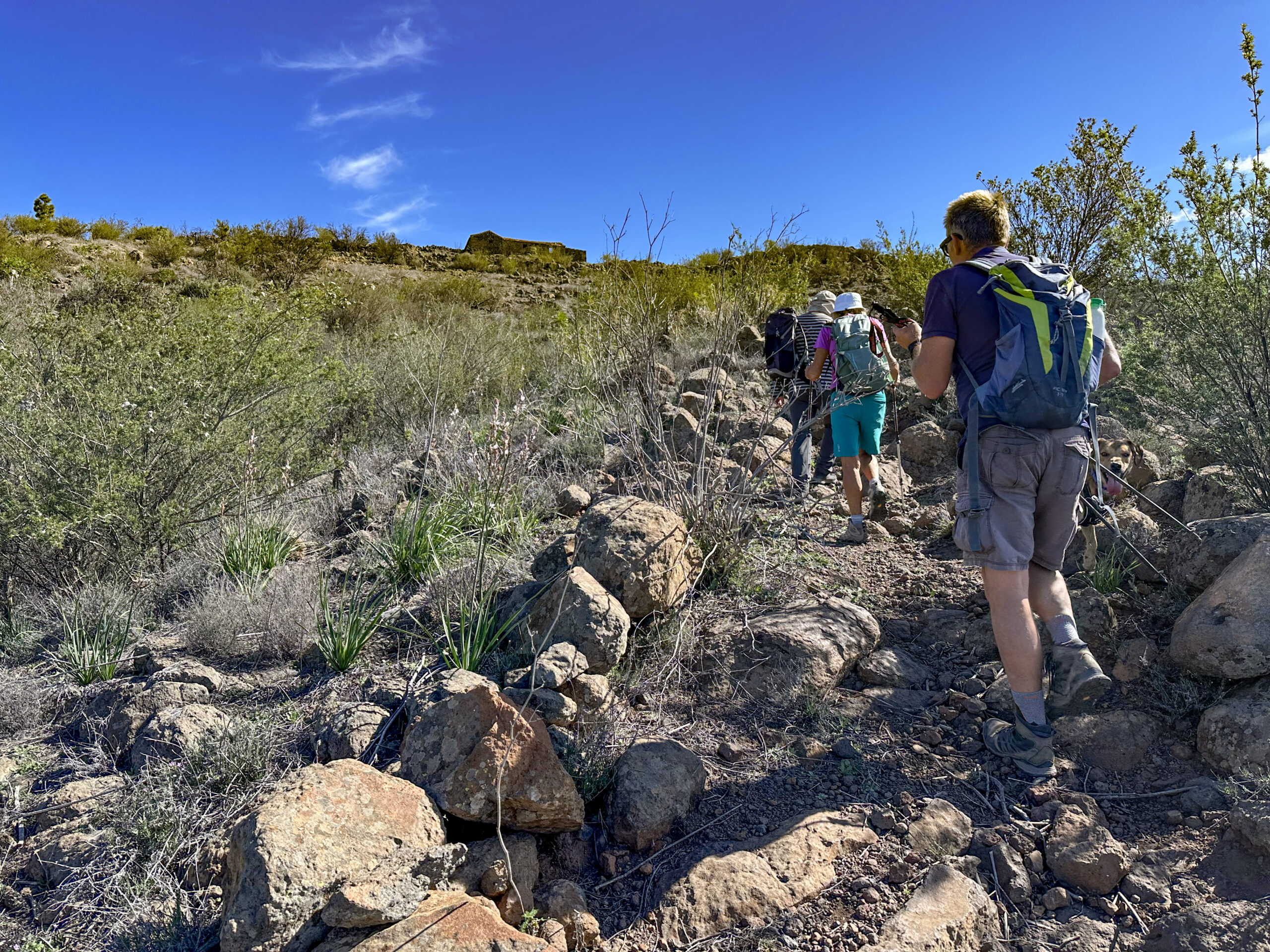
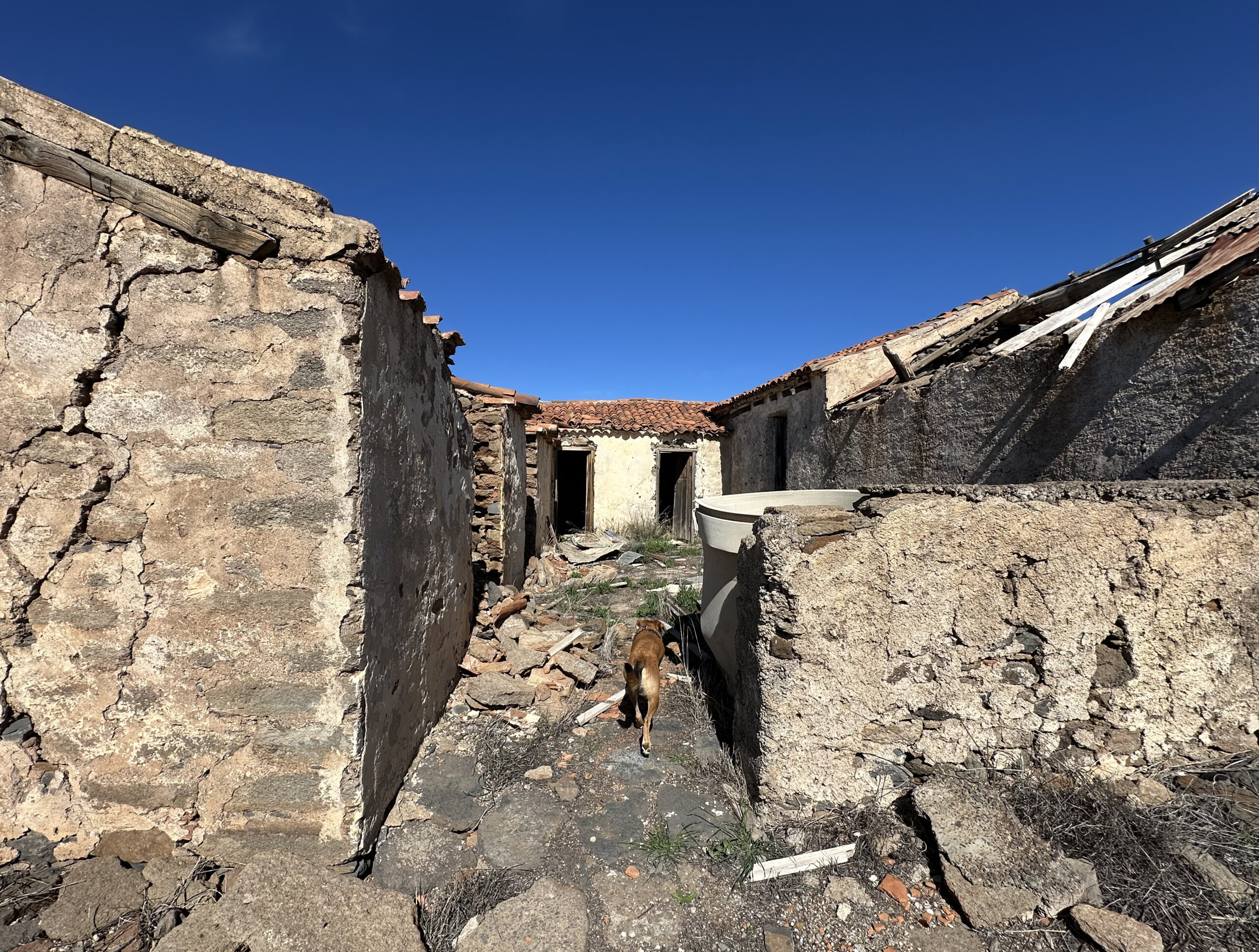
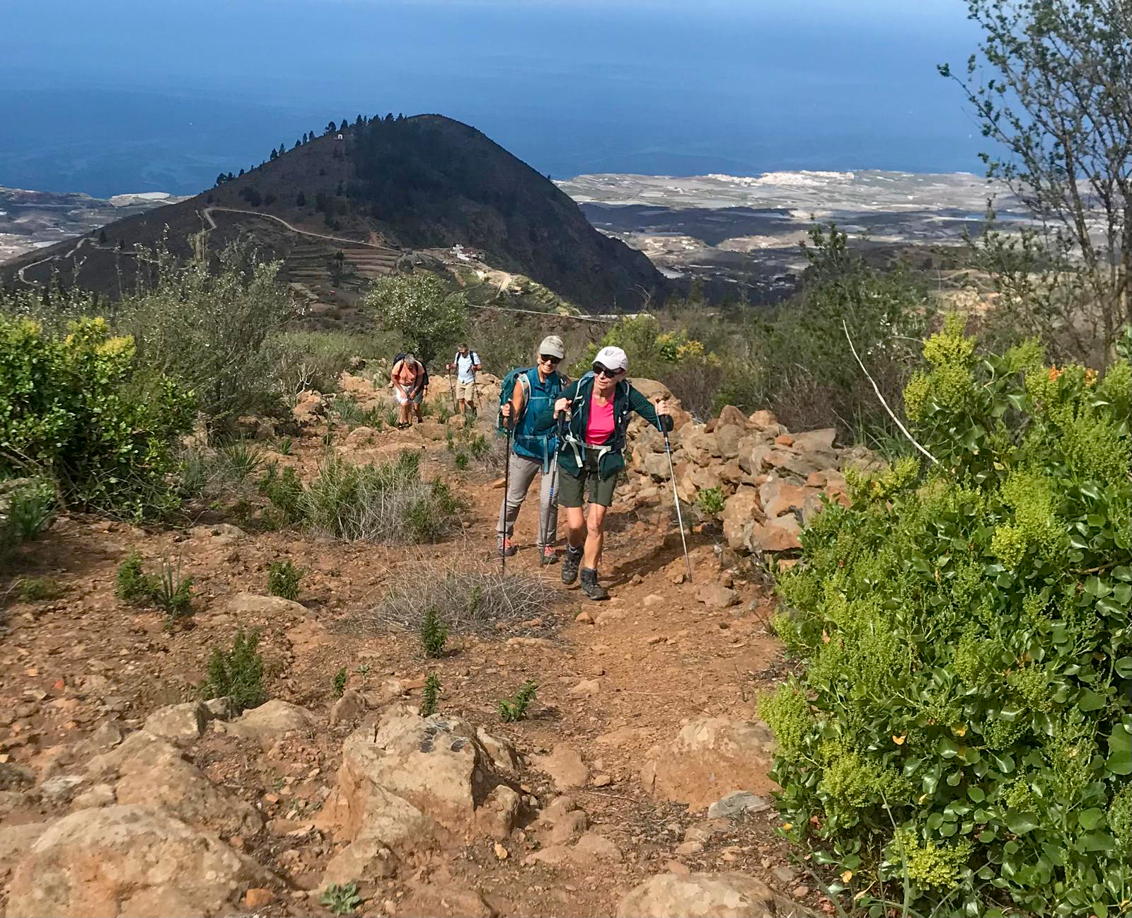
Alternatively, you can ascend via Calle de la Tuna, which merges with the main ascent route above Vera de Erques. The trail offers fantastic views of the coast and La Gomera. The path is easy to follow and forks only once—take the left path. Soon, you will see the ruins of an old estate, Pino Redondo, high above. After another climb, you will reach it.
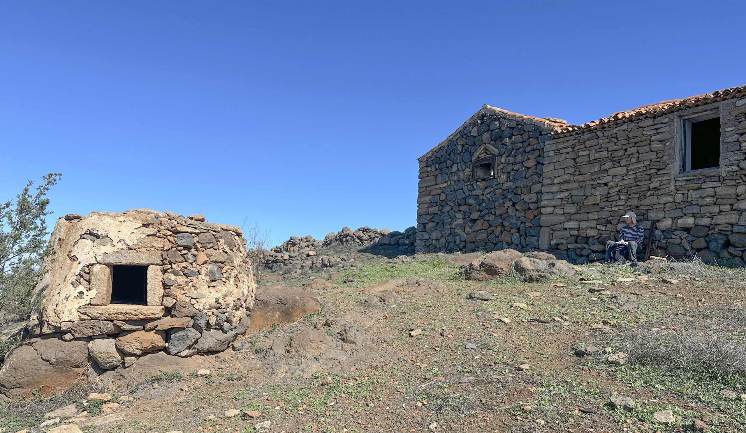
Section: Pino Redondo to the Red Pipeline
Take a short break here to explore the impressive large oven and the many rooms of the estate. If you prefer to avoid more climbing, you can take the hiking trail behind the house, which crosses several small gorges before joining the Camino de las Fuentes PR TF 70.2—the descent path of this circular hike.
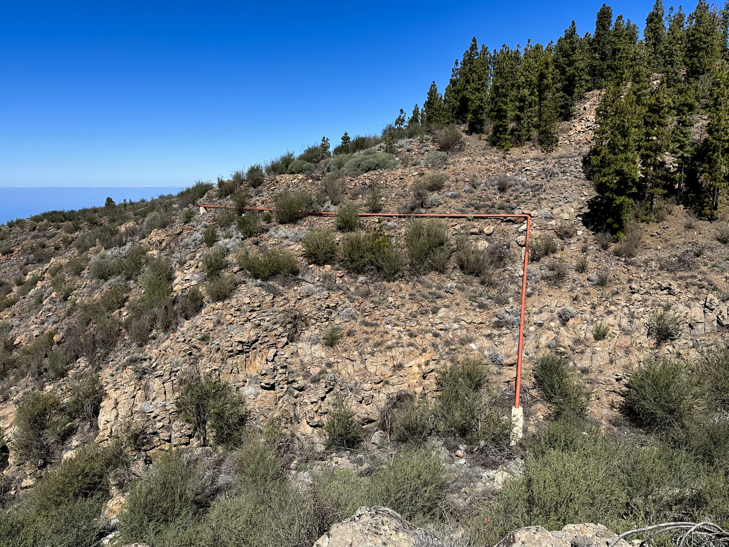
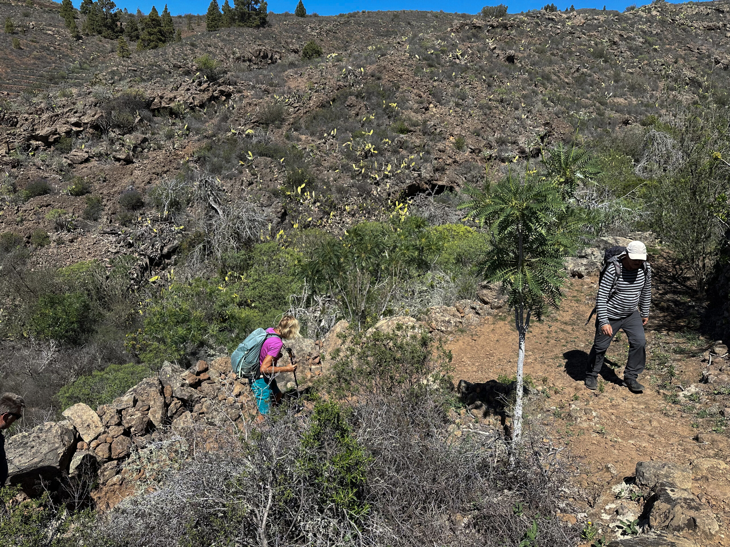
Soon, you will see large red pipelines above. After passing under them, you reach a track. You can follow the track to the left, which narrows and ends at the edge of the Barranco del Chabuibo (or Barranco Cuéscara). This can be crossed via a very narrow, rough path, allowing you to reconnect with PR TF 70.2 to las Fuentes on the other side.
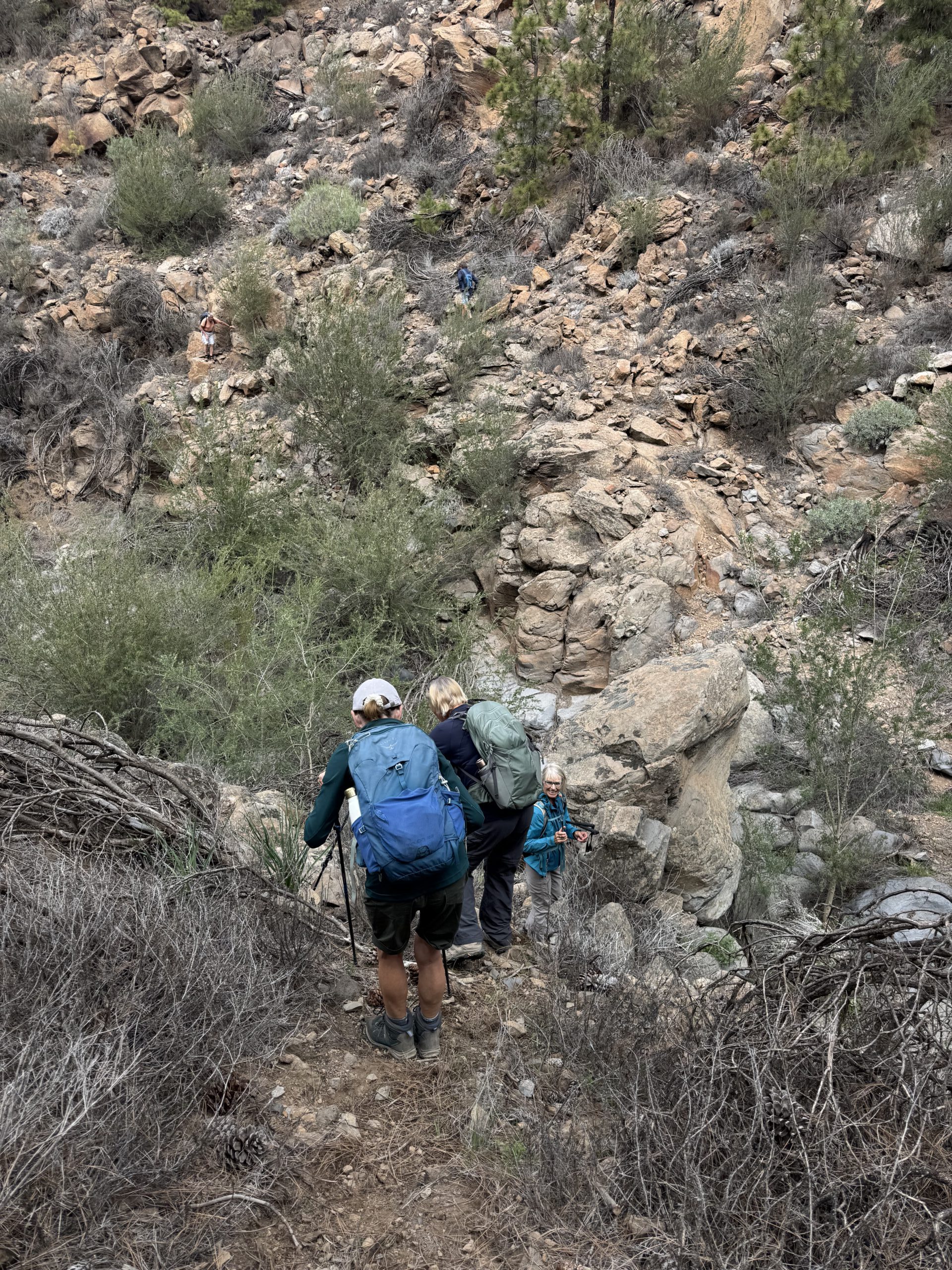
Variant: If you want a shorter hike overall (details above under Shortening by two barranco crossings), you should climb up from Las Fuentes and take the first crossing to Pino Redondo from there. From there, climb up to the red pipeline and then cross the Barranco Chabuibo or Cuéscara (only for the adventurous) and hike back to Las Fuentes on the other side.
Section: Red Pipeline to PR TF 70.2
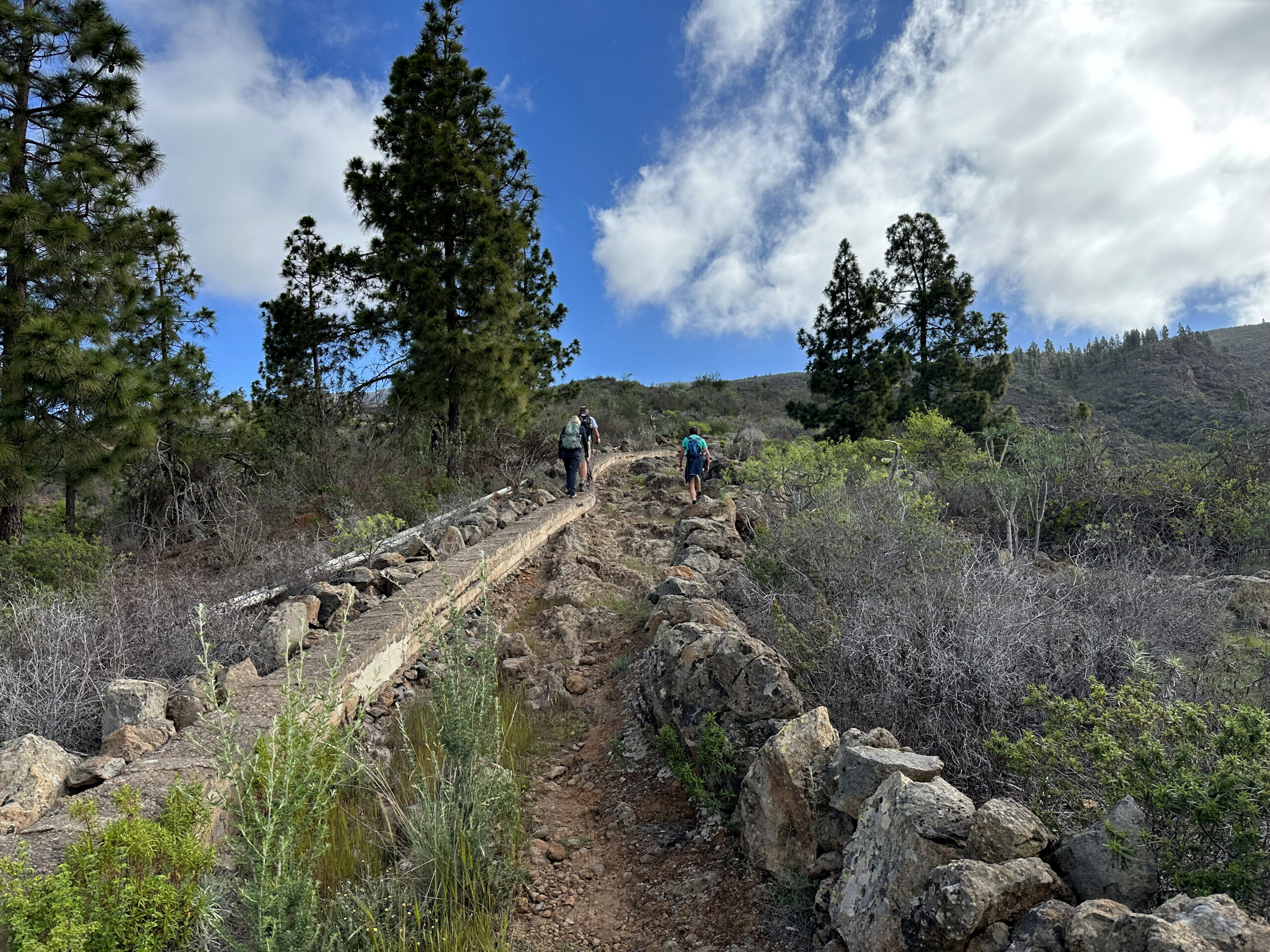
For those continuing to climb, the trail leads past another old house with cave dwellings. The pine forest begins. It won’t be long before you reach a wide track, which you follow round to the left. Turn right to reach the former Cascada de Chindía.
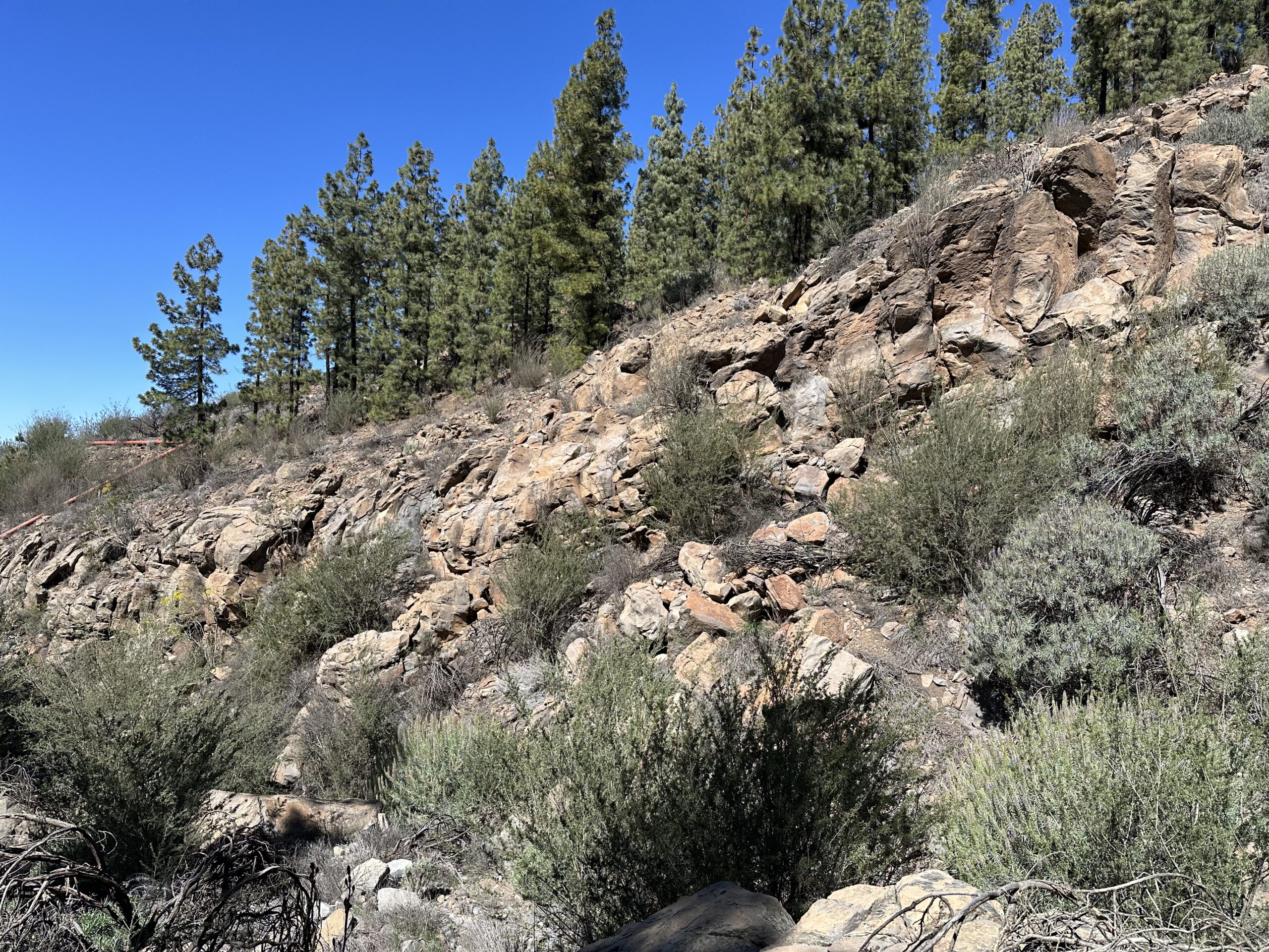
The ascent is not yet over, as the track climbs further through the pine forest, crossing several small ravines before reaching the highest point of the hike at around 1,700 metres. Breathtaking views await you. The path then joins the PR TF 70.2 descent route to Las Fuentes.
Section: PR TF 70.2 to the Junction Beyond Casa de los Poleos
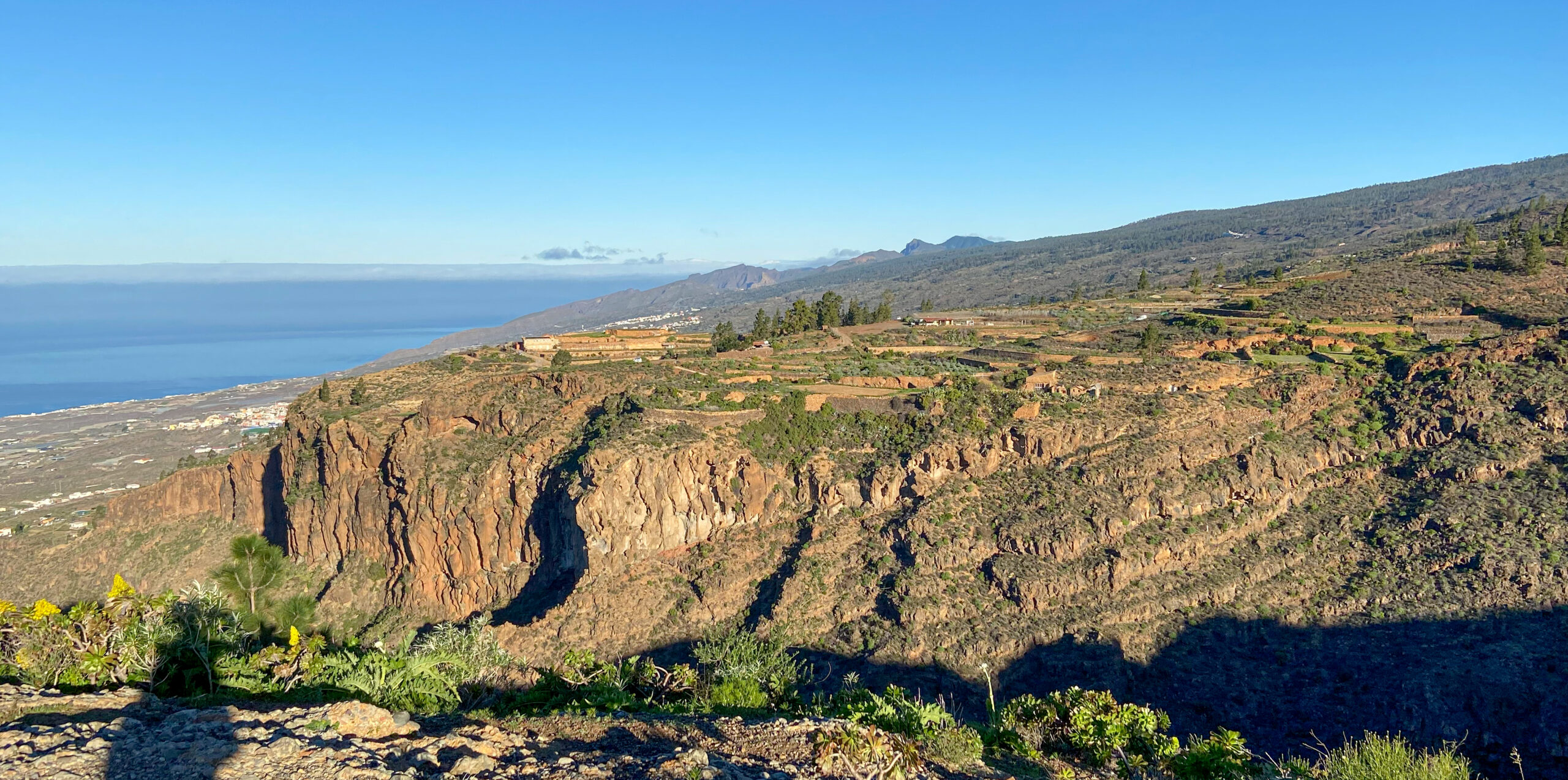
From there, the trail now goes downhill for quite a while. You first walk through the pine forest and then continue along the ridge. The views from the height of Las Fuentes and the coast below you are simply fantastic. From the left, the two shortcut paths described above on the PR TF 70.2 will take you downhill one after the other.
Via Las Fuentes, you will finally reach a fenced-in house (Casa de los Poleos). If you have parked in Las Fuentes and taken the shortcuts, from here you can simply continue straight down the steep hiking trail to Las Fuentes. In the direction of Vera de Erques, however, the PR TF 70.2 branches off to the left shortly after Casa de los Poleos.
Section: Junction Beyond Casa de los Poleos to Vera de Erques
Follow PR TF 70.2 downhill along a canal. The path merges into a road leading down to Las Fuentes, but you continue straight. This steep shortcut avoids the village and meets finally PR TF-69. Follow it leftward. Soon, you approach the road to Las Fuentes and continue uphill.
PR TF 69 is well-marked with yellow and white signage and leads you through several ravines, offering spectacular coastal views. After a final short ascent, the trail ends at the Carretera Vera de Erques (TF-465). Follow this road leftward to the village centre, returning to your starting point.
And finally
I hope you enjoy this grand circular hike with its many variations from Vera de Erques via Las Fuentes. Whatever route you choose for your next adventure, I wish you wonderful hikes!
Dagmar from Siebeninseln