The Volcano Route below Pico Viejo
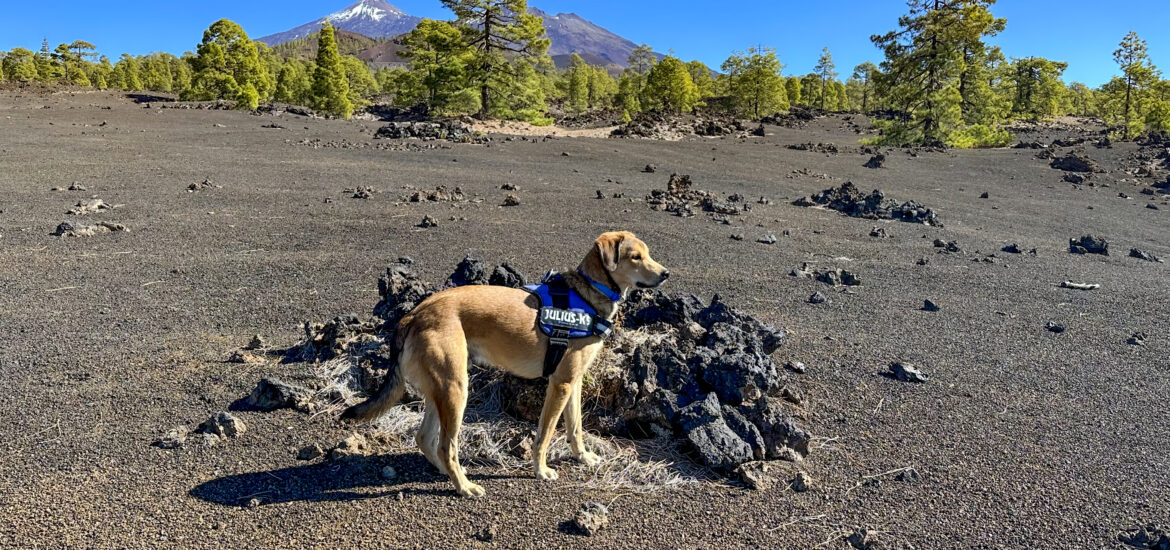
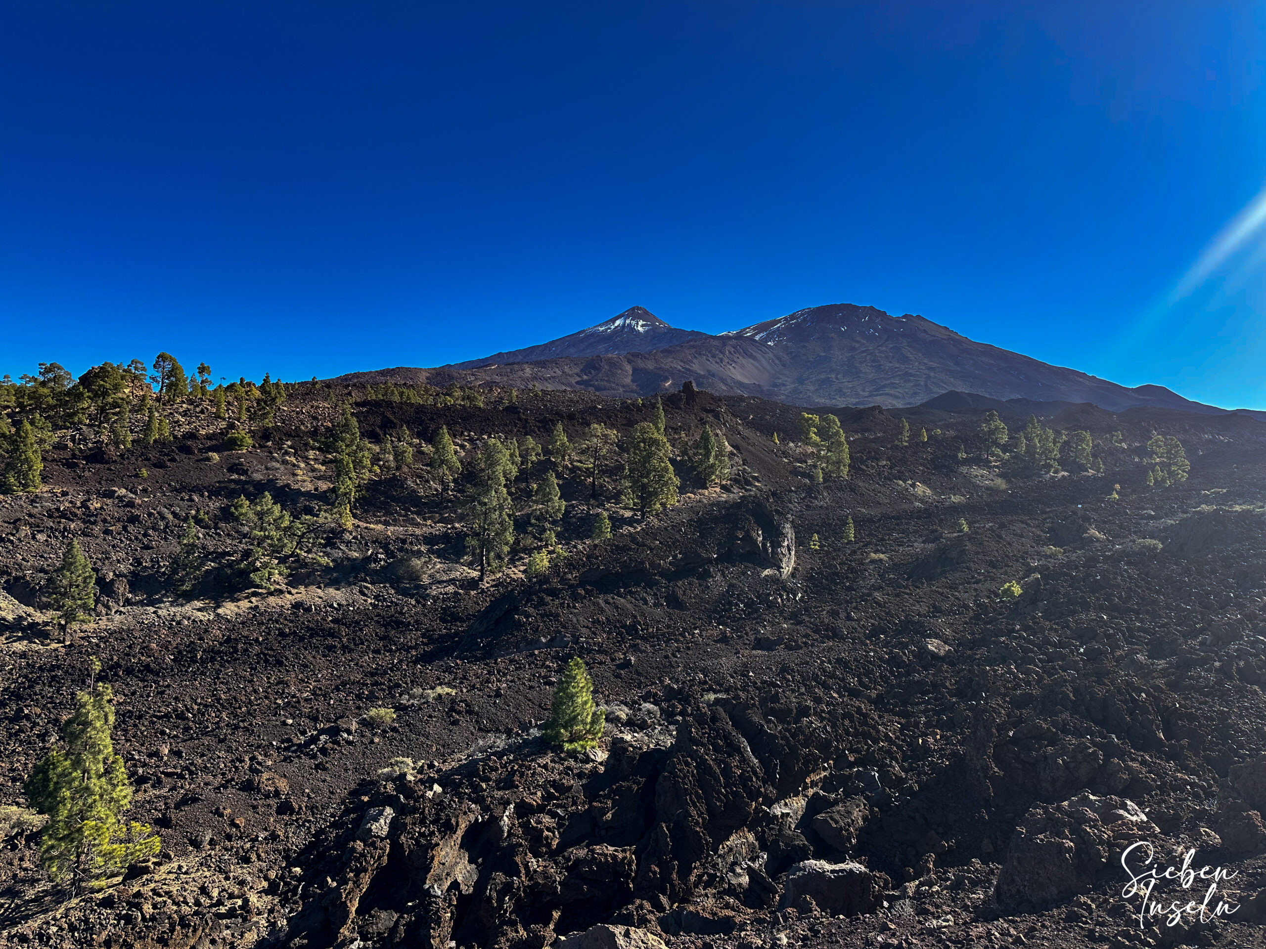
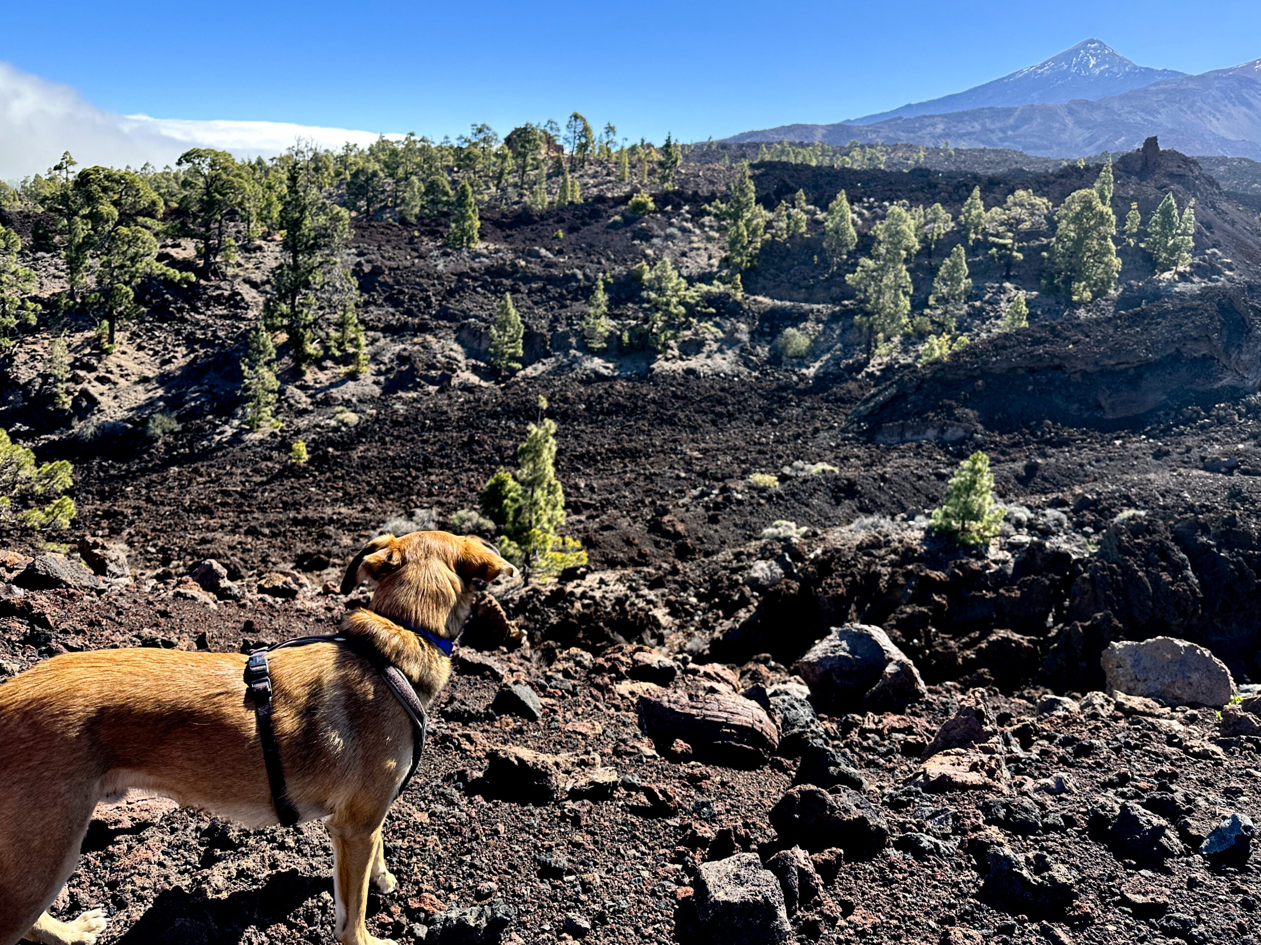
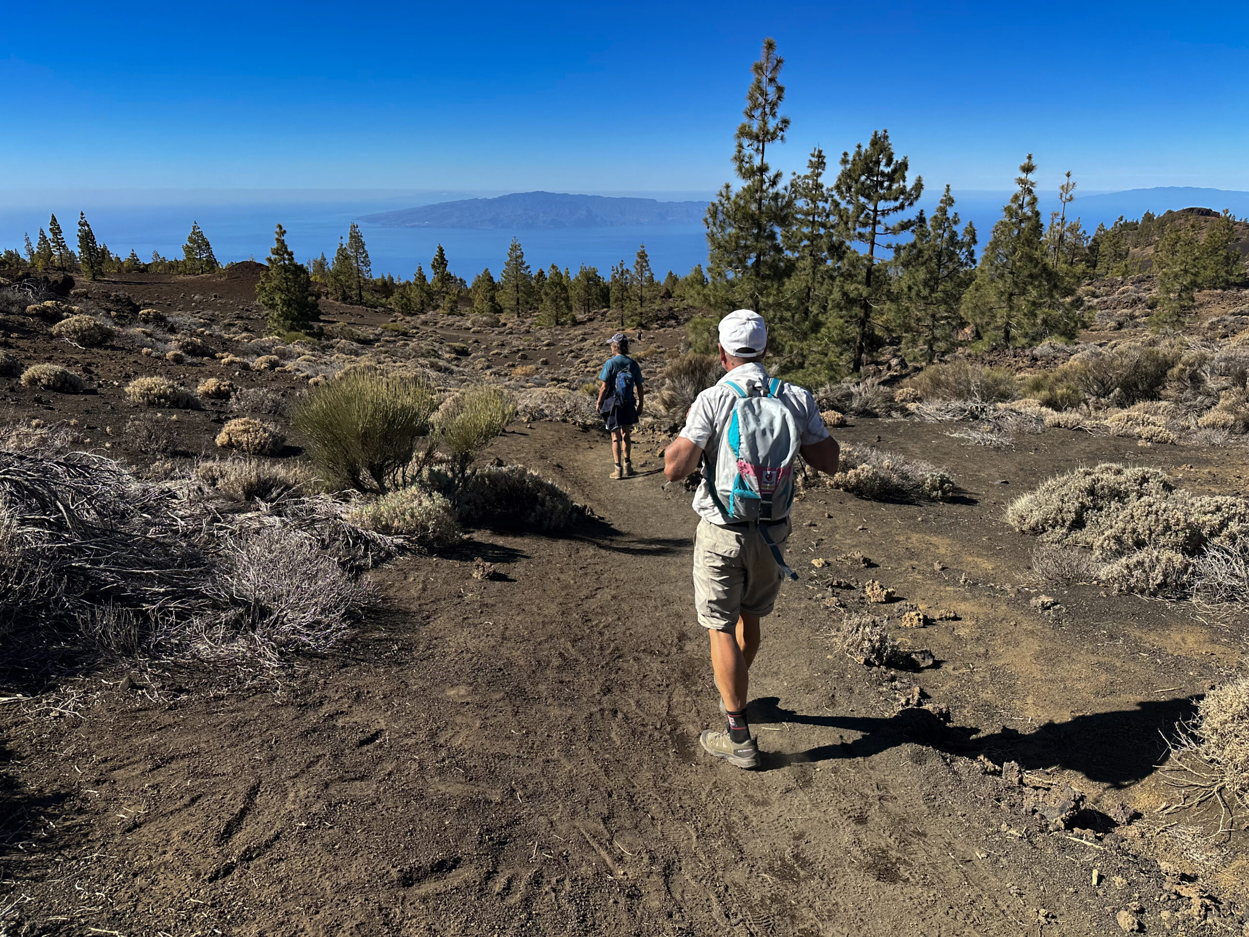
Below the imposing Teide and Pico Viejo, I have already described several circular walks on Tenerife on SiebenInseln. Today follows the Volcano Route, which runs above the Chinyero volcano and below Pico Viejo. Passing several volcanic cones, the Volcano Route leads you through the impressive landscape of the Teide National Park. Already at the starting point an impressive panorama opens up, with black lava fields, pale ash slopes and scattered green pines. The mighty Teide and Pico Viejo tower over the scene, a striking reminder that this region was shaped by fire.
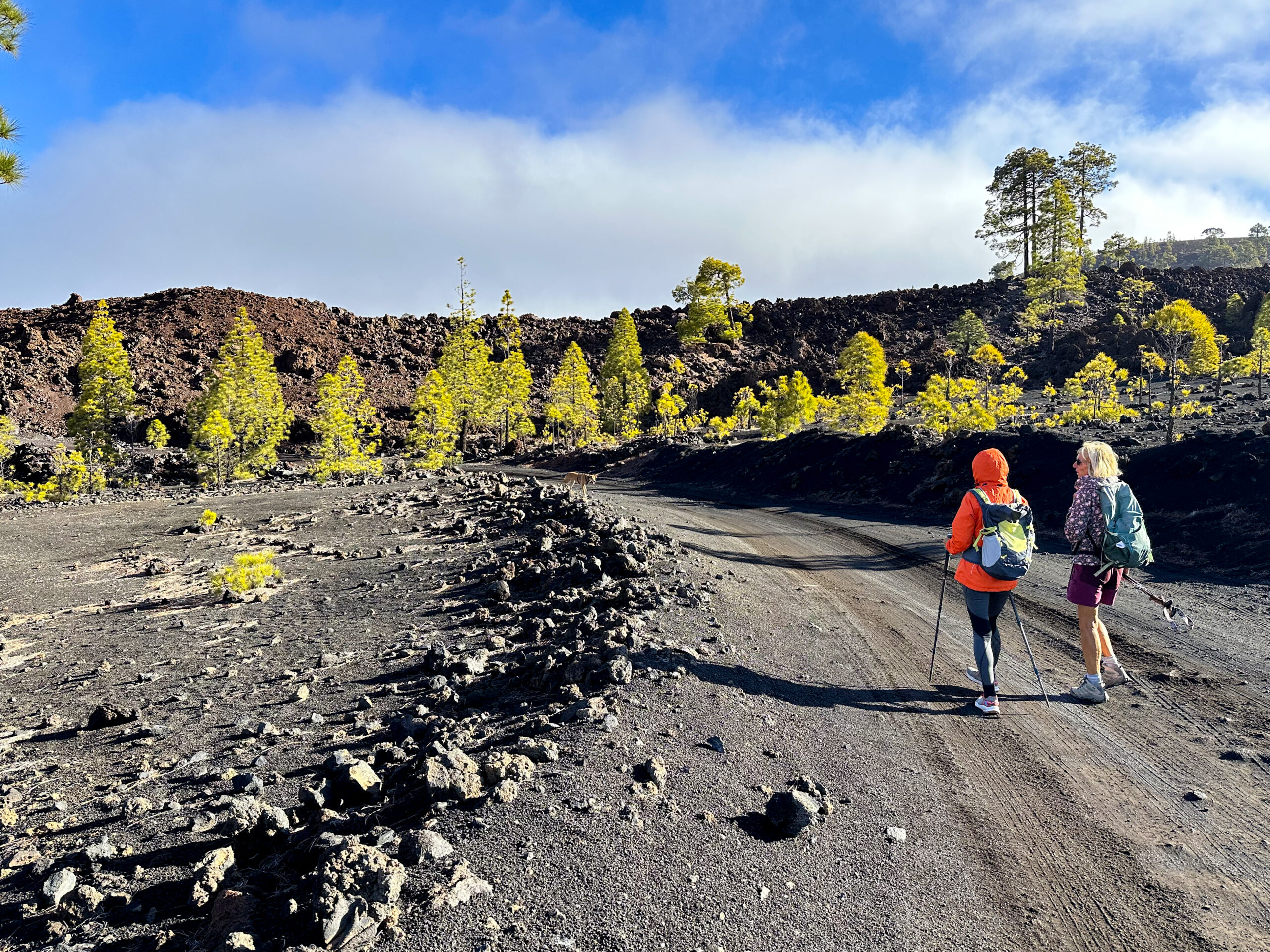
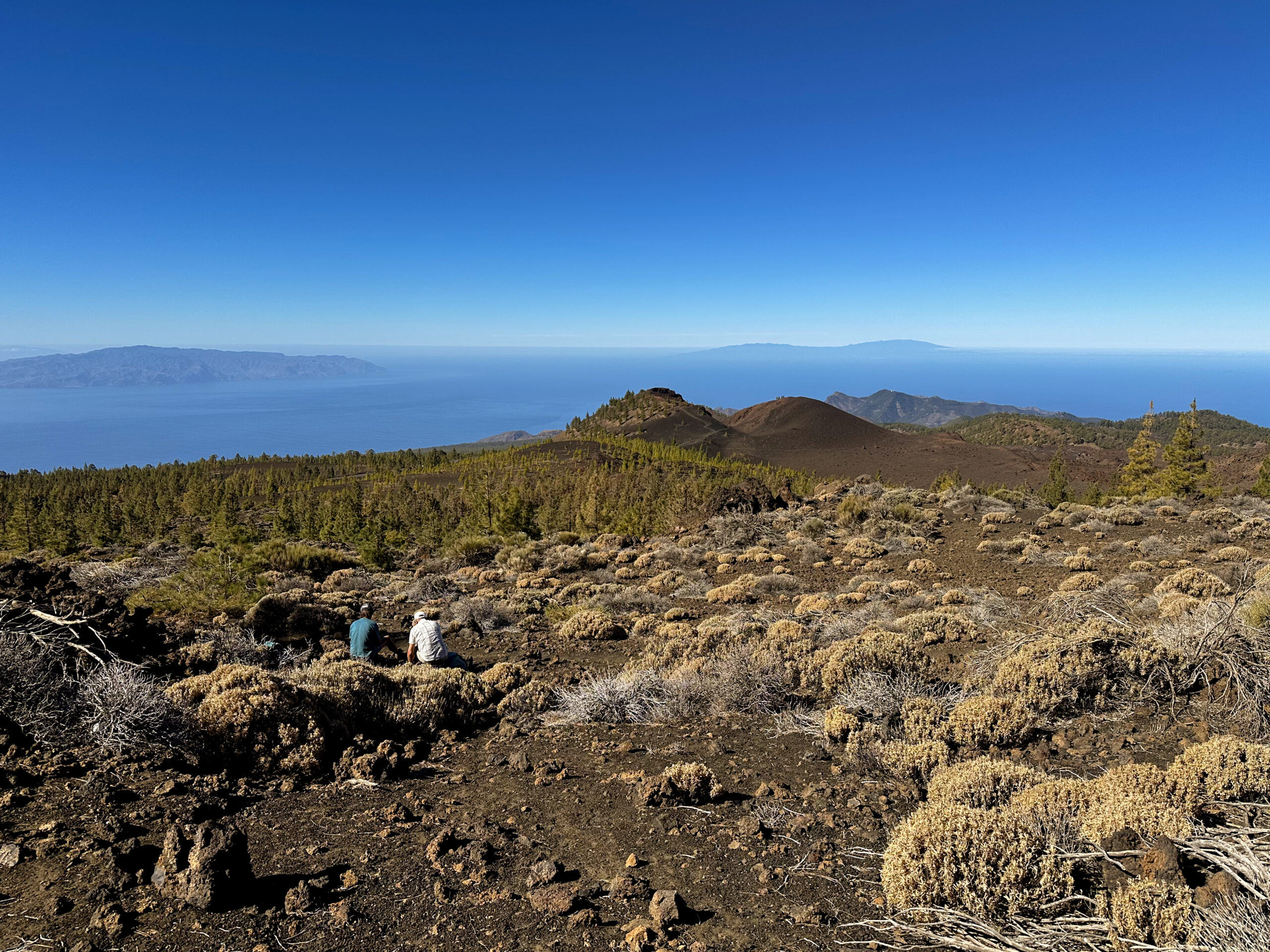
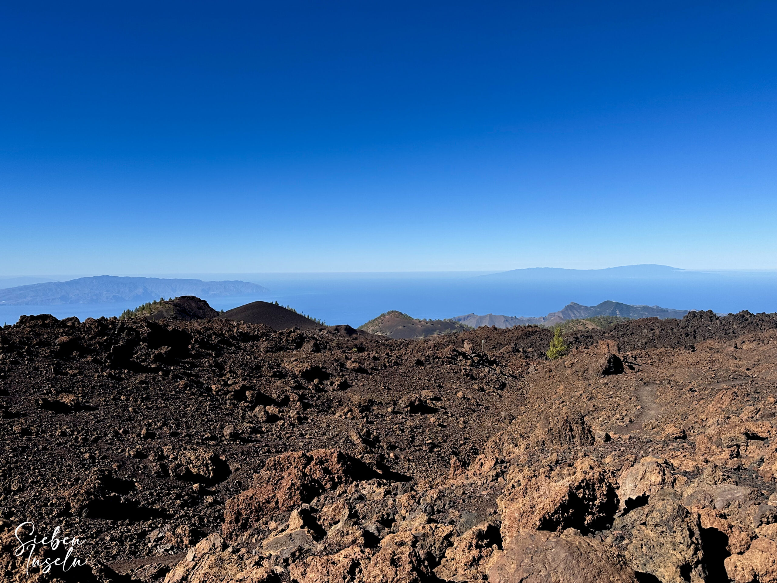
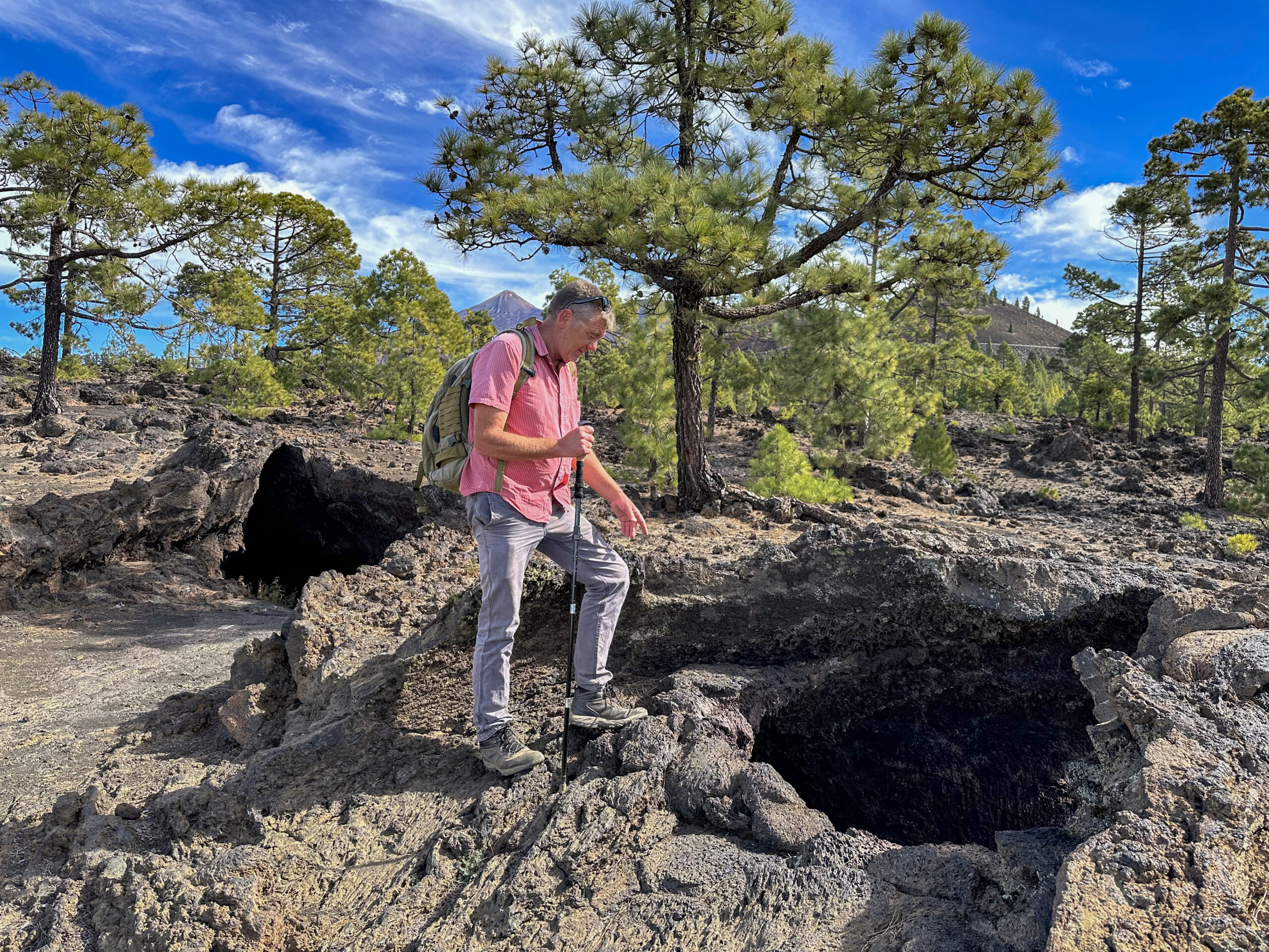
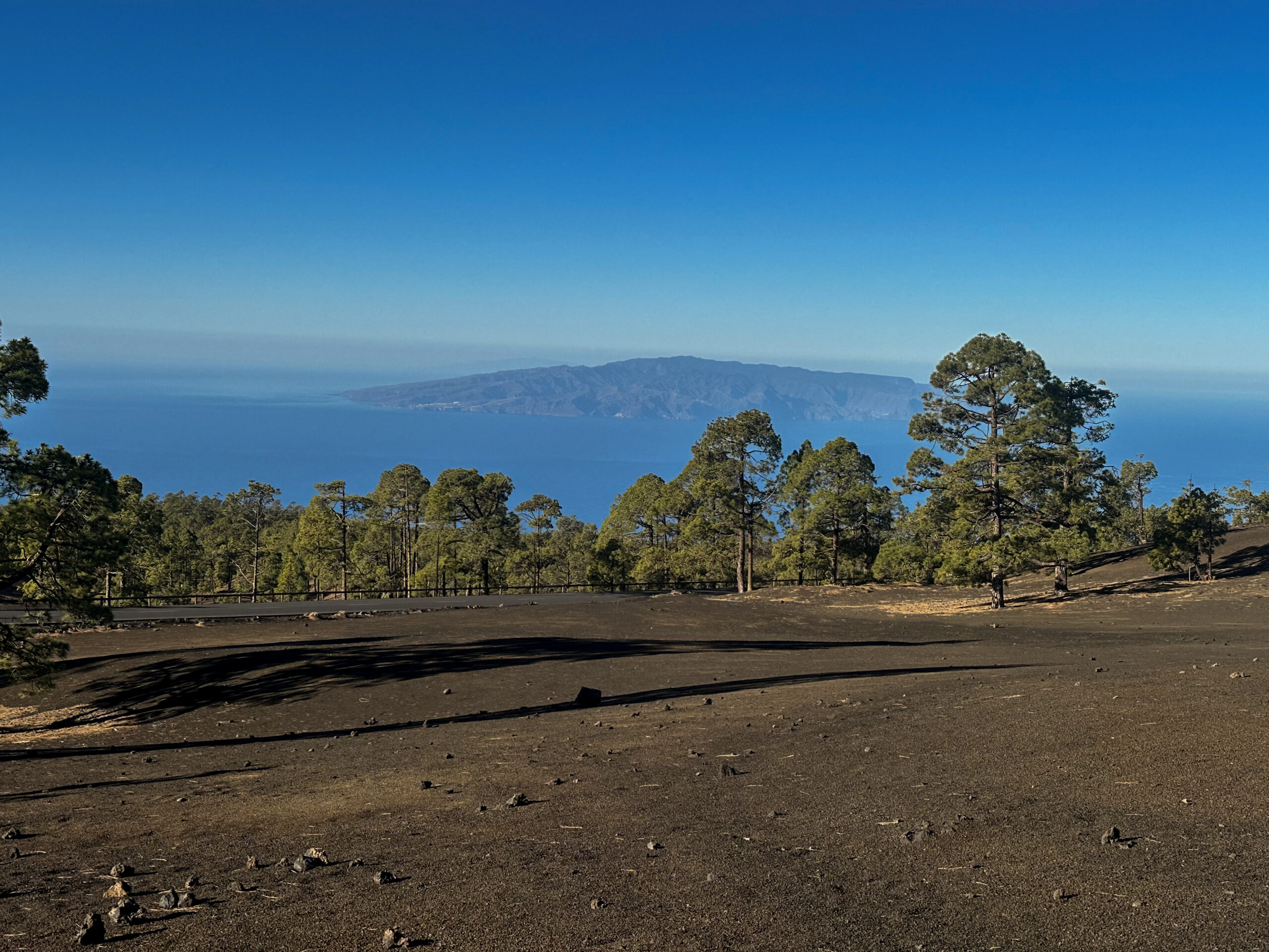
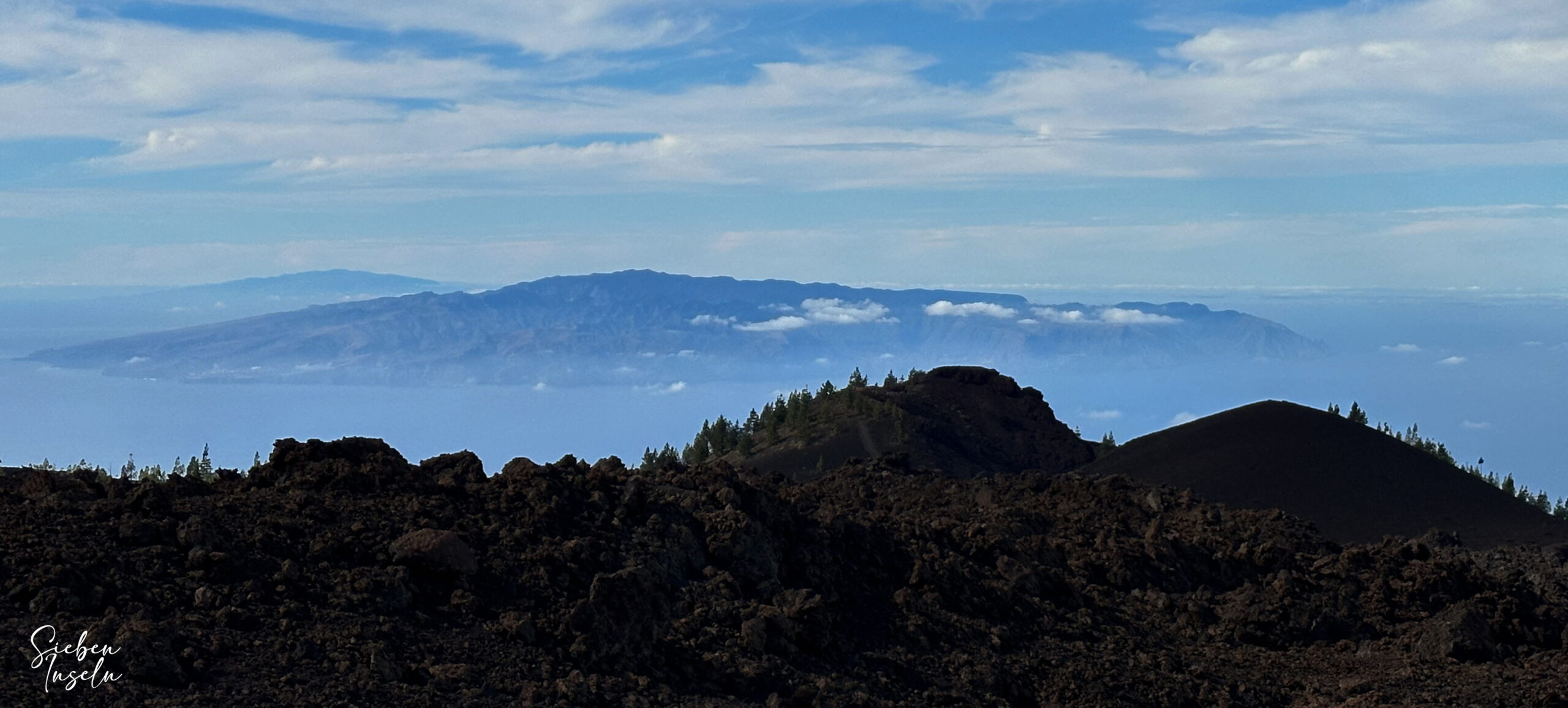
During the hike you follow old lava flows, cross cooled lava streams and pass small lava caves as well as the Cueva de Samara. Time and again you will enjoy wide views of the Atlantic and the neighbouring islands of La Gomera, El Hierro and La Palma. The Volcano Route mostly follows well-marked paths and, despite some rocky sections, is pleasant to walk. If you take your time, you will notice many fascinating structures in the solidified lava along the way.
Between fire mountains and pine trees – pure nature on the Volcano Route
On this Volcano Route between the volcanoes, you will encounter only a few hikers. Compared with the popular routes on Teide, Pico Viejo or Guajara, this area is much quieter and often feels genuinely remote. Only about halfway through the hike do you meet the track of the Samara circuit. There you will suddenly encounter many people who walk only a short distance around the Samara from the nearby car park or simply want to “breathe in a little volcanic air”.
Yet as soon as you have crossed the Teide road, you plunge once again into the silence and expanse of the lava fields. Here you feel the full fascination of Tenerife: wild, pristine and full of contrasts. I hope you will enjoy this walk as much as I did – an unforgettable experience along the impressive Volcano Route below Pico Viejo.
General information about the Volcano Route
Starting point and access
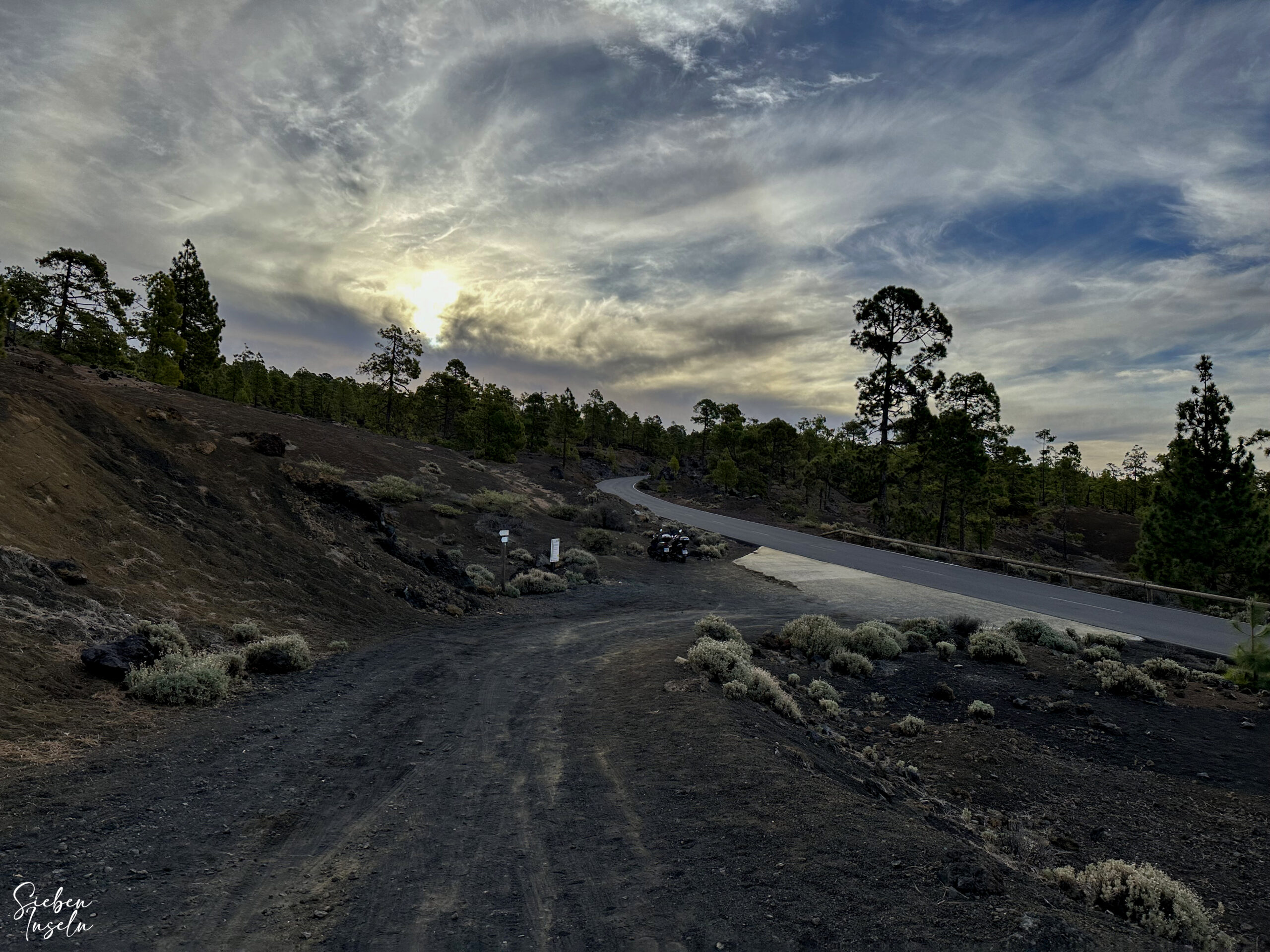
The starting point of the hike is on the TF-38 (between Chío and Boca Tauce) at kilometre 12. The bridle and forest tracks towards Arenas Negras also begin here and are clearly signposted.
Getting there by car
If you are coming from the south of Tenerife or from the north via the TF-1 motorway, take the exits for Guía de Isora or Chío. Then continue on the TF-38 towards Teide National Park. If you are coming from the island’s centre via the Cañadas road TF-38, drive in the direction of Chío or Santiago del Teide. There is space for a few vehicles at kilometre 12 at the start of the hike.
Getting there by bus
Unfortunately, you cannot reach the starting point of this walk by bus, as no Titsa bus route serves this stretch of road.
Time
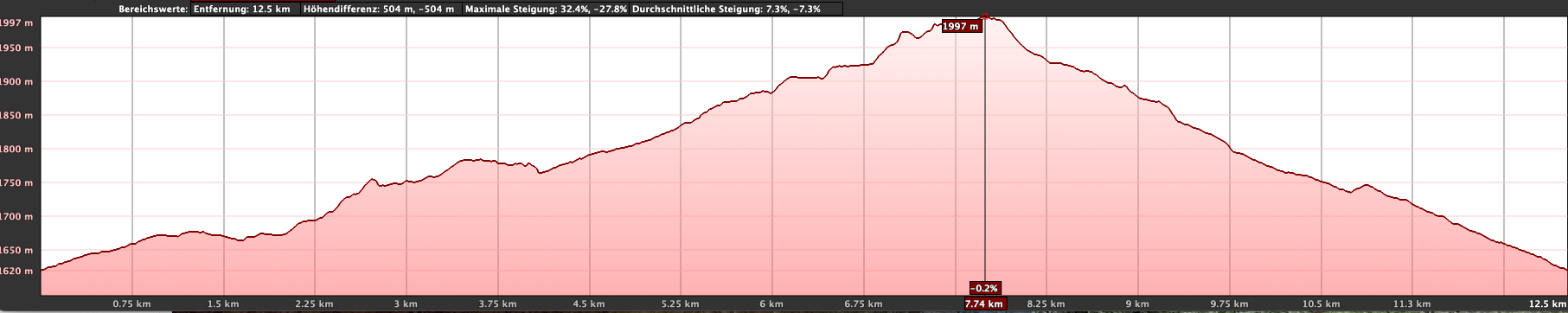
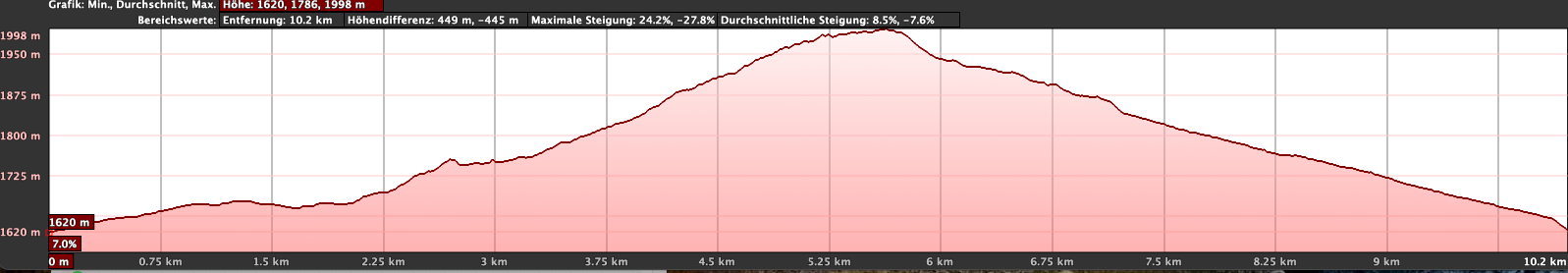
I am reluctant to give general time recommendations for hikes, as the required time is highly individual. On our first exploration of this Volcano Route, including breaks, we needed 4 hours and 45 minutes. For the shorter route, which is 3 kilometres less, it took just under 4 hours.
Elevation gain and distance
The elevation gain is roughly 445 metres, or 408 metres for the shorter version. The total distance is just under 14 kilometres, or 11 kilometres on the shorter route.
Difficulty
Along the entire Volcano Route you mostly walk on good and in places even excellent hiking or forest tracks. However, there are a few sections that are somewhat rocky and uneven.
Refreshments
There are no refreshment facilities anywhere along the Volcano Route. Therefore, be sure to bring sufficient water and food.
Variants
The hike can be varied between 11 and 14 kilometres as described here. There are also additional options to extend the route by climbing or circling some of the volcanoes. I present all possibilities in the article.
Nearby walks on SiebenInseln
Circular walk around Montaña Cruz de Tea
Pico Viejo – walk to the crater rim
Circular walks – Montaña de las Cuevitas and Montaña la Corredera
Chinyero – circular walk around a hot volcano
Walk around Montaña Cascajo to Montaña Corredera
Montaña Samara – small volcanic circular walk
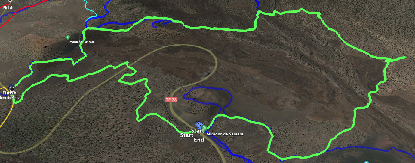
Volcano Route
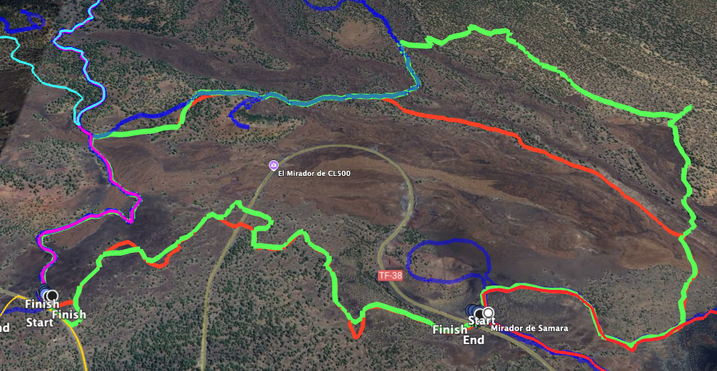
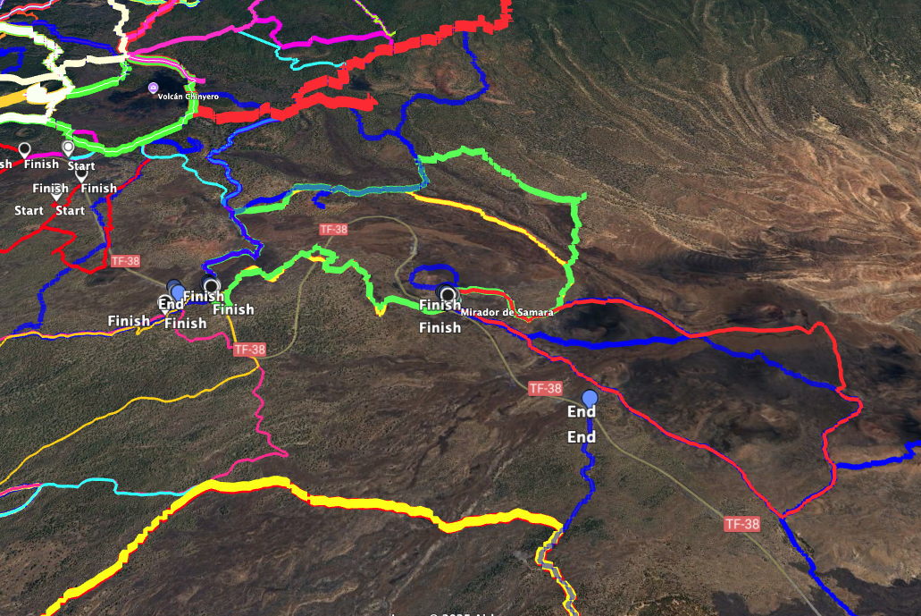
Section: KM-12 of the Teide road to Montaña de Las Cuevitas
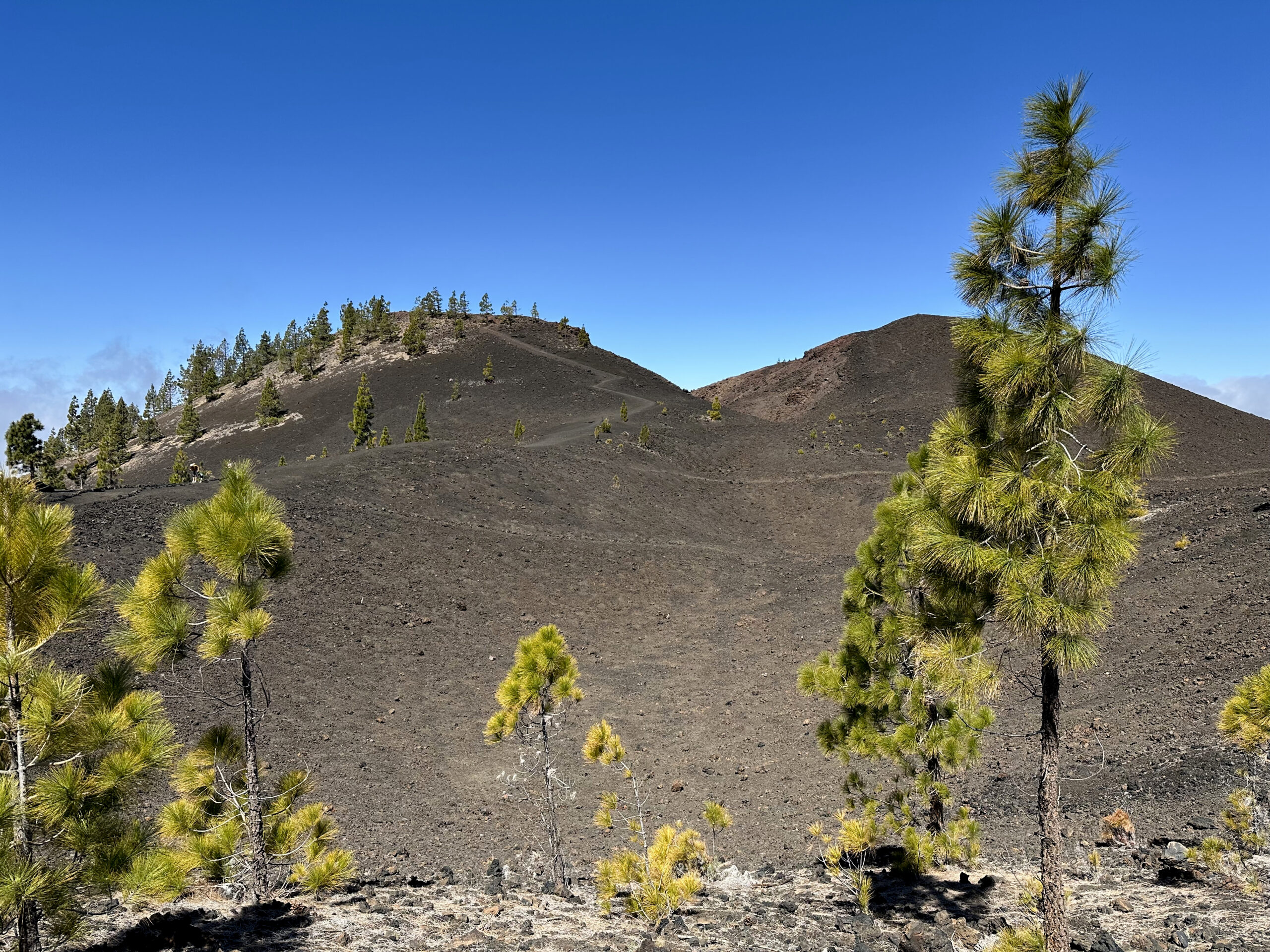
You begin your hike on the TF-38 near KM-12. The well-signposted track for vehicles and hikers is impossible to miss. At first you walk for quite some time on the broad forest track between vast dark lava fields. Even here, in clear weather, you have wonderful views of Teide and Pico Viejo on one side and the neighbouring islands on the other. The track ascends gently in wide bends to Montaña Cascajo, the first volcano on this tour. At the foot of the mountain you encounter a few pine trees and follow the track which leads you around Montaña Cascajo.
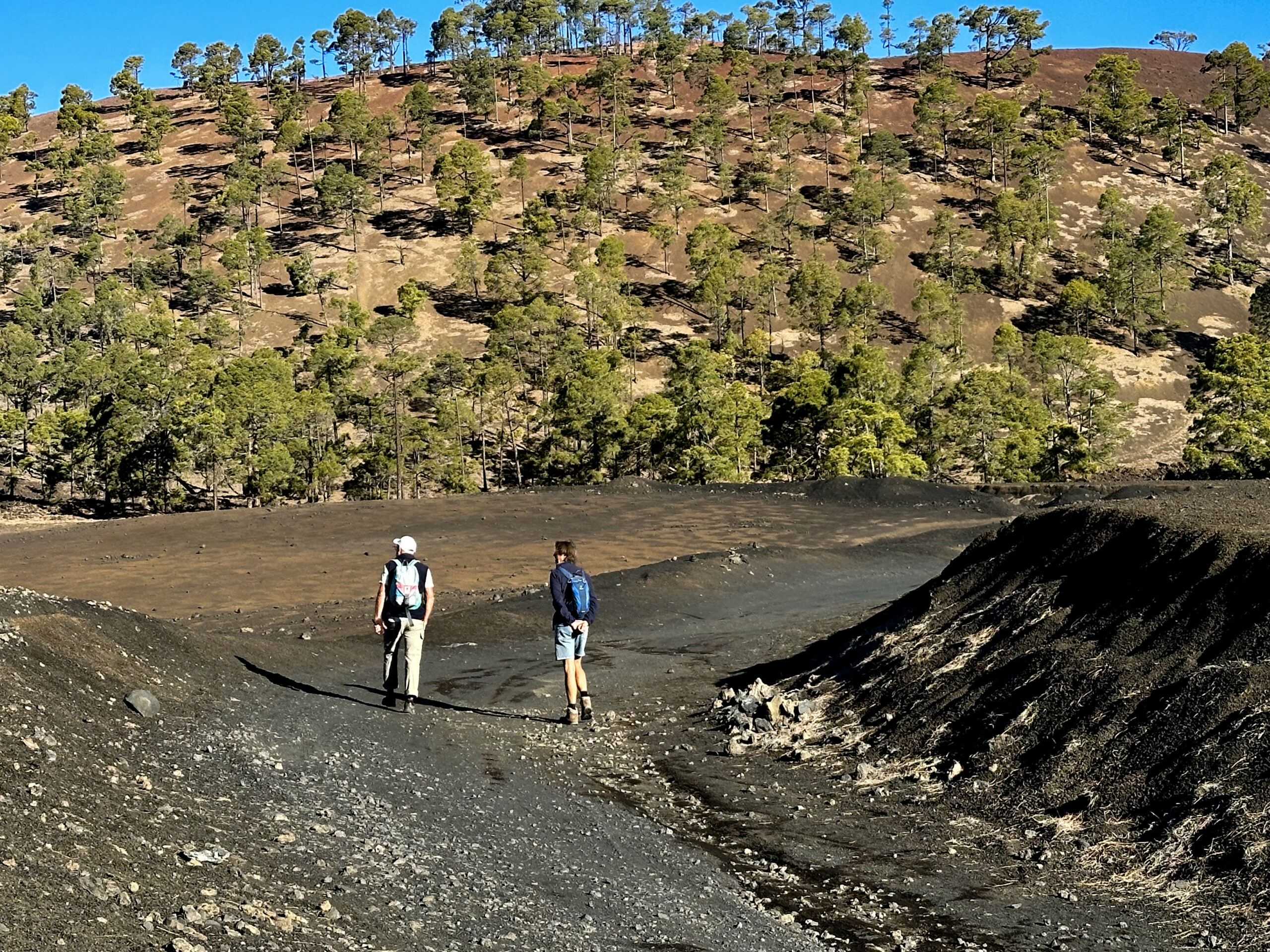
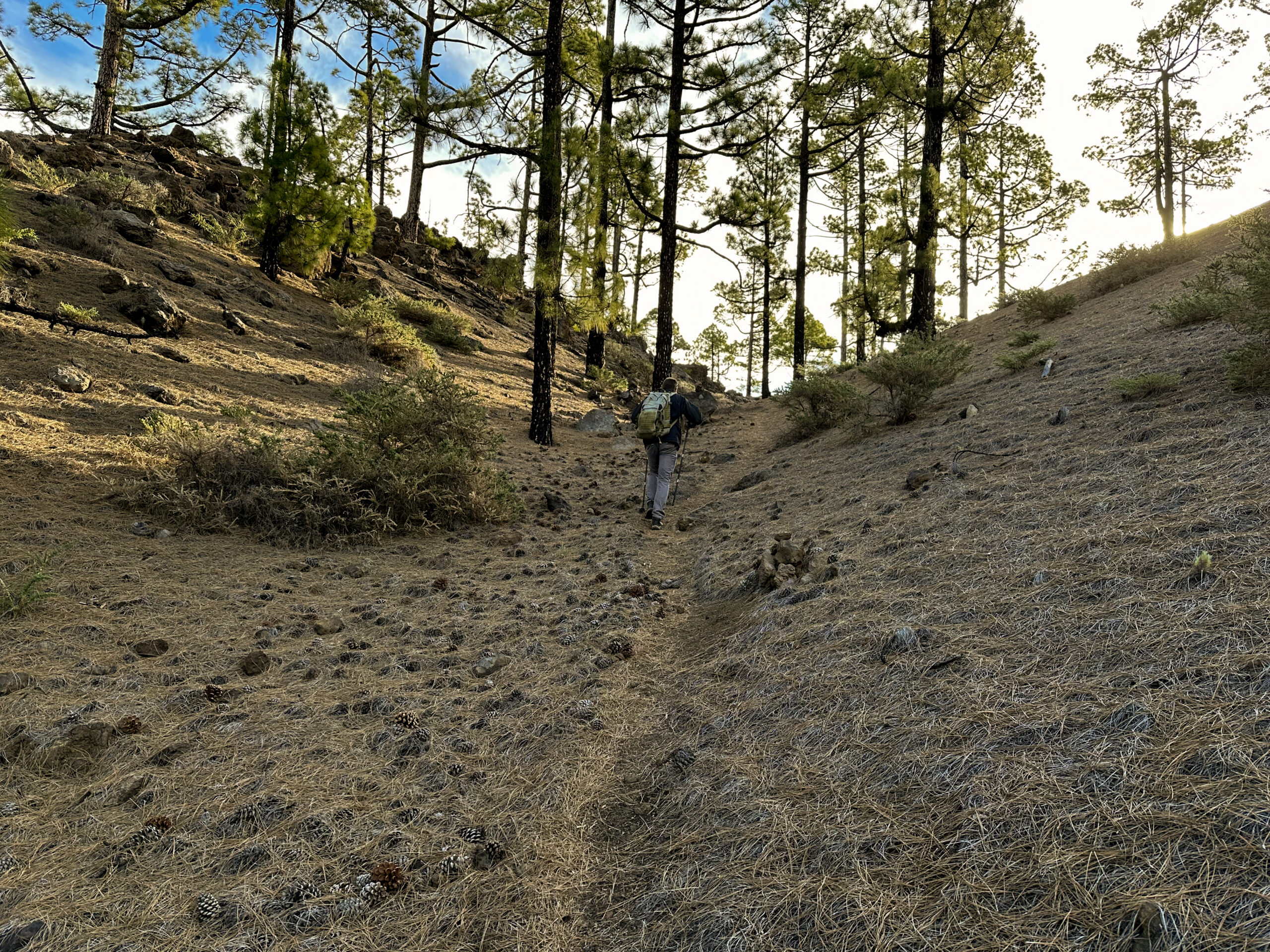
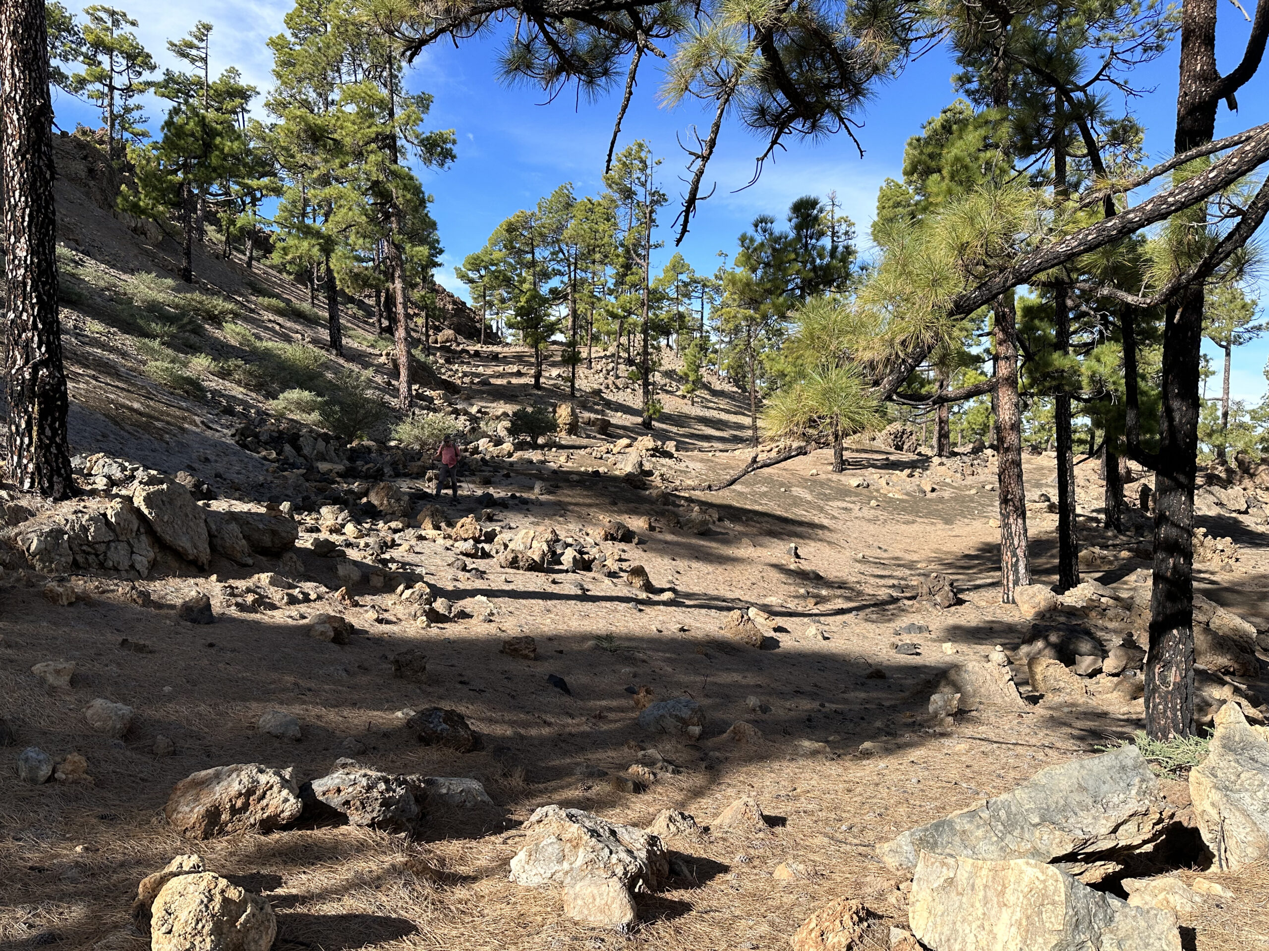
After a while a path branches off to the right from the Pista Montaña Cascajo. Here you leave the forest track. This new path is narrower and leads uphill through pine-dotted lava fields. Even though it is narrower, it is easy to follow, as it is very well trodden and partly marked with stones. You climb along the flank of the next volcano, Montaña de Las Cuevitas. After some time, the path to the summit of this volcano branches off to the right. If you wish to extend the route, this is your first opportunity. You can take the small ridge path to the right and return to the main route.
Section: Montaña de Las Cuevitas to remote lava valley
From here you continue straight ahead over an impressive lava landscape with views of Teide and Pico Viejo. Lava and pine forests dominate the scenery. Before the path swings left, another path branches off to the right. Now you have a choice. If you turn off here, you will save 2–3 kilometres and some elevation. This path leads straight ahead below a mountain through a lava valley. It eventually climbs and joins the main route further up.
If you prefer the longer version and wish to explore a little, continue straight on. The path turns northwards and you follow it for some time. If you were to continue straight ahead, you would reach the Pista de Canal – but that is a different walk. On this route you turn off to the right after a while. In a very remote lava valley below Pico Viejo, the route ascends. As you can see from the track, we also explored a side valley for a short distance. We did not find a path there.
Section: remote lava valley to Montaña de Samara
Below a lava hill, a small path finally leads upwards. You follow this path, cross several lava gullies and then climb higher. At the top the path merges with the shorter variant. From this point the route continues upwards through lava fields and rocky terrain. The views from here are simply fantastic. Eventually, however, you leave the solitude behind, as your path merges with the well-known walking trail around the Samara volcano. Here you will meet other hikers again.
You walk to the right, downhill, and follow the trail that leads towards Montaña de Samara (1,932 metres). To your left, behind you, rises the dark Montaña de la Botija (2,121 metres). If you still have energy, you can turn left uphill and follow the larger circuit around this volcano. Both routes eventually end at the car park below the Samara volcano on the TF-38. As an extension, you might also consider a small loop around the Samara volcano.
Section: Montaña de Samara to the starting point
You now leave the sometimes very busy car park and cross the road. On the other side, keep to the right parallel to the TF-38. There you meet a small path. Follow it downhill and after a short while you reach a wide, good track that you can simply follow. You continue through lava fields scattered with pines. Shortly before you reach the TF-38 again, you can take a short detour to the right. Here you will find the lava cave Cueva de Samara – the final small highlight of this walk. After visiting it, you need to cross the TF-38 once more. The trail continues immediately on the opposite side.
If you were to continue straight on, you would return to Montaña Cascajo. But after a while you turn left downhill. A forest track leads you down in wide bends, once again offering beautiful views. For the last time on this Volcano Route, you walk through lava fields dotted with green pines. As you approach the TF-38, you should leave the track to the right and walk up the small slope to return directly to the starting point. If you stay on the forest track, you will need to follow the road for a short stretch back to the start.
And finally
I hope you have enjoyed this Volcano Route on Tenerife. It offers numerous options for tailoring the walk to your liking. However you decide to walk it, I wish you great pleasure on all your hikes,
Dagmar from SiebenInseln