La Frontera, prominent location on the north side of El Hierro in the El Golfo Valley
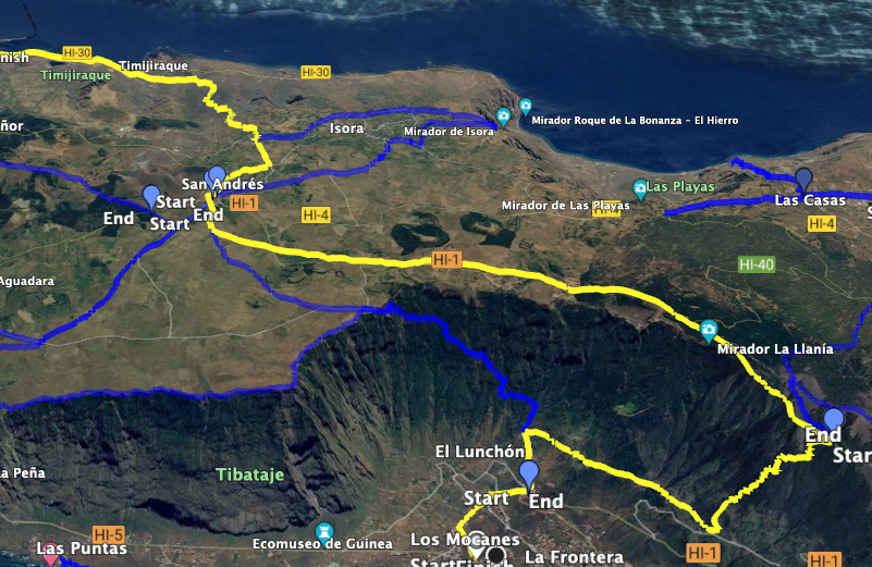
The small town of La Frontera on the north side of El Hierro marks the endpoint of this circular hike across El Hierro (Part 2). And La Frontera is also the starting point for the circular hike (Part 3). In total, we needed three days for our El Hierro circular hike. We began the hike on the first day from Puerto de Estaca on the long-distance hiking trail GR-131 Camino de la Virgen covering 36 kilometers. You can find the detailed description here:
Circular Hike El Hierro – Part 1 Long-Distance Hiking Trail GR-131 Camino de la Virgen
From the endpoint of this section, the Ermita de Nuestra Señora de los Reyes, we continued our hike to La Frontera the next day.
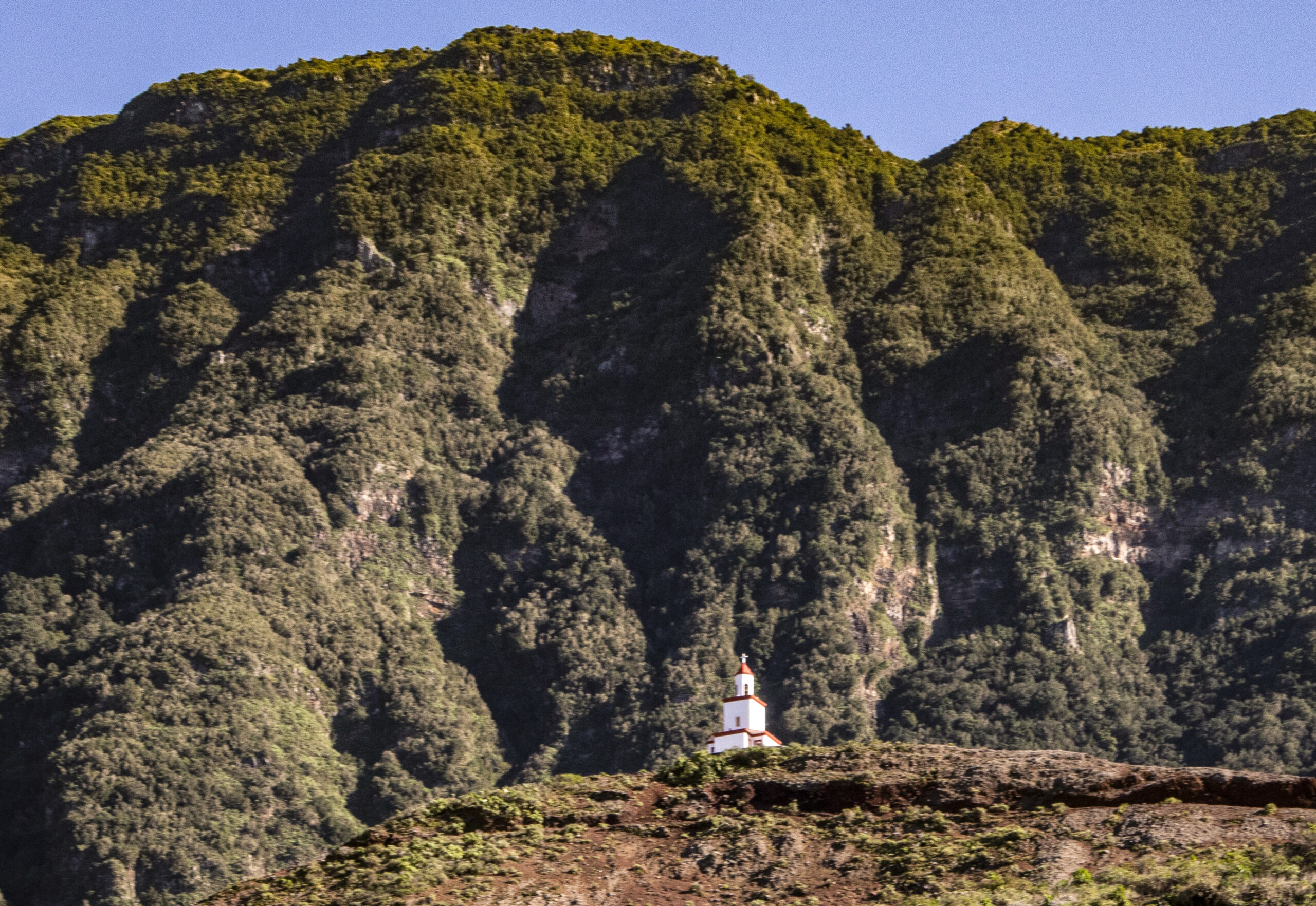
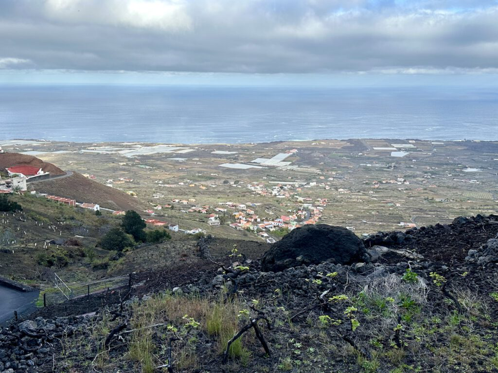
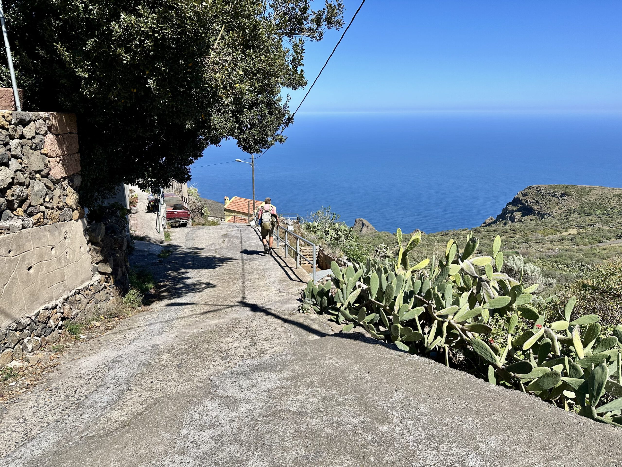
La Frontera is one of three municipalities on El Hierro and is located in the northwestern part of the island. The small town of La Frontera is larger in size and population (approximately 2500 inhabitants) than the island’s capital Valverde. A prominent landmark of La Frontera and the entire El Golfo Valley is the prominently visible bell tower, which was built in 1957. It stands on a volcanic cone in the higher area of La Frontera. Behind it rises the steep cliff edge that separates the Mesata de Nisdafe from the El Golfo Valley.
Hike from the Chapel Nuestra Señora de los Reyes via La Frontera to Puerto de Estaca
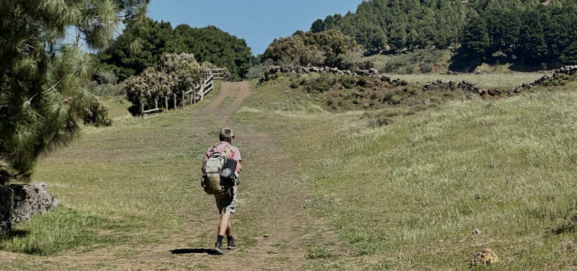
In Part 2 of the circular hike across El Hierro, the route leads from the Chapel Señora de los Reyes up to the Cumbre of La Gomera. From there, the hike descends through the misty forest into the El Golfo Valley. The first place you reach is Sabinosa. From there, you continue for a long time along the canal path through the El Golfo Valley towards La Frontera.
Part 3 of the hike starts in La Frontera and initially takes you to the ascent path to Mirador Jinama. However, as this path was closed in March 2024 due to safety concerns, we retraced our steps to the ascent path San Salvador. This path leads you in a steep and strenuous ascent back to the Cumbre and then to San Andrés. From there, the long and partly steep descent to the northern east coast of El Hierro begins. Once you arrive at Playa de Timijiraque, you hike along the coast back to Puerto de Estaca.

General Information about the Hike from the Chapel Nuestra Señora de los Reyes via La Frontera to Puerto de Estaca
Starting Point and Access
You start Part 2 of your hike at the Chapel Nuestra Señora de los Reyes. Part 3 of the hike starts in La Frontera.
Access by Car
Chapel Nuestra Señora de los Reyes: You can reach the chapel from the northwest via the island road HI-500 and from the northeast via the island road HI-400.
La Frontera: As a major town in the El Golfo Valley, you can reach La Frontera from the northeast via the HI-1 and also via the coastal road HI-5.
Access by Bus
There are no bus connections to the Chapel Nuestra Señora de los Reyes. The bus line R12 runs between Sabinosa and La Frontera, and the line R03 runs between Valverde and La Frontera. Further information on bus connections on El Hierro can be found on the Transhierro website – https://transhierro.com/.
Time
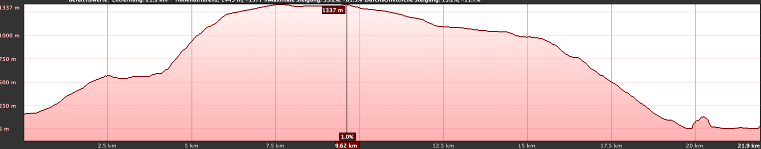
I prefer not to give time estimates, as times can vary greatly depending on individual factors. For Part 2 of the hike from the Chapel de Nuestra Señora de los Reyes to La Frontera, we needed 6.5 hours including breaks. From La Frontera to Puerto de Estaca (Part 3 of the hike), it took us just under 10 hours with some long breaks.
Elevation Difference and Distance
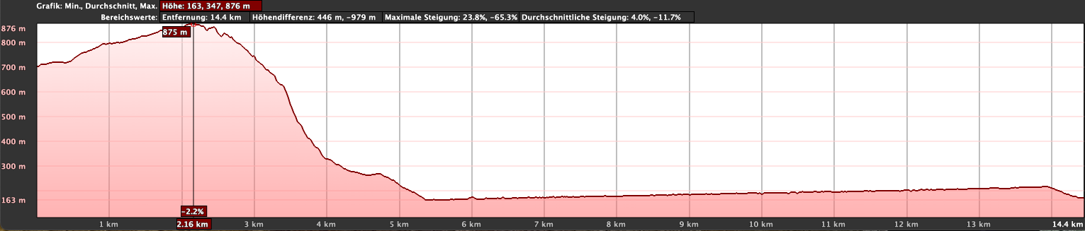
The elevation difference on Part 2 of the hike to La Frontera is only 250 meters, as it is mostly downhill. The distance is 17 kilometers. On Part 3 of the hike from La Frontera to Puerto de Estaca, the elevation difference is 1250 meters, and the distance is just under 27 kilometers.
Requirements
The hike mostly follows good trails. Only the last part of the hike in Part 3 from San Andrés down to the coast is relatively steep and can be a bit challenging due to the many small stones. Especially for Part 3 of the hike, you should have a good level of fitness due to the distance and elevation gain.
Refreshments
You have refreshment options in Sabinosa, La Frontera, San Andrés, and occasionally in Puerto de Estaca as well as occasionally along the way. However, especially for Part 3 of the hike with the long ascents and no refreshment options, you should definitely bring enough water and snacks.

Variants
As a variation for Part 3 of the hike, I can suggest the ascent from La Frontera to Mirador Jinama. This path is much shorter than the one presented here via the ascent path San Salvador. However, in March 2024, the path was unfortunately closed due to rockfall.
If the sections of the route are too long for you, you can of course divide them into smaller sections as you like.
If you find the descent from La Cuesta to the coast too steep and rocky, you can alternatively use the road, which is longer but easier.
Other hikes on SiebenInseln that border on the hikes presented here:
Circular hike on the Meseta de Nisdafe to Arbol Garoé
The Circular hike Mirador de La Peña
Circular hike Merendel and Malpaso
Circular hike from San Andrés over the plateau of Azofa
Part 2: Hike Chapel Nuestra Señora de los Reyes to La Frontera
Section Chapel Nuestra Señora de los Reyes to Mirador de Sabinosa
You start your hike at the Chapel Nuestra Señora de los Reyes and branch off from the HI-506 road onto the GR-131 hiking trail towards Faro de Orchilla. In a few meters, you pass impressive caves, the Cuevas de Caracol. It’s worth stopping here to see these large cave houses where shepherds once lived. Then the GR-131 veers left, but you continue straight ahead, circling around the Montaña de la Virgen. This brings you back to the wide HI-506 road that you came on via the Camino de La Virgen in Part 1 of the hike.
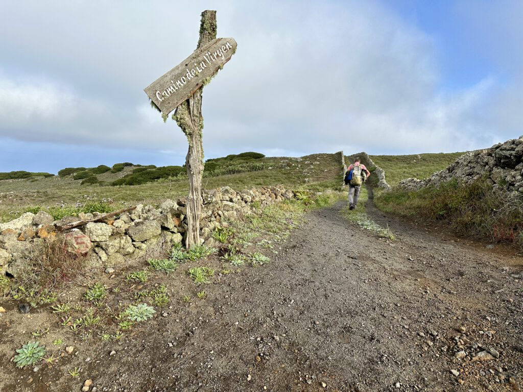
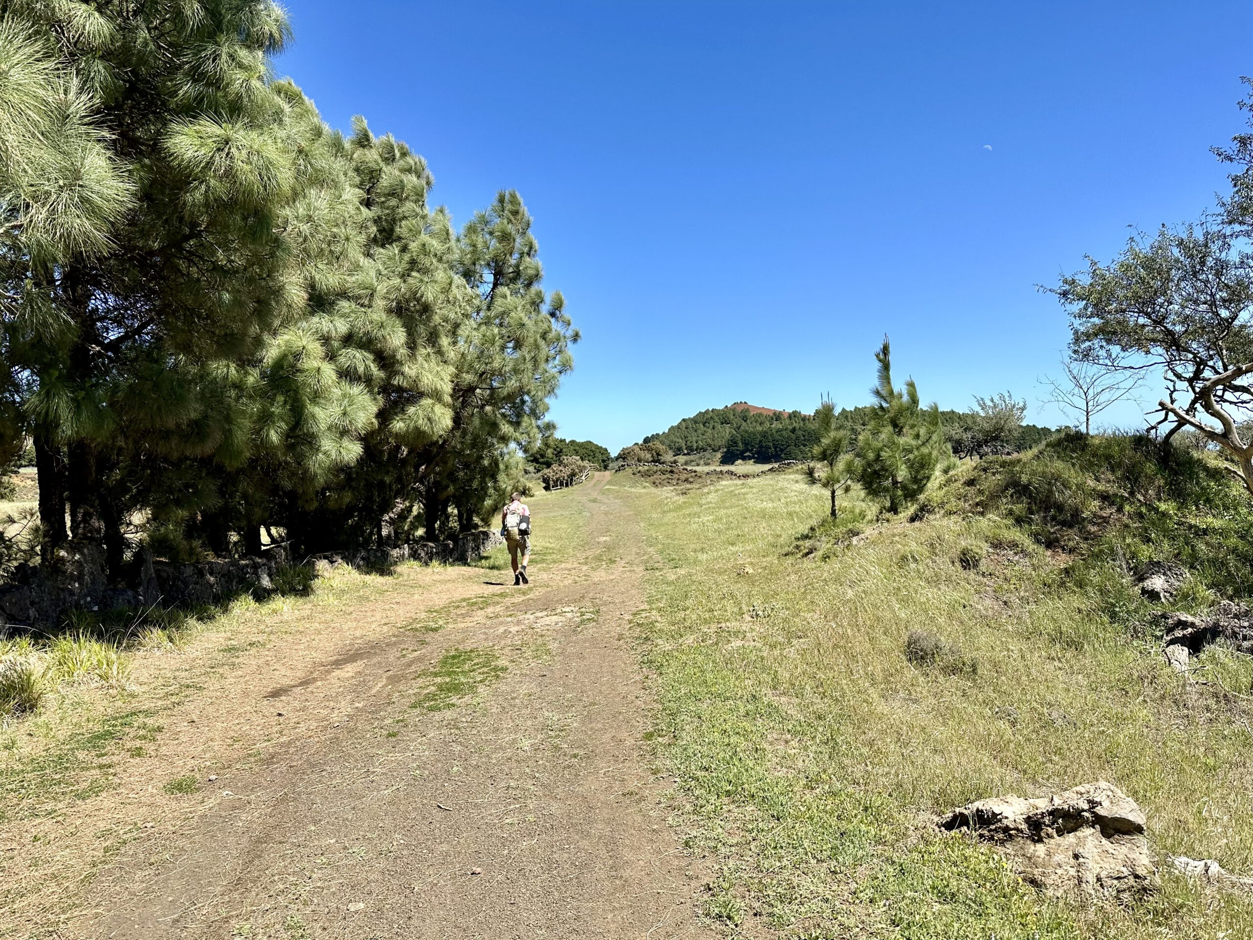
For a short while, you hike uphill again on the GR-131. You pass through a large gate that you have to open and close. Then you come to a junction. The Camino de la Virgen continues straight uphill. However, you turn left. You gently hike uphill through green land, partly surrounded by stone walls, towards Mirador de Sabinosa. Here, not only do hiking trails converge from all directions, but you can also enjoy a beautiful view over the diverse landscapes of El Hierro.
Section Mirador de Sabinosa to HI-553
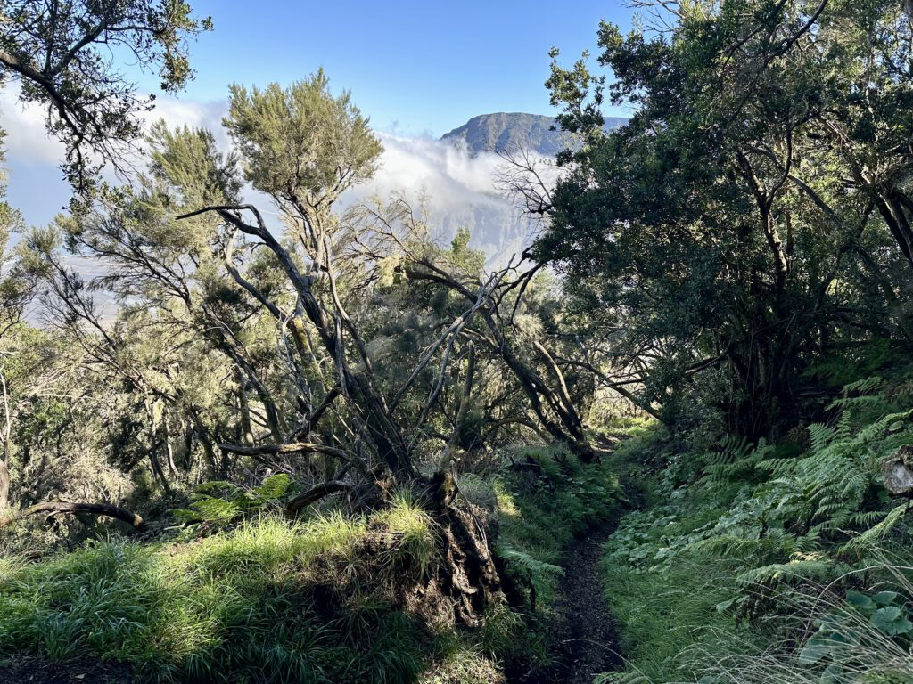
From the Mirador, you then hike on the Camino la Dehesa PR-EH 9.1 for a long time down through the misty forest. Far below, you can occasionally see the town of Sabinosa with its small colorful houses peeking out between the trees. You continue further east along the slope, past Lomo de Las Cabras. Eventually, the path turns northward, leading you down to Sabinosa in numerous small switchbacks.
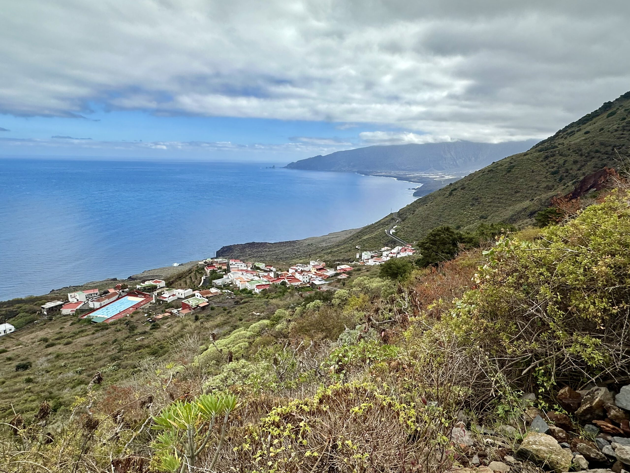
In the town of Sabinosa, you continue downhill along Calle Iglesia and Camino la Dehesa until you reach the main road HI-50. You keep to the right on this road and continue through the town. Finally, you leave the town. Shortly after, a hiking trail (Camino de la Tabla) branches off to the left. This takes you downhill for some time along the mountainside towards the east. You reach the PR-EH 2.3 hiking trail, which you continue to follow to the right. Eventually, you arrive at the HI-553 road.

Section HI-553 to La Frontera
You hike along the road for a short while, uphill to the right, still on the PR-EH 2.3 hiking trail. This trail then branches off to the left from the road as Calle El Canal. From now on, you mostly maintain altitude, hiking left along a canal for a long time. Honestly, after some time, I found it a bit dull. The canal path seemed endless. While you can enjoy views of the coast and later of La Frontera, the long canal path didn’t impress me much, perhaps also due to the dull weather on that day.

It becomes slightly more interesting as you walk below the town of Los Llanillos. There, you will see houses and gardens again beside the canal. The canal path is easy to follow and continues towards La Frontera. Eventually, you reach La Frontera and continue straight ahead along the canal path below the main town. Our hike on the canal path ended at the main street Calle la Corredera in La Frontera. And thus, Part 2 of the circular hike El Hierro comes to an end.
Part 3 of the Hike: La Frontera to Puerto de Estaca
Section La Frontera to Ascent Path to Mirador Jinama
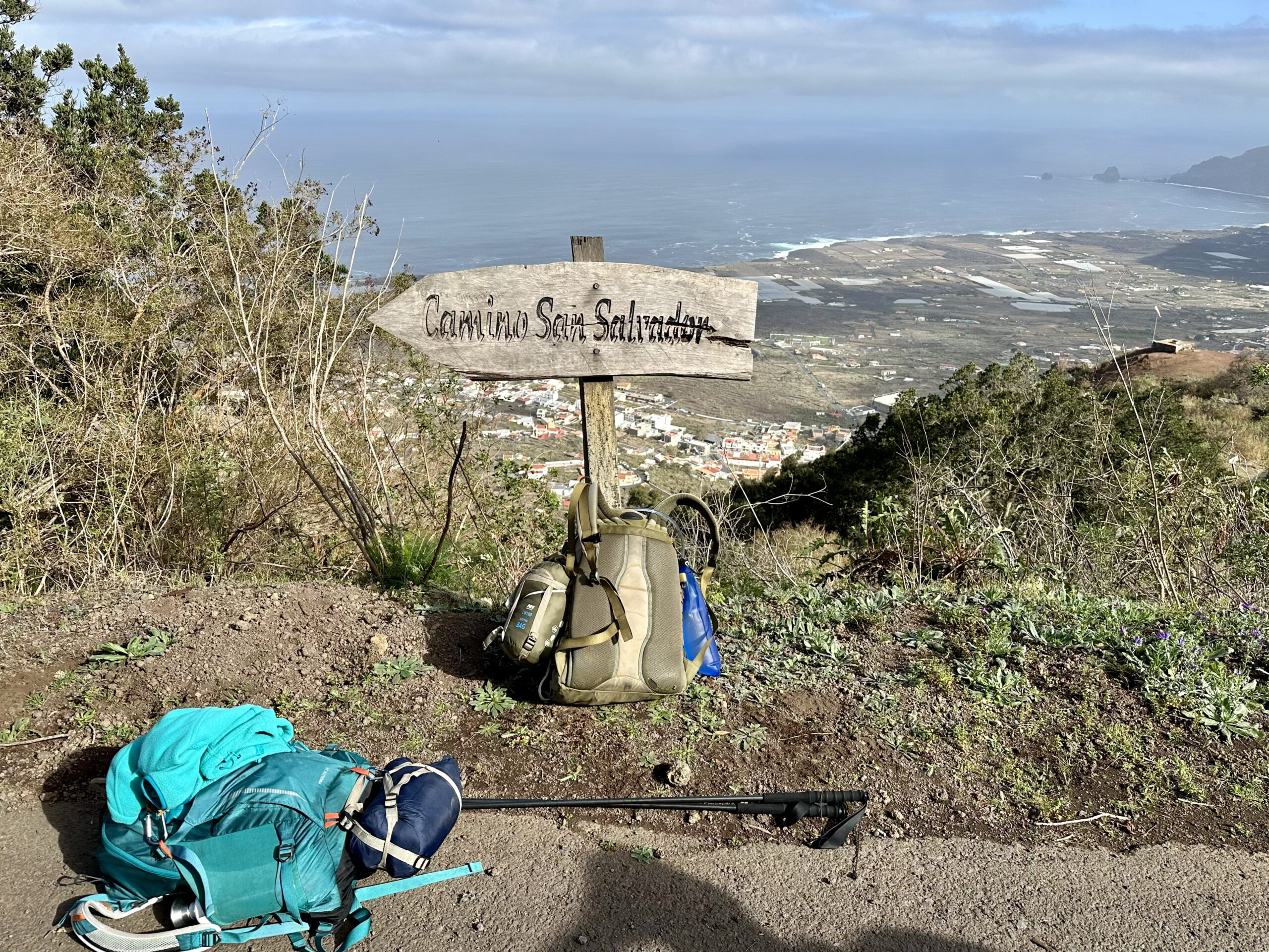
I describe the following section from La Frontera starting from Calle las Lajas (main street), as we stayed nearby and initially went towards the ascent path to Mirador Jinama. Of course, you can start from any point in La Frontera. It is important that you eventually reach the HI-1 road in front of the prominent bell tower in La Frontera. We walked from Calle las Lajas uphill to Calle los Mocanes. We followed this street further uphill until we reached Calle Lomo Alto, which then led us left onto Calle las Lapas. Finally, this street brought us steeply uphill between fields and volcanic rock until we reached the HI-1 road next to the bell tower. This entire path is part of the PR-EH 8 hiking trail, also signposted as Mirador Jinama.

So the hike starts with a decent ascent. After that, you cross Calle Belgara and then turn left at the fork. On Calle los Corchos, you hike, signposted towards Mirador Jinama. You then ascend for a long time between fields and individual houses. The switchbacks of the road are shortened by a hiking trail. Finally, Calle los Corchos makes a sharp right turn. Straight ahead is the entry path to the steep cliff towards Mirador Jinama. The description of the hike to Mirador Jinama on this path can be found here.
Section Ascent Path to Mirador Jinama to Parking Lot at HI-1
However, in March 2024, we were unable to use the ascent path due to the risk of rockfall. So we involuntarily had to take the longer route via San Salvador. Since I was not very familiar with this route, I was not really dissatisfied with this truly impressive ascent path. To get there, you first have to follow Calle los Corchos for a long time, hardly used by cars, high above La Frontera towards the right. You hike through a vineyard area with the most beautiful views of the El Golfo Valley and pass some winemaker’s estates.
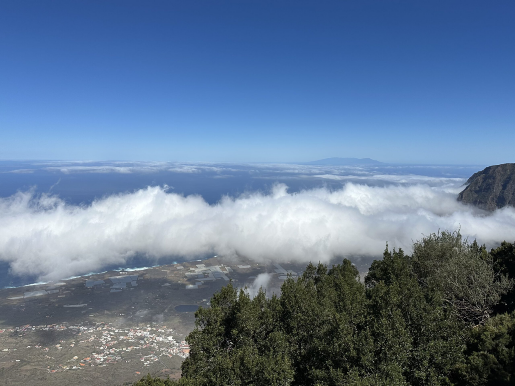
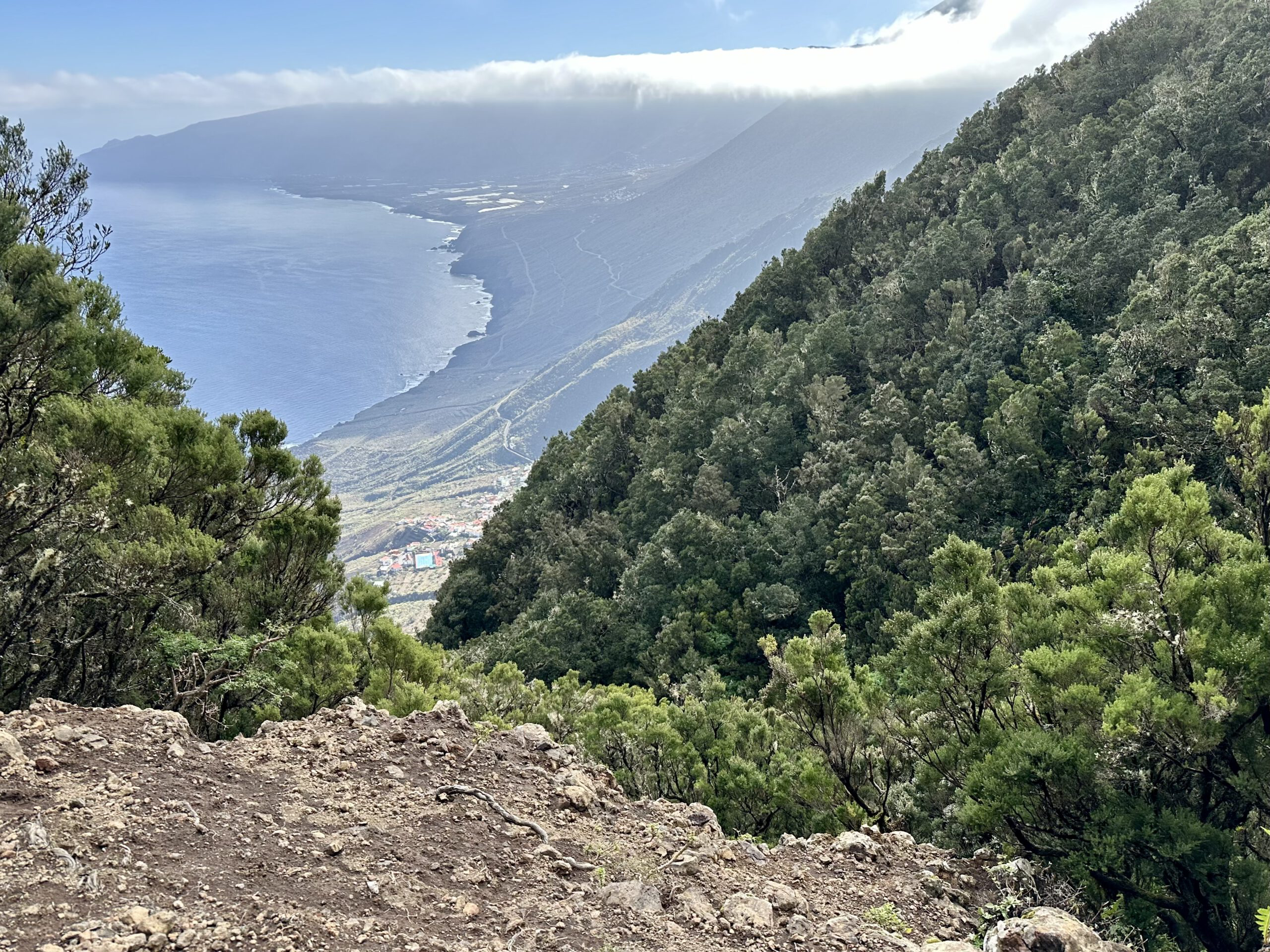
Eventually, you reach the PR-EH 2 hiking trail, signposted as Camino San Salvador. It crosses the road and comes up from the Tigaday district. You continue steeply uphill to the left. From about 500 meters above sea level, you ascend to 1200 meters, up the steep cliff to the Cumbre. The path winds through the forest in small switchbacks. The views become more impressive with increasing altitude. However, this is also the toughest part of the trail. Finally, you arrive at a small parking lot on the HI-1 road, where the Malpaso and Merendel hike also start.
Section Parking Lot at HI-1 to San Andrés
There, you have two options. You can continue uphill on the San Salvador hiking trail to the HI-45 road and then turn left on this road. We decided to simply follow the HI-1 road to the left, as there is little traffic and we had already walked the other way. The routes are roughly the same length. On the HI-1 road, you save a few meters in my opinion. Eventually, both roads merge.

Afterwards, you initially continue along the HI-1 road, signposted as GR-131 Camino de La Virgen. Later, you continue to follow this signage. I have already described this part of the hike in Part 1 of the hike. It is identical on the way back as it was on the way there in Part 1. But then, shortly before San Andrés, you come to a hiking junction. Straight ahead leads to Valverde (see also Part 1 of the hike). However, you turn right and soon arrive at the center of San Andrés on the PR-EH 8 hiking trail. Perhaps you’d like to take a break in a bar, as we did.
Section San Andrés to La Cuesta
If you want to continue from San Andrés, follow Calle Jarera Bajo. The path is initially identical to the hike to Mirador Isora. You cross Calle la Cancela and continue along Calle Jarera Bajo, gradually descending into the town of San Andrés. At a fork, keep straight ahead until the hiking trail branches off to the right shortly after. This trail takes you downhill through rural areas with fields, individual farms, and walls.
You walk downhill for a long time on Calle las Rosas a la Cuesta. At the next major intersection, keep left on the PR-EH 4.1 hiking trail. After some time, this trail leads you to the hamlet La Cuesta. There, you reach the HI-35 road, which you cross. On the other side of the road, the PR-EH 4 hiking trail continues, narrower and steeper now. There is also a road that connects HI-35 with the coastal road HI-30. You will cross this road several times on the hiking trail.

Section La Cuesta to Puerto de Estaca
The trail downhill to the coast is narrow and often steep. In some places, in my opinion, it is also quite difficult to walk due to the many small stones. But overall, it is easy to follow and continues on the other side after crossing a road. In front of you, you can see the coast and occasionally already the Puerto de Estaca harbor in the north. From La Cuesta, you descend 900 meters with magnificent views of the towering rock massif to your right and the coast. If you don’t like the hiking trail at all, you could alternatively choose the longer route via the road.

Eventually, the path flattens out above the town of Timijiraque and turns northward. And then you reach Playa de Timijiraque with a bar and a bus station. The remaining path now follows along HI-30. Initially, you either walk through the road tunnel or bypass it on the PR-EH 4. Then you already see the Puerto de Estaca ahead. You reach it by first walking along HI-30 and then continuing along HI-2.

And finally
With reaching the Puerto de Estaca, the circle closes. After three days of hiking, we have returned to the starting point. I really enjoyed this extensive and varied round around El Hierro. I hope you feel the same and can enjoy El Hierro. If the sections should be too long for you, they can also be divided into smaller parts as desired. Whatever you decide, I wish you a lot of joy on all your hikes,
Dagmar from SiebenInseln