FAQS Hiking Canaries Islands on reader’s request
Hiking canaries an idea of my readers. Since I have been gradually writing down my hiking tours here on seven islands, I have received many e-mails from readers. I am looking forward to any feedback. Of course I am especially happy when readers are inspired by one or the other tour. The blog should serve to use the information and tracks to be able to follow the hiking tours easily and without problems.
If the tours go down well with the reader and people write me their positive experiences or even praise my website, the effort was worth it. But I also make mistakes and there is always room for improvement. Therefore I am happy about every useful hint, which can improve the site. Thank you very much for all your feedback.

FAQs Hiking Canaries – How? What? Where? Frequently asked questions
But lately I have also received more and more general enquiries. Questions about hiking. Mostly it’s about people coming to Tenerife or the Canary Islands for the first time. They want to know where they can live well or where the hiking environment is particularly beautiful. What will the weather be like? I am happy to answer all these questions. However, they are often the same questions.
Summary information about the article and a large selection of GPS hiking tracks are availableRegister now for my newsletter and get exclusive access to my collected GPS tracks as well as all short information about my articles.
So I have come to the decision to present these general questions about hiking here on Seven Islands in “FAQS Hiking Canaries” from time to time. In addition to the island categories, there is now also the frequently asked questions (FAQs) section. Of course I will try to answer all questions as good as possible. But of course I don’t know everything by far. Therefore I would be very happy, if you would add your knowledge by comment. So we could quickly make the best and most current information available to all Canarian enthusiastic hikers.
And now it starts with the first three FAQs Hiking Canaries
1. What is the weather like in the Canary Islands?
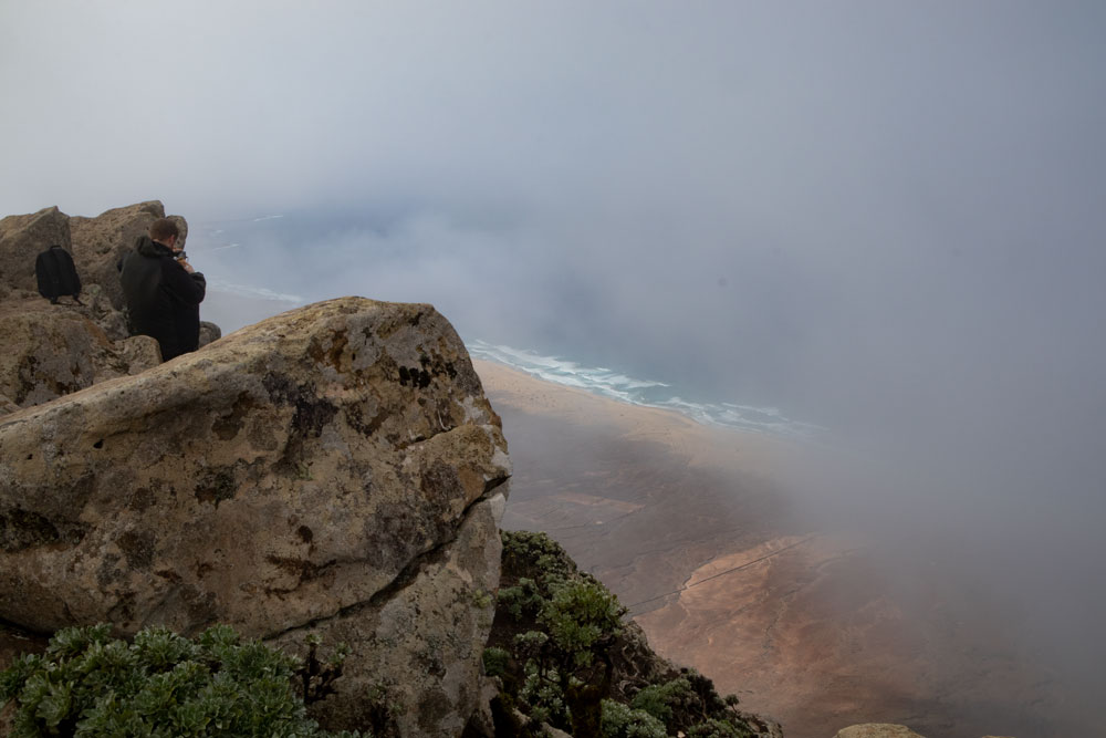
Who wouldn’t like to know what weather awaits them at their destination? Probably almost everyone has their favourite online pages or weather apps today. But maybe these links will help you a little:
I myself have had great experiences in the last years with
Weather Online. So you first have a basic tendency, whether it rains or the sun shines.
Here is the official website of the Spanish Ministry of the Environment Aemet, which points out especially well to upcoming strong winds, waves or thunderstorms/alarm stages.
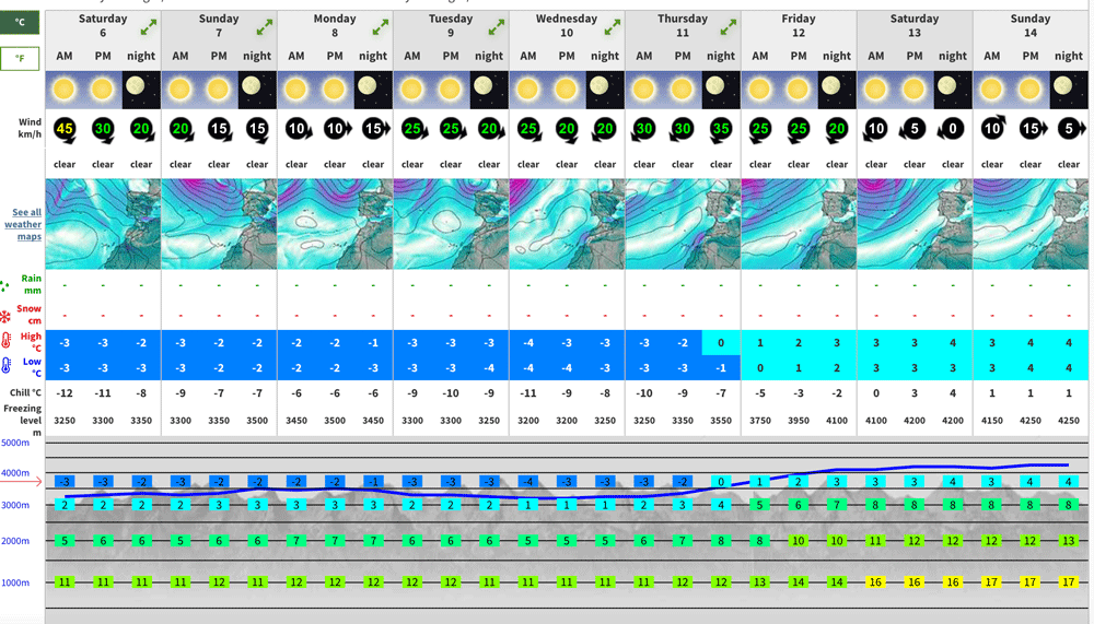
And very accurate and special is the page Mountainforecast, where you can see precipitation, wind, clouds etc. for every altitude and time of day. For me, this page has proved to be indispensable for any hiking planning.
The wind also plays an important role when hiking. Besides the Mountainforecast I just mentioned, I like to use special windfinder sites like windfinder.com.
Who knows more recommendable weather sites?
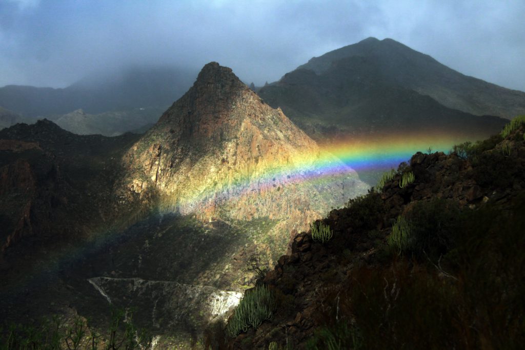
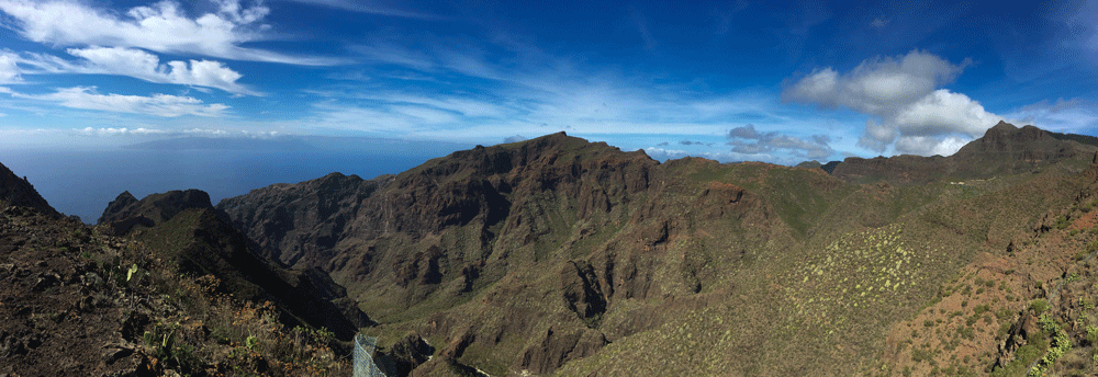
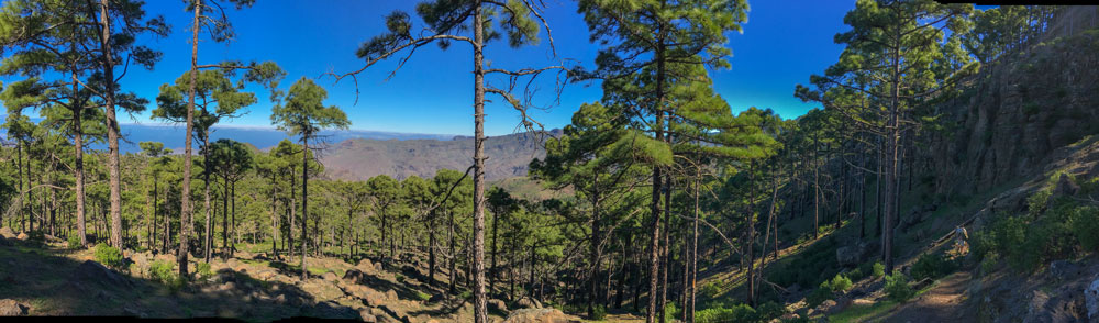
2. When is the best time to go hiking in Tenerife, Gran Canaria, La Palma, La Gomera or El Hierro?
First of all: nothing is as unstable as the weather and 100% statements are difficult to make. But generally it is true that the weather can be cool, foggy and humid from the middle of November until the beginning of March (winter time) on the higher slopes of the northern sides of the islands. This also occurs in the southern parts of the islands, but to a much lesser extent.
In the summer from June to August the opposite awaits you. It can get very hot when hiking in the sun. And not only in the southern parts of the islands.
Therefore, the remaining time between March and May and September to November proves to be ideal. But from time to time a storm low can blow over the Canary Islands or the hot Calima dust from Africa can carry over the islands.
3. How do I move on the islands – which means of transport are there?
Rental car
Who does not come with the car ferry and can bring his own car (exception) can rent a car everywhere at the airports, hotels and in almost every place. I am often asked which company I can recommend. Unfortunately, I am not asked, because I have only borrowed myself 2x a car. And that was quite a while ago. Here I can only recommend myself in the Internet in relevant forums to make smart.
Bus network
Otherwise there is also a very good public bus network on the islands. Details and timetables of the individual islands can be found here:
Note that dogs are not allowed on buses. Therefore it is unfortunately not possible for dog owners to travel by bus.
Taxis
Taxis are still affordable compared to Germany. Especially if a small hiking group shares the price. Often the taxi prices are written down at the places where many taxis are located.
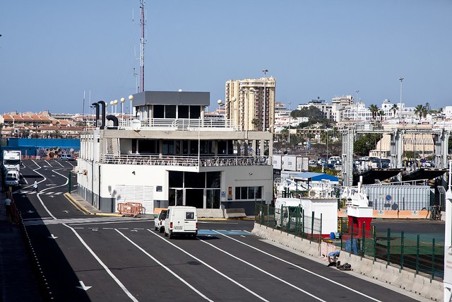
Island hopping – how do I get from island to island?
There are ferry and flight connections between all Canary Islands. Here are some helpful links:
Ferry connections
Corralejo, Fuerteventura – Playa Blanca, Lanzarote
Los Cristianos, Tenerife – San Sebastián de La Gomera
Los Cristianos, Tenerife – Santa Cruz de La Palma
Los Cristianos, Tenerife – Valverde, El Hierro
Los Cristianos, Tenerife – Valle Gran Rey, La Gomera
Los Cristianos, Tenerife – Playa Santiago, La Gomera
San Sebastian de La Gomera – Santa Cruz de La Palma
San Sebastian de La Gomera – Valverde, El Hierro
San Sebastian de La Gomera – Valle Gran Rey, La Gomera
San Sebastian de La Gomera – Playa Santiago, La Gomera
Santa Cruz, Tenerife – Agaete, Gran Canaria
Naviera Armas Ferry Connections
Arrecife, Lanzarote – Santa Cruz, Tenerife
Corralejo, Fuerteventura – Playa Blanca, Lanzarote
Gran Tarajal, Fuerteventura – Las Palmas, Gran Canaria
Gran Tarajal, Fuerteventura – Santa Cruz, Tenerife
Las Palmas, Gran Canaria – Santa Cruz de la Palma
Las Palmas, Gran Canaria – Arrecife, Lanzarote
Las Palmas, Gran Canaria – Santa Cruz, Tenerife
Morrojable, Fuerteventura – Las Palmas, Gran Canaria
Morrojable, Fuerteventura – Santa Cruz, Tenerife
Puerto del Rosario, Fuerteventura – Las Palmas, Gran Canaria
Santa Cruz de La Palma – Arrecife, Lanzarote
Santa Cruz de La Palma – Los Cristianos, Tenerife
Santa Cruz de La Palma – Santa Cruz, Tenerife
San Sebastian La Gomera – Santa Cruz de La Palma
San Sebastian La Gomera – Los Cristianos, Tenerife
Valverde, El Hierro – Las Palmas, Gran Canaria
Valverde, El Hierro – Santa Cruz de La Palma
Valverde, El Hierro – Arrecife, Lanzarote
Valverde, El Hierro – Santa Cruz, Tenerife
Acciona Trasmediteranea Ferry Connections
Arrecife, Lanzarote – Santa Cruz de La Palma
Arrecife, Lanzarote – Las Palmas, Gran Canaria
Arrecife, Lanzarote – Santa Cruz, Tenerife
Las Palmas, Gran Canaria – Puerto del Rosario, Fuerteventura
Flights between the Canary Islands
Who prefers a flight between the Canary Islands is right here:
And finally
I hope that this first general information (FAQs Hiking Canaries) has helped you with the weather, the best hiking time and the connections between the Canary Islands. Soon there will be more information about FAQs Hiking Canaries. Have fun exploring the Canary Islands,
Dagmar von SiebenInseln
Summary information about the article and a large selection of GPS hiking tracks are availableRegister now for my newsletter and get exclusive access to my collected GPS tracks as well as all short information about my articles.