- Circular hike over Montaña el Cedro down into remote ravines
- General information about the circular hike Narices del Teide, Montaña el Cedro and through many ravines on the slopes of the Cañadas
- Circular hike Narices del Teide, Montaña el Cedro and through many ravines on the slopes of the Cañadas
- Route section: Car park Narices del Teide to the foot of Montaña el Cedro
- Route section: Foot of Montaña el Cedro to the rocky plateau
- Route section: Rocky plateau to the fire tower and trail junction
- Route section: Fire tower to Barranco de las Peguerías
- Route section: Barranco de las Peguerías to the junction with PR-TF 70.3
- Route section: Junction with PR-TF 70.3 to the starting point Mirador Narices del Teide
- And finally
Circular hike over Montaña el Cedro down into remote ravines
I have already described a shorter circular hike over Montaña el Cedro on SiebenInseln. For this reason, a small section of this circular walk is identical to the tour already described. However, this longer circuit additionally takes you to the summit of Montaña el Cedro, offering magnificent views of Teide, Pico Viejo and the Cañadas, all the way down to the coast. On this large circular hike, you also descend far down the slopes of the Cañadas towards Chirche.
Before an impressive ascent follows, you will explore many secluded ravines during a long traverse. The route runs along the south-western flank of the Cañadas, often following old paths that were formerly used as connecting routes between grazing areas and livestock gathering points. This circular hike will appeal to all walkers who wish to experience the ravines on the slopes of the Cañadas away from the well-known routes and who value solitude, unspoilt nature and geological diversity.
General information about the circular hike Narices del Teide, Montaña el Cedro and through many ravines on the slopes of the Cañadas
Starting point and access
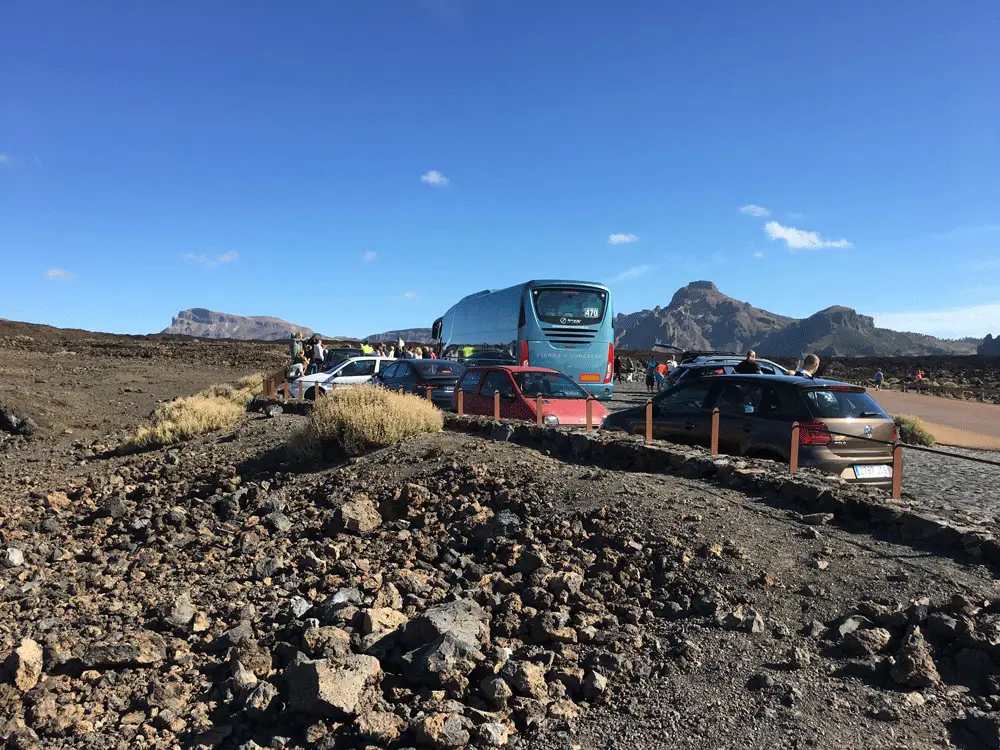
The starting point of the hike is the Mirador de Chío (Narices del Teide) car park on the TF-38 (kilometre 3.3). From here, you can also climb Pico Viejo.
Access by car
f you are coming from the south of Tenerife or from the north via the TF-1 motorway, you can take the exits Guía de Isora or Chío. Then continue on the TF-38 towards Teide National Park. Those coming from the centre of the island via the Cañadas road TF-38 drive towards Chío or Santiago del Teide. As the starting point is a large car park, parking spaces are generally available. However, if you arrive very late, parking can occasionally become a little tight due to the many tourist buses and increasing traffic in 2025.
Access by bus
It is not possible to reach the starting point directly by bus, as there is no TITSA bus line serving this route. However, TITSA bus line number 342 stops about 2.7 kilometres away at the road junction Boca Tauce. From there, you could walk to the starting point. Further information can be found on the TITSA website.
Time
I prefer not to give general time estimates for hiking tours, as times vary greatly from person to person. We took around 6.5 hours for this large circular hike, including long breaks.
Elevation gain and distance
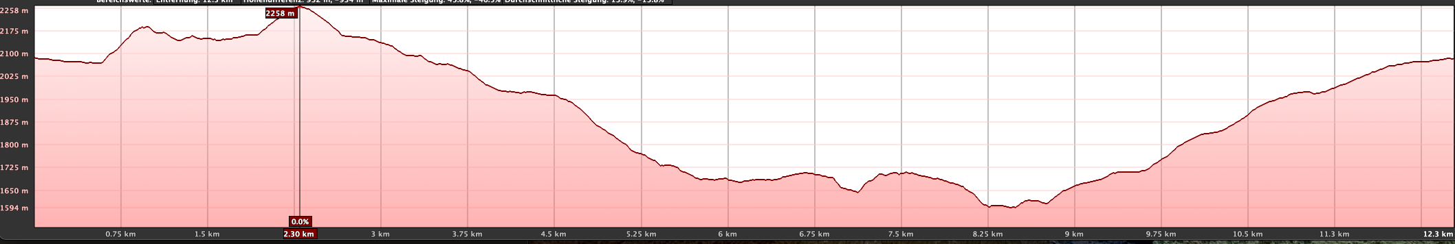
The total elevation difference is approximately 880 metres and the route is around 15 kilometres long.
Requirements
For most of the circular hike, you walk on good hiking or track paths. Only the ascent of Montaña el Cedro involves, for a short time, narrow paths that are sometimes not immediately obvious.
Refreshments
There are no refreshment options along the entire route. Please make sure to carry sufficient water and, if necessary, food.

Variants
You can find a shorter hike over Montaña el Cedro here.
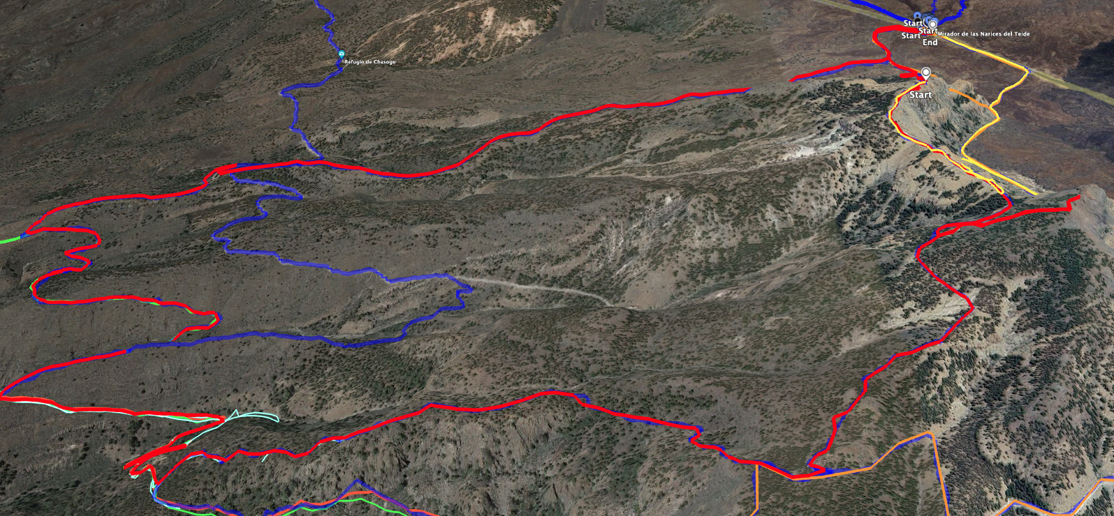
In addition, there are countless hiking options and tours in this area that you can vary in length as you wish. A look at the image showing the variants may provide some inspiration. I myself have walked this area in all directions, as I find it incredibly varied and repeatedly beautiful.
On SiebenInseln you will also find the following hikes nearby:
Hikes on the impressive Pico Viejo
Hike from Boca Tauce to Chindía
Circular hike from Chirche to Refugio Chasogo
Large circular hike from Chirche through Barranco Tagara
Circular hike Narices del Teide, Montaña el Cedro and through many ravines on the slopes of the Cañadas
Route section: Car park Narices del Teide to the foot of Montaña el Cedro
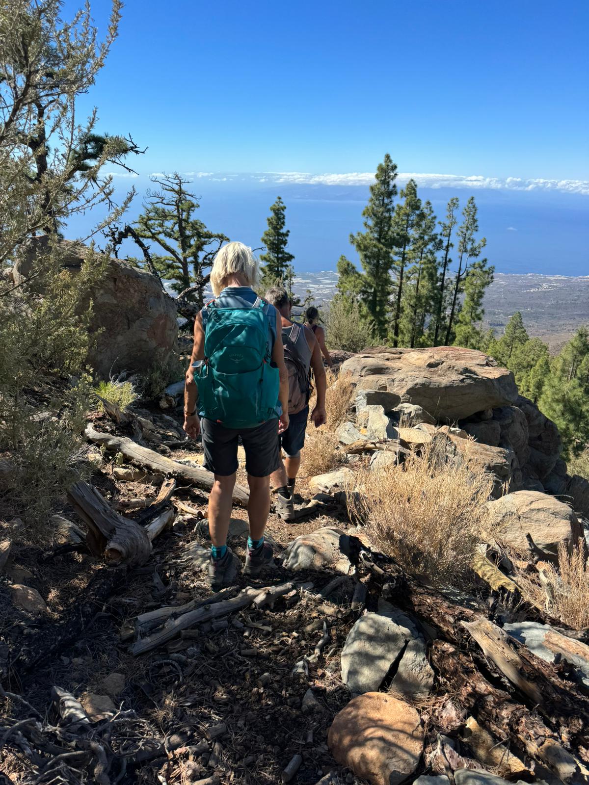
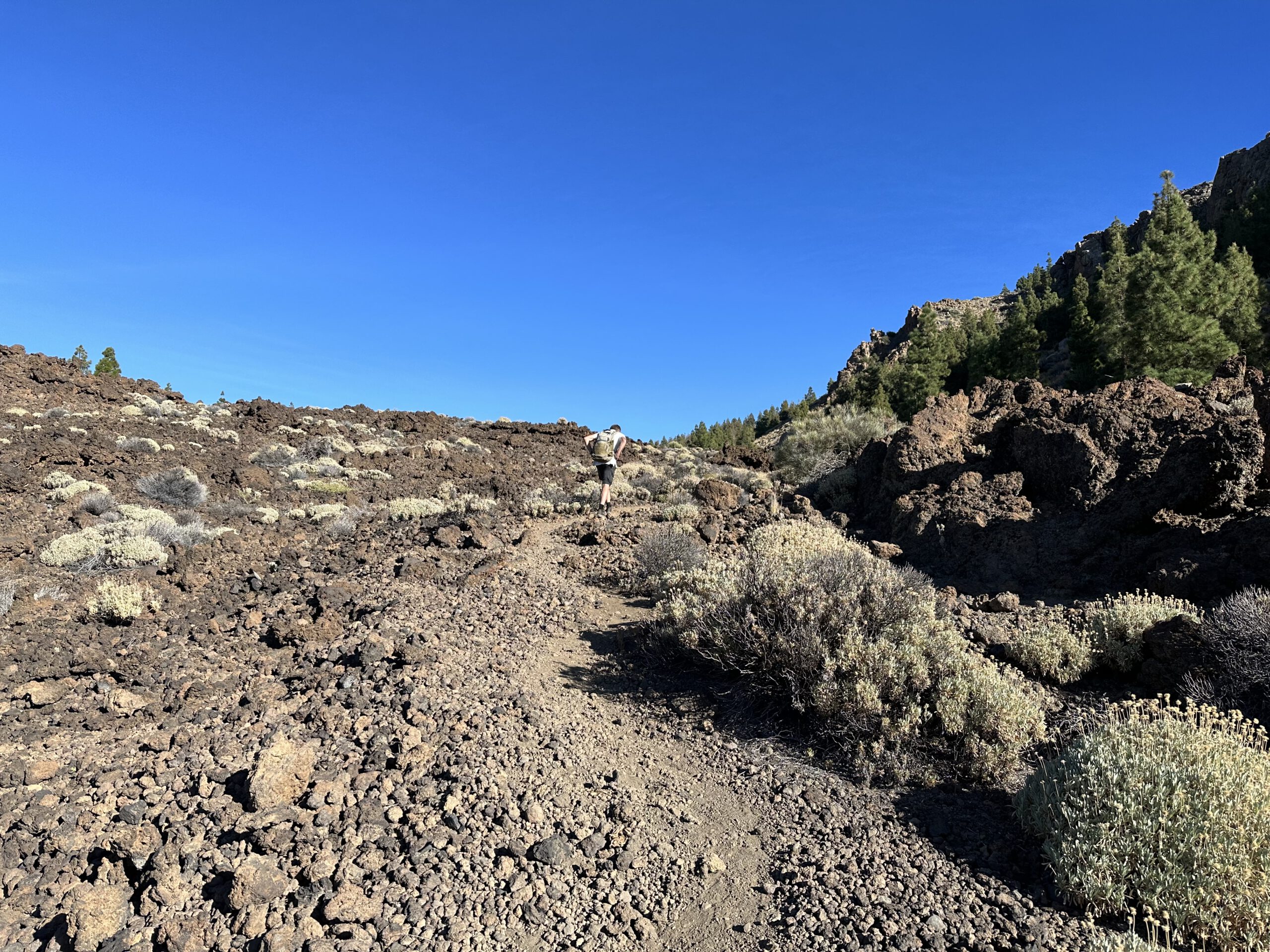
You start the hike towards Montaña el Cedro at the Narices del Teide car park on the TF-38 at kilometre 3.3. There you cross the road and follow the PR-TF 70 trail on the opposite side. At first, it runs slightly to the right parallel to the road, then descends in a curve through lava rock. The hike begins at around 2,100 metres above sea level. From there, you initially descend about 100 metres in elevation to the foot of Montaña el Cedro.
You walk towards the foothills of Montaña el Cedro, heading for the Cañadas del Cedro. Before the path leads through sparse pine forest, you first cross lava fields. You then reach a trail junction. To the left, PR-TF 70.3 leads to Boca Tauce. In the other direction, the path goes to Guía de Isora. However, you follow a smaller path straight ahead through the pine forest and soon reach the foot of Montaña el Cedro.

Route section: Foot of Montaña el Cedro to the rocky plateau
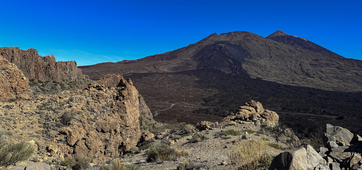
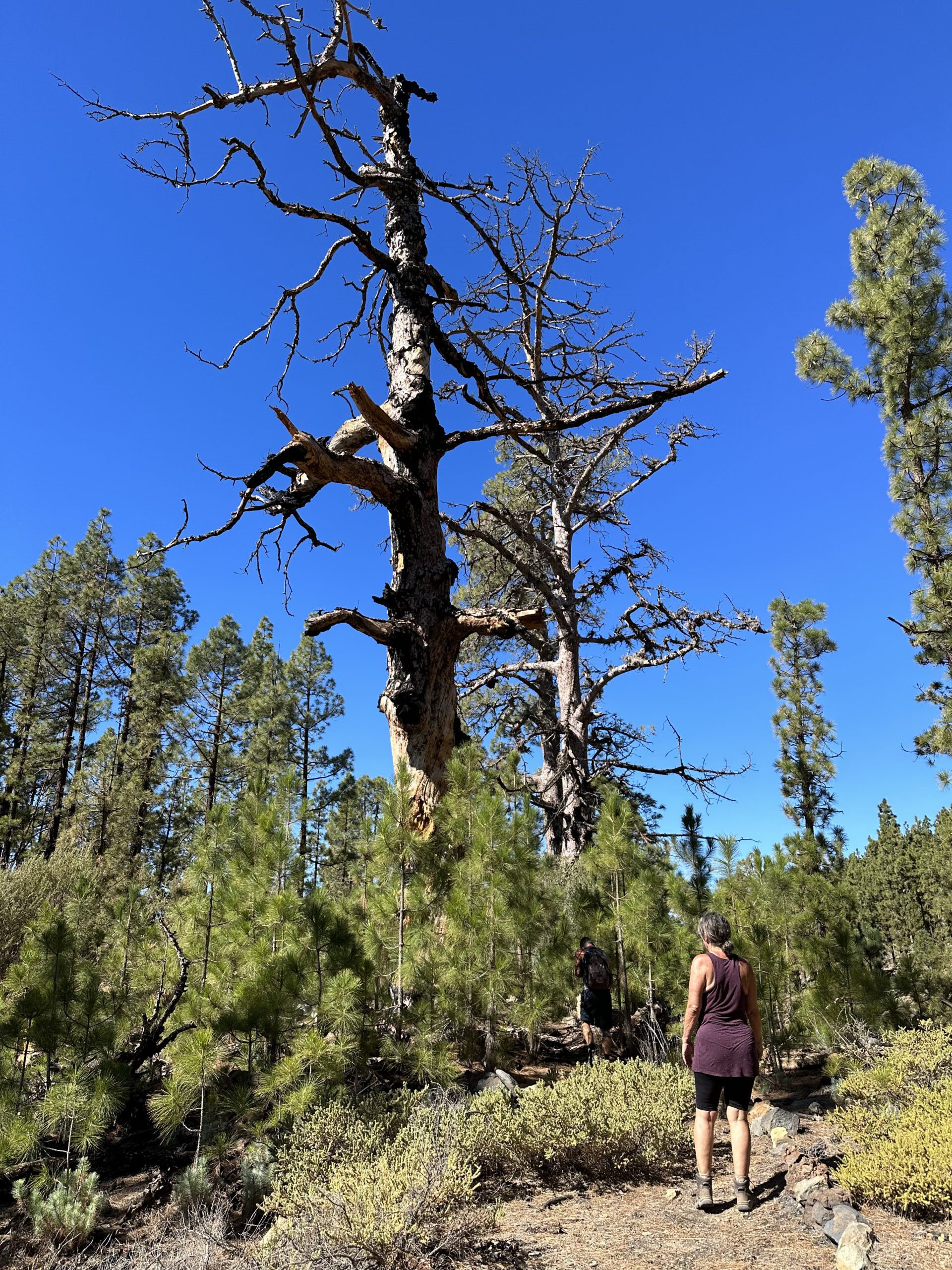
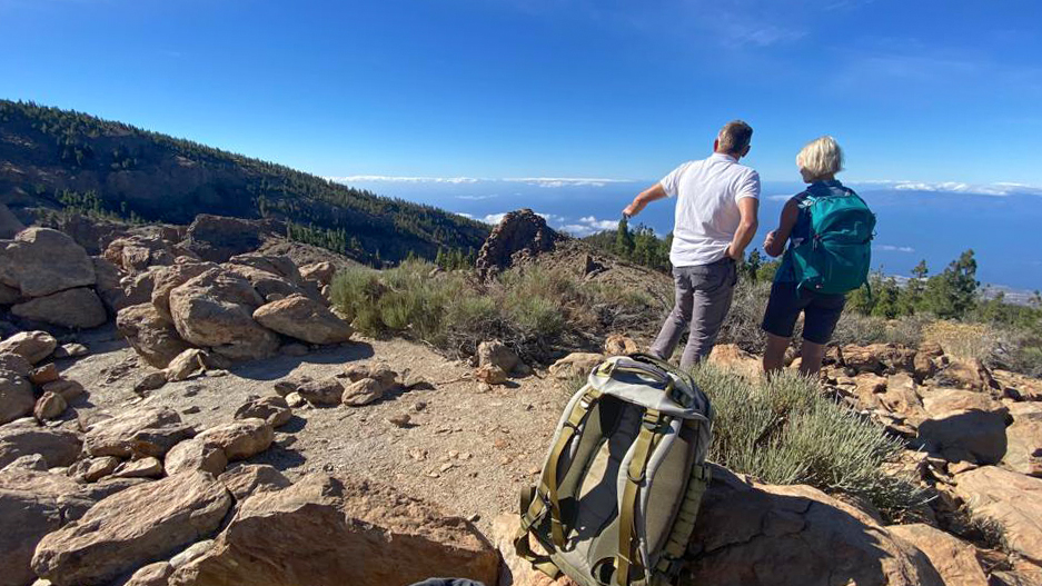
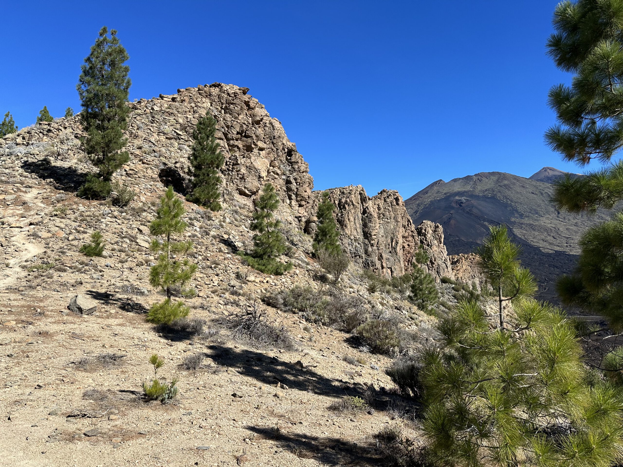
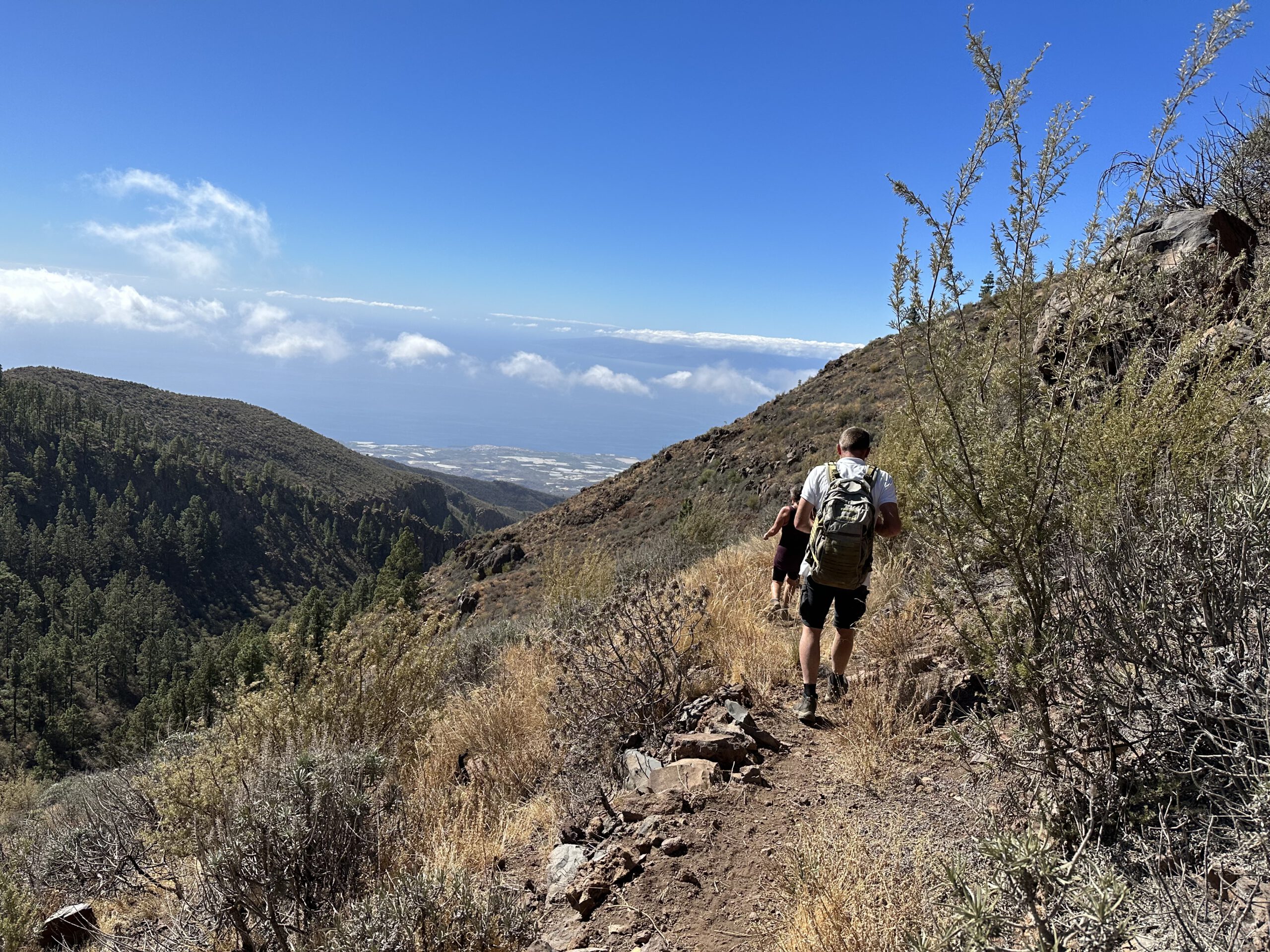
In the following section, the route becomes a little more scrambly. On the narrow path, you climb partly over rocks and otherwise via small zigzag paths. In between, the trail runs along the back of the slope. Gradually, you gain height. You pass a small cave decorated with flowers and other items. Once you round the slope, the ascent becomes steep. If the weather is good and no clouds obstruct the view, you can already enjoy magnificent views from the first summits (Roques de Cedro), which you reach one after another. Opposite you lie Teide and Pico Viejo. Below you, at the foot of the mountain, you can see the track leading to Boca Tauce. On the other side, in good weather, you can see far across the south-west coast of the island and to the neighbouring islands of La Gomera, El Hierro and La Palma.
The route then continues along a rugged, rocky ridge with fine views. The ridge path then descends slightly. Shortly afterwards, a partly very steep path branches off to the left uphill. This leads to the summit of Montaña el Cedro (2,265 metres). You do not have to climb it, but the panoramic views in all directions are well worth the effort. This is an ideal place for a short break. You then return to the main path, which leads downhill through the forest on the back of the slope. After some time, you leave the forest and reach a small rocky plateau.
Route section: Rocky plateau to the fire tower and trail junction
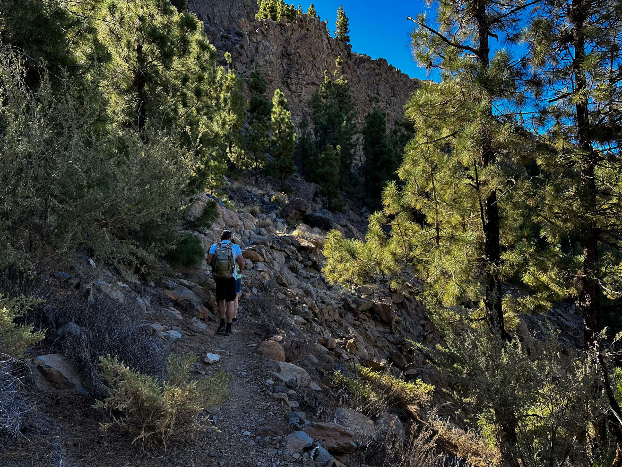
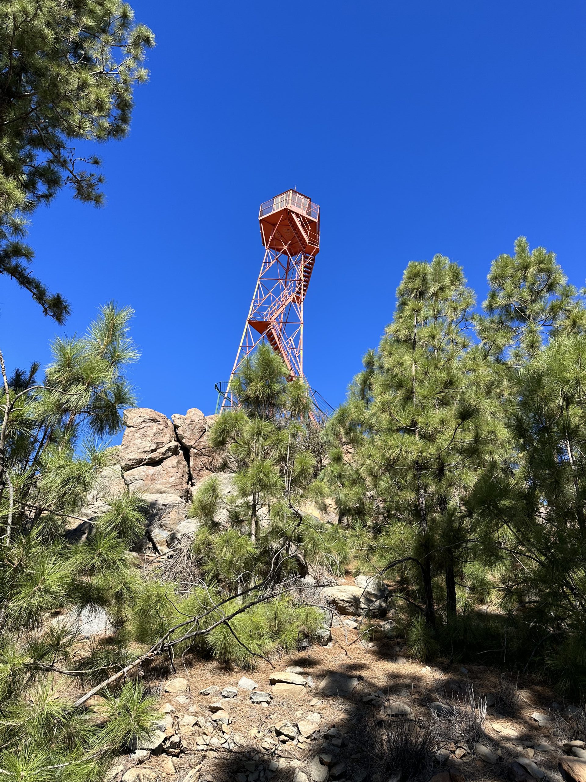
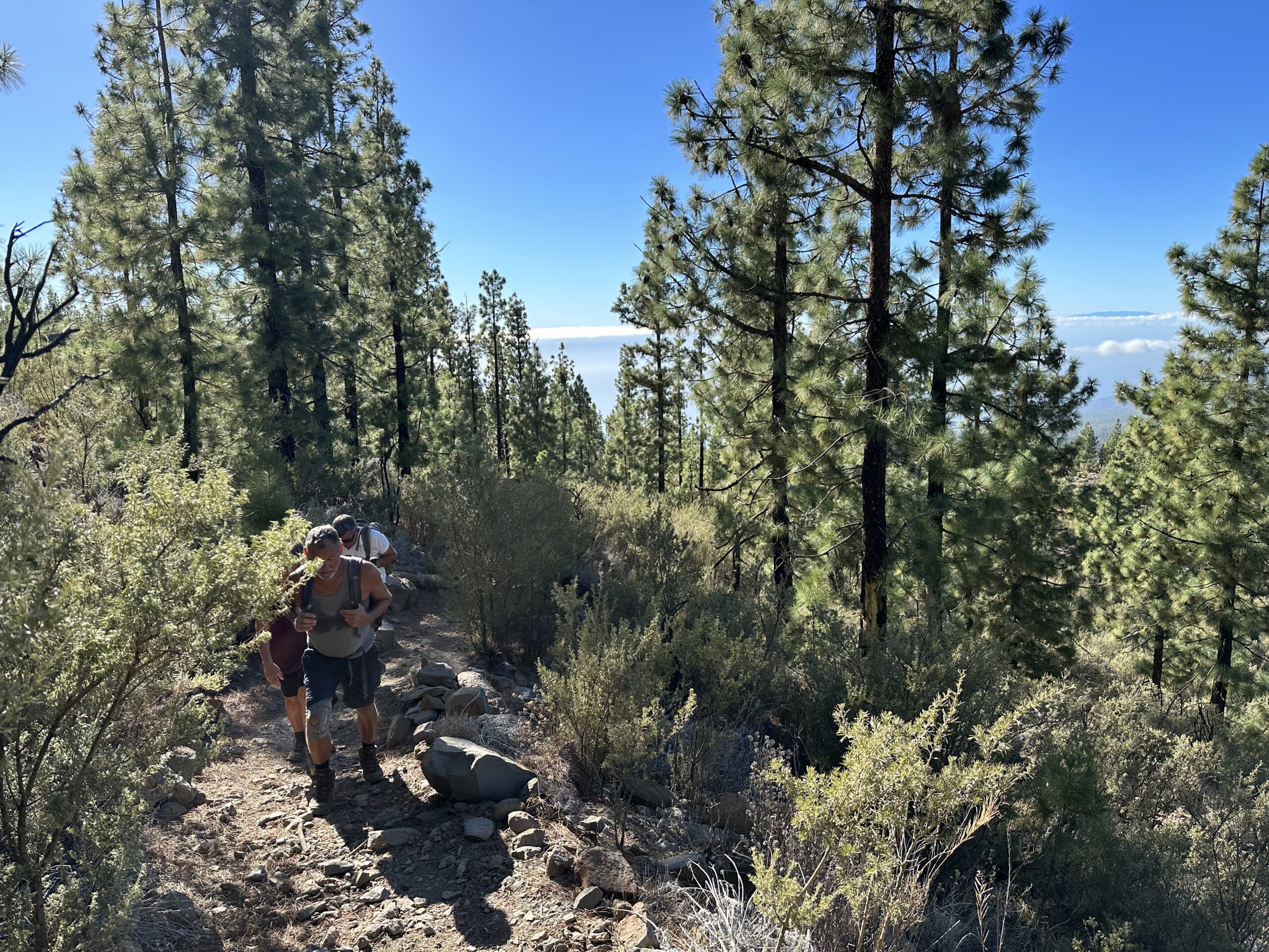
From there, you continue for quite some time, gently descending on a good hiking path along the back of the slopes of the Cañadas through pine forest. From time to time, the forest opens up and offers beautiful views. To your right lie Barranco Mañoca and Barranco de las Peguerías. The path passes both ravines along the ridge. After a while, you will see a fire tower ahead of you. Here you can climb onto the rocks to enjoy the view or take a short rest.
Those who have already walked enough can follow PR-TF 70 towards Boca Tauce at the large trail junction and return around Montaña el Cedro on the track. The large circular hike, however, follows PR-TF 70.1 towards El Jaral and Refugio de Tágara.
Route section: Fire tower to Barranco de las Peguerías
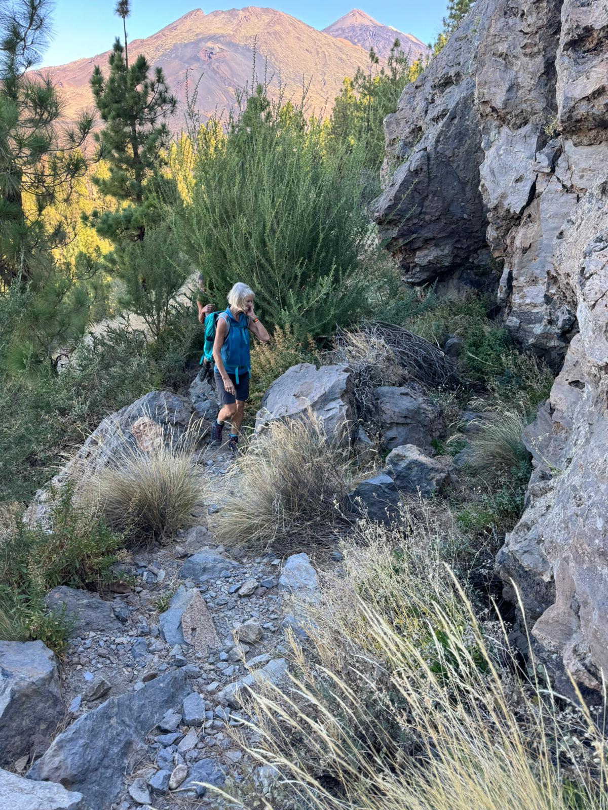
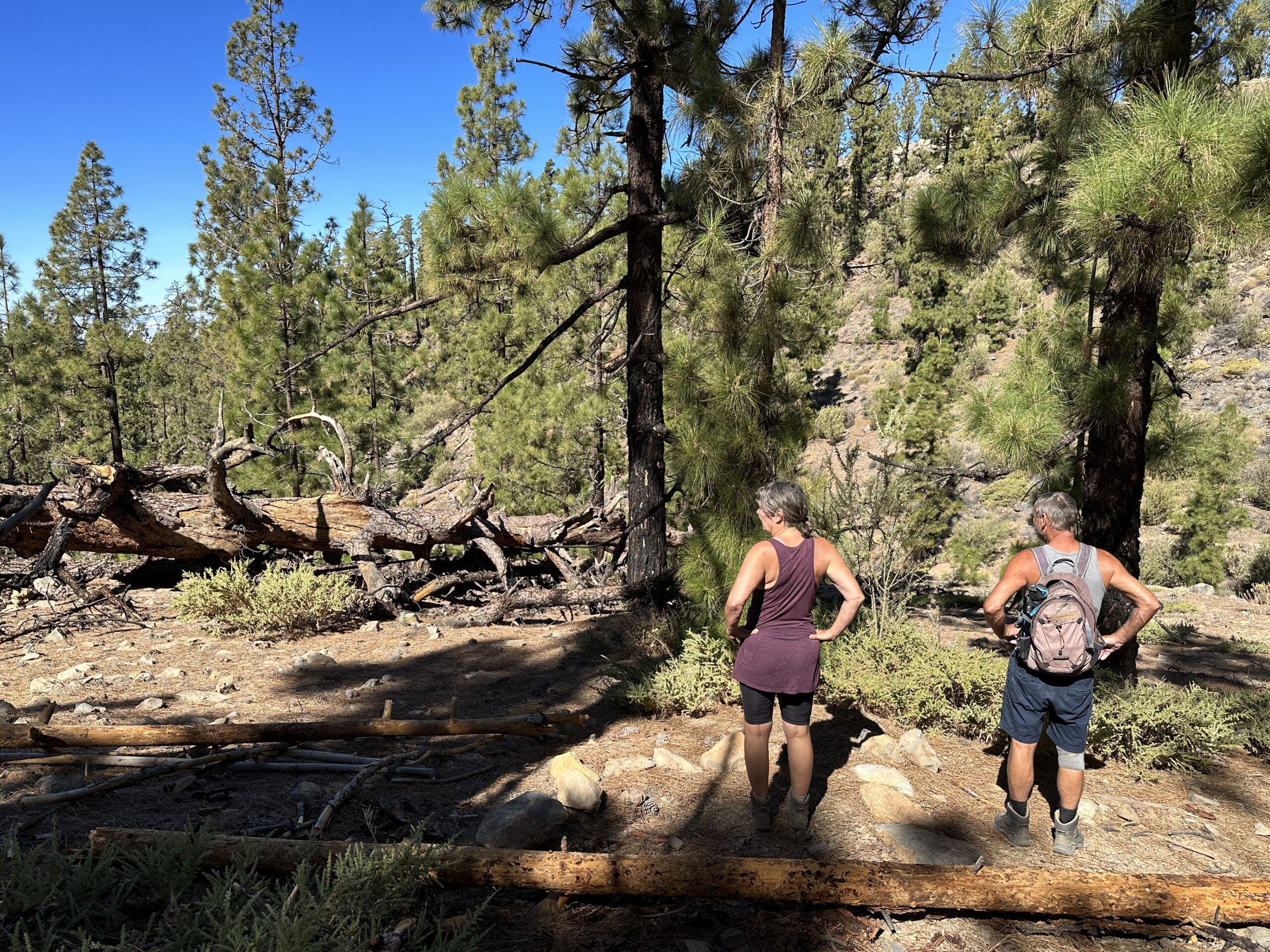
PR-TF 70.1 now leads downhill for quite some time. Initially, it heads towards Barranco de Tágara. Along the way, you will encounter many trees lying on the ground due to storms, thunderstorms and fires. Occasionally, you will have to find your way around these trees (still the case at the beginning of 2025). While the first part of the path is relatively wide and straight, it later descends steeply via small switchbacks towards the barranco.
You descend to approximately 1,750 metres. PR-TF 70.1 continues downhill towards El Jaral. A narrow path branches off to the left from the main trail, marked with a white and yellow crossed symbol. I have already described a short circular hike here. However, you continue on PR-TF 70 downhill through the pine forest. Eventually, the trail leads you through the first large ravine, Barranco de las Peguerías.
Route section: Barranco de las Peguerías to the junction with PR-TF 70.3
After crossing the ravine, you climb uphill on the opposite slope. You then reach a signposted trail junction. Straight ahead downhill, PR-TF 70 continues to Chirche. However, you turn right. The path leads you down through pine forest into Barranco Mañoca / Barranco del Cedro. Once again, you cross a deep and scenically impressive ravine. On the other side, the route continues along the slope, first to the right and then climbing steadily uphill to the left.
These were the major ravines. The trail now climbs uphill through pine forest and over several smaller ravines. After crossing four more small ravines, you reach another small path that descends to the left down to Chirche. You continue straight ahead and then turn right. Through the forest and above another ravine on your left, you walk uphill. This brings you to PR-TF 70.3, which you follow for a short while to the right through pine forest. Turning left leads to Refugio de Chasogo. After two switchbacks, you leave the wide track and climb uphill to the left.
Route section: Junction with PR-TF 70.3 to the starting point Mirador Narices del Teide
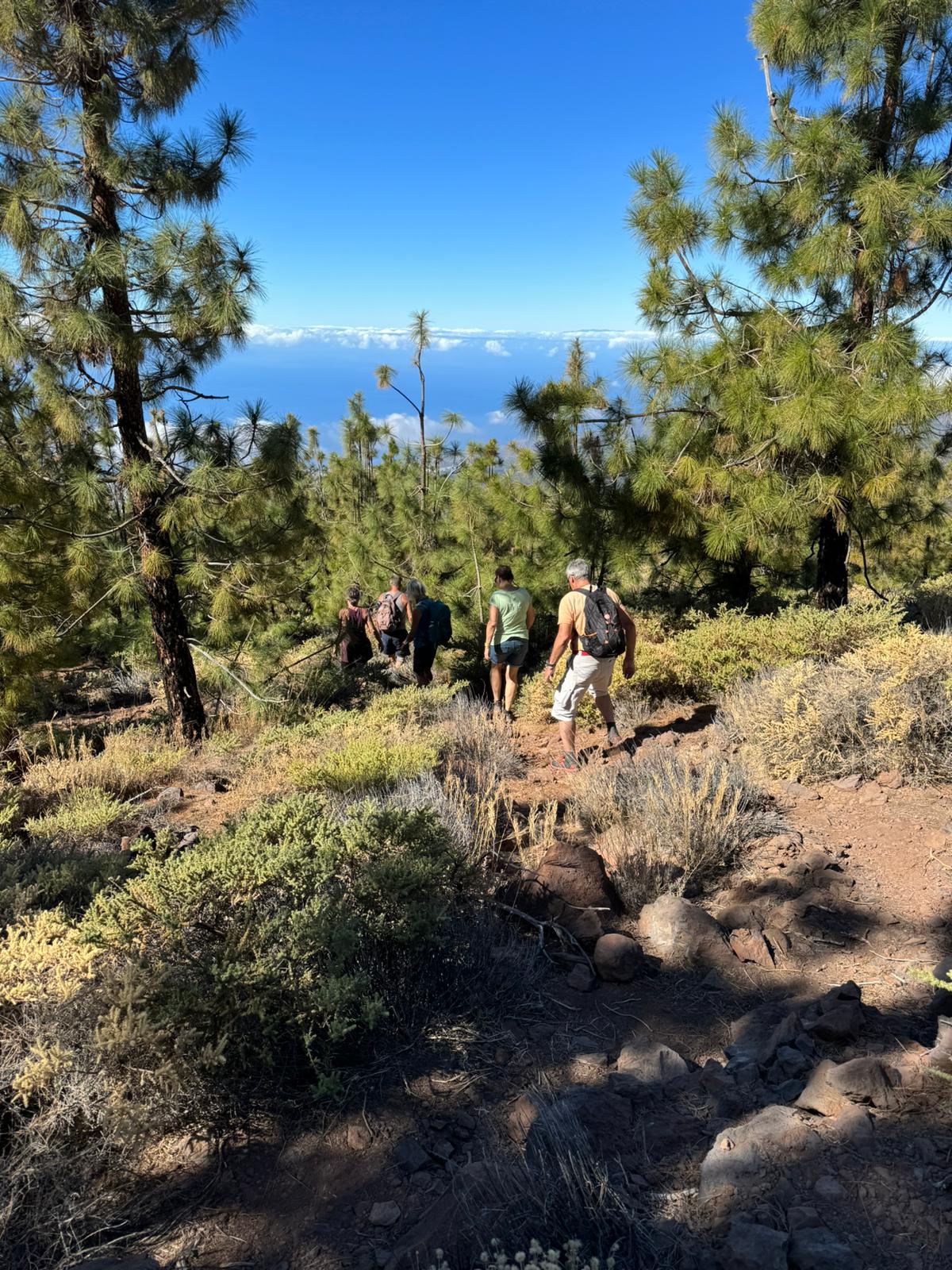
The path climbs for a long time, sometimes quite steeply, with small switchbacks through pine forest. It follows a broad ridge between two ravines. Eventually, the pine forest thins out and you return to rocky terrain. You are now back above 2,000 metres and continue ascending. After a while, Roques de Cedro and Montaña el Cedro reappear on your right. You continue uphill on their left-hand side.
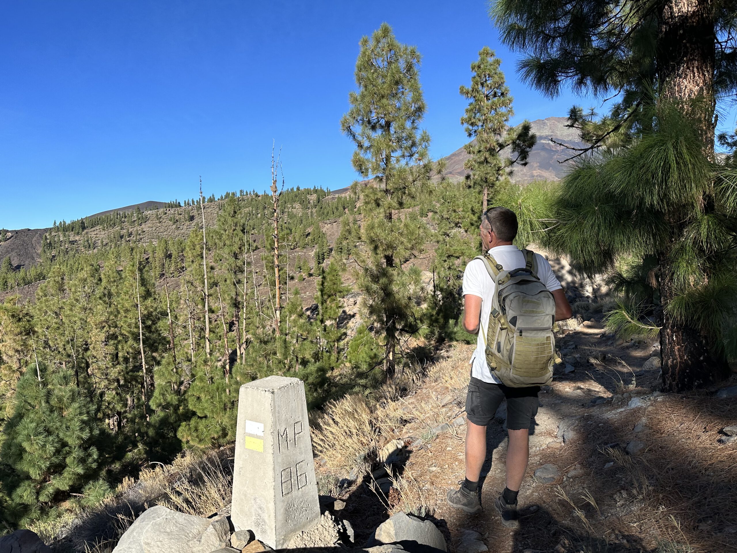
You then re-enter volcanic terrain, where the ascent continues for a short while. Eventually, you rejoin the path on which you arrived earlier. In a wide curve to the left, you now return to the road and the starting point, Mirador Narices del Teide. This completes the large circular hike.
And finally
I hope you enjoyed this large circular hike on the slopes of the Cañadas. You can shorten or extend it in many different ways, allowing you to find the perfect circular hike for yourself. Whatever you decide, I wish you great enjoyment on all your hikes.
Dagmar from SiebenInseln