Madre del Agua – Hike above Granadilla de Abona and Cruz de Tea
The hike to the Madre del Agua takes you to the south-eastern slopes of Tenerife high above the town of Granadilla de Abona, which has about 50,000 inhabitants. With an area of 155 km2, Granadilla de Abona is the third largest municipality on the island.

And the town, together with the neighbouring municipalities of Fasnia, Arico, Vilaflor, San Miguel and Arona, forms the region of Chasna, to which the ancient aboriginal kingdom of Menceyato or Abona also belonged.
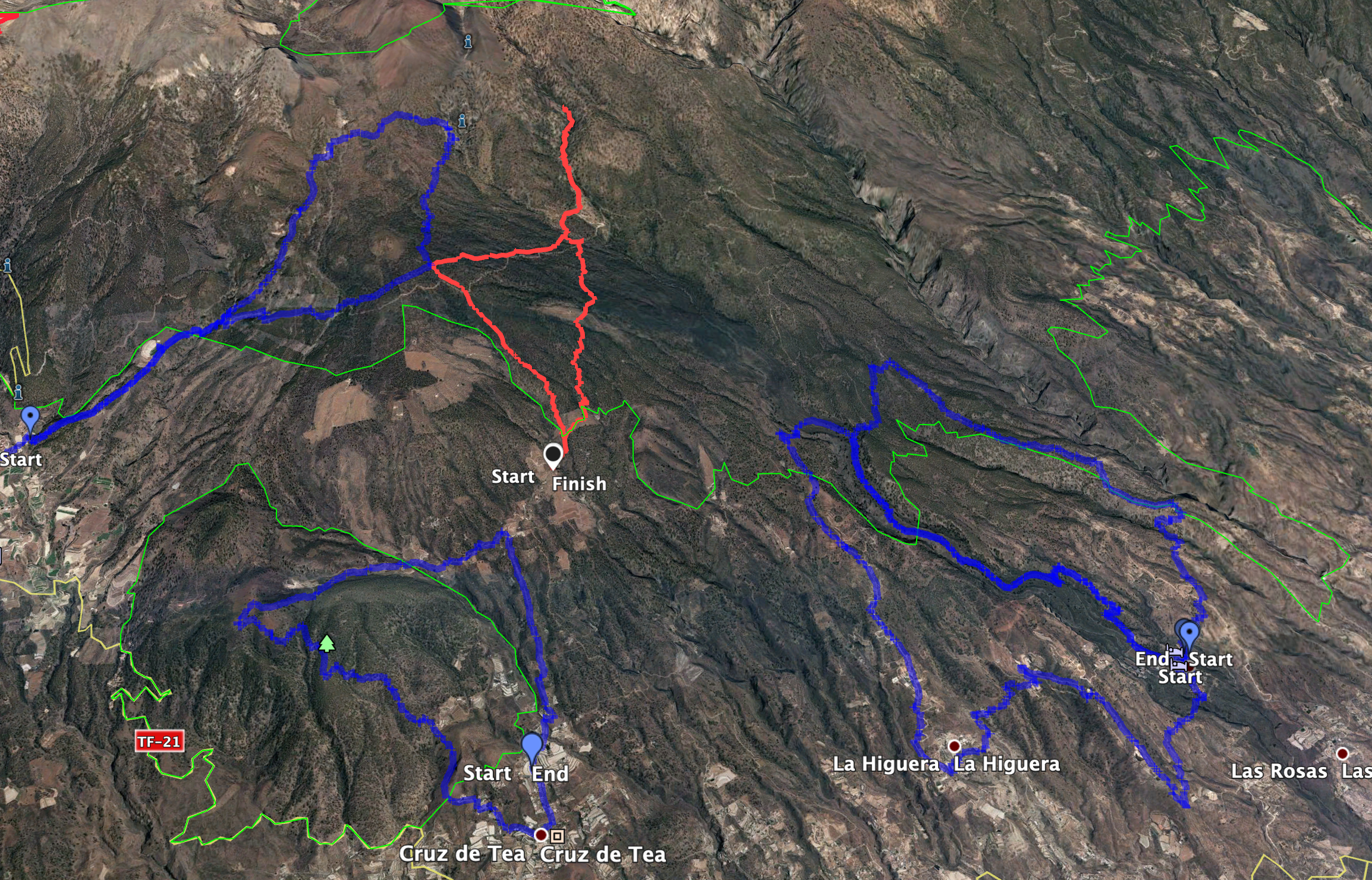
5 kilometres from the city centre, at an altitude of 1,194 metres, lies the small village of Cruz de Tea, which belongs to Granadilla and has about 300 inhabitants. The name comes from its location at a crossroads. A large part of the municipal area lies in the Montaña Colorada nature reserve. And here you can find a seven-island hike to Montañas de las Coloradas. Hi Above Cruz de Tea lies the small hamlet of El Pinar at an altitude of about 1,300 metres. The hike to the Madre del Agua described here starts there.
Hike to the Madre del Agua (campsite and waterfall)
You start the hike to the Madre del Agua in El Pinar and hike upwards along the foothills of the Cañadas. First you reach the Madre del Agua campsite, which lies at an altitude of 1500 metres. It is bordered by steep slopes to the north. You will also see the impressive gorges, Barranco de las Aguas and Barranco de las Vegas. After visiting a mirador from which you can see into the depths of the Barranco de las Vegas, you continue your hike in the Barranco Grund. Later you walk along the slopes above the Barranco until you reach the small waterfall Madre del Agua at an altitude of about 1810 metres.
You can find more waterfall hikes besides the hike to the Madre del Agua on Tenerife on Seven Islands here:
– Hike to the waterfall in Barranco del Río

General information on the Madre del Agua circular walk.
Starting point and route
You start your hike at the end of the small hamlet and driveway in El Pinar above Cruz de Tea.
GPS data: 28.158523, -16.593611
Access by car
From the TF-1 motorway, take the exit at San Isidro and keep going up through the town towards Granadilla de Abona (TF-64). In Granadilla de Abona, turn left onto the TF-21 and follow it until Cruz de Tea. You pass through Cruz de Tea and continue uphill until you reach the small hamlet of El Pinar. You also drive through this until the road ends at a large finca. This is where the hiking trail starts. Vehicles can be parked at the side of the path.
Arrival by bus
To get to the small village of Cruz de Tea, take the Titsa bus number 475 from Granadilla to Arona. If you want to know about connecting buses and times, you can check the Titsa homepage. However, there is no bus service to El Pinar, so if you don’t have a car, you could take a taxi. You can of course also walk from Cruz de Tea to El Pinar, but this would add considerably to the distance.
Time
I don’t like to give general times for hiking tours, as times are very individual. We needed about 4.5 hours for this hike with a long rest in the Barranco Madre del Agua and extensive photo stops at the Mirador and the Madre del Agua.

Difference in altitude and length of route:
The hike covers approximately 680 metres in altitude and the route is 12 kilometres long.
Requirements
Basically, this hike is an easy tour on good hiking trails. It is easy to do with a little bit of fitness. Only on the last few metres to the waterfall is the small path very slippery and steep. So caution is advised or just look at the water from a height.
Refreshments
You will only find a bar on this tour in El Pinar, if it is open. Therefore, take enough water and, if necessary, food with you.
Variants
This tour can be combined well with various other hikes and circular walks in the vicinity. Worth mentioning is the well-known Paisaje Lunar, which is directly adjacent to this tour. Furthermore, the hikes from Cruz de Tea, Las Vegas and La Higuera are nearby.

Hike to the Madre del Agua
Section El Pinar to Great Forest Track
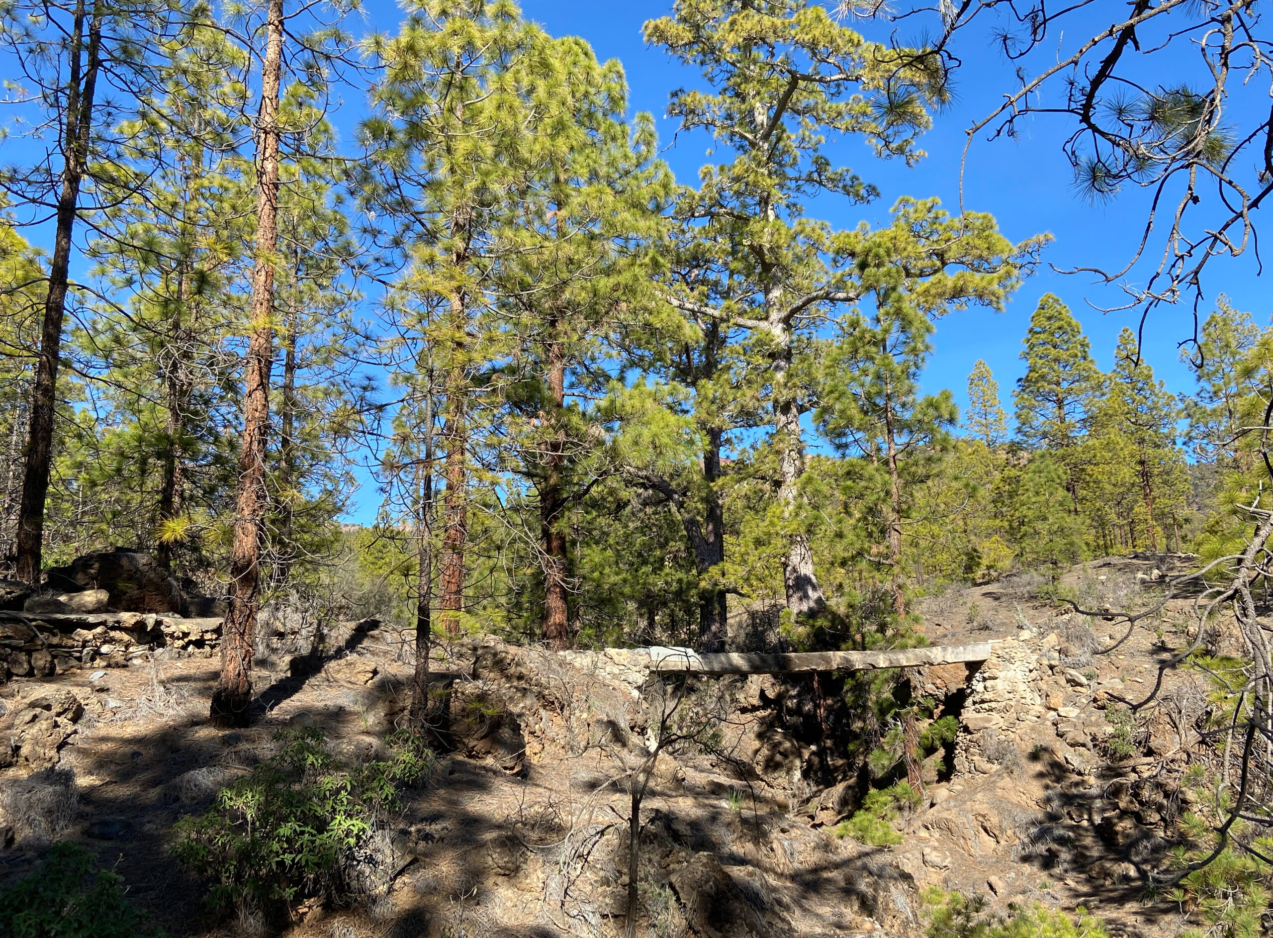
You start your hike at the starting point described above in the hamlet of El Pinar. At the end of the road, the path continues to a finca closed with a gate. The hiking trail, marked yellow and white, branches off to the right of the road, first slightly downhill. You walk along the edge of the Barranco Silvestre. After a while you cross it in the Barranco Grund and walk uphill again on the other side. The path goes uphill for a while through the pine forest. Then you come to a larger fork. Keep to the right in the direction of Madre del Agua. You will return later on the excellent hiking trail signposted to Paisaje Lunar (Los Escurriales).

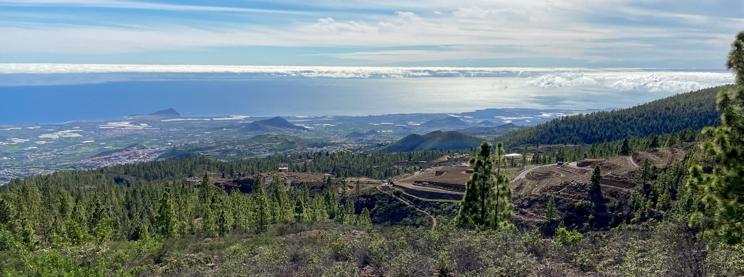
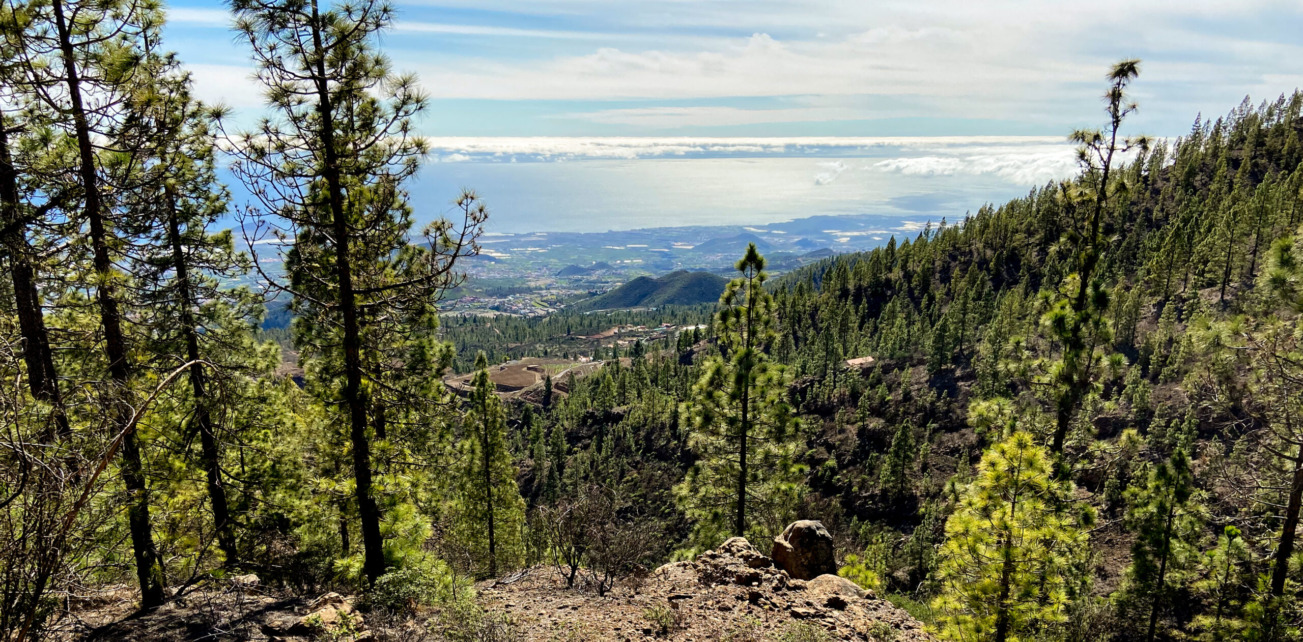
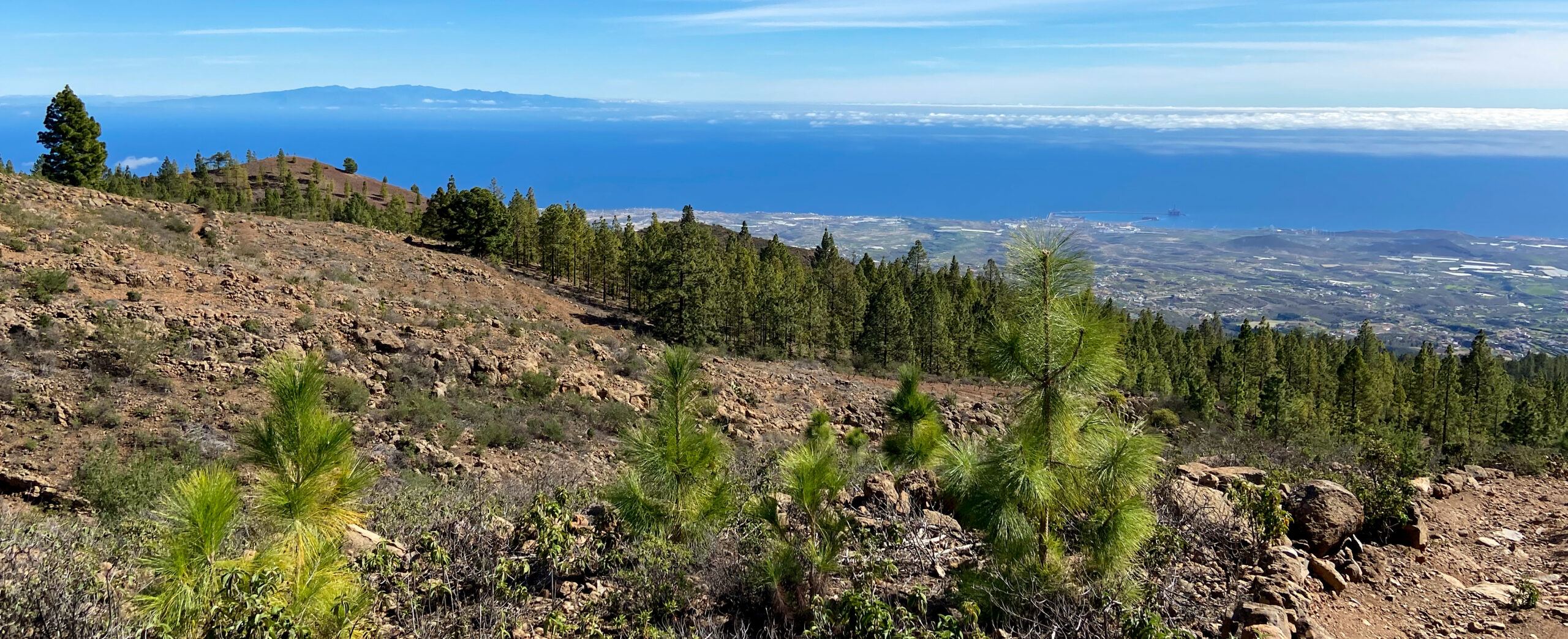
The path continues through pine forest and offers beautiful views of the south-east coast of Tenerife and the neighbouring island of Gran Canaria. Here and there there are also signs to Madre des Agua. And so you can’t miss the path. It goes uphill through the pine forest. You cross the Barranco Las Lajas and also a larger track that leads up to the forest track on which you can reach the Paisaje Lunar. Finally, the trail ends at this large forest track. Turn left to reach Paisaje Lunar and the road above Villaflor.

Section Large forest track to Mirador Barranco de las Vegas
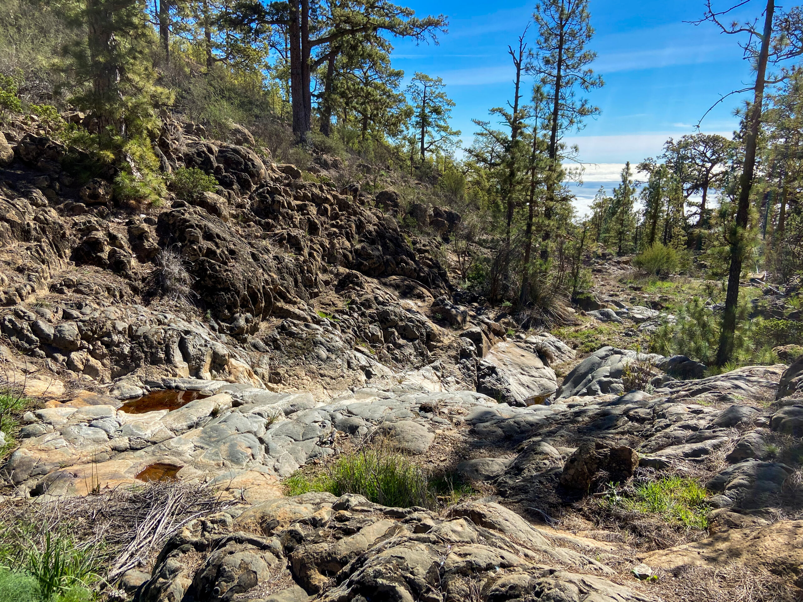
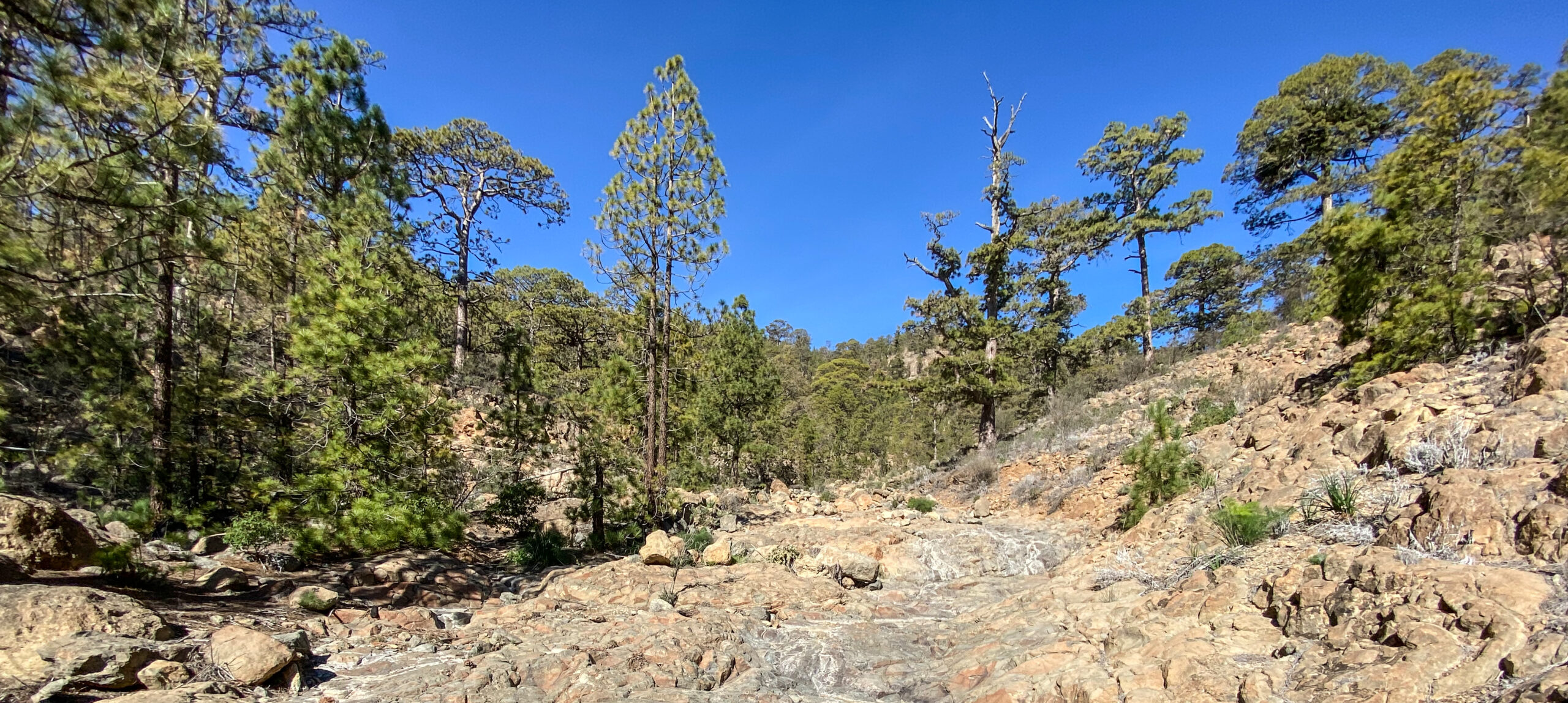
You go a few metres to the right on the track, then cross it and follow the trail that continues on the opposite side of the track on the left side of the Barranco de las Aguas. Here, too, the path leads you further uphill. Finally, the trail crosses the small barranco to the right. Continue uphill and after a short while you will reach the grounds of the Madre del Agua campsite (Campamento Madre del Agua).

Cross the camping and rest area and walk over to the main entrance. From the forecourt of the rest and camping site, the trail to Madre del Agua continues uphill to the left through the pine forest. You will find yourself on a wider ridge. On your right is the Barranco de las Vegas. After passing a white building, you can go around to the right of the path into the upper barranco bed. From there you will come to a mirador. From there you can look down into the impressive depths of the Barranco de las Vegas.
Section Mirador Barranco de las Vegas to Madre del Agua
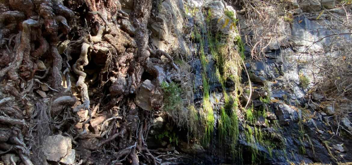
From the Mirador, follow the trail uphill, which leads you first through the Barranco de las Vegas bed and then along the right side of the slope. From there, a small hiking trail leads you uphill, sometimes quite steeply. Once again you cross the gorge, so that the Barranco de las Vegas is finally on your right. At the end of the path, which becomes narrower and narrower and is surrounded by dense bushes, you finally come to a small cave.
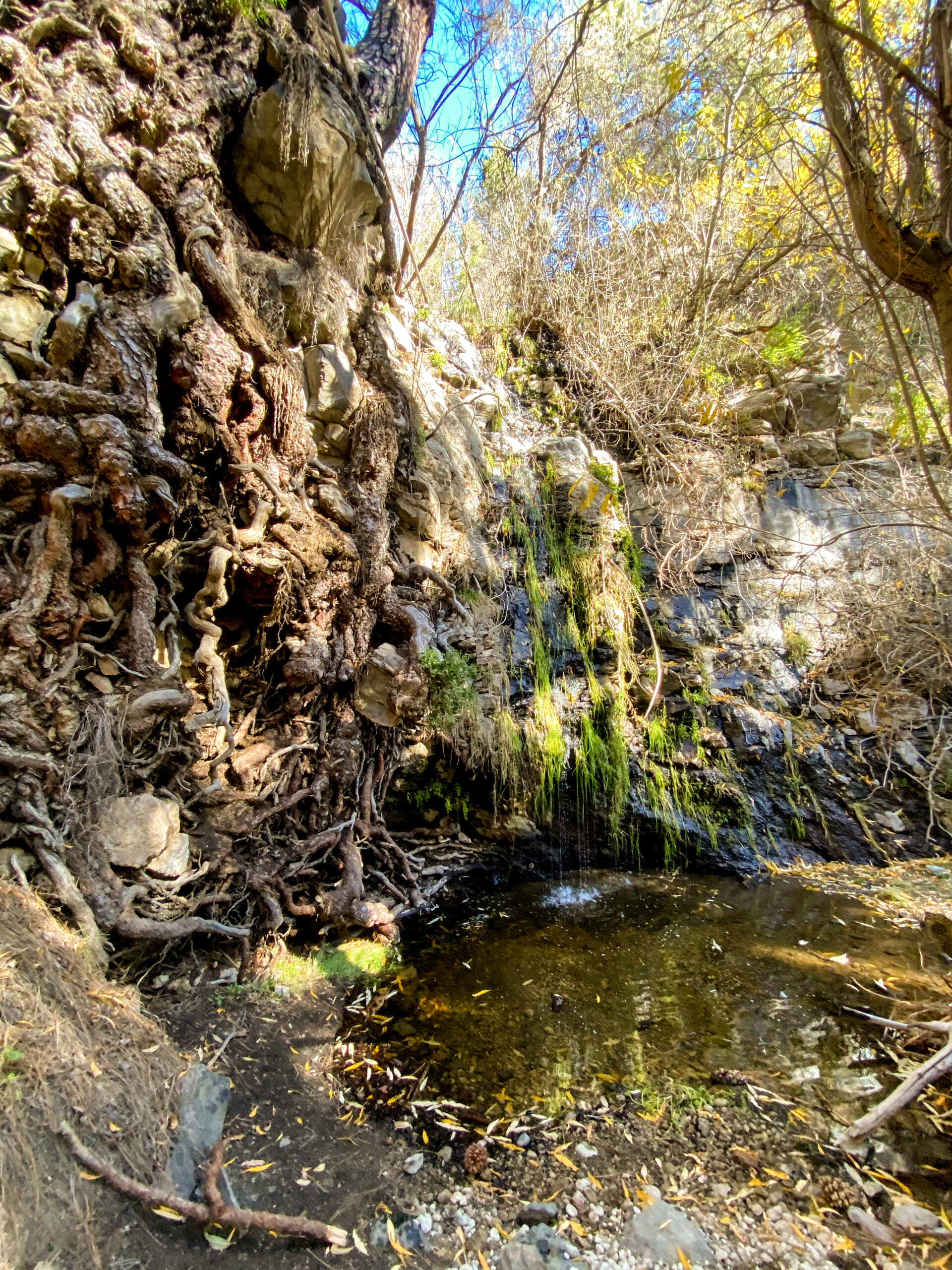
From here it is only a few steps downhill to the waterfall. However, the path is very steep and sometimes slippery. If you are not sure-footed, it is better to stop at the top of the cave. If you go down, you will stand directly in front of the small waterfall of the Madre del Agua. Here you reach the end of the hike at an altitude of about 1810 metres.
Madre del Agua section to Paisaje Lunar track
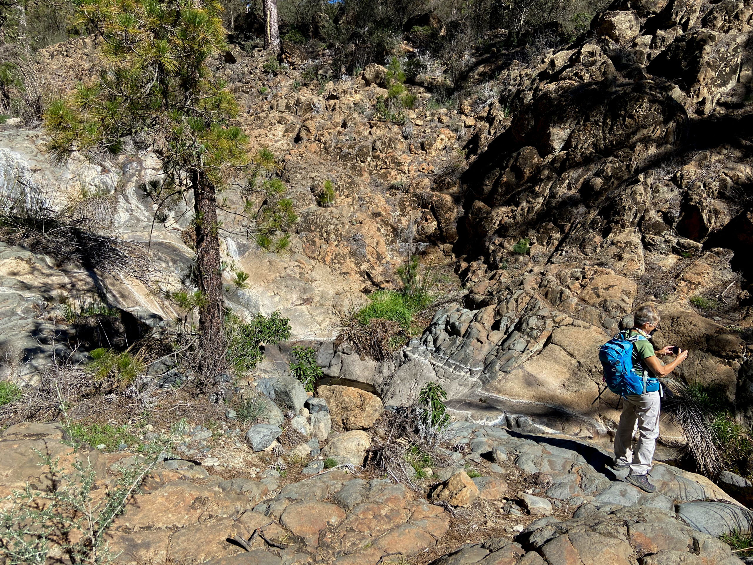
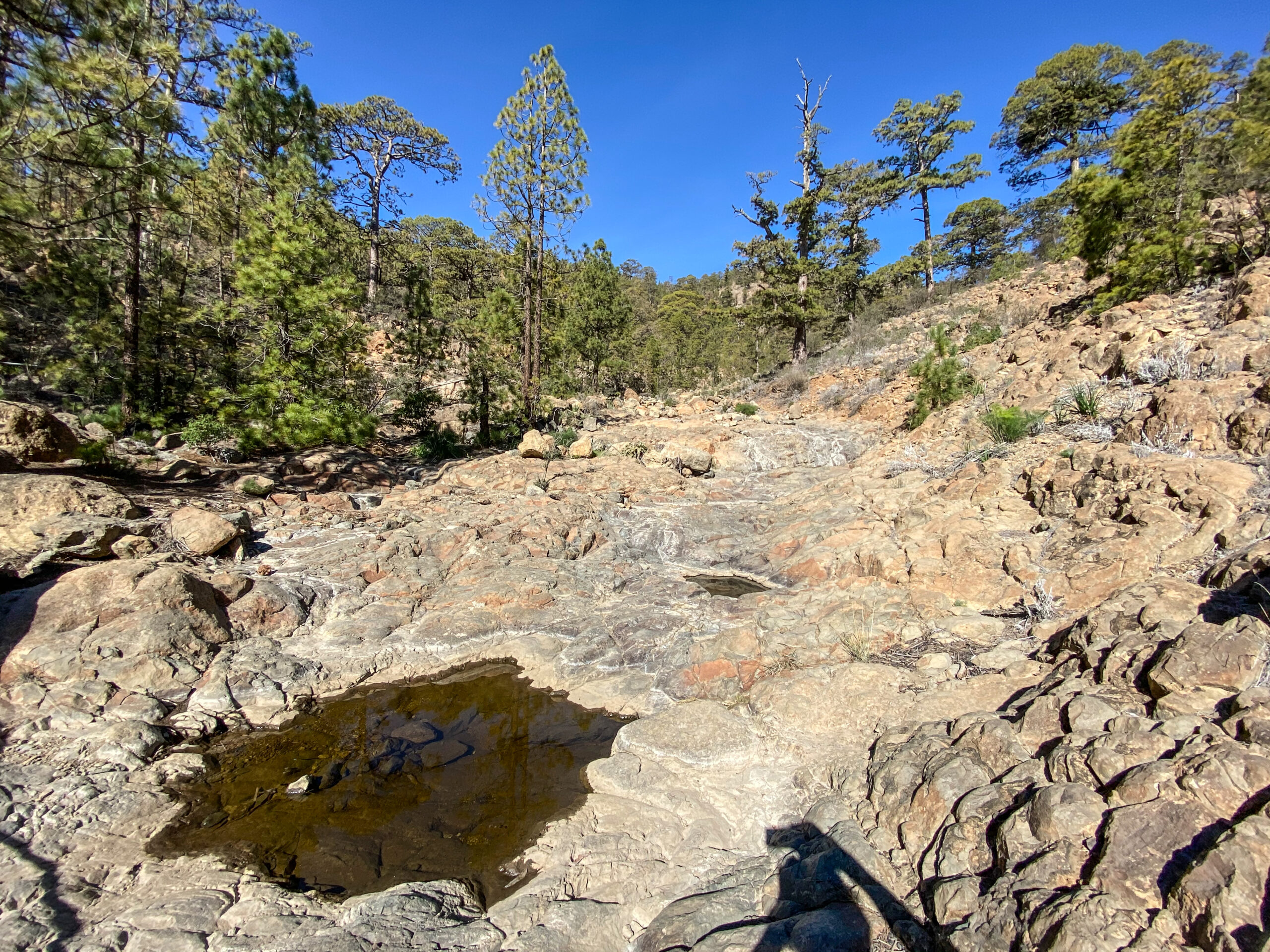
When you have seen everything, you go back the same way. Near the Mirador, there are many small pools of water to look at in the Barranco Bed. This is a good place to stop and have a rest. First, follow the same path you came from. You cross the Madre del Agua campsite again and continue on the way there. Finally, you will cross the small Barranco de las Aguas again. Shortly afterwards you will come to a fork. Here you came from the left and now turn right.
Keep following the hiking trail through the pine forest. Every now and then it goes slightly downhill. But all in all, the path goes uphill for a long time, parallel to the forest track, towards Paisaje Lunar. Then you come to a hiking junction. Here the Paisaje Lunar and Madre del Agua trails meet. Go straight ahead and turn right onto the Paisaje Lunar trail. However, you keep to the left.
Paisaje Lunar track section to starting point in El Pinar
Now the trail goes downhill through the pine forest until you meet the wide forest track again. On the opposite side of the track you will come across two hiking trails. One goes down to La Florida, Las Vegas. But you follow the PR TF 83 towards El Pinar. The path is well signposted and leads you down through the pine forest for a long time. In between, there are even pretty lookout points with stones in the serpentines. Here you not only have a good view of the entire coast and Gran Canaria, but you can also take a last rest.
Some of the serpentines that bring you down quickly from the heights are quite steep. But the view compensates for the hard descent. After a while, you can already see the farms of El Pinar deep below you. Finally, you reach the fork where you turned left at the beginning of the hike. Now keep to the right and take the same path back to El Pinar.
And finally
I hope you also enjoyed this tour to the Madre del Agua. As you know, I run this homepage privately and in addition to my work. Since I don’t always have an overview of all the articles, it can happen that some information in different articles becomes outdated or that something changes in the hiking routes for other reasons. If you notice something while hiking that could be useful for other readers and hikers, I would be very happy about a hint or comment from you. I am always happy to receive comments anyway. Best wishes and wonderful walks,
Dagmar from SiebenInseln
Did it today. Great hike Siebeninseln! Thanks!
P.S.: it took 2h 36minutes. The waterfall has dried up and is not visible. The picnic area was closed due to fires.
Thanks Volodymyr – good to know, because after the fires so many things have changed and I think, every hiker is glad to have actual informations