The Organos High Trail in the Orotava Valley – a “must” for hikers on Tenerife
To be honest: it has always annoyed me a little that the Organos High Trail, which in my opinion is a classic, has not yet been found on the Seven Islands of all places. The reason was not that I didn’t know it or hadn’t hiked it. I have hiked it.
However, that was several years ago and at a time when I didn’t use GPS. So I had no current track and no current pictures. But now I was finally there again. And so now there is also the current tour of the Organos High Trail here on Seven Islands.
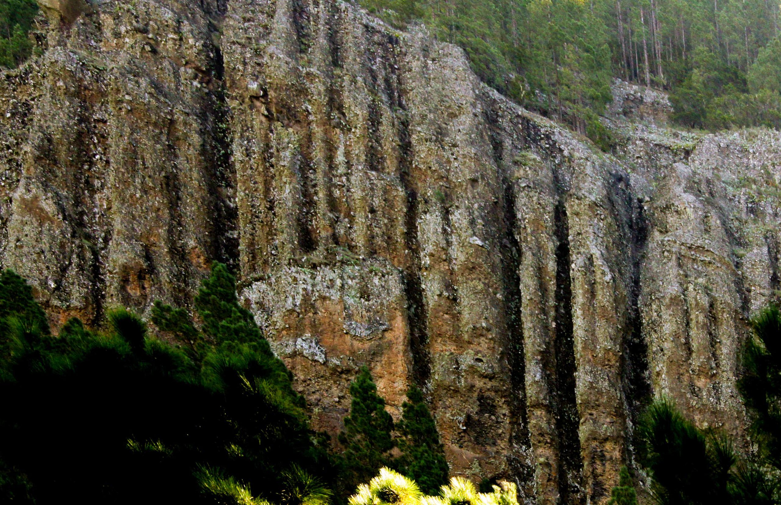
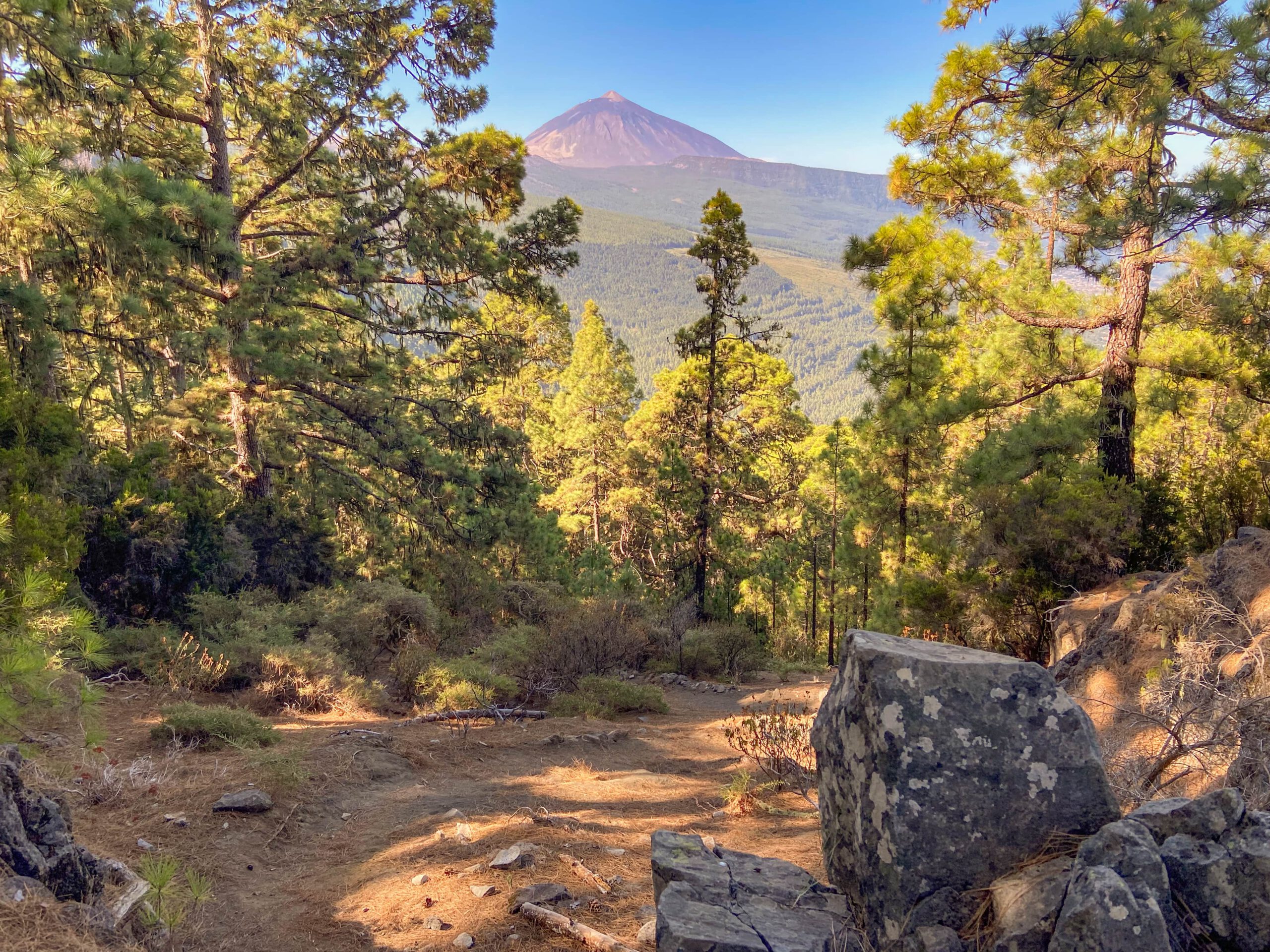
The name of the trail “Organos” comes from the bizarre rocks over which the trail passes with spectacular views. For these look like organ pipes with their vertical folds. And it is precisely above the organ pipes that the path runs on a narrow path parallel to the mountainside. But on the way there and back you not only have to overcome some metres in altitude, but also some gorges in long loops. A varied hike with wonderful views of the Orotava valley and the Teide awaits you.
General information about the Organos High Trail circular hike
Starting point and directions
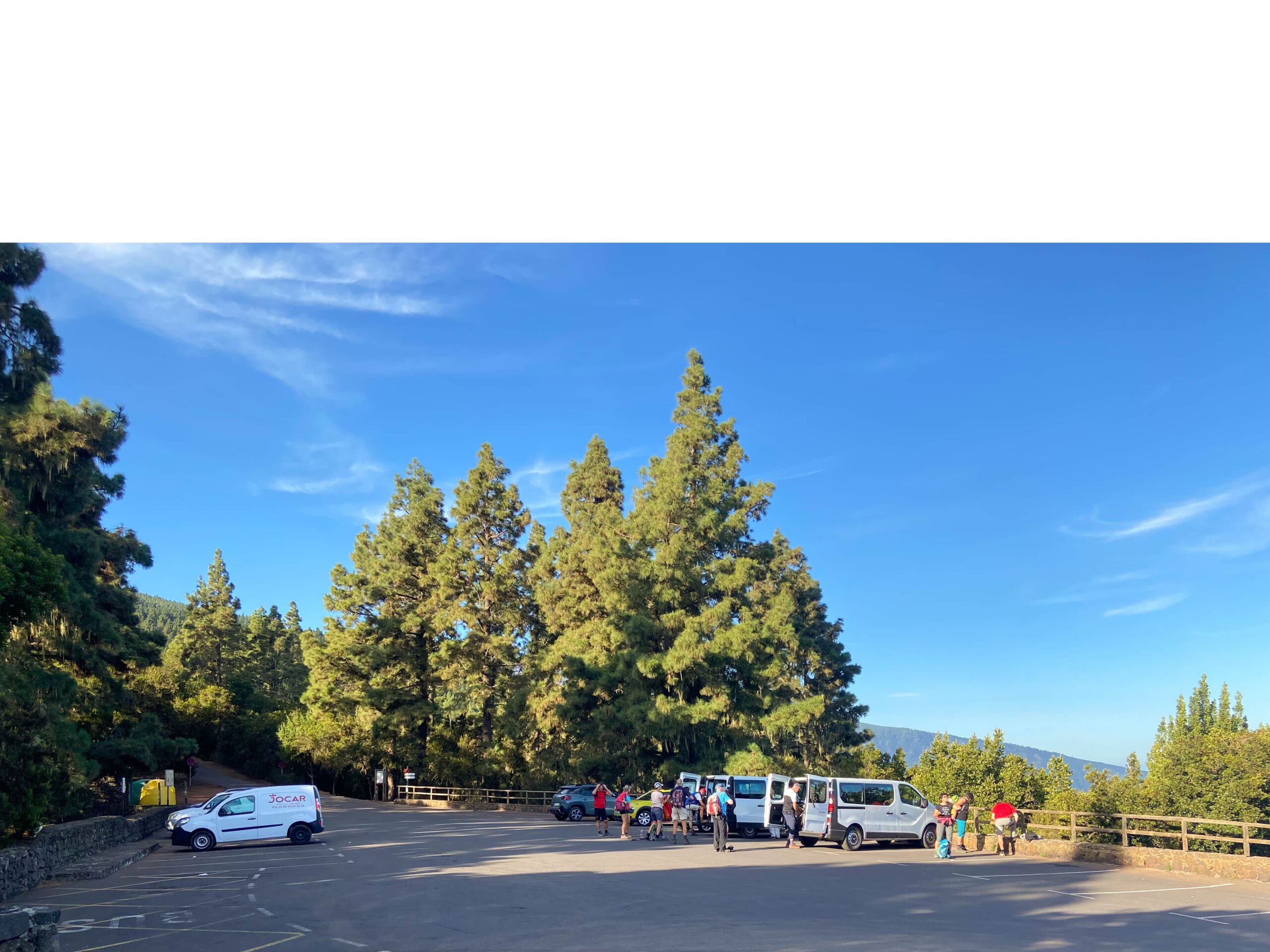
The starting point for this hike is the La Caldera car park (zona recreativa) at an altitude of almost 1200 metres near the TF-21 (access road to the Teide through the Orotava Valley).
Access by car
By car, take the TF-21 from the north in the direction of Teide. If you come via the Cañadas, at El Portillo take the TF-21 towards Orotava. At Aguamansa you leave the road on a small spur road. Here, the La Caldera car park and the Organos high trail are already signposted. You drive through the forest a little and finally arrive at the La Caldera car park. If you arrive early, there are plenty of parking spaces. Due to the popularity and the many hikes that start here, space can get a little tight later on.
Getting there by bus
The Titsa bus lines 345 and 346 stop as their terminus directly at the car park and thus at the starting point. The 345 comes from Puerto de la Cruz and the 346 from Orotava. You can get more information on the Titsa homepage.
Time
I don’t like to give general times for hiking tours, as the times are very individual. We needed 4.5 hours for this hike with long breaks.
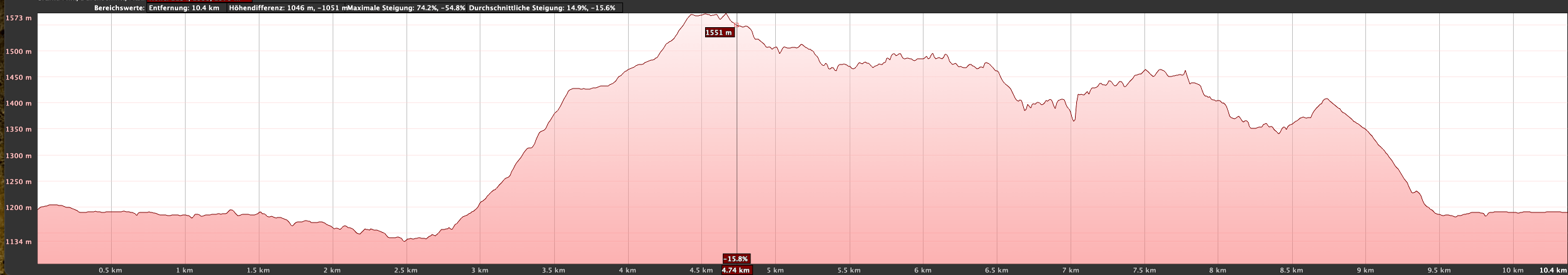
Difference in altitude and distance:
The difference in altitude is a little over 600 metres and the route is just under 11 kilometres long.
Requirement
A beautiful tour on well laid out hiking trails. A few years ago, the path had slipped in places and was no longer passable. Now it is well prepared and easy to walk. However, you should be fit for the steep ascent.
Refreshments
There are restaurants, bars and shops in nearby Aguamansa and a bar/restaurant at the La Caldera rest area (if open), but not on the Orotava high trail. Therefore, take enough water and food with you if necessary.
Variants
This tour can be easily combined with various other hikes in the vicinity. Special mention should be made of the Camino de Candelaria, which is also part of this hike. This trail leads from the Organos High Trail further up to La Crucita and down the other side of the island via Arafo to Candelaria. And the GR 131 and GR 133 long-distance trails are also not far from the Organos High Trail. If the path is too strenuous for you, you can also start from here on various short circular walks, for example in the direction of Aguamansa. It is also possible to take a short hike from the car park into the Barranco de la Madre or to the Choza Chimoche. Another possible combination is the hike to Montaña Limon.

Circular hike on the Organos High Trail
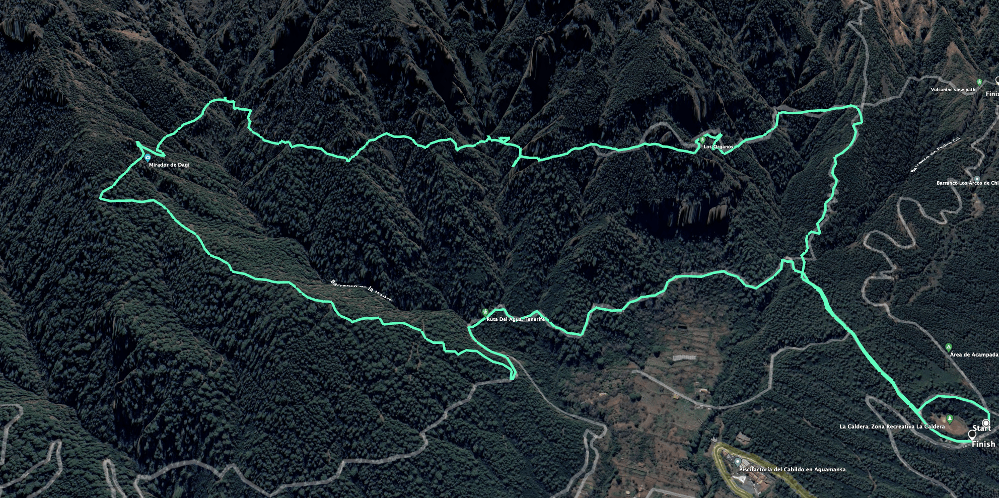
Route section from La Caldera car park to the Organos Ridgeway junction from the forest road
You start your hike at the La Caldera car park. From there, you can walk around the picnic area in a wide arc to the left or right. You will reach a wide forest road (PR TF 35/ GR 131), which you follow straight on for quite a while. After a while you will reach the Choza Pedro Gil. Here a path goes up on the right, which you will take back later. If you want to do the tour the other way round, you have to follow the path uphill. Otherwise, go around to the left on the wide forest path and continue straight ahead through the forest for quite a long time.
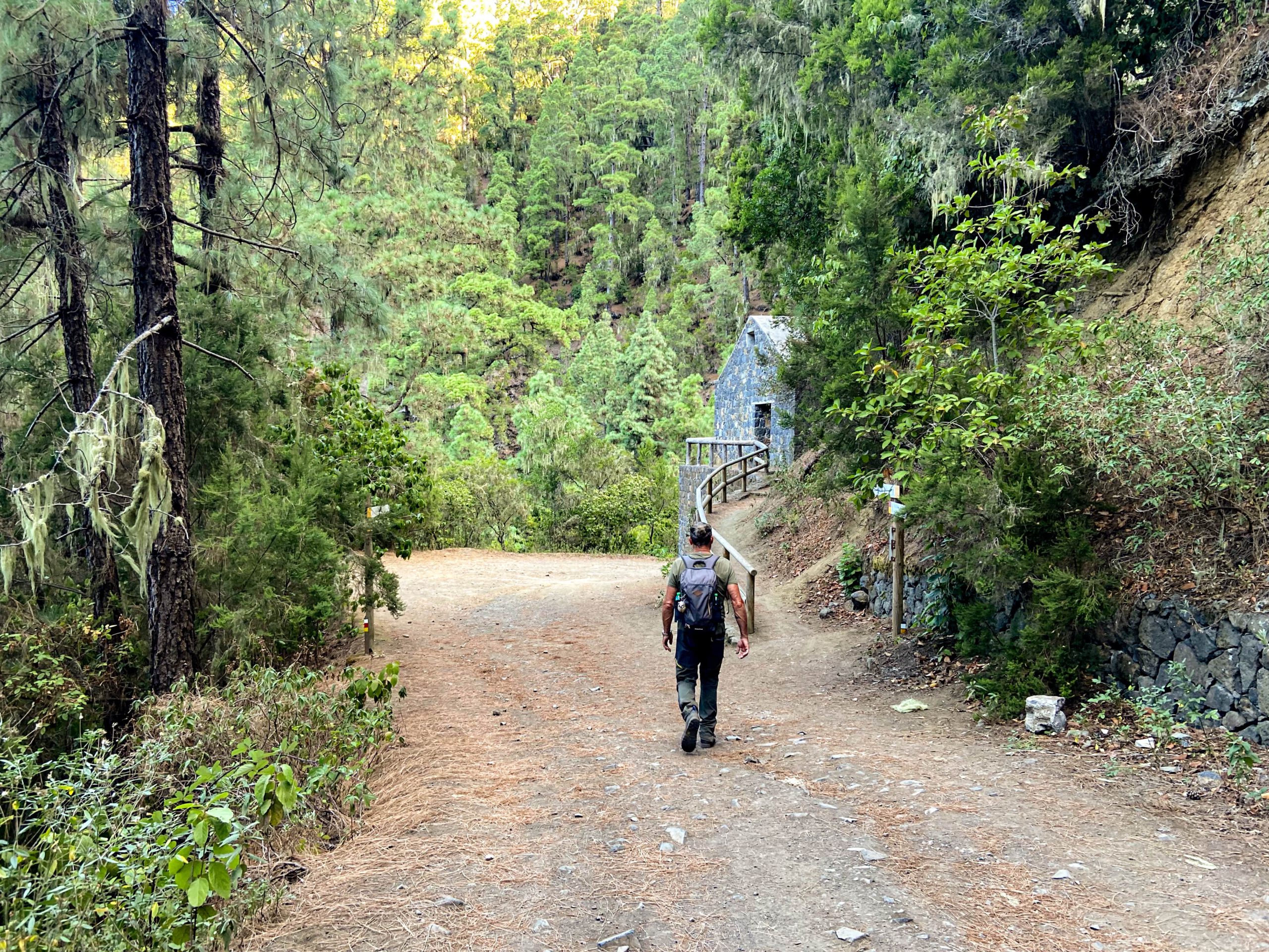
The trail winds gently up and down below the Organos Rocks. After a while you enter a valley and reach the so-called water house. Shortly before, a path branches off to the right uphill. If you follow this, you will go uphill and downhill on the Ruta del Agua Tenerife in a triangle and finally get back to the Organos high trail. Otherwise, continue straight ahead for a short while. After the next big bend, the Organos high trail branches off to the right uphill from the forest road.

Organos ridgeway junction from the forest track to the Barranco de la Madre crossing
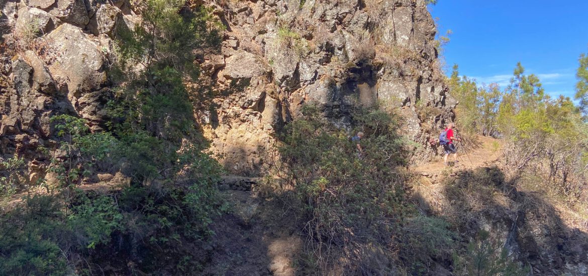
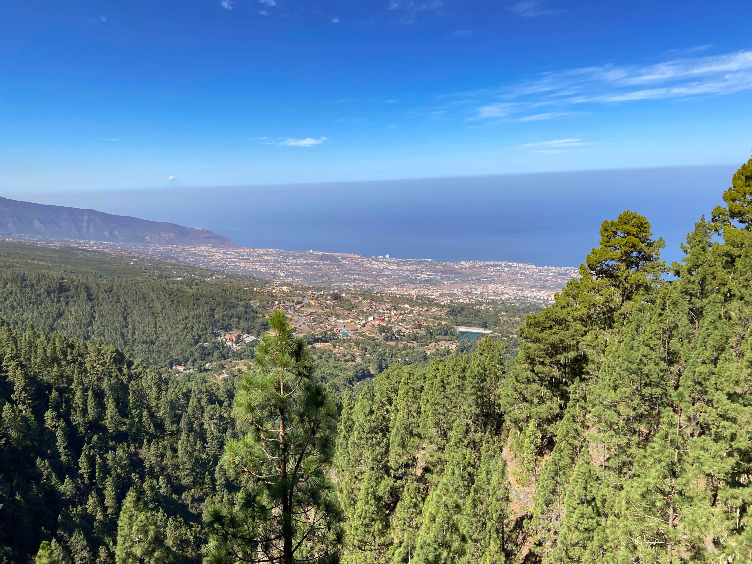
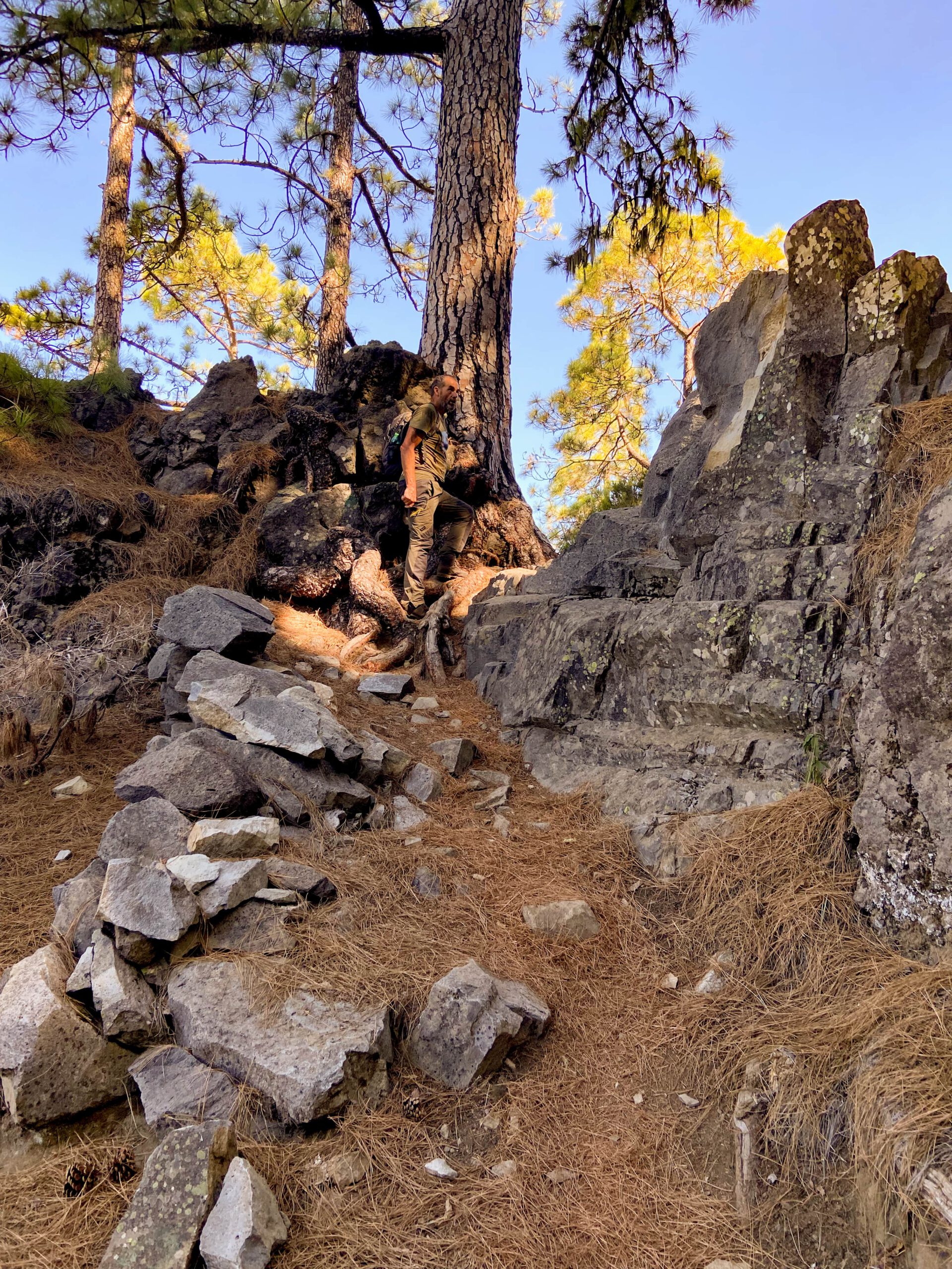
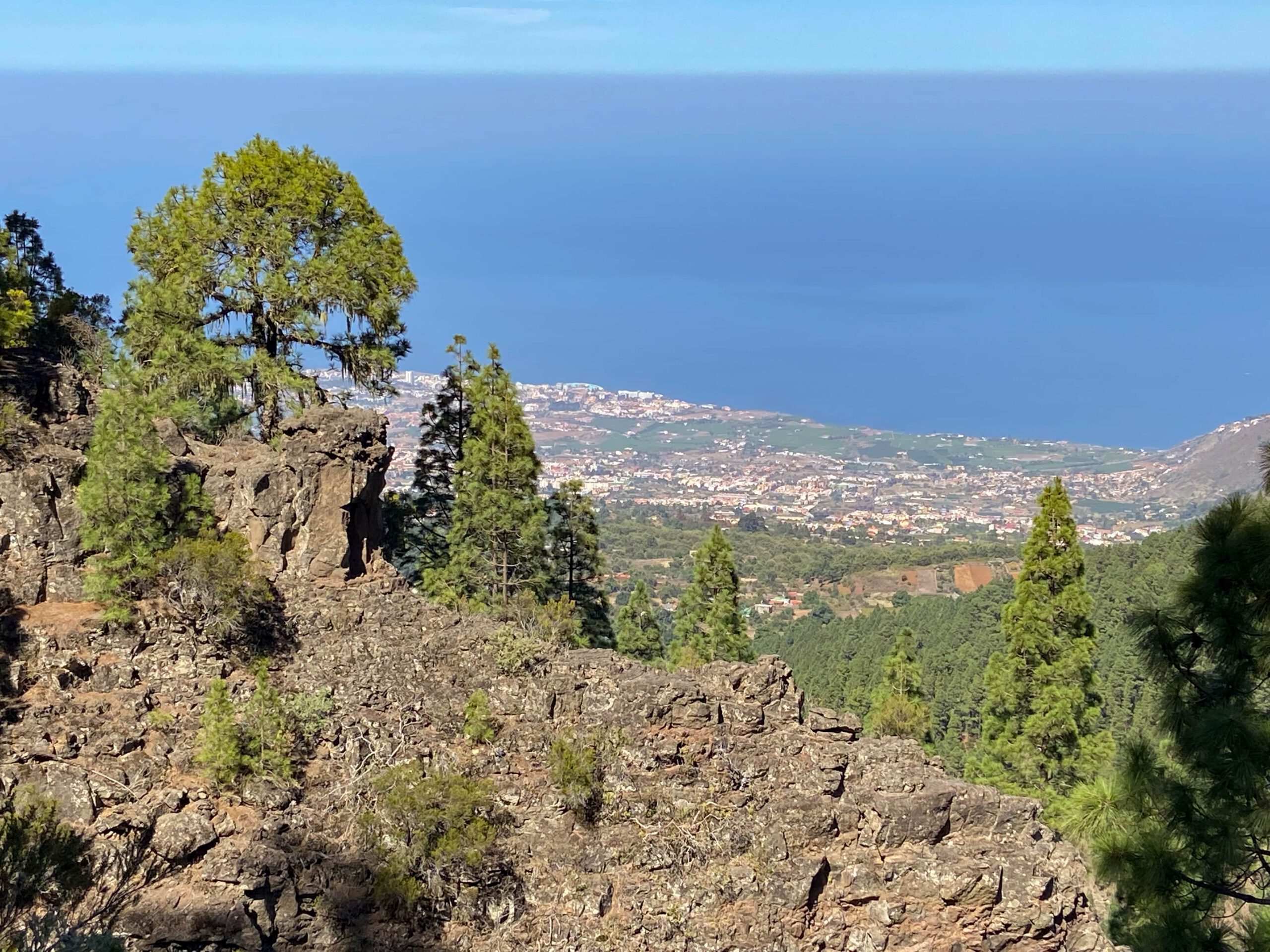
From now on, a narrow path (Camino El Topo marked in white and red) leads you very steeply uphill for a long time. Now you need your stamina. High above the Barranco de la Madre, you climb up the mountain ridge, mostly through the pine forest. Provided there are no clouds, you already have wonderful views back to Aguamansa, the Orotava valley and the coast, as well as of Mount Teide. The steep ascent finally ends at a small rock passage. And the path branches out. The GR 131 long-distance hiking trail continues straight ahead. However, you turn right onto the actual Organos High Trail, which really begins here.
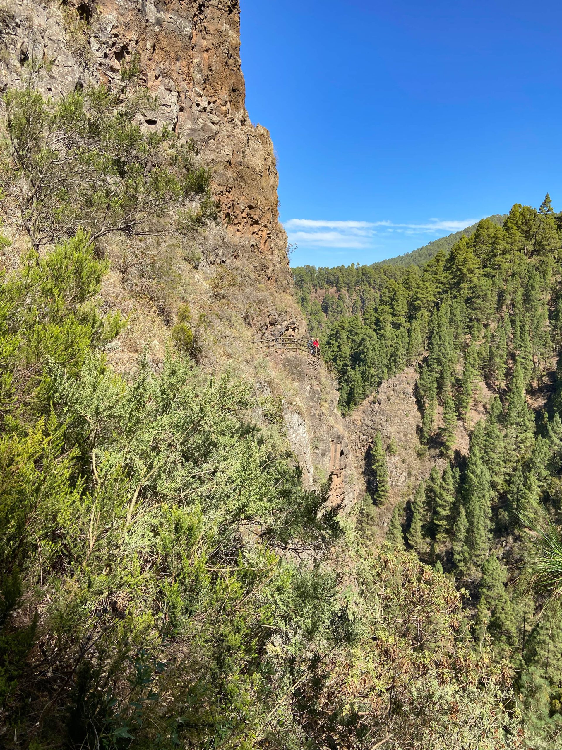
The trail leads you on a narrow path through the pine forest with magnificent views. You will hike along the Organos High Trail, which you will hopefully experience in sunshine and not, as is so often the case in the Orotava Valley, with many clouds. After a short time, you will pass the first viewpoint, the Mirador Dagi. Along the way, you will come across several beautiful viewpoints, ledges and miradors, which are also very suitable for a picnic. After some time at altitude, the path descends steeply and then slowly through the pine forest to just above the Barranco de la Madre. You finally cross it on the side of the slope.
Crossing Barranco de la Madre to La Caldera car park
After crossing the Barranco de la Madre, you continue uphill on the other side of the cliff on the narrow hiking trail. You hike along the slope and cross the Barranco Las Aguas. You hike what feels like several large loops on the Organos high trail. Shortly after Barranco Las Aguas, the hiking trail leads you around a large rock with wonderful views. The path is secured with railings here. The rest of the trail follows the mountain slope and goes up and down along the edge of the cliff.
After a while, you will pass a beautiful little viewing platform on the right-hand side, which is also suitable for a picnic in good weather and for spectacular views in any case. In this section you walk along the “Orgelpfeiffen” without being able to see them. Afterwards, the path slowly descends. Then you come to a junction and meet the Camino de Candelaria. Follow this steep path downhill to the right. You will cross a forest path and finally come back to the forest path you came from at Choza Pedro Gil. From here, turn left and return to the starting point of La Caldera in no time.
And finally
I hope you enjoyed this beautiful Organos High Trail. In my opinion, it is one of the most popular hikes on Tenerife. Since every hiker has different requirements, I try to present on Seven Islands both easy to moderately difficult hikes that every hiker can undertake and sometimes somewhat special hikes that are not suitable for everyone. But this hike should actually be doable for every hiking enthusiast with a bit of stamina. Wherever you walk, I wish you much joy on all your walks,
Dagmar von Siebeninseln