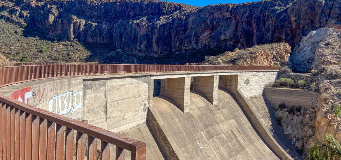
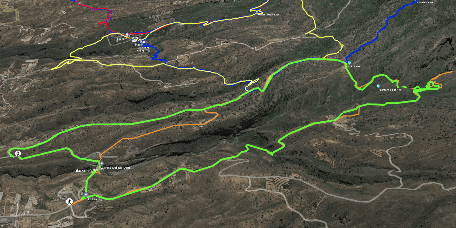
Presa del Río – the unused dam El Río
This beautiful circular walk through a wild landscape starts at the Presa del Río dam. The dam crosses the Barranco El Río. This enormous gorge descends from the Cañadas (in two separate gorges between the Guajara and the Roque de la Grieta) to the coast. In the upper part of the Barranco del Río I have already described a hike to a waterfall. Today’s hike starts lower above the small village of El Rio at about 500 metres altitude. You hike over the Presa del Río dam, the construction of which began at the beginning of the 20th century.
In the meantime, the investors changed and construction continued until the 1960s. However, the dam, which is about 54 metres high and 113 metres long, was never put into operation. The water was to be used for the surrounding villages, for agriculture and to fight forest fires. But the many cracks in the dam could not be sealed until today, despite immense sums of money that have been poured into it again and again.

The Presa del Río dam a well-known lost place and always good for a hike
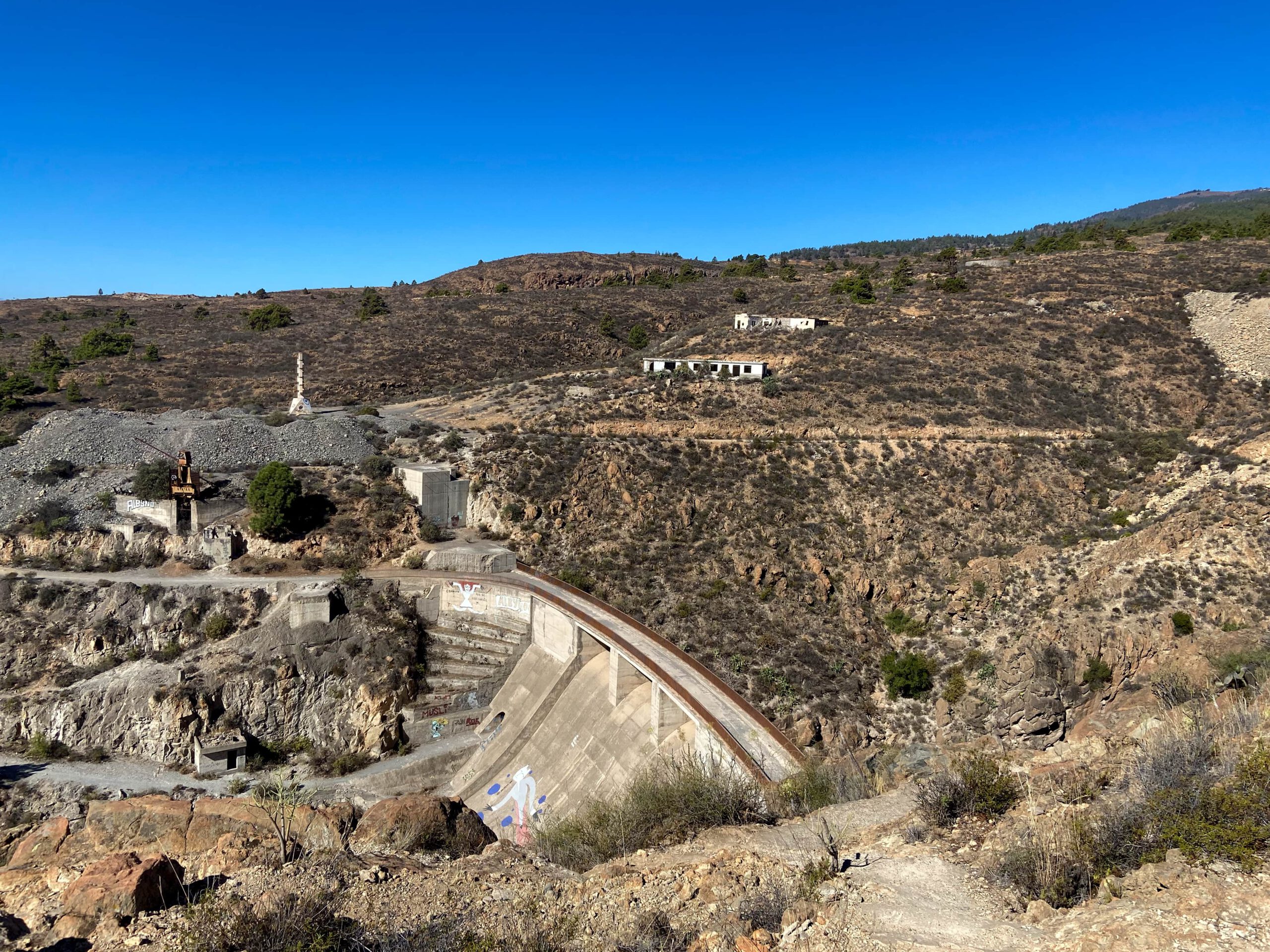
Even though the Presa del Río dam is not in use, it is one of the most famous lost places on Tenerife, along with the “ghost town” of Abades. Not only do you find graffiti, but you can even go inside the old building. But this well-known dam is only one part of the circular walk. You walk over the dam of the huge dam. Then you hike up one side of the Barranco del Río and then, after a small tunnel crossing, steeply downhill into the Barranco bed.

At the bottom of the Barranco you will find an old Galería (de Consuelo). There you can still see old machines and buildings. After walking for a while in the Barranco bed, a narrow path leads you back up the other side of the Barranco. Walk back to Presa del Río via the hiking trail that borders the Las Vegas hiking circuit.
General information about the Presa del Río round trip
Starting point and approach
I started this hike on a driveway below Presa del Río.
GPS: 28.149589, -16.532529
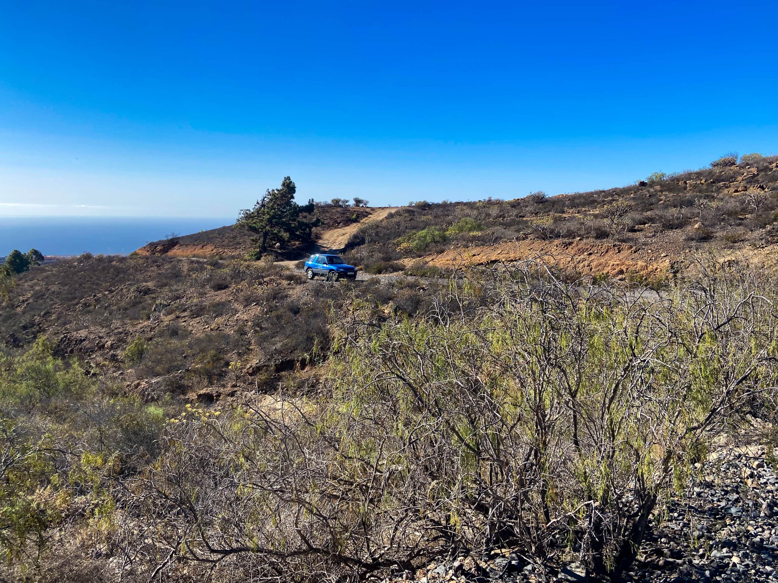
But you can only get there via the very bumpy road with an all-terrain vehicle. The track and the description start there. But it is easier for you to start the hike on the right side of the dam, as you can reach this point of the round trip better by car on a real small road.
Arrival by car
You come from the north or south via the TF-1 and exit at Chimiche No. 49. From there, follow the signs uphill to Chimiche. In the town you will meet the TF-28, which you follow around to the right in the direction of del Río. Just before the village and the Barranco del Río, you will find the road signposted to Presa del Río. I drove up there for quite a while and then started the hike.
GPS: 28.149373,-16.532283
It is easier to drive to the village of El Río and from there take the small road up to the dam. Parking is available both on the roadway and on the side of the road next to the dam.
GPS: 28.156154,-16.532666

Arrival by bus
The Titsa bus 430 stops at El Río. From there you would have to take a taxi or walk the 2-3 kilometres to a starting point of the walk. Details of the bus connections and more information can be found on the Titsa homepage.
Summary information about the article and a large selection of GPS hiking tracks are availableRegister now for my newsletter and get exclusive access to my collected GPS tracks as well as all short information about my articles.
Tiempo
I don’t like to give general times for hiking tours, as the times are very individual. I needed 4 hours for this hike with a long rest and a visit to the Galería. If you start the tour to the right of the dam, it should be a little shorter.

Altitude difference and route length
The difference in altitude is about 520 metres and the route is about 9 kilometres long.
Requirement
This hike runs in parts on good hiking or driving trails. But it also contains many small paths, some of which are difficult to find. I would walk it better with a GPS track. The path down the Barranco is very steep and also full of small stones, so you have to be careful not to slide. Therefore, surefootedness and a head for heights are essential for this tour. This is definitely not a hike for everyone and I would classify it as difficult.
Refreshment stops
Restaurants, bars and shops can only be found in El Río and not at all on the hiking route. Therefore, please take enough water and, if necessary, food with you for the round tour.
Variantes
You can start the round at different places as described above. To extend it, you can also climb further up the Barranco Bed. There are no limits to what you can do. If you get to the starting point of the waterfall hike in the Barranco del Río, please leave a comment. On the way back, the hike partly follows the Las Vegas round trip and can therefore be combined with this hike.
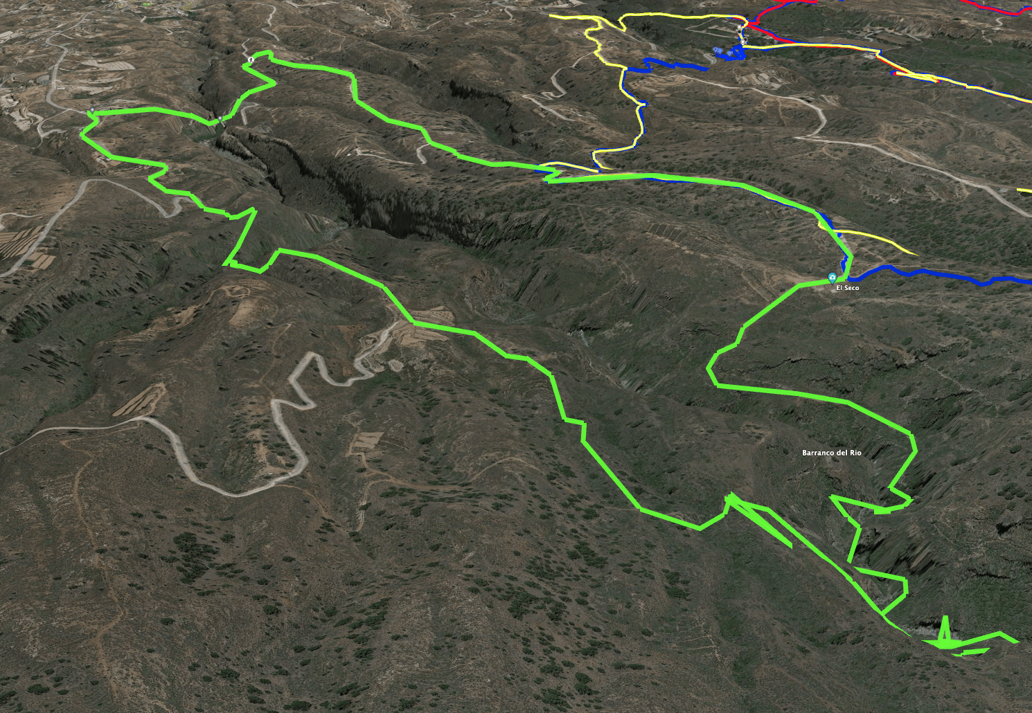
Round trip Presa del Río
Section of road below Presa del Río dam to junction of hiking trail from road
I started the hike on a driveway below the Presa del Río dam at a junction. The return route takes you back to the starting point via the junction. But first you hike about 300 metres uphill until you reach the Presa del Río dam. If you have plenty of time, you can also walk into the dam. Otherwise, the hiking trail over the dam takes you across the Barranco del Río. This way you can enjoy not only the structure, but also wonderful views of the coast and into the barranco.
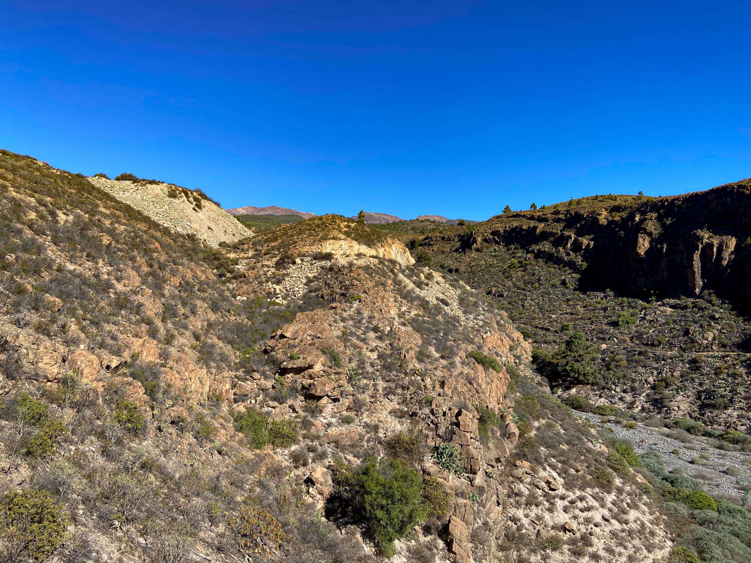
On the other side of the dam, a narrow path and steep steps lead you to the height above the Barranco del Río. From the top, follow a path away from the barranco towards a small road. This road leads down to the village of del Río on the right. So if you want to arrive by car and avoid a bumpy road, you should start your round trip here. The hike takes you uphill on the left side of the road. You stay on the road for a while – as long as it runs parallel to the barranco. At the first sharp bend to the right, leave the road and continue straight ahead on a small path.
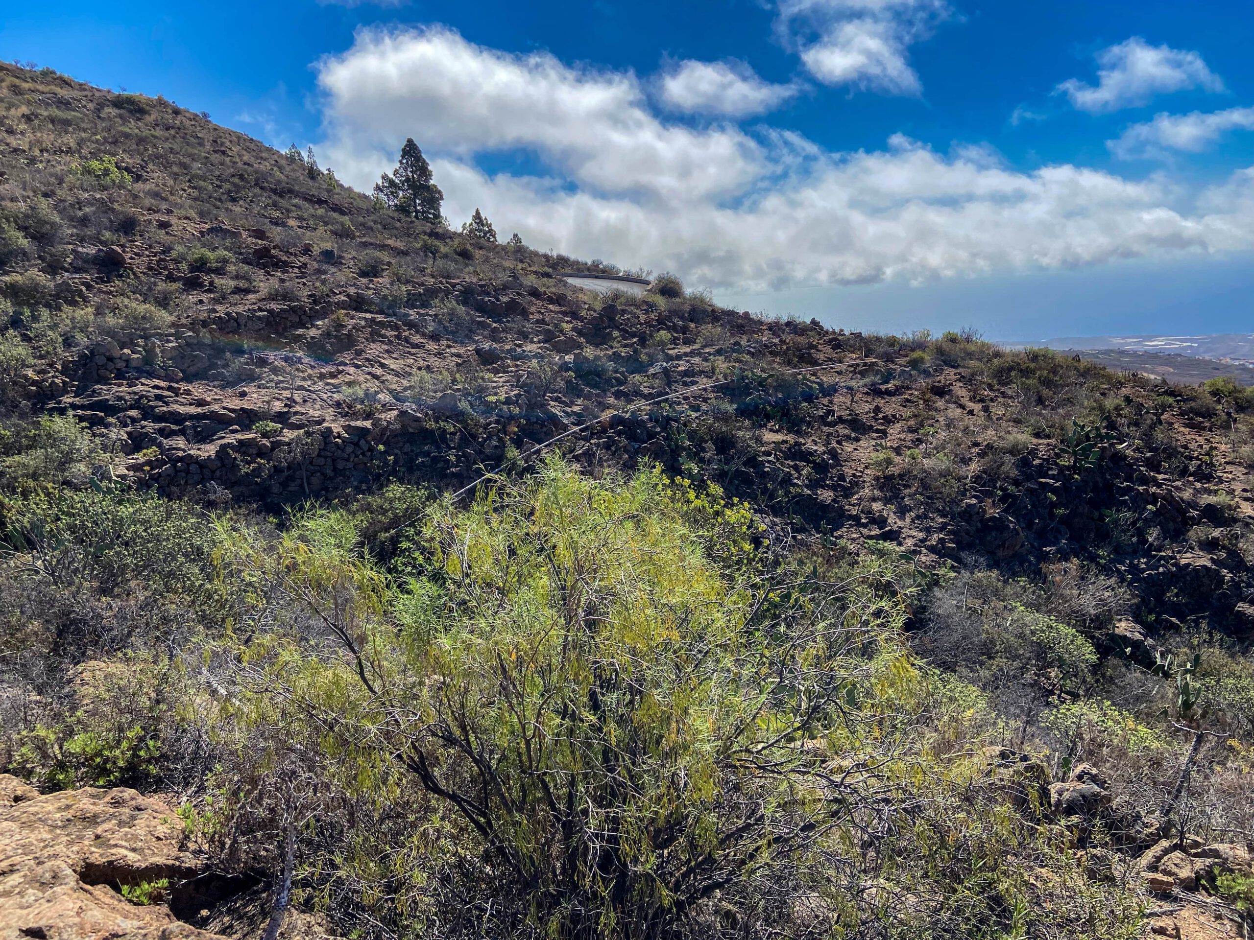
Route section branch hiking trail from the road to Finca
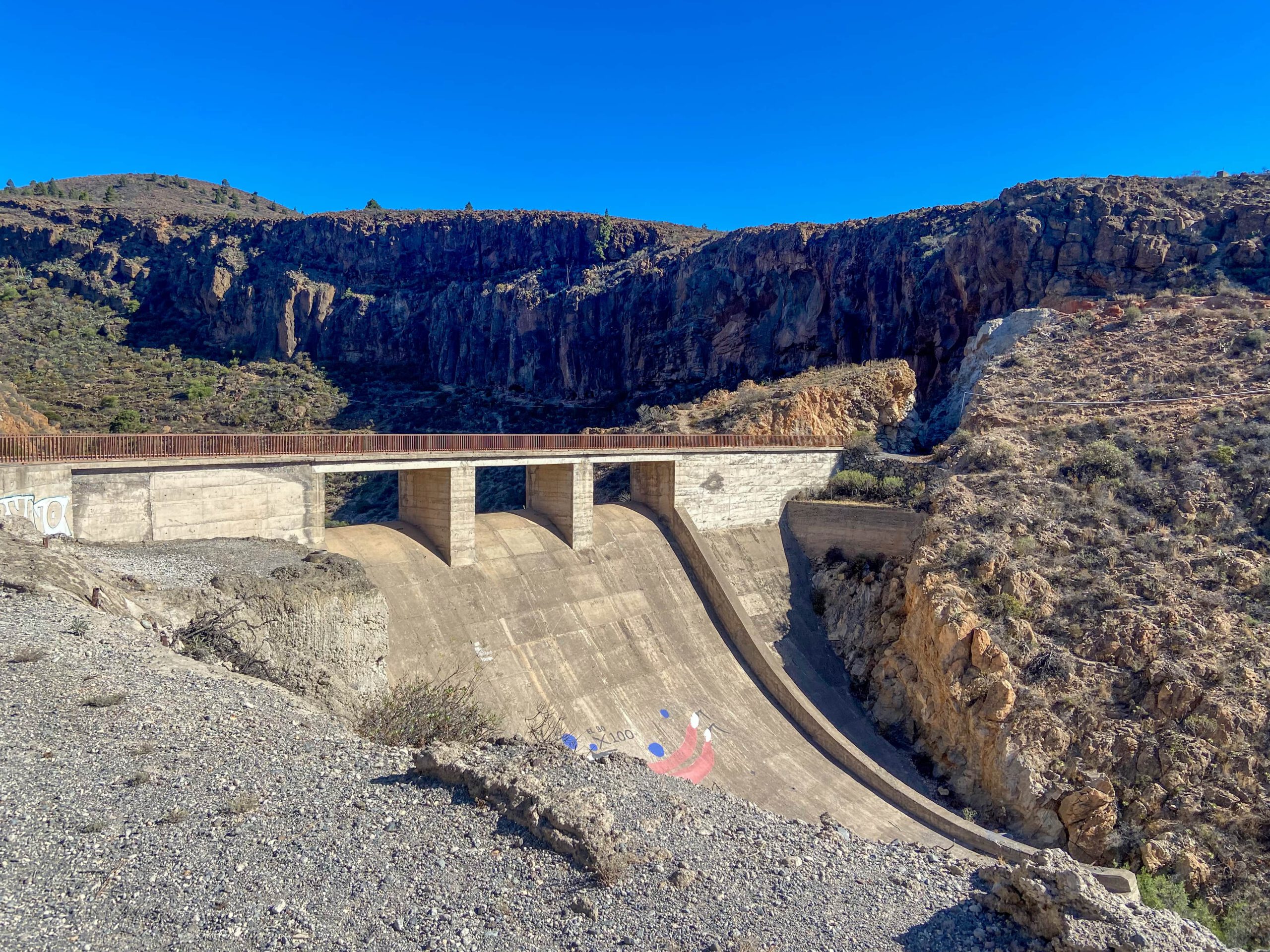
You walk on narrow paths through an impressive landscape. Every now and then you have to look closely to find your way. First you walk through two small side gorges. You reach a ridge. From here you walk along the ridge for a while before the path takes you down into another gorge. You cross the bottom on a narrow wall. On the other side, the path climbs steeply up the cliff.
When you reach the height on the other side of the gorge, you are again on a ridge. Here you can easily walk along the ridge. At the end, you will reach a kind of road that leads you past a finca and landscaped gardens on the left. In front of the house, the path leads down a water channel into a small valley. Follow this.

Finca section to tunnel passage
You cross the small valley below the finca and climb over the water channel. On the other side you go uphill for a short while. Then you are on a ridge again. On this ridge you walk straight ahead for a very long time, always parallel to the Barranco del Río. Paths or tracks are not always clearly visible. But since you are on the ridge and always have to walk straight uphill, you cannot miss the path.

Eventually, the ridge path rejoins a real dirt track. Follow it around to the left. But after only a few metres, the wide path turns into a narrow one. This leads you down into a small valley. There you will see a kind of large tunnel. You have to cross it. I myself first went further up the tunnel on a small path to enjoy a good view into the barranco.
Section of tunnel to Barranco El Río Grund
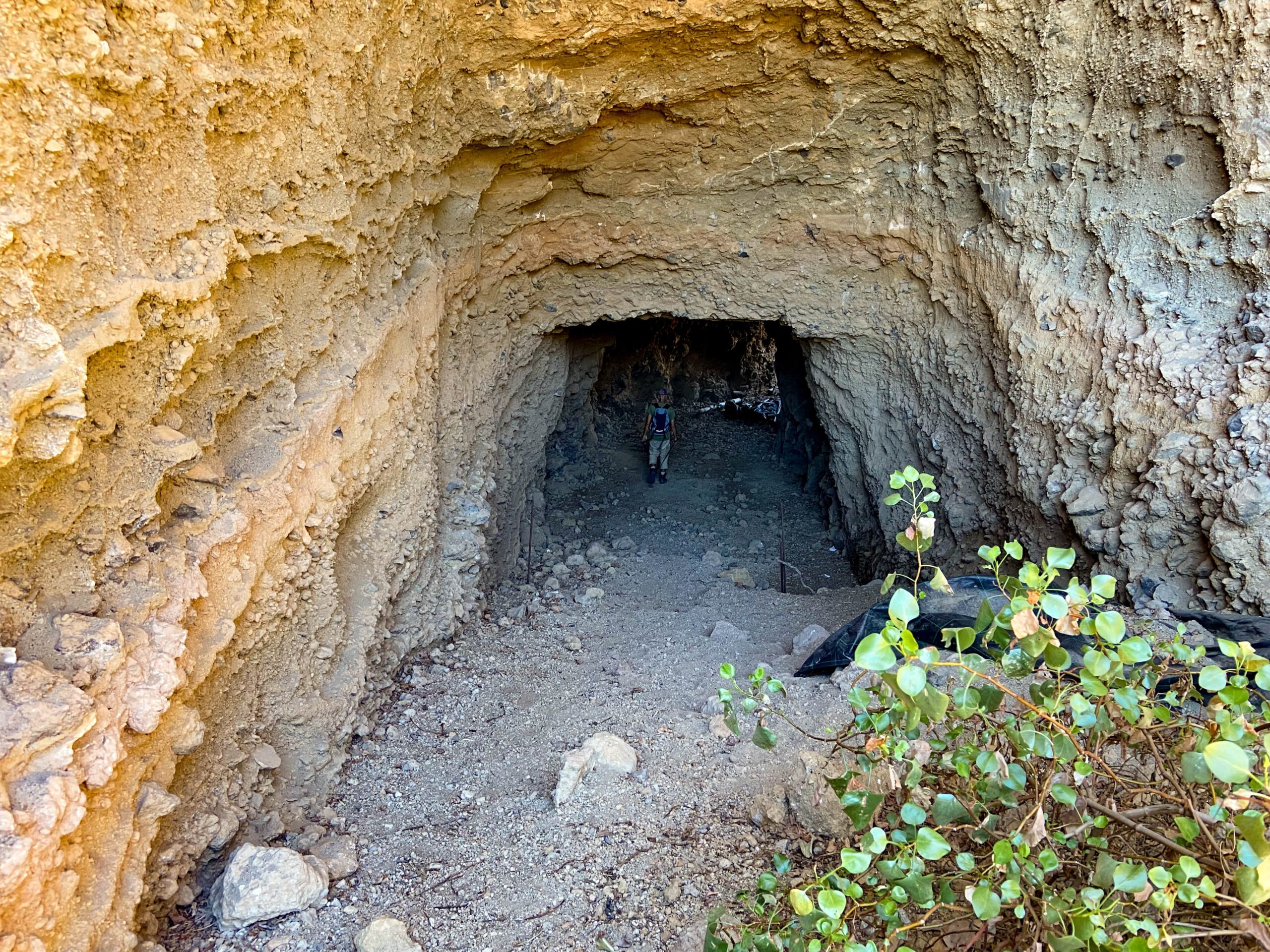
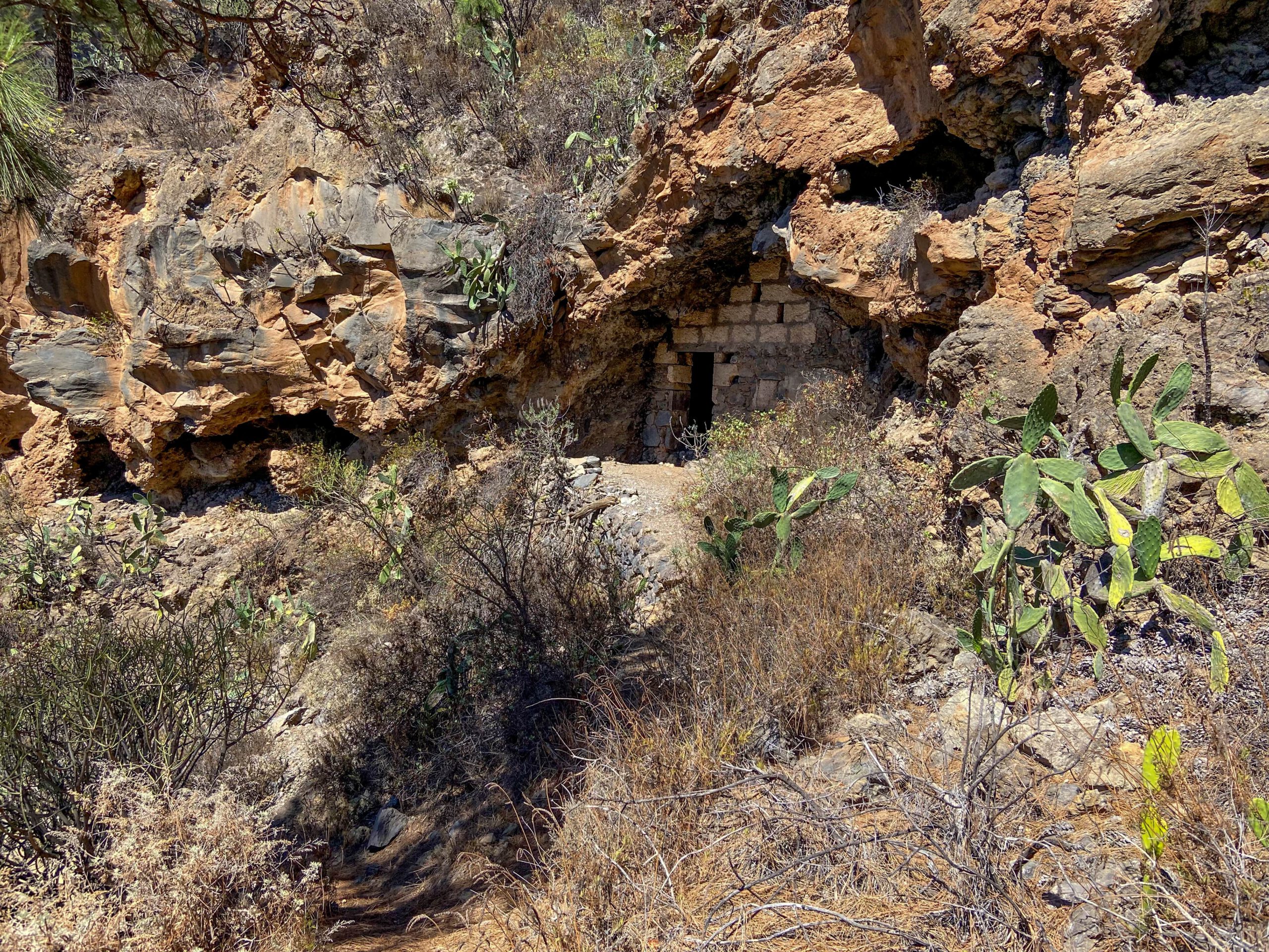
You can also go up there. The view into the deep barranco is really worth it. But from up there you can’t get to the descent path. You have to cross the small tunnel. Behind the tunnel, the unmissable descent path begins, which at first takes you easily down the long side of the slope. Then the path turns to the left and steep serpentines follow. You are already walking past brick caves that probably belong to the Galería.
Summary information about the article and a large selection of GPS hiking tracks are availableRegister now for my newsletter and get exclusive access to my collected GPS tracks as well as all short information about my articles.
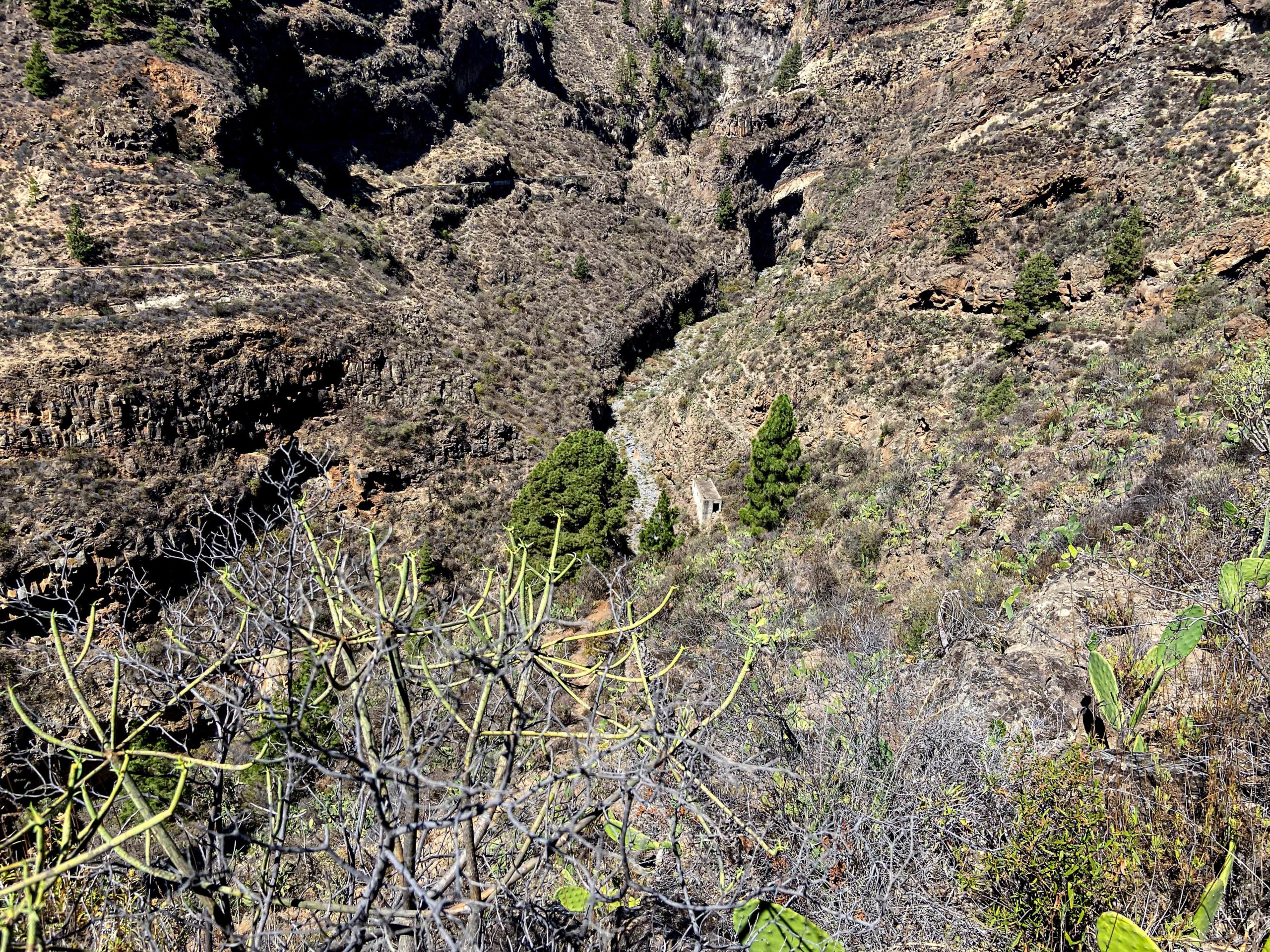
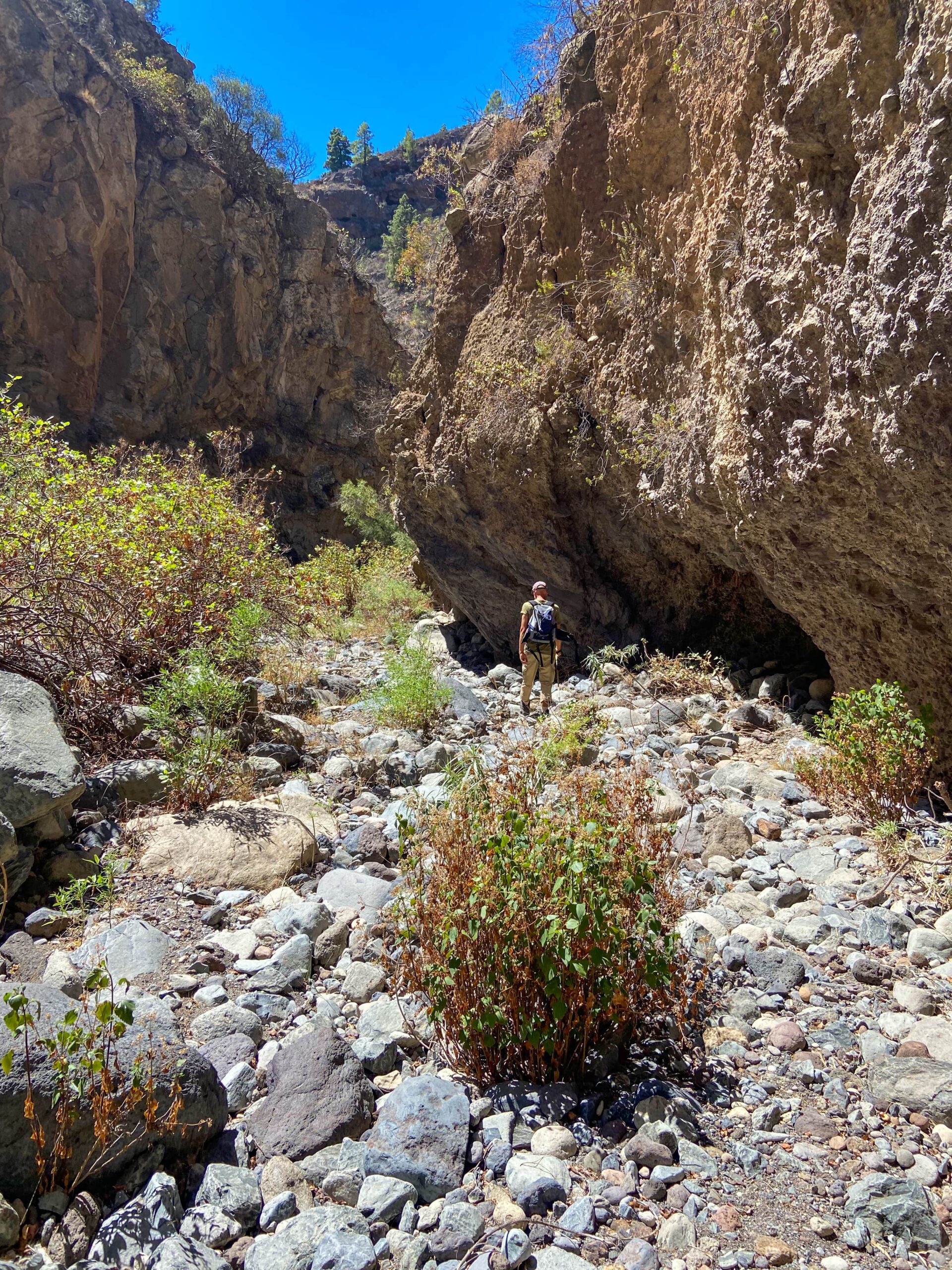
Deep below you, you can see the Barranco Grund with a grey house. But due to the steep serpentines you quickly lose height and reach the grey house first. Inside there are still old machines that were used to extract water. Continue and you will soon reach the bottom of the barranco. The gorge is quite narrow here and the high rock walls around you are all the more impressive.
Barranco del Río ground to ascent trail section
If you want to extend the tour, you are free to walk further up the Barranco. I have seen that some hikers have already walked along there. However, I cannot say whether you can walk the whole barranco to the starting point of the waterfall hike (Barranco El Río). If any of you do it, please let me know. Otherwise, the circular walk takes you down the Barranco from here. You walk for a short time in the middle of the barranco bed.

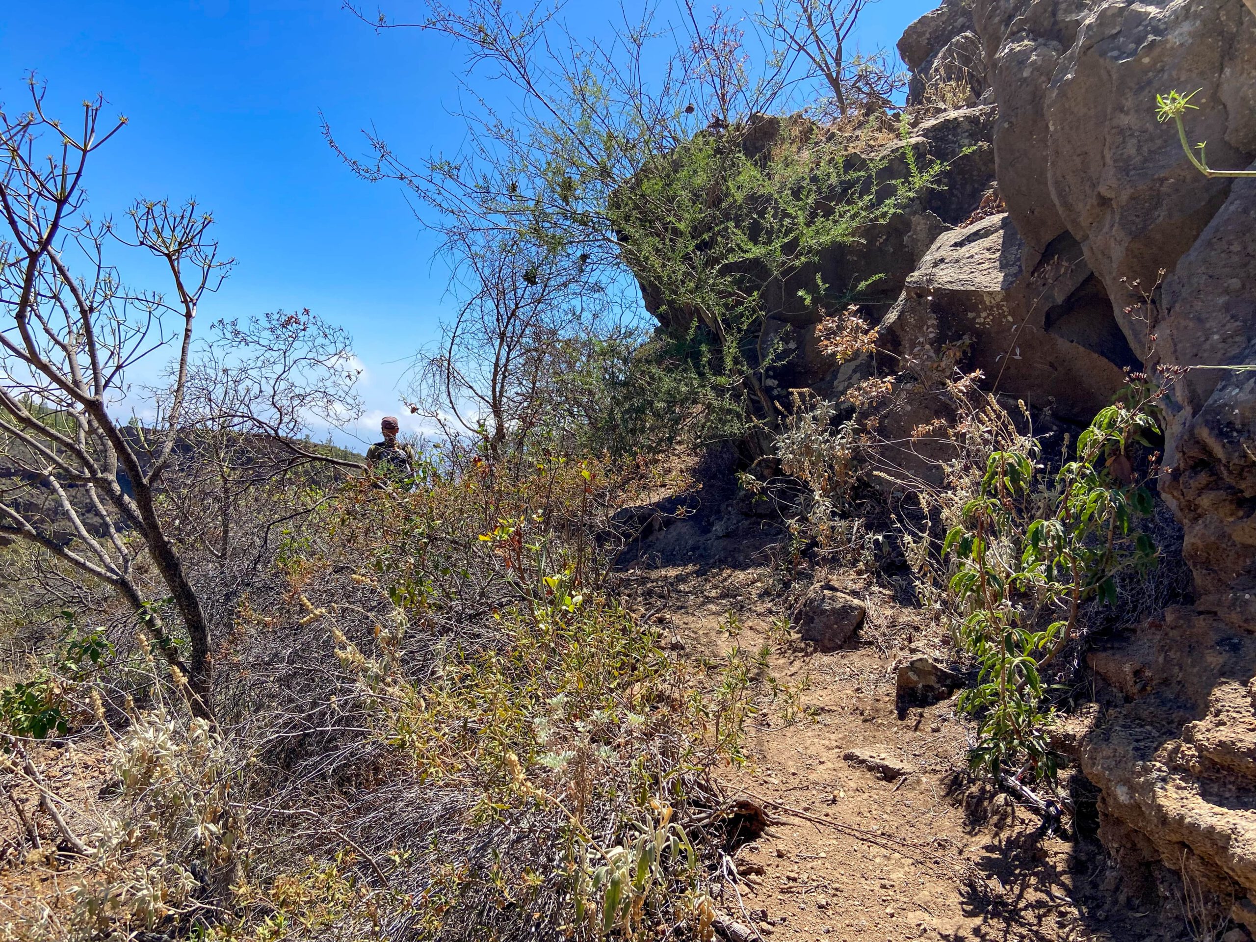
You will come to a place with a pipe that crosses the Barranco. Go through it at the bottom. Shortly afterwards you will find a path on the right side of the gorge that goes steeply uphill. Follow this path. It is partly perfectly good. Then it is overgrown or difficult to find. But you can’t lose it completely, as there are also cairns to help you find your way. Maybe you can use a good app, such as mapy.cz, where even the smallest paths are well marked.
Section ascent trail to starting point car park
The ascent is quite steep in parts, but also offers impressive views back into the barranco. Once you have reached the top, you will pass a finca and cross its forecourt. Then the path joins a hiking trail. This is the path of the Las Vegas hiking circuit. Follow the path downhill to the left. After a short while, you will pass the signposts and the junction for the small Las Vegas circuit. You walk downhill for quite a while on the Las Vegas circuit trail.
Finally you come to a junction where Las Vegas is signposted on the right. However, you hike straight ahead. Now you can already see Presa del Río below you. You will soon come to another fork. If you follow my circular route, you simply continue straight ahead along the road. However, if you parked to the right of the dam, go down to the left here. After a short while, the path will take you to Presa del Río.

To get to my round tour and the starting point, you only have to follow the road straight ahead. At the end, this road joins the road right at the starting point.

And finally
II hope that you also enjoy this round, which I personally liked very much. In terms of kilometres, it is not even very long. But it offers a lot of variety – dam, lonely paths, a deep gorge with a Galería. What more could we wish for as hikers on Tenerife? Have fun on all your hikes,
Dagmar from Siebeninseln