Vilaflor – highest mountain village of the Canary Islands
The mountain resort Vilaflor is not only known for the Paisaje Lunar, which starts from there as a very popular circular hike. Vilaflor, with its 1.420 m altitude, is also the highest place of the whole island and even of the Canary Islands. The air is clean and dry.
Therefore, Vilaflor is a helpful supportive place to stay, especially for asthma and lung diseases. Almost 2000 inhabitants live there. The inhabitants live from tourism, bottled water from mineral springs, agriculture, viticulture and of course their handicrafts.
Worth seeing is the entire historical city centre with its beautiful old houses and small alleys. If you want to do this hike from Ifonche to Vilaflor or the Paisaje Lunar, you should definitely combine it with a visit to the historic old town. Since I wanted to do a circular walk, we returned to Ifonche shortly before Vilaflor on another way. If you have time, you can walk from this point to Vilaflor in about 30 minutes. The centre of the historic city centre is the church square with the church San Pedro from the 17th century, which is built in Canarian style.

Circular walk between Ifonche and Vilaflor on the GR 131
You start this hike in Ifonche at the restaurant El Dornajo. Here is a real hiking junction. For more hiking tours, please check out the variations. On this hike you hike on the famous GR 131, which connects the south of Tenerife with the north. The ascent is somewhat difficult from time to time, but leads you on very well laid out hiking trails through pine forest and past lonely farms and fruit and wine growing areas. If you like, you can make a detour to Vilaflor and perhaps return by bus.

However, the circular walk will take you back to Ifonche on another – somewhat shorter – route. Here it goes first on driving ways and later on narrow ways downhill by fields and pine forest. The last part of the descent is a bit confusing and the path is not always clearly visible. The orientation at the stone men will help you to find the way to Ifonche. To be on the safe side you can also download my track.
General information about the circular walk Ifonche – Vilaflor
Starting point and approach
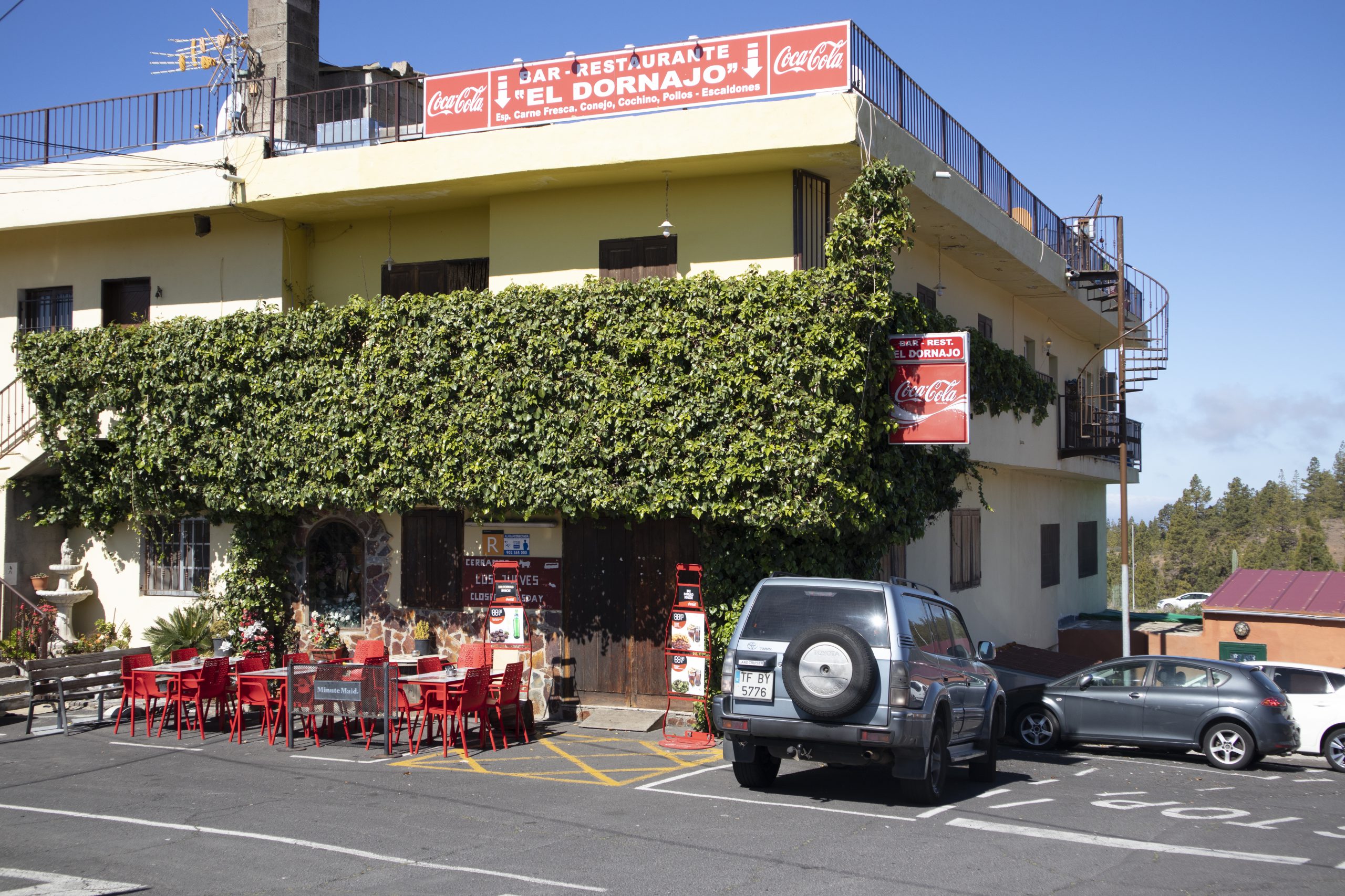
The starting point of the big circular hike is the restaurant El Dornajo in Ifonche at an altitude of 1030 metres.
Arrival by car
You leave the TF-1 motorway in the south at the Arona exit. On the TF-51, continue through Arona in the direction of Vilaflor. At La Escalona turn left/straight onto the TF-567. Continue straight on until the (almost) end of the road. There you stand in front of the restaurant El Dornajo. From the north, take the TF-51 via Vilaflor to La Escalona. There are plenty of parking spaces in front of the restaurant and on the street.
Arrival by bus
From Adeje there is the Titsa bus line 342 to El Portillo. This bus also stops in Ifonche and Vilaflor. Therefore you can only walk one part of the way and take the bus back. Details can be found on the Titsa homepage.
Time
I don’t like to give general time information for hiking tours, because the times are very individual. For this hike we needed more than 5.5 hours with extensive breaks and photo stops.

Difference in altitude and distance
The difference in altitude is about 600 meters, but with up and down about 900 meters. The distance is scarcely 17 kilometers long. If you walk to Vilaflor in the village, it is 20 kilometres.
Requirement
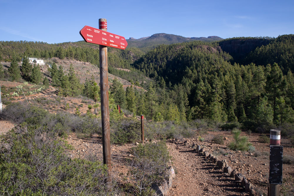
For the ascent with approx. 900 m altitude you need stamina. The paths are very well preserved, fortified and excellent on the outward route, as it is the well-known GR 131 long-distance hiking trail. If you want to do the round trip, you might have difficulties finding your way on the way back. But since the direction is clear and there are little stone figures everywhere, the way back should also be feasible “off the beaten track”.
Refreshment
Restaurants, bars and shops are only available in Ifonche and Vilaflor. Therefore take enough water and food with you.
Variants
This tour can be combined well with various other hiking and circular walks in the vicinity. To mention are the famous Paisaje Lunar, round tour around the Roque Imoque and into the Barranco del Rey and my big round tour above Ifonche. More tours in this region will follow.
If the big tour is too exhausting for you, you can go only one way (up or down) and take the bus back to the starting point. And those who don’t think much of the way back, which is a little off the beaten track, can of course also return to Ifonche on the GR 131.

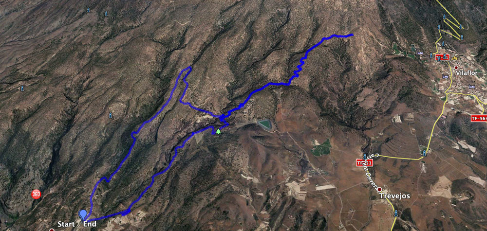
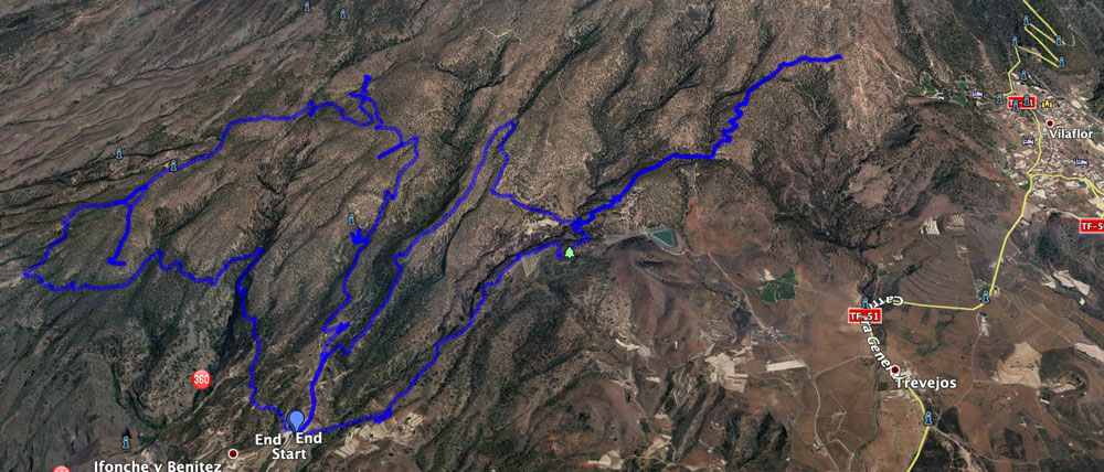
Large circular hike from Ifonche to Vilaflor
El Dornajo Restaurant section to Barranco Seco mountain ridge
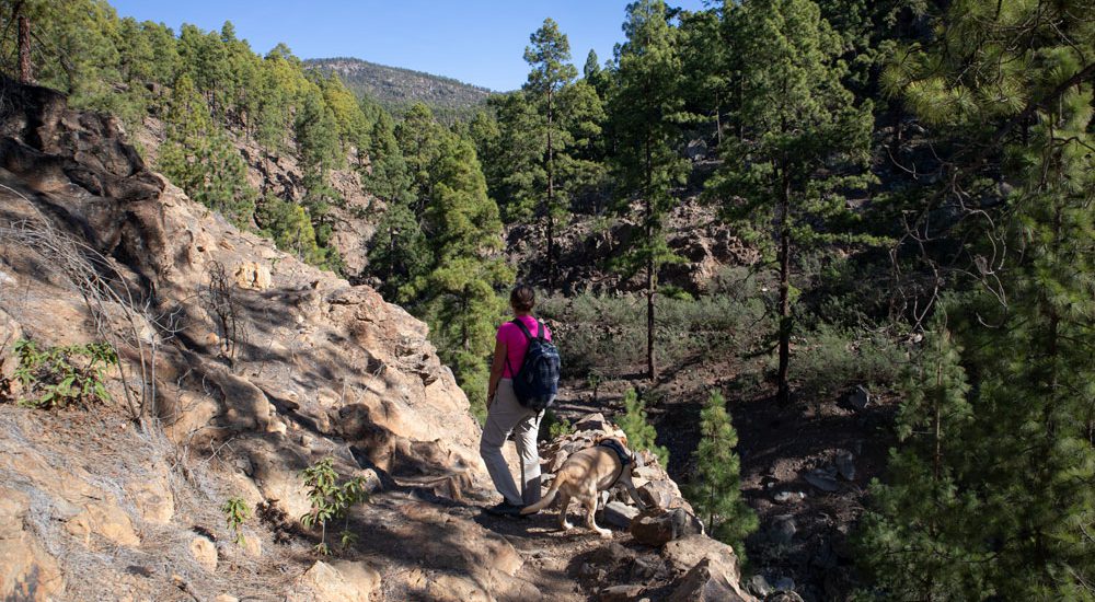
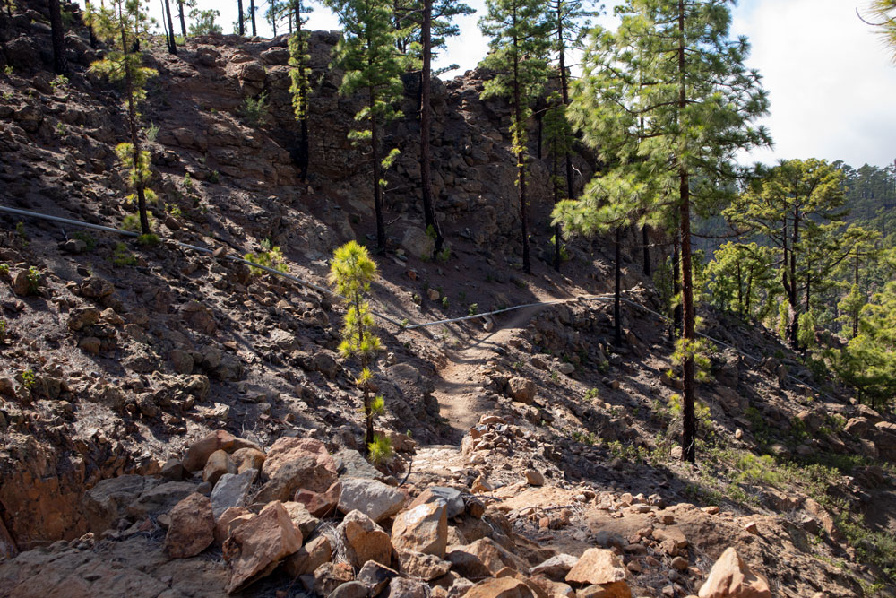
You start your hike in front of the restaurant El Dornajo in Ifonche. There you will find a signposted hiking trail, which starts next to the hiking board in the direction of Vilaflor (GR131). Follow this initially wide path through fields and uphill past two buildings. After a short time, the GR 131 hiking trail branches off to the right of the road. It first takes you downhill on a small path to the right towards Vilaflor. After a short while you reach the bottom of the small gorge, which you cross.

Now, on the opposite side, you climb steeply up the mountain. You are at the end of a ridge between two big gorges. To your right is the Barranco Seco (Dry Gorge). However, several gorges on Tenerife bear this name. Here you already have a good view of the coast below you, the Roque Imoque and the other mountains around Ifonche.
Route section ridge Barranco Seco to small settlement
On this mountain ridge you now hike straight uphill for a very long time. You can’t miss the ridge path. After some time the path leads a little downhill on the left side of the slope, to bring you back to the ridge shortly afterwards. Then you hike up the ridge again for a very long time. After some time the trail turns to the right side of the slope and takes you down to Barranco Seco. On the other side of the slope, after you have crossed the bottom, it goes up again.

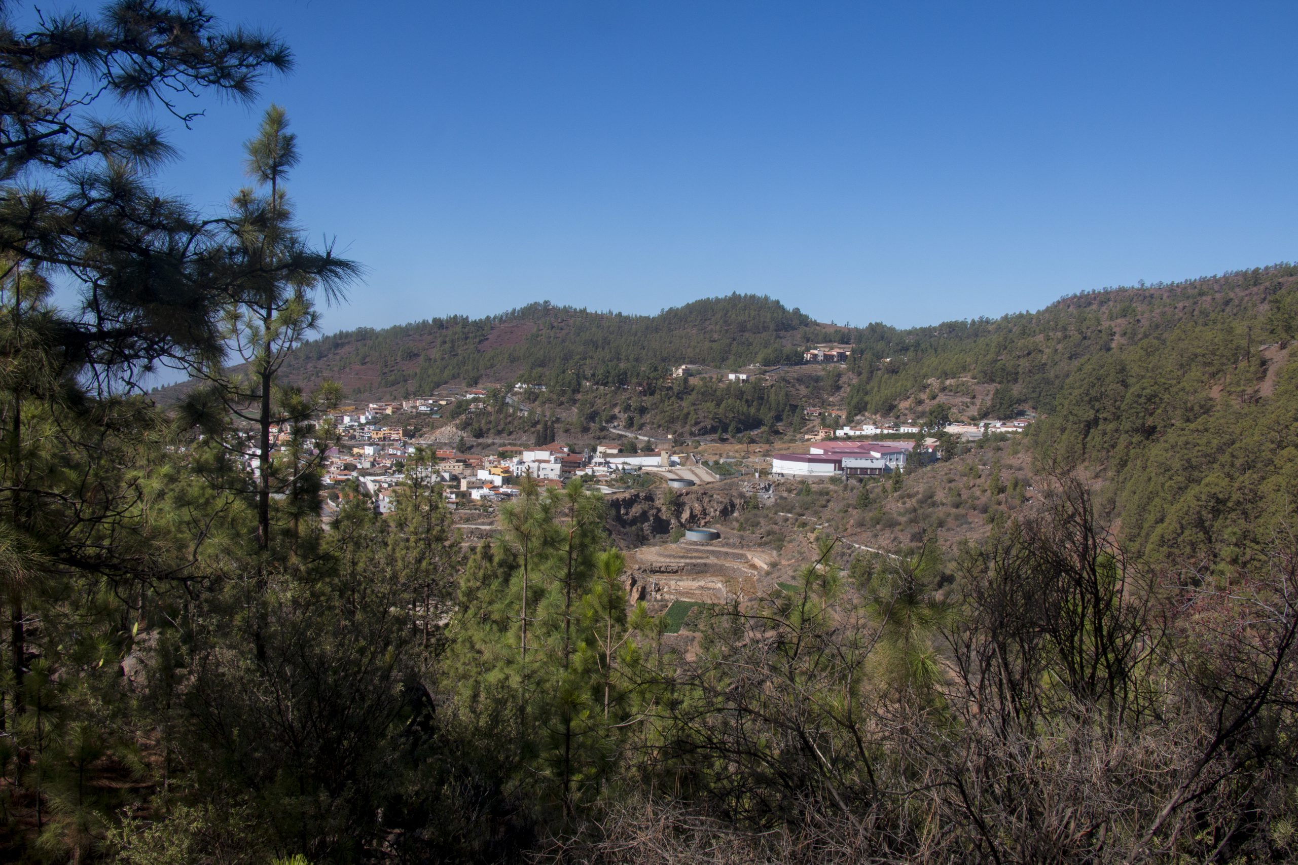
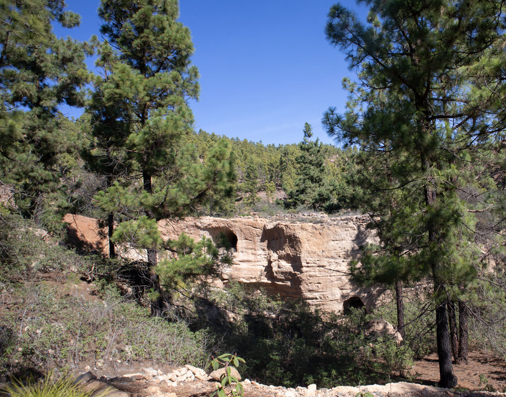
The trail takes you up to the opposite ridge at Barranco Seco. For a while you walk parallel to Barranco Seco. When you reach the ridge, cross it. You now hike down the slope into a more open landscape. In front of you are fields, terraced gardens and some farmsteads. You cross a depression and then walk past the lonely farmsteads, terrace fields and also some white sandstone caves. The trail is well laid out and offers beautiful views of the southern island of Tenerife.
Section small settlement to Salto de las Corujas
After you have passed the lonely settlement, you hike down to the small Barranco Las Goteras. Cross it at the bottom on a bridge (Puente de Guayero). On the other side you ascend through pine forest. Soon you’ll come to a fork. Straight ahead will be the way back later. But now you keep to the left uphill. You hike steeply uphill, cross a small depression and reach a ridge again. Follow this ridge.
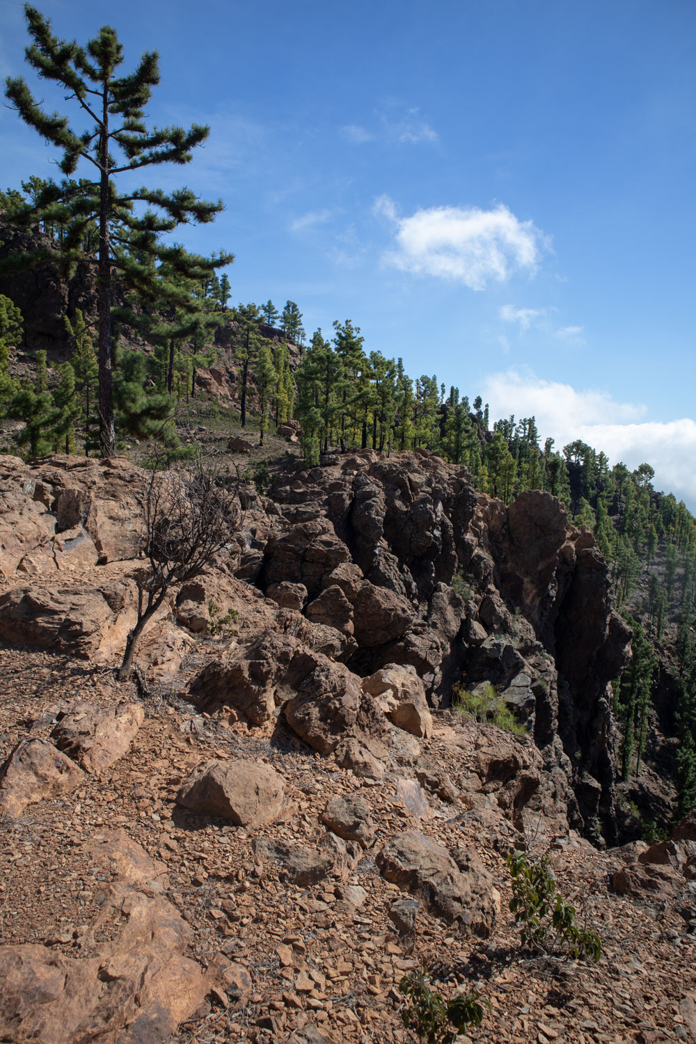
Then the path again runs along terraced fields, which you pass on the left side. Then it goes further up and you follow the hiking trail on the left side of the slope. After some time the path leads into a road in the middle of the pine forest. For a short time you follow the road. Then the trail branches off to the left at a water distributor. Now it goes up again in steep serpentines to another mountain ridge. Some of the paths here have been slightly ridden out by mountain bikers and are difficult to walk on. Finally you get to a wonderful view point at a cliff (Salto de las Corujas).

Section Salto de las Corujas to vine field
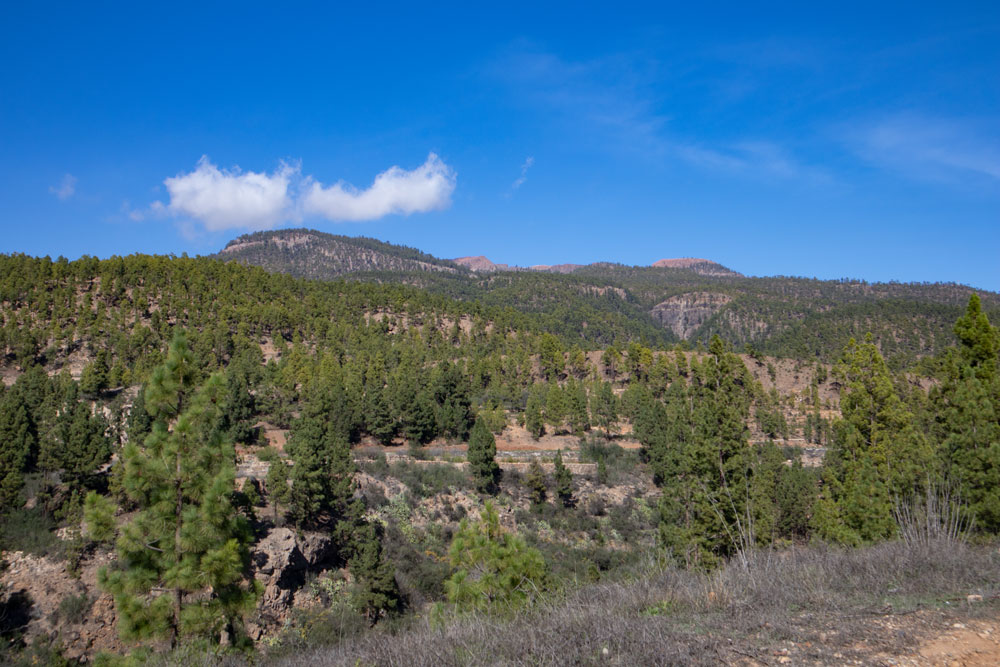
At the edge of Salto de las Corujas you have a wonderful view, which reaches in clear weather up to the island El Hierro. You cross a small Barranco and then follow the trail uphill. Once you have reached the hill, you will find yourself at about 1600 metres above sea level. Vilaflor is now hidden behind a hill below you at 1420 metres above sea level. You will be there in less than half an hour. This option is ideal if you want to go back by bus, for example.
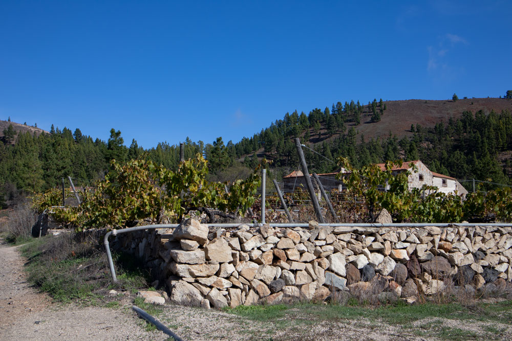
We have turned around on the hill to return to Ifonche in a kind of small circular walk. You follow the same path via Salto de las Corujas back to the fork in the road. On the right you come back to Ifonche. Now go around to the left. The small path runs along the hillside through the pine forest. It ends on a wide road. Follow this road downhill for a long time. It takes you past individual farms, fields until you finally pass a large field with vines on your left.
Section vine field to Ifonche
After the vineyard the road now makes a sharp turn and leads down into the Barranco del Rey. However, you continue on the path that branches off to the left behind the field. This path also leads along fields. You go down on the ridge high above the Barranco del Rey. At first it is still a clear path, which also leads past an abandoned house on the left. Shortly after this house the clear path ends. Now you have to look for the further path a little. It is marked with stone men.
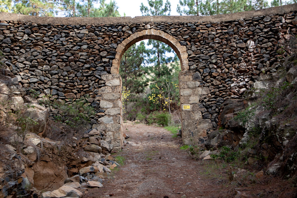
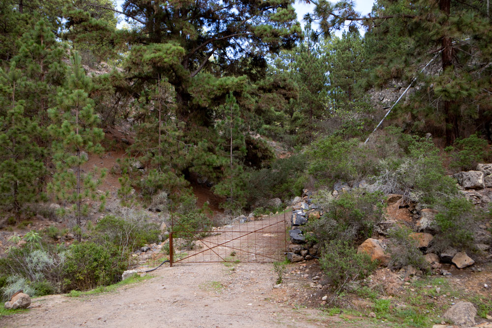
If you look closely or better still use a GPS track, this is easily possible because you are on a mountain ridge and there is only one direction down between the gorges. Later you will see the road to Ifonche and houses below you. The road is a bit difficult and oily from time to time. It ends at a driveway. Here we first went left. But you just have to follow the road to the right downhill. It leads you through a stone gate. And then you stand again on the road TF-567 to Ifonche. You follow the road to the right and after a short time you are back at the starting point of the restaurant El Dornajo.
And finally
I hope you enjoyed this walk from Ifonche to Vilaflor. It is very varied, so there should be something for everyone. I wish you good and safe hiking on all trails,
Dagmar von SiebenInseln
Did it today. I was planning a full route, but I was caught in a downpour under Vilaflor. I had to return by bus. Keep in mind that from stop 482 bus line to the El Dornajo restaurant it is approximately 3.5 km distance on car road. If not a rain I would rather return by suggested track.
Thanks for sharing! In general for the statistic, route from Infonche to Titsa Vilaflor centro (8362) took 02:29h 10.9 km