- La Culata – Two small or one big hiking circuit
- General information about the La Culata hike
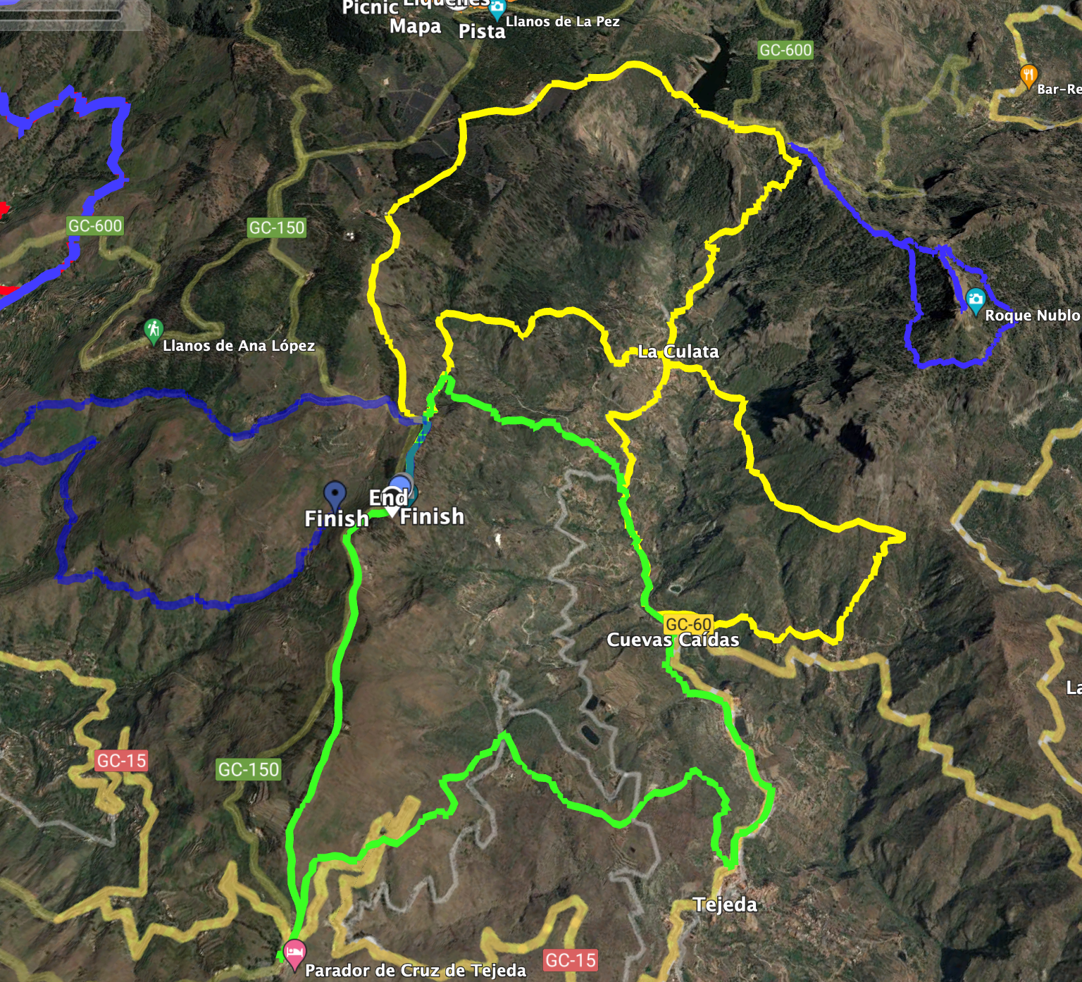
- Circular Hike La Culata
- Section from Mirador Degollada de Becerra to the hiking junction near Llanos de la Pez
- Section from the hiking junction near Llanos de la Pez to La Culata
- Section from La Culata to near Cruz de Timagada
- Section from near Cruz de Timagada to La Culata
- Section from La Culata to the starting point Mirador Degollada de Becerra
- And finally
La Culata – Two small or one big hiking circuit
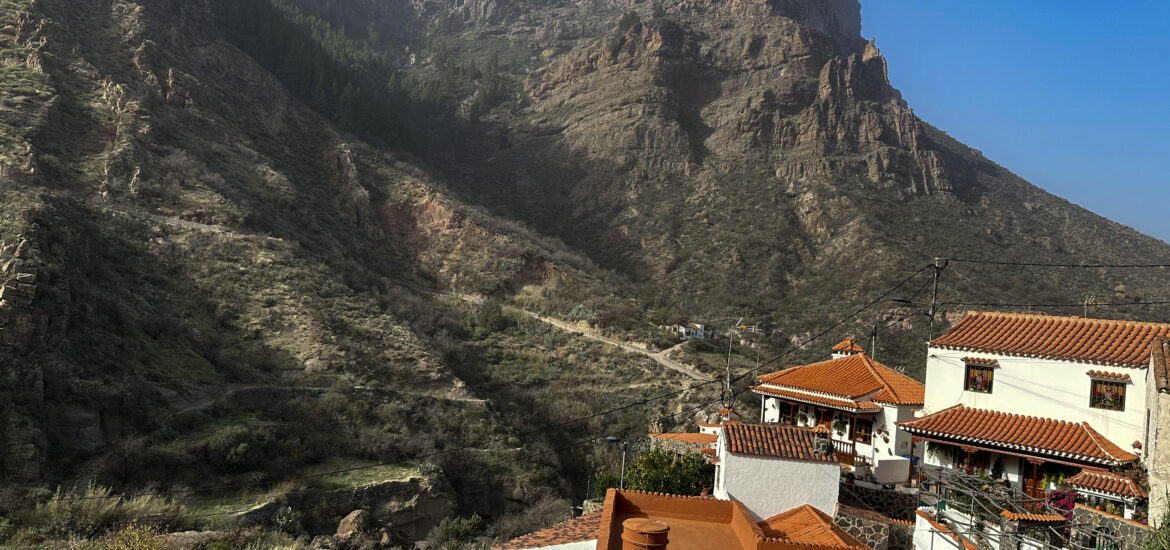
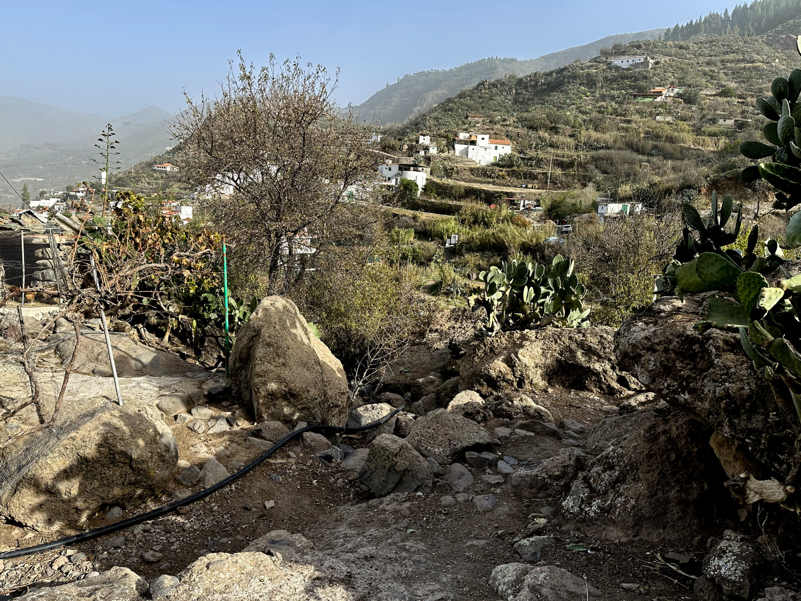
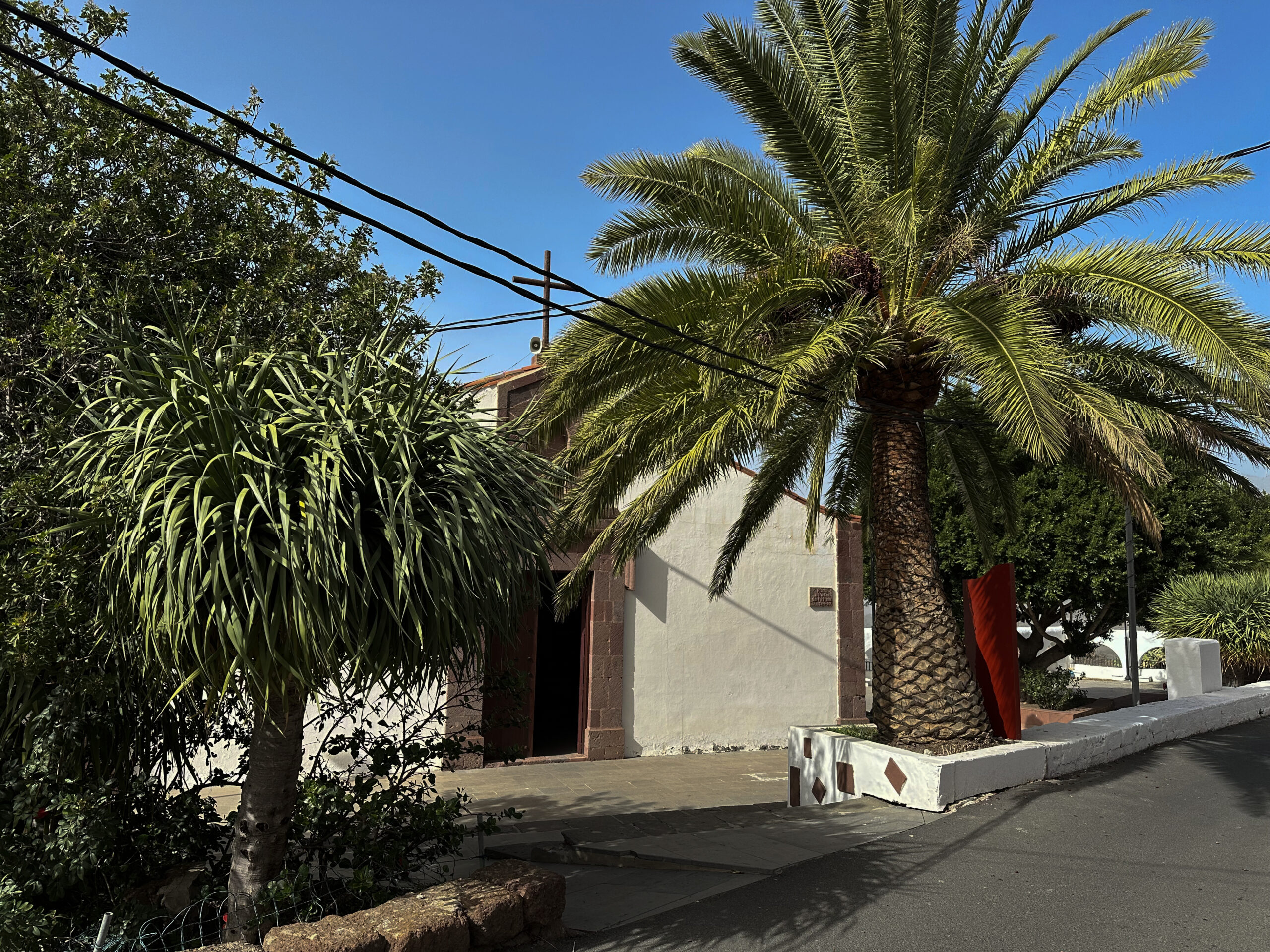
The small village of La Culata is located at approximately 1200 meters above sea level in the center of the island of Gran Canaria and belongs to the municipality of Tejeda. In the village itself, there are still many traditionally built Canarian houses. These were built on a large protruding rock plateau, which also bears the name La Culata. From the upper edge of the ravine, there is a lovely view of the little houses and the terraced fields amidst the hills. In the village itself, there are many horses, mules, and donkeys. And every year, a particularly large livestock market is held in La Culata, attracting many locals and tourists alike.
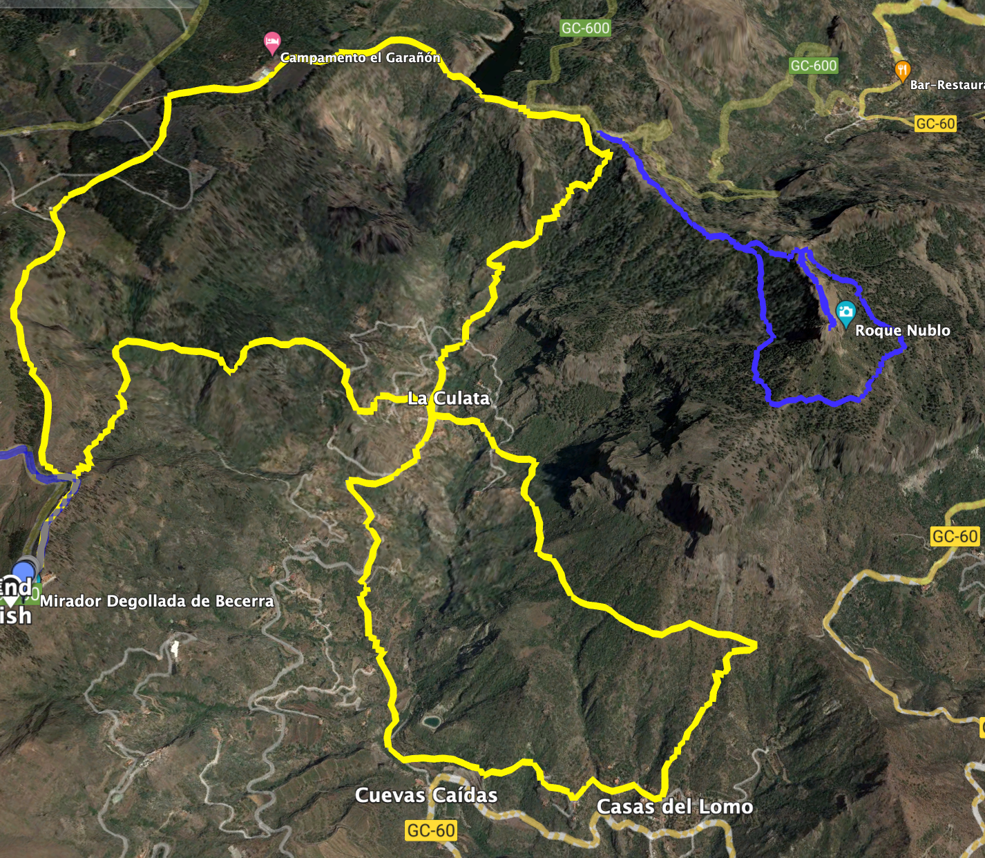
In the described hike, La Culata is situated at the center of the hiking circuit. We hiked in a figure-eight shape. The starting point is the Mirador Degollada de Becerra. From there, you traverse in a large arc under the Roque Nublo and past the reservoir Presa de los Hornos down to La Culata. After hiking through La Culata, you can embark on a second large circuit below La Culata (to complete the figure-eight). Alternatively, you can ascend again. Thus, in this description, you have either a big hike or two small hikes that you can alternatively take from the Mirador Degollada de Becerra or from La Culata.
General information about the La Culata hike
Starting point and directions
You begin your hike at the Mirador Degollada de Becerra parking lot on the GC-150 at KM 2.3 at an altitude of 1550 meters. There are ample parking spaces at the Mirador de Becerra.
Arrival by car
You can travel to the island center from all sides of the island. You can either come via Artenara and the GC15, which will take you to the GC-150 leading to the Mirador Degollada de Becerra. Or you can come from the east and choose various routes that will lead you to the GC-150.
Arrival by bus
There is no bus service to the Mirador Degollada de Becerra. Therefore, you can only travel by car (or possibly taxi).
Time
I am reluctant to provide time estimates as they can vary greatly from person to person. We needed almost 6 hours for the entire big circuit with some breaks. If you were to walk only the upper circuit, it would probably take around 3.5 hours, and for the lower circuit, around 2.5 hours.
Distance and elevation gain
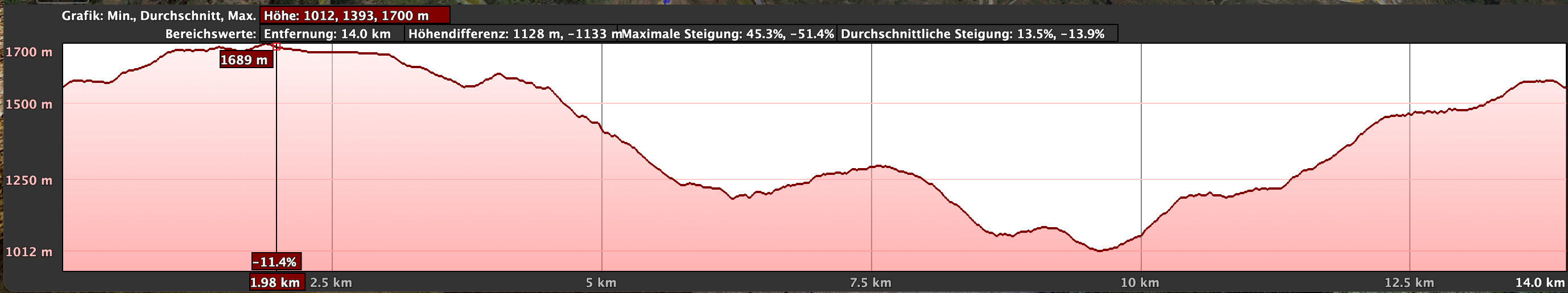
The hike is 16.2 kilometers long, with an elevation gain of nearly 950 meters. If you only want to walk one of the hiking circuits, the distance and elevation gain will be less accordingly.
Requirements
You will hike on well-marked trails throughout the entire route.
Refreshments
There are refreshment options only in La Culata and in Casas del Lomo (here you pass by during the lower circuit near one of the variants). Nevertheless, please remember to bring sufficient water and snacks for the hike.
Variants
Initially, you can divide this big circular tour into two smaller ones if needed. In this case, you must start the second circuit below La Culata also in La Culata. The upper circuit can also be easily walked from La Culata. Therefore, I have provided La Culata as the GPS position and not the Degollada de Becerra.
Furthermore, this hike also passes below the Roque del Nublo, so you can incorporate it into the hike.
However, the actual hike starts at the Mirador Degollada Becerra. This is also where the Cruz de Tejeda hike begins. A small part of the hike at Casas del Lomo and at the end of the hike is even identical to this tour. Both hikes can be combined excellently and thus shortened or extended accordingly.
At the same location, the Panorama Tour Becerra hike also starts.
Circular Hike La Culata
Section from Mirador Degollada de Becerra to the hiking junction near Llanos de la Pez
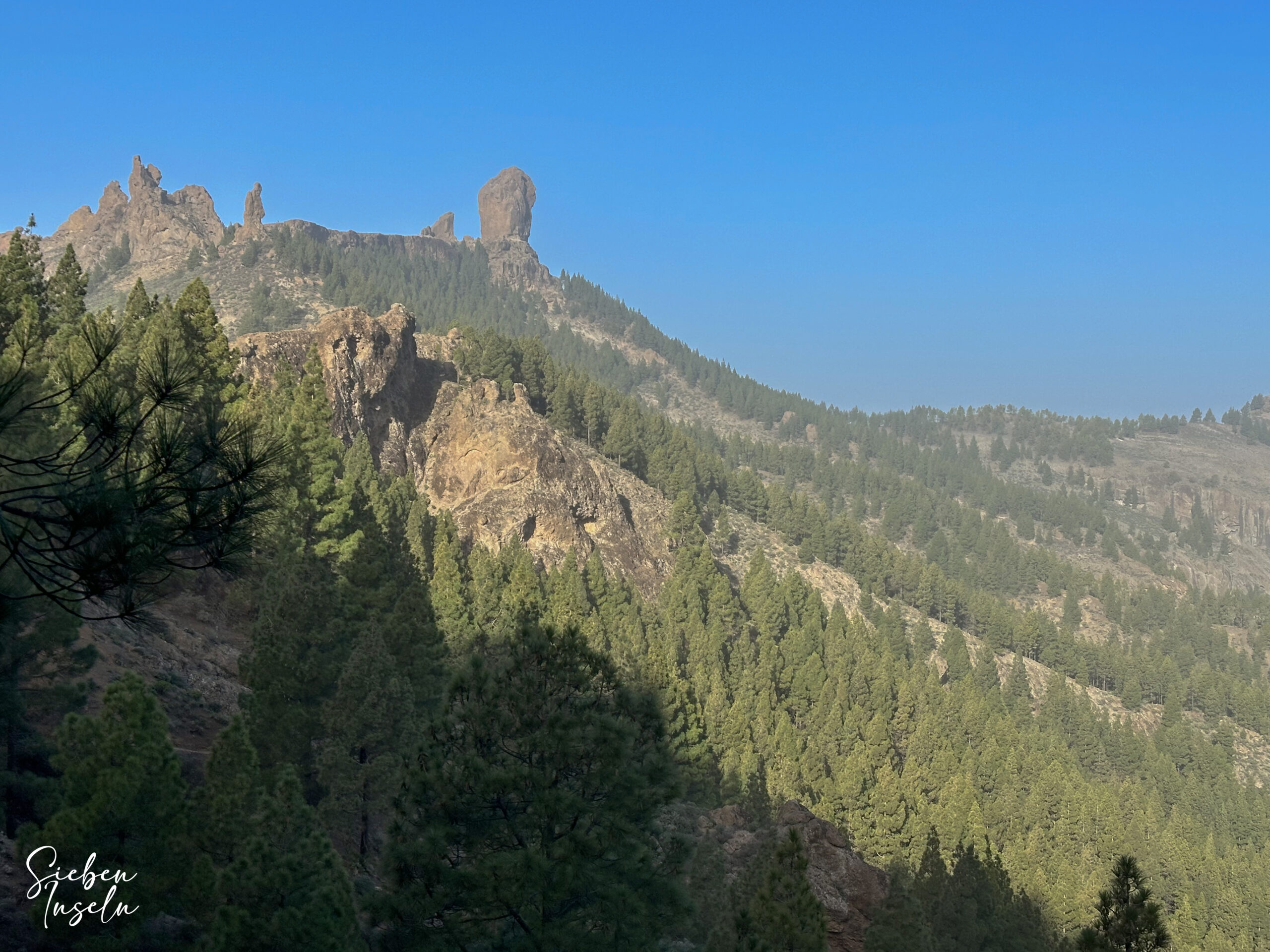
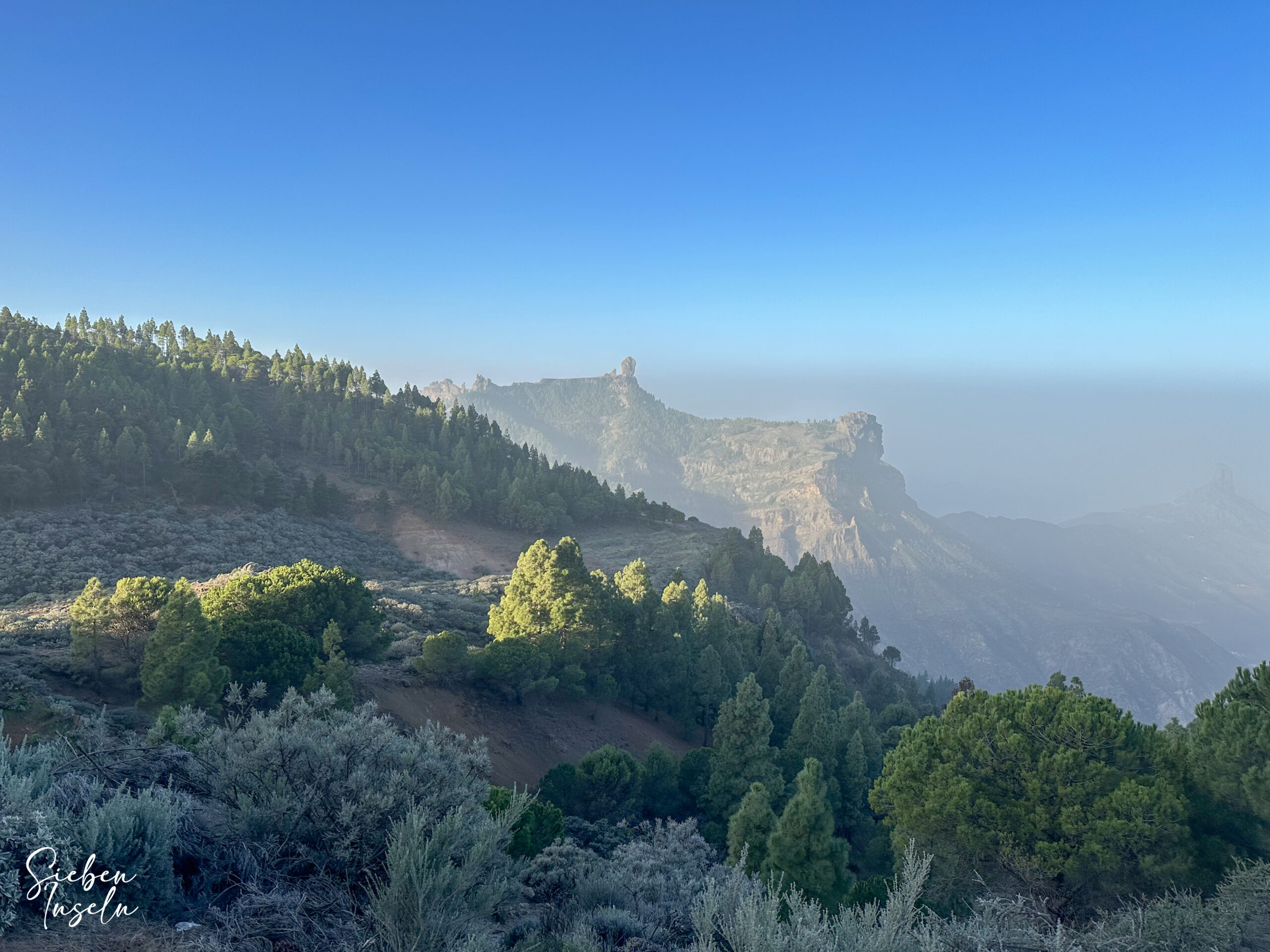
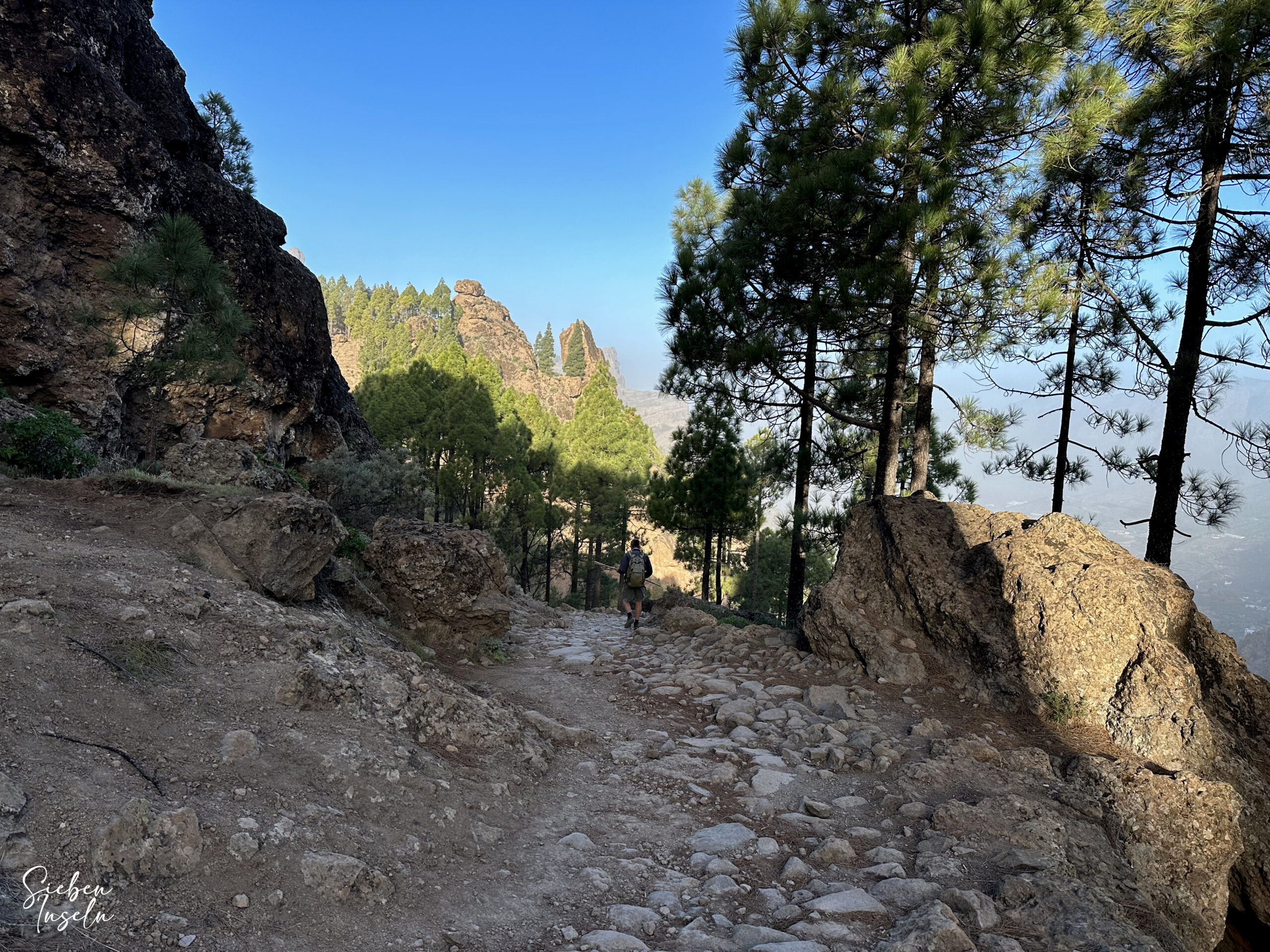
You start your hike at the Mirador Degollada de Becerra and follow the hiking trail southwards, uphill to the left along the Cumbre. Initially, you hike on the GR-131 towards Playa del Burrero or the GR-138 towards Los Llanos de La Pez. The path takes you over the Cumbre for some time with splendid views of the Roque Nublo and the surrounding mountain ranges. Initially, you ascend and then continue at the same altitude for some time. Then the path turns left, and immediately after that, a hiking trail branches off to the right (Cruz de Tejeda hiking circuit). This is also part of your return route.
Now, however, you continue straight ahead for a few more meters towards the road and take the next turn to the right (long-distance hiking trails GR-131 and GR-138). You now hike for a long time at the same altitude in a southerly direction along the slope and can enjoy splendid views of the Roque Nublo and the valley around La Culata below you. Then, you arrive at a larger farmstead (Granja Corral de Los Juncos) on a track, which you continue to follow. Afterwards, you enter a wooded area and cross two tracks one after the other. At the third track, near the Zona Recreativa Lllanos de la Pez, you encounter a major hiking junction.
Section from the hiking junction near Llanos de la Pez to La Culata
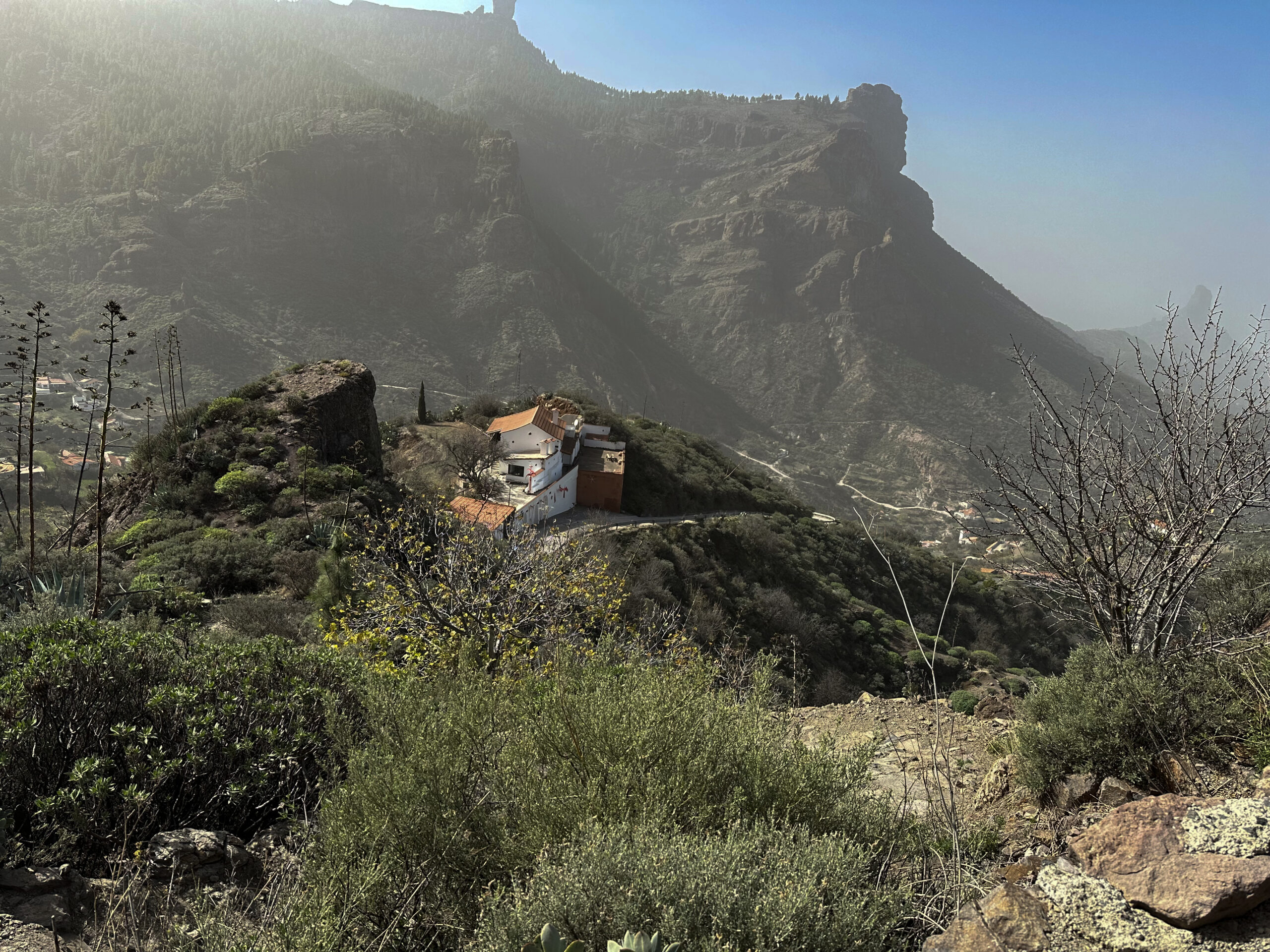
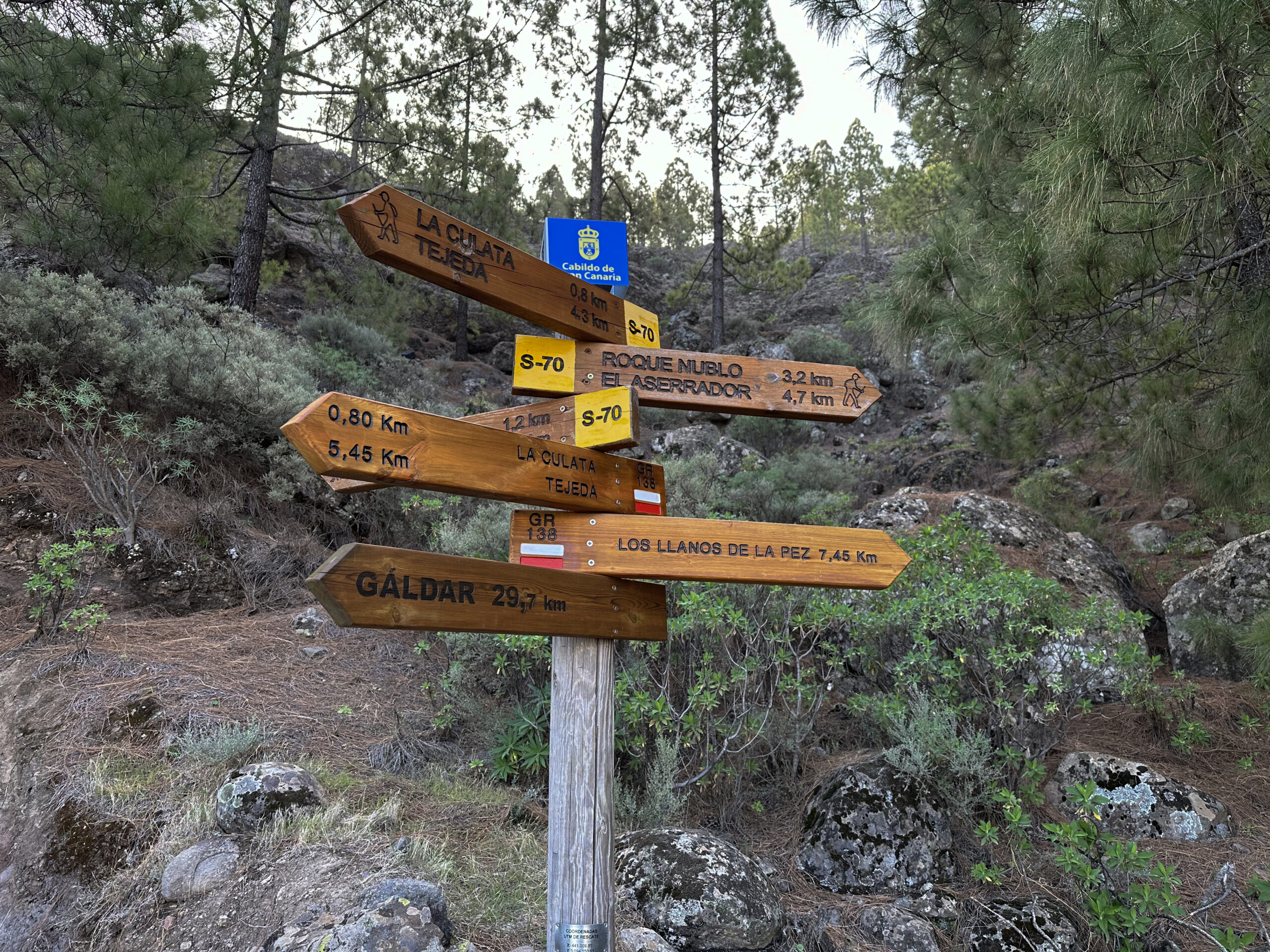
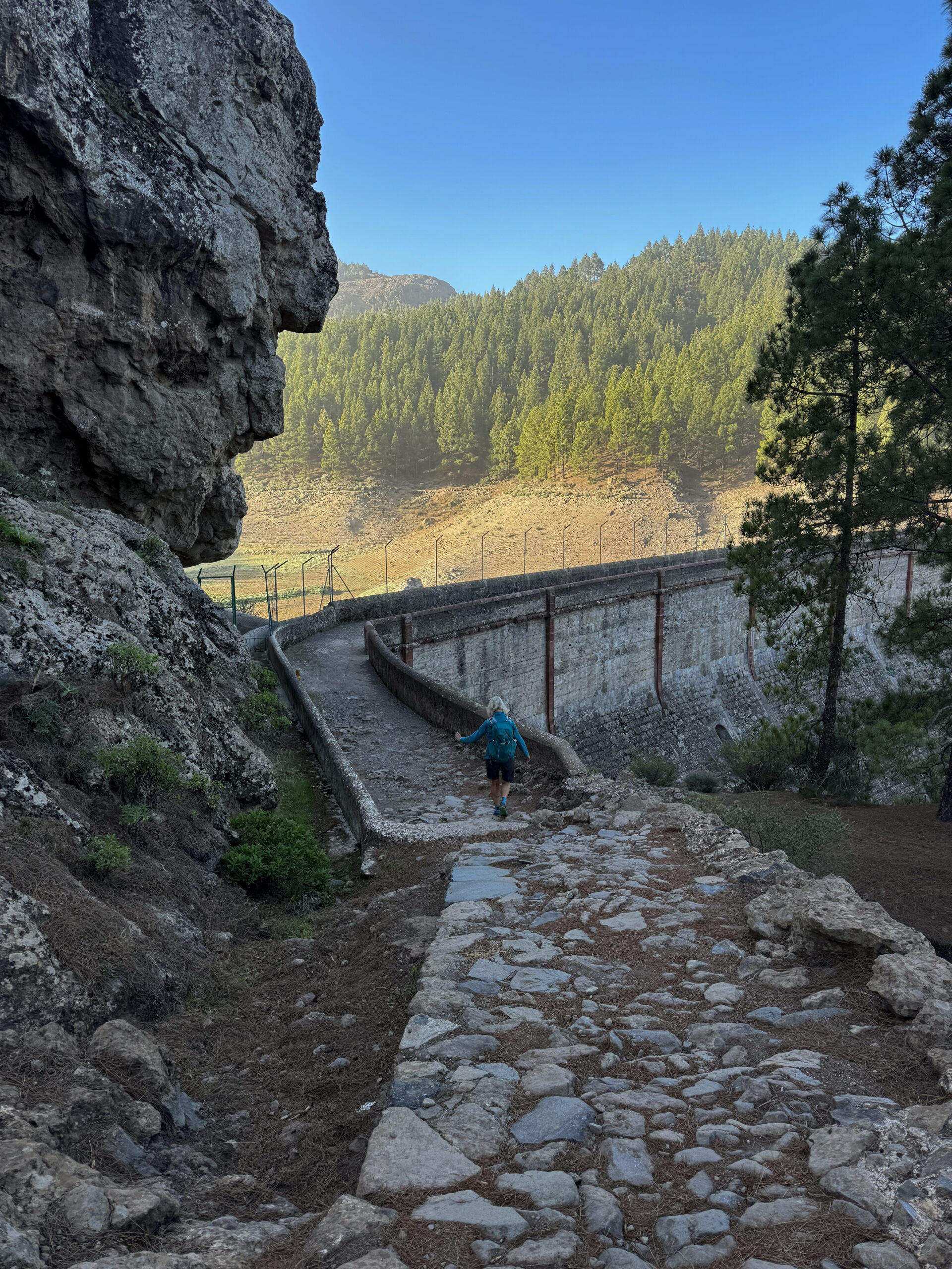
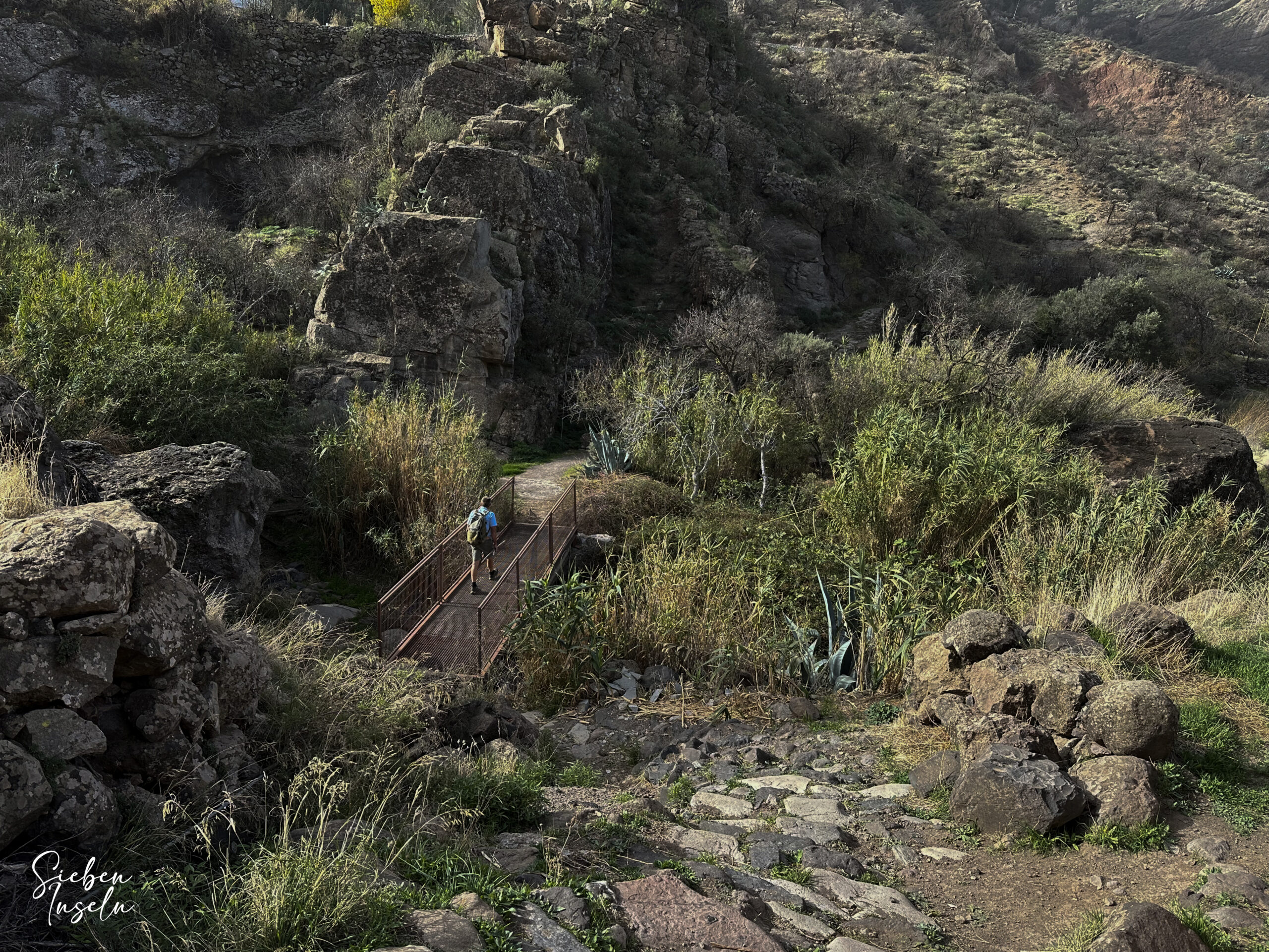
Here, you keep right and continue on the wide track, which ends at some sports fields still belonging to the Llanos de la Pez area. There, the path turns right with the S-51 through the forest. Still, you can also simply follow the signs downhill towards Roque del Nublo. After a short descent, you arrive at the Presa de los Hornos reservoir. From there, you continue across the dam. Afterwards, a short ascent follows to the Mirador Presa de Los Hornos. You are now at the GC-600.
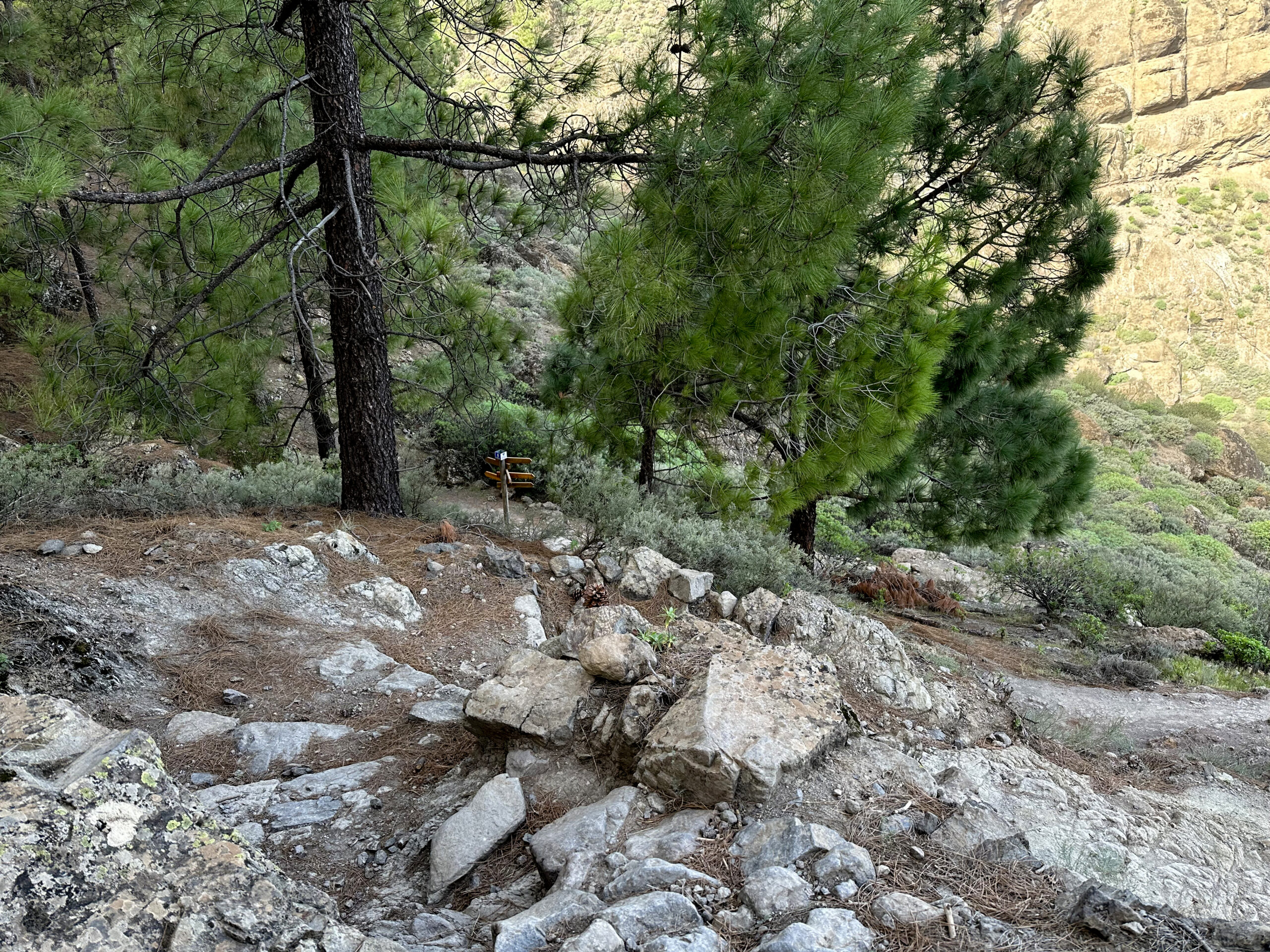
To the right, parallel to the road downhill, runs the continuation of the trail, which leads you to a fork in a short time. To the left uphill, you can reach the circuit around the Roque Nublo from here. However, steeply downhill to the right, the S-70 signposted towards La Culata. The path takes you downhill through the forest closer to La Culata. Before reaching the road, the S-70 forks, leading left back towards Roque Nublo. However, you keep right and eventually reach the first houses of La Culata.
Section from La Culata to near Cruz de Timagada
The hiking trail merges into a road, which you follow straight ahead through the village for a short distance. Then, you leave the road on a narrow hiking trail straight ahead to cut a large hairpin bend of the road. When you return to the road, you are on the GC-608, which you follow to the left towards the center of the village. Now, you can already take a look at the beautiful village of La Culata. At the church on the church square, your return path is uphill to the right. However, if you want to take the big circuit, you keep left next to the church downhill.
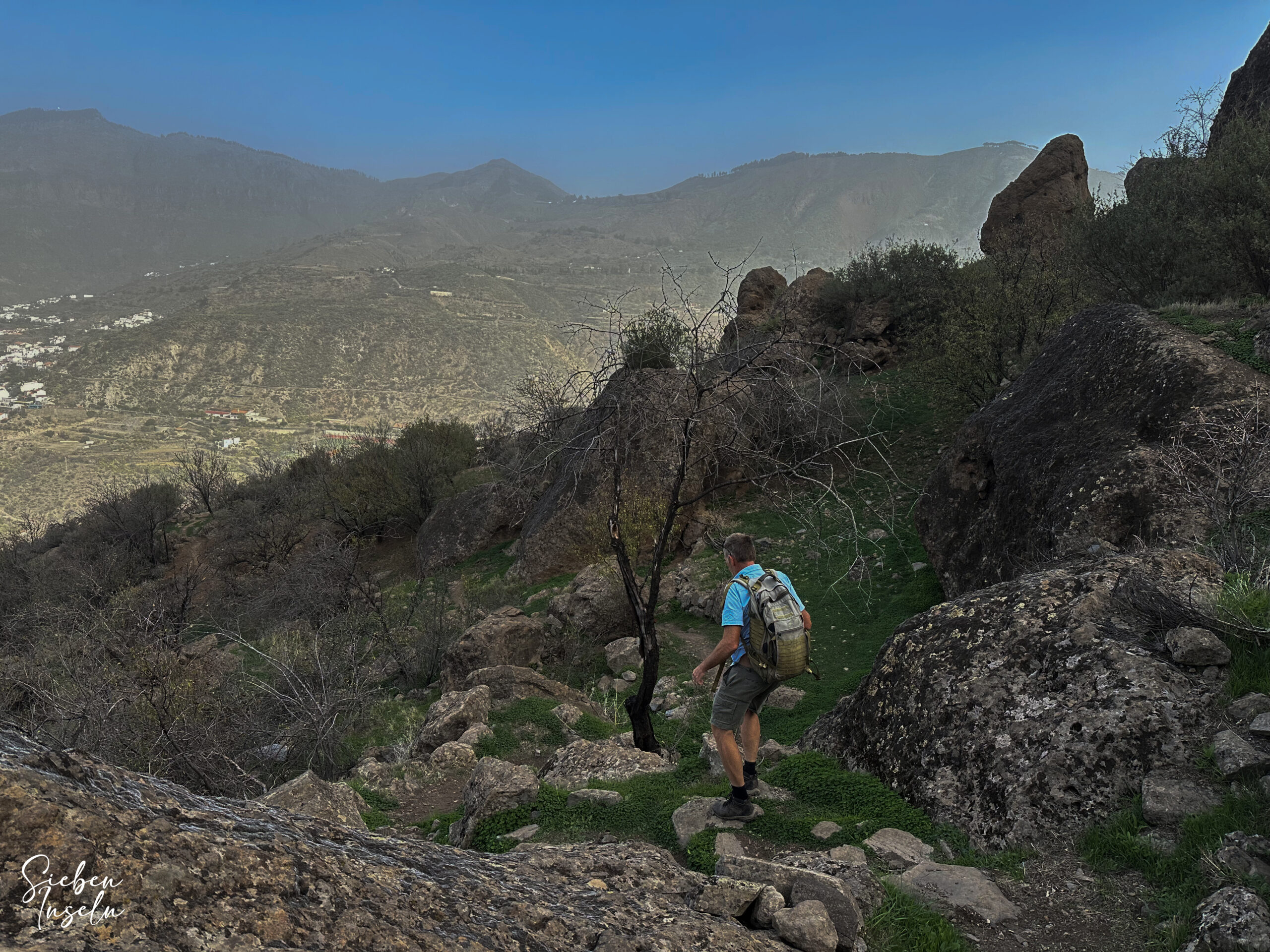
The hiking trail S-82 takes you through a green valley to the west side of La Culata. You cross a road and then the Barranquillo de la Pena. Then, the hiking trail takes you along the heights far below the Roque Nublo. You can enjoy beautiful views as you are still hiking at around 1200 meters above sea level. Eventually, you arrive at a major fork. The S-82 continues uphill towards Cruz de Timagada. However, you go downhill to the right with the S-80.
Section from near Cruz de Timagada to La Culata
Initially, you walk downhill on the S-80 for a short time. Then, you reach a fork. We walked downhill to the left on the S-2 towards Casas del Lomo. This is a rather nice path. However, in Casas del Lomo, you will have to walk on a small road to the right for a while. If you want to avoid this, keep right at the fork. This way, you shorten the distance a bit on the S-80 hiking trail and have to walk less on the road. However, on both variants, you will eventually reach a small road running eastward through Casas del Lomo. At the point where the road ends and turns into a track, the two variants merge again.
You stay on the S-80 hiking trail, continuing to the right. This way, you reach a wide track to the right of the GC-60. This is also where the Tejeda hiking circuit runs in the opposite direction. You are on the S-85 hiking trail, which you follow uphill for a while. Eventually, you reach the GC-608 road. The Tejeda hiking circuit continues straight ahead uphill. You can also follow this and shorten the hike a bit. However, for my variant, you walk to the right along the GC-608 for a while. The road is not very busy, and after an extensive hairpin bend, you will eventually be back in La Culata.
Section from La Culata to the starting point Mirador Degollada de Becerra
You continue walking along the main road GC-608. This way, you return to the church and thus to the starting point of the lower circuit under La Culata. Between the houses on the other side of the square in front of the church lies the hiking trail S-82. You now follow this signposted trail uphill between the houses of La Culata. You cross a road twice until you reach a small road again through terraced fields. You follow this road to the right for a short while. After the first bend, a path leads uphill to the left. You walk along it and after a short while arrive at Finca Palmita, passing it on the left. Here, the hiking trail S-82 continues. Initially, you ascend some quite steep small switchbacks. At a fork, you keep left.
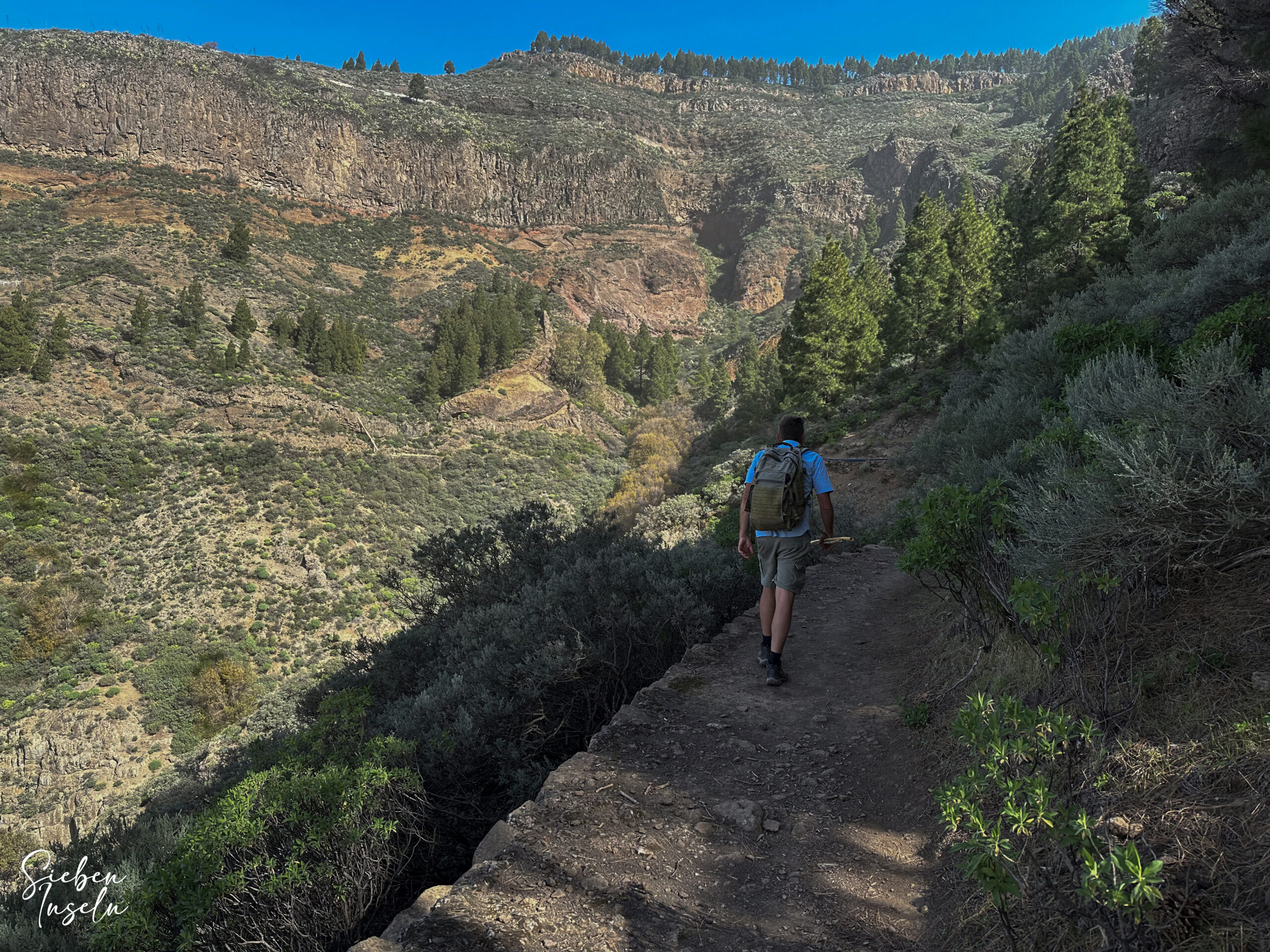
With impressive views, you then hike high above the Barranco del Molino. Eventually, you cross the gorge on the hiking trail and hike uphill on the other side of the Barranco towards Cumbre. After some time, you reach the hiking trail S-85, which belongs to the Tejeda circuit. This merges from the left with your path, and both lead up to the Cumbre. Once at the top, you return to the starting point at the Mirador Degollada de Becerra on the same path you came, taking you back in a short time.
And finally
I hope you enjoyed this beautiful hike around La Culata. It can be combined very well with the Tejeda Circular Hike, so you will certainly find one or more interesting hiking circuits for yourself. Whichever you choose, I wish you much joy on all your hikes,
Dagmar from SiebenInseln