
Mountains, Barrancos and lots of nature
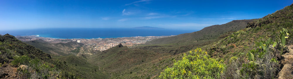
Today’s hike, which starts in Adeje, takes you up over the south coast to the Ifonche mountains. On the quite long hike you can always enjoy fantastic views of the neighbouring mountain ranges, deep Barrancos and the wide south coast.
You will circle the famous Barranco del Infierno and the Barranco de la Fuente. This tour can also be combined very well with various hikes in the vicinity. And if you are in very good physical condition, you can also make the hike into a big circular hike.

Adeje and the Barranco Infierno
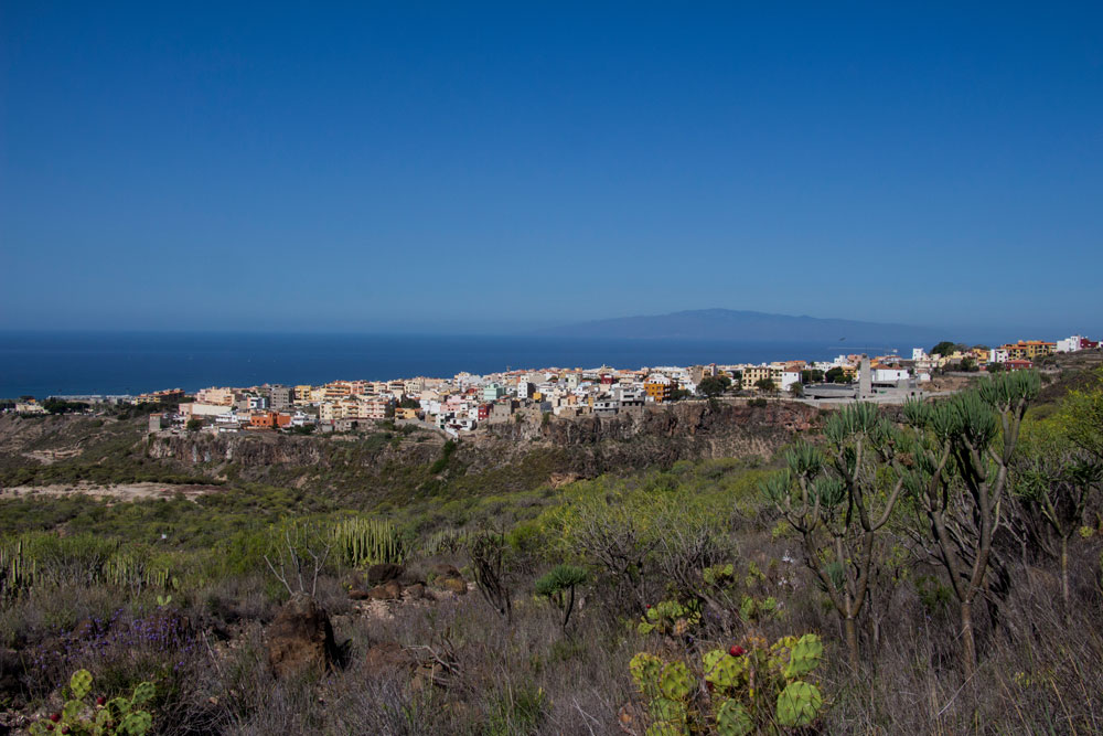
The starting point of today’s hike is the village of Adeje. Adeje has about 50.000 inhabitants and lies 280 meters above sea level. Adeje has grown together from several parts of the municipality and borders on the large tourist metropolis Las Americas. The coast is close and therefore there are more and more tourists in Adeje. The possibility to enjoy the Atlantic Ocean and the water and to have the mountains in your back at the same time is very attractive. Thus Adeje is also the starting point for several delightful hikes in the south of Tenerife.
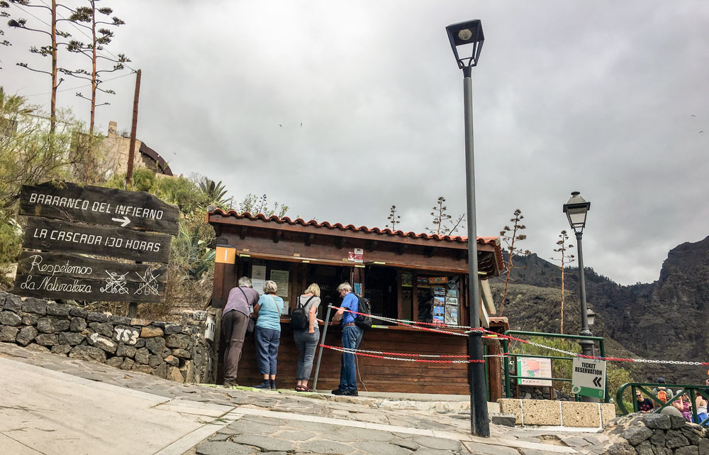
A popular excursion destination near Adeje is the Barranco del Infierno (Hell’s Gorge). The hike in the Barranco is rather easy with just over 6 kilometres and 200 metres of altitude difference and therefore very popular with the many tourists on the south coast. At the end of the gorge there is a waterfall to admire. The native inhabitants of Tenerife, the Guanches, already lived in the Barranco. Today the Barranco is a part of a nature reserve.
Newly opened gorge
The gorge was closed for years from 2009 because of an accident. Since 2015 it is open again. Then after a short time it was closed again because of another accident. And since 2016 the Barranco del Infierno near Adeje is now reopened for a fee of currently 8€. You can see the track on the track pictures. The last time I was there was many years ago and also again after the reopening. You can find the article about the hike through the Barranco del Infierno here.
Summary information about the article and a large selection of GPS hiking tracks are availableRegister now for my newsletter and get exclusive access to my collected GPS tracks as well as all short information about my articles.

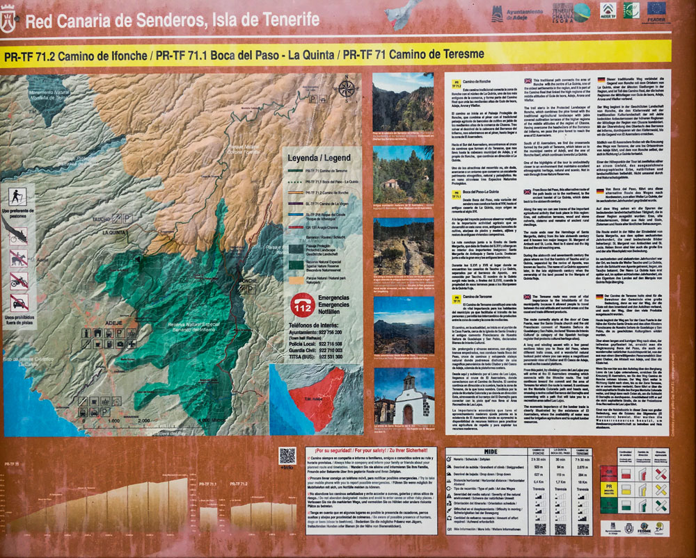
General information about the hike from Adeje to Ifonche
Starting point and approach
The starting point is the upper edge of Adeje at the end of Los Molinos street next to Otelo Restaurant. There is also the entrance to the Barranco del Infierno.
Arrival by car
You come over the motorway TF-1 and take the exit Adeje. Then you follow the direction north/mountains and drive into the village Adeje. Parking is available in the village and along the roads. You will probably have to walk a few minutes to the starting point at the top of Calle Los Molinos. On the track you will see that I have chosen a parking lot at the cemetery, so you will have to walk back there. However, if you want to do the big round walk, you can also end the tour at the cemetery.
Arrival by bus
The Titsa bus lines 416, 447, 473 and 477 stop in Adeje. Further information can be found on the Titsa Homepage.

Time
I don’t like to give general time information for hiking tours, because the times are very individual. For this tour, which we went relatively slowly, I needed about 4 hours.
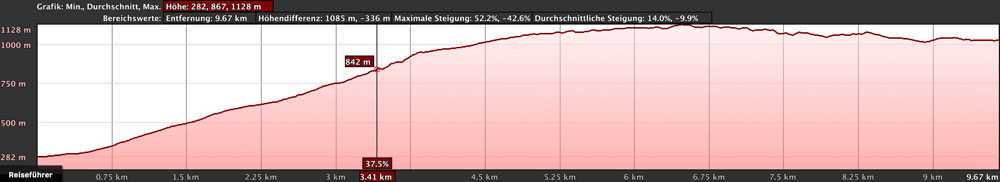
Difference in altitude and distance
The difference in altitude is about 940 meters. The distance is 9.7 kilometers long.
Requirement
An easy and for everyone with a bit of stamina easy to master tour. However, if you want to go back the same way, you should hurry a bit. In this case you have to cover about 20 kilometres.
Refreshment
There are restaurants, bars and shops in Adeje and a restaurant in Ifonche (El Dornajo). Therefore take enough water and food with you on the way.
Options and way back
Since you are walking a relatively long distance on this hike, you have to plan your way back. Either you are very fit and run the way back. But then you need enough time and stamina. You may also be able to have Ifonche pick you up (or organise the hike with two vehicles from the outset). Otherwise you can take a taxi from Ifonche back to Adeje (approx. 35€). This is especially worthwhile if there are several participants.

Variant Great circular hike
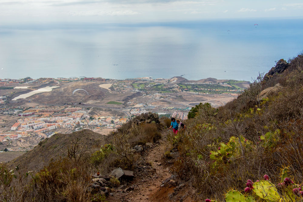
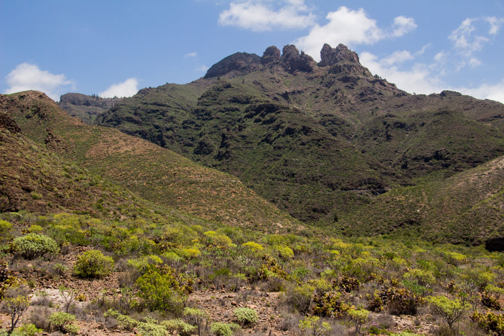
There is also the possibility to go back to Adeje by another route. This way you can do a complete, but also a very big and long round hike. Just before you reach Ifonche, you turn right at a crossroads. Here is a cross crossed out in white and yellow. The path first goes high above the Barranco del Infierno and then goes over to the left side of the mountain range on a saddle. You can enjoy fantastic views of the mountain and the coast.
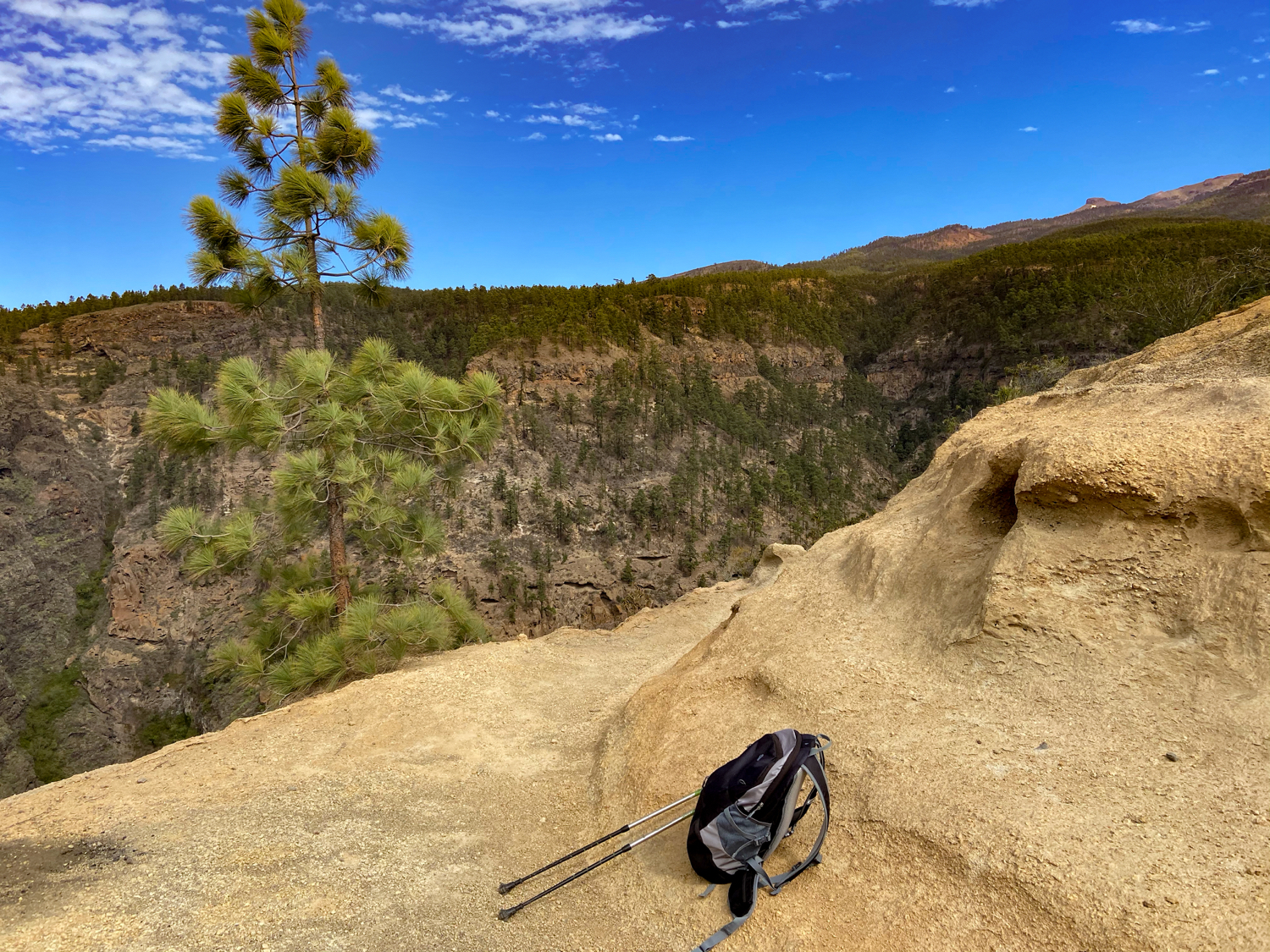
Then the path leads over a very narrow exposed spot. Two meters are really only for people who are sure-footed and have no fear of heights. A short time later the path turns into a normal hiking trail, which takes you down towards the chapel/cemetery in Adeje.

I started this variation of the hike at the cemetery, went up to Ifonche and took the big round trip back to Adeje. The hike took about 6.5 hours with some breaks. It is 15 kilometers long and goes over about 1050 meters of altitude. Important are condition, surefootedness and freedom from vertigo. Here is the altitude profile.

Below you will find the exact description when you start the hike at the cemetery and walk up to Adeje.
Other hikes in the vicinity
Furthermore, this hike can be easily combined with various other hiking and circular walks in the vicinity. From Ifonche there is a beautiful hike to Vilaflor. And also the hikes described here on seven islands around the Roque Imoque and into the Barranco del Rey are right next door.
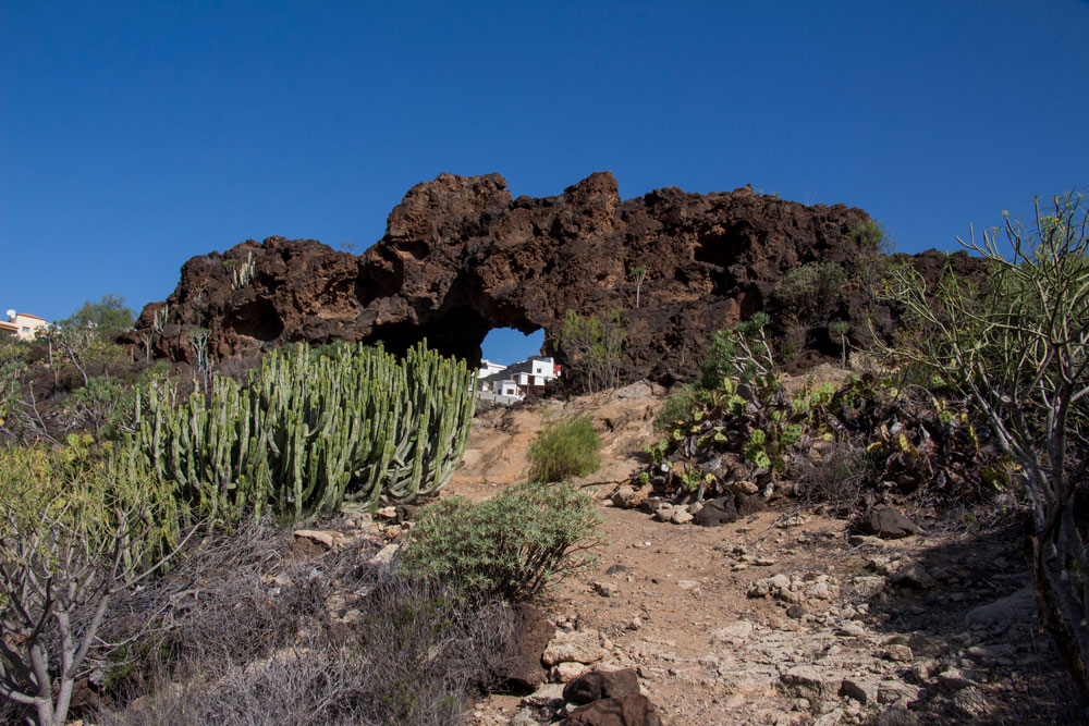
Finally, from Ifonche, you can make an excursion into the lonely pine forests on the Cañadas slopes. The large caves below Ifonche are also worth seeing.
Hike from Adeje to Ifonche
Section Adeje to Boca del Paso
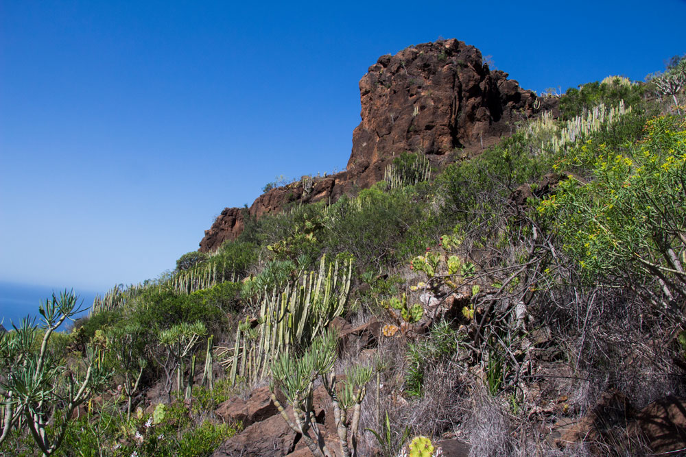
You start the hike in Adeje at the end of Calle Los Molinos next to the restaurant Otelo at about 300 meters altitude. Just above the restaurant you will find a wooden cottage. There is the entrance to the Barranco del Infierno. Go left past the entrance house and follow the concrete path to the left uphill. This is still Calle Los Molinos. After a short time you will find hiking boards here which mark the path PR TF 71 towards Ifonche in yellow and white. Very quickly the path goes from concrete to sand and then to the right leaving the main path on scree.
Summary information about the article and a large selection of GPS hiking tracks are availableRegister now for my newsletter and get exclusive access to my collected GPS tracks as well as all short information about my articles.
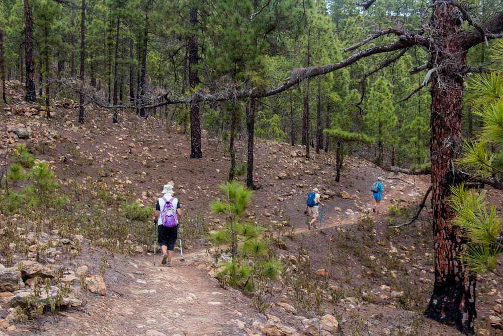
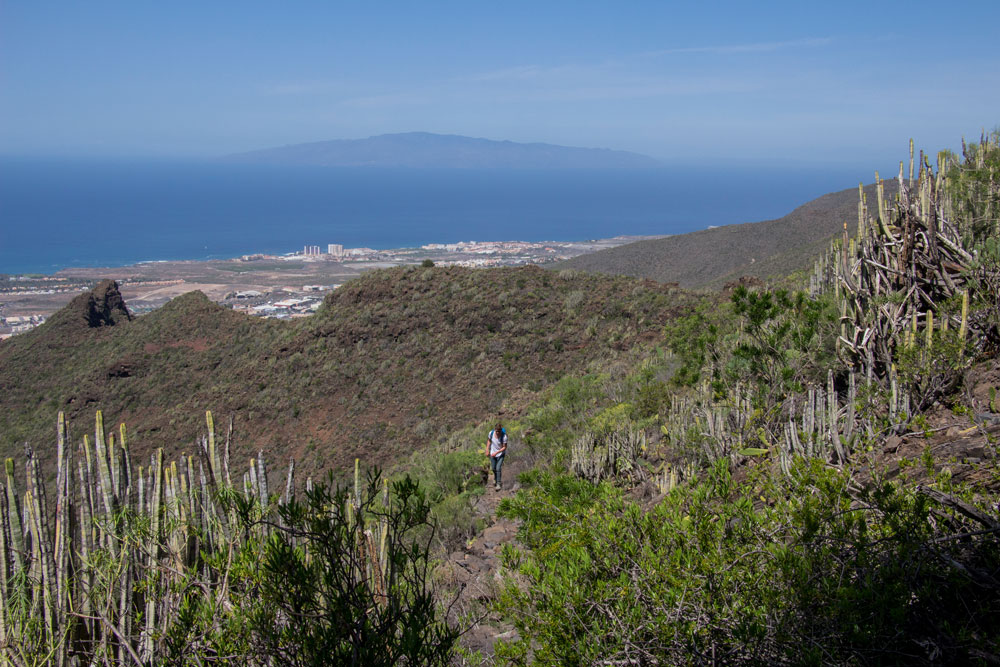
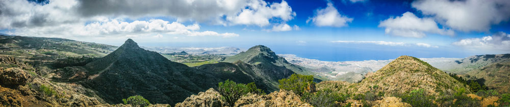
You walk north uphill. First it goes parallel to the Barranco del Infierno in small serpentines and then on a straight wide way very long uphill. You hike through the wide valley incision towards the steep edge. Approximately after one ¾ hour you turn left over a small height. You cross a wide incision in the valley while maintaining altitude. Then the path becomes steeper. From there it goes uphill in long serpentines. Exhausting – but when you look back, you can already enjoy wonderful views of Adeje and the entire south coast behind you. Now comes the hardest part of the tour. You climb up in front of the rock face on steep narrow paths. In less than two hours you should have completed the ascent and probably be happy and content at the Boca del Paso.
Section Boca del Paso to Lomo de las Lajas
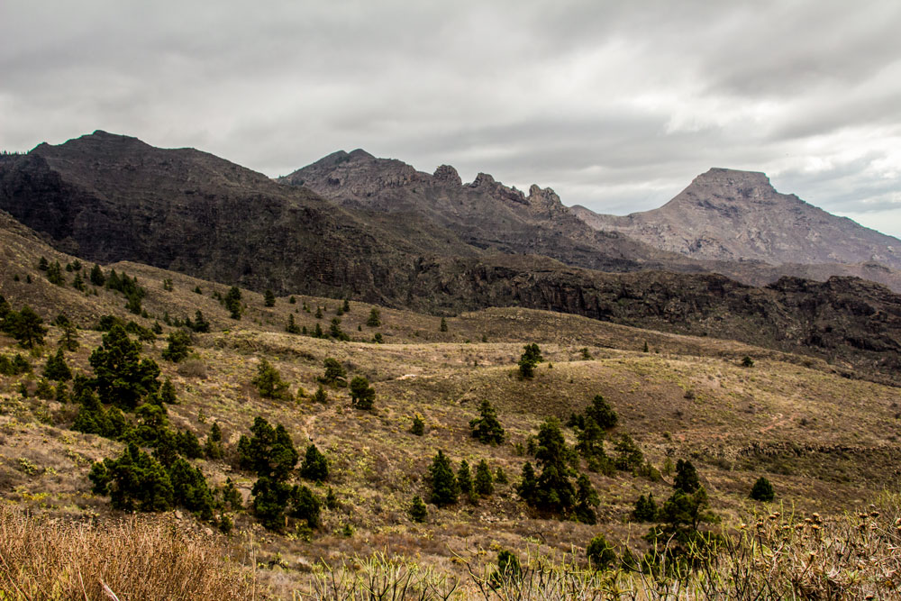
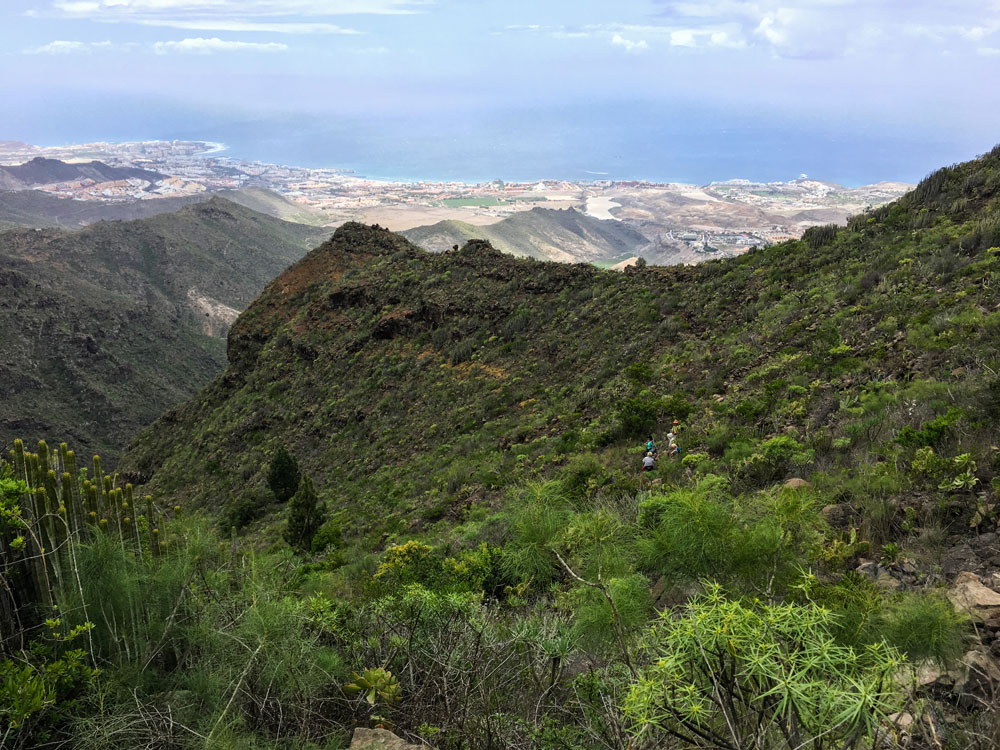
There at the Boca del Paso you will hopefully not find too many clouds and can enjoy the good view far over the south coast to Los Gigantes in the west. In front of you lies the Atlantic Ocean with the neighbouring island La Gomera. At Boca del Paso, on the other side of the pass, the hiking trail PR TF 71.1 branches off to La Quinta. However, you do not go downhill and keep the altitude with the signposted path towards Ifonche. The path runs straight on the other side of the ridge towards the woods. You walk along the ridge and after some time you will come across a water channel, which you walk along uphill.

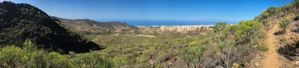
You keep straight on following the path, which now rises only slightly. From time to time it goes downhill for a short time, then uphill again. Since most of the way here is still forest free, you can enjoy beautiful views both to the west and to the east. After some time you come to a kind of small plateau with a light background. This mountain ridge is also called Lomo de las Lajas. Here on the left side a hiking trail branches off to La Quinta.

Section Lomo de las Lajas to crossroads Querweg
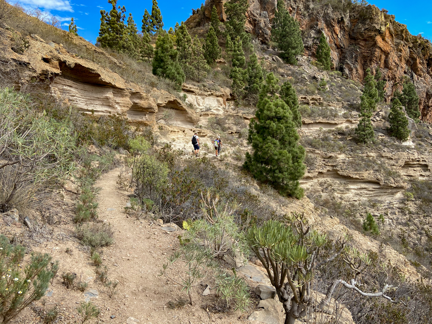
However, you tend to keep right towards the pine forest. From now on you follow the path through the pine forest on the edge of the Barranco de la Fuente. The path takes you up and down in a wide arc around the Barranco de la Fuente. At the end of the western Barranco side, the path descends into the Barranco Grund. There you change to the other side and walk uphill again.
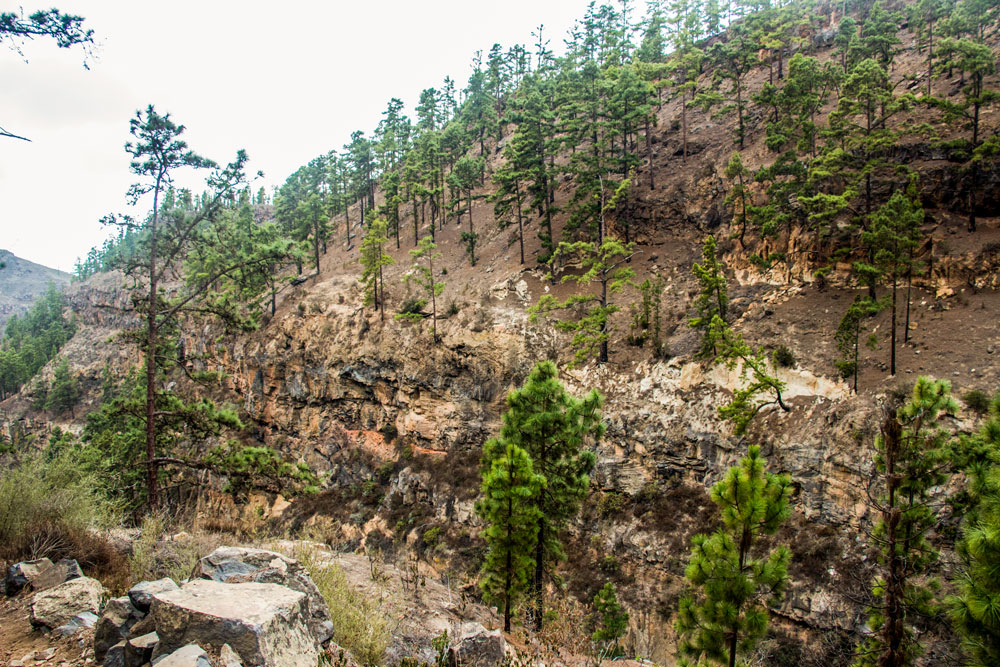
Now the path leads you along the eastern side of the Barranco with wonderful views of the gorge that slopes deep below you. Before you will reach Ifonche you have to hike through some more Barrancos with fabulous views. After some time the trail will lead you over a hilltop towards Ifonche. In front of you you can now see terraced areas and individual farmsteads. The path leads downhill through the slope. Then a main path crosses which is marked with a crossed out cross on the right. At this point the alternative path between Adeje and Ifonche joins. The description follows in the next but one section.
Section Crossroads to Restaurant El Dornajo in Ifonche
To the right of the intersection you can see a large farmstead. If you follow the road to the farm, you are not only on the alternative road to Adeje, but you can also take a look from above below the farm into the Barranco del Infierno. But the tour to Ifonche follows the path straight ahead. It runs below terraced fields. Then it goes slightly up again through a pine forest. After coming out of the forest, the path merges with another path coming from the left. Follow the path to the right.
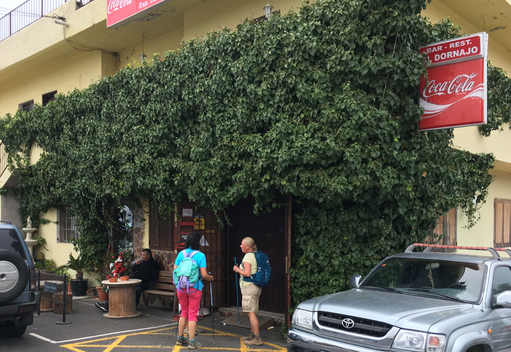
After a short time the path leads into a street where you turn left. In front of you at the top you can already see your destination: the restaurant El Dornajo in Ifonche.
Alternative route Adeje towards Ifonche
Adeje to the end of valley section
You park on the parking lot in Adeje in front of the chapel in Avenida Palo Mayor. You walk along the chapel and shortly after a wide driveway leads you down. Follow it straight ahead for a while below the houses of Adeje. As you can see from my track, after some time you have the possibility to go straight up on small paths. Alternatively you simply follow the main path in a wide serpentine. Both paths meet again on a plateau.
This path always leads you parallel uphill on the right side of the Barranco del Infierno. You can’t miss the path. It is wide and clear. After some time you cross a water pipe. Then the path becomes narrower and a little steeper. Now it goes steadily up the mountain on the right side of the slope. If the valley gets narrower and narrower, you cross the little Barranco at the end. This place is a bit confusing, because the path is a bit overgrown. But in fact the path continues on the other side of the valley.
Section of the valley end up close to Ifonche
He’s taking you to the next ridge now. There you hike up the mountain in wide serpentines. There are some nice resting places under the trees with fantastic views of the coast. When you reach the top, cross the ridge and follow the hiking trail. This leads you on the right side of the mountain towards Ifonche. To your left is a deep gorge. In front of you you can already see the houses of Ifonche.
You now go up serpentines, walk around the mountain and continue straight ahead on the left side of the slope. Then you come to a place where the path is very narrow and exposed. Walk two meters along the mountain wall and cross a small barranco. After that the trail continues along the right side of the mountain and crosses a small barranco. It leads slowly up into the height. Then you will see the left white sandstone. The path takes you to a plateau between two gorges.
There you have fantastic views, especially of the Barranco del Infierno. Now the path continues up the left side of the mountain. A beautiful path close to the crest. Finally, just before Ifonche, it joins the main hiking trail between Adeje and Ifonche. On the right you can go to Ifonche or you can go the big loop back to Adeje on the left.
And finally
I hope you enjoyed this great circular route, which you can also walk in parts or combine wonderfully. This article was updated by me in February 2020, as I was still missing the last small part of the way to Ifonche. Thanks to nice hiking friends I finally had the opportunity to open up this little “black spot” for me. Thank you very much for that.
And if you have information that might be interesting for other hikers or are looking for fellow hikers – simply register here on this page in the new Hiking Forum. I am looking forward to active participation.
Have fun hiking,
Dagmar von SiebenInseln
Summary information about the article and a large selection of GPS hiking tracks are availableRegister now for my newsletter and get exclusive access to my collected GPS tracks as well as all short information about my articles.
I walked this route, the full circular, late October and it was beautiful. I did it in reverse, though, but would recommend the direction mentioned here. The path back towards the cemetery is quite technical and tricky when going downhill, especially when you are already a bit more tired. You’ll see a great variety of vegetation, and I am sure a geologist would be interested in all the different exposed layers: The colors are amazing. Passing the pinewood area, I also came across quail-like birds (sorry, not an ornithologist at all).
I am very happy I came across this site!
Thank you very much to share your experience here with others. Enjoy your hiking holidays, Dagmar
Did it today. In foggy and rainy day. Camino Carrasco is in pretty good state after all these rains but I suggest you to hold off until everything is thoroughly dry. I saw a couple of fresh tracks, someone had already walked here this morning or yesterday. I extended this trail with “Camino de la Virgen” from La Caleta SL TF 71 and it was 26km and 6h 45 min for full circle. Thanks for sharing this track!
P.S.: in two places that are mentioned in this article (28.1329639,-16.7003333), the path is completely destroyed and the detour is carried out along an old water canal. It’s a very dangerous place in the rain. Be careful.
https://photos.app.goo.gl/PGJzBnpSDTqzYHXk9