Big strenuous circular hike across Playa Antequera
From Igueste, I have already described the hike along the ridge path. This hike to Playa Antequera is identical to the small but challenging loop at the beginning and end. But overall, this hike to Playa Antequera beach is bigger and more strenuous. You have to climb up and down twice. You can see this very clearly in the altitude profile.
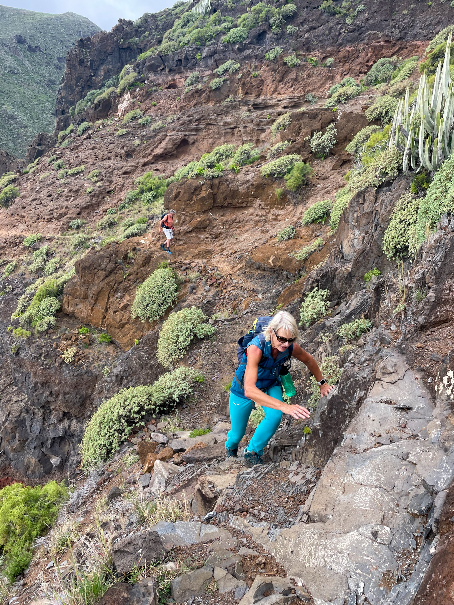
In addition, the last section before Playa Antequera is a breezy walk on a small path above the cliff. You need to be sure-footed and free from vertigo. A little scrambling is also part of the hike here. I would describe this section in particular as very difficult for normal hikers.
Playa Antequera compensates for the effort
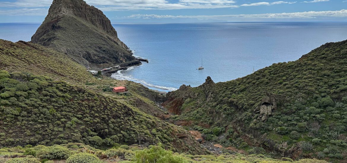
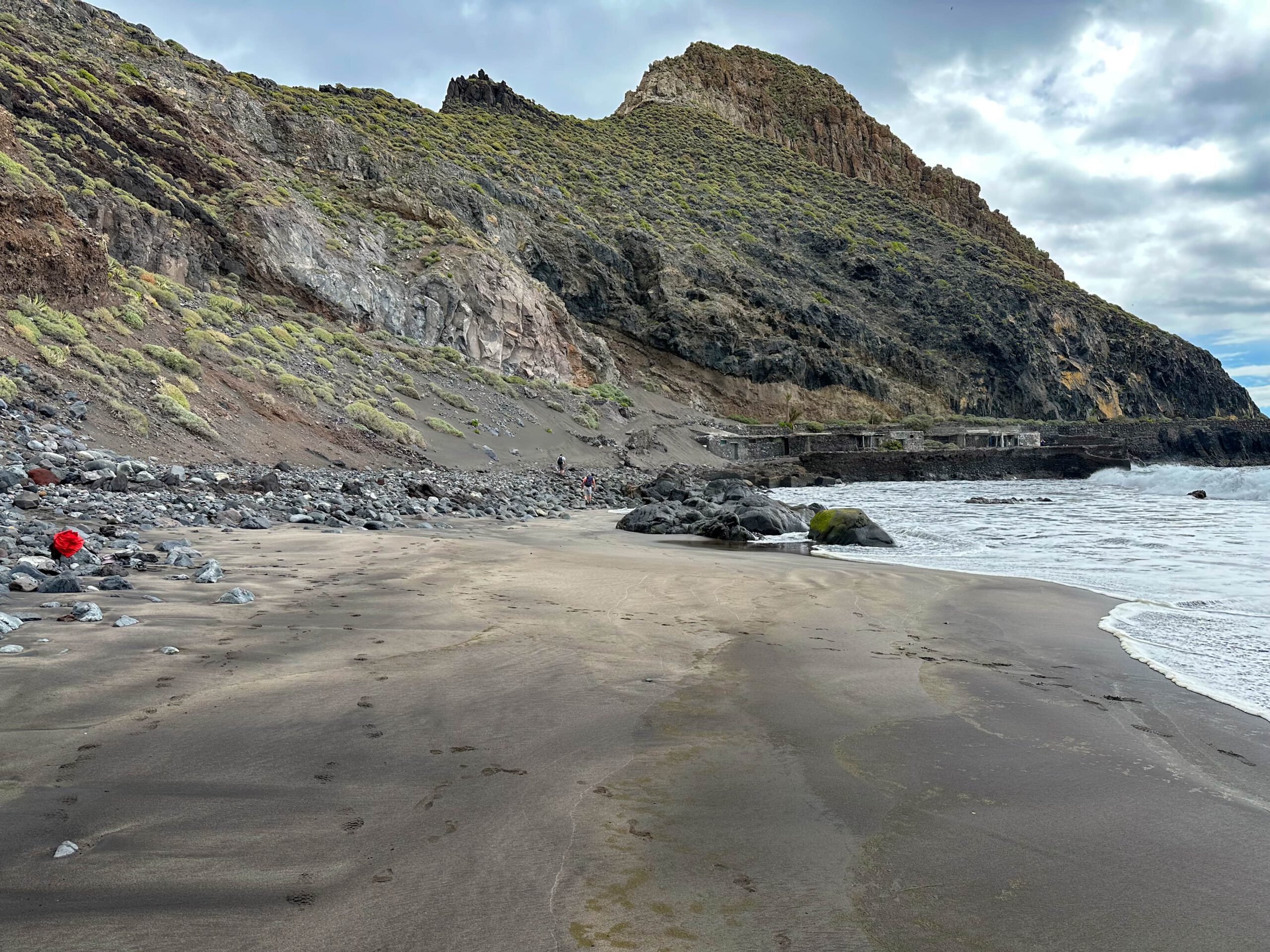
But when you reach Playa Antequera after some scrambling, you are rewarded with a lonely sandy beach. Here you are far away from the world and share the beach only with a few other hikers and sailors. There are also a few abandoned buildings in front of the rock that faces the bay. I have not yet been able to find out whether they served as accommodation for fishermen or for some other purpose.
The ascent in Barranco Antequera can be described as leisurely compared to the descent. You hike constantly uphill, but in a moderate manner. The Barranco de Antequera offers you another varied landscape and vegetation. Many goats can also be seen here. Once you have reached the ridge, you will soon return to the normal hiking trail down to Igueste.

General information about the Playa Antequera hike
Starting point and approach
The starting point of the hike is the small village of Igueste de San Andrés on the TF-121.
Arrival by car
You can only get to Igueste de San Andrés via Santa Cruz de Tenerife and San Andrés on the TF-121. The road ends here in the upper valley. You can park anywhere along the road in Igueste. A good starting point for the hike is the Carretera de Igueste de San Andrés. From there you start the hike and return to it.
Arrival by bus
The Titsa bus line 945 goes to Igueste de San Andrés. The bus stop is right at the starting point of the hike. More information is available on the Titsa homepage.
Time
I don’t like to give general times for hiking tours, as the times are very individual. We needed 5 hours 45 minutes for this round tour with a few stops and a rest at Playa Antequera.

Altitude difference and route length
The difference in altitude is just under 1000 metres and the route is a little less than 15 kilometres long.
Requirements
At the start and end of the hike you walk on good hiking trails (PR-TF 5 and PR-TF 5.1). But in between, you walk on narrow paths for most of the way. Especially towards the beach down to Playa Antequera, the path is not always easy to find. It becomes very difficult shortly before Playa Antequera. There you hike high up and a little exposed on the steep coast along a small airy path. Sure-footedness and a head for heights are absolutely essential here. From time to time, a little scrambling is called for. Because of the length and the two climbs in the tour, you should of course also be in good physical condition.
Do not do this tour in bad weather, storm and rain.
Refreshment stops
I did not even see any refreshment stops in Igueste de San Andrés. Therefore, please take enough water and, if necessary, food with you for the hike.
Variants
If you wish, you can also take a boat to Playa Antequera or have someone pick you up there. You can find out more about the water taxi here.
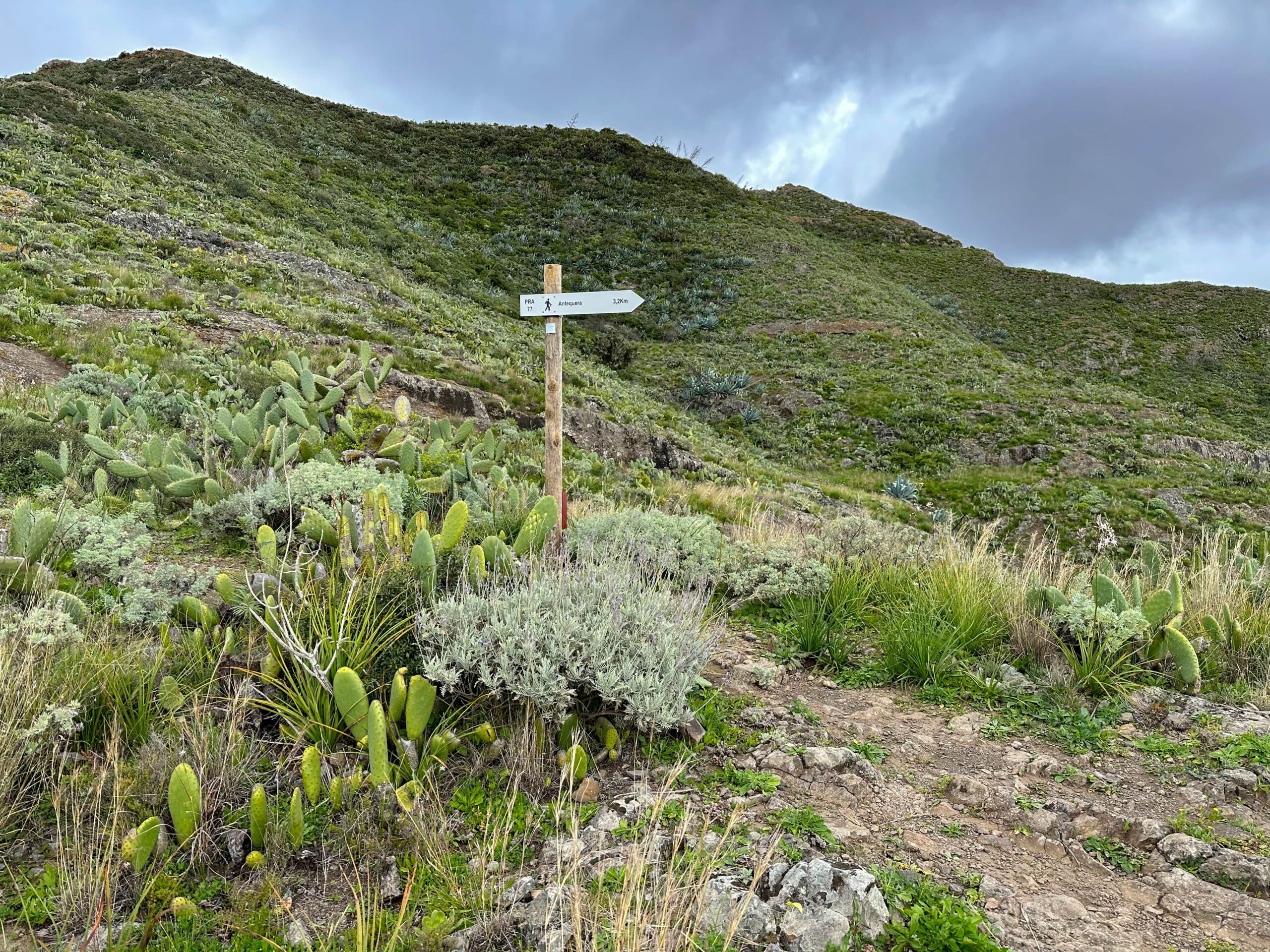
The hike can be combined very well with the hike from Igueste via the ridge trail. Of course, you can also continue on the PR-TF 5 trail to Lomo de las Casillas and further up into the Anaga. If you like, you can even hike to Chamorga. The extensions to Mirador Atalaya and Semáforo de Igueste are also optional.
Hike Playa Antequera
Igueste de San Andrés section to Semáforo de Igueste path junction
You start your hike in Igueste de San Andrés on the main road Carretera Igueste de San Andrés. You walk towards the sea along the Barranco de Igueste and then turn into Calle San Pedro. The yellow and white hiking trail is signposted PR-TF 5.1 towards Semáforo. You walk past the Iglesia de San Pedro Apóstol. You climb a few steps and then take a kind of coastal path (Pista el Cementerio). This first takes you slightly uphill. Then a steep path turns off to the left of the path, signposted PR-TF 5.1.
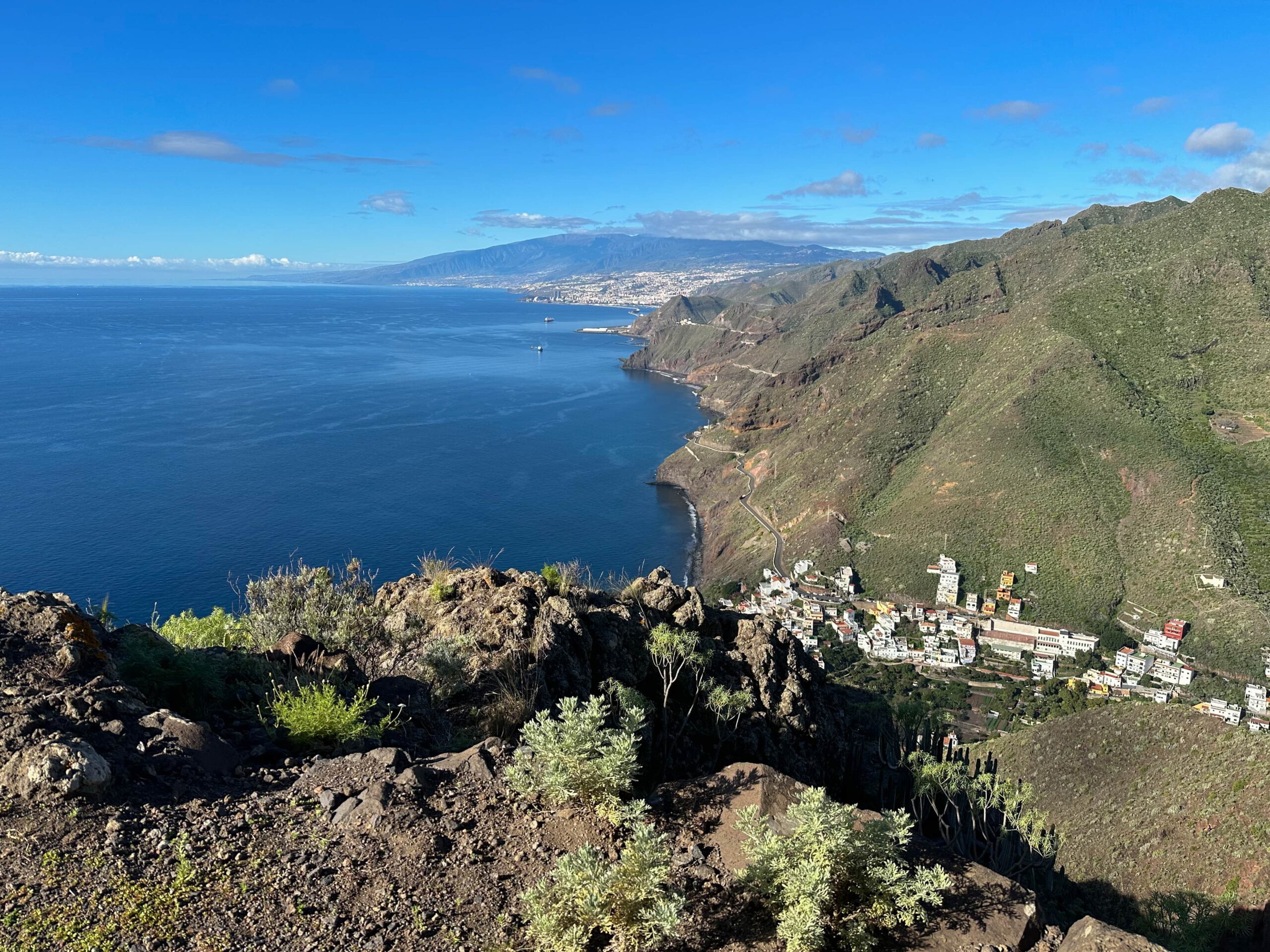
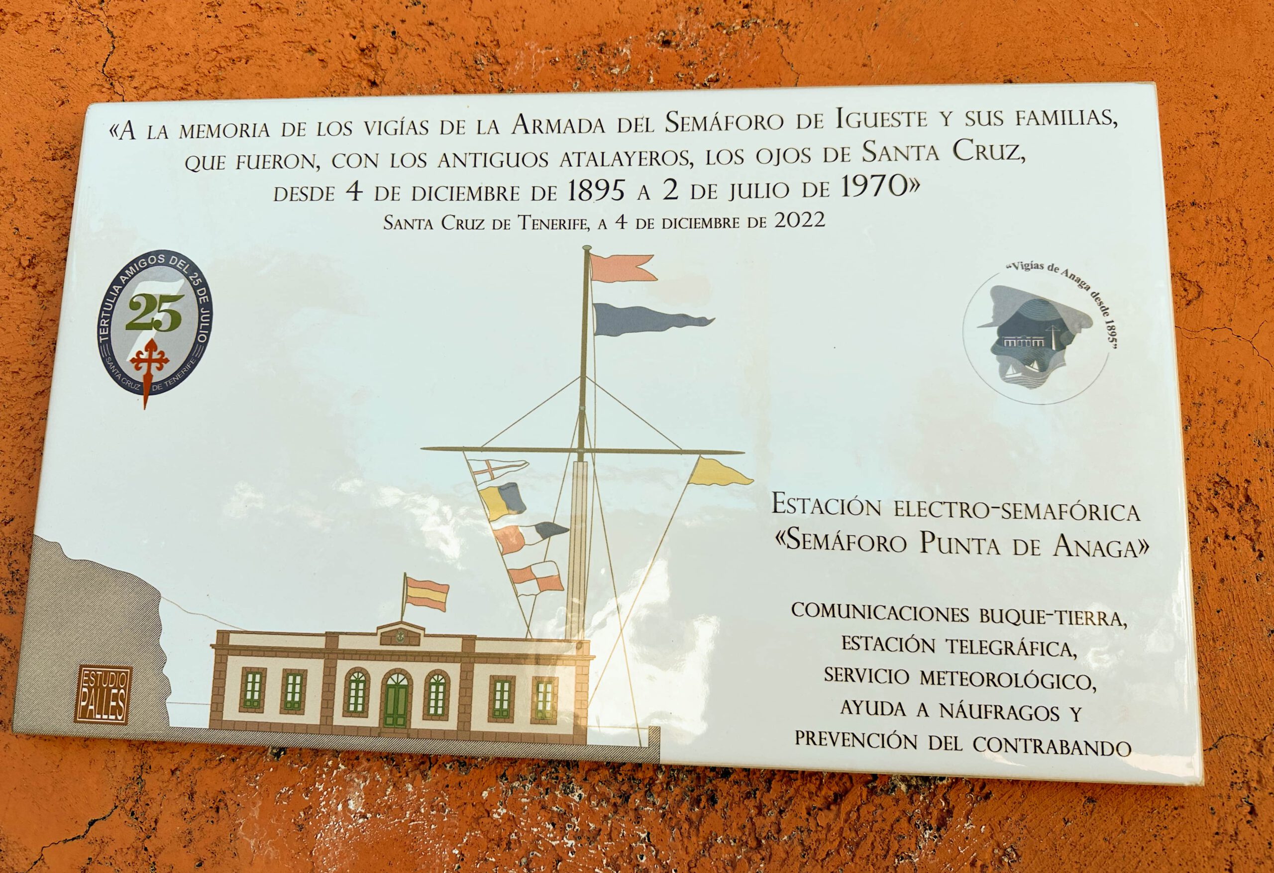
Follow this washed-out and partly paved path uphill for a long time. It takes you very steeply up the ridge with very beautiful views of Igueste de San Andrés and Santa Cruz de Tenerife. A climb up the steep face that is quite something. At the top, you can make a detour to El Semáforo de Igueste (600 metres down). If you decide to make this extension, you will have to return the same way afterwards, because there is no way to continue from the Semáforo.
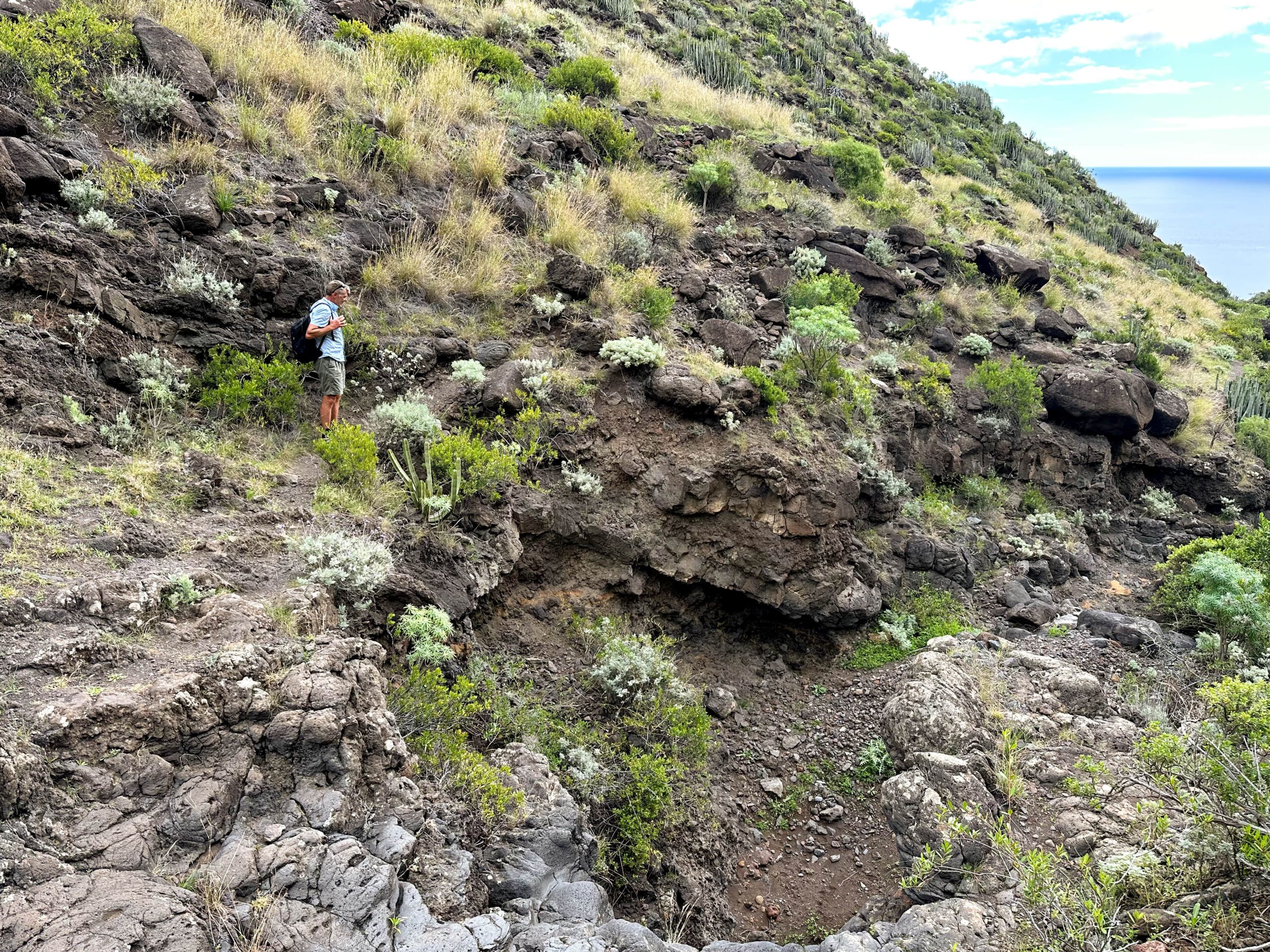
Route section branch Semáforo de Igueste path to Barranco de Zápata
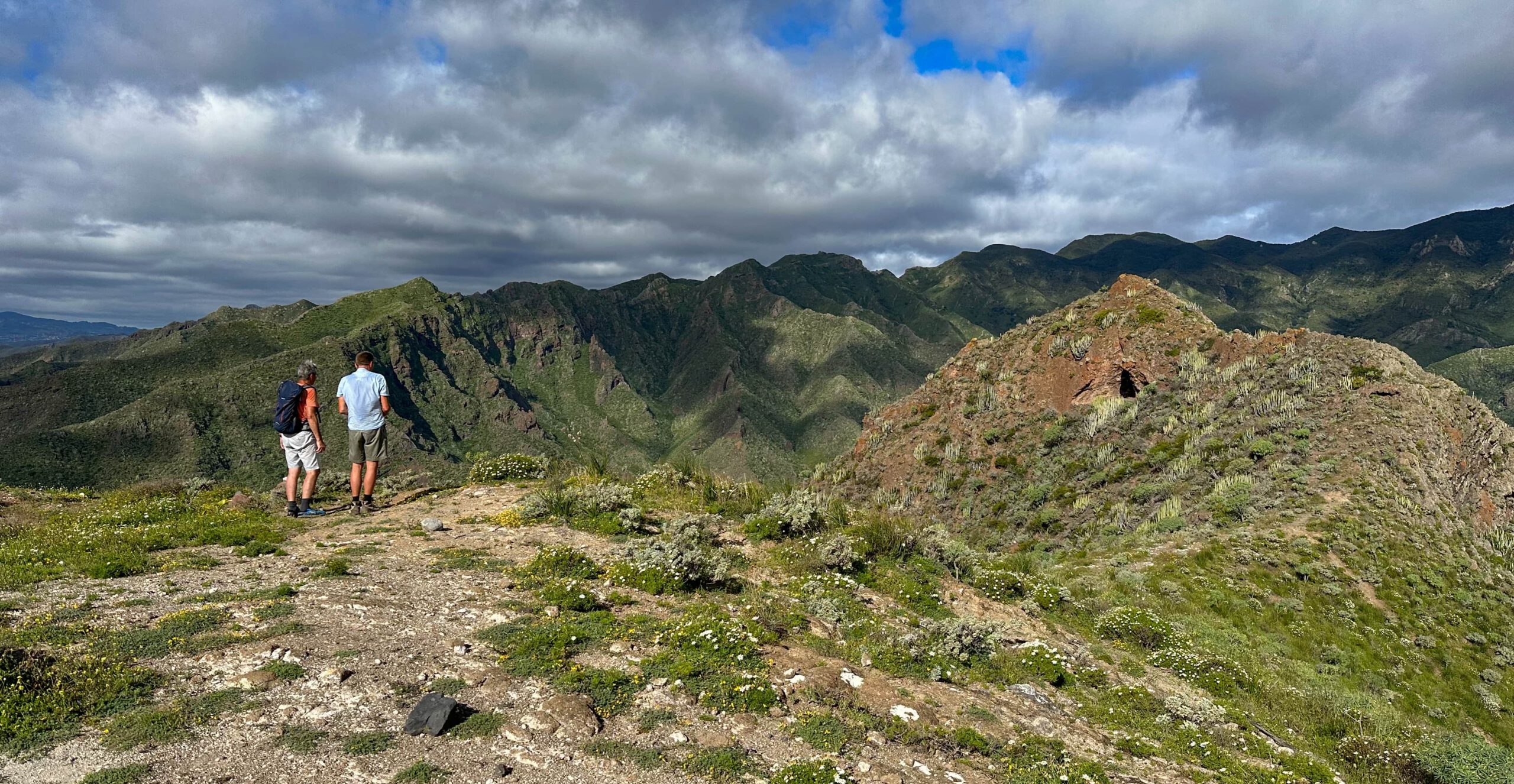
Up here on the ridge, leave the signposted hiking trail to the left on a small path. Take a small path along the slope and climb up to the ridge. From here, the trail continues straight up the mountain. After a short while you will reach a house and ruins. From here you can take a short detour to the right to Mirador Atalaya. This detour is worth it just for the magnificent view of Playa Antequera. Back at the house, follow a path marked with two large stones.
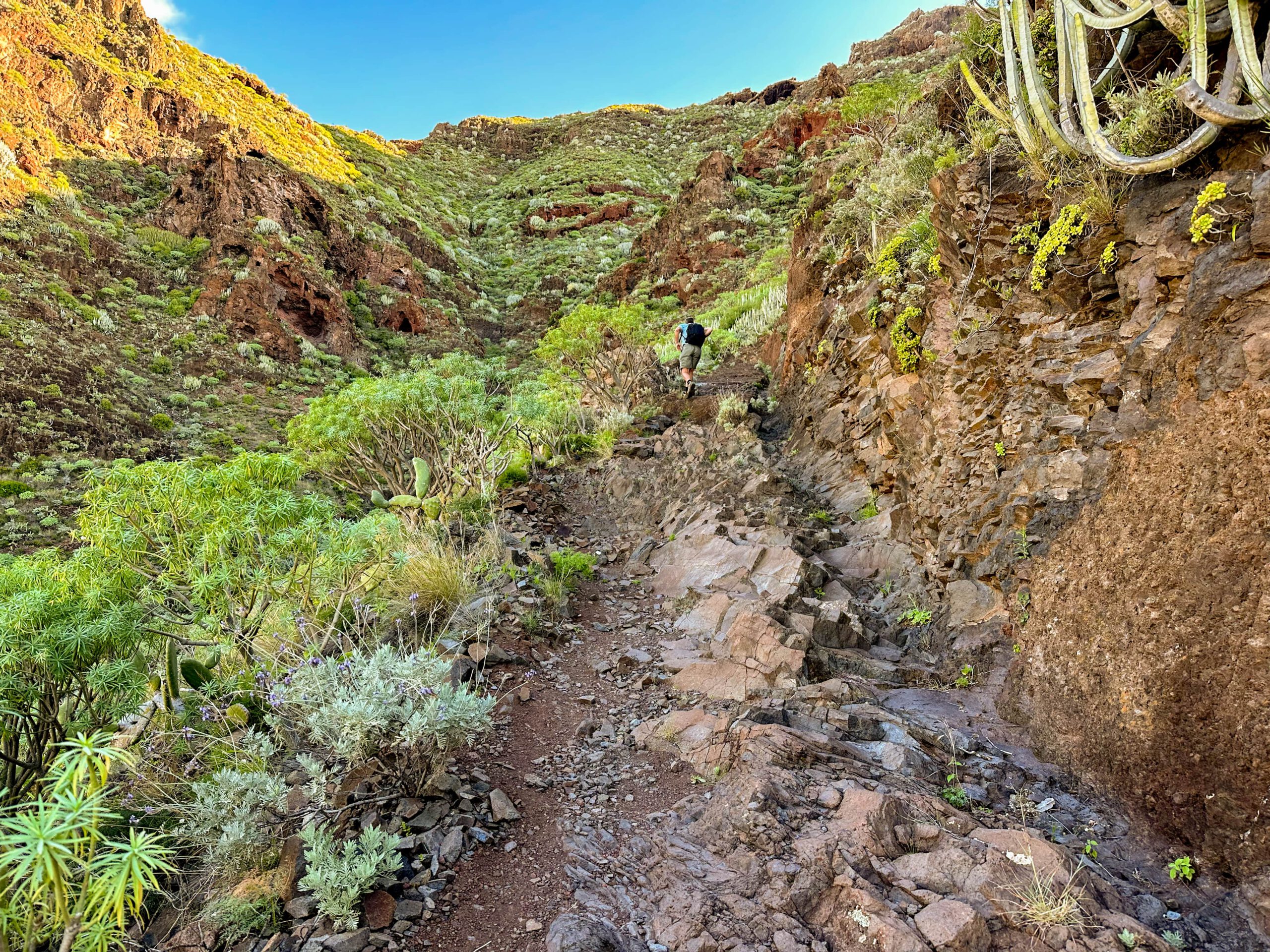
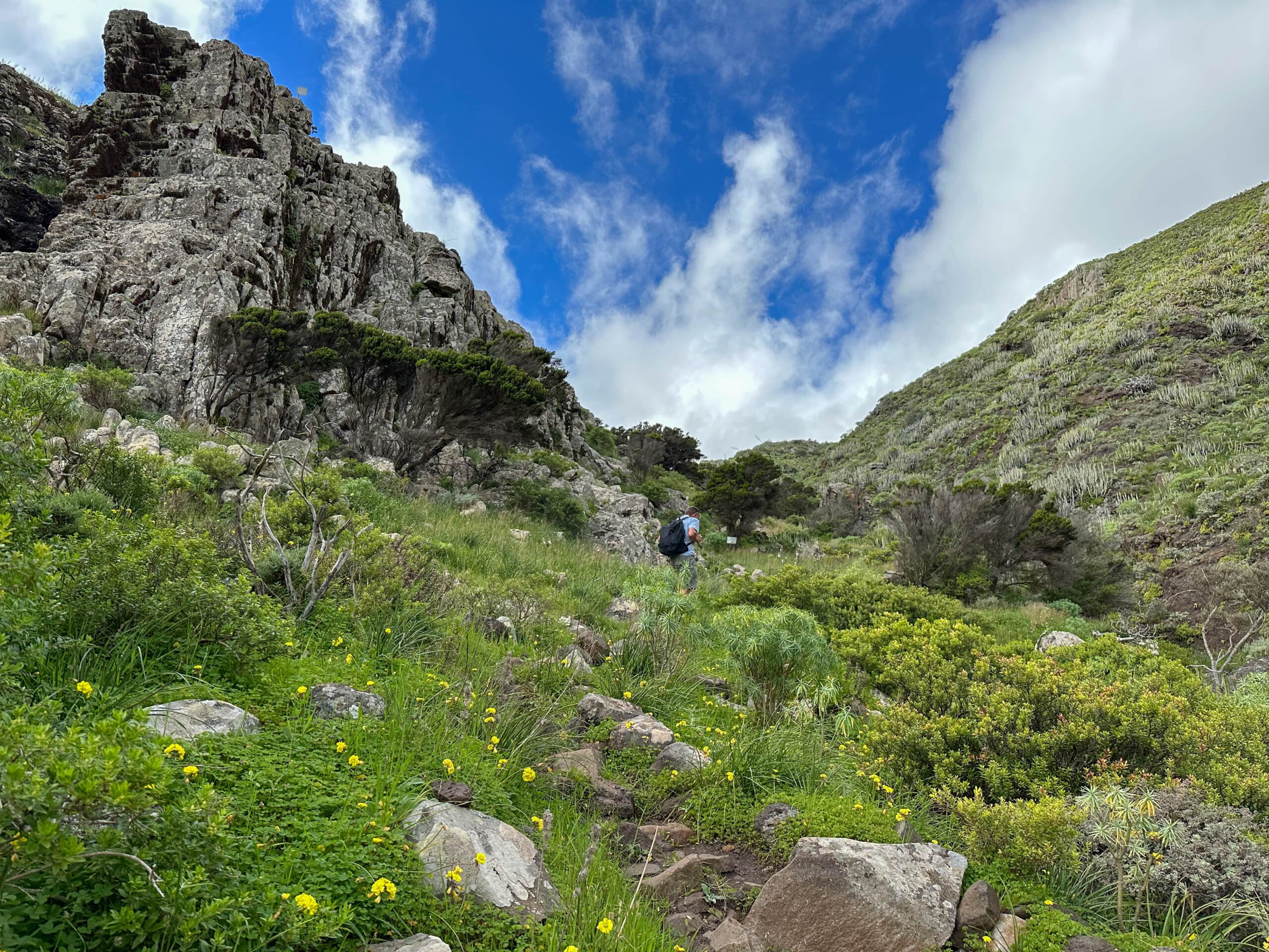
This takes you downhill on the right side of the slope on a narrow path. After a while, a path branches off to the right to Playa Antequera. Follow this path down the slope for a while. It takes you into a ravine, the Barranco de Zápata. The small path runs occasionally on the left and then again on the right side of the gorge. From time to time, the path continues directly through the barranco.
Barranco de Zápata to Playa Antequera section
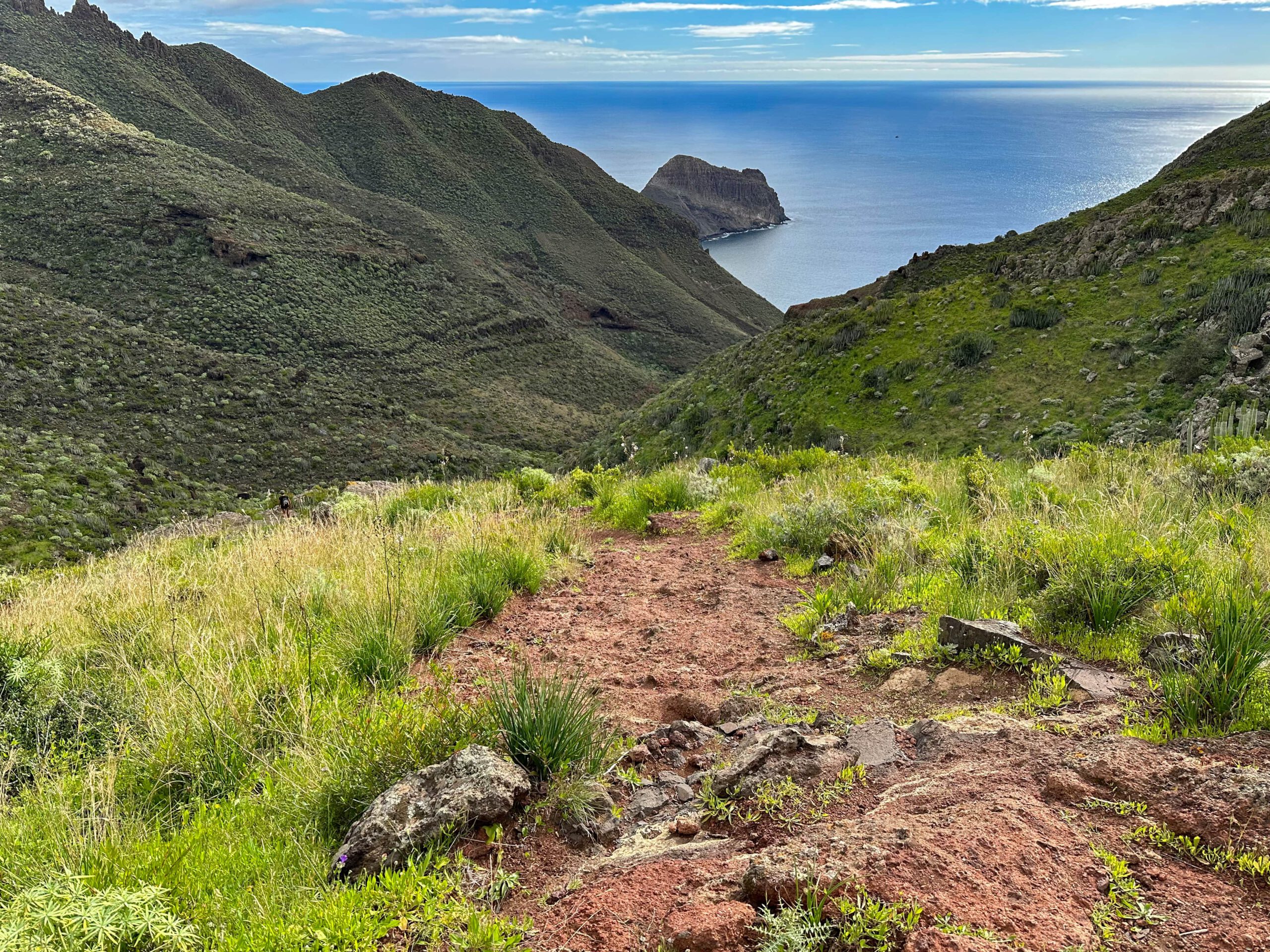
The path through the Barranco de Zápata is not to be missed, as it always goes downhill. From time to time it is also marked by cairns. Eventually the path forks. If you want to make another extension to the beach de Zápata, you have to follow the path down into the barranco at this point. However, the path continues on the left side of the slope above the barranco. This gives you the opportunity to view the Barranco from above all the time. From high up on the slope you can even catch a glimpse of Playa de Zápata. After a while you cross a gully.
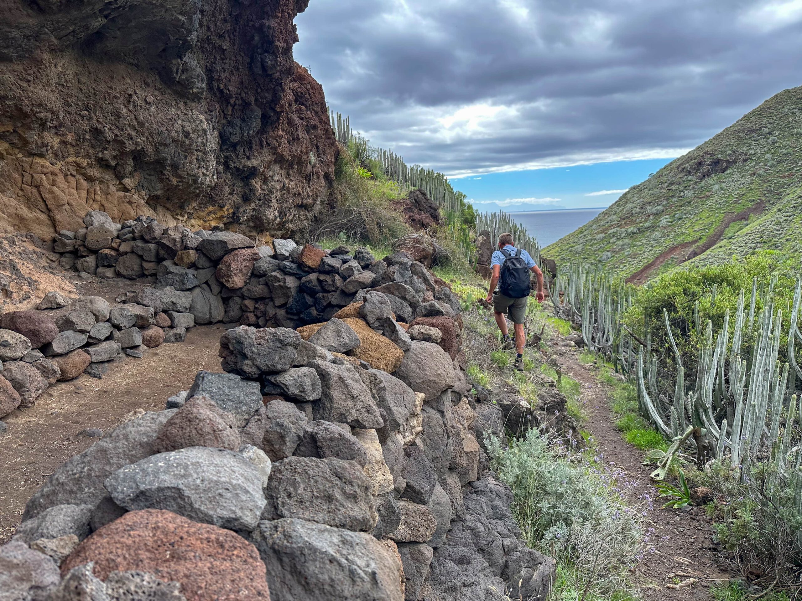
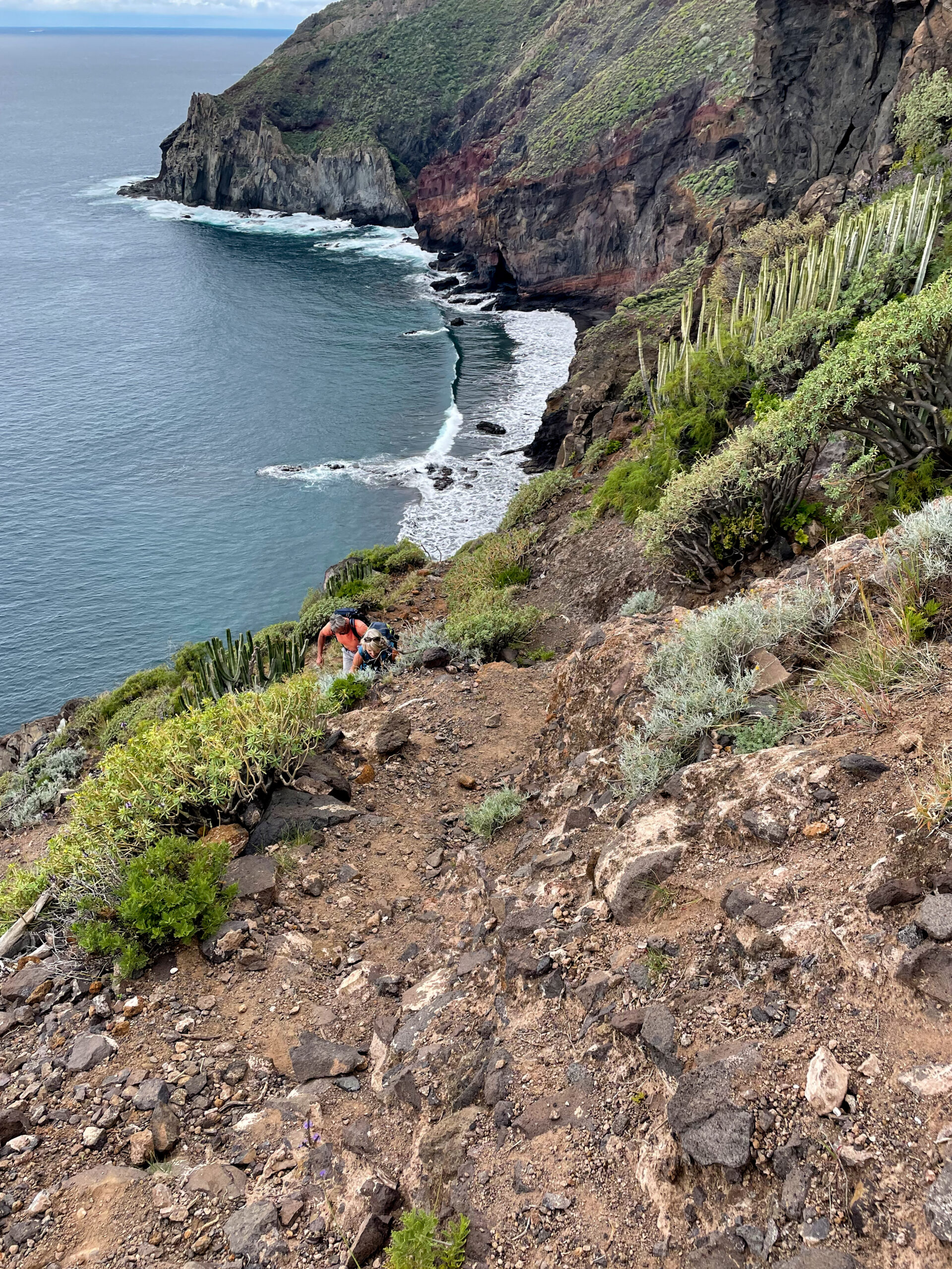
Then the path turns towards Playa Antequera, high on the slope parallel to the coast. This is probably the most exciting part of the whole hike. Although you have wonderful views of Antequera beach and the Atlantic from up here, the path is narrow and exposed. Here you have to concentrate very much on the path. Be careful, because the descent to your right is steep and rugged. But finally, after 15-20 minutes, you will reach the Barranco Antequera and descend to Playa Antequera on a narrow path on the outgoing ridge.
Route section Playa Antequera to PR-TF 5
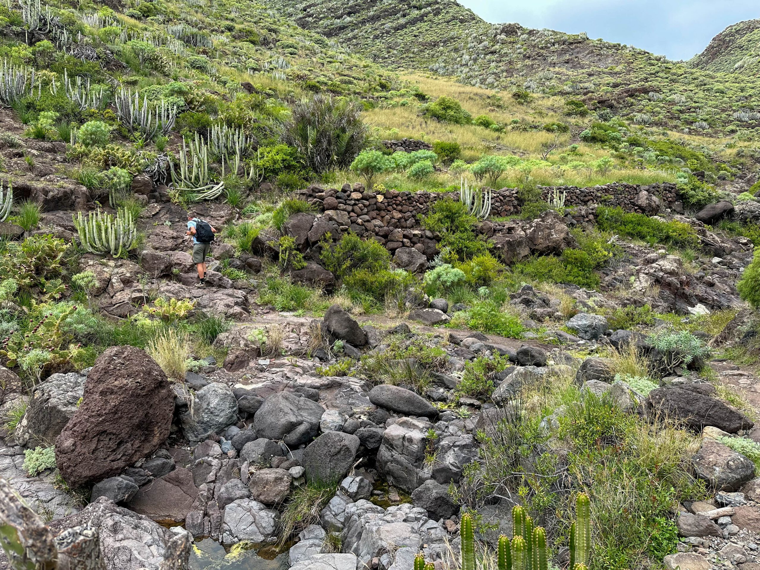
You can rest on the beach and perhaps take a break. You can also walk along the rocky massif in front and the old houses. The way back leads you first along the right side of the slope of the Barranco Antequera between the only two high houses. You walk along the right side of the slope for a long time. The path cannot be missed. Finally, it runs along the bottom of the barranco. Then it alternates between the left and right side.

You will encounter lots of vegetation, goats and, depending on the season, water. Finally, after about an hour, the path rejoins the one I described on the Igueste circular walk. Follow this path to the right. From there, continue straight up along the ridge. You will then reach the PR-TF 5 trail, which comes up from Igueste de San Andrés on the left. On the right, the trail continues uphill to Las Casillas. However, you keep to the left.
Route section PR-TF 5 to Igueste de San Andrés
At the junction, simply follow the PR-TF 5 trail downhill towards Igueste de San Andrés. It is well paved in many places and quickly takes you downhill over a ridge on many serpentines. The trail joins the TF-121, which ends up here in the Barranco del Igueste. From here you simply follow the TF-121 down the valley.
You pass through the small hamlet of Lomo Bermejo. In very wet times, the road is flooded with water from the barranco in some places, and you have to wade through it. Finally, you will reach the main road again in Igueste de San Andrés. All you have to do is walk back to your parking space or to the bus stop.
And finally
I hope you enjoyed this varied circular walk to Playa Antequera. It can be wonderfully combined with the circular walk from Igueste. I hope you enjoy all your hikes,
Dagmar from Siebeninseln